Hiking the Tripler Ridge Trail on Oʻahu, Hawaiʻi
Distance (Tripler AMC): 9.0 miles / 14.5 km
Distance (Moanalua Valley): 8.8 miles / 14.2 km
The Tripler Ridge Trail, historically called the Kauākaulani Ridge Trail, in the southern Koʻolau Mountains on Oʻahu is one of the island’s least-trafficked day hikes—especially when compared to the neighboring Moanalua Middle Ridge Trail.
That said, Tripler Ridge is considered by many to be one of the more challenging ridge hikes up to the Koʻolau Summit, comparable to others on the island, such as ʻAiea Ridge and Kapālama Ridge, with the difficulty largely influenced by the trailhead in which you choose to begin.
By this, I mean that the Triple Ridge Trail can either begin from the trailhead behind Tripler Army Medical Center, or at the Moanalua Valley Trailhead, which is the much more popular option.
I say this because a Military/ DOD ID is required to begin from Tripler Army Medical Center, but the Moanalua Valley Trail is open to the public.
Given these options, I prefer to begin from the trailhead behind Tripler Hospital because it cuts out about 900 ft. (274 m) of steep hiking from the valley floor to the ridge. However, this is obviously a luxury if you have, or know someone who has, base access.
Tripler Ridge Trailhead Parking
Depending on where you choose to begin, parking for the Tripler Ridge Trail is either located in the very back of Moanalua Valley, just before Moanalua Valley Neighborhood Park, or off Reasoner Road in Rainbow Village, behind Tripler Army Medical Center.
Note that if you decide to begin from Moanalua Valley, you are required to park in the residential neighborhood just before the gate. Parking within Moanalua Valley Neighborhood Park is not allowed for day hikers.
Google Maps Directions: Tripler Ridge Trailhead / Moanalua Valley Trailhead
Hiking the Tripler Ridge Trail
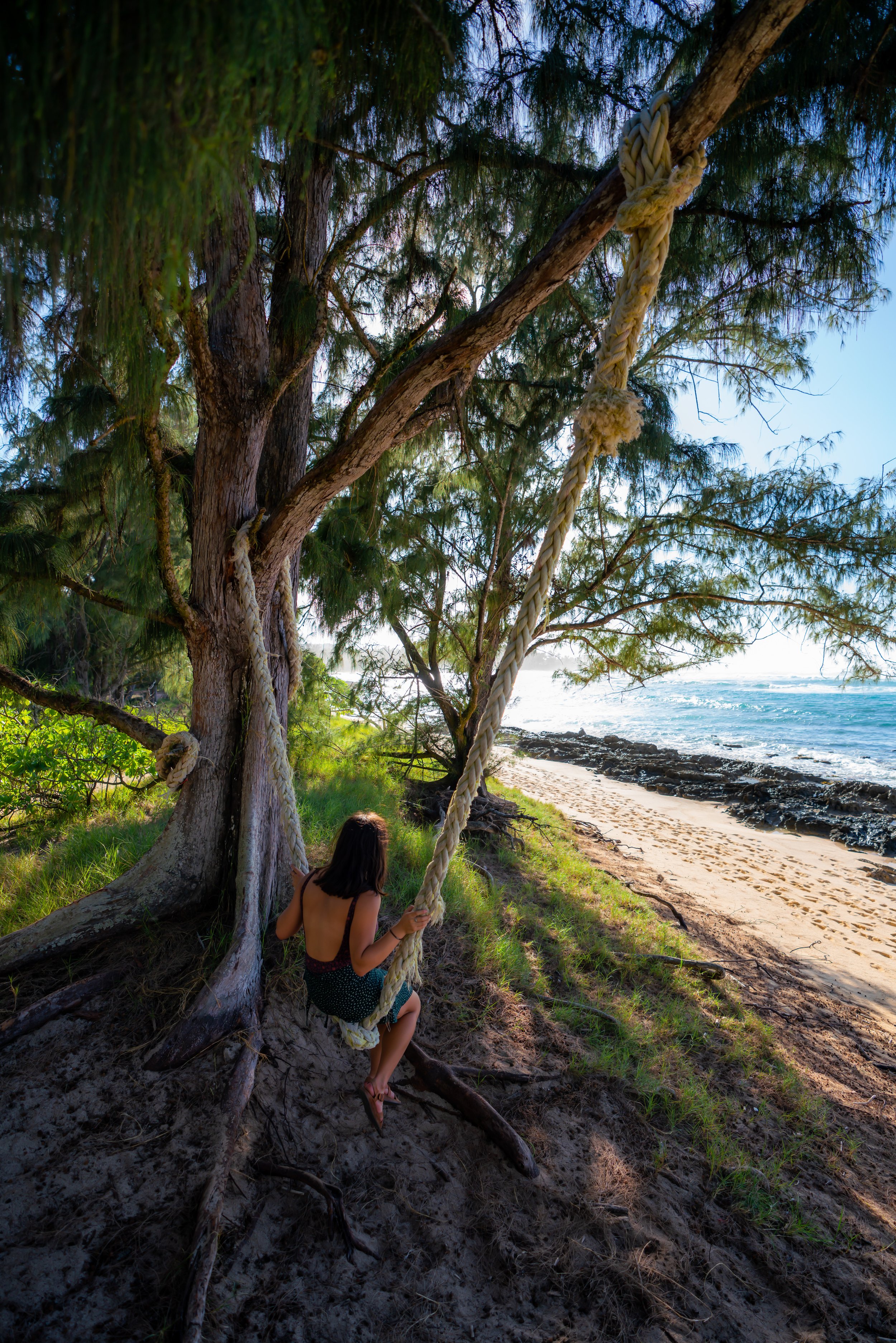
This is the Tripler Ridge Trail, beginning from Rainbow Village off Reasoner Road.
I ask that if you are fortunate enough to have DOD access and begin from this trailhead, you please be quiet and respectful.
All too often, trails in Hawaiʻi draw too much negative attention because people just don’t understand this.
To begin reading about Tripler Ridge from the Moanalua Valley Trailhead, click here.
After just 0.1 miles (0.2 km), turn left to continue up the Access Road leading to the start of the trail.
It’s always nice to see a few native plants—like this ʻĀkia—in an area otherwise dominated by invasive species at these lower elevations.
Tripler Ridge Trailhead
After 1.1 miles (1.8 km) of walking, the paved Access Road ends, and the Tripler Ridge Trail begins.
Here, stay to the right of the building to begin the Tripler Ridge Trail.
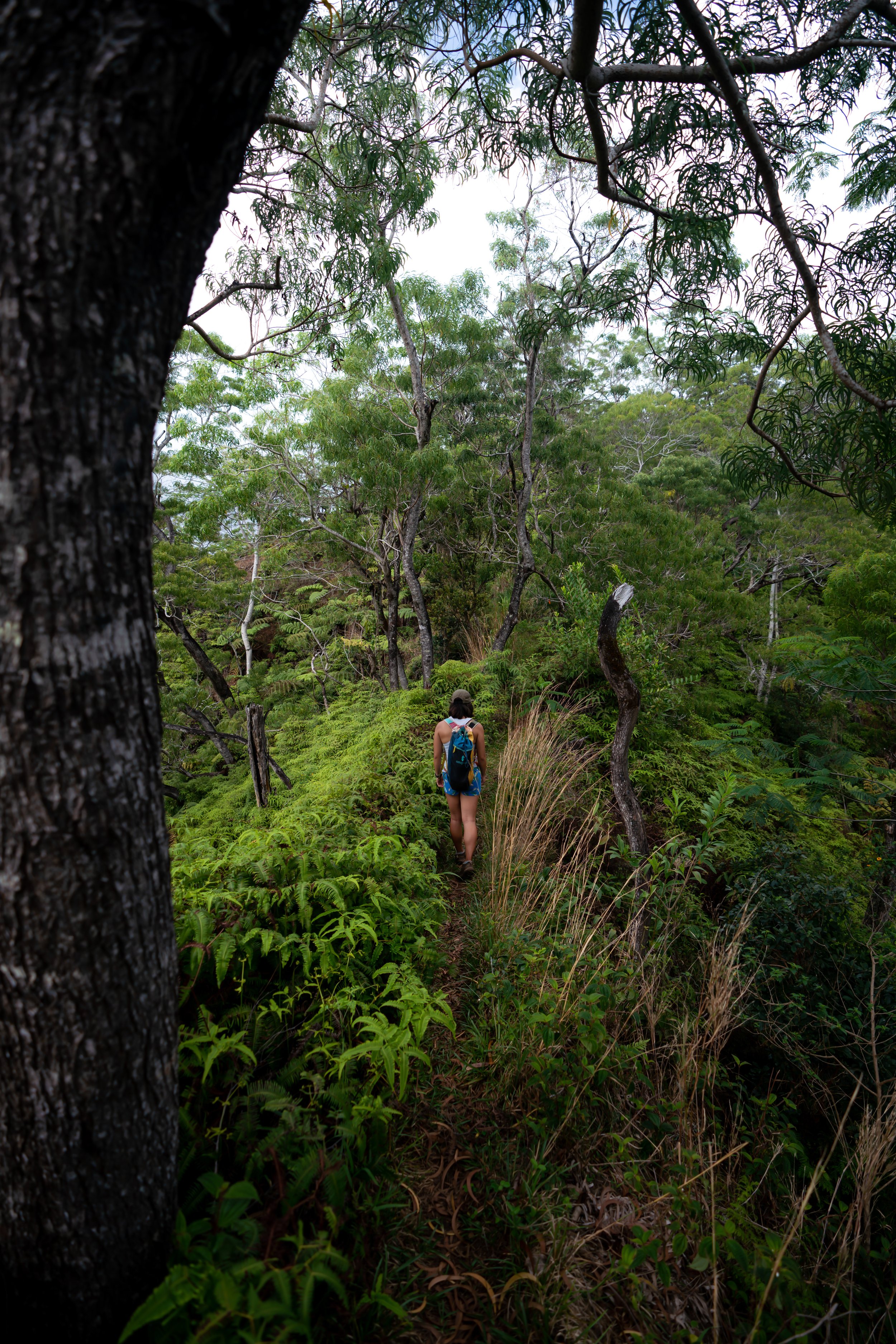
At first, the Tripler Ridge Trail passes by several power lines, which can be a bit overgrown, before the true trail begins about 0.25 miles (0.4 km) away.
This is where the Tripler Ridge Trail begins past the power lines.
These Cook Pine trees are always a nice sign that you’re not too far from Tripler Ridge Access Road on the hike back down.
After roughly 0.8 miles (1.3 km) from the upper trailhead, the Koʻolau Summit and the rest of Tripler Ridge become visible for the first time.
It is here that the hills on Tripler Ridge become more distinguishable, with the story truly being that all the elevation gain is at the end!
Yes, there is only about 450 ft. (137 m) of net elevation change between the Upper Tripler Ridge Trailhead and the last mile of the hike, meaning that the final stretch to the top is fairly steep!
When the trail reaches this large erosion scar, it descends steeply down one of two different routes, which may or may not have a rope.
Either way, this section can be particularly slippery, whether it has rained recently or not.
Here’s another example of a Hawaiian native making its way through this dense, invasive Strawberry Guava forest.
Tripler Ridge-Moanalua Valley Junction
After 2.2 miles (3.5 km) from Rainbow Village, the Tripler Ridge Trail meets the Moanalua Valley Connector, which branches off Kamananui Valley Road at the 1.7-mile (2.7 km) mark.
This is where both routes to the KST become one.
If you plan to descend the Moanalua Valley–Tripler Ridge Connector, be sure to take a picture or make a mental note of this area so you don’t miss the turn on the hike back down—especially because all the sections through the Strawberry Guava can look the same!
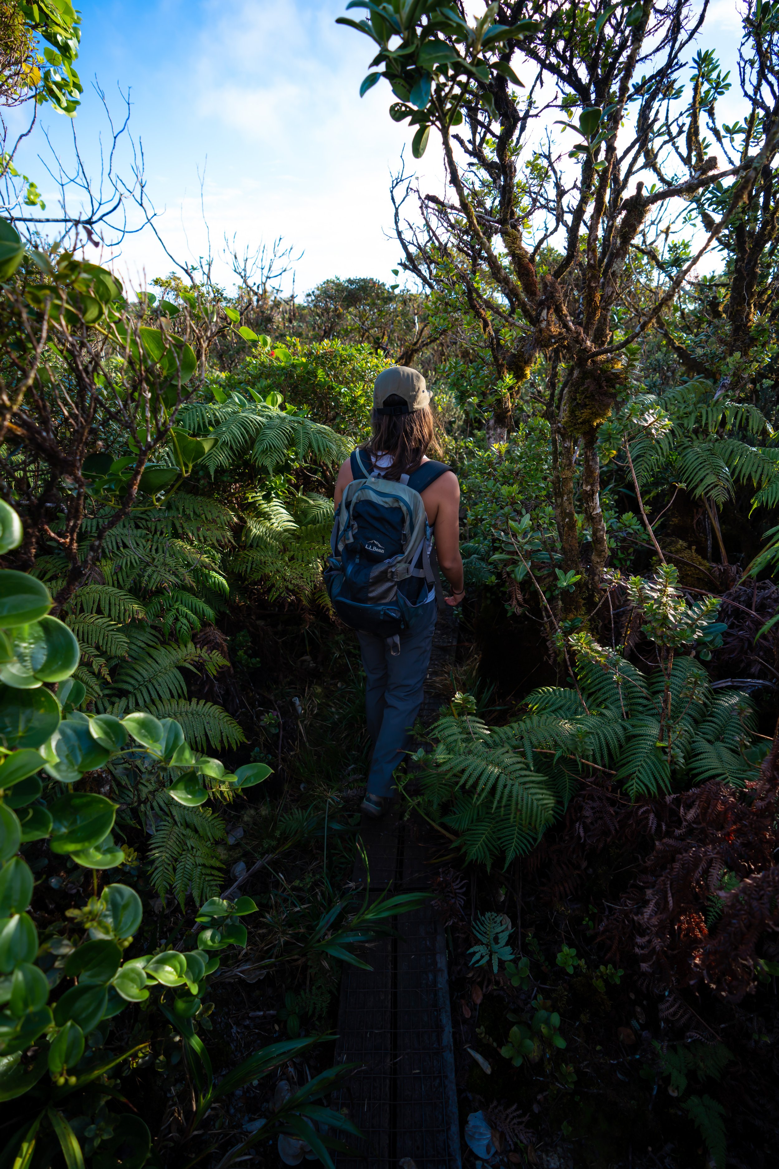
As the Tripler Ridge Trail climbs higher, the dense Strawberry Guava begins to thin, giving way to Koa and ʻŌhiʻa as the miles pass.
Something that’s also apparent on these less-trafficked Oʻahu trails is that the overgrowth inevitably gets worse and worse the closer to the summit the trail gets. This is why I recommend wearing good hiking pants.
The pants below are my recommendations that hold up the best with the overgrowth here in Hawaiʻi, but with any hiking pants that need to be durable, make sure that they are at or near 100% nylon. This is really the most important factor!
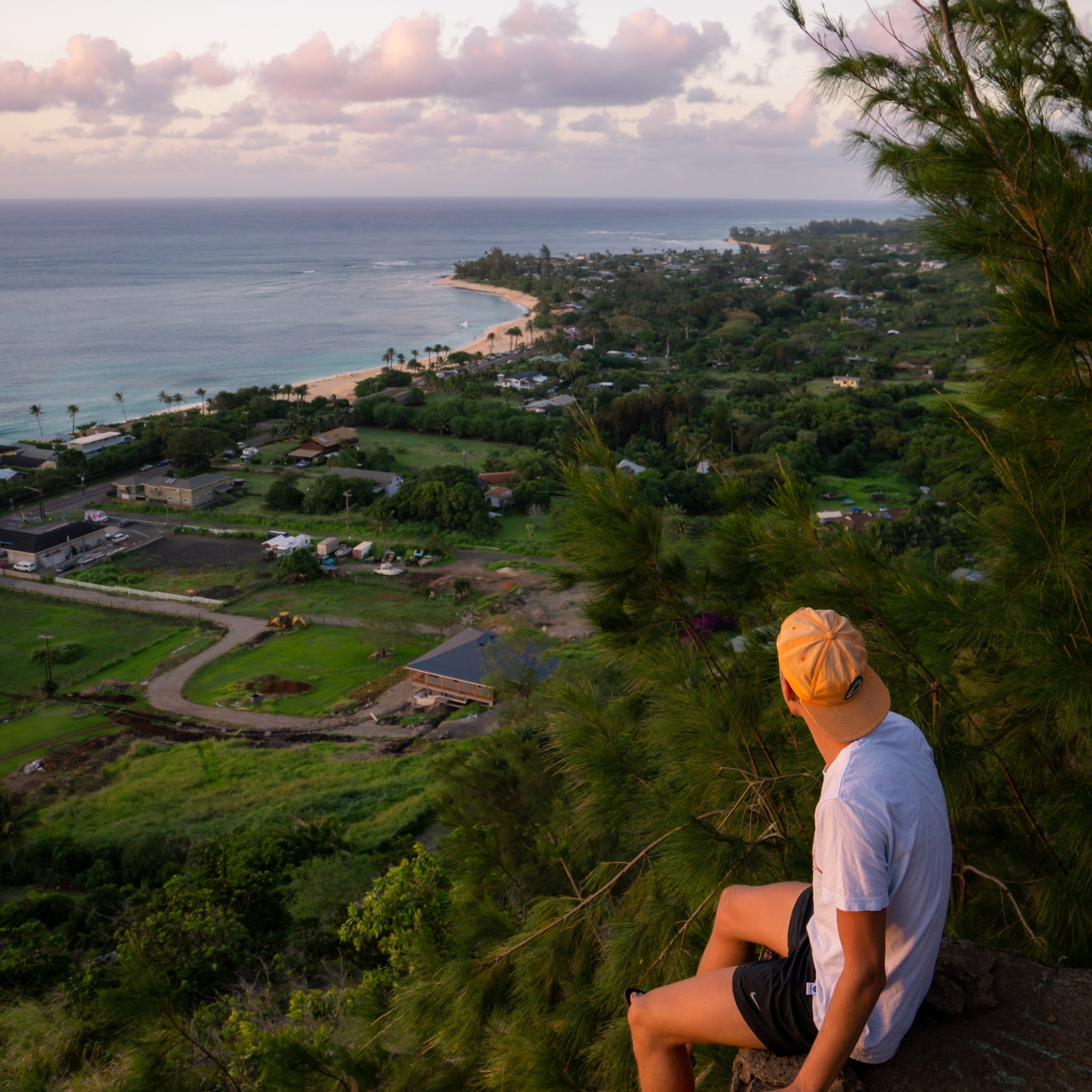
On a clear day you can see Hālawa, Stairway to Heaven, Moanalua Middle, Tripler, and Puʻu Lanihuli from left to right.
Kōlea is definitely a favorite of mine, with this hybrid in particular being one to look out for, as it is not too common to stumble upon!
There’s always new landslides on these wet Hawaiʻi ridges!
This was such a perfect day to be in the mountains!
The one comment that usually comes out after finishing Tripler Ridge is how long of a hike it is compared to others on Oʻahu!
However, this is just a trend that seems to increase the further north you go, with ridges such as Kapālama, just to the south, being shorter than Tripler, and ridges further north, like Waimano, Mānana, and Schofield-Waikāne, all being longer than Tripler.
The only exception to this is Poamoho, due to the long Poamoho Hele Loa Access Road that makes getting fairly high up so easy!
Upper Tripler Ridge-Moanalua Valley Junction
The area shown below is the second and last trail that meets with Tripler Ridge from Moanalua Valley at the end of the Kamananui Valley Road.
That said, deciding whether to hike out of Moanalua Valley at the 1.7-mile (2.7 km) mark or the end of Kamananui Valley Road depends entirely on how you prefer to distribute the elevation gain.
By taking the first route up, about 900 ft. (274 m) must be climbed in just 0.4 miles (0.6 km), or by taking the second route up, about 620 ft. (189 m) must be climbed in the same distance.
However, keep in mind that after reaching this upper junction, the elevation gain from here to the summit is nearly constant, meaning there are essentially no breaks from the valley floor to the KST when starting at the end of the road.
This is where the steepest elevation gain on Tripler Ridge truly begins.
With that in mind, much of the hike up the Tripler Ridge Trail traverses countless rolling hills, leaving the vast majority of the elevation gain on the Access Road at the very beginning and these steep sections at the end of the hike.
That said, the Tripler Ridge Trail climbs roughly 1,100 ft. (335 m) over the course of the last 1.0 mile (1.6 km), with only one good flat spot on the way up to take a break.
There is so much Kōlea diversity to see in just this one hike!
This is the best spot, up the steep final sections, to take a break before reaching the summit!
It’s always great to see one of Oʻahu’s three endemic ʻŌhiʻa species.
Yes, Oʻahu has the most ʻŌhiʻa diversity of any island in Hawaiʻi, meaning that four out of the five total species can be seen when hiking across Oʻahu, with three of those four native only to Oʻahu!
As Tripler Ridge nears the summit, the trail traverses a very short, washed-out section along the left-hand side of the ridge before gaining the ridgeline shortly thereafter.
The power lines that can be seen in the photo below are a good visual indicator of how much farther there is to hike before reaching the top, as both sit right on the crest of the Koʻolau Summit.
When the weather is clear, Moanalua Middle can be seen very clearly on these upper sections.
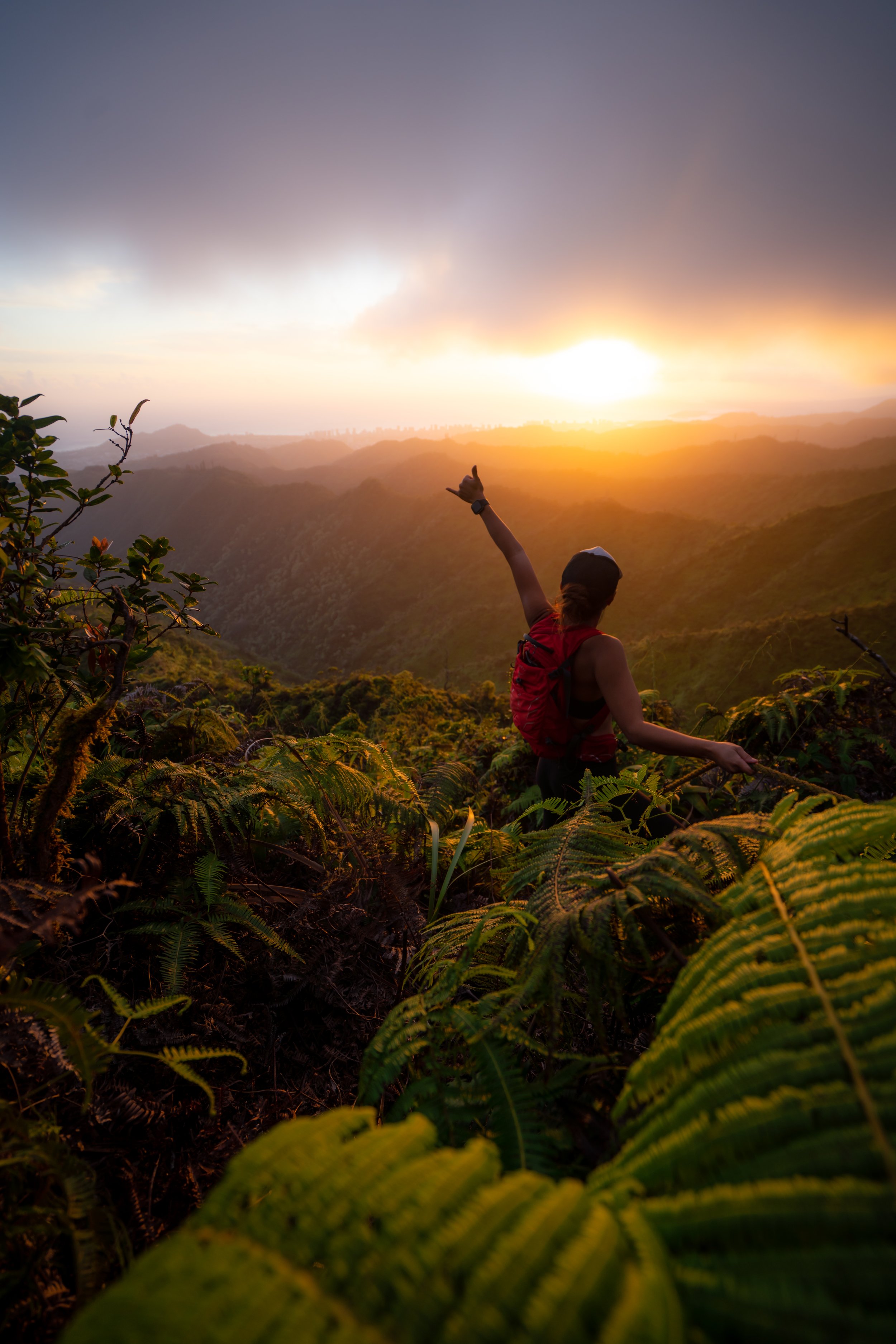
Kahoʻomoe ʻihikapulani (Tripler Summit)
From the summit of Kahoʻomoe ʻihikapulani, more commonly known as Tripler Summit, you can see amazing views across much of Oʻahu’s east side, including notable places like Mt. Olomana, Puʻu Māʻeliʻeli, Mokoliʻi, and the Lanikai Pillboxes.
It’s a very popular option to hike north on the 0.4-mile (0.6 km) section of the Koʻolau Summit Trail (KST) to the Moanalua Middle Summit, but I want to caution against exploring the KST if you didn’t prepare for it.
By this, I mean that any hike along the KST is generally considered to be more difficult than the ridges to get there, which is why I recommend turning back down Tripler Ridge if you had not prepared for the sections to come.
Read My Separate Post: Koʻolau Summit Trail (KST)
Warning
Since Bowman to the south is a less-than-ideal access trail for the Koʻolau Summit, I wanted to make a mention of the Kalihi Saddle, as Tripler Ridge is more than likely the access trail of choice for those interested in hiking the north side of Kalihi from the top down.
All I can say is that the Kalihi Saddle is not meant for 99.9% of hikers. The Koʻolau Summit down to the Power Line Trail is extremely eroded, it’s surrounded by areas where a fall would most certainly be fatal, and the ridge only continues to get worse and worse as more hikers attempt to complete the entire trail.
Seriously, stay safe out there! I have lived through the worst possible outcome, regarding a close friend of mine.
Read My Separate Post: Koʻolau Summit Trail (KST)
Hiking the Tripler Ridge Trail via Moanalua
The Tripler Ridge Trail via Moanalua Valley begins on Kamananui Valley Road—the same road that also serves the Kulanaʻahane Trail, among countless other day hikes in the valley.
Walking to the Trailhead
To begin the Moanalua Valley Trail, walk through Moanalua Valley Neighborhood Park and up the service road at the upper end of the parking lot.
Moanalua Valley Trailhead (Kamananui Valley Road)
At the upper end of the Moanalua Valley Neighborhood Park, the dirt road reaches the Moanalua Valley Trailhead, which serves as the starting point for countless different day hikes in the valley.
From this point, the Moanalua Valley Trail follows Kamananui Valley Road for roughly 1.7 miles (2.7 km), where the trail will abruptly branch away from the road to begin climbing up and out of the valley.
After just 0.1 miles (0.2 km), the Moanalua Valley Trail passes this restoration area on the left-hand side.
I mention this because, on the long hike out of Moanalua Valley, this restoration area is one of the best mental checkpoints that the trailhead is not far away!
In the beginning of Kamananui Valley Road, the trail splits seven different times, with both a path that leads down toward the Moanalua Stream and an upper path that passes over the stream.
At each bridge, I recommend following the upper path because it’s always easier and more direct than doing an unnecessary down and up through the stream.
This is the first of seven times both paths on Kamananui Valley Road come back together.
This is the second of seven times Kamananui Valley Road splits.
This is the fourth split on Kamananui Valley Road and the first time the upper path leads to the right instead of the left.
This is the fifth of seven times Kamananui Valley Road splits.
After the sixth split, there is only one more to go!
This is ʻAwa or Kava, and while it is not a native Hawaiian plant, it is a canoe plant in Hawaiʻi, meaning a species brought to the islands by the original Polynesians.
Furthermore, Kava, just like Māmaki tea, is widely commercially available, as you can see using the links below.
This is the seventh and final time Kamananui Valley Road splits, meaning that from this point on, the hike to the Tripler Ridge Trail simply follows the main road along the Moanalua Stream.
On a beautiful, sunny day such as this, I highly recommend wearing a hooded sun shirt, as almost any day hike in or up one of the ridges out of Moanalua Valley inevitably means spending a lot of time outside.
That said, there really are no short day hikes that begin at the Moanalua Valley Trailhead, which is why coming prepared for a long day is so essential—especially when planning the Tripler Ridge Trail.
Kamananui Valley Road-Tripler Ridge Connector Junction
This is the Tripler Ridge Connector junction at the 1.7-mile (2.7 km) mark.
From here, the Connector Trail begins a very steep 900-ft. (274 m), 0.4-mile (0.6 km) ascent out of Moanalua Valley, which is very comparable to the ascent up the Koko Crater Stairs in southeast Oʻahu.
If you are interested in reading about the hike further up Moanalua Valley, all the details can be found in my separate post linked below.
Read My Separate Post: Kulanaʻahane Trail
The very beginning of the Connector Trail out of Kamananui Valley is gradual, but this doesn’t last long before the climb really begins!
This is where the Connector Trail noticeably gets steeper, which will remain the case for nearly the entire hike to the top of Tripler Ridge!
While highly invasive, all the Strawberry Guava along the trail make the climb out of Moanalua Valley a bit easier, as they are great to use on both the hike up and down!
It’s always cool to see how Koa trees get their start compared to all the mature ones elsewhere on the Tripler Ridge Trail!
The Connector Trail out of Kamananui Valley really is this steep, and in my opinion, it’s the most challenging part of the hike—that is, unless you have DOD access to begin at the top of Tripler Army Medical Center.
It’s also nice to see all the Alaheʻe trees on the hike up Tripler Ridge!
With about 0.1 miles (0.2 km) left before the top of Tripler Ridge, the trail leaves the ridgeline to contour along the right-hand side.
This is where the Connector Trail turns sharply to climb back to the top of the ridgeline.
This is where the Connector Trail regains the ridge, which it follows for the rest of the hike to the top.
Tripler Ridge-Moanalua Valley Junction
This is where the Connector Trail from Kamananui Valley Road reaches the top of Tripler Ridge.
Once here, go left to begin the roughly 2.3-mile (3.7 km) hike from this point to the Koʻoalu Summit, as the trail to the right of this split simply leads down to Tripler Army Medical Center Trailhead.
To skip back to this same junction above, click here.
Native Plants on the Tripler Ridge Trail
The Moanalua Valley Trail is not the best trail for finding native Hawaiian plants other than Hau and Māmaki. However, Tripler Ridge to the Koʻolau Summit is one of the more beautiful Hawaiian forests, especially on the upper elevations of the hike!
Some of these include various species of ʻŌhiʻa lehua, ʻAhakea lau nui, Kōpiko, Koa, Uluhe, Kōlea, Alaheʻe, Kokolau, Kāpana, ʻIliahi, and Loulu, to truly only name a few.
If you would like to learn more about these and many other native Hawaiian plants from across the islands, I encourage you to check out my separate post linked below.
Read My Separate Post: Native Hawaiian Plant Guide