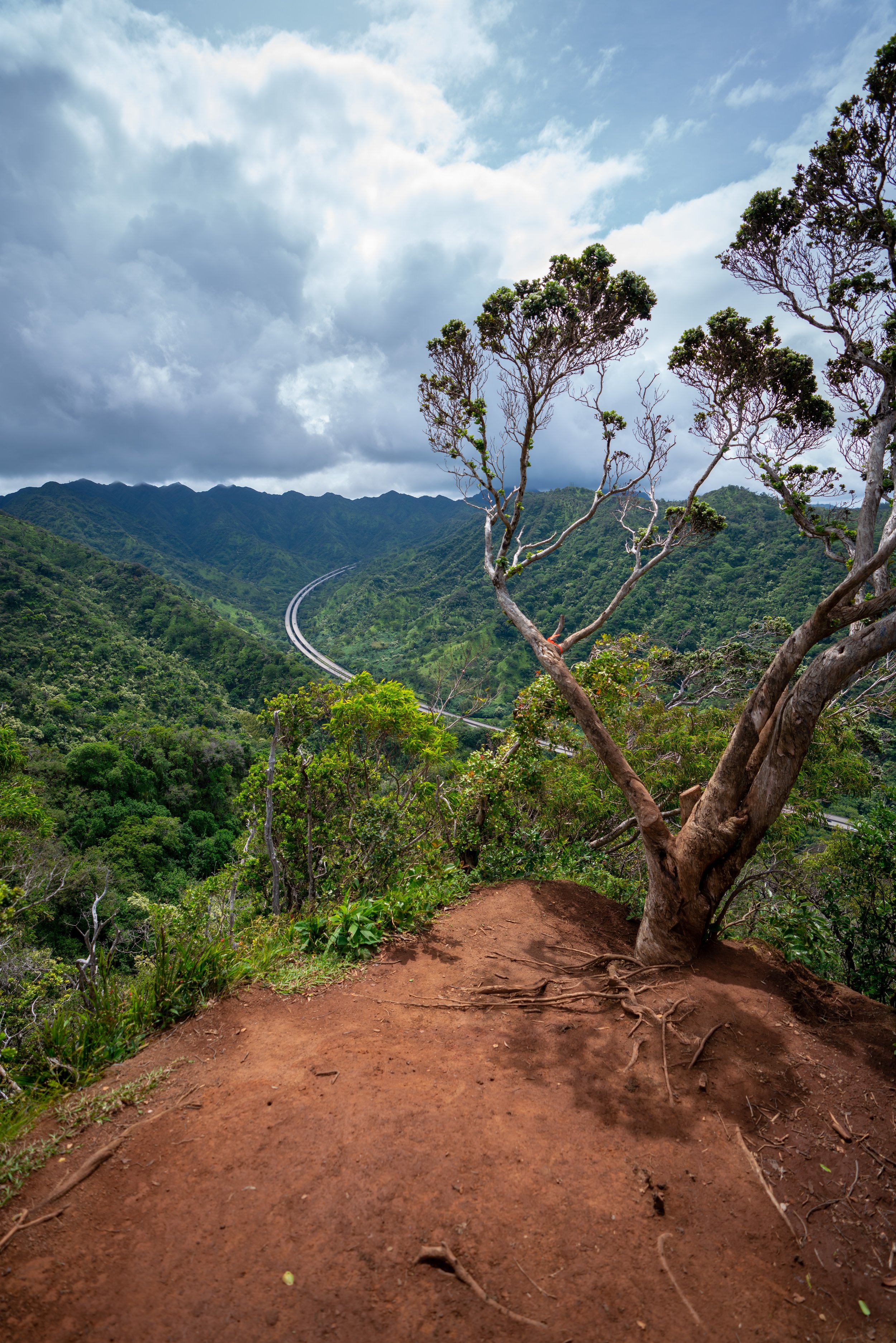
Hiking the Pyramid Rock Loop Trail on Oʻahu, Hawaiʻi
Distance: 3.0 miles / 4.8 km
The Hahaiʻone Ridge Trail to Pyramid Rock, commonly called the Pyramid Rock Loop Trail, on Oʻahu is a beautiful, short but steep loop that makes for a fun and less-crowded alternative to other nearby Hawaiʻi Kai adventures, such as Kuliʻouʻou Ridge, Hawaiʻi Loa Ridge, and the Koko Crater Stairs.
That being said, Pyramid Rock is typically the sought-after destination that most hikers want to visit for the best views, which is why some may prefer to only hike up the Pyramid Rock Ridge Trail, instead of the full loop talked about here.
However, I almost exclusively prefer the Pyramid Rock Trail by way of Hahaʻione Ridge because the short loop with the Koʻolau Summit Trail (KST) is a great way to extend the short Pyramid Rock hike into a slightly longer 3.0-mile (4.8 km) adventure, while still beginning and ending at the same place.
Pyramid Rock Trailhead Parking
Parking for the Pyramid Rock Trail, as well as Hahaʻione Ridge, is located in the back of Hahaʻione Valley near the end of Hahaʻione Street.
That being said, both Hahaʻione and Pūkoʻo Street are two very quiet residential streets, which is why I ask that you please be quiet, respectful, park legally, and do not do anything that would draw negative attention to this local trailhead.
Google Maps Directions: Pyramid Rock Trailhead
Hiking the Pyramid Rock Loop Trail
The Hahaʻione-Pyramid Rock Loop Trail begins at the very end Hahaʻione Street.
Once on the trail, follow it straight back into Hahaʻione Valley until you reach the Pyramid Rock Loop, located about 0.1 miles (0.2 km) away.
Hahaʻione-Pyramid Rock Loop
At the split, the Hahaʻione Ridge Trail splits to the left, and the Pyramid Rock Ridge Trail splits to the right.
However, I recommend against accessing Pyramid Rock from this direction/ trailhead, which will make more sense from the photos at the end.
Through the lower forest in Hahaʻione Valley, the trail to the base of the ridge may seem a little confusing, but there is one central path to follow.
At this open area, take the trail on the right to continue toward Hahaʻione Ridge.
This is where the switchbacks begin and continue until the Hahaʻione Trail gains the ridge.
Hahaʻione Ridge
Once the trail reaches Hahaʻione Ridge, the hike will level off briefly, but eventually, the Hahaʻione Ridge will get steeper and steeper, as the hike nears Koʻolau Summit.
Hahaʻione-Kuliʻouʻou Junction
When the Hahaʻione Ridge Trail splits, go right to continue on the Pyramid Rock Loop.
The trail to the left is the Kuliʻouʻou Crossover, which is a completely different adventure that most hikers likely wouldn’t be interested in.
Hahaʻione Summit
The photos below are from the Hahaʻione Summit and the start of the Koʻolau Summit Trail (KST) that makes the loop with Pyramid Rock.
That being said, go right to hike south (right) on the KST to Pyramid Rock. The KST to the north (left) is the route that leads to Kuliʻouʻou.
For the most part, the KST portion of the Pyramid Rock Loop is fairly straightforward, with the exception of a few tricky turns right before Pyramid Rock.
Depending on the amount of maintenance, if any, the trail receives, the grass can be particularly overgrown near the power lines.
It’s always great to see the endemic Kokolau flower!
At about the 1.7-mile (2.7 km) mark, the tricky turns on the KST begin and continue until Pyramid Rock shortly ahead.
That being said, go around this tree on the left-hand side, and look for the trail that makes a sharp left turn off the ridge almost immediately after.
It will appear as if this isn’t the correct route at first, but if you don’t make this left and remain on the ridge, the ridgeline will cliff out, and you’ll be looking at Pyramid Rock, instead of being on Pyramid Rock.
The photos below show the hidden left turn that may be tricky to notice.
Following the section above, the KST will continue to descend until it comes to this very vague overgrown area in the photo below.
To continue toward Pyramid Rock, you need to go right on the not-so-obvious trail down this hillside, which will likely look less straightforward than staying on the ridge on the left.
At this rock feature, the Pyramid Rock Loop curves around on the windward side along a little skinny trail.
Next, at this split in the photo below, go right down the steep path.
The path going straight will cliff out shortly after.
Pyramid Rock-Koʻolau Summit Junction
The intersection in the photo below is where the Pyramid Rock Loop leaves the Koʻolau Summit Trail.
The trail to the left around the windward side is the route to continue along the KST, and the trail to the right is the best and easiest path to continue on to Pyramid Rock.
Read My Separate Post: Koʻolau Summit Trail (KST)
After the KST junction above, the Pyramid Rock Trail will begin the scramble up to Pyramid Rock itself.
In my opinion, this short section up and down Pyramid Rock on the Hahaʻione side is nothing more than a moderate class 2/ 3 scramble, but even still, a fall could have fatal consequences.
Pyramid Rock
Standing at roughly 1,550 ft. (472 m), Pyramid Rock is one of the most prominent summits above Hawaiʻi Kai, and from the top, you can get great views of Koko Head, Hanauma Bay, and much of the windward side across Waimānalo.
Pyramid Rock Ridge Trail
From the summit of Pyramid Rock, the trail down to Hahaʻione Valley descends a very steep trail, dropping roughly 1,200 ft. (366 m) in just over 0.6 miles (1.0 km).
From the top, the Pyramid Rock Trail initially drops off a fairly steep rock face, which is easiest to navigate to the left.
After this first drop, the rest of the Pyramid Rock Ridge Trail is more or less one steep path along the ridgeline until it comes to a fence just above the neighborhood.
Once at the fence, drop down to the trail below, and then you’ll have to decide between one of two options to return back to the beginning.
To complete the true Pyramid Rock Loop, there’s the option of following the trail when it splits to the right to hike back through Hahaʻione Valley to the initial junction show earlier.
However, the more popular and much more practical option is to follow the service road by simply cutting straight down the hillside until it reaches the road.
This option is typically more popular and faster of the two.
This service road will end on Pūkoʻo Street, which will be just a short walk away from where the Pyramid Rock Loop began.
Native Plants on the Pyramid Rock Loop
The Pyramid Rock Loop Trail is a relatively low-elevation trail, as far as the Koʻolau Mountains on Oʻahu are concerned, meaning this area is not the best place to find different native Hawaiian plants.
However, the few that I did notice were ʻŪlei, ʻUhaloa, Kokolau, Globe Schiedea, and ʻIlima.
If you would like to learn more about these and tons of other native Hawaiian plants from across the islands, I encourage you to check out my separate post linked below.
Read My Separate Post: Native Hawaiian Plant Guide


