Hiking Mt. Kaʻala: The Tallest Peak on Oʻahu, Hawaiʻi
Distance: 7.1 miles / 11.4 km
Elevation Gain: ~3,400 ft. / 1,036 m
The Mt. Kaʻala Trail in Waiʻanae Valley is a popular and typically sought-after adventure among those seeking to climb the tallest peak on Oʻahu!
Now, while climbing the tallest peak might make the trail sound intimidating, Mt. Kaʻala is nowhere near the hardest hike on the island. In fact, if you would like to read about a number of trails that are all more challenging than Mt. Kaʻala, I encourage you to click the link below.
In any case, Mt. Kaʻala is truly a 'gentle giant' for what hiking to the highest point on the island could be, but know that the elevation gain to the summit bog at the top is nearly constant, meaning only those prepared for such a steep and challenging ascent should attempt to hike Mt. Kaʻala.
Read My Separate Post: Most Challenging Trails on Oʻahu
Mt. Kaʻala Trailhead Parking
Parking for the Mt. Kaʻala Trail is located at the very end of Waiʻanae Valley Road in the dirt parking lot shown below.
Out of caution, consider the Mt. Kaʻala Trailhead to be a high-crime area for petty theft, meaning you should never leave visible bags or anything valuable in your car.
Google Maps Directions: Mt. Kaʻala Trailhead
Hiking the Mt. Kaʻala Trail
From the parking area, the Mt. Kaʻala Trail begins beyond the gates for the service road shown below.
For the first 1.4 miles (2.3 km), the Mt. Kaʻala Trail ascends about 1,000 ft. (305 m) until the true trail begins at the Waiʻanae Kai Shelter, located further in the valley.
These beginning sections of the Mt. Kaʻala Trail are a great place to see a number of native plants, like the beautiful Wiliwili trees or Pōhinahina, to name just a few.
At about 0.9 miles (1.4 km), the service road passes by the first of a few different Board of Water Supply buildings before the start of the trail.
This stretch before the second set of buildings is typically a bit muddy, but never as bad as this, as these were taken shortly after a multi-day storm with a lot of very heavy wet weather.
Waiʻanae Kai Shelter
After 1.4 miles (2.3 km), the true Mt. Kaʻala Trail begins, where vehicles are prevented from driving any further.
Once here, go straight at the Waiʻanae Kai Shelter to follow the trail that begins immediately after.
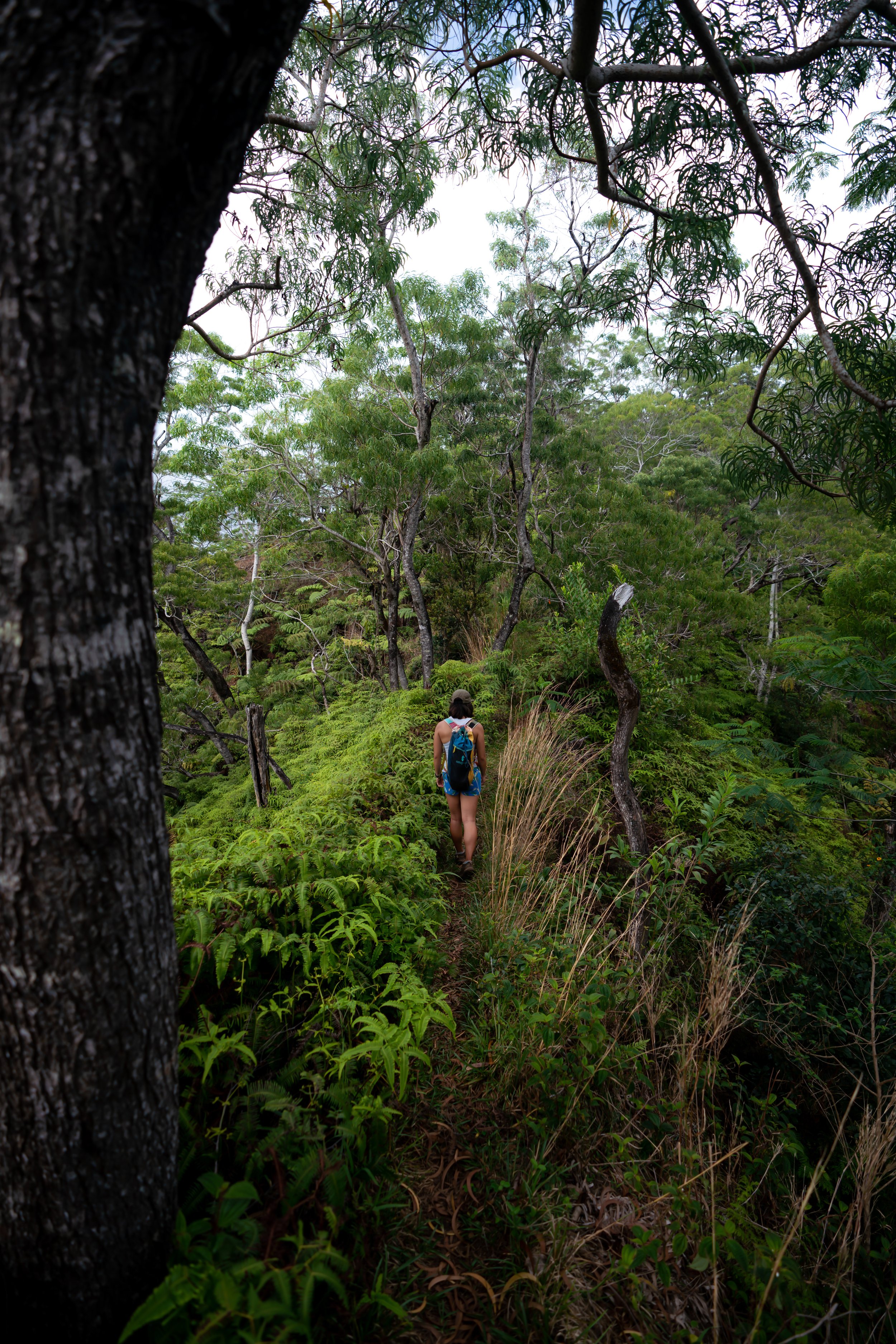
Lower Forest
In my opinion, these first sections through the lower forest are typically a bit more vague than the rest, but follow the most obvious path and look for the markers on the trees, which should represent the Mt. Kaʻala Trail.
Mt. Kaʻala-Kaʻala Falls Junction
Shortly after beginning the initial ridge, the Mt. Kaʻala Trail splits to the left to cross over Kūmaipō Stream, located down the trail.
That said, if you were to miss this important turn, you will not find your way up Mt. Kaʻala, as the trail going straight is best known for being a shortcut to Kaʻala Falls.
On a side note, regardless that the ridge is the quickest route to Kaʻala Falls, know that it is also incredibly confusing if you don’t have any prior knowledge, meaning the most straightforward way to hike Kaʻala Falls is actually by following the stream, located shortly ahead.
Kūmaipō Stream
After the split, the Mt. Kaʻala Trail crosses over Kūmaipō Stream—the one and only stream crossing on the entire hike, which is almost always dry unless it has been particularly wet recently.
Furthermore, while I said that hiking to Kaʻala Falls is more straightforward by following the stream, it is also much more difficult and dangerous than the ridge, making neither route more or less ideal than the other.
After the stream, the Mt. Kaʻala Trail begins ascending on the far side.
Mt. Kaʻala-Tiki Ridge Junction
At about 1.9 miles (3.1 km), the Mt. Kaʻala Trail splits once more with Tiki Ridge, which is often regarded as the best trail up to the Saddle in order to reach Puʻu Kawiwi.
That said, go right to stay on the Mt. Kaʻala Trail, or you will likely add about 30 minutes onto your adventure if you end up ascending Tiki Ridge instead of the Mt. Kaʻala Trail.
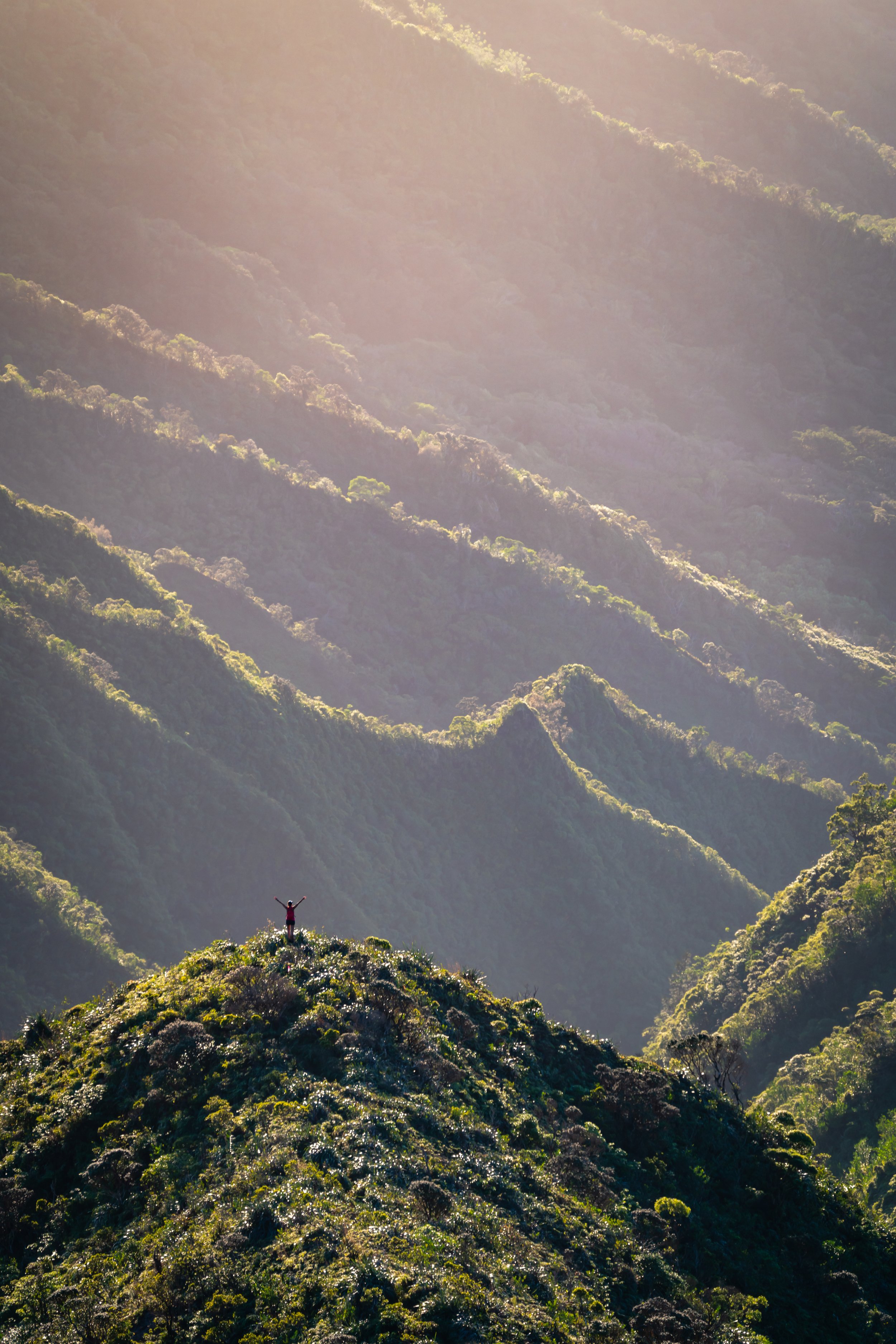
After the Tiki Ridge split, the trail begins the steep ascent up the ridge to the Kaʻala Saddle.
When the Mt. Kaʻala Trail begins this ascent, know there are very few places along this stretch to get a break from the constant elevation gain.
To put it in perspective, the ascent begins at about 1,900 ft. (579 m), making the total climb just over 2,100 ft. (640 m) from this point to the summit.
For those paying attention, this ascent is also where the Mt. Kaʻala Trail makes the biggest transition from a predominantly non-native/ invasive forest to a native forest that continues to become more and more pristine the higher you hike.
Kaʻala Saddle
Then, at about 2,700 ft. (823 m), the steep climb through the lower forest abruptly comes to an end when Mt. Kaʻala Trail reaches the Kaʻala Saddle.
At this junction, go right to continue toward the summit of Mt. Kaʻala.
As the trail follows the fence line, the hike continues to climb, but not as steep as the ridge leading up to the Saddle.
However, this slightly more gradual pace will soon come to an end at once at the scrambling sections, located further up the mountain.
Mt. Kaʻala Ladder
At roughly halfway between the Saddle junction and the summit bog, the Mt. Kaʻala Trail climbs through a few steep boulder sections.
However, I think it’s worth noting that the ladder installed today is more of a 'recent' luxury, meaning hikers of years past had to find their own way up this steep section.
This is the top of the ladder looking down.
If you’re wondering, these shoes are a pair of light trail runners that I sometimes prefer to use on less-overgrown hikes, such as Mt. Kaʻala.
Past the ladder, the Mt. Kaʻala Trail climbs a number of steep sections, as the trail typically gets wetter and wetter the closer you get toward the bog.
Mt. Kaʻala Summit Bog
When the trail finally levels out, you have reached the famous Mt. Kaʻala summit bog.
That said, the Mt. Kaʻala summit bog is one of the most pristine native forests in Hawaiʻi, with many rare and endangered species being found right along the trail.
Therefore, I kindly ask that you do everything you can to minimize your impact in this fragile environment, as some of the rarest plant and animal species in the world call this place home!
To further this point, Mt. Kaʻala is not only home to native species that can only be found on Oʻahu or in the Waiʻanae Mountains, but also species that only exist on the Mt. Kaʻala, making the bog one of most critical habitats amongst a host of non-native threats found elsewhere.
Please be sure to close the ungulate-exclusion fence after entering.
Shortly after entering the bog, the Mt. Kaʻala Trail follows a series of boardwalks to the far side of the summit, where the trail ends at Mt. Kaʻala Road.
Again, please be sure to lock the gate behind you.
Mt. Kaʻala
According to the Hawaiʻi Department of Land and Natural Resources (DLNR), the summit of Mt. Kaʻala is 4,025 ft (1,227 m), making it the highest point and only summit over 4,000 ft. (1,219 m) on Oʻahu.
The fences and communication equipment that you can see at the summit is an active military installation, which is why I recommend turning back once the trail ends at Kaʻala Road.
Native Plants on the Mt. Kaʻala Trail
As previously mentioned, Mt. Kaʻala is one of the most pristine native forests on the island, meaning, for obvious reasons, it is also one of the best hikes on Oʻahu to see and learn about a variety of native plants across all elevations of the hike.
To name a few, you can expect to find Lapalapa, ʻŌhiʻa lehua, Koliʻi, Kāpana, Kōpiko, Māmaki, Kāmakahala, Kanawao, Wiliwili, Maile, multiple Kōlea species, and honestly, too many more to list here.
Furthermore, if you are curious about trying the native Hawaiian Māmaki tea, I kindly ask that you don’t harvest Māmaki from our native forests but, instead, buy from one of the local reputable vendors, such as those listed below.
If you would like to learn more about these and many other native Hawaiian plants from across the islands, I encourage you to check out my separate post linked below.
Read My Separate Post: Native Hawaiian Plant Guide