Hiking the ʻAiea Ridge Trail to Stairway to Hell on Oʻahu, Hawaiʻi
Distance (Roundtrip): 11.6 miles / 18.7 km
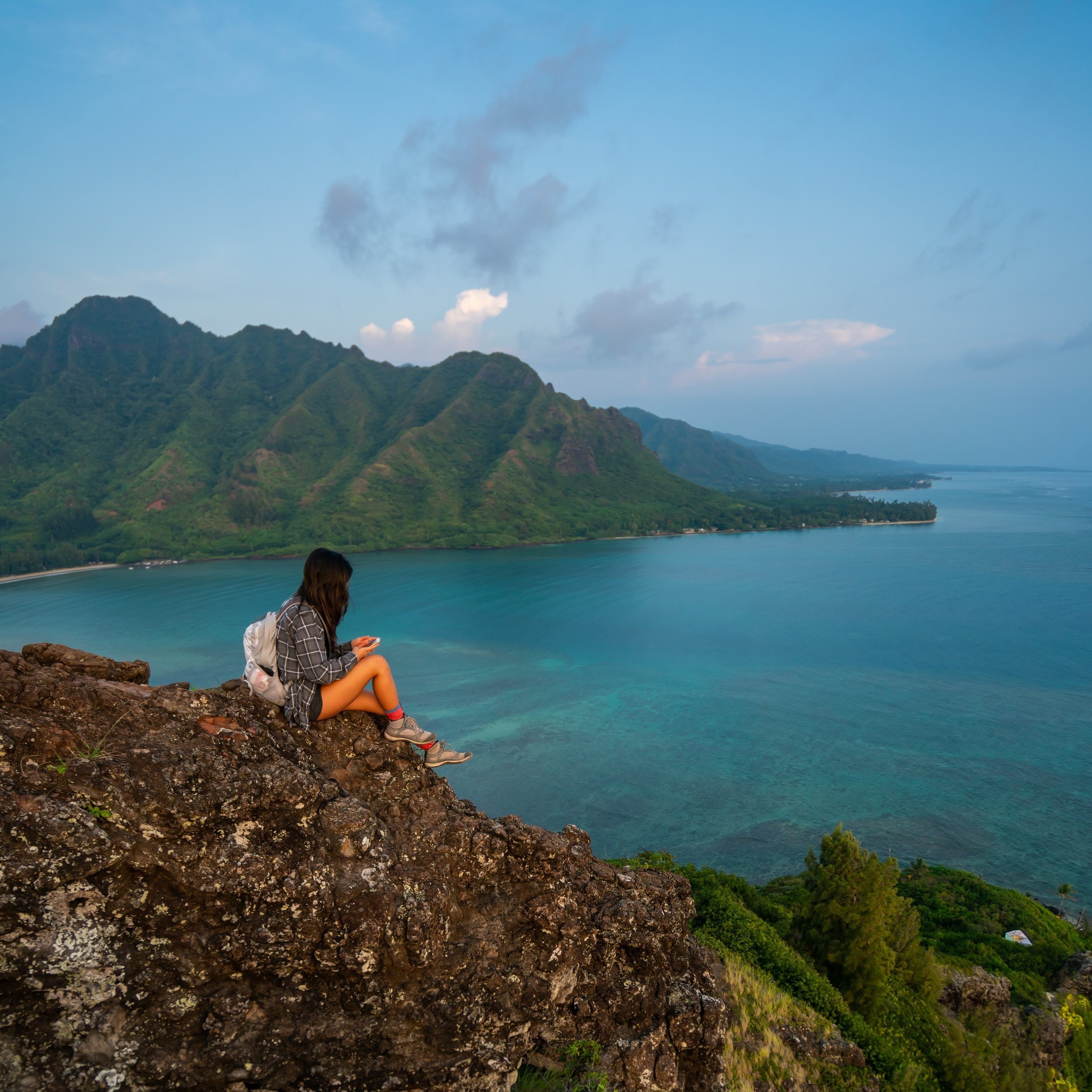
The ʻAiea Ridge Trail in the central Koʻolau Mountains on Oʻahu is a long, slow adventure to the Koʻolau Summit that is most commonly associated with the nearby 'Stairway to Hell,' just to the south of ʻAiea Summit.
I say this because most hikers don’t simply hike out and back on the ʻAiea Ridge Trail without continuing further to Stairway to Hell once at the top, given that the KST takes so much effort to reach from the beginning of the ʻAiea Loop Trail.
In any case, most Oʻahu hikers are familiar with the infamous Stairway to Heaven hike, but, in my opinion, the lesser-known and much more beautiful Stairway to Hell via ʻAiea Ridge, is the better experience—especially when treated at an overnight backcountry adventure!
How to Get to Stairway to Hell on Oʻahu?
While there is more than one way to hike to Stairway to Hell—also called the North Haʻikū Stairs—including ʻAiea Ridge, Hālawa Ridge, and the Moanalua Saddle via Kulanaʻahane, in this post, I talk about the best route: the ʻAiea Ridge Trail.
I say this because if you’ve ever hiked any Oʻahu saddle completely, you would know that they are nothing to take lightly, and they are not something that you want to attempt with a heavy overnight bag.
My Hawaiʻi Hiking Checklist
Obviously, for camping, you will need general backpacking gear. For this reason, I wrote a separate post about what backpacking gear is worth the money, from my experience, and what the best alternatives are to save you money.
Read My Separate Post: Best Ultralight Backpacking Gear
In addition, here is a complete list of must-have things that you will want for any hike on Oʻahu.
ʻAiea Ridge Trailhead Parking
If you’re planning on an overnight hike, don’t park your car at the ʻAiea Loop Trailhead. There are signs warning that you may be ticketed and towed.
To get around this, park just outside of the gate for the Keaʻīwa Heiau State Recreation Area on one of the residential streets.
In my opinion, it’s best to drive everyone to the trailhead, then have one person head back down to park the car and walk up.
Google Maps Directions: ʻAiea Loop Trailhead
Hiking the North Haʻikū Stairs
Beginning from the ʻAiea Loop Trail, the entire hike is roughly 11.6 miles (18.7 km) roundtrip and should be completed in at least two days for a much more enjoyable experience.
That said, 11.6 miles (18.7 km) may not sound like much to some, but camping is always a better choice in order to have the opportunity to watch the sunset and sunrise from the stairs.
However, if you plan for two days, you now have to factor in more food, at least 5-6L of water per person at a minimum, and a tent to sleep in. Also, don’t count on a hammock because there are no trees!
To get to ʻAiea Ridge, start by hiking the upper half (north side) of the ʻAiea Loop Trail. If you make the mistake of taking the lower trail, you will still reach ʻAiea Ridge; it will just take a little longer.
ʻAiea Ridge Junction (Puʻu ʻUaʻu)
At about 1.6 miles (2.6 km) into the hike, the Upper Half of the ʻAiea Loop Trail reaches the beginning of the Lower Half, which is where the real ʻAiea Ridge Trail begins.
It’s here that you will start to see views of the H-3 freeway, which is always a nice sign that you’re on the correct route.
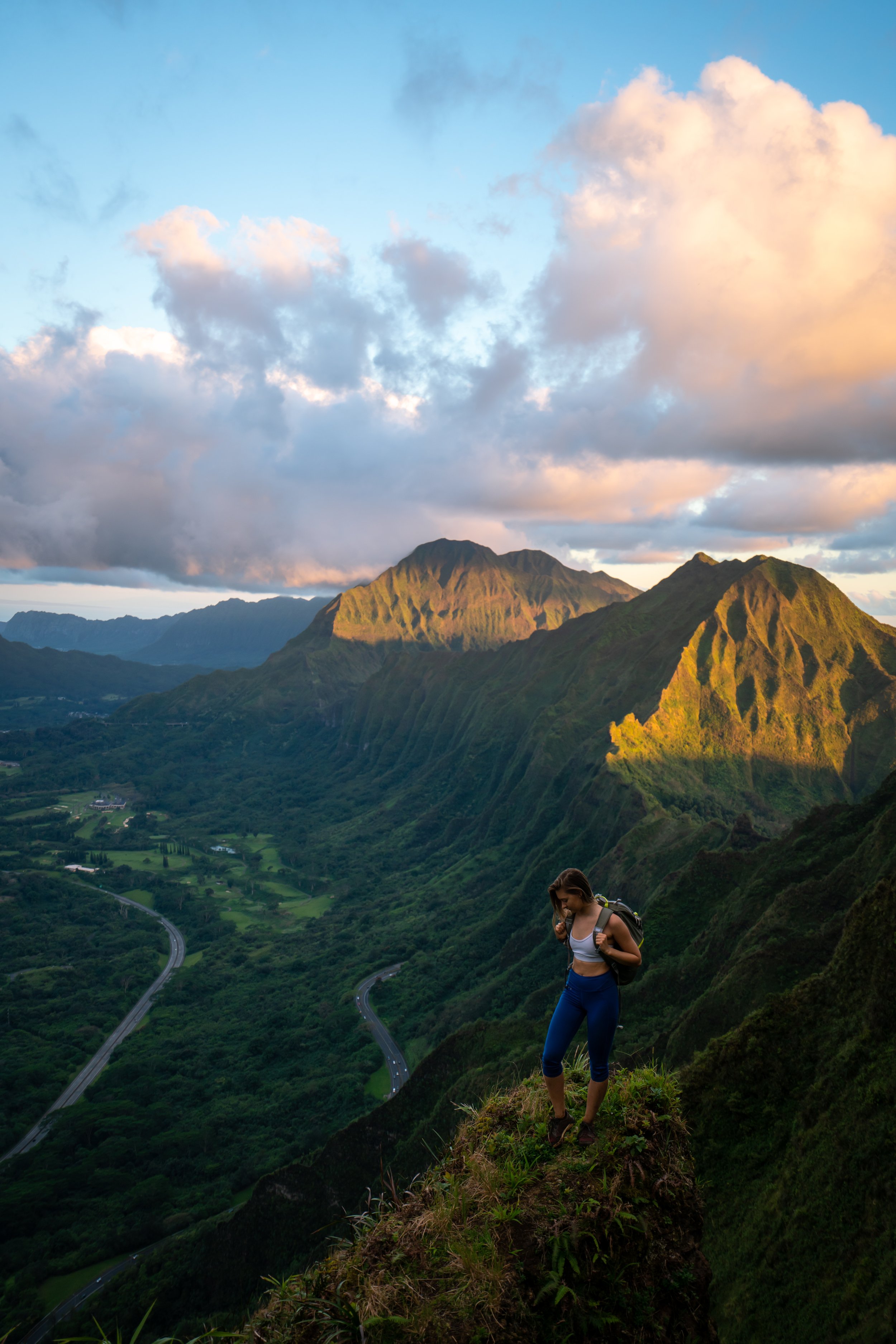
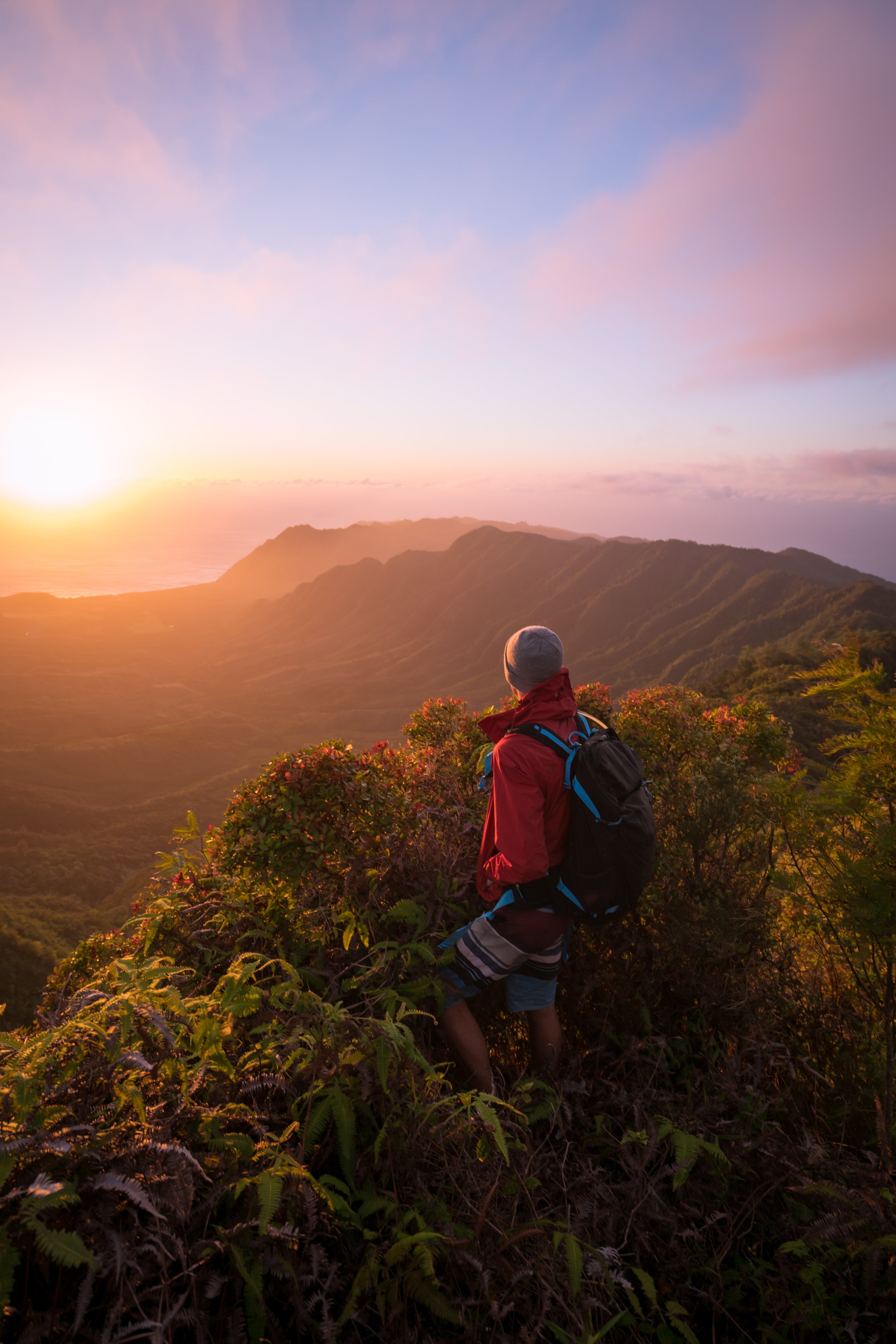
ʻAiea Ridge
From here, there's not many places that you can get lost.
By this, I mean that ʻAiea Ridge is the only trail from this point on until you reach the Koʻolau Summit Trail (KST) at the top of the mountains.
As it should probably go without saying, the ʻAiea Ridge Trail, past the ʻAiea Loop, is a hike where pants are necessary.
The pants below are my recommendations that hold up the best with the overgrowth here in Hawaiʻi, but with any hiking pants that need to be durable, make sure that they are at or near 100% nylon. This is really the most important factor!
The closest peak in the photo below is Puʻu Kawipoʻo, and in my opinion, it’s the best spot to take a break on ʻAiea Ridge.
I say this because before the peak, there aren’t many great spots that open up for a nice place to take your pack off.
The first flat area that you will reach at the top of the ridge is not ʻAiea Summit.
The true ʻAiea Summit is about a five-minute or less hike away, past the power line.
ʻAiea Summit
Once at ʻAiea Summit, you will have reached the KST.
From here, you are about 1-2 hours away from Stairway to Hell, depending on your pace.
Read My Separate Post: Koʻolau Summit Trail (KST)
Koʻolau Summit Trail (KST)
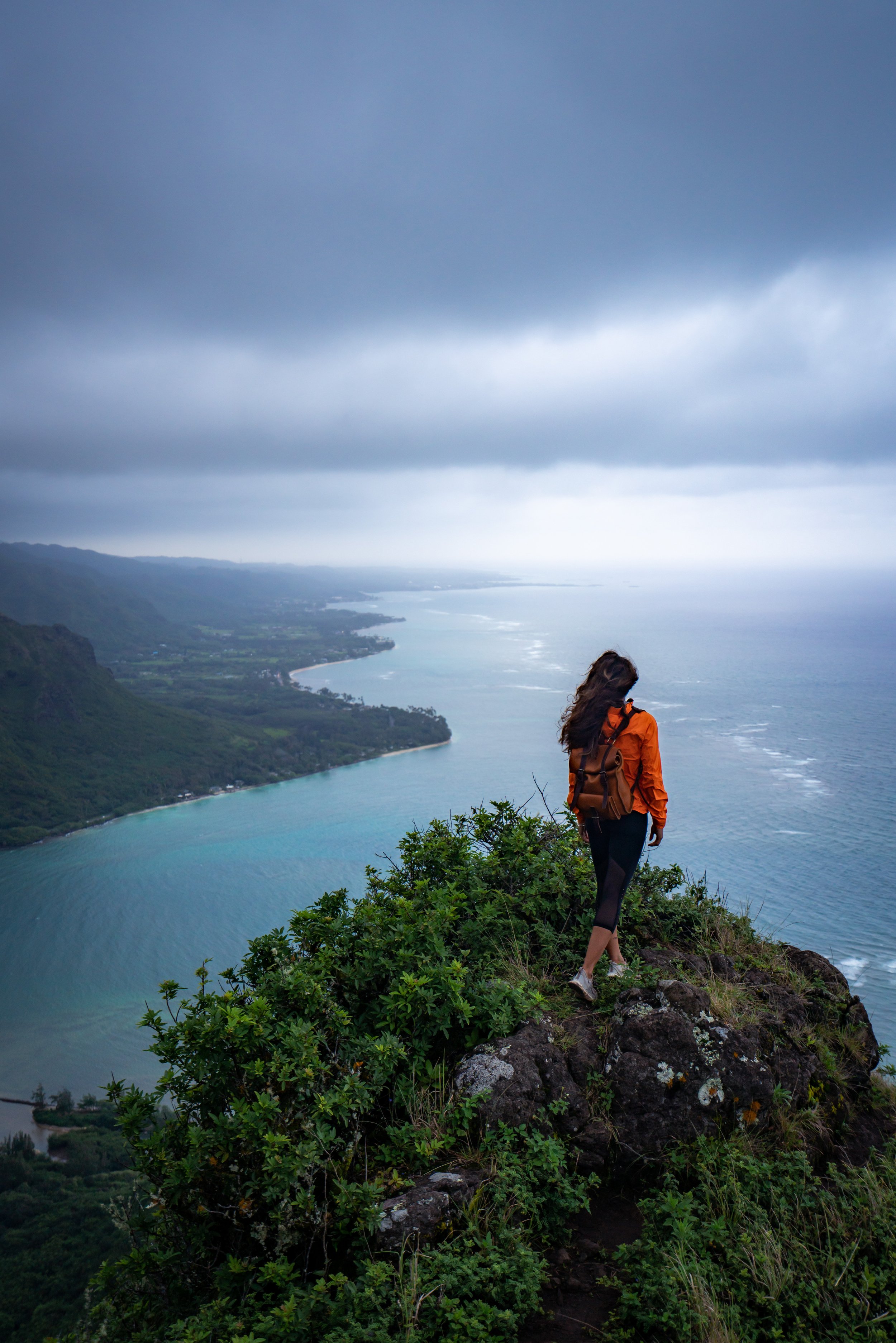
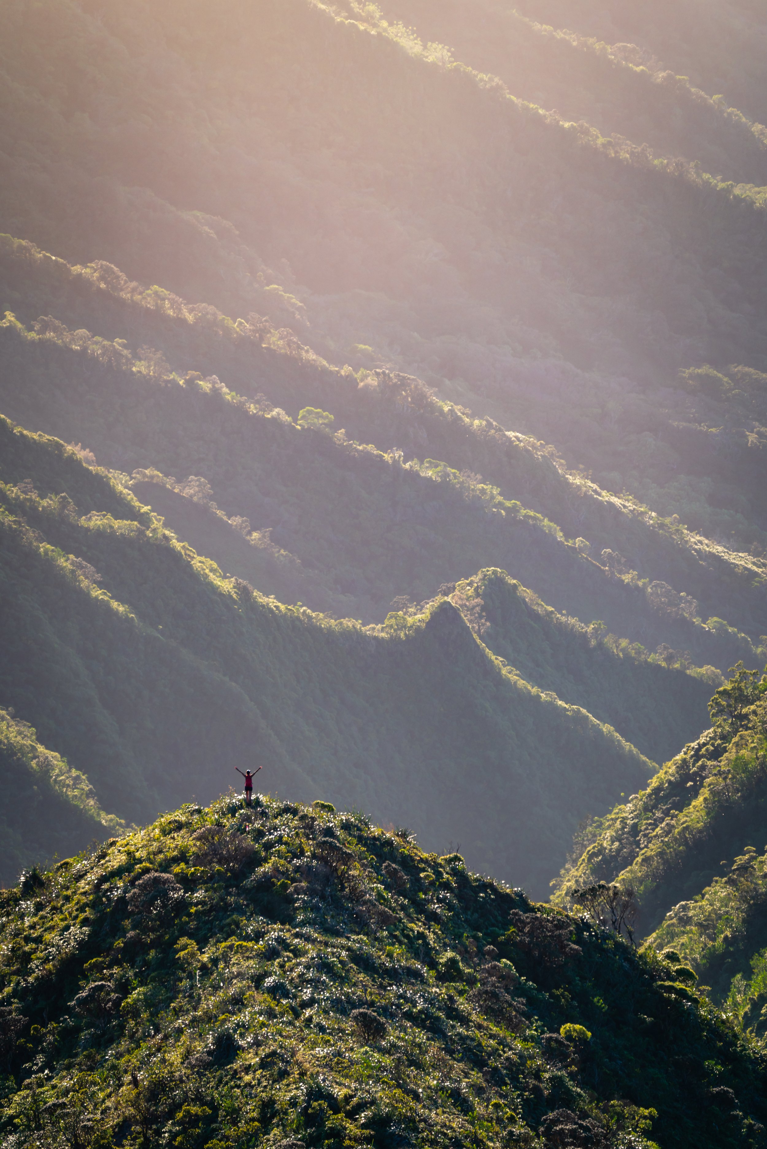
From ʻAiea Summit, turn right (south) on the KST toward the H-3 to get to Stairway to Hell. In my opinion, this is the most tedious section of the hike.
To get to Stairway to Hell, you will need to go up and down about four different peaks on the ridgeline, which can be seen in the photo above.
ʻAiea Summit is the peak on the far left, and Stairway to Hell is just below the second little bump on the ridge to the right of the big dip (the dip to the left of the ʻŌhiʻa tree in the bottom of the photo).
This aside, some longtime Oʻahu hikers may remember that it was back in 2015 when a hiker went missing on this section and was never recovered. It happened somewhere between the Mānana Ridge Trail and Stairway to Heaven, and I say to emphasize how important it is to be careful!
Stairway to Hell
When you finally see the H-3 come out of Haʻikū Valley, you’ve made it! There is a perfect grassy meadow to set up camp, and even a little shelter if the weather decides to take a turn for the worst.
The old famous disintegrating stairs are on the ridge descending toward Kāneʻohe right when you get off the final peak.
That said, I advise you to wear gloves when hiking the stairs because the rusted handrails will literally disintegrate in your hand, and this is the last place that you want to get a bad cut.
Depending on how much it has rained recently, the ground may be very saturated, which is why we set up camp on the concrete pad.
Therefore, in case this ends up being your scenario, I recommend packing a sleeping pad.
Hiking Out (Moanalua Saddle)
Unless you know exactly what you’re getting into on the Moanalua Saddle without a heavy bag, I would strongly advise turning around toward ʻAiea Ridge.
In any case, these are some photos from our hike out on the Moanalua Saddle.
Initially, the stairs from Stairway to Hell continue for a little more than 0.25 miles (0.4 km) past the meadow.
As the trail continues toward and past Hālawa Summit, the KST isn’t too different from the initial sections between ʻAiea Summit and Stairway to Hell.
But then, the Moanalua Saddle becomes significantly more exposed, erroded, and dangerous, making the hiking very tricking from here until the bottom of the saddle at Kulanaʻahane.
Moanalua Saddle (Kulanaʻahane)
This is the bottom of the saddle, where the state-managed Kulanaʻahane Trail meets the Koʻolau Summit.
Kulanaʻahane Trail
If you’re interested in seeing what the rest of the hike through Moanalua Valley looks like on the Kulanaʻahane Trail, I encourage you to check out my separate post.
Read My Separate Post: Kulanaʻahane Trail
Notes for Hiking Stairway to Hell
Don’t park your car within the Keaʻīwa Heiau State Recreation Area. The park will close, and your car may be ticketed and towed. That said, even if you decide to day hike it and your car is still there, you will probably get back after the gate has closed.
Don’t underestimate the amount of food and water that you will need. Always plan for the worst, and hope for the best. There are no reliable water sources on this hike, but you may get lucky at Stairway to Hell if the ground is saturated or in the adjacent drainage. If that’s the case, you will need a water filter.
Lastly, the hike from ʻAiea Loop Trail to the Moanalua Valley Trailhead is 13.5 miles (21.7 km), and it should only be done if you had planned in advance for traversing the Moanalua Saddle. This could also mean packing ropes, as ropes on the KST are replaced far less frequently than on more popular hikes, such as Mt. Olomana.
Native Plants on the Stairway to Hell Trail
Like any upper-elevation trail on Oʻahu, the ʻAiea Ridge Trail and the KST are great places to see a ton of different native Hawaiian plants, which are far less common in other low-elevation areas.
I think my favorite find was this hybrid Kōlea, but others that can be found include ʻIliahi, ʻŌhiʻa lehua, Koa, Alani, Kalia, and Hāhā, to truly name only a few.
If you’d like to learn about these and other native plants from across Hawaiʻi, I encourage you to check out my post that I wrote to help others learn and identify plants from around the islands.
Read My Separate Post: Native Hawaiian Plant Guide