Hiking the Kulanaʻahane Trail to the Moanalua Saddle on Oʻahu, Hawaiʻi
Distance: 9.8 miles / 15.8 km
Elevation Gain: ~1,375 ft. / 419 m
The Kulanaʻahane Trail in central Oʻahu is a little-known adventure that winds its way through the bottom of Kamananui Valley, ultimately ending at the Moanalua Saddle above the beautiful Haʻikū Valley and H-3 Freeway in Kāneʻohe on the east side of the island!
That said, the Kulanaʻahane Trail is not a busy adventure by any means, as the popularity of Stairway to Heaven is the reason the vast majority of hikers venture up Kamananui Valley. To this point, Kulanaʻahane often sees hikers on the trail by mistake rather than those intentionally hiking up Kamananui Valley to reach the summit of the Moanalua Saddle.
All this to say, this article is not intended to provide step-by-step directions to the off-limits Haʻikū Stairs. Instead, it’s written with the intention of providing a detailed overview of one of the island’s least-visited, state-managed trails.
Moanalua Valley Trailhead Parking
Parking for the Kulanaʻahane Trail is located near the very end of Ala Aolani Street, in the back of Moanalua Valley, just outside Moanalua Valley Neighborhood Park.
That said, hiker parking is not allowed within Moanalua Valley Neighborhood Park, and it is possible to receive a citation from the Honolulu Police Department for doing so.
Google Maps Directions: Kulanaʻahane Trailhead
Hiking the Kulanaʻahane Trail
Walking to the Trailhead
To begin the Kulanaʻahane Trail, walk through Moanalua Valley Neighborhood Park and up the service road at the upper end of the parking lot.
Moanalua Valley Trailhead (Kamananui Valley Road)
At the upper end of the Moanalua Valley Neighborhood Park, the dirt road reaches the Moanalua Valley Trailhead, which serves as the starting point for countless different day hikes in the valley.
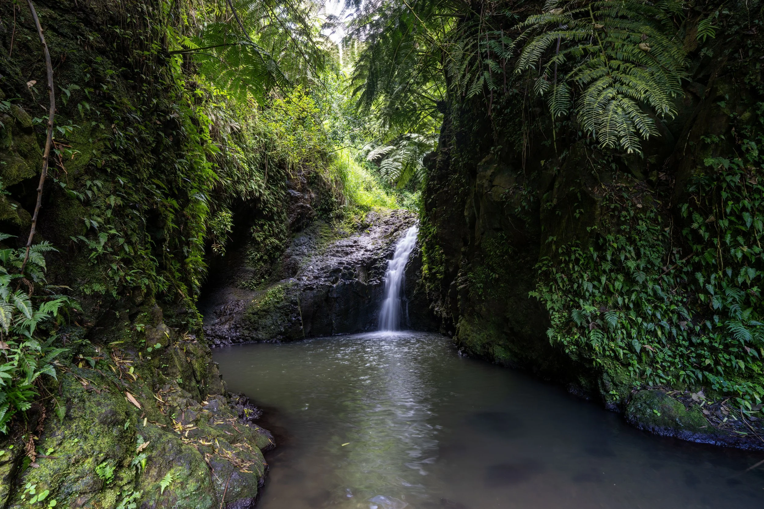
From this point, the Kulanaʻahane Trail follows Kamananui Valley Road for roughly 2.8 miles (4.5 km), where the trail will abruptly branch away from the road to cross the Moanalua Stream and begin the real trail up the valley.
After just 0.1 miles (0.2 km), the Kualanaʻahane Trail passes this restoration area on the left-hand side.
I mention this because, on the long hike out of Moanalua Valley, this restoration area is one of the best mental checkpoints that the trailhead is not far away!
In the beginning of Kamananui Valley Road, the trail splits seven different times, with both a path that leads down toward the Moanalua Stream and an upper path that passes over the stream.
At each bridge, I recommend following the upper path because it’s always easier and more direct than doing an unnecessary down and up through the stream.
This is the first of seven times both paths on Kamananui Valley Road come back together.
This is the second of seven times Kamananui Valley Road splits.
This is the fourth split on Kamananui Valley Road and the first time the upper path leads to the right instead of the left.
This is the fifth of seven times Kamananui Valley Road splits.
After the sixth split, there is only one more to go!
This is ʻAwa or Kava, and while it is not a native Hawaiian plant, it is a canoe plant in Hawaiʻi, meaning a species brought to the islands by the original Polynesians.
Furthermore, Kava, just like Māmaki tea, is widely commercially available, as you can see using the links below.
This is the seventh and final time Kamananui Valley Road splits, meaning that from this point on, the hike to the Kulanaʻahane Trail simply follows the main road along the Moanalua Stream.
On a beautiful, sunny day such as this, I highly recommend wearing a hooded sun shirt, as almost any day hike in or up one of the ridges out of Moanalua Valley inevitably means spending a lot of time outside.
That said, there really are no short day hikes that begin at the Moanalua Valley Trailhead, which is why coming prepared for a long day is so essential—especially if you plan to climb any of the ridges that ascend above the valley floor.
Kamananui Valley Road-Tripler Ridge Connector Junction
At almost exactly the 1.7-mile (2.7 km) mark, Kamananui Valley Road passes a little-known connector trail that leads up to Tripler Ridge.
This is the route that hikers without a valid DOD ID must take to hike the Tripler Ridge Trail, which is far more challenging because of the steep ascent out of the valley just to reach the crest of the ridge.
All this to say, I’ve written an entirely separate post about the Tripler Ridge Trail, but to continue hiking toward the start of the true Kulanaʻahane Trail, go straight to keep hiking up Kamananui Valley Road.
Read My Separate Post: Tripler Ridge Trail
After the Tripler Ridge junction, the hike up Kamananui Valley Road continues for another 1.1 miles (1.8 km) until it reaches the start of the Kulanaʻahane Trail.
Hau trees are one of the most common native Hawaiian plants in Moanalua Valley, which will become much more noticeable when the Kulanaʻahane Trail starts heading up the North Fork of the Moanalua Stream up ahead.
For those interested in hiking up to Tripler Ridge, this open clearing just before the 2.0-mile (3.2 km) mark is a great mental indicator that you missed the turn for the trail that leads up and out of Moanalua Valley.
At this point, after the clearing, there is only 0.8 miles (1.3 km) left until the Kulanaʻahane Trail branches away from Kamananui Valley Road.
What is the Difference Between Kamananui and Moanalua Valley?
When people refer to Moanalua Valley, they are often talking about the neighborhood at the base of the trail, the road up what is actually Kamananui Valley, or the back way to the Stairway to Heaven.
This confusion—and the answer to this question—comes from the fact that Moanalua Valley actually encompasses multiple smaller valleys, including the Moanalua Stream in Kamananui and the Manaiki Stream in Kamanaiki Valley just to the south. A better visual reference is that Moanalua Valley stretches from the summit of Hālawa Ridge, to the left of Kamananui Valley, to Puʻu Kahuauli (the final peak before the KST drops down the Kalihi Saddle).
This is why the signs and the name of the service road up Kamananui Valley are different from what most people refer to as the Moanalua Valley Trail. However, the reality is that it’s all just one place, with Moanalua simply being the name for the larger area.
This section, shortly before the beginning of the Kulanaʻahane Trail, is notorious for being the muddiest section of the entire hike.
That said, these photos were taken one day after a multi-day storm, and while the state does what they can to lay gravel and keep this section dry, the mud always seems to come back down the mountain after enough rain.
Just like ʻAwa, Kukui is another of the many canoe plants on the hike up Kulanaʻahane, and it is one of the most common, as it continues far up the valley once the trail branches away from Kamananui Valley Road.
What is the History of Moanalua and Kamananui Valley?
Moanalua Valley and the smaller Kamananui Valley within have a long history dating back to pre-contact Hawaiʻi, when land in Hawaiʻi was organized as an ahupuaʻa stretching from the Summit of the Koʻolau Mountains to the sea. During this time, native Hawaiians lived and in Moanalua for centuries, leaving behind terraces and kiʻi pōhaku (petroglyphs) that can still be found in the upper valley today.
Then in 1848, the Māhele reshaped land ownership across Hawaiʻi, and Moanalua eventually came under the control of high-ranking aliʻi, including Princess Bernice Pauahi Bishop. When she died in 1884, Moanalua was left to Samuel Mills Damon, beginning more than a century of Damon family stewardship. Samuel Damon eventually moved to the valley in the 1890s, made it his home, and carefully managed the land as both a private estate and working landscape. He preserved historic structures such as Kamehameha V’s cottage and cultivated what later became known as the Moanalua Gardens.
After Damon’s death in 1924, the Damon Estate continued to oversee the valley for roughly 80 more years. Even as Honolulu expanded rapidly in the mid-20th century, much of the interior valley remained undeveloped under estate management. In 1970, Damon’s descendants established the Moanalua Gardens Foundation to preserve the valley’s cultural and historic resources.
Finally, in 2004, the Damon Estate dissolved, and in 2007, large portions of Kamananui Valley were transferred to the State of Hawaiʻi for conservation and public access. The presence of ancient petroglyphs in the upper valley, along with other archaeological findings, helped prevent residential development and reinforced the valley’s protection giving us the largely undeveloped landscape that we have today!
Kulanaʻahane-Kamananui Valley Road Junction
After 2.8 miles (4.5 km) on Kamananui Valley Road, the Kulanaʻahane Trail finally branches away on the left-hand side.
At this split, go left to cross the Moanalua Stream and begin the Kulanaʻahane Trail on the far side.
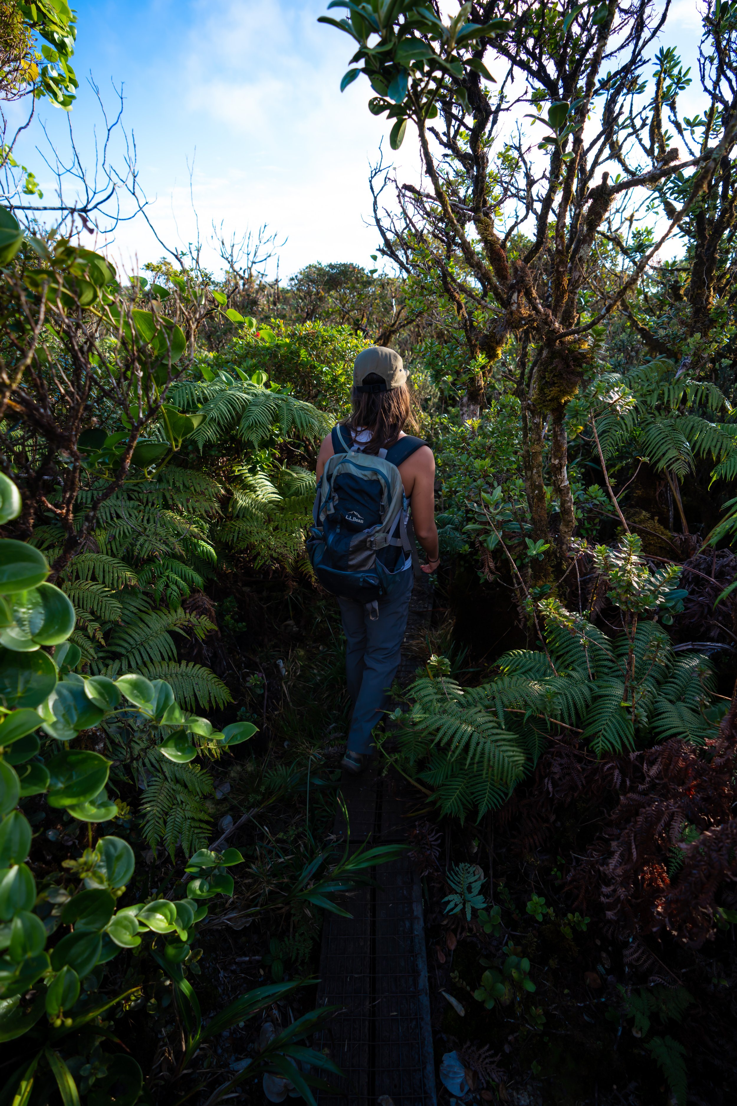
On the far side of the Moanalua Stream, the Kulanaʻahane Trail finally feels like it’s beginning for the first time!
I say this because this is the point where the hike begins to traverse an actual trail up the valley, which continues all the way to the Koʻolau Summit.
This entanglement of branches is called Hau, the native tree previously mentioned that continues up much of the Kulanaʻahane Trail until the ridge starts climbing out of the valley at the very end.
That said, the Hau trees on Kulanaʻahane can make the hike feel very slow and tedious, as the next 2.0 miles (3.2 km) to the Koʻolau Summit duck and weave their way through these branches and across countless stream crossings!
Shortly after the Kulanaʻahane Trail leaves Kamananui Valley Road, the trail passes the USGS stream gage for the Moanalua Stream, which is really nothing more than a nice mental checkpoint on both the hike to the saddle and back.
However, if you want to know what to expect at the stream crossings on Kulanaʻahane after periods of very wet weather, real-time data can be found using the link above.
This is the first of 22 times the Kulanaʻahane Trail crosses the North Fork of the Moanalua Stream.
This is why I mentioned above that the hike following Kamananui Valley Road is very slow going, but it can help if you decide to count the crossings as you go!
The second crossing is one of two 'longer' stream crossings, where the Kulanaʻahane Trail heads upstream a short distance before continuing up the trail on the far side.
This is the fourth North Fork stream crossing.
This is the sixth time the Kulanaʻahane Trail crosses the North Fork of the Moanalua Stream.
The 'entrance,' so to speak, begins one of the longest entanglements of Hau trees on the Kulanaʻahane Trail, which often means a lot of ducking and weaving through the best openings that exist.
This hard right turn is where the 'long' Hau tree tunnel finally ends!
This is the 9th of 22 times the Kulanaʻahane Trail crosses the North Fork.
Since there are so many stream crossings on the Kulanaʻahane Trail, as well as muddy sections on Kamananui Valley Road, some hikers may want to bring trekking poles, which can certainly be useful for navigating up these sections after or during periods of rainy weather.
In addition to poles, I strongly recommend wearing hiking pants on the Kulanaʻahane Trail because, while it’s certainly not the most overgrown adventure on Oʻahu, pants are nice to have for the mosquitoes, which are mostly a problem when taking a break anywhere past Kamananui Valley Road.
ʻIeʻie is one of the few native plants within the larger Hau forest, which I mention because seeing it is a nice sign that the Kulanaʻahane Trail is climbing higher in elevation up the valley.
At the 13th stream crossing, the Kulanaʻahane Trail makes a hard right turn up the stream, which is the second time the trail does not directly cross straight over to the other side.
This is where the Kulanaʻahane Trail continues on the far side.
I think it’s important to mention that a bright, beautiful, sunny day like this is quite rare this far up Moanalua Valley.
I mention this because I largely regard this long day in Moanalua Valley as one of the most beautiful Hawaiʻi days I’ve ever experienced, but also to say that it’s important to come prepared for a much wetter hike than these photos may indicate.
Now, I don’t write this to suggest that sunny weather doesn’t exist here, but it’s certainly not as common as partly or mostly cloudy weather with passing showers, which is why I recommend coming prepared with a good rain jacket.
This big boulder at the 15th stream crossing is one of the better ways to keep track on both the hike to the Moanalua Saddle and back.
It’s always great to see the Kokolau flower, as all the native species are endemic to Hawaiʻi.
Near the back of Kamananui Valley, the Kulanaʻahane Trail passes pieces from the wreckage of a Republic F-47N Thunderbolt, a military fighter plane that crashed here on September 2, 1948.
That said, only pieces of the actual crash are located near the Kulanaʻahane Trail, as the majority of what remains is off the main path shown in this post.
This is the 18th stream crossing, meaning there are only four more before the Kulanaʻahane Trail begins climbing out of Kamananui Valley.
This is the 20th stream crossing, which is located just before a large clearing in the back of Kamananui Valley—another great mental checkpoint when counting the crossings up the North Fork of the Moanalua Stream.
This is the second-to-last stream crossing before the ridge out of Kamananui Valley.
This is the 22nd and final stream crossing before the Kulanaʻahane Trail leaves the valley and begins climbing up to the Moanalua Saddle.
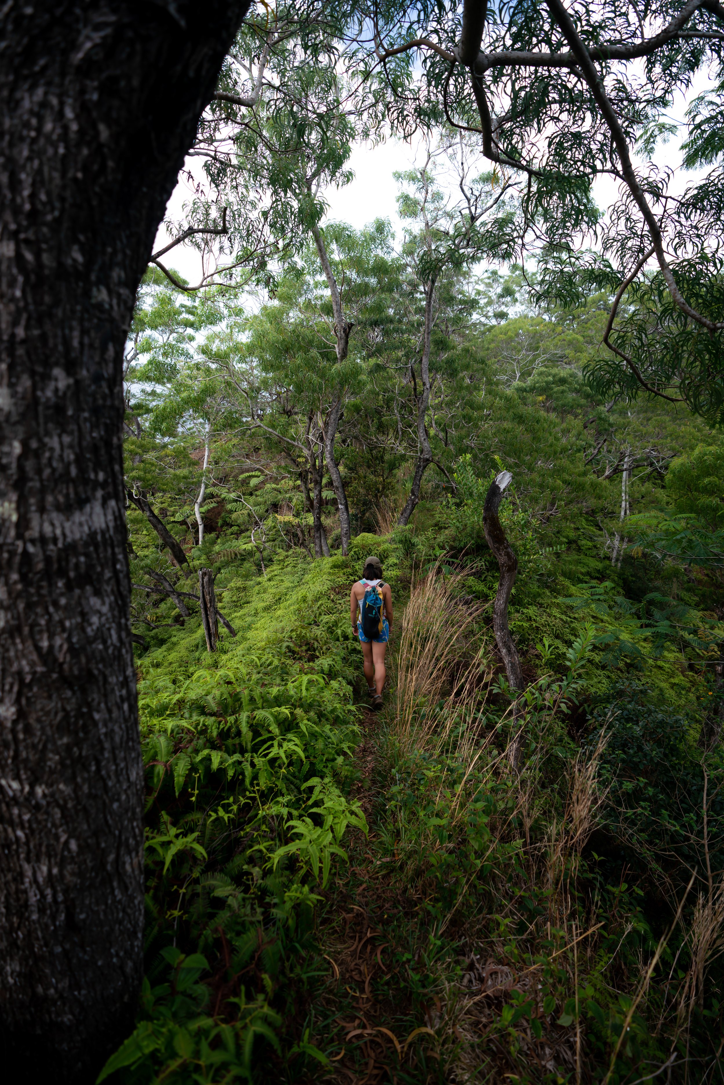
Kulanaʻahane Ridge Trail
After the trail crosses the North Fork of the Moanalua Stream for the final time, the Kulanaʻahane Trail begins ascending the Kulanaʻahane Ridge Trail up to the Moanalua Saddle and the Koʻolau Summit.
That said, this final ascent climbs roughly 420 ft. (128 m) in about 0.25 miles (0.4 km) to the end of the trail.
Once the ridge out of Kamananui Valley starts climbing, it essentially remains this steep for the rest of the hike to the Koʻolau Summit.
This is ʻŌhiʻa ʻāhihi, and it’s one of three ʻŌhiʻa species that are endemic to Oʻahu, all of which can be seen in the higher elevations of Moanalua Valley.
The nice thing about the ridge out of Kamananui Valley is that, unlike most Oʻahu ridge trails, the climb really doesn’t last long compared to others, such as the Kōnāhuanui Trail via Kalāwahine.
I mention this because the entirety of the hike from the Moanalua Valley Trailhead is very gradual, and it really isn’t until this final section that the hike actually becomes steep.
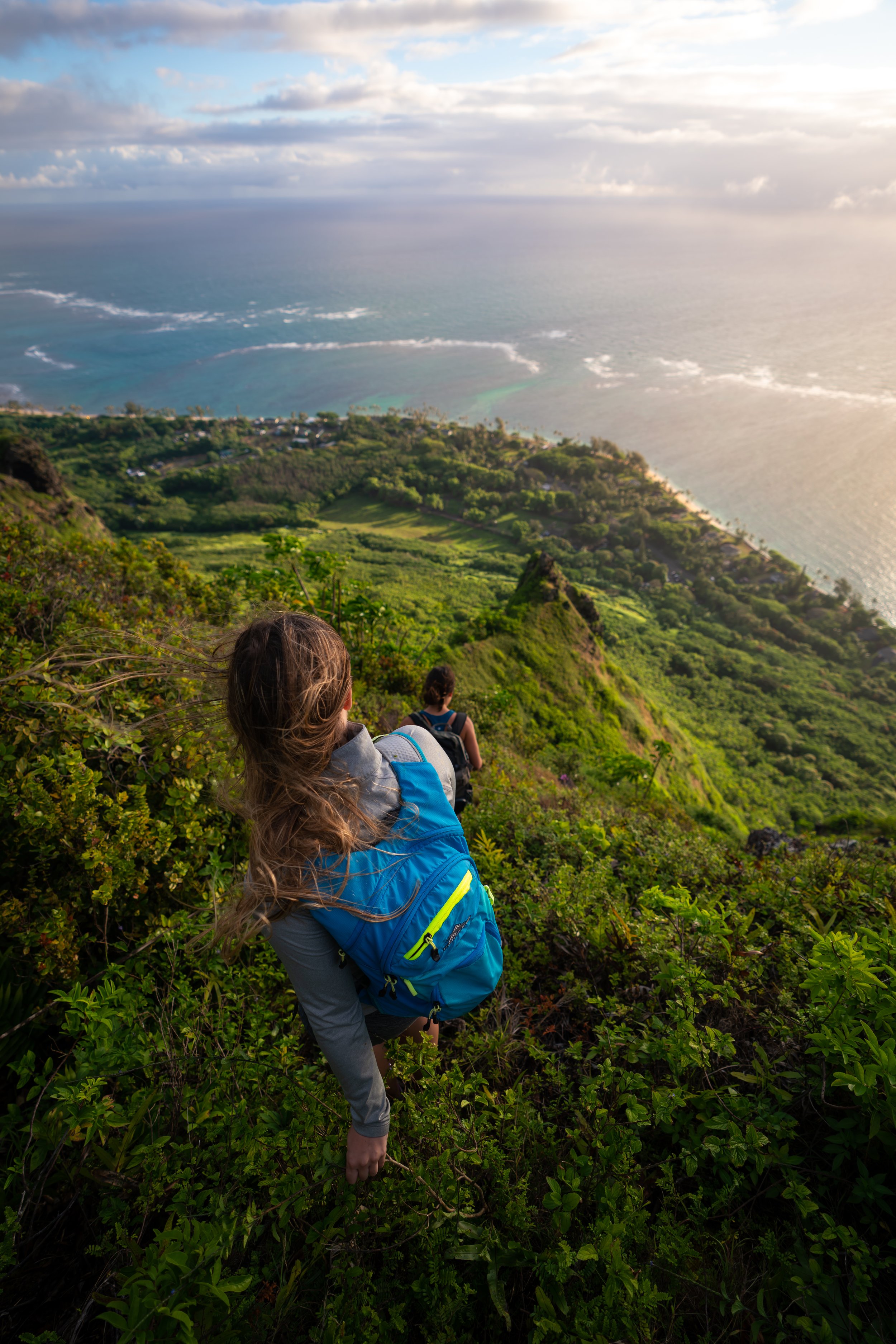
This is where the top of the Moanalua Saddle and the end of the Kulanaʻahane Trail can be seen for the first time!
These ropes may make the final ascent up Kulanaʻahane appear more difficult than it actually is, but in reality they are just nice to have in hand, as the uppermost elevations are often very wet and slippery, considering this is one of the wetter places across the central Koʻolau Mountains.
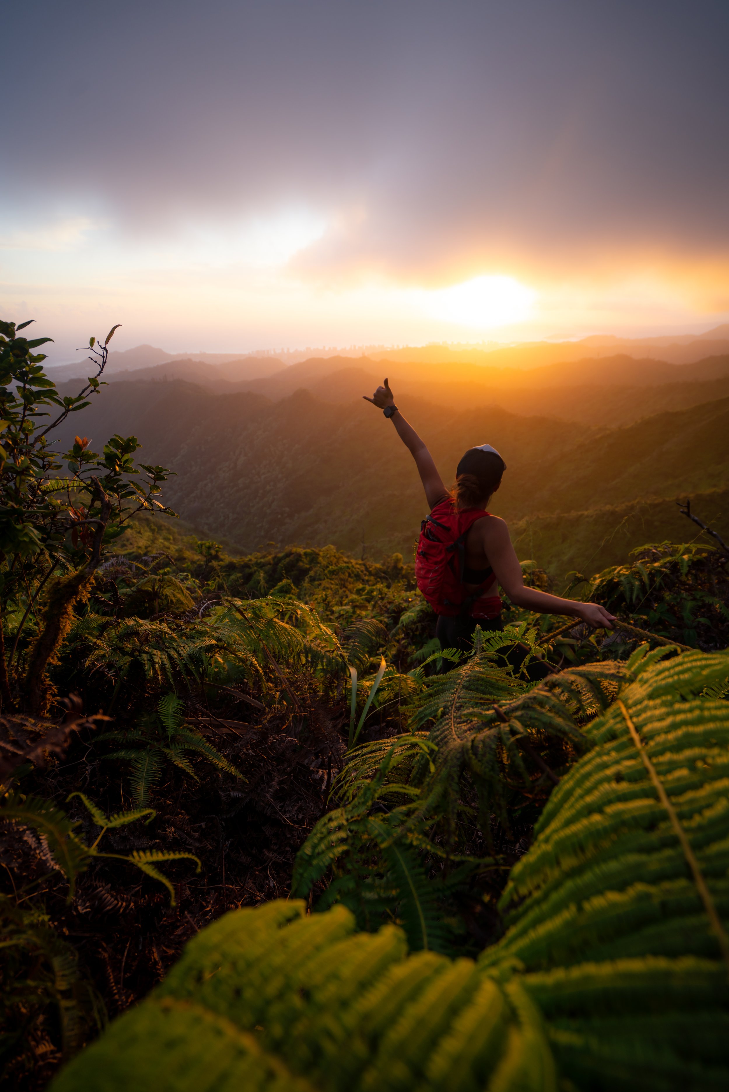
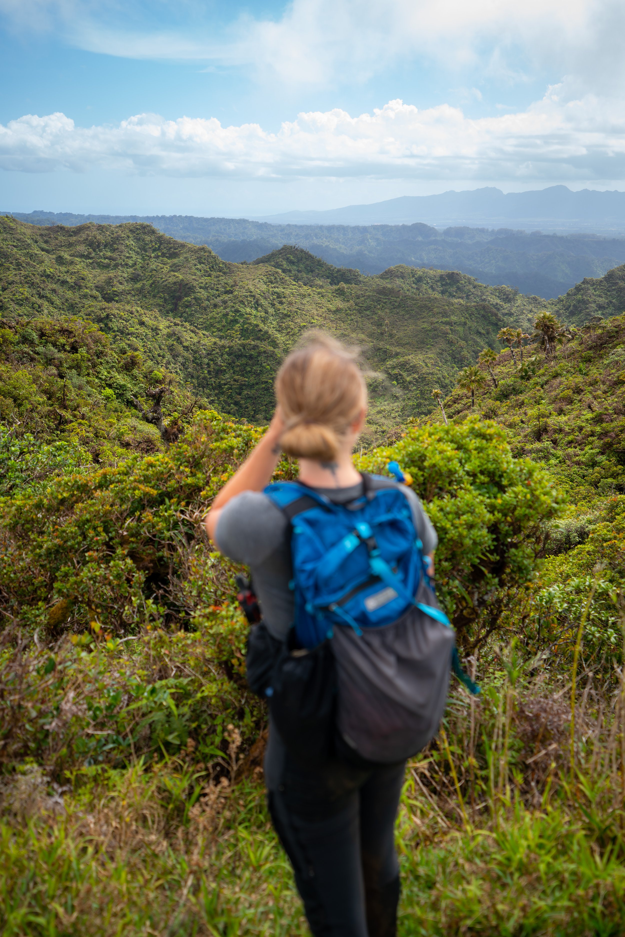
Moanalua Saddle (Kaunakōlea)
The end of the Kulanaʻahane Trail is the lowest point on the Moanalua Saddle, where you’ll have expansive views across Haʻikū Valley and Kāneʻohe to the east!
Some of the other notable hikes that can be seen from the top include the Kalāheo and Oneʻawa Hills.
Koʻolau Summit Trail
On a different note, the end of the Kulanaʻahane Trail and the Moanalua Saddle is also a very small section of the Koʻolau Summit Trail (KST)—the 56.0-mile (90.1 km) cross-island hike that begins in Pūpūkea on Oʻahu’s North Shore and ends at the Makapuʻu Lighthouse on the southern end.
The Moanalua Saddle is one of three on the Koʻolau Summit, which are widely considered to be the most challenging and dangerous parts of the entire hike.
That said, do not hike past the summit of Kulanaʻahane if you weren’t planning on continuing farther, or if you ended up here by mistake while trying to get to Stairway to Heaven.
I say this because everything both to the north and south is far more difficult and dangerous than everything up the Kulanaʻahane Trail thus far—especially the short 0.8-mile (1.3 km) section between the saddle and Stairway to Heaven.
I only write this from a place of respect and to urge caution, as I have lived through the worst possible outcome of losing a good friend in the mountains here in Hawaiʻi. So honestly, trust me! Getting to Stairway to Heaven is not worth risking your life over!
For a little more context, here’s a good story about the Moanalua Saddle.
On one hike, when I was traversing down the north side of the saddle with some friends, we were taking a break at the summit of Kulanaʻahane.
Shortly after we got here, a couple of fit hikers came up the ridge, only to be disappointed when they realized they had made a mistake, ultimately finding themselves looking at Stairway to Heaven instead of being on the infamous stairs. This is almost a daily occurrence, as the correct route is often not well marked.
In any case, we got to talking to them and tried to convince them not to go up the saddle toward Stairway, but they chose not to listen. To be fair, they were clearly two very fit, young military guys.
After they left, our group sat and watched them as they made their way up the south side of the saddle to the first tricky section. This initial climb does not take long to reach.
Once there, they almost immediately put themselves in a very dangerous situation on the first climb because they didn’t know the correct and best way to go up. In their defense, it looks easier and more straightforward from far away.
However, after about half an hour of failed attempts to get up the first climb, they both thankfully made the right decision to turn back.
I’m not kidding when I say Hawaiʻi has the most challenging hiking in the country, and that’s not even mentioning that the Moanalua Saddle is the easiest of the three saddles. Take that as you will, but I strongly recommend against leaving the summit of Kulanaʻahane if you don’t know what you’re doing.
Stay safe out there!
Read My Separate Post: Koʻolau Summit Trail (KST)
Native Plants on the Kulanaʻahane Trail
Outside of a few native plant restoration sites in the Moanalua Valley, the trek through the lower elevations of the forest is heavily invaded by non-native, invasive species such as Strawberry Guava, Golden Pothos, and Kukui—the canoe plant mentioned previously that has proven to carry invasive tendencies.
That said, there are a variety of native Hawaiian plants along the Kulanaʻahane Trail, with Hau being one of the most abundant throughout the entire hike.
However, when the Kulanaʻahane Trail begins climbing up from the valley floor toward the end, there are many more native plants to find, including ʻŌhiʻa lehua, Koa, ʻOhe Mauka, ʻAhakea lau nui, and ʻUki grass, to name just a few.
If you would like to learn more about these and many other native Hawaiian plants from across the islands, I encourage you to check out my separate post linked below.
Read My Separate Post: Native Hawaiian Plant Guide