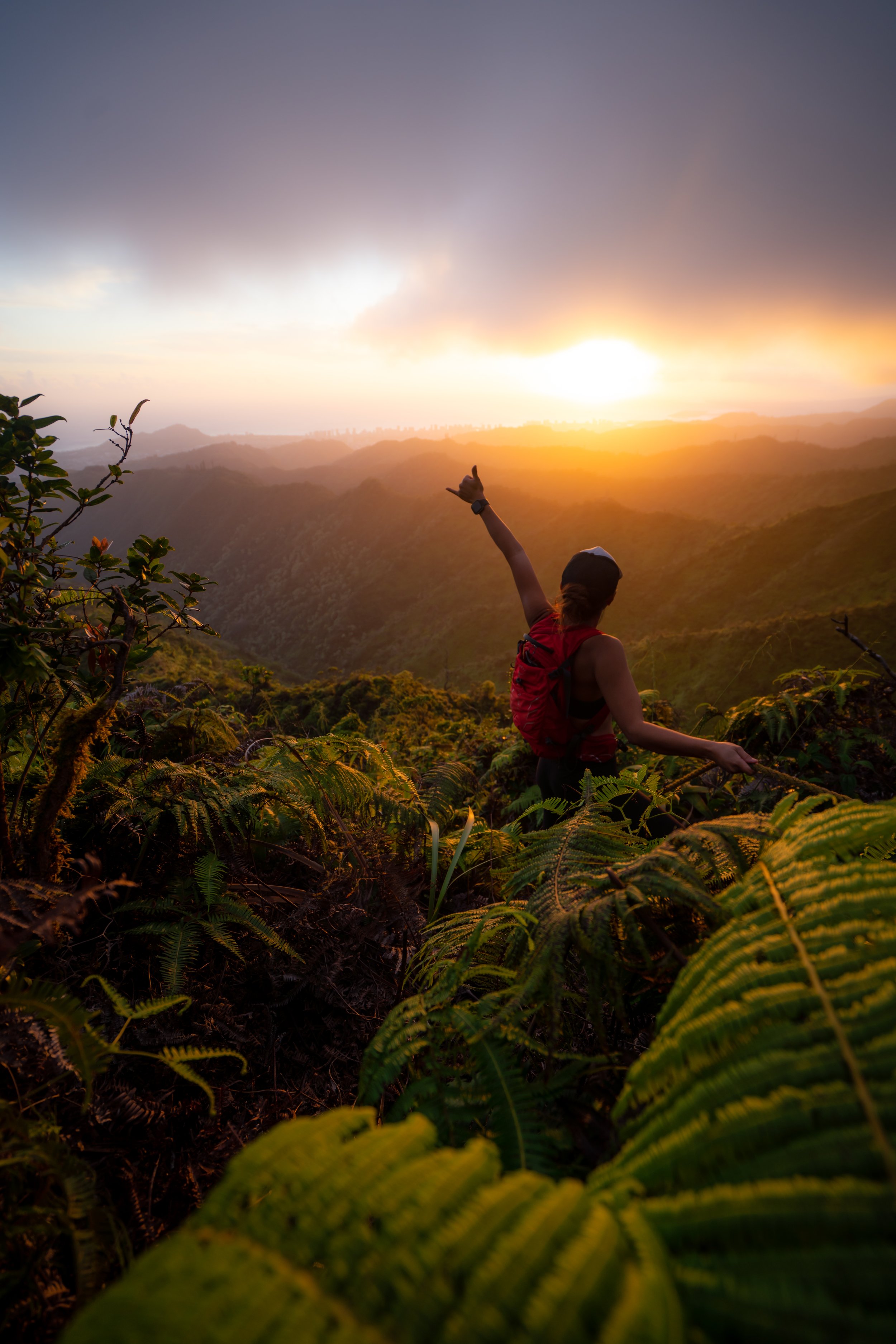
Hiking the Puʻu Kōnāhuanui Ridge Trail (Tantalus to K1) on Oʻahu, Hawaiʻi
Distance: 8.1 miles / 13.0 km
The Puʻu Kōnāhuanui Trail is a renowned favorite on Oʻahu, as the roughly 4.0-mile (6.4 km) one-way ridge that begins atop Tantalus leads to the highest summit in the Koʻolau Mountains at 3,150 ft. (960 m), making K1 the third-highest summit on the island!
That said, there’s a saying that Oʻahu hikers use, which is, 'All Tantalus trails lead to K1,' but there are two trailheads that are better to begin than others. They are the Puʻu ʻŌhiʻa Trail and the Kalāwahine Trail, and I say this because either option is the most straightforward and direct route to the summit of Kōnāhuanui.
That aside, know that just because K1 is the tallest peak in the Koʻolau Mountains, doesn’t mean that it’s the hardest. By comparison, the neighboring Kapālama Ridge to Puʻu Lanihuli is considerably more challenging to reach a shorter summit.
All this to say, there are at least five different routes from all sides of the peak that can be taken to climb Puʻu Kōnāhuanui, but this post is specifically about one of the two most practical routes on Tantalus: the Kalāwahine Trail.
Puʻu ʻŌhiʻa vs. Kalāwahine Trailhead
Deciding whether to begin at the Puʻu ʻŌhiʻa or Kalāwahine Trailhead should really come down to one thing: hills!
By this, I mean that the Puʻu ʻŌhiʻa Trail to the Kalāwahine–Pauoa Flats junction is only 0.2 miles (0.3 km) shorter than the Kalāwahine Trail to the same junction, but it is much hillier.
This is because the Puʻu ʻŌhiʻa Trail climbs straight up toward the summit on Tantalus, while the Kalāwahine Trail contours its way along the side and doesn’t ascend or descend any unnecessary hills.
This contour often makes the Kalāwahine Trail feel slower, but even so, it is my preferred route up K1.
Puʻu Kōnāhuanui Trailhead Parking
Parking for the Puʻu Kōnāhuanui Trail is located at one of two places off Tantalus–Round Top Drive, depending on which trail you choose to hike to reach the Pauoa Flats Bench.
The first is the Puʻu ʻŌhiʻa Trailhead near the road crest. Here, there is a small parking lot that hikers can use to park off the road.
The second area is the Kalāwahine Trailhead on the Tantalus Drive side of the loop near Telephone Road. Parking at this trailhead is located in one of a handful of spots just up the hill from the trailhead, directly alongside the road.
However, if no good parking is available just up the road from the Kalāwahine Trailhead, a slightly larger lot can be found just down the road from the Nahuina Trail.
Out of caution, consider the Puʻu ʻŌhiʻa Trailhead and the Kalāwahine Trailhead to be a high-crime area for petty theft, meaning you should never leave visible bags or anything valuable in your car.
Google Maps Directions: Kalāwahine Trailhead / Puʻu ʻŌhiʻa Trailhead
Hiking the Puʻu Kōnāhuanui Ridge Trail
This is the Kalāwahine Trailhead, which is also the beginning of Telephone Road—the same road that meets up with the Puʻu ʻŌhiʻa Trail a short distance into the hike from the other direction.
That said, go left to begin the Kalāwahine Trail toward the Pauoa Flats Trail, about 1.3 miles (2.1 km) away.
I’ve never understood these signs, as this short stretch is really no different than the vast majority of the Kalāwahine Trail.
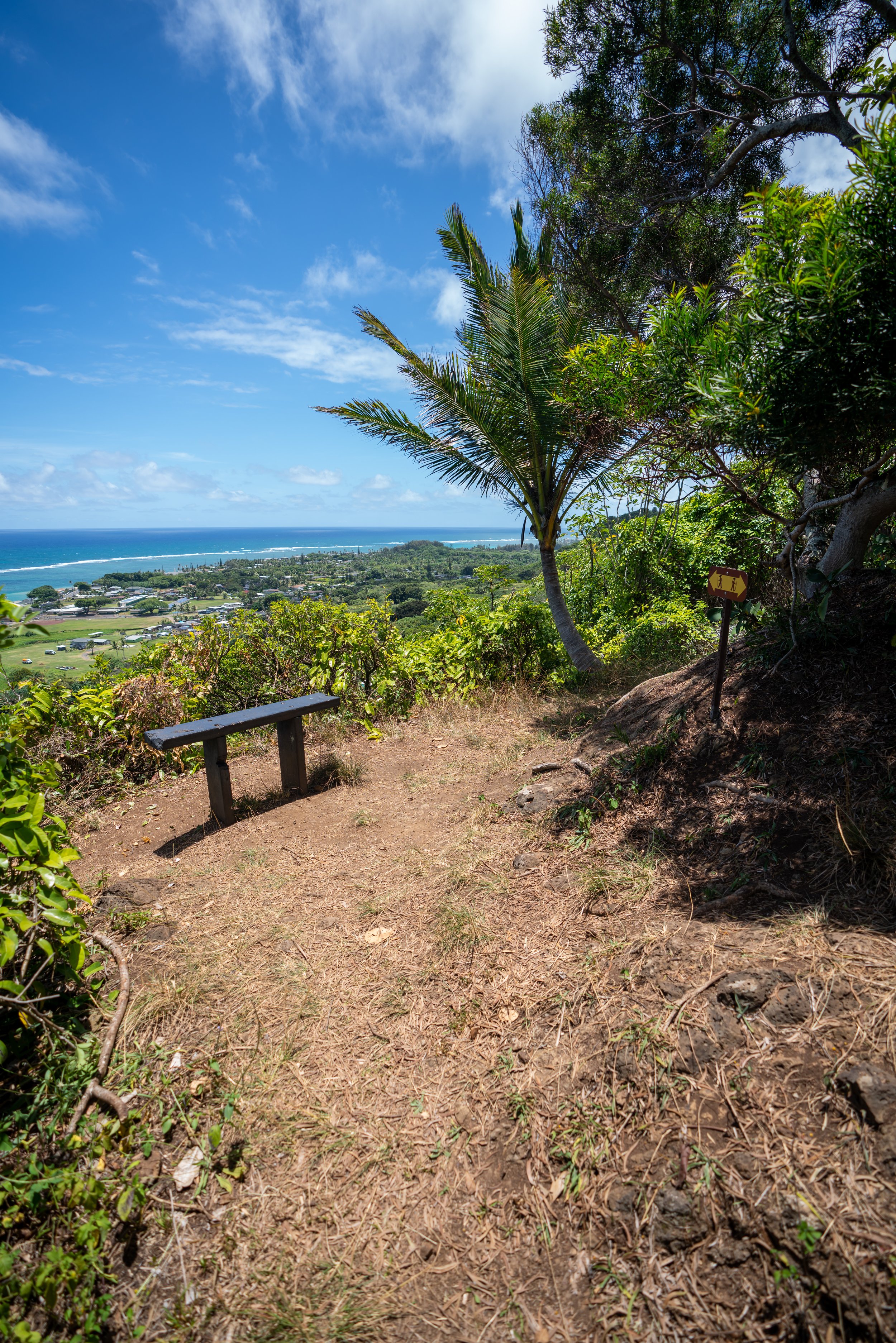
The views from this bench look southwest toward the Waiʻanaes, with places as far away as Mt. Kaʻala visible on a clear day!
I often used to question the legitimacy of the Kāhuli habitat between these signs, given the number of predators like Chameleons and Rats all over Tantalus, but they are in fact still present in the gully ahead—you just have to know what to look for!
This unnamed gulch is where they can still be found today!
Along the walls that line the Kalāwahine Trail, Māmaki can be seen growing, which is one of the four main host plants for the Pulelehua, the endemic Hawaiian butterfly.
Another fairly easy host plant to find on Tantalus is Olonā, but it is much more abundant on the Mānoa Cliff Trail than down here on Kalāwahine.
I mention this because, back in 2017, efforts to reintroduce the Pulelehua were attempted on Tantalus. However, they largely failed due to non-native predators, most likely birds.
This is all to say that conservation efforts on Tantalus are constantly underway, and opportunities to volunteer occur weekly. Furthermore, please don’t harvest Māmaki where it is found across Hawaiʻi’s native landscapes. Instead, Māmaki tea can be responsibly purchased using one of the links below if you are curious to try it.
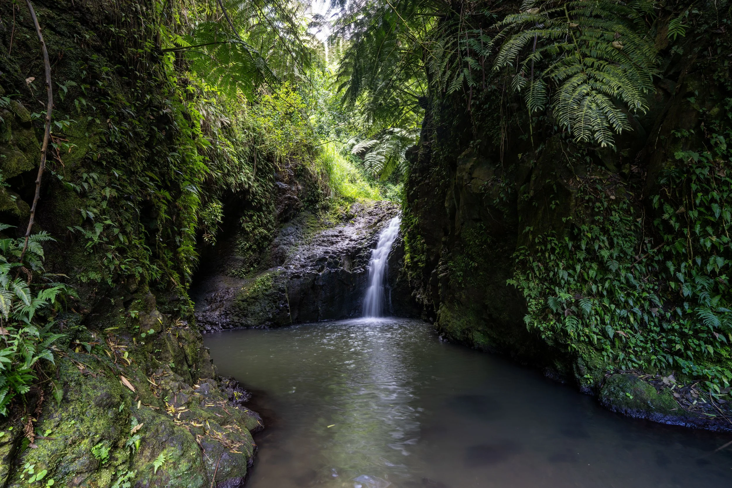
I’ve often tried to count all the little gulches and stream crossings on the Kalāwahine Trail, but in the end, I always lose track.
It’s certainly not like counting switchbacks.
It’s important to mention that this tall overstory canopy only lasts for the Tantalus portion of the hike to K1, which is why I recommend wearing a hooded sun shirt for the long hike up—especially considering that the Kōnāhuanui Trail past the Pauoa Flats Bench is much slower than everything leading up to it.
ʻIeʻie is a fairly common native throughout the understory of the forest on Tantalus.
Kalāwahine-Mānoa Cliff Junction
After a somewhat tedious 1.0-mile (1.6 km) hike to get to this point, the Kalāwahine Trail reaches the first junction off the Tantalus Loop, the north side of the Mānoa Cliff Trail.
That said, the Mānoa Cliff Trail from this junction simply leads over to the alternative Puʻu Kōnāhuanui route from the Puʻu ʻŌhiʻa Trailhead, but to continue on the fastest route to the Pauoa Flats Bench and up to the summit, go straight at this split.
This is ʻAwa or Kava, and while it is not a native Hawaiian plant, it is a canoe plant in Hawaiʻi, meaning a species brought to the islands by the original Polynesians.
Furthermore, Kava, just like Māmaki tea, is widely commercially available, as you can see using the links below.
When the Kalāwahine Trail turns away from the cliffside along Nuʻuanu Valley, it’s a nice sign that it’s getting close to the Pauoa Flats boardwalk.
Kalāwahine-Pauoa Flats Junction
After 1.3 miles (2.1 km), the Kalāwahine Trail ends where it meets the Pauoa Flats boardwalk.
At this point, go left to continue hiking up to Puʻu Kōnāhuanui, as the Pauoa Flats Trail to the right is where the Puʻu ʻŌhiʻa route would have met this same junction.
Once on the Pauoa Flats boardwalk, the trail will pass two more junctions on the way out to the bench, both of which serve as connector trails between Tantalus and Nuʻuanu/ Mānoa Valley, respectively.
That said, both the Nuʻuanu Trail and the ʻAihualama Trail are incredibly useful when hiking beyond Kōnāhuanui.
More specifically, I mean that the Nuʻuanu Trail is great to use as a return route after hiking up Lulumahu Ridge, and the ʻAihualama Trail is great for making a loop out of the KST, as well as Mānoa Middle or Waʻahila Ridge.
In either case, both routes off Kōnāhuanui are far more challenging than this hike leading up to it, which is why I only recommend continuing farther for experienced Hawaiʻi hikers.
Pauoa Flats-Nuʻuanu Junction
The first junction the Pauoa Flats Trail will pass is the Nuʻuanu Trail, which is more or less a connector trail down to Nuʻuanu Valley and the Judd Trail at the bottom.
To continue on the Pauoa Flats Trail to Puʻu Kōnāhuanui, go straight, and the Pauoa Flats Trail will reach the final junction on Tantalus a short distance ahead.
Read My Separate Posts: Nuʻuanu Trail / Judd Trail
Pauoa Flats-ʻAihualama Junction
About 0.1 miles (0.2 km) after the Nuʻuanu junction, the Pauoa Flats Trail will pass the final split on Tantalus.
This is the ʻAihualama Trail, which serves as a connector between this point on Tantalus and the Mānoa Falls Trail below.
That aside, to continue hiking up to the Pauoa Flats Bench and on to K1, go straight at this final junction.
Read My Separate Posts: ʻAihualama Trail / Mānoa Falls Trail
Even on a beautiful sunny day like this, the Pauoa Flats Trail between ʻAihualama and the bench is often very muddy!
Pauoa Flats Bench
The Pauoa Flats Bench marks the end of the maintained trails on Tantalus, meaning that from this point on the Puʻu Kōnāhuanui Trail continues along a largely socially-managed trail, though it is popular enough that there is really no difference from other longer state trails, like Mānana Ridge.
That said, go straight past the bench to begin the true Puʻu Kōnāhuanui Ridge Trail.
Puʻu Kōnāhuanui Ridge Trail
From this point on, good hiking pants will become more and more useful on the hike to Kōnāhuanui, as the overgrowth picks up considerably after the junction shortly ahead.
The pants below are my recommendations that hold up the best with the overgrowth here in Hawaiʻi, but with any hiking pants that need to be durable, make sure that they are at or near 100% nylon. This is really the most important factor!
I’ve often believed this sign is hidden to obscure the fact that there’s a trail beyond the Pauoa Flats Bench.
The cool thing about the Puʻu Kōnāhuanui Ridge Trail is that all four of the ʻŌhiʻa species found on Oʻahu can be seen on the hike up, with ʻŌhiʻa ʻāhihi (Metrosideros tremuloides) being one of the most abundant—especially on the Contour Trail.
Lower Puʻu Kōnāhuanui Ridge-Contour Junction
After just 0.25 miles (0.4 km) from the Pauoa Flats Bench, the Puʻu Kōnāhuanui Trail reaches an inconspicuous split, which is the difference between taking the Puʻu Kōnāhuanui Ridge Trail or the Contour Trail.
By this, I mean that the trail going straight is the Puʻu Kōnāhuanui Ridge Trail, which follows the crest of the ridgeline, while the trail to the left (the switchback) is the Puʻu Kōnāhuanui Contour Trail.
Both routes lead to the same place farther up the mountain, but I almost exclusively take the Contour Trail because it’s much easier.
I say this because the Contour Trail only gains about 300 ft. (91 m) over the course of 0.8 miles (1.3 km) to reach the upper junction, with no unnecessary ups and downs. However, the same cannot be said about the ridgeline, which involves more unnecessary climbing and descending to reach the same junction.
Regarding my thoughts above, I chose to go left to begin the Kōnāhuanui Contour Trail.
This is the view looking north toward the Pali Puka and Puʻu Lanihuli.
ʻAkolea is a very common native along the cliffs of the Contour Trail, and it, like Māmaki and Olonā mentioned previously, is another of the Pulelehua’s four main host plants, though its similar appearance does not mean it can be used for tea in the way that Māmaki is.
These seemingly endless drainages that the Contour Trail follows are what can make this section feel so tedious, similar to the Kalāwahine Trail at the beginning.
However, this stretch is shorter than the Kalāwahine Trail by about 0.5 miles (0.8 km).
On a morning hike up the Puʻu Kōnāhuanui Trail, this view can be very telling about whether there will be a view at the summit or not.
However, the same can’t be said about an afternoon hike like this, as clouds tend to gather and build over the mountains later in the day.
The one thing these photos fail to show is just how uneven the Kōnāhuanui Contour Trail is, as it’s constantly stepping up and down over this entire section—seemingly with every tree!
From this view looking up the Lulumahu drainage, K1 can be seen on the left, K2 in the middle, but the rightmost summit is an unnamed peak along the Koʻolau Summit.
Even though there is a fairly defined trail, I once again want to suggest wearing good hiking pants that can handle the overgrowth in Hawaiʻi, as I can speak from experience that it’s always a much longer day if you decide to try and play it tough without them.
Along this stretch, there are countless ʻŌhiʻa ʻāhihi trees to find if you’re interested in seeing all three endemic Oʻahu species.
When the ridge that the Contour Trail parallels starts to slope down, it’s a nice sign that the upper junction is not far ahead!
This ʻŌhiʻa species is the second Oʻahu endemic, like ʻŌhiʻa ʻāhihi, but it is often missed by most unless it is showing its bright yellow crown flowers.
That said, simply finding a yellow ʻŌhiʻa flower is not indicative that you’ve come across Metrosideros macropus—this Oʻahu endemic—as Metrosideros polymorpha can also flower yellow, not to mention that polymorpha quite literally means 'many forms.'
This is just one reason why plant ID in Hawaiʻi can be so tricky, especially considering that the ʻŌhiʻa tree is relatively easy to identify across the islands.
Upper Puʻu Kōnāhuanui Ridge-Contour Junction
This is where the Puʻu Kōnāhuanui Contour Trail and Ridge Trail come back together.
From here, go straight to continue hiking up to K1, and know that the Puʻu Kōnāhuanui Ridge Trail will not reach another notable junction until it meets the Koʻolau Summit, just before K2.
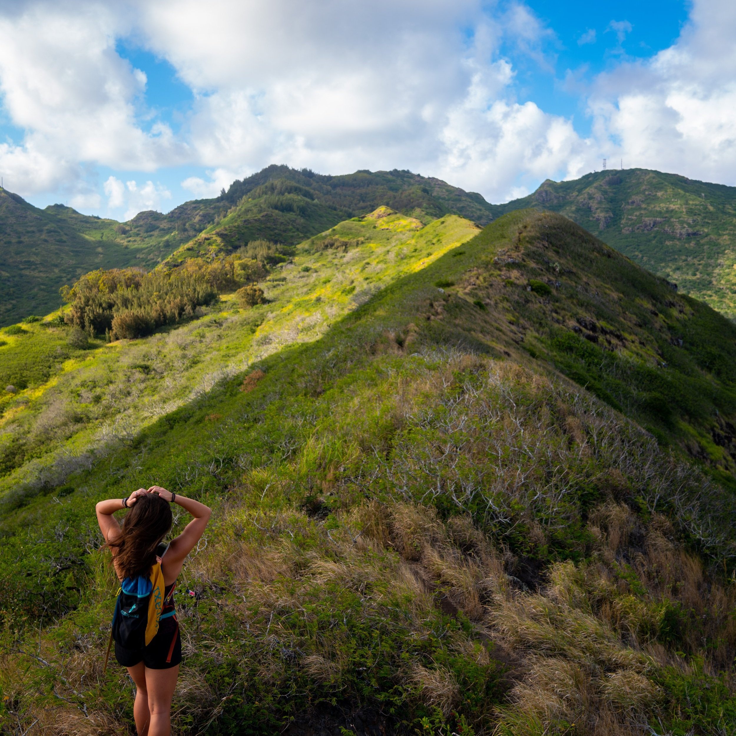
After the two routes come together, the Puʻu Kōnāhuanui Trail follows the ridgeline, gaining about 1,000 ft. (305 m) over the next 0.8 miles (1.3 km) to the summit of K2—the lower of the two summits—by about 100 ft. (30.5 m).
This makes three of the four ʻŌhiʻa species native to Oʻahu, and it’s the last of the three that are endemic only to the Island of Oʻahu.
On that note, the only species I have yet to show is Metrosideros polymorpha, which is the most widespread, as it can be found across the major Hawaiian Islands.
The beginning sections after the upper junction will climb gradually, but this abruptly changes at the bottom of Dinosaur Hill up ahead.
This is where the steep climb up to K2 noticeably begins!
Dinosaur Hill
Dinosaur Hill is the first of two flat hills on the Puʻu Kōnāhuanui Trail before the KST.
The other is located at the top of the steep, eroded section that can be seen in the distance.
This stretch between the first and second steep climb is relatively flat, but this will change quickly at the base of the hill straight ahead.
The second flat spot, and next best place to take a break, is at the top of this steep climb.
If you look closely, you can see one of Hawaiʻi’s endemic Damselflies.
Waihī Hill
At the top of Waihī Hill, the remaining steep ascent to the Koʻolau Summit Trail (KST) can be seen in the distance, with K2 located a short distance beyond.
Note that the KST is not at the top of the climb straight ahead; rather, the top of the ridge that leads to the left of this initial climb.
Apart from the steep sections between K2 and K1, this is the last notable steep ascent before reaching K2.
At the top of the ropes, the Puʻu Kōnāhuanui Trail turns to the north, where it follows a steady incline along the ridgeline to reach the KST.
A short distance below K2, I began to hike up into the clouds, which is common in the mid- to late-afternoon hours across the Koʻolaus.
That said, starting in the morning on a mostly clear/ partly cloudy day from Tantalus is the best way to try to catch the summit with a view, but the later you get started, the more likely it is that clouds will gather over the mountains like I experienced here.
If you didn’t get muddy down below, it’s almost certain you will on the hike to K2 and beyond.
The final climb to the Koʻolau Summit is not nearly as steep as the prior sections.
Puʻu Kōnāhuanui Ridge-Koʻolau Summit (KST) Junction
Just before the summit of K2, the Puʻu Kōnāhuanui Ridge Trail meets the Koʻolau Summit Trail, which it will follow up to K2 and beyond to K1.
Once here, go left to begin hiking the KST toward K2, less than 0.1 miles (0.2 km) away.
Read My Separate Post: Koʻolau Summit Trail (KST)
Puʻu Kōnāhuanui II (K2)
This is the summit of K2, the shorter of the two summits on Kōnāhuanui by about 100 ft. (30.5 m).
That said, the KST between K2 and K1 is not nearly as straightforward as simply hiking up another 100 ft. (30.5 m) to reach the summit, as the trail first loses about 150 ft. (46 m) from the summit of K2 to the lowest point between the two.
From K2 to K1, there’s only about 0.4 miles (0.6 km) left along the KST to reach the true summit of Kōnāhuanui.
Along the summit, there are quite a few Lapalapa trees that can be seen along the way!
This is where the steep descent off K2 begins.
This steep drop is notorious for being very muddy at the bottom!
A personal story about me is that, back when I decided to go to graduate school, I spent a lot of time on Puʻu Kōnāhuanui, learning this summit inside and out.
From the countless hikes up and down the route from Tantalus shown here, in both good weather and bad, I got to learn all about Kōnāhuanui from the intimate level of its unique, rare plant ecosystem.
In fact, one species in particular is endemic to Puʻu Kōnāhuanui and nowhere else on Oʻahu!
However, the impacts of humans can largely be felt on Kōnāhuanui, as the KST between K1, K2, and beyond is littered with the invasive Kahili ginger, which is easily the number one threat to the native plants that call this summit home.
I’ve actually spent so much time on Kōnāhuanui that I remember a time when there was no Kahili Ginger to be found up here. This was back when the rare endemic was first discovered up here in the mid-2010s.
But, things quickly changed on Kōnāhuanui, and when the Kahili Ginger began taking over the windward slopes and eventually made it up to the summit, the landscape started to become unrecognizable. I even noted to one botanist here on Oʻahu that it appeared ten times worse in just a year’s time—not to mention, the summit of K1 has almost no view today, as it is encompassed on all sides by the Ginger.
This is all to say that Puʻu Kōnāhuanui is still a very special place, and there are still rare endemics that find a home up here, which is why I strongly ask that you hike responsibly, meaning stay on the trail, don’t use spikes, and do what you can to clean your hiking gear before and after every hike. It’s certainly no secret on Oʻahu that much shorter Koʻolau summits are far more pristine than Kōnāhuanui, which largely speaks to its popularity as the highest peak in the Koʻolau Mountains.
The bottom of this descent is the low point between the two peaks, but it is not the beginning of the final ascent to K1.
On a different note, the broad-leaved plant on the right-hand side of this photo is the invasive Kahili Ginger, not to mention all the Palm Grass and Koster’s Curse dominating the landscape everywhere in between.
This is the lowest point between K2 and K1.
This is where the Puʻu Kōnāhuanui Ridge Trail drops down to the base of the final ascent.
This is the final ascent to the summit of Kōnāhuanui, measuring about 0.1 miles (0.2 km) from the bottom to the top.
Puʻu Kōnāhuanui (K1) / KST-Lulumahu Ridge Junction
After the short but tedious 0.4-mile (0.6 km) traverse from K2, the Puʻu Kōnāhuanui Trail ends at the 3,150 ft. (960 m) peak—the highest summit in the Koʻolau Mountains.
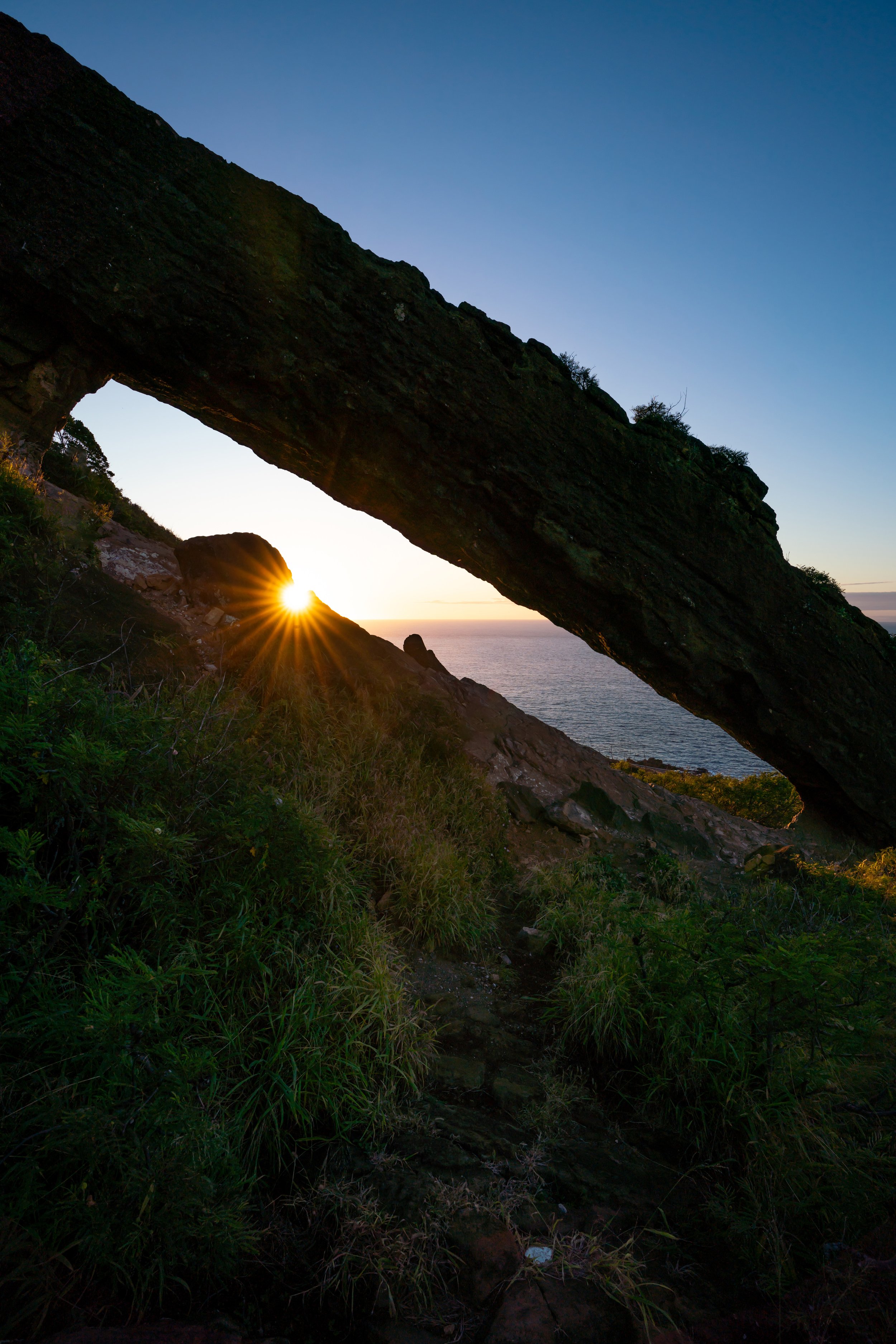
On a clear day, you can see expansive views in all directions, including the Waiʻanae Mountains and Mt. Kaʻala to the west, Puʻu Lanihuli to the north, Mt. Olomana to the east, and other notable hikes, like Waʻahila Ridge to the south.
Furthermore, many in the hiking community are aware that the trail doesn’t necessary end at the summit of Puʻu Kōnāhuanui, but I caution against proceeding in any direction off the summit if you weren’t planning on hiking further.
I say this because all hikes, including Lulumahu Ridge to Lulumahu Falls, the KST to the Pali Notches, Piliwale, and the KST across Mānoa are all significantly more difficult and more dangerous than everything thus far.
Read My Separate Posts: Koʻolau Summit Trail (KST) / Lulumahu Ridge Trail
This is the view looking down from the summit of K1 toward Piliwale.
Native Plants on the Kōnāhuanui Trail
Being that Puʻu Kōnāhuanui is the highest peak in the Koʻolau Mountains, the entire trail has a ton of native diversity, which is surprising considering its popularity and relative close proximity to Honolulu.
To name just a few, plants like Koa, Kokiʻo Keʻokeʻo, ʻŌhiʻa lehua, ʻAkolea, Lapalapa, Alani, Kōlea, ʻAhakea, Kōpiko, ʻIeʻie, Naupaka, and Olonā are among many that can be seen along the way—not to mention, the summit area is the best place in the southern Koʻolaus to see the beautiful Lapalapa trees!
If you would like to learn more about these and many other native Hawaiian plants from across the islands, I encourage you to check out my separate post linked below.
Read My Separate Post: Native Hawaiian Plant Guide