Hiking the Mānoa Middle Ridge Trail on Oʻahu, Hawaiʻi
Distance: 3.6 miles / 5.8 km
The Mānoa Middle Ridge Trail, in the heart of Mānoa Valley, is a trail to the Koʻolau Summit, not often hiked compared to neighboring ridge trails, like the Puʻu Kōnāhuanui Trail to the north and Waʻahila Ridge to the south.
Nevertheless, the Mānoa Middle Ridge Trail is only 1.8 miles (2.9 km) from the valley floor to the summit, which hopefully indicates that Mānoa Middle is a very steep hike—especially considering that the first 0.7 miles (1.1 km) through the bottom of Mānoa Valley are relatively flat.
This means that there’s about 1,850 ft. (564 m) of elevation gain in just the remaining 1.3 miles (2.1 km), but since it’s so direct, Mānoa Middle moves fast, which is one of my favorite parts about hiking it over neighboring trails to the summit.
Mānoa Middle Ridge Trailhead Parking
Parking for the Mānoa Middle Ridge is located on Waʻaloa Place in the back of Mānoa Valley.
It’s important to mention that this area in Mānoa Valley is very quiet compared to the adjacent Mānoa Falls Trail, and I say this to emphasize the importance of parking legally and being quiet and respectful, so as not to do anything that would draw negative attention to this local trail.
Google Maps Directions: Mānoa Middle Ridge Trailhead
Hiking the Mānoa Middle Ridge Trail
The Mānoa Middle Ridge Trail begins at the Seven Bridges Trailhead, located at the very end of Waʻaloa Place.
Now, it’s important to mention that the Seven Bridges Trail, including the neighboring Puʻu Pia Trail, is truly a maze of interconnecting trails through the back of Mānoa Valley. This is why there is a lot of conflicting information regarding the best route to reach the Mānoa Middle Ridge.
That said, the route I prefer and recommend follows the true Mānoa Middle Ridge Trail from the base of the ridge, making it the most direct and straightforward route by eliminating other unnecessary trails and elevation gain on those trails—like Puʻu Pia and parts of the Waiakeakua Falls Trail.
After the gate, getting to the Mānoa Middle Ridge is all about making the correct turns on the Seven Bridges Trail, and be aware, there are four important turns to remember.
That said, this is the first split, where the Seven Bridges Trail continues to the right.
This is the second of the Seven Bridges, the first being the one at the trailhead.
At this second split, it truly doesn’t matter which direction you choose to hike, as both will meet up about 0.25 miles (0.4 km) ahead.
However, I personally prefer to go left to remain on the Seven Bridges Trail, which is the direction this article is written.
This is the third of the Seven Bridges.
Mānoa Middle Ridge-Naniuapō Falls Junction
This third split may look less obvious, but it’s the difference between making it to Waiakeakua/ Mānoa Middle to the right and Naniuapō Falls to the left.
Therefore, go right to continue toward the base of the Mānoa Middle Ridge.
This bridge is the fourth of the Seven Bridges, and it’s where long-time hikers may remember the massive Banyan tree that once fell right before the bridge—which was, honestly, quite lucky not to have crushed it entirely!
Eventually, the Seven Bridges Trail will transition into a true trail for the rest of the hike to Mānoa Middle and Waiakeakua Falls.
These first sections through the bottom of Mānoa Valley are typically muddier than anything encountered higher on the ridge.
Even though there may appear to be other routes that branch off, stay on the main trail to the left.
These other routes are often for the fruit trees or simply a connector to the paralleling trail on the other side.
This is where both sides of the trail meet back up, following the second split from earlier.
That said, go left to continue on the correct trail to Mānoa Middle.
At this split, it doesn’t matter which direction you go, as both sides meet up shortly ahead.
Lower Mānoa Middle Ridge-Waiakeakua Falls Junction
This is the fourth and final junction in the valley, where the Mānoa Middle Ridge Trail and Waiakeakua Falls Trail split from one another.
Here, go left to continue toward the base of Mānoa Middle, but it must be said that other people may suggest going right here to meet up with the ridge further ahead.
Personally, I don’t recommend this because it’s a less direct route to the ridge, as opposed to simply picking up the ridge shortly after the stream crossing.
Waiakeakua Stream
This is where the Mānoa Middle Ridge Trail crosses over the Waiakeakua Stream, which is a good indicator that you’re hiking in the right direction.
It’s always a good time to jump in the stream after making it off the ridge on the way back!
Mānoa Middle Ridge
This is where the trail leaves the valley floor, and the Mānoa Middle Ridge begins!
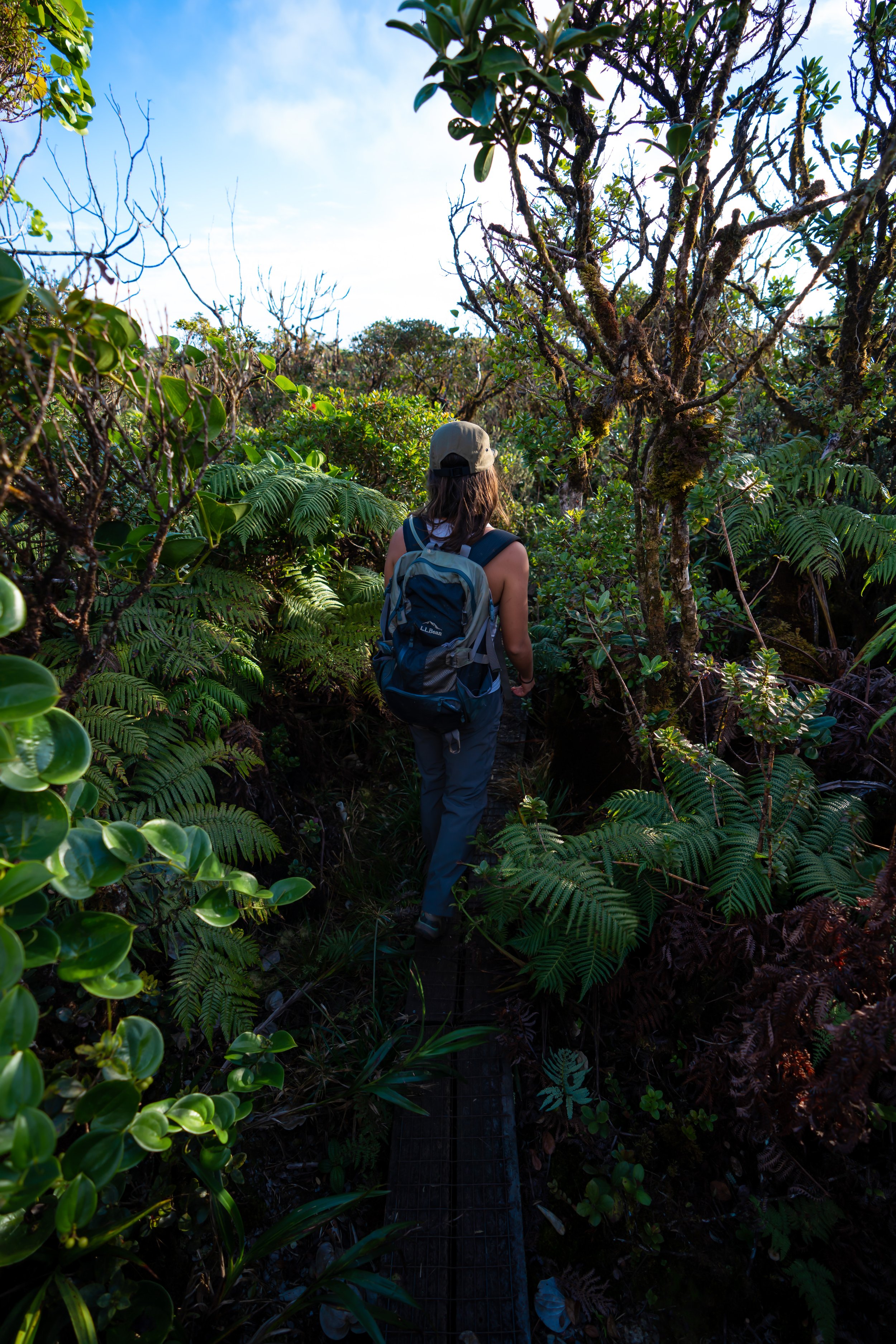
The true Mānoa Middle Ridge is very steep in the beginning compared to spending more time on the Waiakeakua Falls Trail.
However, I honestly think this is preferred, as Mānoa Valley can be very wet and muddy—not to mention all the mosquitoes!
Toward the top of the hill, the Bamboo begins to thin, which is where the remaining trail to the top of the ridge may likely look a little confusing.
That said, simply keep going up until the cutover to the left, which will eventually top out on the ridge.
This is where the trail cuts to the left.
Upper Mānoa Middle Ridge-Waiakeakua Falls Junction
Once on the ridge crest, go left to continue up Mānoa Middle, as the trail to the right is simply the alternate route from Waiakeakua Falls, had you chosen to go right at the Lower Mānoa Middle Ridge–Waiakeakua Falls Junction.
Once on the true ridge, Mānoa Middle starts off gradual through the Bamboo and Strawberry Guava, but it doesn’t take long for the ridge to start getting steeper.
It’s honestly quite sad how invaded Mānoa Valley is with non-native Shoebutton, Koster’s Curse, and Strawberry Guava—to name just a few of the common weeds.
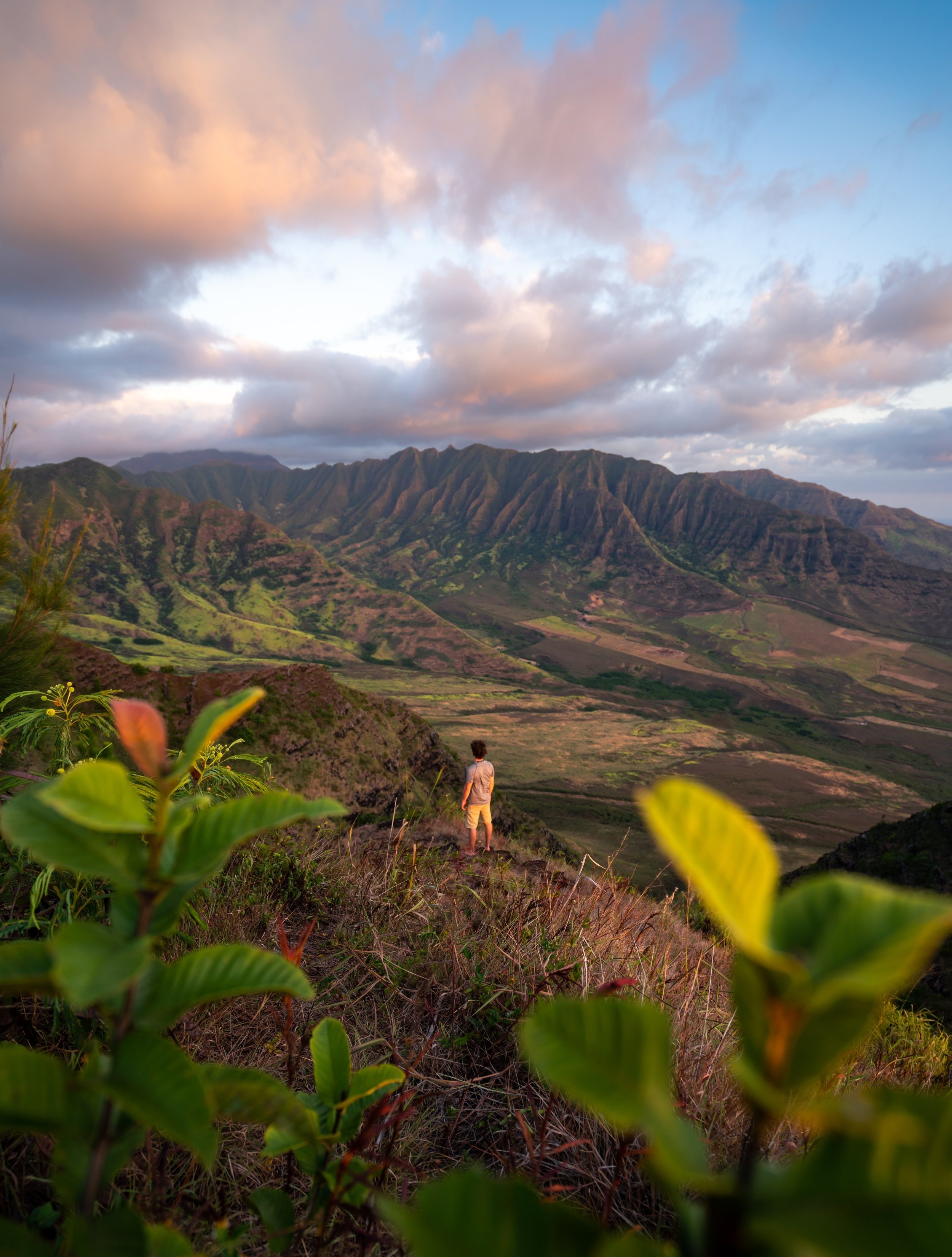
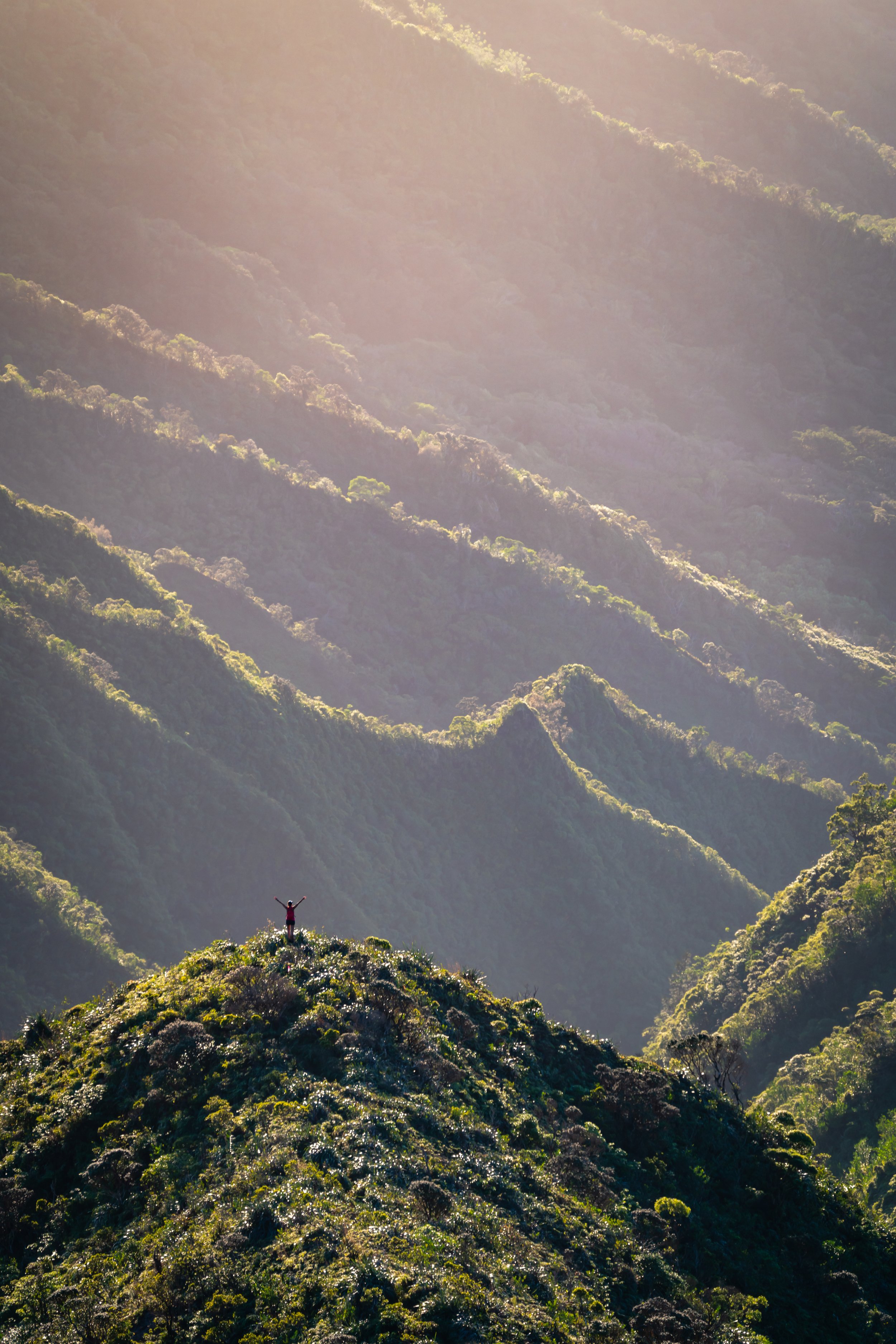
This peak that can be seen in the photo below is not the Mānoa Middle Summit.
Rather, the true summit is a short distance beyond this first peak.
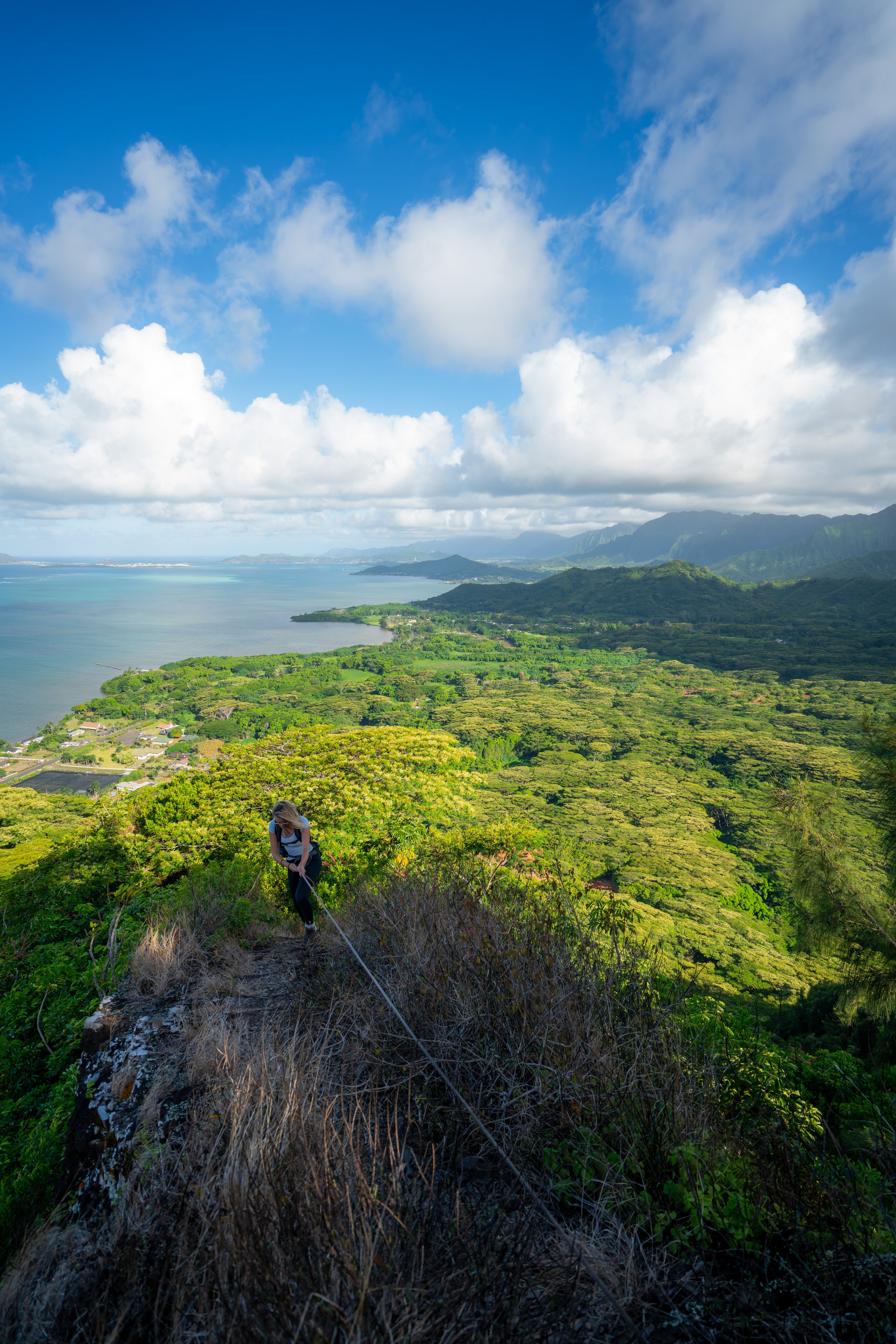
This rope section traverses the skinniest part of Mānoa Middle, but with all the vegetation, it’s fairly easy to make it across without slipping.
After the narrowest section, the Mānoa Middle Ridge climbs a short but steep section up to the junction with Naniuapō Falls.
Mānoa Middle Ridge-Naniuapō Ridge Junction
When the Mānoa Middle Ridge reaches this clearing, the trail splits, with the much less trafficked Naniuapō Ridge Trail.
Essentially, Naniuapō Ridge is a direct connection between the Mānoa Middle Ridge Trail and Naniuapō Falls. However, after previously hiking the trail once before, I don’t recommend it.
It’s slow and overgrown, and if you’re going to hike either Mānoa Middle Ridge or Naniuapō Falls, I recommend treating them as separate day hikes.
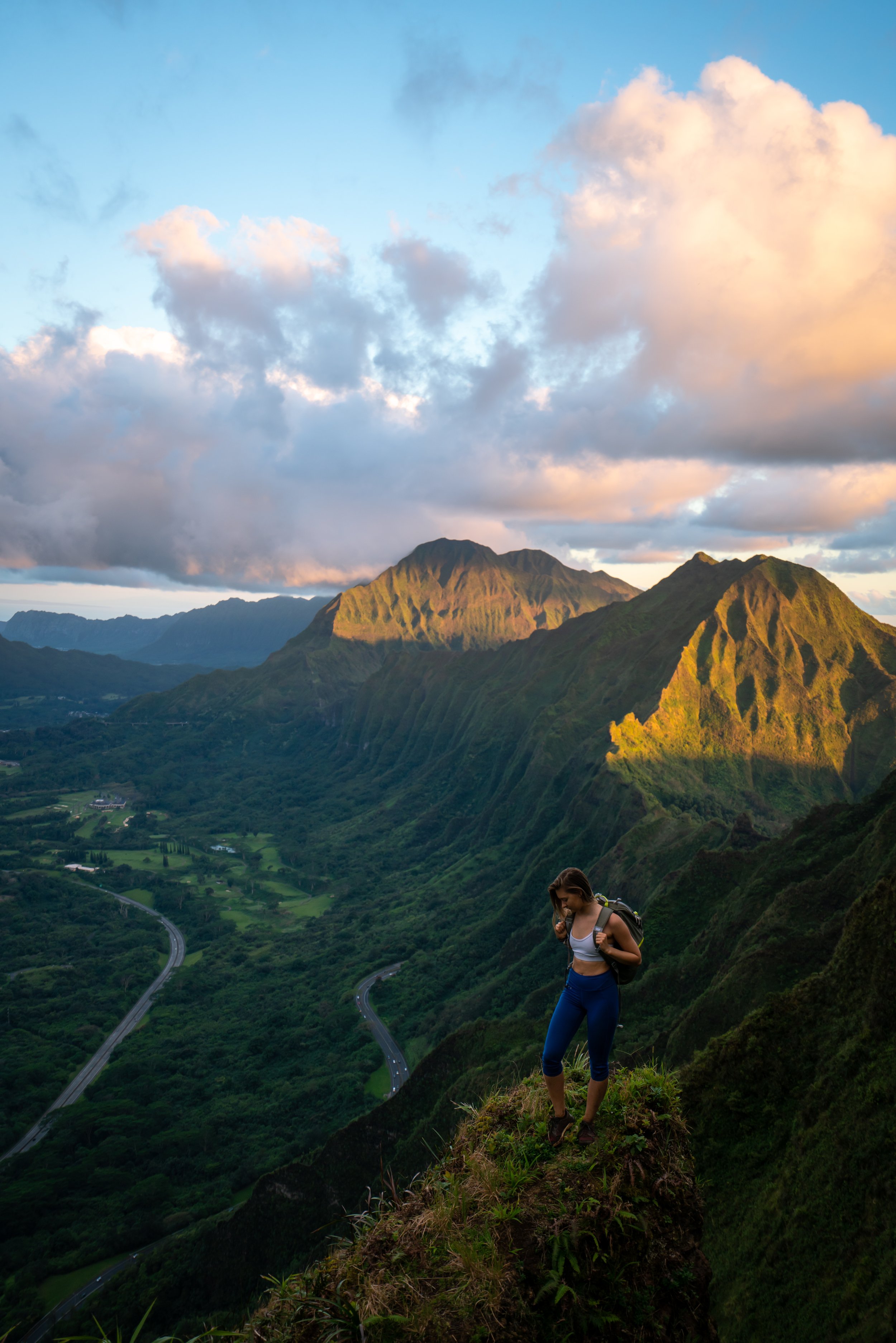
Following the Naniuapō Ridge junction, the Mānoa Middle Ridge Trail becomes much more straightforward, as there is only 0.4 miles (0.6 km) left to hike to reach the Koʻolau Summit.
However, this is also where Mānoa Middle becomes noticeably more overgrown, which is why I recommend hiking in durable pants—not only to help here but also with the mosquitoes down in the valley.
The pants below are my recommendations that hold up the best with the overgrowth here in Hawaiʻi, but with any hiking pants that need to be durable, make sure that they are at or near 100% nylon. This is really the most important factor!
Needless to say, the final summit push is very steep!
In addition to good hiking pants, there is very little shade on the upper mountain, which is why I always recommend hiking Hawaʻi ridges in good sun shirt.
These rope sections may look more difficult in the photos than they actually are.
Mānoa Contour Trail (MCT)
There will be a point where the Mānoa Middle Ridge Trail crosses the historic Mānoa Contour Trail (MCT), which may or may not be obvious.
Regardless, don’t follow the contour trail if you’re hiking up Mānoa Middle for the Koʻolau Summit Trail (KST). Rather, continue up to the Mānoa Middle Summit before moving north or south on the KST.
I say this because the contour is very overgrown toward Puʻu Kōnāhuanui, north of Mānoa Middle, while to the south, the contour trail is a little better, but not until the KST reaches Waiakeakua Summit.
This is where the Mānoa Middle Ridge Trail reaches the top of the first false summit, with the true summit less than 0.1 miles (0.2 km) away.
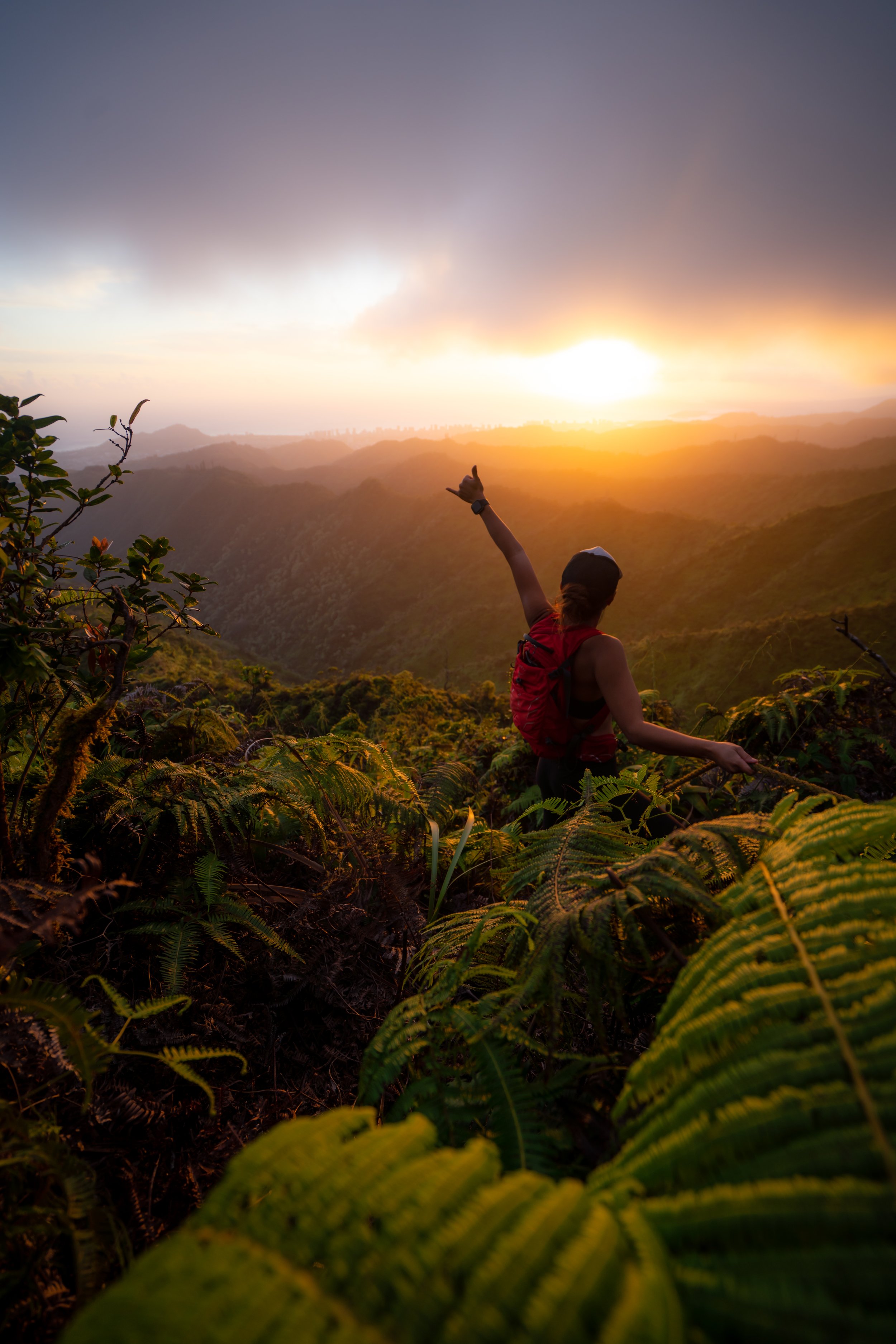
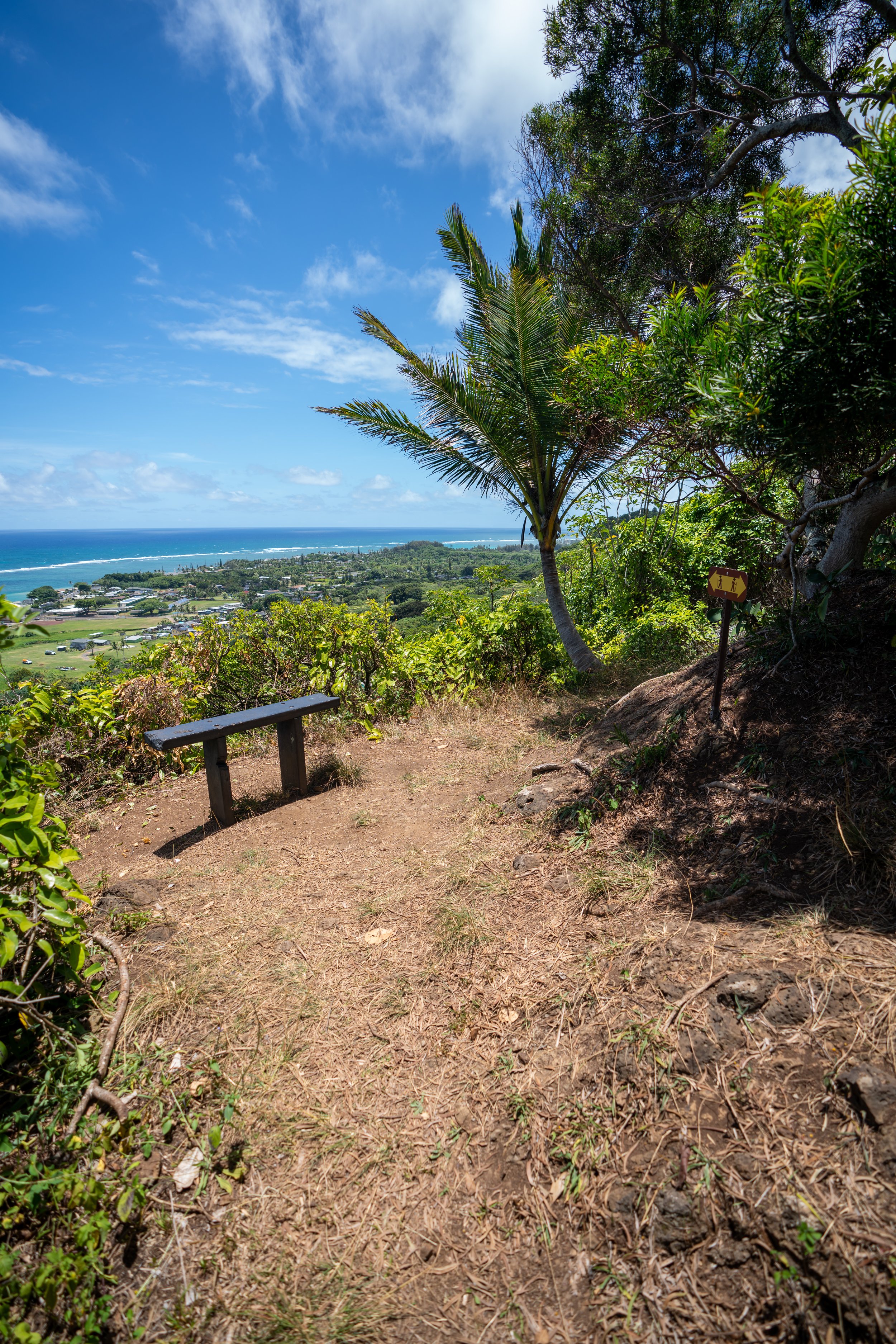
Mānoa Middle Summit
From the summit of Mānoa Middle, places across the east side of Oʻahu can be seen, including Maunawili, Kailua, the Lanikai Pillboxes, Mt. Olomana, and much of Kāneʻohe.
If you are continuing further on the Koʻolau Summit, be aware that the next major trail to the north is Puʻu Kōnāhuanui, while Waʻahila Ridge is the next significant trail to the south.
Read My Separate Post: Koʻolau Summit Trail (KST)
Native Plants on the Mānoa Middle Ridge
On the Mānoa Middle Ridge Trail, there aren’t many native Hawaiian plants to talk about in the lower valley beside the Hau, Palaʻā, ʻĒkaha, and Māmaki.
However, once on the ridge, native plants include ʻŌhiʻa lehua, Kōpiko, ʻAhakea, Akaʻawa, ʻAmaʻu, Koa, and Hame, to truly only name a few.
If you would like to learn more about these and many other native Hawaiian plants from across the islands, I encourage you to check out my separate post linked below.
Read My Separate Post: Native Hawaiian Plant Guide