Hiking the Mauʻumae Ridge Trail to Puʻu Lanipō on Oʻahu, Hawaiʻi
Distance to Puʻu Kainawaʻanui (Roundtrip): 6.6 miles / 10.6 km
Distance to Puʻu Lanipō (Roundtrip): 7.1 miles / 11.4 km
The Mauʻumae Ridge Trail to Puʻu Lanipō in the southern Koʻolau Mountains on Oʻahu is one of the longer, more challenging day hikes south of the Pali Lookout, comparable to only Kūlepeamoa Ridge in terms of how long it takes to reach the Koʻolau Summit.
For this reason, Mauʻumae Ridge is often overlooked compared to neighboring Oʻahu ridge hikes, like Wiliwilinui and Waʻahila Ridge, which largely has to do with Mauʻumae being a bit longer and inherently more difficult.
This is because there’s more elevation gain and loss over the course of the trail, and Mauʻumae Ridge gets more overgrown as the trail climbs higher, which is certainly not very common when it comes to southern Koʻolau ridge trails.
However, all these things are what make Mauʻumae Ridge one of my personal favorite day hikes on the south side of the island, especially since most who begin the trail never make it all the way to the KST!
Mauʻumae Ridge Trailhead Parking
Parking for the Mauʻumae Ridge Trail is located on Maunalani Circle, at the very top of Wilhelmina Rise above Kaimukī, where the trailhead can be found along the upper portion of the loop.
Google Maps Directions: Mauʻumae Ridge Trailhead
Hiking the Mauʻumae Ridge Trail
The Mauʻumae Ridge Trailhead begins between a couple of fences near the top of Maunalani Circle, adjacent to 4969 Maunalani Circle and a fenced-in Board of Water Supply facility.
This is where the Mauʻumae Ridge Trail leaves the residential area behind.
After the initial 0.1-mile (0.2 km) hill, the Mauʻumae Ridge Trail begins an easy downhill section, where the trail descends about 250 ft. (76 m) over the next 0.4 miles (0.6 km) to the bottom of the Maunalani Gap.
This is the top of the steepest part of the descent, which will inevitably have to be re-climbed on the return hike.
While this is certainly a steep descent, it’s certainly not as challenging as the ups and downs at the beginning of the Waʻahila Ridge Trail.
Maunalani Gap
This is where the Mauʻumae Ridge Trail reaches the bottom of the Maunalani Gap, beginning the long, slow ascent to the Koʻolau Summit.
This ascent to the Mauʻumae Bench after the Maunalani Gap is always a bit annoying, knowing how much elevation was lost in the first 0.5 miles (0.8 km) of the hike.
Mauʻumae Bench
The Mauʻumae Bench on the far side of the Maunalani Gap is always a nice mental checkpoint on the hike back down from the summit.
This really was the clearest of days I could have chosen to hike Mauʻumae Ridge!
After the bench, the number of hikers on Mauʻumae Ridge noticeably decreases, as the bench is a popular turnaround point for those working out in the evening.
These lower-elevation sections are very similar to the first few miles of Waʻahila Ridge, located just on the other side of Pālolo Valley to the north.
As the Mauʻumae Ridge Trail passes the 1.0-mile (1.6 km) mark, the forest begins a slow transition from one dominated by non-native, invasive species to a mixed Koa–ʻŌhiʻa lehua forest that will continue all the way to the Koʻolau Summit.
At the bottom of this large erosion scar, there’s either the option to go right through the trees or straight up the hill, with both routes meeting again shortly ahead.
It’s always great to see Olopua growing in the southern Koʻolaus because this mesic/ dry forest species has seen so much of its habitat taken over by non-native, invasive plants over the years.
This is why places like Kānepuʻu on Lānaʻi are of such importance to protect what’s left of Hawaiʻi’s severely fragmented dry-forest landscapes.
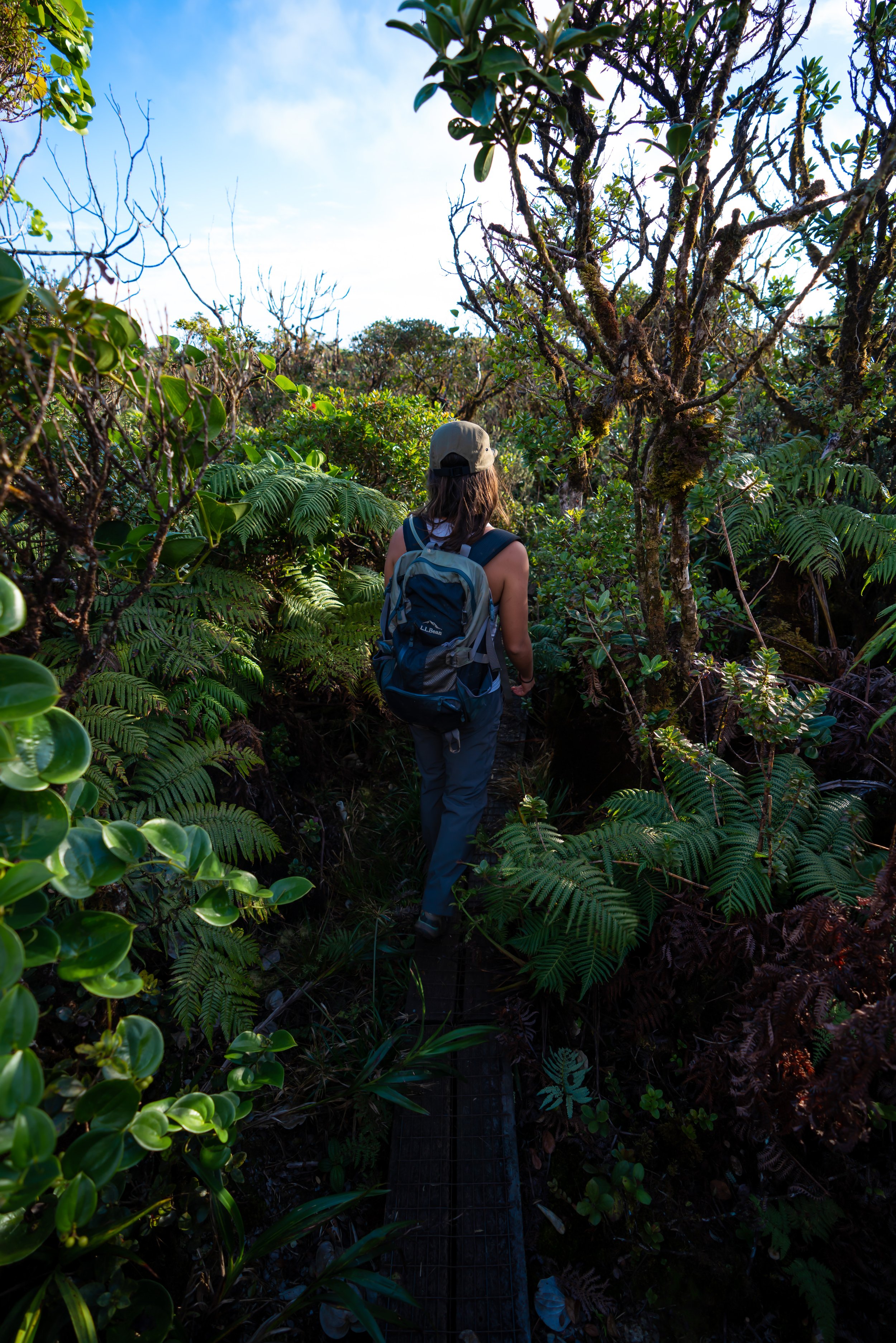
Shortly before the first clearing, the Mauʻumae Ridge Trail will begin to enter sections dominated by Uluhe.
That said, this is where the overgrowth begins to increase as the trail climbs higher, which is why I highly recommend hiking Mauʻumae Ridge in pants—something that’s certainly not always needed on other southern Koʻolau adventures. However, trails like the hike to Puʻu Lanipō, the Wailupe Loop, and even the Puʻu Kōnāhuanui Trail are all exceptions to this, whereas on state-managed trails, like Kuliʻouʻou and Hawaiʻi Loa Ridge, wearing pants is less necessary.
All that to say, the pants below are my recommendations that hold up the best with the overgrowth here in Hawaiʻi, but with any hiking pants that need to be durable, make sure that they are at or near 100% nylon. This is really the most important factor!
This clearing is the first of four on Mauʻumae Ridge before Puʻu Kainawaʻaunui, and, after the Mauʻumae Bench, it’s the second most popular turnaround point—especially among evening hikers and trail runners.
For those interested in a great Oʻahu sunset hike, consider hiking up to this first clearing, only 1.4 miles (2.3 km) from the trailhead.
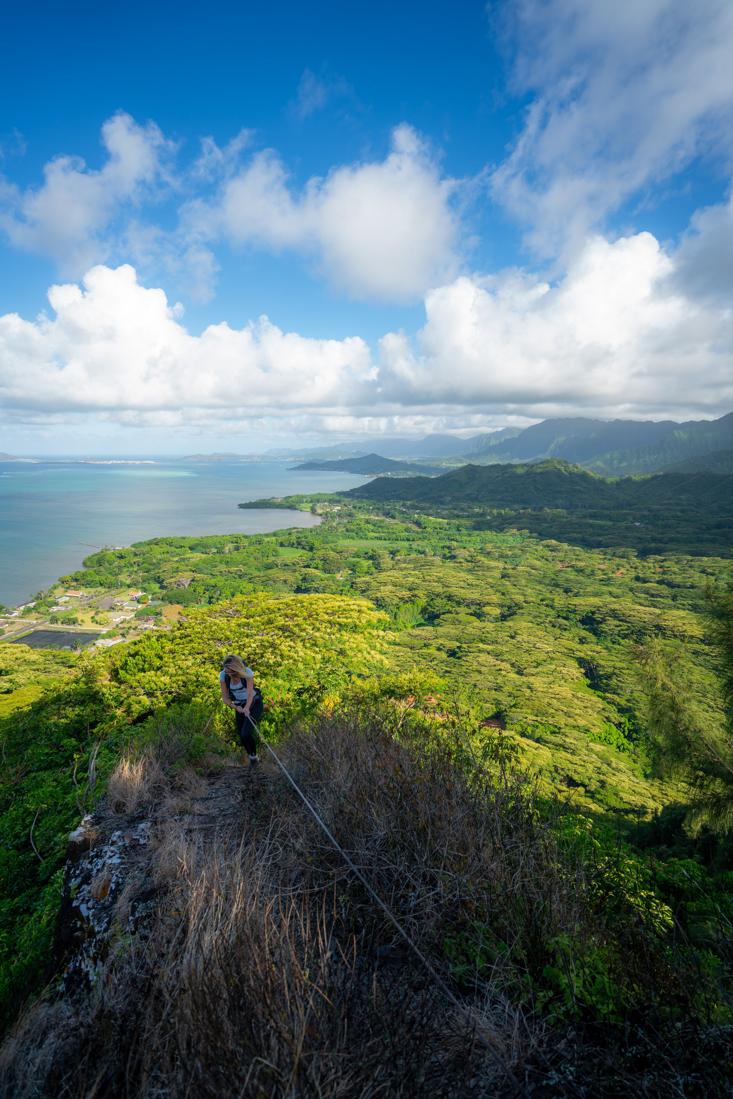
On a clear day like this, there is very little shade throughout much of the Mauʻumae Ridge Trail, which is especially true the higher the trail climbs.
This is why I highly recommend hiking in a hooded sun shirt, as one can be useful here and on countless other Hawaiʻi trails.
The Cook Pine trees in the distance signify the second of the four clearings on Mauʻumae Ridge.
At roughly 1.6 miles (2.6 km), Mauʻumae Ridge comes to the second of four unnamed clearings before the summit.
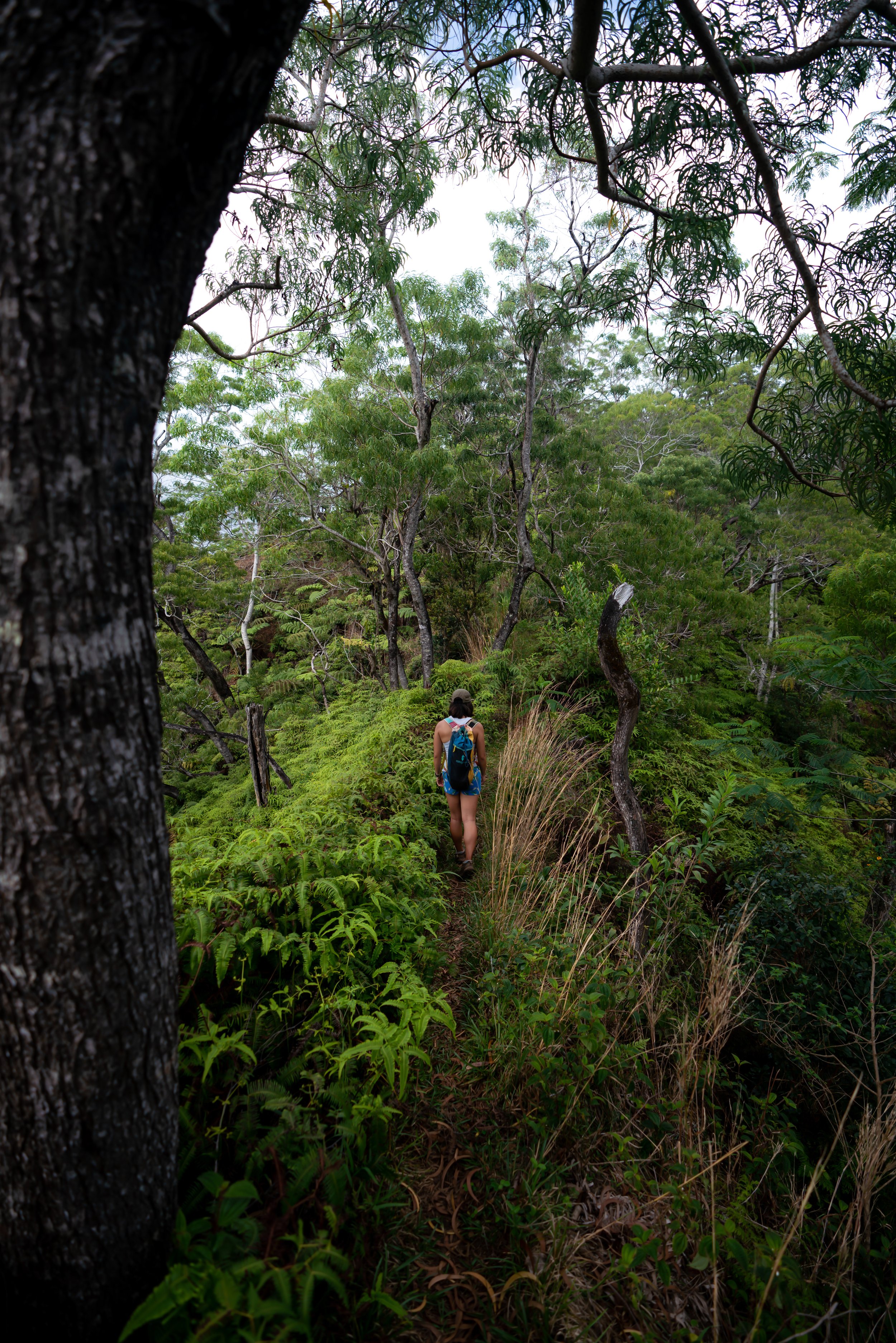
After the second clearing, the Mauʻumae Ridge Trail starts to get much hillier and more overgrown, resembling other Oʻahu ridge hikes, like Mānana Ridge and the Schofield–Waikāne Trail.
This is the third of the four clearings on the hike up Mauʻumae Ridge to Puʻu Lanipō.
These upper-elevation sections are really where good hiking pants are the most useful!
This is where Kaʻau Crater and the third waterfall on the loop start to become visible from Mauʻumae Ridge to the north.
These never-ending hills are where the Mauʻumae Ridge Trail really begins to feel like Mānana Ridge, as it is truly one of the hilliest hikes in the southern Koʻolau Mountains.
As the Mauʻumae Ridge Trail gets closer to Puʻu Kainawaʻaunui, the views down into Kaʻau Crater get better and better, serving as a good visual indicator of how much farther there is to climb to reach the KST.
This hill is one of the steepest sections on Mauʻumae Ridge, prior to the KST traverse to Puʻu Lanipō.
On a clear day, the views of ʻAwaʻawaloa and Kaʻau Crater get better with every hill!
For those who are interested, Mauʻumae Ridge to Puʻu Lanipō is one of the best southern Koʻolau trails to learn how to identify native Hawaiian plants, as the upper elevations are a great place to see a large amount of diversity over a relatively short distance.
Hills, just like this one, are really what make Mauʻumae Ridge such a tedious ascent!
With just 0.5 miles (0.8 km) left before the Koʻolau Summit, the Mauʻumae Ridge Trail comes to the fourth and final clearing.
This erosion scar is often the trickiest section to navigate on Mauʻumae Ridge, which is even more true if it has rained recently.
That said, I recommend carrying at least one rope if you have any doubts about the hike—especially if you plan to continue past the first summit to get to Puʻu Lanipō.
After the eroded section, the Mauʻumae Ridge Trail begins a slow descent before the final hill that leads up to the Koʻolau Summit.
This is where Puʻu Kainawaʻanui, the summit of Mauʻumae Ridge on the left, and Puʻu Lanipō, the peak on the far right of the three, truly stand out for the first time.
This is the bottom of the descent before the final climb to the summit begins.
This Kōpiko is another great example of just how much Hawaiian diversity there is on Mauʻumae Ridge.
From this point, the rest of the Mauʻumae Ridge Trail to the Koʻolau Summit can be seen on a clear day!
This is the bottom of the final summit push to Puʻu Kainawaʻanui.
Puʻu Kainawaʻanui (False Lanipō)
The summit of Mauʻumae Ridge is Puʻu Kainawaʻanui, not Puʻu Lanipō, which is why Puʻu Kainawaʻanui is sometimes called 'False Lanipō.'
That said, Puʻu Lanipō is the next summit to the south (right) of Puʻu Kainawaʻanui, located about 0.25 miles (0.4 km) away.
If you are interested in hiking further along the Koʻolau Summit, note that the next notable summit to the north is Puʻu Palikea, more commonly known as Kaʻau Crater, and to the south, the next major trail is Wiliwilinui, with Puʻu Lanipō in between.
Read My Separate Post: Koʻolau Summit Trail (KST)
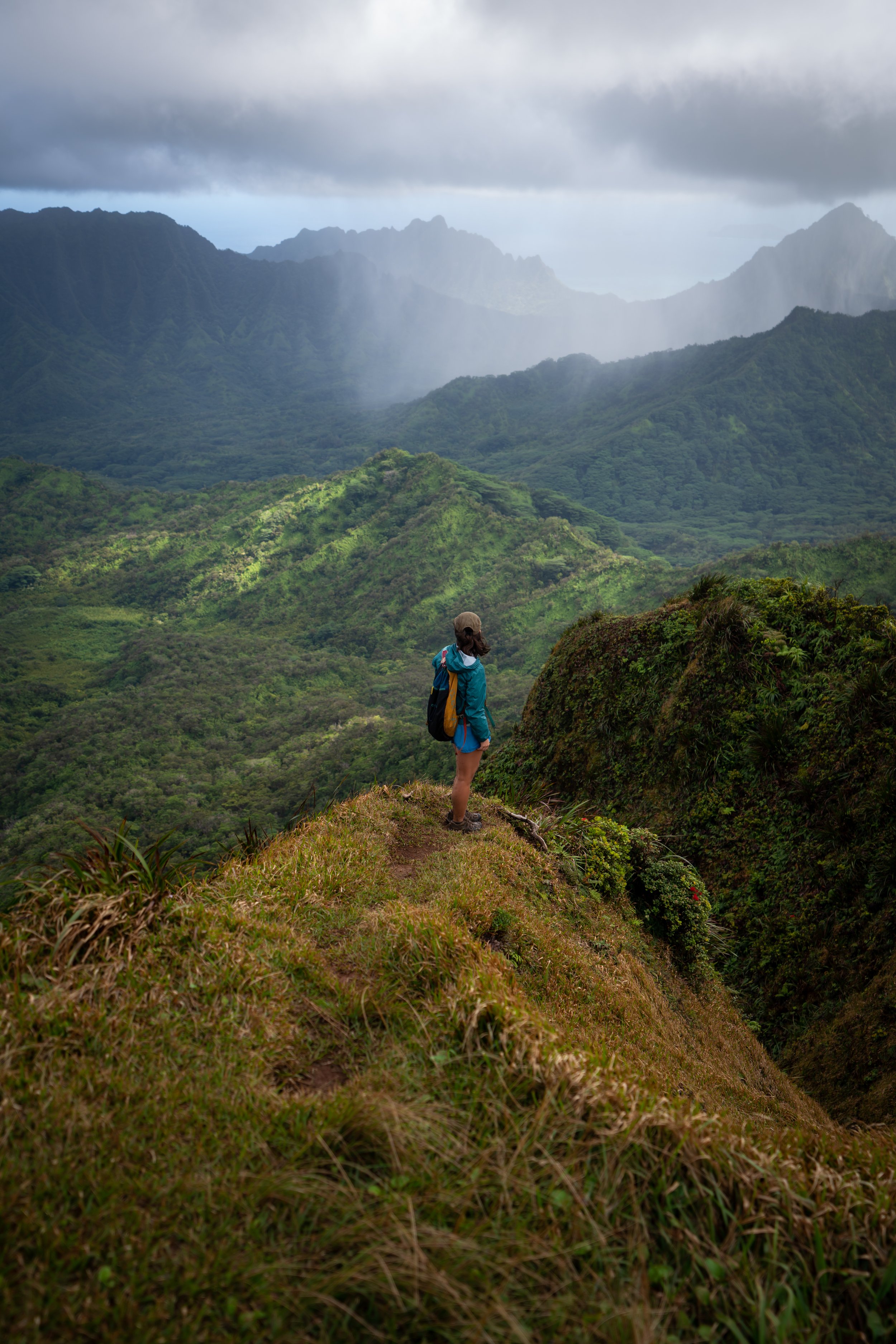
This truly was one of the clearest days I’ve experienced on the hike to Puʻu Lanipō!
Koʻolau Summit Trail (KST)
To get to Puʻu Lanipō from Puʻu Kainawaʻanui, go right (south) to begin hiking on the Koʻolau Summit Trail.
That said, something I always say about leaving any ridge trail to begin the KST is that hiking on the Koʻolau Summit should not be compared to anything experienced thus far. It’s almost always harder, slower, more overgrown, and more dangerous—which is certainly the case for the short 0.25-mile (0.4 km) section between Puʻu Kainawaʻanui and Puʻu Lanipō.
Read My Separate Post: Koʻolau Summit Trail (KST)
The initial drop off Puʻu Kainawaʻanui is fairly steep, but not nearly as steep as the drop if you decide to continue past Puʻu Lanipō on the KST.
This is the top of the first false summit, the unnamed middle peak between Puʻu Kainawaʻanui and Puʻu Lanipō, that could be seen from lower on the trail.
This endangered Kōlea species certainly isn’t difficult to see if you find yourself hiking in other areas across the Koʻolau Summit, but I think it’s an important reminder to do what you can to minimize your impact in these fragile environments, as endangered Hawaiian species are found all across Hawaiʻi’s mountains—whether they are easy to come across like this or not.
At the top of the next steep hill, there’s one more short, flatter traverse to reach the true summit of Puʻu Lanipō.
Puʻu Lanipō
Standing at roughly 2,590 ft. (789 m), Puʻu Lanipō marks the end of the long hike up the Mauʻumae Ridge Trail.
That said, Puʻu Lanipō is, without a doubt, one of the longer and more challenging day hikes in the southern Koʻolaus—comparable only to others like Kūlepeamoa Ridge to the south and Kapālama Ridge and Tripler Ridge to the north. Even the Wailupe Loop Trail and Puʻu Kōnāhuanui aren’t as challenging, but this is just one person’s opinion.
In any case, there’s the option to turn back at Puʻu Lanipō to hike down Mauʻumae Ridge, but what I often do is continue just a little further south to Wiliwilinui Ridge, because it ends up being a much faster—not to mention much easier—hike back down.
To learn more about this next section, all the details can be found in my separate post about the entire Koʻolau Summit Trail.
Read My Separate Post: Koʻolau Summit Trail (KST)
Native Plants on the Mauʻumae Ridge Trail
The Mauʻumae Ridge Trail to Puʻu Lanipō is one of the better day hikes in the southern Koʻolaus to see a variety of native Hawaiian plants throughout the entire hike.
In the beginning, some of these include ʻŪlei, ʻAʻaliʻi, and ʻIlima, but as the trail climbs higher, it doesn’t take long to reach a predominantly native Koa-ʻŌhiʻa lehua forest that continues for the rest of the hike.
Here, some native plants that can be seen include ʻIliahi, Olopua, Alani, ʻŌhelo, Maile, ʻIeʻie, Pūkiawe, Māmaki, ʻUki grass, ʻAhakea, and Kōpiko — to truly only name a few.
If you are curious about trying the native Hawaiian Māmaki tea, I kindly ask that you don’t harvest Māmaki from our native forests but, instead, buy from one of the local reputable vendors, such as those listed below.
If you would like to learn more about these and many other native Hawaiian plants from across the islands, I encourage you to check out my separate post linked below.
Read My Separate Post: Native Hawaiian Plant Guide