Hiking the Waimano Ridge Trail on Oʻahu, Hawaiʻi
Distance: 14.6 miles / 23.5 km
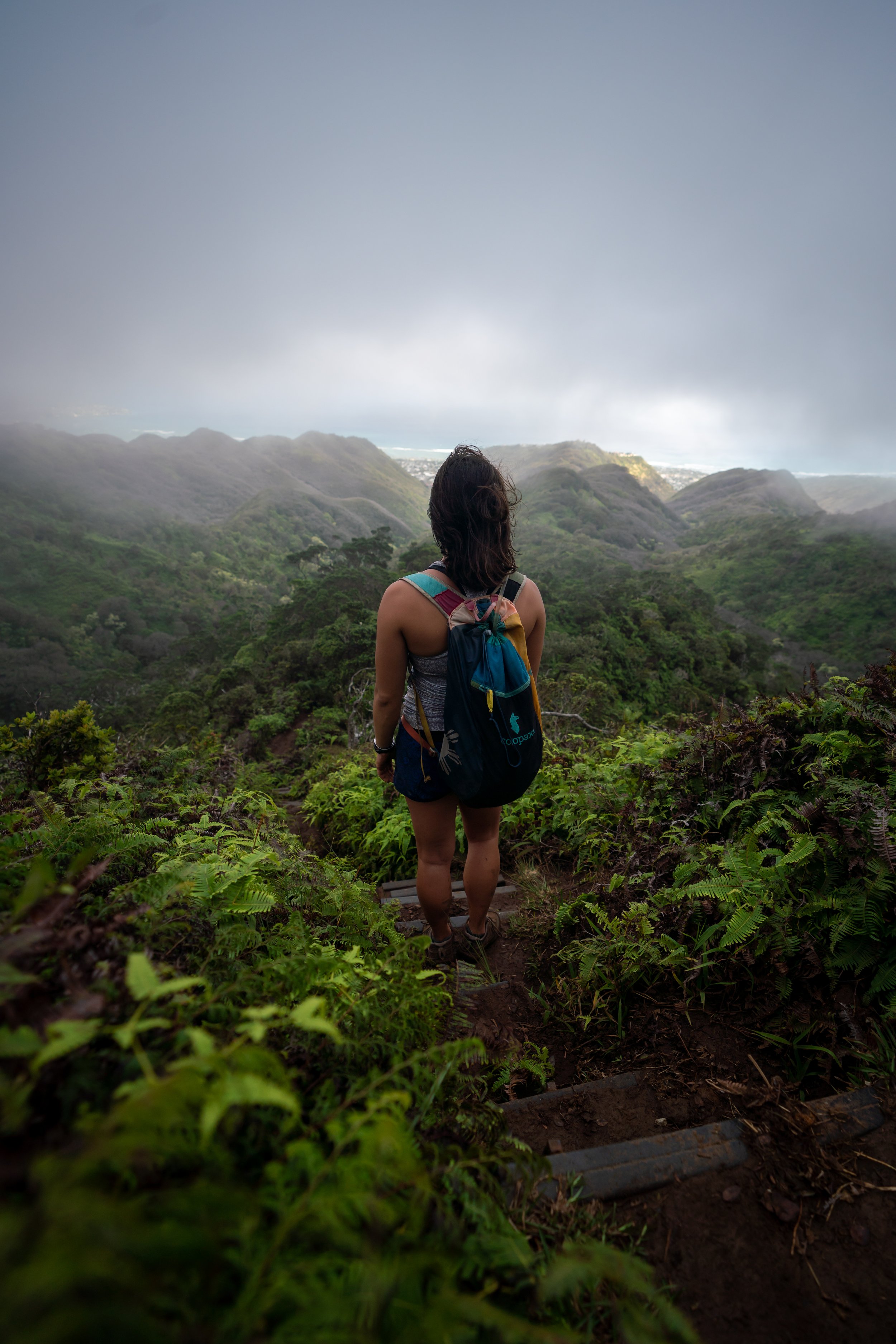
The Waimano Ridge Trail in the central Koʻolau Mountains on Oʻahu is an adventure not often hiked in its entirety by most who begin from the trailhead in Pearl City.
I say this because most hikers who begin from the Waimano Trailhead only explore the initial 2.5-mile (4.0 km) Waimano Loop Trail, missing the best of Waimano Ridge on the upper mountain.
With that in mind, Waimano Ridge even sees fewer hikers than its sister trail to the north, Mānana Ridge, due largely to the fact that Waimano Ridge is a long and tedious all-day adventure.
However, this same sentiment is also what makes the Waimano Trail so special. For those willing to stick out the long trek to the summit, the hike can make for a great, uncrowded adventure compared to other, more popular day hikes, like the nearby ʻAiea Loop Trail.
Waimano Ridge Trailhead Parking
Parking for the Waimano Ridge Trail is located at the very top of Waimano Home Road in Pearl City.
Out of caution, consider the Waimano Trailhead to be a high-crime area for petty theft, meaning you should never leave visible bags or anything valuable in your car.
Google Maps Directions: Waimano Ridge Trailhead
Hiking the Waimano Ridge Trail
Personally, I have a love-hate relationship with the Waimano Ridge Trail, which often steers me away from it in favor of other Oʻahu ridge hikes, like the Schofield-Waikāne Trail.
I say this because I find the first 3.5 miles (5.6 km) until the Waimano Stream crossing to be very tedious and annoying, as it passes through some of my least-favorite environments in all of Hawaiʻi.
By this, I mean that the first 3.5 miles (5.6 km) has a lot of elevation gain followed by a lot of elevation loss, and I’m personally never a fan of the feral pig-mosquito-Strawberry Guava-like habitat that is the first few miles of the trail.
However, on a clear day, the views from the upper mountain always make these first few miles worth the trek. I only say all this to try and say: don’t get discouraged by the beginning of the hike, which is absolutely the worst of the two halves!
In any case, on this beautiful summer day, I hiked to the summit in 2 hours and 25 minutes, but that was without taking any breaks.
First Upper-Lower Waimano Junction (Waimano Loop Trail)
Immediately after leaving the trailhead, the Waimano Trail splits into both an Upper and Lower Trail, which are often hiked together as a loop known as the Waimano Loop Trail.
That said, I personally recommend taking the Upper Waimano Trail because it’s more direct than the Lower.
This is where the Upper Waimano Trail steers away from the fence line, which makes for a nice mental checkpoint on the long return hike.
At this split, it makes no difference which direction you choose to go, as both sides meet up shortly ahead.
At the top of the next hill, go straight over to the far side where the Upper Waimano Trail continues.
Eventually, the Waimano Trail will begin to pass by the remnants of an old sugarcane-era irrigation system, known today as the Waimano Tunnels.
Waimano Tunnels
Whenever the Waimano Trail comes to one of the Waimano Tunnels, always take the path around them.
There are only a few tunnels on Oʻahu that are worth going through, but they are all completely separate hikes.
Second Upper-Lower Waimano Junction (Waimano Loop Trail)
After 1.1 miles (1.8 km), the Upper and Lower Waimano Trail meet again.
Here, go straight (right) to begin hiking the Waimano Ridge Trail.
6th Tunnel Bypass
The 6th Tunnel Bypass is a relatively 'new' alternate route compared to the trail heading straight past this sign.
That said, I personally prefer to go straight because it’s more direct, but you will have to scramble down a small rocky section immediately after this sign if you choose to take the old route.
However, it’s easy enough to turn back to the bypass if you decide against the scramble.
Waimano Ridge-6th Tunnel Bypass Junction
This is where the two trails come back together after the down climb.
With that in mind, this junction can be particularly difficult to notice on the return hike, which is why I recommend dropping a pin on your phone or taking a mental note of something on the trail in order to notice it on the way back.
This second small down climb is the only other section like this on Waimano Ridge Trail.
This is the first of two times where the Waimano Ridge Trail crosses a stream.
After the first stream crossing, go right at the split to avoid the next tunnel.
I’ve been hiking on Oʻahu for so many years that I actually remember when this big Eucalyptus came down on the trail!
At this point, you can either go straight up the hill or take the switchback to reach the Waimano Shelter.
Waimano Shelter
This is the Waimano Shelter, and it’s the only shelter on the entire trail.
That said, the Waimano Ridge Trail continues straight over this hill, like the first hill from the Upper Waimano Trail.
Past the shelter, the Waimano Ridge Trail begins its descent back down to the second and final stream crossing.
Most Oʻahu trails don’t have trail markers, but from what I was tracking, this one on the Waimano Trail is fairly accurate.
Waimano Stream
The Waimano Stream crossing is the second and final time the Waimano Ridge Trail crosses a stream, which can be a bit more confusing than the first.
That said, stay to the right side and continue upstream for a short distance, where the trail heading up the ridge will be found on the far side.
Waimano Ridge
After the Waimano Stream crossing, the Waimano Ridge Trail begins climbing what is truly known as 'Waimano Ridge'.
This is the 3.5-mile (5.6 km) mark, and it is from this point on that personally think the Waimano Ridge Trail gets much more enjoyable!
These Koa trees are the best indicator that the worst of the tedious beginning sections are behind you, and the better, more beautiful hiking is to come!
After the Waimano Stream, the trail will climb four switchbacks, depending on how you count, up to the Waimano Contour Trail.
Waimano Contour Trail
This is the fourth and final switchback, where Waimano Contour Trail (Waimano Ridge) continues from here to the Koʻolau Summit.
It’s always nice to see the Oʻahu endemic ʻIliahi growing alongside the trail!
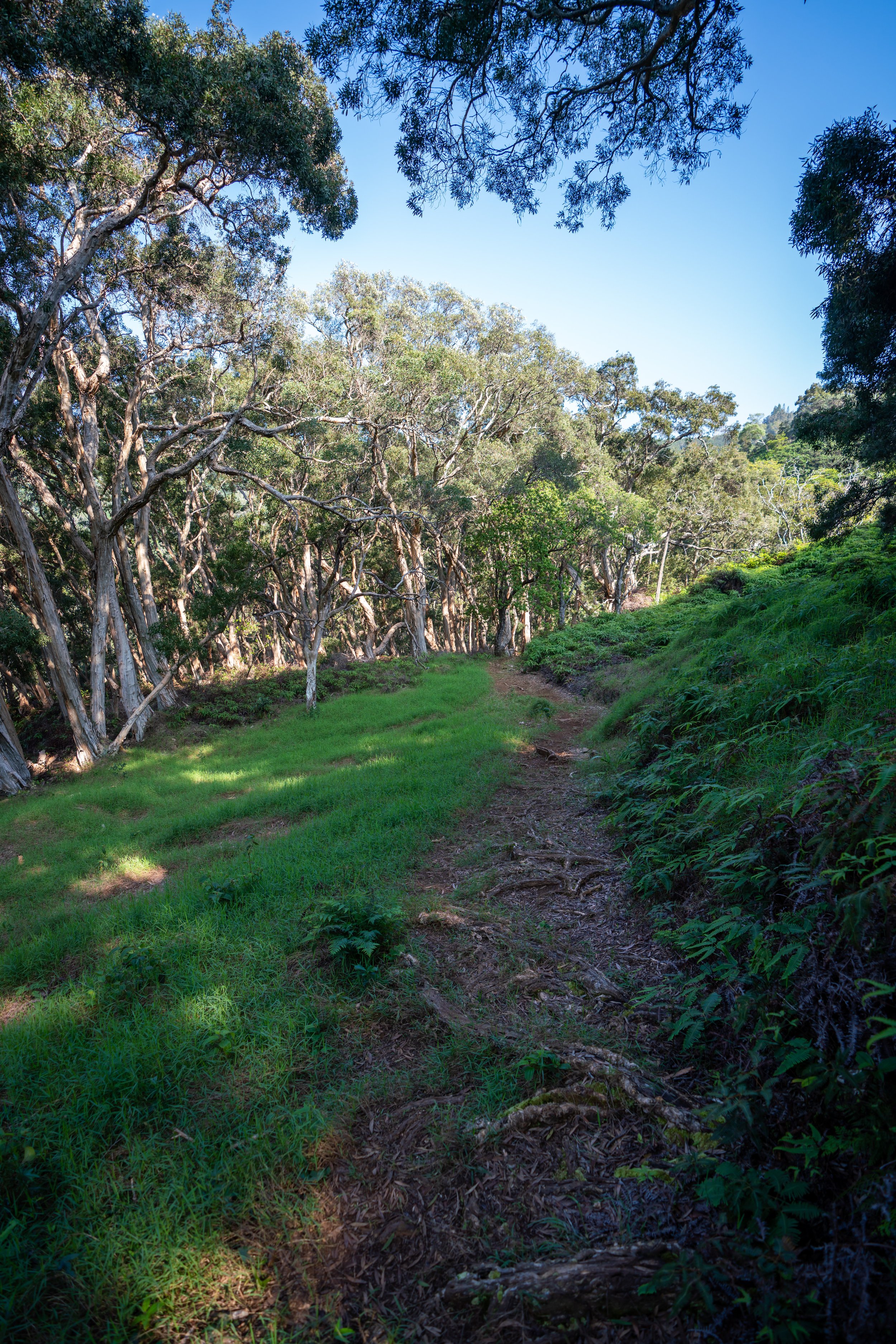
Once on the upper ridge, the Waimano Trail will noticeably become more and more overgrown as the miles go on.
With that in mind, good hiking pants are a must on the Waimano Ridge Trail because they not only help with the overgrowth here but also with the mosquitoes in the beginning sections!
The pants below are my recommendations that hold up the best with the overgrowth here in Hawaiʻi, but with any hiking pants that need to be durable, make sure that they are at or near 100% nylon. This is really the most important factor!
Regardless of my opinion about the beginning, some may say that these overgrown sections are worse than the lower elevations.
However, as long as you’re prepared with plenty of food, water, and good hiking pants, I think that these remaining miles are much more tolerable than the beginning, especially because there are no unnecessary ups and downs—hence the 'Contour Trail'.
Upper-elevation ʻŌhiʻa lehua trees with blooms like this are a great way to see the endemic ʻApapane on Oʻahu, especially in the early morning and late evening hours!
I love these two side-by-side photos because the first photo is a full-grown Koa tree with a baby sapling growing right beside it.
That said, please be mindful as you hike to not trample the little saplings like this, as these baby Koa trees are the future integrity of these soft-soil landscapes.
I then passed by the Oʻahu endemic yellow ʻŌhiʻa, Metrosideros macropus, which is one of three ʻŌhiʻa species native only to Oʻahu.
With that in mind, know that the color alone is not enough to determine the species, as M. polymorpha, shown above, can also flower yellow. 'Polymorpha' quite literally means many forms.
Therefore, use the leaves, especially the petioles, when determining the difference between these two species.
Waimano Corner
This hard switchback at 6.5 miles (10.5 km) that immediately follows the lower switchback in the photo above is known as the Waimano Corner, and it’s always a nice sign after a long hike on the Contour Trail that the summit is 'relatively' close!
From here, there is only 0.8 miles (1.3 km) left to reach the Koʻolau Summit.
This is where the views of summit truly begin to become visible for the first time!
Koʻolau Summit Trail (KST)
This is where the Waimano Ridge Trail meets the KST that heads north toward Mānana.
Once here, continue straight toward the true Waimano Summit shortly ahead, which is where the trail on the KST continues to the south.
Read My Separate Post: Koʻolau Summit Trail (KST)
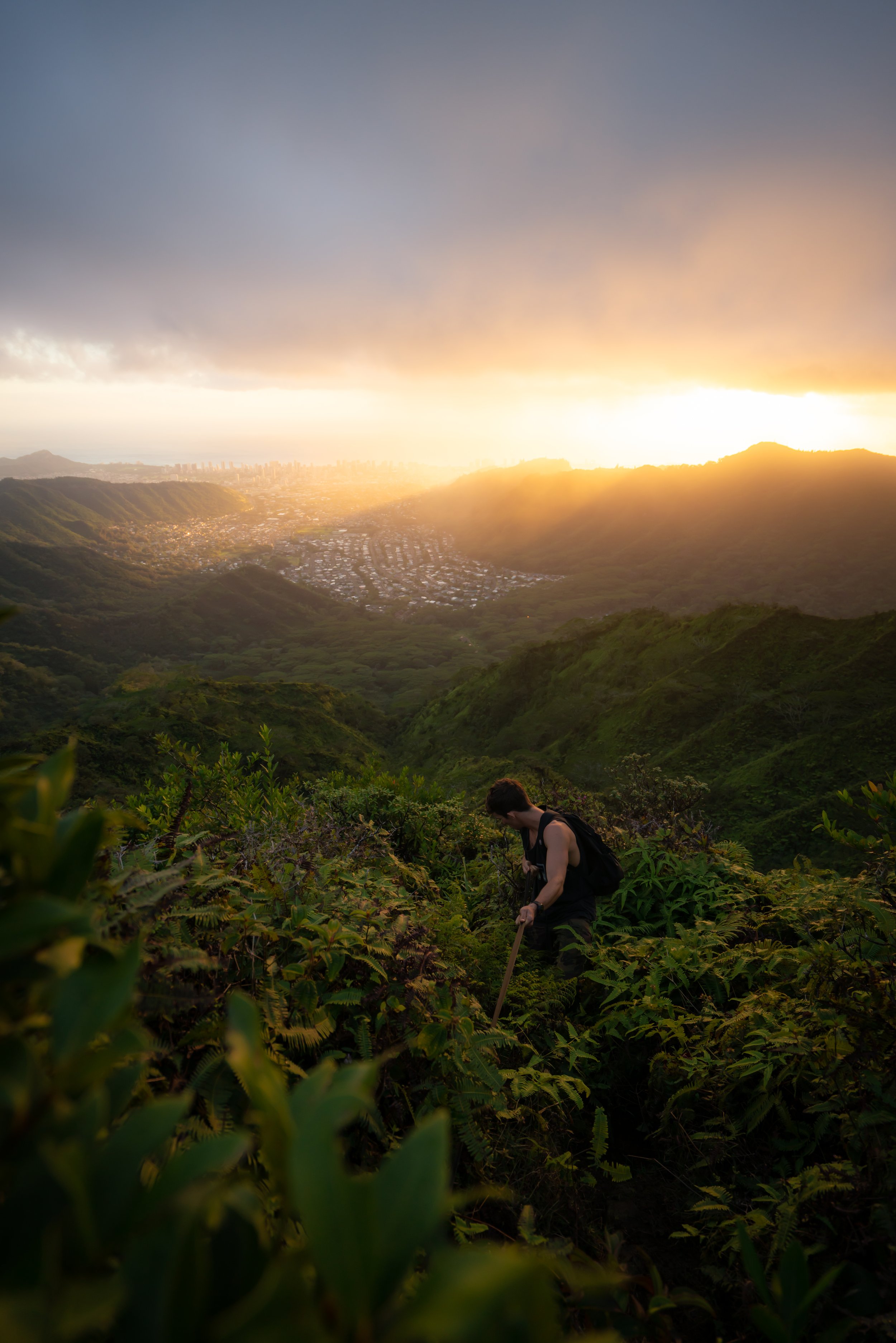
Waimano Summit
Waimano Summit is a weird one because you’re not actually on a peak; rather, the summit is the true low point on the KST between both ʻEleao to the north and Waimalu to the south.
That said, the views from Waimano Summit on a clear day are unique in that this is the only summit on Oʻahu that allows you to see the two hardest hikes on the island from one location: ʻEleao Ridge to the north and the Kalahaku Teeth to the south. Personally, I’ve done Kalahaku, and after that experience, I would never suggest either to anyone ever!
In any case, the summit views out toward Kahaluʻu offer beautiful panoramic views of Waiheʻe Valley, as well as Puʻu Māʻeliʻeli and Mokoliʻi.
On a different note, I recommend against hiking in either direction on the Koʻolau Summit unless that is something that you were planning for. I say this because hiking these remote miles on the summit is significantly more difficult than anything on Waimano Ridge to get to this point, and the options for exit trails are few and far between, especially if you hike south!
Read My Separate Post: Koʻolau Summit Trail (KST)
Native Plants on the Waimano Ridge Trail
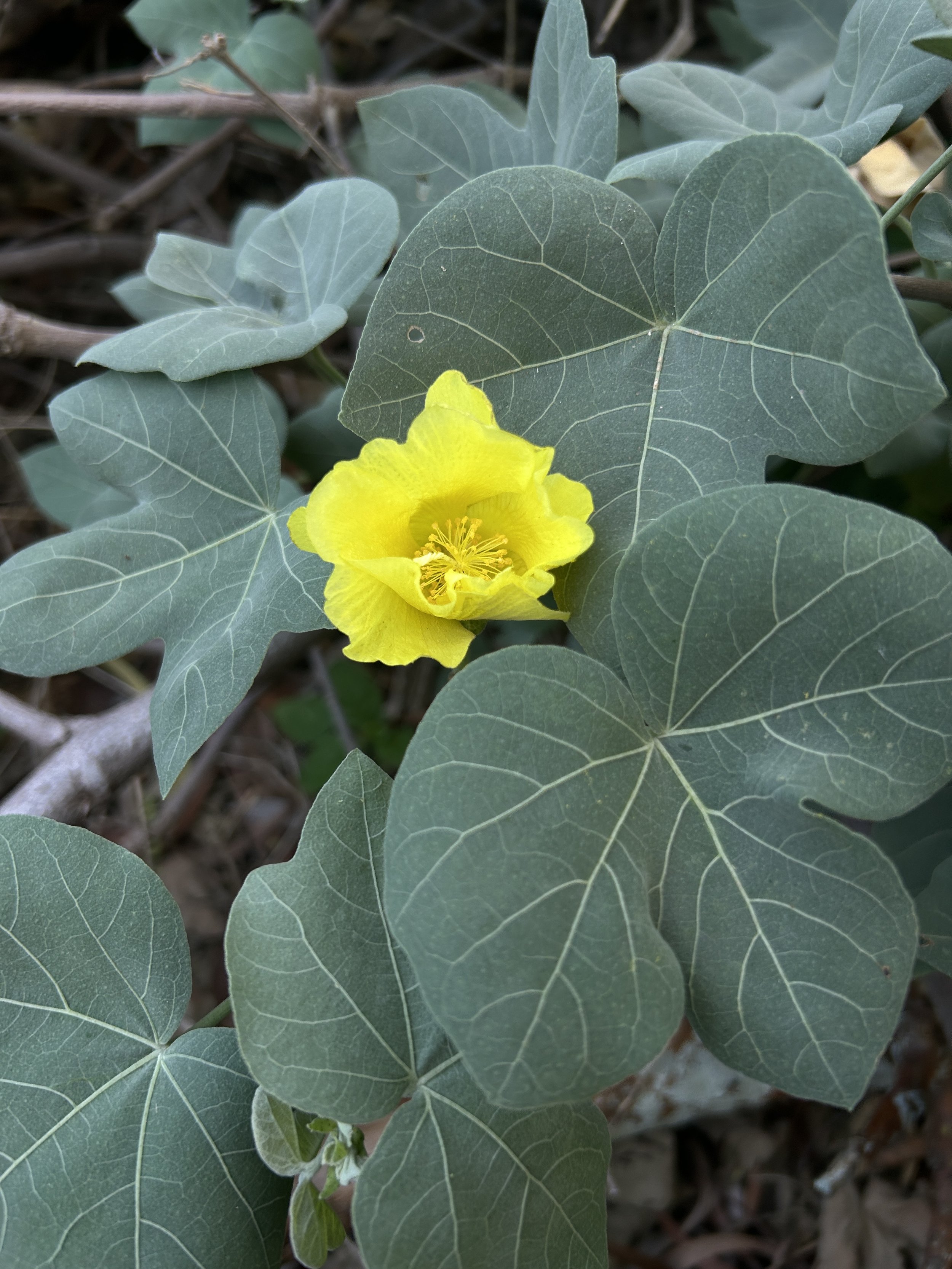
Perhaps the lack of native plants in the first 3.5 miles (5.6 km) is another reason why I don’t like the beginning of the Waimano Ridge Trail, but the one native plant that comes to mind in the lower elevations is Hau.
Nevertheless, from the upper ridge to the summit, you can find natives like ʻŌhiʻa lehua, Koa, Kōpiko, ʻAhakea lau nui, Akaʻawa, Alani, Hame, ʻIliahi, ʻĀlaʻa, and Hōʻawa—to really only scratch the surface!
If you would like to learn more about these and many other native Hawaiian plants from across the islands, I encourage you to check out my separate post linked below.
Read My Separate Post: Native Hawaiian Plant Guide