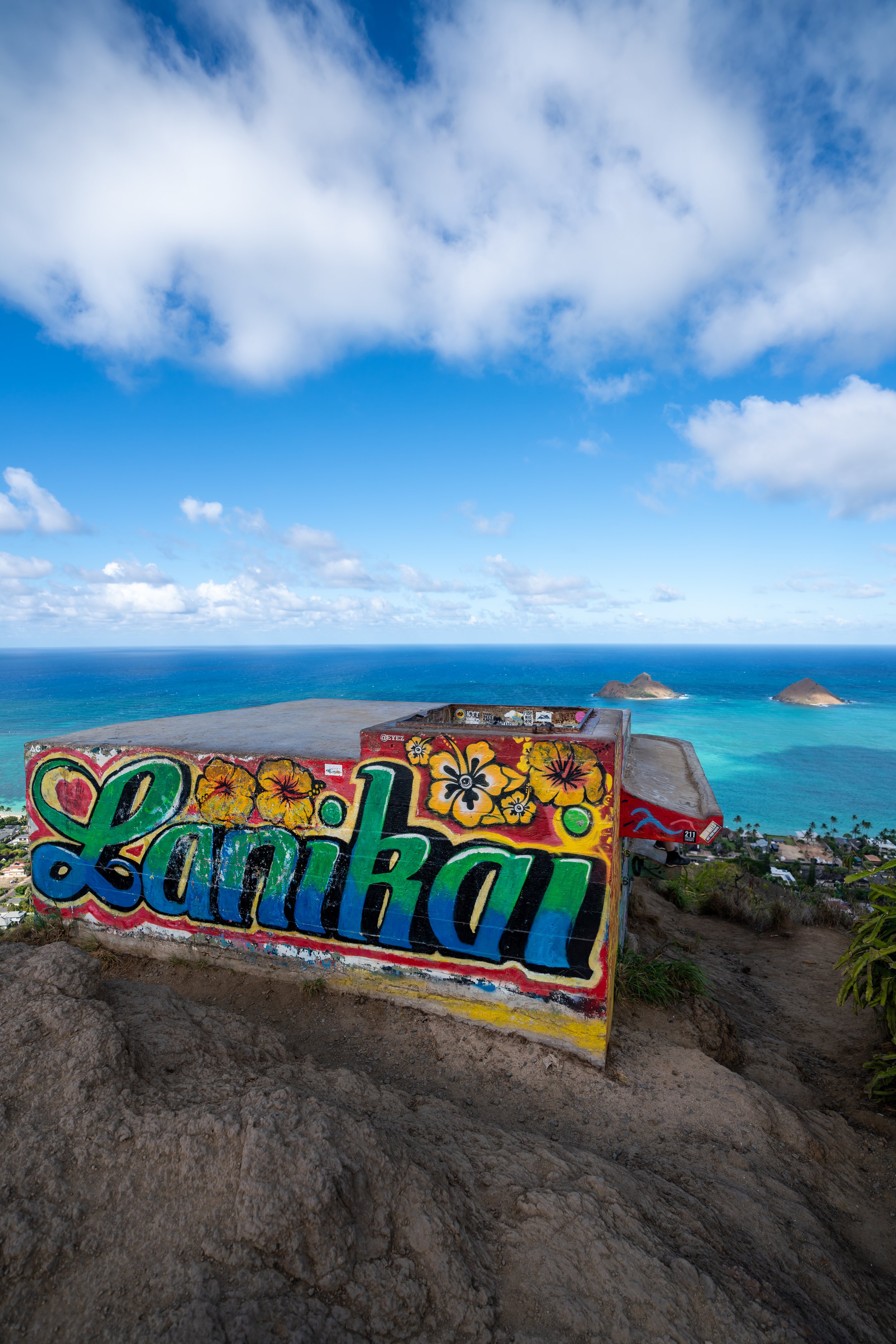
Hiking the Kaʻau Crater Trail on Oʻahu, Hawaiʻi
Distance: 5.3 miles / 8.5 km
The Kaʻau Crater Trail in the southern Koʻolau Mountains on Oʻahu is a renowned favorite that attracts both residents and visitors alike, as the full Kaʻau Crater Loop ascends past three different waterfalls, loops around a dormant volcanic crater, and offers beautiful summit views above the Honolulu skyline and much of the island’s east side, all making the Kaʻau Crater Trail one of Honolulu’s best and most popular day hikes!
That said, the Kaʻau Crater Trail is arguably the most challenging day hike in the southern Koʻolaus, and its difficulty is often underestimated by many first-time hikers, leading to a lack of preparation in terms of gear, food, water, and proper clothes to hike in.
To add to this, the Kaʻau Crater Trail has two near-vertical climbing sections at both the first and second waterfalls, with countless other very steep, slippery, and muddy sections scattered throughout.
This is all to say that the Kaʻau Crater Trail is not for the faint of heart, even if you only plan to hike up Waiʻōmaʻo Valley to see the waterfalls. However, I think it’s important to note that the hardest part of the Kaʻau Crater hike is the first 2.7 miles (4.3 km) to the summit of Puʻu Palikea (the first peak), which I emphasize to suggest that there is a significantly easier way to hike down than the route up Waiʻōmaʻo Valley shown at the beginning of this post.
How Long is the Kaʻau Crater Trail?
Since many hikers only explore parts of the full Kaʻau Crater Trail, I’ve broken down each section to help you plan your adventure.
Bear in mind that the relatively short distances for each section are a bad way to estimate time—it will take longer.
Kaʻau Crater Distances:
Kaʻau Crater Trailhead to the Kaʻau Crater Ridge Trail: 0.5 miles (0.8 km)
Kaʻau Crater Ridge Trail to Lower Waiʻōmaʻo Falls: 1.0 miles (1.6 km)
Lower Waiʻōmaʻo Falls to Middle Waiʻōmaʻo Falls: 0.2 miles (0.3 km)
Middle Waiʻōmaʻo Falls to Upper Waiʻōmaʻo Falls: 0.1 miles (0.2 km)
Upper Waiʻōmaʻo Falls to the Kaʻau Crater Loop Trail: 0.2 miles (0.3 km)
Full Kaʻau Crater Loop Trail 1.9 miles (3.1 km)
Part of Loop Actually Hiked: 1.7 miles (2.7 km)
Kaʻau Crater Ridge Trail to Waiʻōmaʻo Valley: 1.1 miles (1.8 km)
Total Distance: 5.3 miles (8.5 km)
Kaʻau Crater Trailhead Parking
Parking for the Kaʻau Crater Trail is located near the end of Waiʻōmaʻo Road, in the back of Pālolo Valley.
That said, Waiʻōmaʻo Road narrows considerably within the last 0.3 miles (0.5 km) of the trailhead, beginning at the intersection of Waiʻōmaʻo and Halenoho. At the same time, parking starts to become more and more challenging the closer you drive to the trailhead, with some seemingly-legal spots located on private property.
This is why I recommend taking the first legal spot you find upon making this final turn up Waiʻōmaʻo Road, especially on weekends when the hike gets busier.
Google Maps Directions: Kaʻau Crater Trailhead
Hiking the Kaʻau Crater Trail
Walking to the Trailhead
This is the walk up Waiʻōmaʻo Road from the farthest parking spots near the intersection of Waiʻōmaʻo and Halenoho.
To skip ahead to the Kaʻau Crater Trailhead, click here.
Signs like this have been here on Waiʻōmaʻo Road for many years!
At the intersection of Waiʻōmaʻo and Keaolele, go straight (right) to continue up to the Kaʻau Crater Trailhead.
Kaʻau Crater Trailhead
This is the Kaʻau Crater Trailhead on the left-hand side of Waiʻōmaʻo Road.
Immediately after leaving the trailhead, the Kaʻau Crater Trail begins a fairly steep, rapid descent to the Waiʻōmaʻo Stream.
Waiʻōmaʻo Valley
The Kaʻau Crater Trail levels out when it reaches Waiʻōmaʻo Stream, beginning the longest and most dreaded section of the entire hike.
I say this because the next 1.7 miles (2.7 km) are incredibly slow, muddy, and therefore tedious, which continues to the point where the Kaʻau Crater Trail reaches the base of the third waterfall.
That said, the hike back is not nearly as challenging as the hike up to Puʻu Palikea.
I’ll dive into more detail about this later.
These beginning sections of the Kaʻau Crater Trail are the only parts of the hike that will be repeated on the way back—that is, if you decide to hike the full loop, as outlined in this article.
The Kaʻau Crater Trail will cross the Waiʻōmaʻo Stream seven times before the Kaʻau Crater Ridge junction, which is nice to keep in mind, since these are the same seven crossings that will have to be repeated on the hike out.
After just 0.3 miles (0.5 km), the Kaʻau Crater Trail reaches the infamous Waiʻōmaʻo Pipe, more formally known as the Board of Water Supply (BWS) Pālolo Transmission Line, which has been supplying urban Honolulu with freshwater for more than 100 years following the completion of a tunnel project in Waiʻōmaʻo Valley in 1920.
However, this pipe along the Kaʻau Crater Trail today is a more recent addition, dating back to the 1990s.
While all this may seem irrelevant, the Kaʻau Crater Trail follows this pipe until it reaches the first waterfall, which is the best way to know you’re following the right path.
This is the fourth Waiʻōmaʻo Stream crossing.
It’s worth mentioning that the Kaʻau Crater Trail should not be hiked during or immediately following periods of very wet weather, as the Waiʻōmaʻo Stream, like any stream in Hawaiʻi, can flash flood, making all these crossings very dangerous to attempt.
This is the sixth Waiʻōmaʻo Stream crossing, meaning the Kaʻau Crater Ridge junction is not far ahead.
Waiʻōmaʻo Valley-Kaʻau Crater Ridge Junction
At about 0.5 miles (0.8 km) into the hike, the Kaʻau Crater Trail reaches a not-so-obvious junction that most hikers don’t even notice until the hike back down.
This is because the Kaʻau Crater Trail heading up Waiʻōmaʻo Stream is much more obvious than the trail to the left on the other side.
That said, the trail on the left side of the stream is the Kaʻau Crater Ridge Trail, and it’s the route I recommend taking on the hike back down, because it’s very fast-moving and cuts out the vast majority of the slow, muddy, and tedious sections between this point and the Kaʻau Crater Loop Trail.
However, there is no opportunity to take the Kaʻau Crater Ridge Trail back if you decide to turn around at or before the third waterfall. At a minimum, you must hike up to the start of the Kaʻau Crater Loop Trail—the 1.9-mile (3.1 km) loop that circles Kaʻau Crater—in order to reach the top of the ridge trail to take it back down.
If you were asking me, I personally would argue that the very steep ascent between the third waterfall and the Kaʻau Crater Loop Trail is less effort than simply turning back at the third waterfall to return by way of the pipe trail along Waiʻōmaʻo Stream.
This is obviously just one person’s opinion, but what I’m really saying is that I almost exclusively take the ridge back down, because it’s so much easier and faster, in my opinion, than the Kaʻau Crater Trail through Waiʻōmaʻo Valley.
After the seventh stream crossing, the Kaʻau Crater Trail will not cross the Waiʻōmaʻo Stream again until it climbs above the first waterfall.
This is good to keep in mind because, for lack of a better way of wording it, this pipe will become your best friend for the next 1.0 mile (1.6 km) to Lower Waiʻōmaʻo Falls!
On top of the mud, the overgrowth, and the mosquitoes, I highly recommend wearing good hiking pants because of all the hazards associated with the old, deteriorating well infrastructure from the 1920s.
To add to this, nearby residents often say they constantly see hikers begin the Kaʻau Crater Trail vastly underprepared, which is why I want to warn about its difficulty, as well as recommend wearing good, closed-toe hiking shoes and pants, like the ones linked below.
I think it’s very important to mention that a bright, beautiful, sunny day in the back of Pālolo Valley—like this—is not the norm.
In fact, a largely cloudless day like this is quite rare, which I mention for two reasons.
The first is that the entire Kaʻau Crater Trail receives a lot of rain, which is why the hike is so muddy and, therefore, slower than the short distances would lead you to believe.
The second reason I mention this is because it’s very important to hike with a good headlamp on the Kaʻau Crater Trail in case of an emergency.
I say this because the back of Pālolo Valley is notorious for getting very dark by the mid- to late afternoon hours—not to mention, a headlamp, in the worst-case scenario, can help crews locate you in the event of a rescue, which happens much more often than you may think!
The broad-leafed plants on the right-hand side of the photo below are called Ti, or Kī, and they’re one of many Hawaiian canoe plants found along the Kaʻau Crater Trail through Waiʻōmaʻo Valley.
To add a little more context, canoe plants in Hawaiʻi are species that were brought by the original Polynesians when the islands were first discovered, allowing those that arrived first an easier way to establish reliable food sources and grow materials, as well as obtain other essentials for daily life and cultural practice.
In addition to good shoes, hiking pants, and a headlamp, I also recommend wearing a hooded sun shirt, since the Kaʻau Crater Trail is such a long day outside.
I say this because, while one may not seem necessary in Waiʻōmaʻo Valley, the entire Kaʻau Crater Loop on the upper half of the hike is very exposed compared to these lower elevations.
This is one of countless examples where the Kaʻau Crater Trail climbs up and drops down constantly on the hike to the first waterfall, which is just another reason why it’s challenging to move quickly, especially when it’s muddy.
This corner is where hikers can see the first views of the Koʻolau Summit, with Puʻu Palikea—the summit of the Kaʻau Crater Trail—being the tallest peak above the branch on the left side of the Trumpet tree.
One of the cool things about the Kaʻau Crater Trail is that hikers can see two of the most common endemic Hāpuʻu ferns growing directly alongside the trail.
That said, telling the two most common species apart can be challenging, unless you know the little trick described below!
Cibotium glaucum vs. Cibotium chamissoi
There are subtle differences in the pinnae that can be hard to describe, but for a quick, easy way to determine which species you’re looking at, flip the fronds!
The underside of Cibotium glaucum will look pale/ light green, while Cibotium chamissoi will be a distinct green color (not pale).
The tall tree, straight ahead in the photo below, is Kukui, another of Hawaiʻi’s many canoe plants that can be found on the Kaʻau Crater Trail.
This is ʻAwa, or Kava, and while it is not a native Hawaiian plant, it is another Hawaiian canoe plant that may be more familiar, as Kava, like Māmaki tea, is widely available commercially, as you can see using the links below.
Just like Kī, Kukui, and ʻAwa, this plant called ʻŌhiʻa ʻAi, or Mountain Apple, is yet again another Hawaiian canoe plant on the Kaʻau Crater Trail.
If there’s one thing I hope all these photos show—which I continually stress throughout this article—it’s that the Kaʻau Crater Trail is very long!
This is why I said back at the very beginning that the relatively short distances are a bad indicator when it comes to estimating time.
That said, the Kaʻau Crater Trail is an almost all-day adventure, and I would even say that even though it’s considerably shorter than other day hikes on Oʻahu, like Mt. Kaʻala (the tallest peak on the island), it’s more challenging in comparison.
I don’t constantly say this to discourage anyone from hiking the Kaʻau Crater Trail, but I write this to say, it’s important to start the hike early and go into it with the proper expectations in mind.
With about 0.25 miles (0.4 km) left before the Kaʻau Crater Trail reaches the first waterfall, the trail seemingly splits, with one path leading down to the Waiʻōmaʻo Stream and one path continuing up to the left.
At this point, go left to continue following the pipe, as the path to the right is not the Kaʻau Crater Trail. Rather, it’s a much slower, more overgrown side trail that hikers have created over time between this point and the first waterfall.
As previously mentioned, you’ll know you’re following the correct trail by continually hiking along the pipe after the seventh crossing—not the stream.
This is one of the steeper spots that hikers must climb up and over the pipe.
Shortly before Lower Waiʻōmaʻo Falls, the Kaʻau Crater Trail traverses an awkward section where the trail abruptly drops and climbs back up again, serving as a great mental checkpoint to let you know you’re getting close to the end of the pipe!
This is where Lower Waiʻōmaʻo Falls can be seen through the trees for the first time!
This is the end of the Board of Water Supply (BWS) Pālolo Transmission Line.
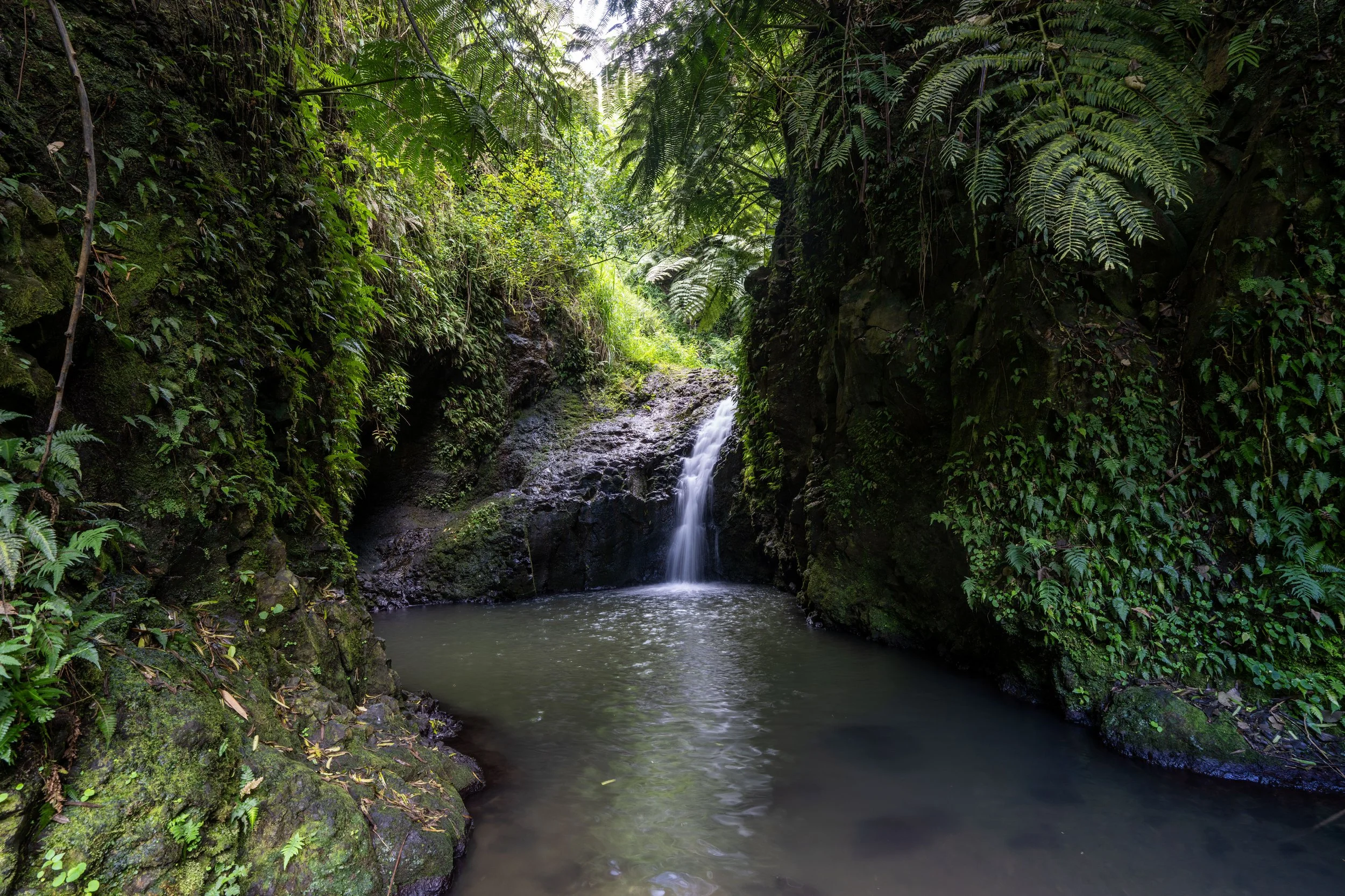
Lower Waiʻōmaʻo Falls
After a very long and slow 1.4 miles (2.3 km) from the beginning, the Kaʻau Crater Trail reaches this split for the first waterfall, located just off the main trail.
This junction is also the first of two spots in Waiʻōmaʻo Valley where the Kaʻau Crater Trail climbs a near-vertical section to continue up to the Kaʻau Crater Loop.
That said, if you have any difficulty with the short climb here, I recommend turning back, as the trail only gets more difficult and more dangerous from this point on.
All that to say, go left to continue on the Kaʻau Crater Trail, or go right to hike down to the first waterfall before continuing higher.
This is the top of the first near-vertical climb, with one more straight ahead, before the top of the first waterfall.
This is the second short climb to get to the top of Lower Waiʻōmaʻo Falls.
This short traverse above the first waterfall is definitely a no-fall zone, but it is not nearly as exposed as the short traverse above the second waterfall shortly ahead.
Warning
This is where the Kaʻau Crater Trail reaches the top of the first waterfall, which I highlight because I think it’s important to mention that, in 2016, a hiker fell the height of this waterfall by making one wrong step at the top.
Thankfully, she survived the fall and has the entire incident on video, though I must warn it may be disturbing for some to watch.
However, the same cannot be said about a similar incident at the same spot in 2017 that claimed the life of hiker Kaitlan Prugger, which is all to say: don’t go and check out the view! It’s not worth it!
This is the eighth Waiʻōmaʻo Stream crossing and the first since the junction with the Kaʻau Crater Ridge Trail back near the beginning.
After crossing the stream, the Kaʻau Crater Trail will stay on the right side for the entire hike up to the top of the second waterfall.
When the Kaʻau Crater Trail returns to the stream, stay on the right side to continue up to the second waterfall.
Middle Waiʻōmaʻo Falls
About 0.2 miles (0.3 km) up the stream from the first waterfall, the Kaʻau Crater Trail reaches Middle Waiʻōmaʻo Falls, the second waterfall, which is not located off the main trail like the first.
The Kaʻau Crater Trail past the second waterfall begins the second notable near-vertical climb, which is often considered to be the most dangerous part of the entire hike.
I say this because the very top of the climb, along the edge of the waterfall, traverses a very narrow, slippery section where a mistake simply cannot be made.
This is why I said it’s best to turn around at the first waterfall if you or anyone in your group had any difficulty getting up.
These first sections up to the second waterfall are steep, but they are not nearly as exposed as the short traverse just ahead.
Warning
This is the very short but dangerous traverse across the top of the second waterfall.
That said, this section is arguably the most dangerous spot on the entire Kaʻau Crater Trail, due largely to the fact that it’s one of the most exposed areas on the entire hike.
Seriously, make each step count!
On a different note, there’s a hidden plaque on the big boulder above the second waterfall for a woman named Heidi Marie, and while her life was tragically cut short here back in 1997, this incident was much different than Kaitlan Prugger’s at the first waterfall.
Once past the top of the second waterfall, the Kaʻau Crater Trail crosses to the left side of the stream, where it will follow a path for about 0.1 miles (0.2 km) until it reaches the base of the third waterfall and the beginning of the steep climb to Kaʻau Crater.
Stay on the left side when the Kaʻau Crater Trail returns to the stream.
Upper Waiʻōmaʻo Falls
Upper Waiʻōmaʻo Falls is the third and final waterfall on the Kaʻau Crater Trail, and it’s where hikers need to choose between either climbing directly up the third waterfall to the rim of the crater or taking the side trail just to the left.
When considering either option, I think it’s important to mention that the waterfall is the more direct route, but at the same time, it is more dangerous—especially when there has been a lot of recent rain!
Alternatively, the trail to the left parallels the third waterfall to the rim of the crater, but it is often seen as more challenging because it’s very steep, has some overgrowth, and actually climbs higher than necessary, meaning hikers must then descend back down to the stream upon reaching the rim of Kaʻau Crater.
This is the steep and, in my opinion, safer route up the steep 0.2-mile (0.3 km) trail to the left of Upper Waiʻōmaʻo Falls.
While the climb is certainly very steep, I want to highlight that all the overgrowth makes this ascent much less exposed compared to climbing up the third waterfall.
Seeing Koa for the first time is a nice sign that the Kaʻau Crater Trail is starting to get close to the upper elevations of the hike.
Paʻiniu is a fairly common, overlooked native plant in Hawaiʻi, but it’s great to come across because it means that pigs aren’t present in this area, as they like to eat Paʻiniu.
Now, I want to stress that wild boars certainly are prevalent on most of the Kaʻau Crater Trail, but the likely reason Paʻiniu is common here is because this section is so steep!
The plants alongside this section are also more Paʻiniu!
Kaʻau Crater Loop Trail
The top of the very steep 0.2-mile (0.3 km) ascent is the beginning of the Kaʻau Crater Loop Trail, the 1.9-mile (3.1 km) loop that circles Kaʻau Crater.
However, the loop from this point to the Koʻolau Summit and around the north side of the rim to the Kaʻu Crater Ridge Trail only traverses 1.7 miles (2.7 km) of the full loop.
All that to say, go right at this first junction to hike down to the top of the third waterfall, or go left if you’re most interested in hiking over to the Kaʻau Crater Ridge Trail to begin the hike back to the trailhead, about 0.2 miles (0.3 km) away.
From the top of the steep ascent, I chose to go right to begin hiking the Kaʻau Crater Loop Trail toward the stream and up to Puʻu Palikea beyond.
This section, between the beginning of the loop and the stream, loses about 75 ft. (23 m) in 0.1 miles (0.2 km), which isn’t the worst to have to regain on the hike back up the other side.
This is where the Kaʻau Crater Loop drops down to the stream that flows out of Kaʻau Crater—the same place at the top of the climb above the third waterfall.
Once here, walk downstream just a few steps to find the trail that continues up the rim on the other side.
This is where the Kaʻau Crater Loop Trail climbs out of the little gulch on the far side.
Once the Kaʻau Crater Trail regains the rim, the hike to Puʻu Palikea is much more straightforward and similar to most Oʻahu ridge hikes, like the neighboring Mauʻumae Ridge to Puʻu Lanipō, to the south, or Waʻahila Ridge to Mt. Olympus, to the north.
The peak straight ahead in the distance is not quite the summit of Puʻu Palikea, but the good thing is that the true summit is just a few steps beyond that point, which is why it doesn’t really feel like a false summit.
Since the Kaʻau Crater Trail only loops around the crater, you may be wondering what the inside is actually like, and there is a fairly good comparison you might be familiar with!
By this, I mean that the boggy volcanic soil on the inside of Kaʻau Crater is the exact same unique soil series as the soils on the Alakaʻi Plateau that the Alakaʻi Swamp Trail on Kauaʻi traverses—the trail with the beautiful viewpoint above Hanalei, if you’re lucky to get it on a clear day!
To add to this, I want to please ask that you don’t attempt to hike out into the crater, as one footstep takes many years, if ever, to fully recover.
This is when the typical late-afternoon clouds started to build over the mountains, but I was very fortunate to have the view for the entire hike around the rim!
The eroded sections straight ahead are the steepest the Kaʻau Crater Trail gets on the hike up to Puʻu Palikea.
These heavily eroded sections are truly a testament to how popular the Kaʻau Crater Trail is, which is most comparable to the upper elevations on the Waʻahila Ridge Trail, as well as the Puʻu Kōnāhuanui Trail.
If you or anyone in your group is worried about these rope sections, it’s not the worst idea to carry your own, especially if you’re planning to complete the full Kaʻau Crater Loop.
This is where the Kaʻau Crater Trail begins to climb up the false summit mentioned previously, meaning the true summit of Puʻu Palikea is not far beyond the top of this next steep section.
This is where the Kaʻau Crater Trail reaches the top of all the steepest sections leading up to Puʻu Palikea.
Puʻu Palikea
Standing at roughly 2,395 ft. (730 m), according to the USGS, Puʻu Palikea is the highest point on the entire Kaʻau Crater Trail!
That said, Puʻu Palikea is often the turnaround point for many hikers, but if you’ve made it this far, I recommend continuing around the Kaʻau Crater Loop Trail, as the next 0.3-mile (0.5 km) stretch along the Koʻolau Summit Trail (KST) is one of the easier sections of the entire cross-island hike, largely due to the fact that it’s so well trafficked.
However, if you decide to turn back, I recommend hiking down the Kaʻau Crater Ridge Trail instead of hiking down the Waiʻōmaʻo Stream, because the ridge is significantly faster and more straightforward.
Read My Separate Post: Koʻolau Summit Trail (KST)
Koʻolau Summit Trail (KST)
To continue around the Kaʻau Crater Loop Trail, go left (north) to begin the 0.3-mile (0.5 km) section across the Koʻolau Summit, which will start descending immediately upon heading north from Puʻu Palikea.
After the initial steep and somewhat slippery descent, the Kaʻau Crater Loop becomes much easier to traverse until it turns off the KST, just a few steps after the second set of power lines.
From the first set of power lines to the second, the KST is much flatter compared to the steep descent off Puʻu Palikea.
North Puʻu Palikea
Shortly after the second set of power lines, the Koʻolau Summit Trail will reach the north side of the Kaʻau Crater Loop.
That said, the Koʻolau Summit-Kaʻau Crater Loop junction is not very obvious, but the correct trail leads down to the left, while the KST continues to the right and on to Waʻahila Ridge (ʻAwaʻawaloa), the next major summit that can be seen in the distance.
Read My Separate Post: Koʻolau Summit Trail (KST)
The Kaʻau Crater Trail should noticeably leave the ridge line behind.
About 0.1 miles (0.2 km) after leaving the Koʻolau Summit, the Kaʻau Crater Trail will begin the steepest and most eroded sections on the north side of the loop.
However, these steep sections are no more difficult than the south side leading up to Puʻu Palikea.
In fact, I personally find the north side to be easier because it’s less trafficked and therefore a lot less eroded.
As a reminder, once again, it may not be the worst idea to bring a rope you’re okay leaving behind, which can be very helpful descending slippery sections like this that don’t have one.
At a few different spots on the north side of the loop, the Kaʻau Crater Trail will drop below the ridgeline and subsequently regain it shortly thereafter.
This is the second spot the Kaʻau Crater Trail drops below the ridgeline.
The one thing that’s nice about the Kaʻau Crater Loop Trail is that the views toward the inside of the crater change fairly quickly, making the hike feel like it’s moving, even though it is quite a slow trail overall.
This is where the Kaʻau Crater Trail starts to wrap around the south side of the loop.
Once again, don’t forget to wear good hiking pants, even if you don’t plan to hike the full loop trail.
On the south side of the Kaʻau Crater Loop, the trail will pass the same power lines as it did on the Koʻolau Summit.
With that in mind, the second set of power lines is again the same mental indicator to start looking for the return trail—the Kaʻau Crater Ridge Trail—to take back down.
The second set of power lines is located just 0.1 miles (0.2 km) after the first.
This is the second set of power lines, which, unlike the Koʻolau Summit Trail, is located a little farther away from the ridge down.
By this, I mean that on the KST, the north side of the Kaʻau Crater Loop begins just a few steps after the second set of power lines, but here, the Kaʻau Crater Ridge Trail is located a little less than 0.2 miles (0.3 km) away.
I write all this to say, don’t expect to find the ridge down immediately, but start looking for it after the second set of power lines.
Within just a few steps of the Kaʻau Crater Ridge Trail, the Kaʻau Crater Loop passes this final view of the crater, which hopefully serves as a good mental checkpoint, so as not to miss the turn for the ridge back down.
Kaʻau Crater Loop-Kaʻau Crater Ridge Junction
After 1.7 miles (2.7 km) around the Kaʻau Crater Loop, the trail reaches the beginning of the Kaʻau Crater Ridge Trail.
From here, the initial junction from the top of the ascent above the third waterfall is only 0.2 miles (0.3 km) ahead, but I do not recommend completing the full loop since the return ridge is so much easier than everything thus far.
All that to say, go right to begin the Kaʻau Crater Ridge Trail back to Waiʻōmaʻo Valley.
Kaʻau Crater Ridge Trail
After leaving the Kaʻau Crater Loop Trail behind, there are only 1.6 miles (2.6 km) left until the Kaʻau Crater Trailhead, which breaks down into 1.1 miles (1.8 km) to the Waiʻōmaʻo Valley floor and 0.5 miles (0.8 km) back along the same Kaʻau Crater Trail from the beginning of the hike.
That said, these next 1.1 miles (1.8 km) down the Kaʻau Crater Ridge Trail are some of the fastest-moving sections of the entire hike, which is the main reason I almost exclusively choose to take the ridge back down, as opposed to completing the full Kaʻau Crater Loop Trail and returning the same way already shown.
Compared to all the steep sections on the Kaʻau Crater Trail up to this point, the ridge trail back to Waiʻōmaʻo Valley is fairly gradual.
All these Koa trees are, again, a nice way to know you’re around the mid-elevations in terms of Oʻahu ridge hiking.
When the Strawberry Guava trees start to become more and more frequent, the turn off the ridge into Waiʻōmaʻo Valley is not far ahead!
This is where the Kaʻau Crater Trail starts to turn off the ridge to begin the steepest parts of the descent back into Waiʻōmaʻo Valley.
The rest of the hike back down into Waiʻōmaʻo Valley is fairly steep and muddy from this point on, but since there are so many Strawberry Guava trees to grab, the descent isn’t all that challenging.
When the trail leaves the dense Strawberry Guava forest behind, the bottom of Waiʻōmaʻo Valley is not far ahead!
Waiʻōmaʻo Valley-Kaʻau Crater Ridge Junction
After a long and slow 4.8 miles (7.7 km), the Kaʻau Crater Trail finally returns to the Waiʻōmaʻo Stream, where the trail back to the beginning can be found on the far side.
Once here, cross the stream, then go right to begin the return hike back up the initial 0.5 miles (0.8 km) to the trailhead—the same sections shown at the very beginning of this article.
Native Plants on the Kaʻau Crater Trail
The Kaʻau Crater Trail is filled with native Hawaiian plants at all elevations of the hike, with the landscape becoming much more native as the trail starts to climb the steep sections up to the rim of the crater.
Some of these include ʻŌhiʻa lehua, Koa, Māmaki, ʻAhakea, Kōpiko, Alani, ʻĀkia, ʻIeʻie, Hala Pepe, Loulu, and ʻŌhelo, to name just a few.
If you would like to learn more about these and many other native Hawaiian plants from across the islands, I encourage you to check out my separate post linked below.
Read My Separate Post: Native Hawaiian Plant Guide