Hiking the Kūlepeamoa Ridge Trail on Oʻahu, Hawaiʻi
Distance (Roundtrip): 5.3 miles / 8.5 km
The Kūlepeamoa Ridge Trail in Niu Valley on Oʻahu is one of the longer, more challenging day hikes in the southern Koʻolau Mountains to reach the Koʻolau Summit Trail (KST).
I say this because the 'long' and typically untrafficked trail sees few hikers compared to the neighboring Hawaiʻi Loa Ridge Trail and Wiliwilinui—not to mention, Kūlepeamoa Ridge is more challenging than these other trails because of the location of the trailhead at the bottom of Pia Valley. This means that Kūlepeamoa Ridge has much more elevation to gain—unlike nearby hikes, where the trailheads are already located partway up the ridge.
However, all these things are what make Kūlepeamoa Ridge one of my favorite day hikes on Oʻahu, as the trail feels like a hidden gem, given that it is so untrafficked in an otherwise busy area for hiking! For reference, Kūlepeamoa can most closely be compared with the Wailupe Loop Trail in ʻĀina Haina, just to the north, or the Kapālama Ridge Trail to Puʻu Lanihuli—the ridge that divides the Pali and Likelike highways from one another.
All this to say, the Kūlepeamoa Ridge Trail is an amazing and beautiful day hike, but come prepared for a much longer, more involved adventure than almost all of the surrounding trails would require.
Kūlepeamoa Ridge Trailhead Parking
Parking for the Kūlepeamoa Ridge Trail is located in the very back of Pia Valley on Anolani Street.
That said, please be quiet and respectful in this residential neighborhood, as too many trails in Hawaiʻi draw too much negative attention because people just don’t understand this.
Google Maps Directions: Kūlepeamoa Ridge Trailhead
Hiking the Kūlepeamoa Ridge Trail
The Kūlepeamoa Ridge Trail begins on a 0.1-mile (0.2 km) service road on the Pia Valley side (north side) of Niu Valley.
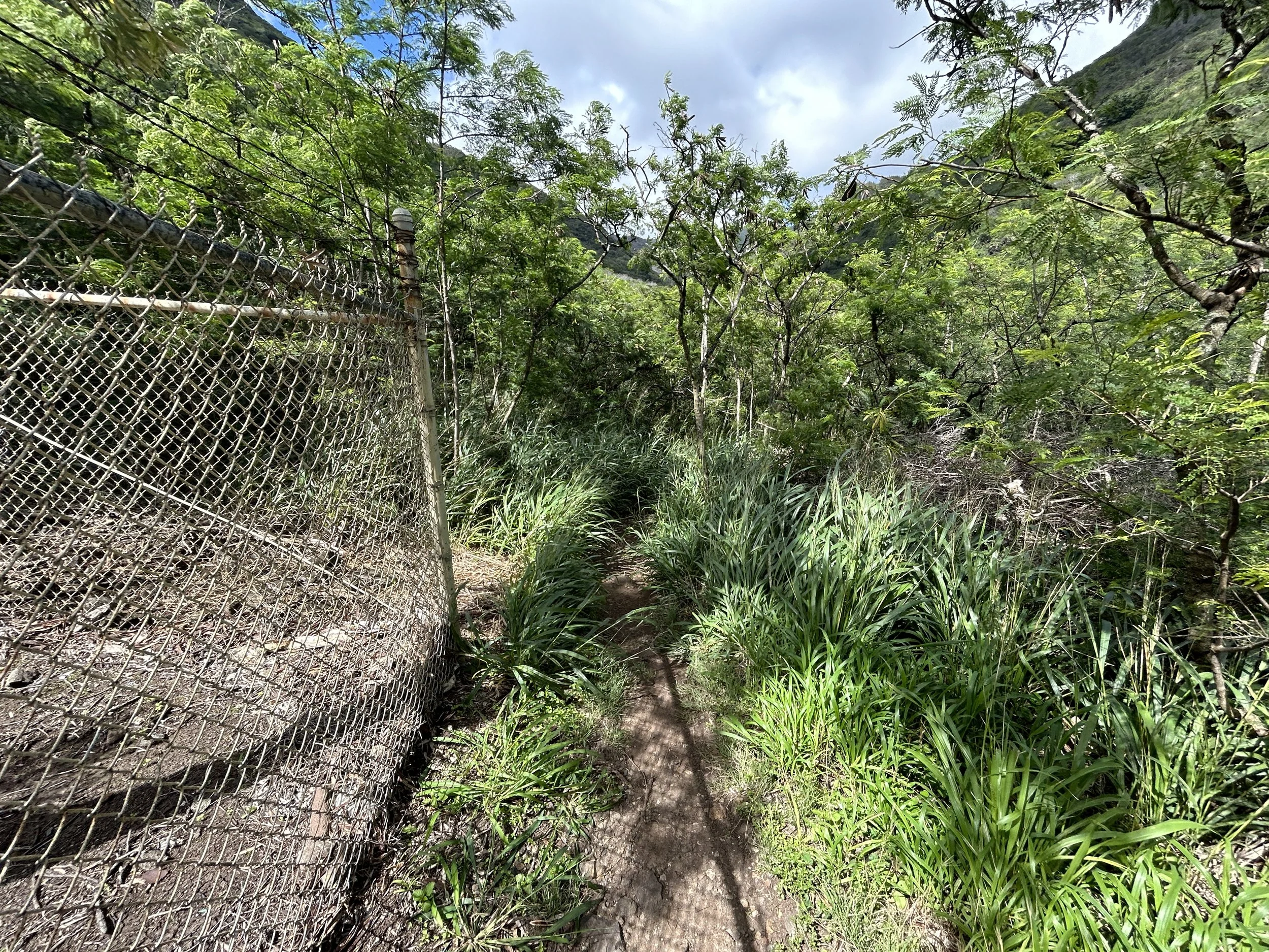
At the water tank, the trail continues around the fence to the right.
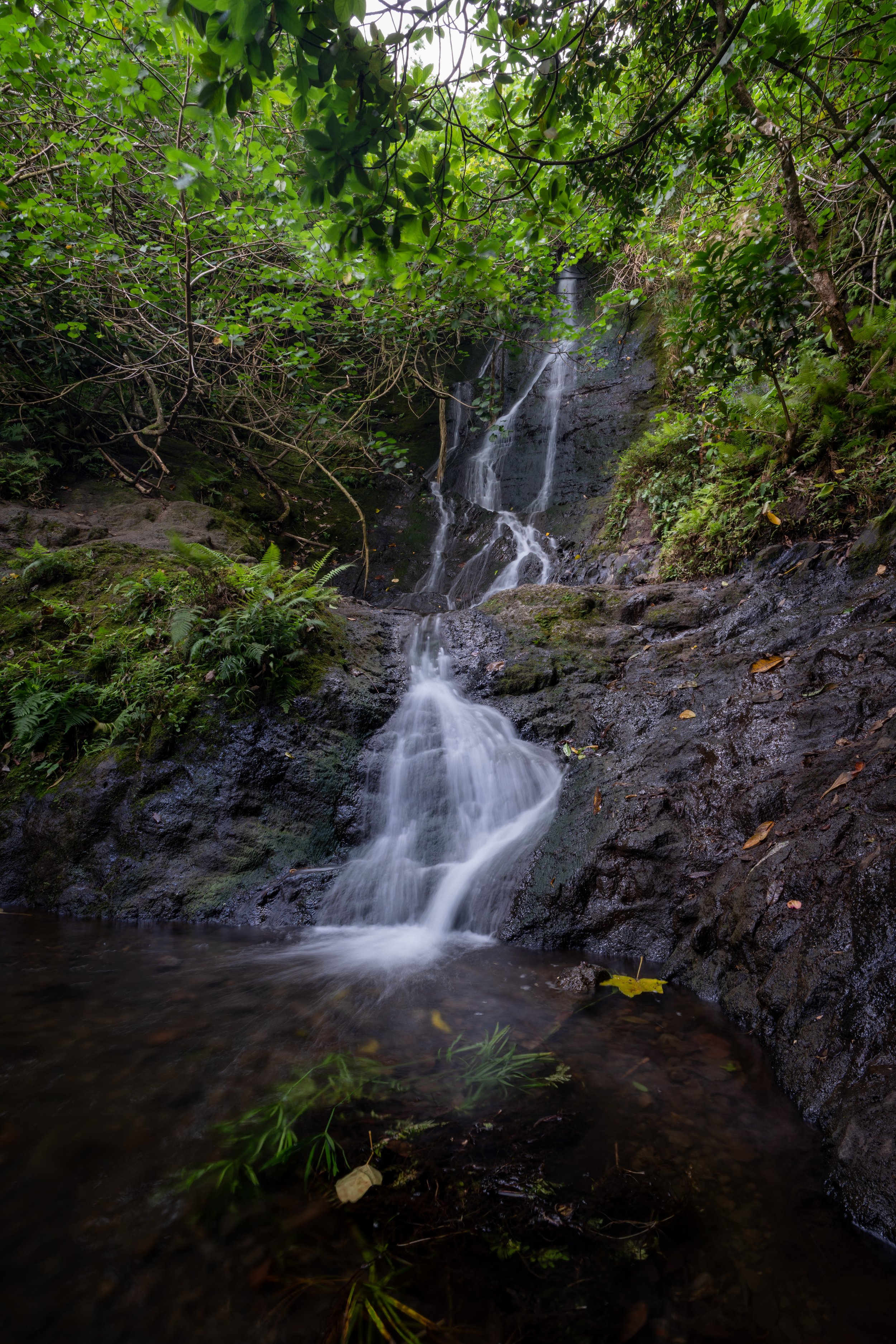
Pia Valley
The first part of the trail into Pia Valley begins through a native reforestation area.
Please stay on the trail.
Kūlepeamoa Ridge Trail
At the split, go left to stay on the most direct route.
The Kūpaua Stream crossing will be the only stream crossing on the entire hike. Also, it will likely be dry, but this was taken during a very wet winter.
Kūlepeamoa Ridge-Pia Valley Junction
At the 0.6-mile (1.0 km) mark, go right at the split to hike up to Kūlepeamoa Ridge.
At this erosion scar, stay to the right and look for the trail heading up the ridge on the right.
It may look more obvious to go to the left, but you’ll find the trail heading up on the right as it initially turns back toward the direction you just came.
This stretch is the hardest/ steepest part on the entire trail, as I often compare it to Koko Head just to hike out of Pia Valley.
The Ironwood trees at the top is where the trail meets Kūlepeamoa Ridge, which signifies the end of the steep ascent.
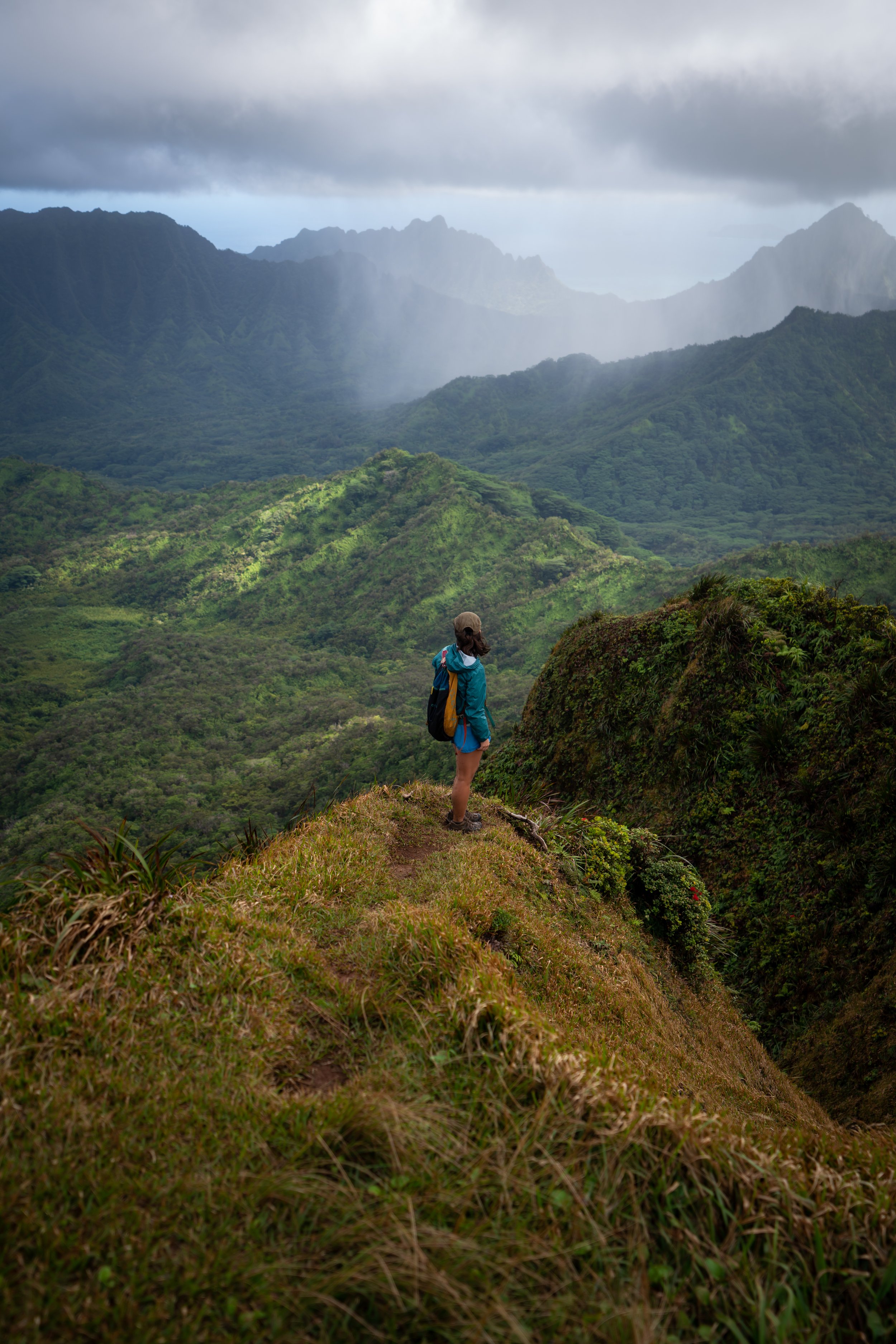
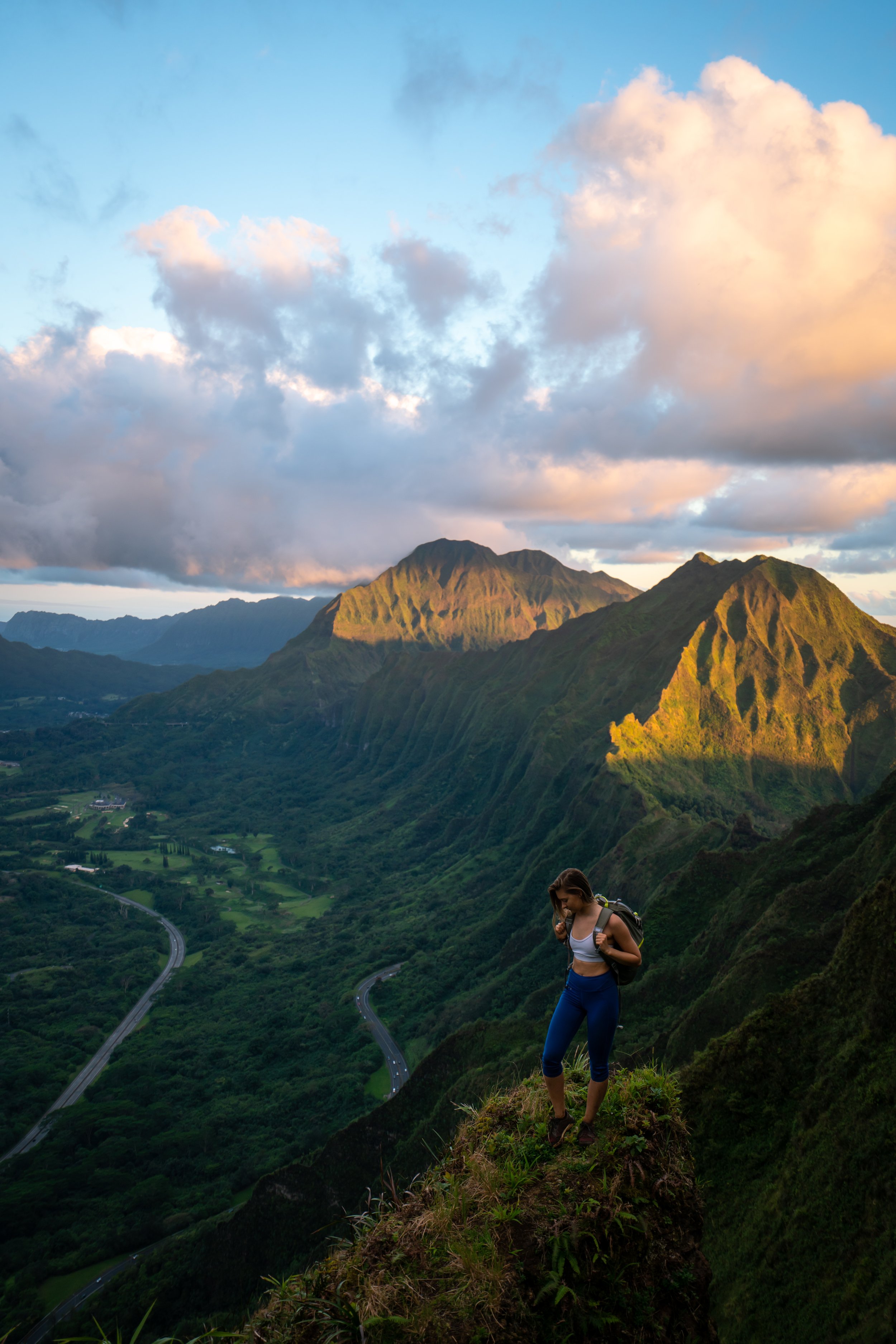
Kūlepeamoa Ridge
Once on Kūlepeamoa Ridge, take a mental note of the area for when you hike back. It can be easy to overlook the turn heading down to the right if it’s getting dark out.
Overall, Kūlepeamoa is fairly straight forward once you’re out of Pia Valley. There’s no more essential turns to reach the summit.
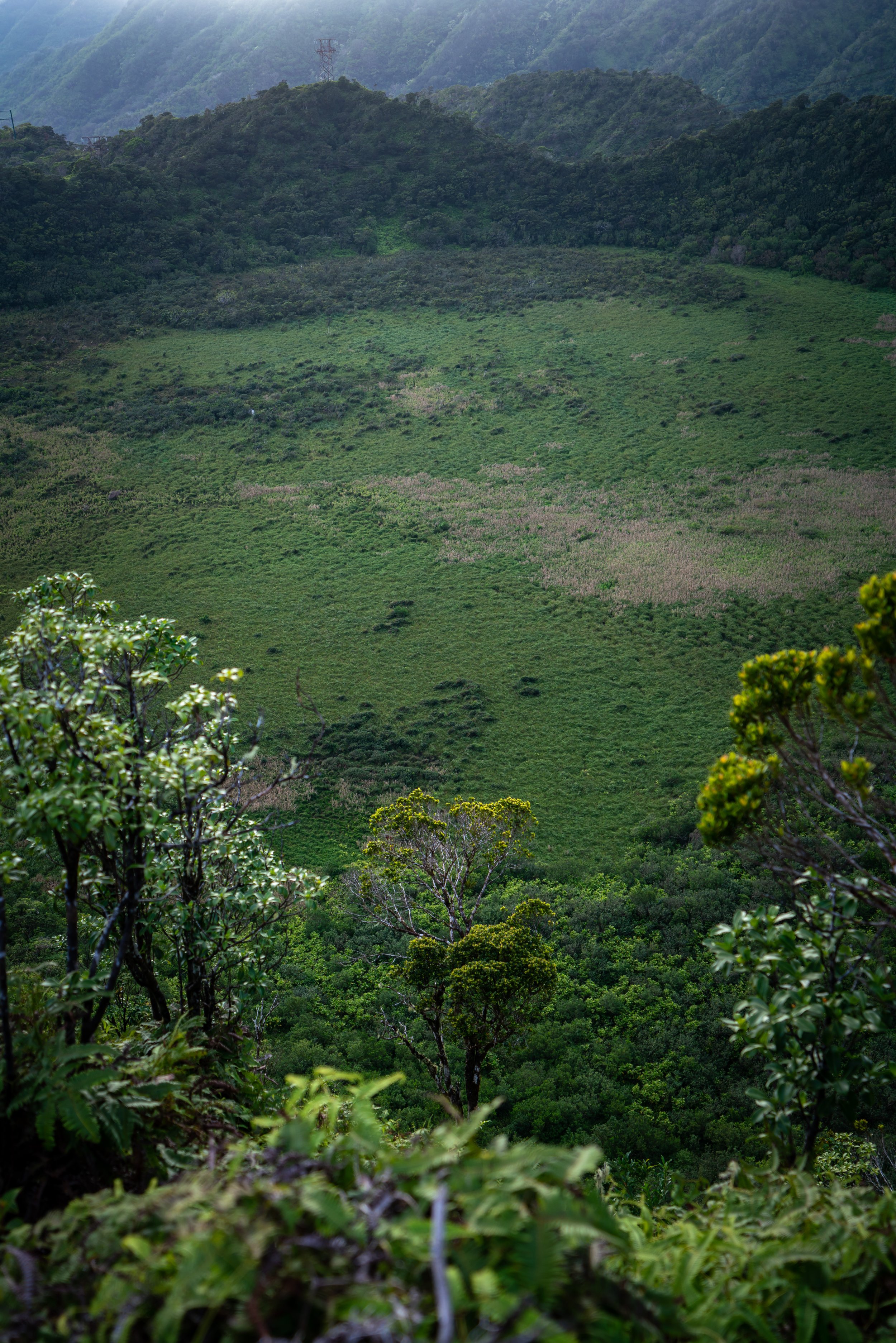
At a certain point, the Uluhe almost always becomes more overgrown as you get closer to the summit. This photo is the exception, as I could tell someone just cleared this section.
However, you will still want to wear pants for the later sections, which is why Kūlepeamoa is the perfect example of a hike where convertible hiking pants are the best! This way you can wear shorts in the steep beginning sections and pants toward the summit.
The pants below are my recommendations that hold up the best with the overgrowth here in Hawaiʻi, but with any hiking pants that need to be durable, make sure that they are at or near 100% nylon. This is really the most important factor!
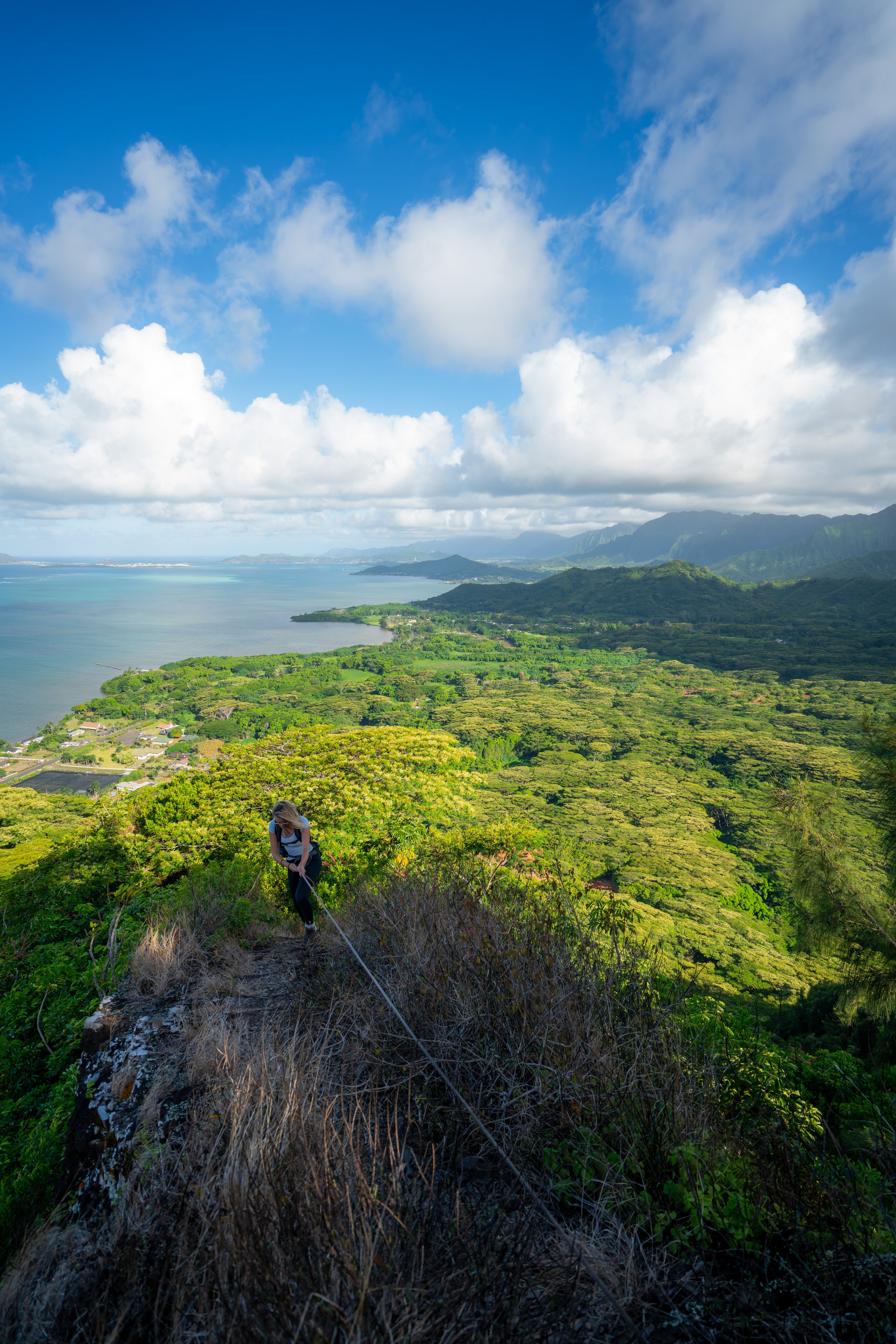
This is one of my favorite spots on the island!
After the beautiful outcropping in the photos above, Kūlepeamoa becomes a bit more narrow, steep, and overgrown as you get near the summit.
This is the only section with ropes on the entire ridge.
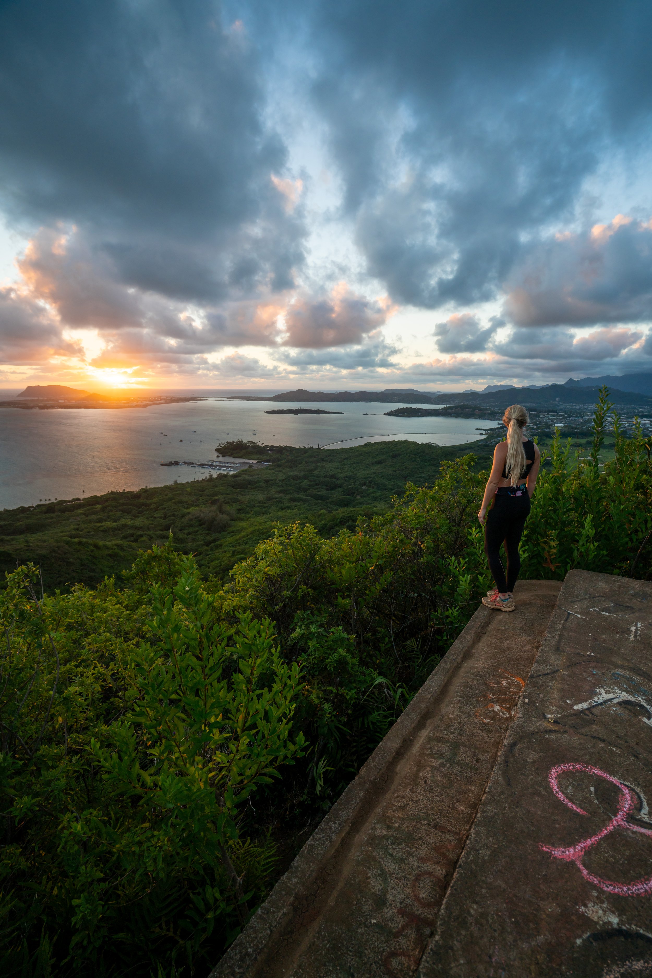
Kūlepeamoa Summit
On a clear day, you can see as far as Kualoa Ranch and Mokoliʻi to the north!
If you’re going to hike anywhere on the KST, Hawaiʻi Loa Ridge is the next trail to the north, and Puʻu ʻO Kona is the next trail to the south.
I personally avoided Kūlepeamoa when hiking the KST because it’s a bit more challenging than some of the neighboring ridges to hike across this stretch.
Read My Separate Post: Koʻolau Summit Trail (KST)
Hiking Down
When hiking back down, make sure to look out for the right turn down into Pia Valley.
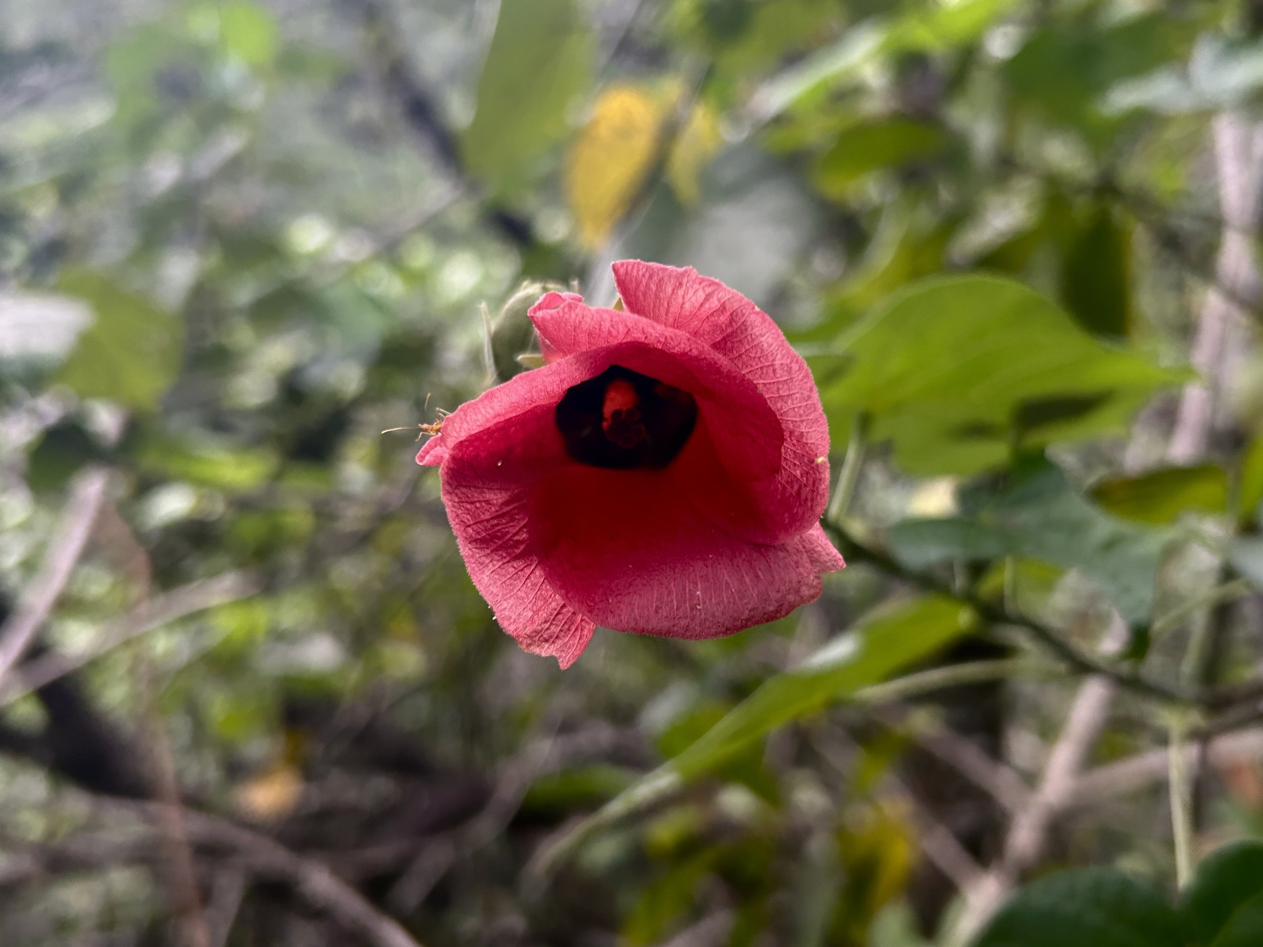
Native Plants on Kūlepeamoa Ridge
From the trailhead to the summit, Kūlepeamoa Ridge is one of the better Oʻahu hikes to see native plants throughout the trail.
You can expect to see ʻIlima, Māmaki, Wiliwili, ʻAkoko, ʻĀlaʻa, Alaheʻe, Alani, ʻAmaʻu, Kōpiko, Lama, Hōʻawa, and multiple ʻIliahi species to really only name a few. There’s really so many that I could have named which is just a testament to how much better a trail does when it’s less crowded.
On a different note, if you are curious about trying the native Hawaiian Māmaki tea, I kindly ask that you don’t harvest Māmaki from our native forests but, instead, buy from one of the local reputable vendors, such as those listed below.
If you would like to learn more about identifying these and other native plants from around Hawaiʻi, check out my separate post on native Hawaiian plants below.
Read My Separate Post: Native Hawaiian Plant Guide