15 Best Sunset Hikes on Oʻahu, Hawaiʻi
Apart from a few specific trails on the outer Hawaiian islands, like Kālepa Ridge and Awaʻawapuhi in Kōkeʻe State Park on Kauaʻi, Oʻahu is the best island in Hawaiʻi when it comes to catching sunset from the mountains, which I largely believe for a few main reasons.
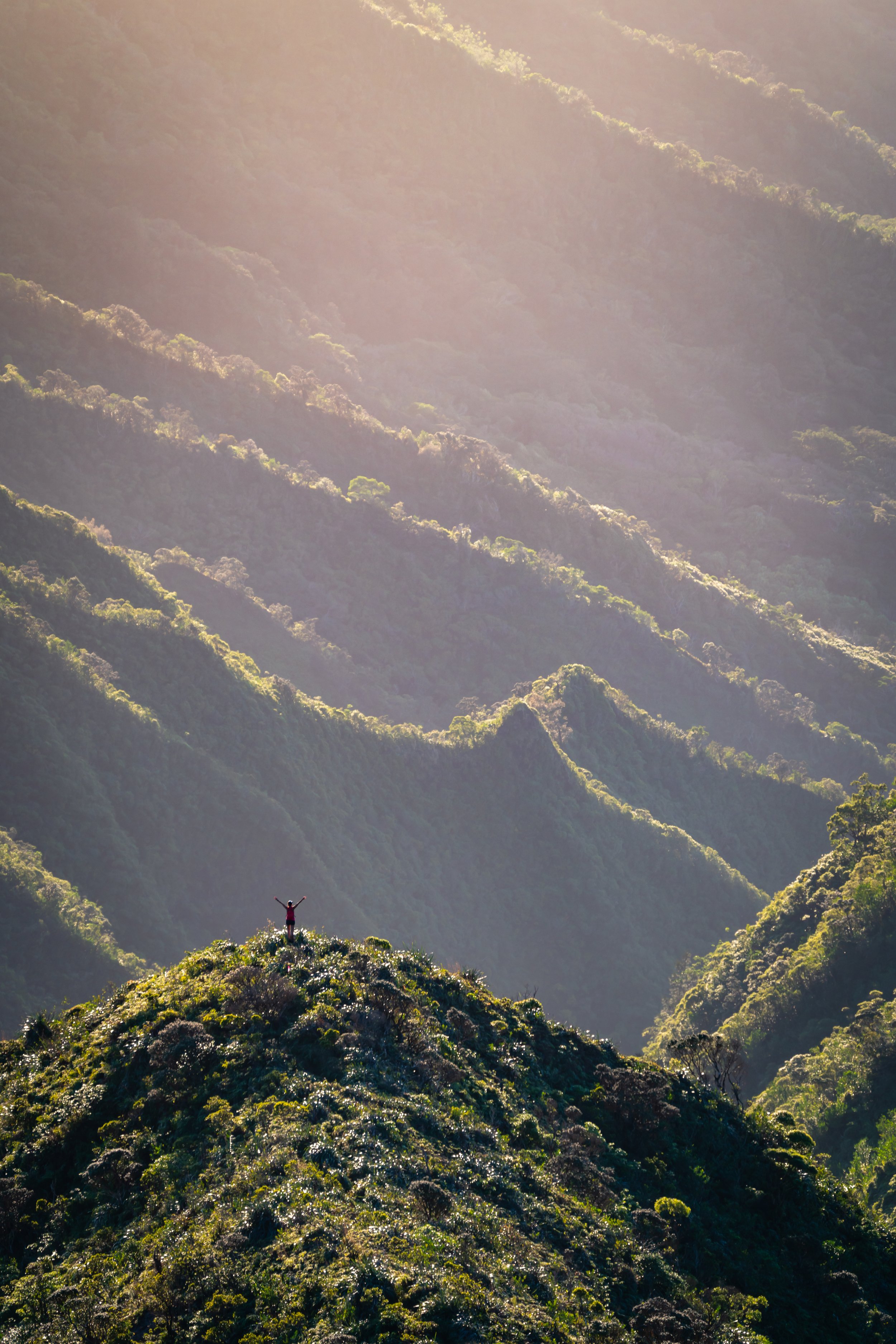
The first is that the ridges across the Koʻolau Mountains—particularly the southeastern ridges—are unique in that they all face south/ southwest toward the sunset. This is why almost any ridge hike across the Koʻolaus can make for an amazing sunset hike, with the ridges further south being the most practical in terms of hiking back in the dark.
The second reason is that Oʻahu has two mountain ranges. Apart from the ridges across the Koʻolaus, the ridges across the Waiʻanae Mountains to the west offer much more expansive views of the sunset throughout the year, with many local favorites being shorter and quicker than most ridge hikes in the Koʻolaus.
I say all this from the perspective of someone who hiked to both the easiest and most remote places on the island to catch the sunset, that Oʻahu has some of the best sunset hikes and the largest variety of them of any island in Hawaiʻi!
15 Best Sunset Hikes on Oʻahu
The following list is written in no particular order of best or worst.
On a different note, it’s important to keep in mind that the best sunset hike for one person may not be the best sunset hike for another. What I’m really saying is that it all depends on how much time and effort you want to spend on hiking back in the dark.
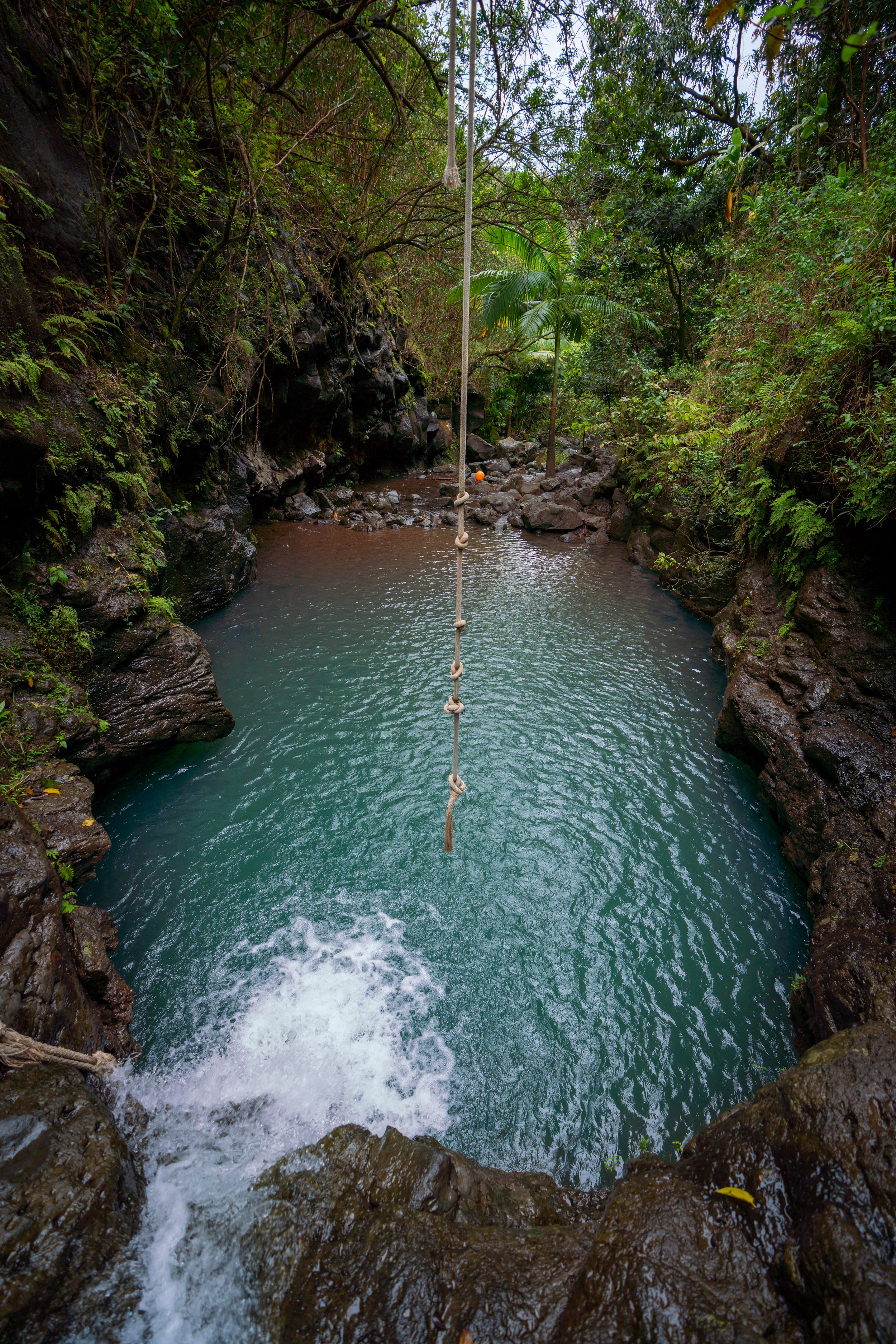
That said, some of my favorite sunset moments on Oʻahu have meant hiking countless miles after the sun has gone down, but I can confidently say that these nights, as in the image below, have created some of my most favorite memories that I have on this island!
1. Puʻu O Hulu Trail (Pink Pillbox)
Distance: 1.5 miles / 2.4 km
The Puʻu O Hulu Trail, also called the Pink Pillbox Trail, is a short but steep west Oʻahu day hike that climbs to a handful of WWII-era pillboxes atop a panoramic summit above the Waiʻanae Coast, with Mt. Kaʻala, the highest peak on Oʻahu, off in the distance on a clear day!
That said, sunset is truly the only time of day I like to hike up Puʻu O Hulu, as the trail is not located in a great position for sunrise, midday can be very hot since there is little shade on the way up, but sunset is much cooler and more beautiful when the best of the colors across the dramatic Waiʻanae Range light up at golden hour!
This is all to say that if you decide to hike the Pink Pillbox for sunset, the short but steep hike back down as it’s getting dark is very manageable, given that you’ll likely make it back to the trailhead before it’s completely dark.
Read My Separate Post: Puʻu O Hulu Trail (Pink Pillbox)
2. Puʻu Pia Trail
Distance: 2.0 miles / 3.2 km
The Puʻu Pia Trail is a short day hike in a quiet little corner of Mānoa Valley, away from the business near Mānoa Falls, and it’s one that I think is a bit different from a traditional Hawaiʻi sunset hike, in that I don’t recommend Puʻu Pia for the views you get of the sunset. Instead, the Puʻu Pia Trail is a great sunset hike for the views of the mountains, when the late-day sun lights up the ridges in the back of Mānoa Valley on a clear night!
That said, sunset from the summit of Puʻu Pia is typically better in the winter months than in the summer, but it’s worth noting that winter is typically wetter and muddier overall.
Therefore, I like to say, don’t let the time of year dictate your decision on whether to go or not, as Puʻu Pia is just as beautiful when the clouds are hanging over the valley as it is on a clear night!
Read My Separate Post: Puʻu Pia Trail
3. ʻEhukai Pillbox Trail
Distance: 1.4 miles / 2.3 km
The ʻEhukai Pillbox Trail is a short, steep day hike on the North Shore of Oʻahu that leads to not one, but two WWII-era bunkers at the end of the hike, similar to the Puʻu O Hulu Trail on the West Side of Oʻahu!
That said, the views from either pillbox at the top of the ʻEhukai Pillbox Trail are beautiful and renowned by both locals and visitors alike because, when the big waves roll into the beaches across Pūpūkea in the winter, the hike is one of the best places to sit back and take it all in—especially in the late evening, when golden hour lights up the best of the beaches across the North Shore!
Read My Separate Post: ʻEhukai Pillbox Trail
4. Kaʻena Point Trail & Pillbox
Distance (West Side): 2.1 miles / 3.4 km
Distance (North Shore): 2.4 miles / 3.9 km
Kaʻena Point State Park, on the northwest side of Oʻahu, is home to one of the island’s longest undeveloped coastlines, where visitors can hike one of two different trails, beginning from either the North Shore in Mokulēʻia or the West Side past Mākua and Keawaʻula Bay.
That said, both the North and West Kaʻena Point Trails are very similar coastal trails, but in many ways they could not be more different from one another. Therefore, I highly recommend reading my side-by-side comparison at the beginning of either article linked below, where I explain in detail the main differences between the two.
In any case, the Kaʻena Point Trail from either direction can be extended by hiking up the Kaʻena Point Pillbox Trail to the WWII-era bunker above Kaʻena Point, which easily makes for one of the best year-round sunset hikes on Oʻahu!
Read My Separate Post: Kaʻena Point (North Shore) / Kaʻena Point (West Side)
5. Pali Notches Trail
Distance: 0.8 miles / 1.3 km
The Pali Notches Trail is just one small 0.4-mile (0.6 km) section of Oʻahu’s cross-island Koʻolau Summit Trail (KST), but its distance should not be used to judge its difficulty.
By this, I mean that the Pali Notches Trail is certainly one that I see as one of the best all-around sunset and sunrise hikes on Oʻahu, but that doesn’t go without saying that the Pali Notches is not for people of all abilities.
I say this because the short trail is very steep and exposed, and many hikers have taken fatal or near-fatal falls in the past. This is just one of countless different reasons I always say that Hawaiʻi has the hardest hiking in the country.
That said, the Pali Notches Trail certainly deserves a place on this list because it really is that beautiful. However, I write all this because it’s not fair to talk about its beauty without first discussing the challenges and dangers associated with the hike—not to mention, the Pali Notches is NOT an established or maintained trail, and there are potential legal consequences that you accept if you decide to hike this closed trail.
Read My Separate Post: Pali Notches Trail
6. Koko Head Stairs
Distance: 0.9 miles / 1.4 km
Elevation Gain: ~930 ft. / 283 m
The Koko Head Stairs is a beautiful but steep east Oʻahu hike in Hawaiʻi Kai that climbs the steps of a historic WWII-era tramway built in the early 1940s by the U.S. Army, ultimately ending at the summit of an ancient volcanic crater called Puʻu Mai!
Following its historic past, the Koko Crater Stairs have since become a favorite among both locals and visitors from around the world, with many Oʻahu residents hiking the railway as a quick morning or evening workout, often beginning just before sunrise or sunset.
That said, the Koko Head hike may not be for everyone, as the steep tramway climbs a little under 1,000 ft. (305 m) in only 0.45 miles (0.7 km). However, if you think you’re up for the challenge, the views from the summit cannot be beat—especially when hiked during golden hour!
Read My Separate Post: Koko Crater Stairs
7. Mauna Lahilahi Trail (Turtle Rock)
Distance: 0.6 miles / 1.0 km
The Mauna Lahilahi Trail, sometimes referred to as Turtle Rock, is a very short, easy hike on the West Side of Oʻahu that climbs to the summit of one big rock, or 'mountain,' that sticks out into the water above Papaoneone Beach in Mākaha!
For this reason, the Mauna Lahilahi Trail is the perfect adventure for someone looking for something quick, beautiful, but not too involved. However, it must be said that the hike to the summit is more of a scramble than a trail, unlike Puʻu O Hulu that follows a true trail, just up the road.
Read My Separate Post: Mauna Lahilahi Trail
8. Hanauma Bay Rock Bridge Trail
Distance: 3.2 miles / 5.1 km
The Hanauma Bay Rock Bridge Trail, also called the Hanauma Bay Rim Trail, is a beautiful, fairly straightforward hike around the perimeter of Hanauma Bay that leads to a small, hidden rock bridge at the very end!
However, this recommendation for the Hanauma Bay Rock Bridge Trail does not come from the bridge itself. Rather, I recommend the Hanauma Bay Trail because of the initial ridge/ road that climbs the first part of the trail.
It is on this beginning section that hikers can find one of many different viewpoints looking across Hawaiʻi Kai and East Honolulu—not to mention, the views are very similar to the Koko Crater Stairs, though the Hanauma Bay Rim Trail is certainly easier!
Read My Separate Post: Hanauma Bay Rock Bridge Trail
9. Mauʻumae Ridge Trail (Puʻu Lanipō)
Distance to Puʻu Kainawaʻanui (Roundtrip): 6.6 miles / 10.6 km
Distance to Puʻu Lanipō (Roundtrip): 7.1 miles / 11.4 km
The Mauʻumae Ridge Trail to Puʻu Lanipō is one of the longer, more advanced trails in the southern Koʻolau Mountains on Oʻahu, but what I think sets it apart is the beautiful views of Kaʻau Crater that hikers can see on a clear day!
On that note, my favorite thing about the Mauʻumae Ridge Trail is that the beautiful views open up within just minutes of beginning the hike and continue for nearly the entire distance to the summit!
This is why it certainly makes no difference how far or how high up you decide to hike, as the mid-elevations well before the summit are all great places to get out and enjoy the views and the sunset, meaning it’s more a matter of personal preference regarding how much of the long trail you should prepare for.
Read My Separate Post: Mauʻumae Ridge Trail (Puʻu Lanipō)
10. Wiliwilinui Ridge Trail
Distance: 4.7 miles / 7.6 km
The Wiliwilinui Ridge Trail is a stunning adventure on the southeast side of Oʻahu, and it’s a hike that I believe is the best introductory Hawaiʻi ridge trail!
That said, Wiliwilinui Ridge is generally not considered a sunset hike, and if you are driving up late in the afternoon, the security for the private neighborhood below the trailhead may turn you away if you arrive too close to sunset.
However, as long as you arrive with more than two and a half hours of daylight, you can hike up the ridge and take your time on the way back down, enjoying the best of golden hour high in the Koʻolaus before making the fairly straightforward hike back to the trailhead!
Read My Separate Post: Wiliwilinui Ridge Trail

My Print - Wiliwilinui Ridge Trail
11. Wailupe Loop Trail
Distance: 5.0 miles / 8.0 km
The Wailupe Loop Trail is a little-known day hike in the southern Koʻolaus that I think is one of the more challenging adventures among all the neighboring trails across this part of the range, largely because the loop is very steep and some route-finding is required in order to stay on the best and easiest trail in the valley.
However, the effort is certainly worth the reward, as the upper elevations of the Wailupe Loop Trail—particularly at sunset—are stunning, to say the least!
Now, sunset is and always has been my preferred time of day to hike the Wailupe Loop Trail, but it’s worth mentioning that it is quite a long hike back in the dark—and again, getting back requires good navigational skills when it’s most difficult to figure out directions in the valley, which is why this certainly is not the sunset hike for all people of all abilities.
Read My Separate Post: Wailupe Loop Trail
12. Waʻahila Ridge Trail (Mt. Olympus)
Distance: 5.6 miles / 9.0 km
The Waʻahila Ridge Trail is an out-and-back day hike along Mānoa Valley and up the hill from Waikīkī that climbs to a beautiful summit known as ʻAwaʻawaloa, commonly called Mt. Olympus.
Given its location, the Waʻahila Ridge Trail is one of the more popular day hikes on the town side of the Koʻolau Mountains and a favorite among locals as both an evening trail run and a sunset hike!
That said, it’s important to mention that the best sunset views on Waʻahila Ridge are roughly 1.8 miles (2.9 km) into the hike. This certainly isn’t the longest return hike on this list, but I recommend reading all the details in my separate post, as there is a little bit to know when it comes to parking before making Waʻahila Ridge a sunset adventure.
Read My Separate Post: Waʻahila Ridge Trail
13. Kūlepeamoa Ridge Trail
Distance: 5.3 miles / 8.5 km
The Kūlepeamoa Ridge Trail is a steep but very beautiful ridge in Oʻahu’s southern Koʻolau Mountains that few hikers venture up compared to the surrounding trails, like Puʻu ʻO Kona, Kuliʻouʻou Ridge, and even Kamiloʻiki Ridge, which I believe is for one of two main reasons.
The first is that far fewer people know about Kūlepeamoa Ridge compared to the other, more popular day hikes that surround it.
The second is that Kūlepeamoa Ridge has quite a bit of elevation change over a very short distance, meaning it is one of the more challenging options in the area, similar to the Wailupe Loop Trail up the road.
However, unlike Wailupe, the Kūlepeamoa Ridge Trail is a much more straightforward day hike, so long as you don’t miss either the turn that climbs up and out of the valley or the turn off the ridge on the way back down.
All this aside, Kūlepeamoa Ridge is, in my opinion, one of the most beautiful sunset hikes on this list, though you certainly have to put in the effort to get the reward!
Read My Separate Post: Kūlepeamoa Ridge Trail
14. Hawaiʻi Loa Ridge Trail
Distance: 4.2 miles / 6.8 km
The Hawaiʻi Loa Ridge Trail is a state-managed trail in the southern Koʻolau Mountains that can most similarly be compared with the Wiliwilinui Ridge Trail mentioned above.
However, the biggest difference between Hawaiʻi Loa Ridge and Wiliwilinui is that it is, by and large, less trafficked, as access to the hike is restricted to those with a State of Hawaiʻi or military ID.
This means that Hawaiʻi Loa Ridge can be a great option for those visiting family or friends on the island, who have the ability to access the trailhead located atop a private residential neighborhood.
All this to say, the Hawaiʻi Loa Ridge Trail is slightly more difficult than Wiliwilinui, but they are both very similarly constructed, neighboring state trails near Waikīkī, which is why I think I’d be splitting hairs to say which of the two is better.
Read My Separate Post: Hawaiʻi Loa Ridge Trail
15. Mokulēʻia Trail
Distance (RT via Mokulēʻia Access Road Gate): 14.3 miles / 23.0 km
Distance (RT Way via Peacock Flats): 7.1 miles / 11.4 km
Distance (RT via Mokulēʻia TH): 5.6 miles / 9.0 km
The Mokulēʻia Trail is one of the longer suggestions on this list, but the reason I’ve included it here is because it’s one of the easiest in terms of hiking and navigating back after dark!
That said, the Mokulēʻia Trail is a beautiful, forested, and relatively flat day hike in the Waiʻanae Mountains that leads to one of a few different panoramic viewpoints, both at the Mokulēʻia Shelter and at the end of the trail. The viewpoint at the Mokulēʻia Shelter is the viewpoint I recommend for sunset!
As for hiking the Mokulēʻia Trail, the trailhead is most practically accessed from the North Shore of Oʻahu, as advanced planning to reserve a day-use permit is not required, which also eliminates the need to have a high-clearance 4x4 vehicle.
Combining both the Access Road and the Mokulēʻia Trail is what makes the total roundtrip distance 14.3 miles (23.0 km), though at least 4.0 miles (6.4 km) can be avoided if you choose not to hike all the way to the Mokulēʻia Overlook after the Eucalyptus forest at the end.
When starting from the North Shore, it’s important to understand that the initial 3.6 miles (5.8 km), from the gate off Farrington Highway to Peacock Flats, gains roughly 1,550 ft. (472 m), which is steeper than it may seem because the first 0.9 miles (1.4 km) is flat, meaning the climb is really condensed into 2.7 miles (4.3 km).
Since there is so much to know about the Mokulēʻia Trail, I highly recommend reading all the details in both of my separate posts.
Above all else, I think it’s important to mention that the Mokulēʻia Access Road and Trail is not a difficult adventure. It just happens to be a longer day if you decide to begin from the North Shore, which really isn’t overly strenuous if you plan accordingly and understand what you’re getting into before setting off.
Read My Separate Posts: Mokulēʻia Forest Reserve Access Road / Mokulēʻia Trail
Best Sunrise Hikes on Oʻahu
If you enjoyed reading my sunset recommendations, I have also written a similar list about the best sunrise hikes across Oʻahu, which you can read in my separate article linked below.
Read My Separate Post: Best Sunrise Hikes on Oʻahu
Native Hawaiian Plants on Hawaiʻi Trails
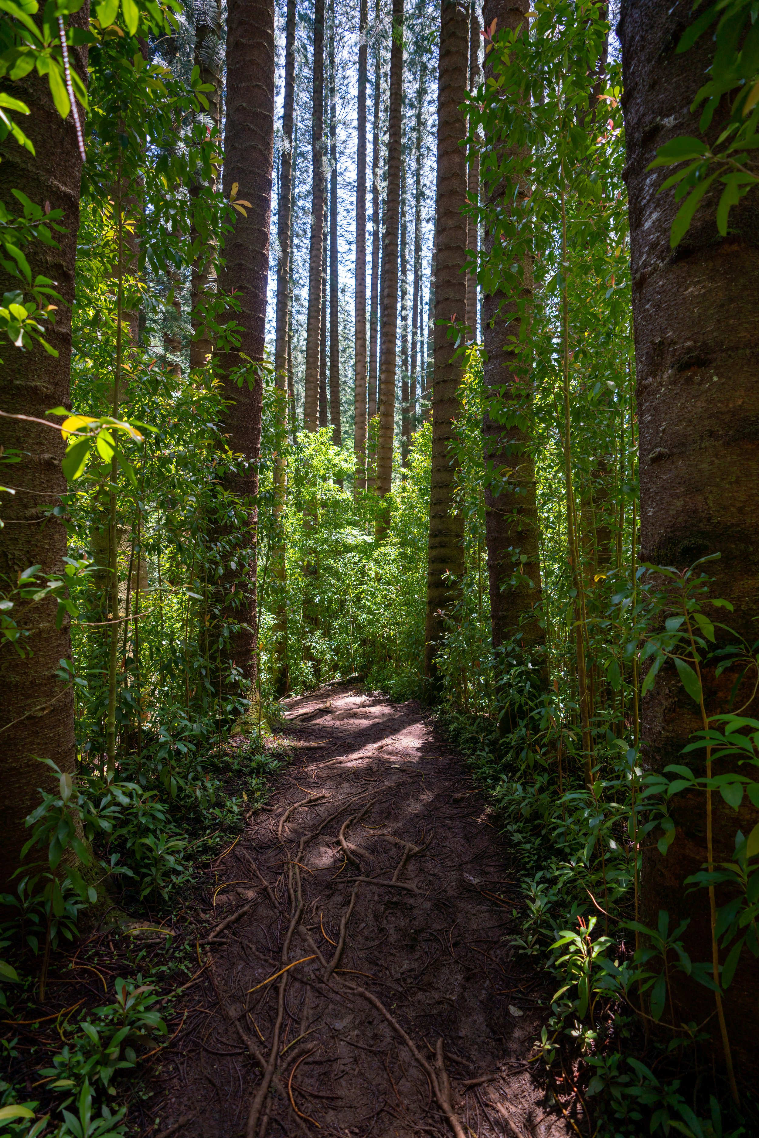
I wanted to include this last section on this post because this is a subject that’s personal to me.
The native plant biodiversity in Hawaiʻi is insane, and I say this because 90% of the native plants that you will see around the islands are found nowhere else on Earth, which I mention for two reasons.
The first is that I ask that you please do everything you can to minimize your impact on Hawaiʻi’s trails, as many native plants across the islands at risk of extinction. The second is that if you have a personal interest in the subject or may be curious about something that you found, I wrote a separate post entirely about native Hawaiian plants, which hopefully can help to identify anything that you might be curious about!
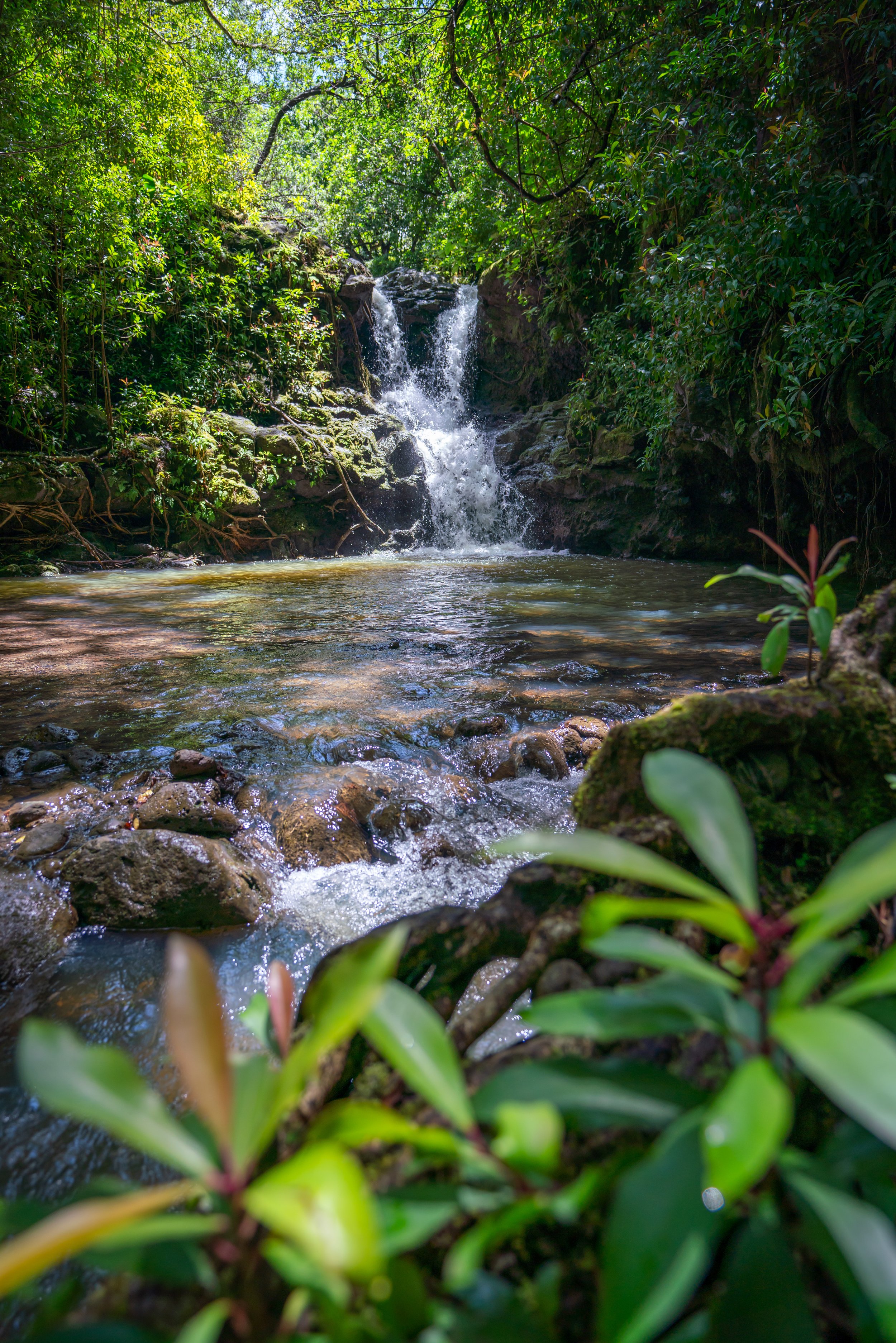
For example, this species in the photo below can only be found on the Island of Oʻahu and nowhere else on Earth!
Read My Separate Post: Native Hawaiian Plant Guide