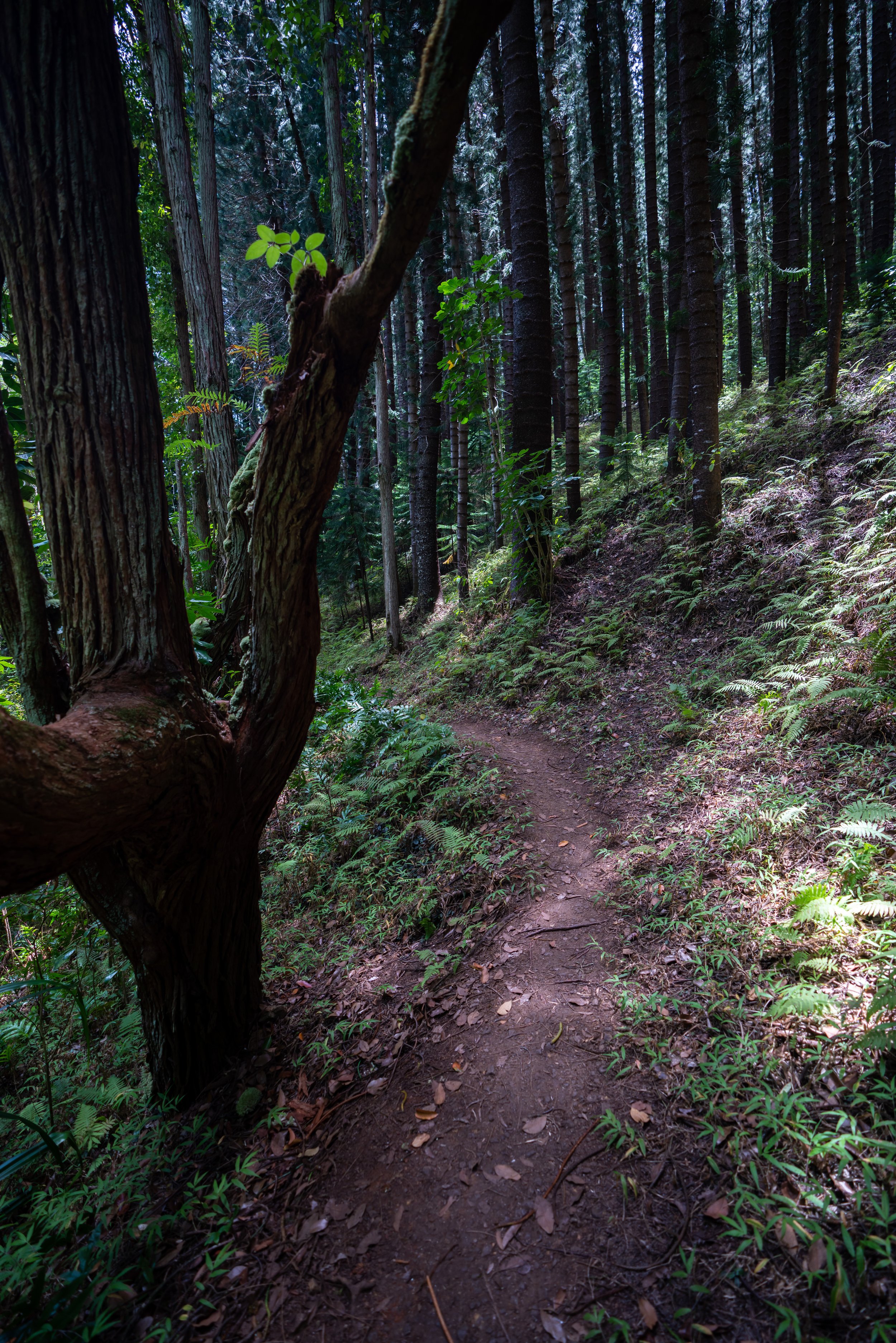
Hiking the Lulumahu Falls Trail on Oʻahu, Hawaiʻi
Distance (Roundtrip): 1.8 miles / 2.9 km
The Lulumahu Falls Trail on Oʻahu is a relatively short, out-and-back day hike off the Pali Highway that leads to a beautiful multi-tiered waterfall, which I see as the best year-round waterfall hike on the island!
I say this because, unlike other waterfalls on Oʻahu—such as the much more popular Mānoa Falls Trail—Lulumahu Falls is not dependent on rainfall. This is especially important for those visiting Oʻahu during the summer months when Hawaiʻi receives less rain compared to the winter. Nevertheless, Lulumahu Falls will always be flowing throughout the year, regardless of how wet or dry the weather has been!
On a different note, I also want to highlight Likeke Falls, located on the other side of the Pali Highway tunnels, as it is the best short, kid-friendly waterfall hike on Oʻahu, making it another great option to consider, since it is also not dependent on rainfall.
Do I Need a Permit to Hike the Lulumahu Falls Trail?
Yes, permits are required to hike the trail legally. However, permits are free—apart from an annoying processing fee.
That said, Lulumahu Falls permits can generally be reserved shortly before your actual hike, as the Hawaiʻi Department of Land and Natural Resources (DLNR) issues 100 hiking permits per day.
Book Here: Lulumahu Falls Trail Permit
Lulumahu Falls Trailhead Parking
Parking for Lulumahu Falls Trail is located in a large, unpaved parking lot near the intersection of Nuʻuanu Pali Drive and the Pali Highway.
Out of caution, consider the Lulumahu Falls Trailhead to be a high-crime area for petty theft, meaning you should never leave visible bags or anything valuable in your car.
Google Maps Directions: Lulumahu Falls Trailhead
Hiking the Lulumahu Falls Trail
Over the years, the Lulumahu Falls Trail has become a less-than-straightforward hike, as so much inaccurate information and directions have proliferated the increase of misleading social trails that stray from the best, fastest, and most straightforward route to the waterfall.
This being the case, hikers get off-route and end up hiking much farther than is actually necessary by following one of these many wrong paths, which is why I highly recommend following this article as it is specifically written, as I have outlined the best route to reach Lulumahu Falls with the least amount of effort.
Immediately after beginning the hike, the Lulumahu Falls Trail will split.
From here, go right, then right again at both splits, to follow the trail through the Bamboo to the service road, about 0.1 miles (0.2 km) away.
This is the second right turn immediately after the one shown above.
After the first two turns, follow the trail through the Bamboo until it opens up to a service road shortly ahead.
When the trail reaches the service road, go left to continue hiking toward Lulumahu Falls.
When the road splits again, with a very obvious path on the left-hand side, go straight, as the trail to the left leads the wrong way, like the split at the very beginning.
These big circular leaves above the Lulumahu Falls Trail are called Hau, and they are one of the few native Hawaiian plants on the trail, as most this relatively low-elevation hike is dominated by non-native, invasive species.
Lulumahu Falls-Kaniakapūpū Junction
When the trail comes to this T-intersection, go left to continue hiking toward Lulumahu Falls.
That said, do not follow the path on the right, as it leads to a highly protected historic site, where first-time trespassers will receive a $10,000 fine for entering without permission.
The State of Hawaiʻi isn’t messing around!
This check dam is always a nice sign that you’re following the correct trail.
The next best mental checkpoint is where the Lulumahu Falls Trail reaches this long, straight section through these tall Eucalyptus trees.
When the Lulumahu Falls Trail reaches this clearing, go straight/ slightly to the right to find where the trail continues through the trees ahead.
This is where the Lulumahu Falls Trail continues just to the right of the clearing.
When the Lulumahu Falls Trail reaches this next clearing in the Strawberry Guava forest, go left, and the trail should become more defined just a few steps ahead.
This next split is where all the incorrect paths finally come together for the rest of the hike to Lulumahu Falls, with the exception of the Lulumahu Ridge Trail that branches away just outside of the gulch ahead.
Once here, go right at this split to continue hiking to Lulumahu Falls, but don’t forget to make a mental note of this left turn for the return hike.
Luakaha Weir
When the Lulumahu Falls Trail reaches this weir, walk along the wall toward the top of the overflow, at which point there are two options.
Once at this point, there’s either the option to walk directly upstream, as the Lulumahu Falls Trail continues on the left-hand side, or to cross the weir, then cross almost immediately again to reach the same trail on the left side of the stream.
I usually choose to cross, then cross again.
This is where the Lulumahu Falls Trail continues up the left side of the stream.
As the Lulumahu Falls Trail enters the gulch, Māmaki—the native Hawaiian tea—starts to become more and more abundant as the dominant native species on the trail, similar to the Hau trees from the beginning.
That said, if you are curious about trying the native Hawaiian Māmaki tea, I kindly ask that you don’t harvest Māmaki from our native forests.
Instead, Māmaki can be bought from one of the local reputable vendors listed below.
Lulumahu Falls-Lulumahu Ridge Junction
With about 0.2 miles (0.3 km) left before Lulumahu Falls, the trail reaches arguably the most important junction on the hike, as this is the difference between ending up on the Lulumahu Ridge Trail vs. the Lulumahu Falls Trail.
That said, hikers get off-track here daily because the Lulumahu Falls Trail is seemingly the less-obvious option, as it drops steeply down to cross the stream as opposed to staying on the nicer, easier path to the left.
All that to say, go right to cross the Lulumahu Stream, where the trail should become more obvious once on the other side.
Read My Separate Post: Lulumahu Ridge Trail
After the stream crossing, there are a lot less places to get off track, notably because this is where the walls of the gulch begin to close in on both sides.
However, there are still a few alternate paths that branch off the main trail shown here, which is why I recommend doing your best to remember these final few turns in order to hike up the Lulumahu Falls Trail with the least amount of effort.
Warning
It’s important to be aware of the risks when hiking the final sections up Lulumahu Stream, as the short but narrow gulch can, and will, flash flood during periods of extremely wet weather.
I mention this because all these final stream crossings can become impassable if the Lulumahu Stream were to flash flood, especially the uppermost crossings shortly ahead.
At the next split, go right to continue upstream, as the trail to the left is another incorrect social trail created by hikers missing this turn on the way back down.
This next split is arguably the most crucial one to stay on the easiest path, as the trail to the left unnecessarily climbs up the steep hillside to avoid going in stream.
However, the correct route is the trail to the right, given that the social trail created on the left drops down a steep hillside just around the corner once hikers realize they took the wrong route.
In the final few sections just before Lulumahu Falls, the trail will hug the stream in the narrowest parts of the gulch.
Once here, stay on the left-hand side of the stream, and the Lulumahu Falls Trail will become more obvious shortly ahead.
This is where the incorrect path I previously mentioned drops down the steep, unnecessary hillside, as there really is no avoiding the stream when the trail starts to approach Lulumahu Falls.
This is the second-to-last stream crossing.
This is the final stream crossing before Lulumahu Falls.
Lulumahu Falls
After a somewhat tedious 0.9-mile (1.4 km) hike, the trail ends at the roughly 50-ft. (15 m) Lulumahu Falls, which is only the lowest tier of the multi-drop waterfall that begins its descent high up in the Koʻolau Mountains, atop Puʻu Kōnāhuanui—the highest summit in the mountain range!
Warning
Just as equally as flash floods are a serious risk in these upper reaches of the gulch, so is the risk of rockfall.
While this, unlike flash floods, is less avoidable, it’s important to be aware of the risk, as rocks can and do fall from the steep canyon walls all the time.
I have personally seen it happen many times!
Native Plants on the Lulumahu Falls Trail
The Lulumahu Falls Trail is a very low-elevation trail by Hawaiʻi standards, meaning the hike is dominated by non-native, invasive species, such as Cinnamon trees and Downy Wood Ferns.
However, there are a few native Hawaiian plants along the short trail that are very easy to see, such as Hau, Māmaki, ʻAkolea, and Palaʻā.
If you would like to learn more about these and many other native Hawaiian plants from across the islands, I encourage you to check out my separate post linked below.
Read My Separate Post: Native Hawaiian Plant Guide


