


Hiking the Wiliwilinui Ridge Trail on Oʻahu, Hawaiʻi
Distance: 4.7 miles / 7.6 km
The Wiliwilinui Ridge Trail in the southern Koʻolau Mountains on Oʻahu is a popular yet stunning state-managed ridge hike that climbs to a beautiful panoramic summit above Honolulu and the island’s east side!
That said, Wiliwilinui Ridge is often regarded as one of the easiest and best introductory hikes to reach the rugged Koʻolau Summit, which I mention because it’s a great adventure to know if you’re ready to branch out to more challenging trails across Oʻahu.
Furthermore, this same sentiment also applies to the neighboring Hawaiʻi Loa Ridge Trail, but between the two, Wiliwilinui is the easier and quicker choice!
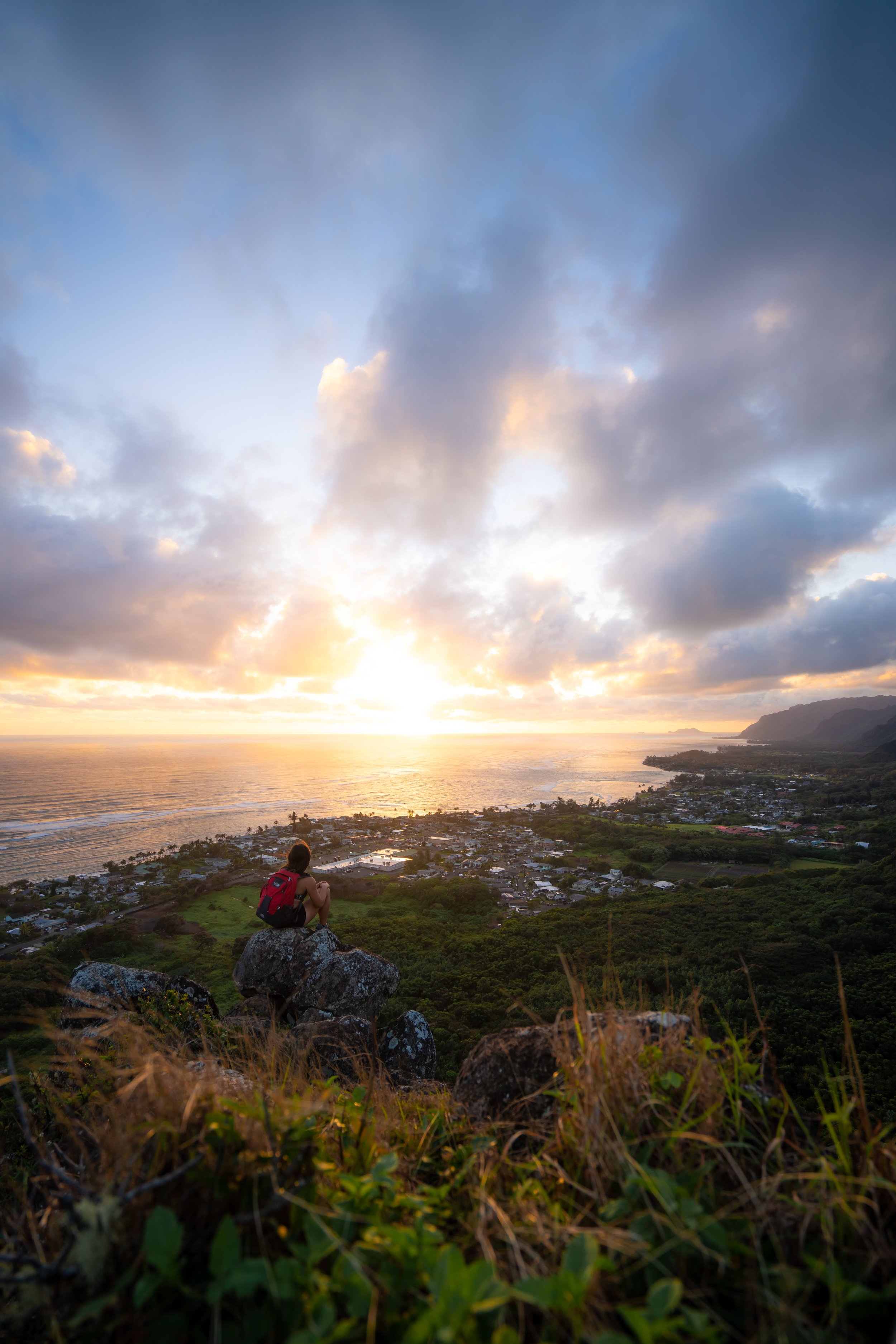
All this to say, I love the Wiliwilinui Ridge Trail because it requires so little effort for an incredible reward! It doesn’t take long to reach amazing views on Wiliwilinui, which is great because if you happen to be hiking on a cloudy day, I think the first 1.9 miles (3.1 km), prior to the steepest parts of the hike to the summit, are worth the effort alone!

My Print - Wiliwilinui Ridge Trail
Wiliwilinui Ridge Trailhead Parking
Parking for the Wiliwilinui Ridge Trail is located at the very end of ʻOkoʻa Street, within a private neighborhood at the base of the trail.
That said, all hikers are required to present a valid ID to the security in charge of the private community in order to obtain a parking pass for the lot at the top. Be aware that passes are limited, and I have been denied access in the past when the parking lot was full, which often happens on weekends and holidays.
Furthermore, private security has also been known to turn away hikers who arrive too close to sunset. This is why I recommend arriving no later than two and a half hours before sunset, in order to have plenty of time to enjoy the trail and return safely.
Google Maps Directions: Wiliwilinui Ridge Trailhead
Hiking the Wiliwilinui Ridge Trail
The Wiliwilinui Ridge Trail begins on a paved service road for the water tank and power lines located up on the ridge, making the beginning of the hike—up to the steepest sections and the stairs at the end—relatively easy.
After 0.2 miles (0.3 km), the Wiliwilinui Ridge Trail passes a water tank on the right-hand side, where the road transitions from pavement to dirt, much like Mānana Ridge in central Oʻahu.
This is where the Wiliwilinui Ridge Trail noticeably starts gaining elevation.
That said, the total climb from the trailhead to the summit is roughly 1,325 ft. (404 m), with much of that located in the last 0.4 miles (0.6 km).
For those interested in trail running on Oʻahu, Wiliwilinui Ridge is a great option, granted that it hasn’t been raining recently.
If it has, some sections can be particularly challenging, but on a nice day like this, Wiliwilinui is truly a locals’ favorite, with my best time from the trailhead to the summit and back being 57:18!
The shoes linked below are the ones I trust for both road and trail running on Oʻahu, making them perfect for Wiliwilinui!
If there’s one thing I hope these photos show, it’s that on a beautiful day like this, there isn’t a lot of shade on the Wiliwilinui Ridge Trail, outside of a few very short sections before the final ascent.
This is why I highly recommend hiking in a hooded sun shirt, which is something I do for almost any trail across Hawaiʻi.
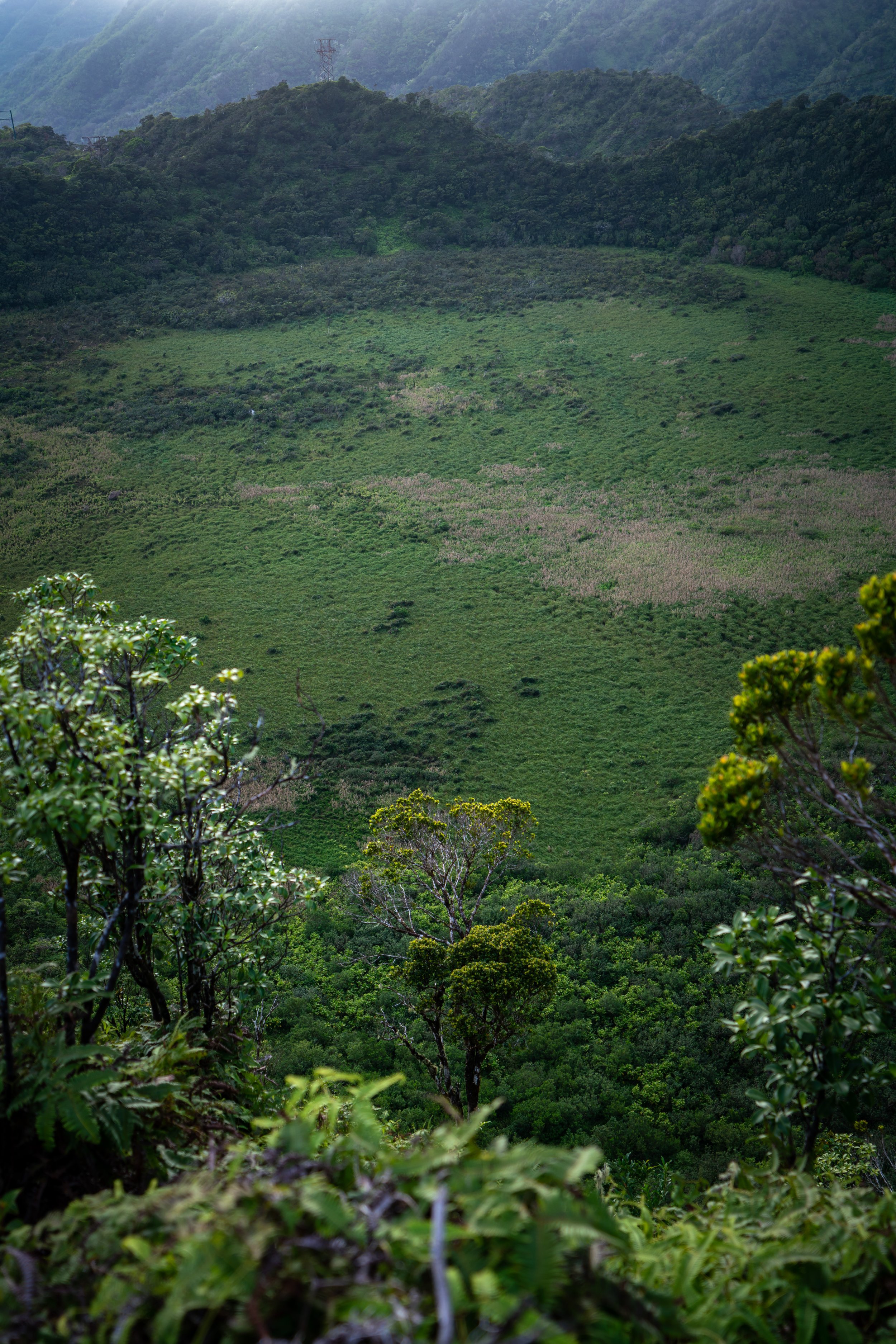
This is where the summit of Wiliwilinui Ridge can be seen for the first time, about 0.8 miles (1.3 km) into the hike!
Wiliwilinui Ridge-Wailupe Valley Junction
This hard left-hand turn in the trail is notorious for being one of the muddiest spots on the Wiliwilinui Ridge Trail.
However, what’s often less apparent is that this turn is also the junction that connects with Wailupe Valley.
That said, other sources often incorrectly label this connector trail as part of the Wailupe Loop Trail, but that is not true. In fact, I corrected AllTrails some years ago to reflect the true Wailupe Loop Trail, which never leaves Wailupe Valley. That’s really the key!
Instead, the Wailupe Loop Trail splits at the junction within Wailupe Valley to climb up the East Middle Ridge before it meets again with the West Middle Ridge just below the Koʻolau Summit. Then, the West Middle Ridge is used as the return loop back into Wailupe Valley.
It’s not that all this has anything to do with the hike up Wiliwilinui Ridge in this post, but from time to time, I feel that it’s important to correct inaccurate information I find about Hawaiʻi trails, which is why I wanted to explain this further.
In any case, the Wiliwilinui Ridge Trail continues uphill on the much more obvious trail to the left.
Read My Separate Post: Wailupe Loop Trail
As previously mentioned, this section, which includes the junction shown above and this uphill stretch, can be one of the muddiest, most slippery sections on Wiliwilinui Ridge if it has recently been raining!
I hope this rope on the ground helps to show just how slippery this uphill section can be!
After climbing up the steep hill following the Wailupe Valley junction, the Wiliwilinui Ridge Trail becomes much easier until it reaches the next steeper section, about 0.3 miles (0.5 km) ahead.
This long, flat tree tunnel can be one of the muddier areas on Wiliwilinui Ridge when it has been raining.
This is the view looking southwest toward Honolulu.
This is the next steep section that, prior to the final ascent, can be challenging when the trail is muddy and slippery.
This open area in the photo below is where the Wiliwilinui Ridge Trail starts climbing the first set of stairs.
That said, this is not the beginning of the steep final ascent to the summit.
Rather, the steepest parts of the Wiliwilinui Ridge Trail begin in about 0.4 miles (0.6 km) from this point, a little past the last power line on the ridge.
The first set of stairs doesn’t last long, as it’s truly a precursor to the steep final ascent at the very end.
This is the second-to-last set of power line poles on Wiliwilinui Ridge.
This is the final set of power lines on Wiliwilinui Ridge, and it’s a nice sign that the trail is nearing the final ascent to the tower that can be seen on the peak in the distance.
This is where the final, steep 0.4-mile (0.6 km) ascent up the Wiliwilinui Ridge Trail begins, gaining roughly 660 ft. (201 m) from this point to the Koʻolau Summit.
The final climb up the Wiliwilinui Ridge Trail is notorious for being one of the most eroded ridges in the southern Koʻolaus, which largely speaks to how popular the hike is.
That said, this erosion is one reason I mentioned at the beginning that Wiliwilinui Ridge is a great introductory hike for Hawaiʻi ridge hiking, as I personally believe this hike should feel easy—even when conditions are the wettest and at their worst.
I say this because if you feel comfortable here, then it’s worth considering other, more challenging day hikes across the island—but only if a hike like Wiliwilinui comes easy to you!
It’s worth noting that the tower that can be seen in the distance is not the summit of Wiliwilinui Ridge.
Rather, it’s a false summit, and the true summit is located 0.1 miles (0.2 km) beyond.
Since the final ascent up Wiliwilinui Ridge is so steep and eroded, some hikers may want to use trekking poles, especially if the trail is wet—which is more common than not!
One of the cool things about the Wiliwilinui Ridge Trail is that hikers can see two of the most common endemic Hāpuʻu ferns growing directly alongside the trail.
However, telling the two most common species apart can be challenging, unless you know the little trick described below!
Cibotium glaucum vs. Cibotium chamissoi
There are subtle differences in the pinnae that can be hard to describe, but for a quick, easy way to determine which species you’re looking at, flip the fronds!
The underside of Cibotium glaucum will look pale/ light green, while Cibotium chamissoi will be a distinct green color (not pale).
This short stretch is one of the steepest and most eroded sections on the Wiliwilinui Ridge Trail prior to the tower.
After the most eroded areas of the final ascent, the Wiliwilinui Ridge Trail simply finishes the remaining sections up a long set of stairs to the HECO Tower at the top of the false summit.
HECO Tower
At the top of the final set of stairs, the Wiliwilinui Ridge reaches the HECO Tower, which is the false summit previously mentioned.
From here, the trail continues around the left-hand side of the tower toward the true summit along the KST, about 0.1 miles (0.2 km) from this point.
This final stretch between the HECO Tower and the KST is significantly easier than the previous 0.3 miles (0.5 km) up the steepest sections of Wiliwilinui Ridge.
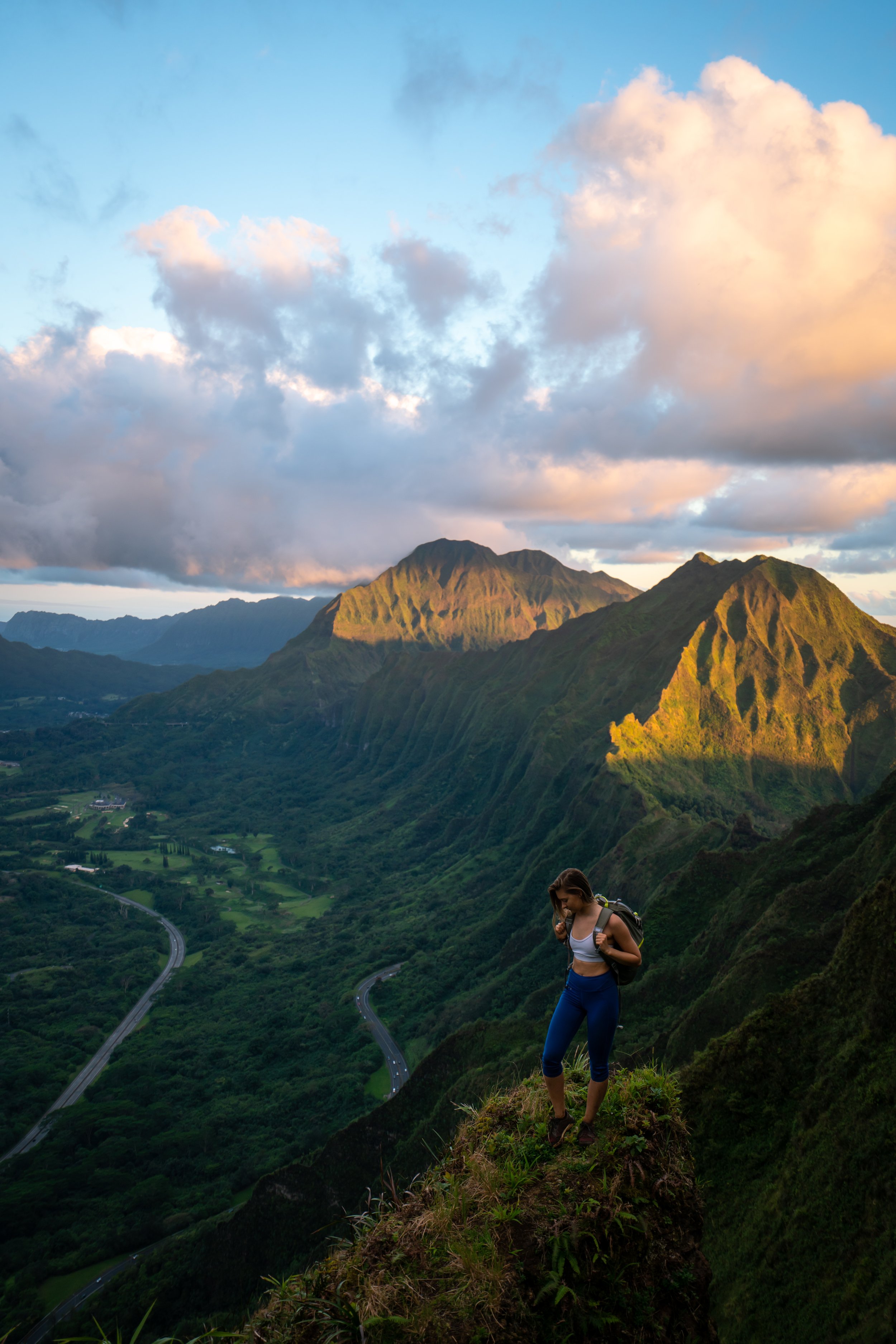
Wiliwilinui Summit
This is the summit of Wiliwilinui Ridge, and on a clear day, you can see amazing views across much of Oʻahu’s east side, including Mt. Olomana, the Lanikai Pillboxes, and even as far as Kualoa Ranch and Mokoliʻi to the north!
Furthermore the summit of Wiliwilinui Ridge is also a part of the long Koʻolau Summit Trail (KST), with Puʻu Lanipō being the next notable summit to the north and Wailupe to the south.
However, if you were not prepared to hike past the end of the Wiliwilinui Ridge Trail, I recommend turning back here. I say this because the KST is significantly harder and more challenging than everything experienced on the Wiliwilinui Ridge Trail to get to this point—not to mention that both the Mauʻumae Ridge Trail to Puʻu Lanipō and the Wailupe Loop are more challenging than Wiliwilinui Ridge, meaning the next best exit trails are longer and more involved.
Read My Separate Post: Koʻolau Summit Trail (KST)
Native Plants on the Wiliwilinui Ridge Trail
The Wiliwilinui Ridge Trail begins in a mostly non-native, mesic forest, but it doesn’t take long for native Hawaiian plants to start dominating the landscape.
Some of these include Uluhe, Koa, ʻŌhiʻa lehua, Alani, Kōpiko, ʻAhakea, ʻŌlapa, ʻUki, Palaʻā, ʻIliahi, Paʻiniu, Hōʻawa, Kōlea, Akaʻawa, and ʻĀkia, to name just a few.
If you would like to learn more about these and many other native Hawaiian plants from across the islands, I encourage you to check out my separate post linked below.
Read My Separate Post: Native Hawaiian Plant Guide


My Print - Wiliwilinui Ridge Trail