10 Best Trail Runs on Oʻahu, Hawaiʻi
Trail running in Hawaiʻi can be quite challenging compared to the U.S. mainland on account of the mud, overgrowth, and steepness on even very basic trails.
That said, all of these factors on Oʻahu combine—particularly considering elevation change—to make many of the best trails to run very difficult!
It is for this reason that this list is written in terms of effort-to-reward, minimal overgrowth, and great views, without considering how steep a trail might be, as trying to recommend only flat adventures on Oʻahu would severely limit the amount of recommendations I could make, considering how dramatic elevation changes across the island really are!
This is why many of the trails on this list are only likely to be run in part on the way up, but all—with the exception of the Koko Crater Stairs—make for amazing and beautiful trail runs on the way back down!
Best Road-to-Trail Running Shoes
Oʻahu is a perfect example of a place where the best way to prepare is to have a good road and trail shoe, especially on Mokulēʻia Trail and the Kaunala Trail, listed below.
For this reason, I prefer the shoes linked below, as they are the best option I’ve found for a comfortable road shoe, as well as a shoe with good grip when transitioning to a trail.
10 Best Trail Runs on Oʻahu
With the exception of the first recommendation below, the following list is written in no particular order of best or worst.
That said, I think it depends on what kind of difficulty/ elevation gain you are comfortable with, as some, like the Mokulēʻia Access Road, are fairly steep to run the entire distance up but can make for a very fun run on the way back down!
1. ʻAiea Loop Trail
Distance: 4.9 miles / 7.9 km
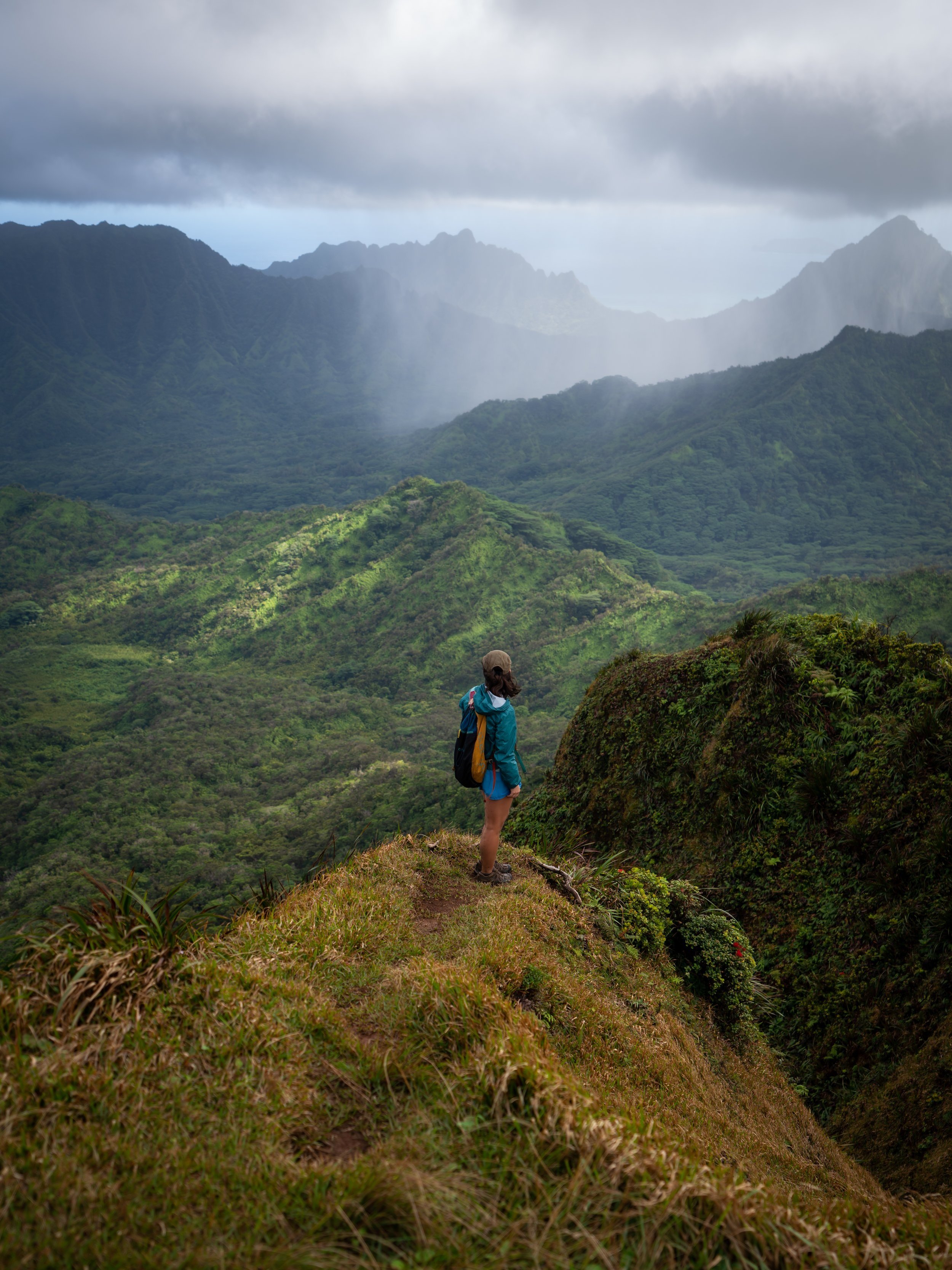
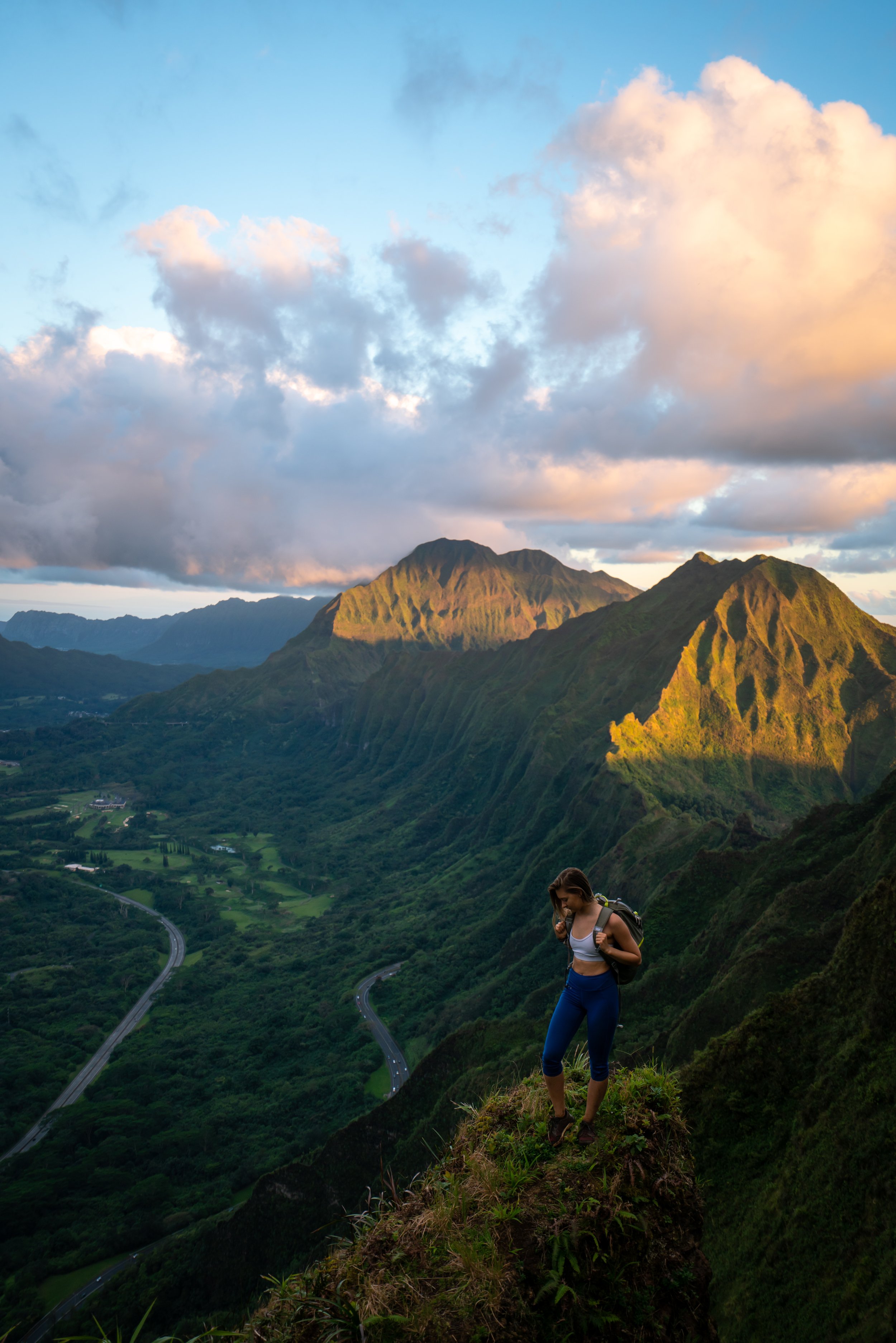
The ʻAiea Loop Trail is a beautiful day hike in central Oʻahu that winds its way through a towering Eucalyptus–Koa–ʻŌhiʻa forest, past a number of panoramic viewpoints that look far up the Koʻolau Range, before ultimately looping back around to the beginning.
What all this doesn’t mention is that the elevation change on the trail is fairly minimal, which is why the ʻAiea Loop Trail is often regarded as the best trail-running hike and the best kid-friendly hike on Oʻahu!
To this point, the ʻAiea Loop Trail can most practically be thought of as having two 'halves,' meaning that whether you’re running or hiking with young kids, it’s easy enough to turn around at any number of points before beginning the second half of the loop.
Now, all of this goes without mentioning that one of the biggest reasons I believe the ʻAiea Loop Trail is the best all-around trail-running and kid-friendly hike on Oʻahu is that even after it has recently rained, the trail is typically doesn’t get very muddy—something that certainly cannot be said about countless other adventures on this list!
Read My Separate Post: ʻAiea Loop Trail
2. Mokulēʻia Trail
Distance (RT via Mokulēʻia Access Road Gate): 14.3 miles / 23.0 km
Distance (RT Way via Peacock Flats): 7.1 miles / 11.4 km
Distance (RT via Mokulēʻia TH): 5.6 miles / 9.0 km
The Mokulēʻia Trail is a beautiful, forested, and relatively flat day hike in the Waiʻanae Mountains that leads to one of a few different panoramic viewpoints, both at the Mokulēʻia Shelter and at the end of the trail.
As for running the Mokulēʻia Trail, the trailhead is most practically accessed from the North Shore of Oʻahu, as advanced planning to reserve a day-use permit is not required, which also eliminates the need to have a high-clearance 4x4 vehicle.
That said, combining both the Access Road and the Mokulēʻia Trail is what makes the total roundtrip distance 14.3 miles (23.0 km), though at least 4.0 miles (6.4 km) can be avoided if you choose not to run all the way to the Mokulēʻia Overlook after the Eucalyptus forest at the end.
When starting from the North Shore, it’s important to understand that the initial 3.6 miles (5.8 km), from the gate off Farrington Highway to Peacock Flats, gains roughly 1,550 ft. (472 m), which is steeper to run than it may seem because the first 0.9 miles (1.4 km) is flat, meaning the climb is really condensed into 2.7 miles (4.3 km).
Since there is so much to know about the Mokulēʻia Trail, I highly recommend reading all the details in both of my separate posts.
Above all else, I think it’s important to mention that the Mokulēʻia Access Road and Trail is not a difficult adventure. It just happens to be a longer day if you decide to begin from the North Shore, which really isn’t overly strenuous if you plan accordingly and understand what you’re getting into before setting off.
Read My Separate Posts: Mokulēʻia Forest Reserve Access Road / Mokulēʻia Trail
3. Keālia-Kuaokalā Trail
Keālia Distance (One Way): 1.5 miles / 2.4 km
Kuaokalā Distance (One Way): 2.6 miles / 4.2 km
The Keālia Trail and the Kuaokalā Trail are two separate Oʻahu day hikes that are seemingly synonymous, similar to both the Mokulēʻia Trail and Mokulēʻia Access Road mentioned above.
What I mean when I say this is that the Keālia Trail, like the Mokulēʻia Access Road, is a day hike that begins in Mokulēʻia on the North Shore of Kaʻena Point and climbs its way up into the Waiʻanae Mountain Range before ultimately reaching a vast network of roads and trails once at the top.
This is why I also like to say that the Kuaokalā Trail is one of a few day hikes on the island where the trailhead (actually two trailheads) begins in the mountains already, just like the Mokulēʻia Trail a few miles to the east.
This is all to say that the Kuaokalā Trail is one of the most beautiful day hikes on Oʻahu and certainly one of my all-time favorites! However, there is quite a bit of effort required to get there from Keālia on the North Shore, but I believe that whether you hike or trail run your way there, the views from the Kuaokalā Trail speak for themselves!
Now, I would be remiss if I didn’t mention that there is indeed an easier way to reach the Kuaokalā Trail by reserving a permit through the Hawaiʻi State Department of Land and Natural Resources (DLNR). By doing so, hikers or trail runners can actually drive to a little-known trailhead up in the Waiʻanae Mountains, which you can learn all about in my separate Kuaokalā article linked below.
That said, reserving a permit can be a great option for those who plan ahead, but since hiking from the North Shore via Keālia requires no advanced planning, this is often the option I default to—not to mention, accessing the Keālia Trailhead is much quicker and easier compared to the long drive out to the West Side to get to the Kuaokalā Trailhead.
Read My Separate Posts: Keālia Trail / Kuaokalā Trail
4. Kaʻena Point Trail
Distance (West Side): 2.1 miles / 3.4 km
Distance (North Shore): 2.4 miles / 3.9 km
Kaʻena Point State Park, on the northwest side of Oʻahu, is home to one of the island’s longest undeveloped coastlines, where visitors can hike one of two different trails, beginning from either the North Shore in Mokulēʻia or the West Side past Mākua and Keawaʻula Bay.
That said, both the North and West Kaʻena Point Trails are very similar coastal trails, but in many ways they could not be more different from one another. Therefore, I highly recommend reading my side-by-side comparison at the beginning of either article linked below, where I explain in detail the main differences between the two.
In any case, the Kaʻena Point Trail from either direction can be extended by hiking up the Kaʻena Point Pillbox Trail to the WWII-era bunker above Kaʻena Point, which easily makes for one of the best year-round sunset hikes on Oʻahu!
Read My Separate Posts: Kaʻena Point (North Shore) / Kaʻena Point (West Side)
5. Hawaiʻi Loa Ridge Trail
Distance: 4.2 miles / 6.8 km
The Hawaiʻi Loa Ridge Trail is a state-managed trail in the southern Koʻolau Mountains that can most similarly be compared with the Wiliwilinui Ridge Trail mentioned below.
However, the biggest difference between Hawaiʻi Loa Ridge and Wiliwilinui is that it is, by and large, less trafficked, as access to the hike is restricted to those with a State of Hawaiʻi or military ID.
This means that Hawaiʻi Loa Ridge can be a great option for those visiting family or friends on the island, who have the ability to access the trailhead located atop a private residential neighborhood.
All this to say, the Hawaiʻi Loa Ridge Trail is slightly more difficult than Wiliwilinui, but they are both very similarly constructed, neighboring state trails near Waikīkī, which is why I think I’d be splitting hairs to say which of the two is better.
Read My Separate Post: Hawaiʻi Loa Ridge Trail
6. Kaunala Loop Trail
Distance: 5.4 miles / 8.7 km
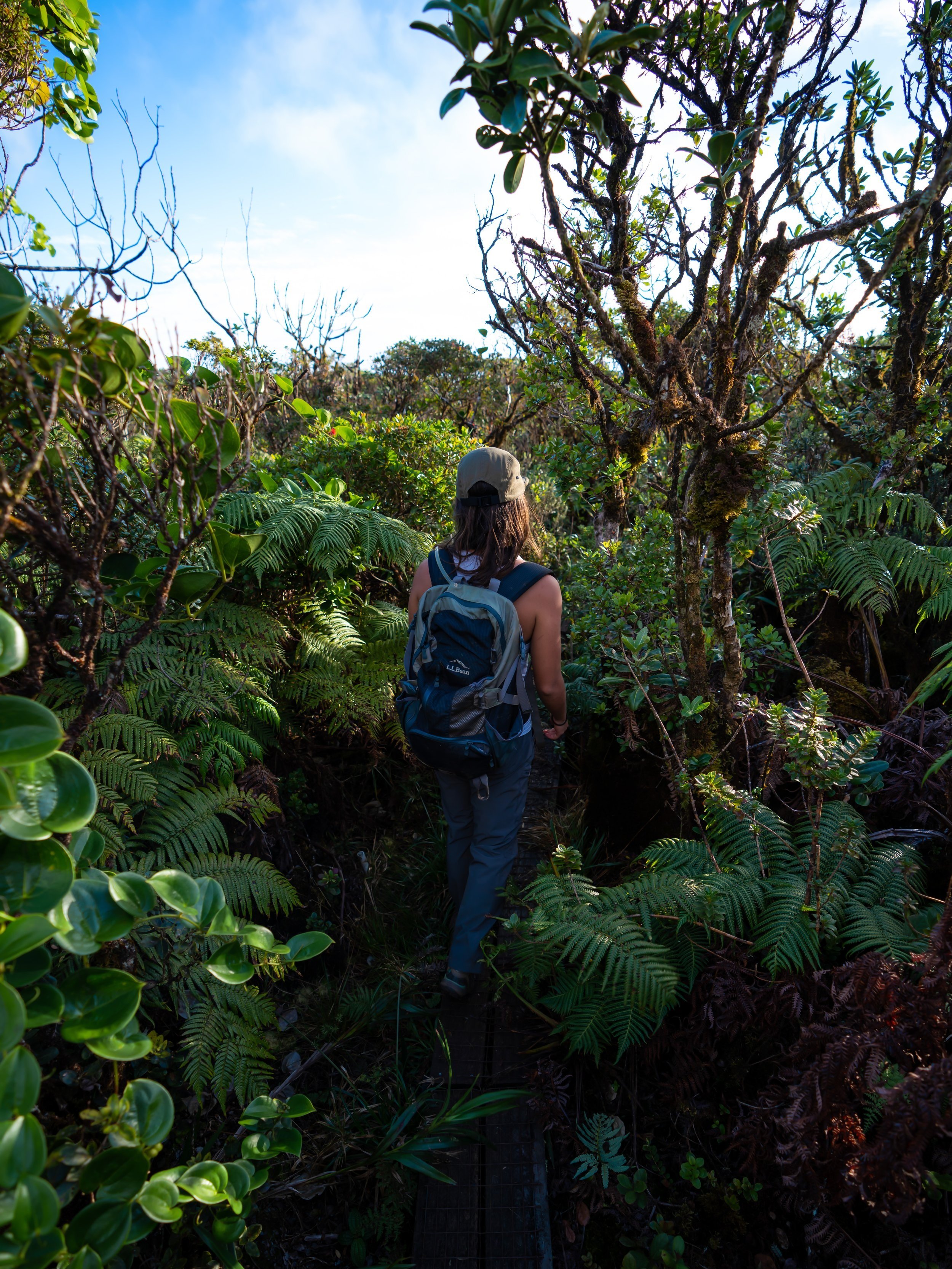
The Kaunala Trail, also called the Kaunala Loop Trail, is a hidden day hike in Pūpūkea on the North Shore of Oʻahu that traverses a mix of Eucalyptus and native Uluhe–Koa–ʻŌhiʻa forest before ultimately looping back around on an easy paved road at the end!
This is why I like to think of Kaunala as both a great hike and a trail run, as certain sections are better for one while other parts are better for the other.
All this to say, I personally think the Kaunala Loop Trail is one of the best local hidden gems on Oʻahu, especially when compared to much more popular, similar adventures, like the ʻAiea Loop Trail.
Read My Separate Post: Kaunala Trail
7. Koko Crater Stairs & Botanical Garden
Stairs Distance: 0.9 mile / 1.4 km
Botanical Garden Distance: 2.0 - 3.0 miles / 3.2 - 4.8 km
The Koko Head Stairs is a beautiful but steep east Oʻahu hike in Hawaiʻi Kai that climbs the steps of a historic WWII-era tramway built in the early 1940s by the U.S. Army, ultimately ending at the summit of an ancient volcanic crater called Puʻu Mai!
Following its historic past, the Koko Crater Stairs have since become a favorite among both locals and visitors from around the world, with many Oʻahu residents hiking the railway as a quick morning or evening workout, often beginning just before sunrise or sunset.
That said, the Koko Head hike may not be for everyone, as the steep tramway climbs a little under 1,000 ft. (305 m) in only 0.45 miles (0.7 km). However, if you think you’re up for the challenge, the views from the summit cannot be beat—especially when hiked during golden hour!
On a different note, it’s also worth highlighting that there is a much easier, much flatter loop on the inside of the crater that can make for a better and more relaxing place to run than the steep Koko Crater Stairs.
Read My Separate Posts: Koko Crater Stairs / Koko Crater Botanical Garden
8. Wiliwilinui Ridge Trail
Distance: 4.7 miles / 7.6 km
The Wiliwilinui Ridge Trail is a stunning adventure on the southeast side of Oʻahu, and it’s a hike that I believe is the best introductory Hawaiʻi ridge trail!
What I mean when I say this is that I know Hawaiʻi ridges and trails to be among the most difficult places to hike of anywhere in the world. However, there are a number of trails, including Wiliwilinui and others mentioned in this article, that make for fun, beautiful, and easy-to-navigate adventures.
To add to this, both Wiliwilinui and Kuliʻouʻou Ridge are two of the easier ridge trails in southern Koʻolau Mountains, and both make for great day hikes near Waikīkī!
Read My Separate Post: Wiliwilinui Ridge Trail

My Print - Wiliwilinui Ridge Trail
9. Tantalus Loop Trail (Makiki Valley)
Distance: 8.4 miles / 13.5 km
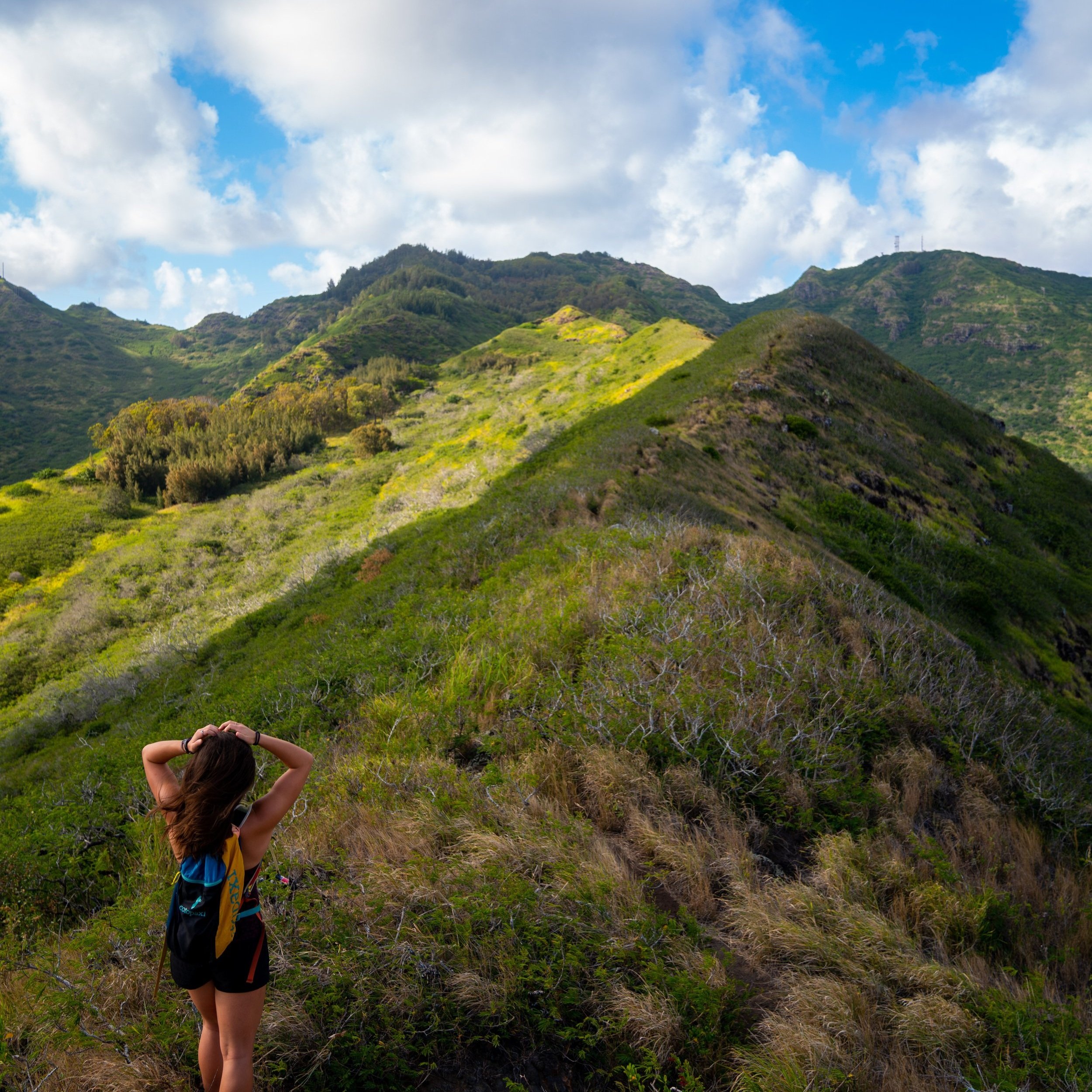
The Tantalus Loop Trail is not a reference to an individual trail on Oʻahu, but instead to the outer loop in the large Tantalus Trail network that spans from the Makiki Valley Trailhead to the Pauoa Flats Bench at the beginning of the Puʻu Kōnāhuanui Trail.
That said, the entire Tantalus Trail network is one of the best places to trail run on Oʻahu, as any number of different routes of varying length can be created while also utilizing Tantalus–Round Top Drive to connect different trailheads.
Now, this all goes without saying that there is quite a bit of elevation change between the Makiki Valley Trailhead and the Pauoa Flats Bench—not to mention, mud!
This is why some sections will be very easy to run, while others, particularly the steep climb out of Makiki Valley, are much easier to hike.
In any case, simply getting out on any of the Tantalus Trails is always a great day outside, and my separate article can simply be used as a reference when planning certain sections of the long loop!
Read My Separate Post: Tantalus Loop Trail
10. Makapuʻu Point Lighthouse Trail
Distance (Roundtrip): 2.4 miles / 3.9 km
Elevation Gain: ~475 ft. / 145 m
The Makapuʻu Lighthouse Trail is a short, paved day hike in east Oʻahu that leads to a beautiful overlook atop Makapuʻu Point, overlooking Makapuʻu Beach and the southeastern Koʻolau Mountains!
For this reason, the Makapuʻu Point Lighthouse Trail is, without a doubt, the easiest and most straightforward hike on this list, which is why it is one of the most popular sunrise adventures on Oʻahu for both locals and visitors alike!
Saying all this, I think it’s important to stress once again that the entire trail, from the parking lot to the viewpoint at the top, is paved, which is why the Makapuʻu Lighthouse Trail is the best and easiest family-friendly hike I’ve talked about thus far!
Read My Separate Post: Makapuʻu Point Lighthouse Trail
Bonus: Hauʻula Loop Trail
Distance: 2.7 miles / 4.3 km
The Hauʻula Loop Trail is a beautiful North Shore day hike through a native and non-native ʻŌhiʻa–Cook Pine forest, where visitors can enjoy panoramic views of Kaipapaʻu Gulch, slow down and take pictures in the towering Cook Pine forest, and trail run—which is easily one of the better trails on Oʻahu to go for a run!
That said, the Hauʻula Loop Trail can most similarly be compared with the ʻAiea Loop Trail in central Oʻahu, with the exception that the Hauʻula Loop has more elevation change.
However, the main difference is that the Hauʻula Loop Trail’s location on the North Shore inherently makes it much less trafficked and much quieter overall, which is why it’s an adventure that I often think is one of Oʻahu’s best-kept secrets—especially if you’re staying at the Turtle Bay Resort just a few minutes up the road!
Read My Separate Post: Hauʻula Loop Trail
Native Hawaiian Plants on Hawaiʻi Trails
I wanted to include this last section on this post because this is a subject that’s personal to me.
The native plant biodiversity in Hawaiʻi is insane, and I say this because 90% of the native plants that you will see around the islands are found nowhere else on Earth, which I mention for two reasons.
The first is that I ask that you please do everything you can to minimize your impact on Hawaiʻi’s trails, as many native plants across the islands at risk of extinction. The second is that if you have a personal interest in the subject or may be curious about something that you found, I wrote a separate post entirely about native Hawaiian plants, which hopefully can help to identify anything that you might be curious about!
For example, this species in the photo below can only be found on the Island of Oʻahu and nowhere else on Earth!
Read My Separate Post: Native Hawaiian Plant Guide