Hiking the Keālia Trail on the North Shore of Oʻahu, Hawaiʻi
Distance (Roundtrip to Keālia Shelter): 3.0 miles / 4.8 km
Elevation Gain: ~1,000 ft. / 305 m
Located behind the Kawaihāpai Airfield in Mokulēʻia, formerly known as Dillingham, the Keālia Trail is like the North Shore version of the Koko Crater Stairs in Hawaiʻi Kai.
By this, I mean that just like Koko Head, North Shore residents treat the Keālia Trail like a quick evening workout before sunset.
However, the Keālia Trail is truly a local favorite because of all the different places you can explore past the Keālia Shelter at the top—especially when you hike as far as the Waiʻanae Summit Trail (WST)!
That said, the distance and the elevation gain posted above only represent the Keālia Trailhead to the Keālia Shelter at the top of the switchbacks, but if you’re considering hiking further, be sure to read the sections past the shelter, as there a number of different turns to remember in order to hike as far as Kuaokalā and the Waiʻanae Summit.
Connecting Keālia to the Mokulēʻia Access Road
Distance: ~13.0 miles / 20.9 km
One of the most common Waiʻanae Range trail runs is connecting the Keālia Trail with the Mokulēʻia Access Road, utilizing either the Mokulēʻia-Kuaokalā Access Road or the Waiʻanae Summit Trail.
That said, the total 13-mile (20.9 km) roundtrip distance may sound long, but all parts of the trail move fairly quickly, and the distance above includes the 3.6 miles (5.8 km) along Farrington Highway to get from trailhead to trailhead.
In any case, there’s really no telling how much one can explore past the Keālia Shelter, as there are still new places I’m learning of all the time! However, if you’d like to learn more about the best trail runs on Oʻahu, including the Mokulēʻia Access Road mentioned above, I encourage you to read more in my separate article.
Read My Separate Post: Best Trail Runs on Oʻahu
Keālia Trailhead Parking
Parking for the Keālia Trail is located within the west entrance for the Kawaihāpai Airfield in Mokulēʻia. This is not the same entrance that is used for skydiving.
Furthermore, the Keālia Trail has a designated parking lot within the airfield, but be sure to check the posted times on the Kawaihāpai gate as you drive in because security will lock the gate every night around sunset.
Google Maps Directions: Keālia Trailhead
Hiking the Keālia Trail
The Keālia Trail begins up the short service road that you would have driven past to get to the trailhead parking lot.
Here, go left, and the Keālia Trailhead will be found about 0.25 miles (0.4 km) up the road.
Keālia Trailhead
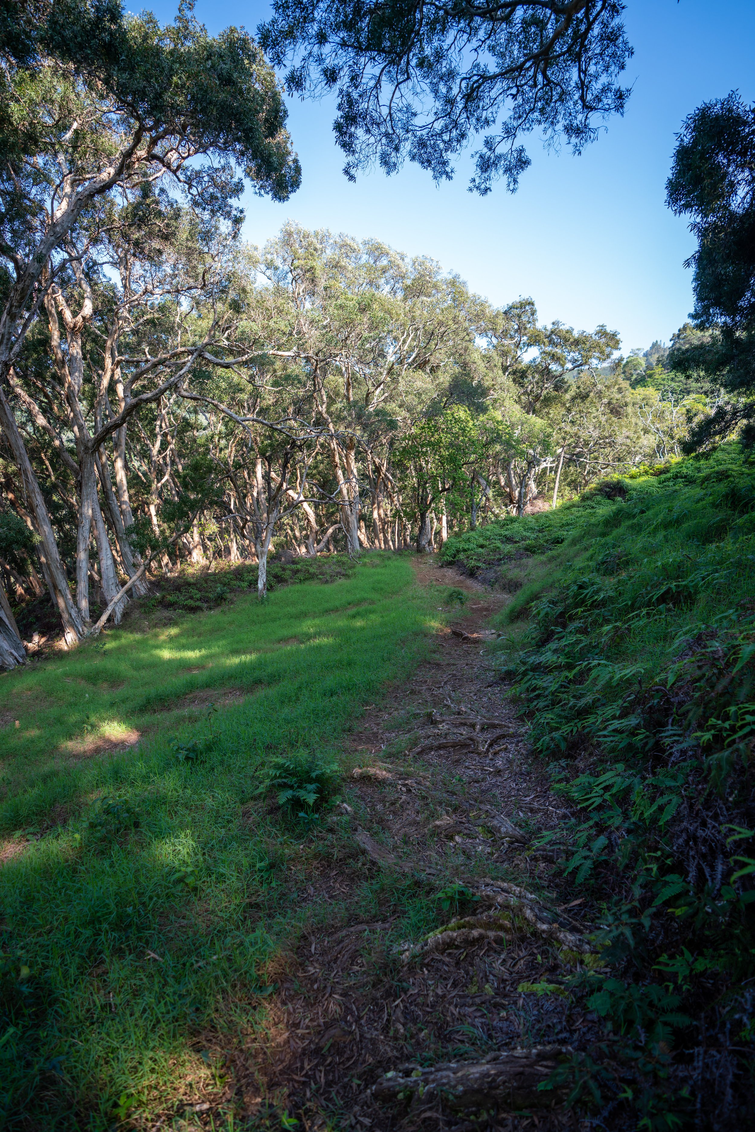
Once at the trailhead, the Keālia Trail begins climbing a series of about 19 switchbacks—depending on how you count—from the trailhead to the Keālia Shelter at the top.
That said, the lower elevation switchbacks tend to be slightly longer, but they gradually get shorter and shorter the closer the trail gets to the shelter.
ʻIlieʻe is one of two common native species that can be found along these beginning switchbacks.
As the trail begins to climb above the lower canopy, Wiliwili trees begin to become more and more abundant as the hike goes on.
Around the middle elevations, the canopy essentially disappears altogether, which is why I highly recommend hiking in a hooded sun shirt to be safe!
It’s hard to miss all the beautiful Wiliwilis on the hike up!
This large rock in the trail is from a rockslide that occurred back in 2021.
ʻAʻaliʻi, along with Alaheʻe, are two other common natives that you can expect to see on the Keālia Trail.
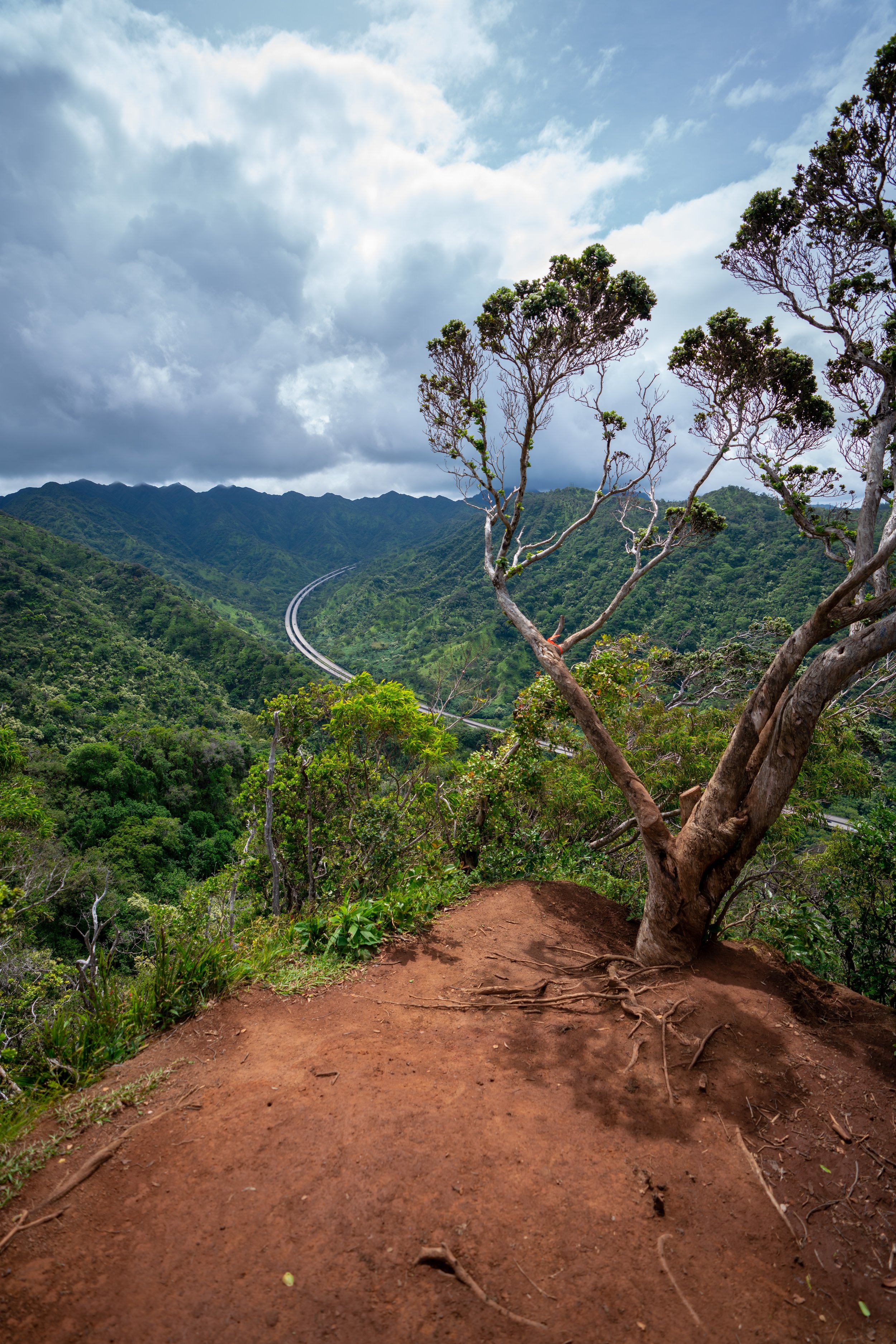
Then, after the 16th switchback, the Keālia Trail traverses a distinctly flatter switchback than the rest, which is often regarded as one of the best places on the hike to see some of the expansive views across the Mokulēʻia stretch of Oʻahu’s North Shore.
Keālia Shelter
After climbing all 19 switchbacks to the top, the Keālia Trail ends at the Keālia Shelter, where the Keālia Road begins.
For most hikers, the Keālia Shelter is the end of the trail, but if you’re interested in hiking further in order to see some of the best views in the Waiʻanaes, be sure to read the section below.
Keālia Road (Keālia Shelter to Kuaokalā)
Distance (One Way): 1.8 miles / 2.9 km
The distance above is the one-way distance from the Keālia Shelter to the Kuaokalā Trailhead.
That said, hiking both the Keālia Trail and Road is my preferred way to hike the Kuaokalā Trail, in order to avoid the hassle of getting the Kuaokalā permit. To learn more about why I say this, I encourage you to read all the details in my separate Kuaokalā article linked below.
In any case, simply follow Keālia Road from the Keālia Shelter, continuing uphill.
Read My Separate Post:Kuaokalā Trail
The main thing to know about hiking from the Keālia Shelter to Kuaokalā is that there are three major hills and a number of turns, all labeled below.
At the first split past the Keālia Shelter, go right to continue on Keālia Road.
The Three Hills on Keālia Road (Hill 1)
Up until this point, Keālia Road constantly climbs uphill, but know that this first hill in the photo below is unmistakable from the rest.
It is, by far, the steepest and longest hill on the hike over to Kuaokalā, meaning the remaining two get easier after the first.
Along Keālia Road, there are a number of native plants that you may see, such as ʻAʻaliʻi, Palaʻā, ʻIliahi, and ʻUkiʻuki, to truly only name a few.
Keālia-Makai Road Junction (Hill 2)
The next split in Keālia Road is the beginning of the second hill.
Here, go left up the hill to continue toward Kuaokalā.
Once at the top of the second hill, Keālia Road, very disappointingly, begins descending back down toward the bottom of the third and final hill.
Hill 3
After climbing and descending the second hill, the third hill immediately follows, which is by far the easiest and most gradual of the three.
Keālia-Mokulēʻia-Kuaokalā Access Road Junction
At the top of the third hill, the Keālia Road ends, where the road to Peacock Flats begins.
At this junction, go left for both the Mokulēʻia Access Road, the Waiʻanae Summit Trail (WST), and the Kuaokalā Trail, as the road to the right simply leads to the Kaʻena Point Space Force Tracking Station.
Access Road-Kuaokalā Trail Junction
At the split in the photo below, go right to continue toward the Kuaokalā Trailhead, located shortly ahead.
East Kuaokalā Trailhead
Finally, after 1.8 miles (2.9 km) of hiking from the Keālia Shelter, the hike across the Waiʻanaes from the North Shore to the West Side ends at the East Kuaokalā Trailhead.
To learn more about hiking the Kuaokalā Trail from this east trailhead, I highly recommend checking out my separate article linked below.
That said, the East Kuaokalā Trailhead is also where the roads meet the Waiʻanae Summit Trail, which encompasses both the Kuaokalā Trail and the fence line heading east toward Pahole.
Read My Separate Posts: Kuaokalā Trail / Waiʻanae Summit Trail (WST)
Native Plants on the Keālia Trail
Along with the Koko Crater Botanical Garden, the Keālia Trail is the best trail on Oʻahu to find Wiliwili trees growing in their native habitat.
On top of this, other native plants that can be found on the Keālia Trail include Lonomea, ʻIlieʻe, Alaheʻe, ʻAlaʻala wai nui, Kokolau, and Schiedea kealiae, which is endemic only to Oʻahu.
If you would like to learn more about these and many other native Hawaiian plants from across the islands, I encourage you to check out my separate post linked below.
Read My Separate Post: Native Hawaiian Plant Guide