Hiking the Ulupaina Loop Trail on Oʻahu, Hawaiʻi
Distance: 4.1 miles / 6.6 km
The Ulupaina Trail in east Oʻahu is best known for being a workout hike more than anything. By this, I mean that Ulupaina is a mostly forested trail, with only a few viewpoints along the way, the best being at the top of the hike.
With that in mind, the Ulupaina Trail can be a great alternative hike to other nearby adventures, like Pride Rock, Crouching Lion, or even the Kahekili Pillbox, but I think it’s worth noting that the Ulupaina Loop is not worth the effort to try and catch sunrise from the trail.
I say this because I personally think that the adjacent Puʻu Māʻeliʻeli Trail is a much better effort-to-reward adventure if you’re looking for a great sunrise hike on Oʻahu!
Ulupaina Trailhead Parking
Parking for the Ulupaina Trail is located on East Hui ʻIwa Street, as close to the McDonalds as you can find parking.
Google Maps Directions: Ulupaina Trailhead Parking
Hiking the Ulupaina Trail
To get to the Ulupaina Trailhead, cross over Kahekili Highway, and then again over the Valley of the Temples Street, to walk up the asphalt path to the trailhead.
From here, the trailhead is located where the forest meets the highway.
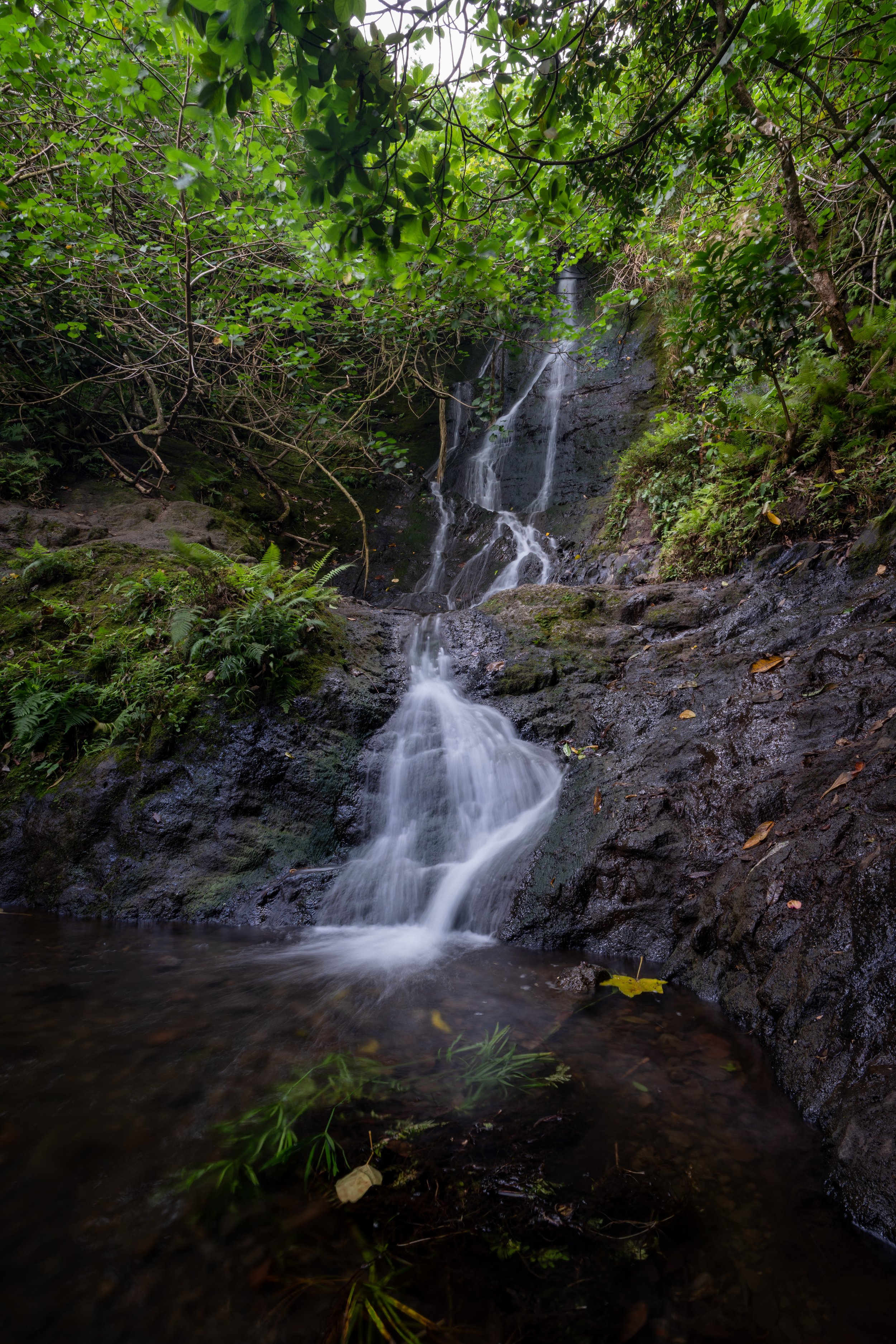
Ulupaina Trailhead
The Ulupaina Trailhead and the sections immediately following are the most confusing parts of the hike.
With that in mind, don’t rely on AllTrails to find the true trailhead because the true route and the AllTrails route won’t match until you reach the Upper-Lower Loop junction.
In any case, enter the forest at the most obvious-looking trailhead at the bottom of the hill.
Then, go right immediately after the trailhead to begin hiking uphill.
If you feel like you’re seeing a split in the lower trail, always choose the route to the right.
The correct path should be heading uphill until you reach the Upper-Lower Loop junction.
Upper-Lower Loop Junction (Ulupaina Loop Trail)
When the Ulupaina Trail comes to this split, go left to begin the Lower Loop, or go right for the Upper Loop.
That said, the Upper Loop is a much nicer, faster-moving trail, but it is steeper because it’s more of a direct path to the top. However, the Lower Ulupaina Loop tends to be slower-moving because there are almost always some trickier areas to navigate with fallen trees as you wind your way below the ridge.
Considering all this, I recommend hiking the more challenging Lower Loop first if you’re planning on hiking the full Ulupaina Loop, as the return hike down the Upper Loop will seem much nicer in comparison.
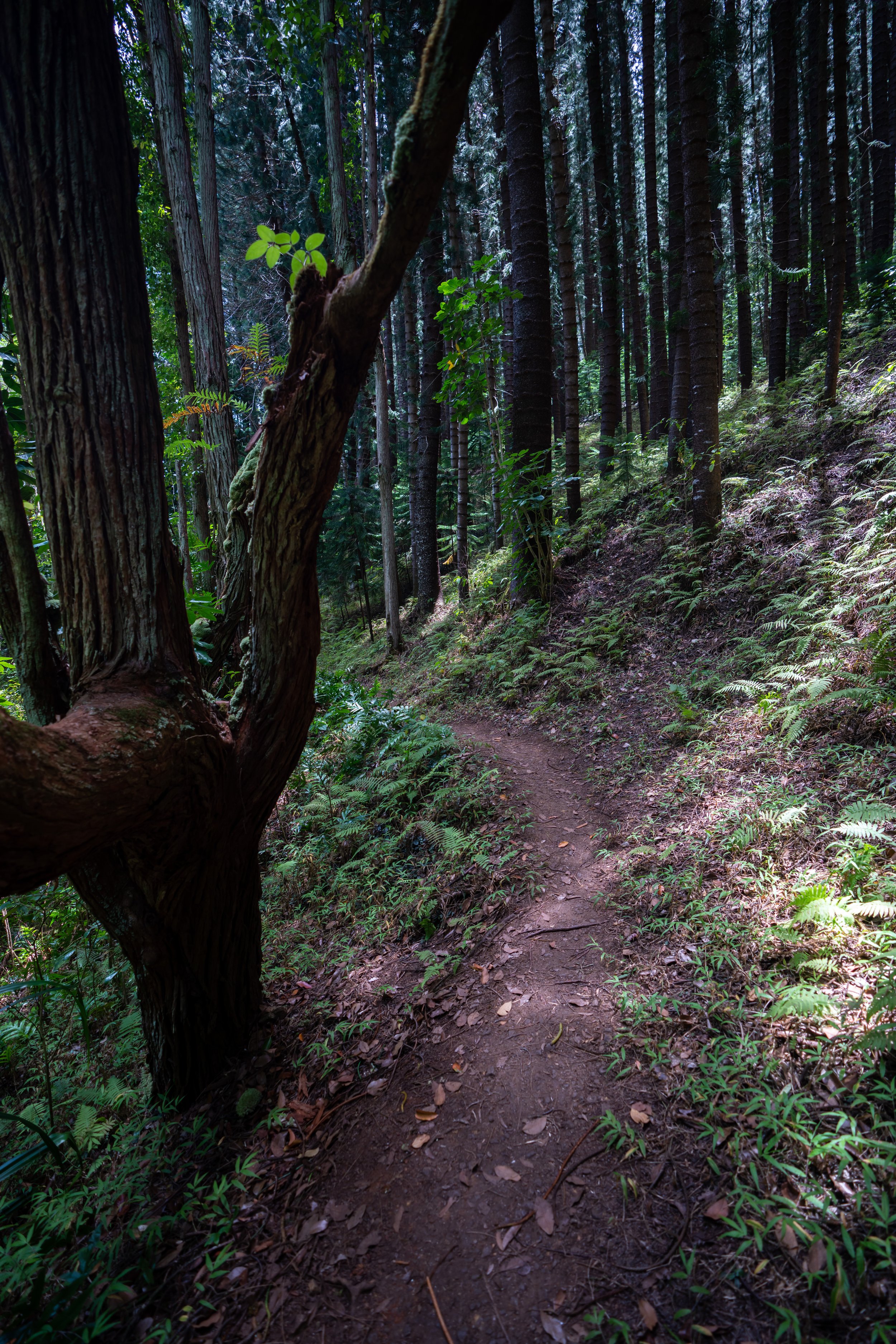
Ulupaina Lower Loop
Past the Upper-Lower Loop junction, the Ulupaina Loop Trail becomes much more obvious for the rest of the hike.
If you like to look out for native plants, the Lower Loop is much better to see a number of them compared to the Upper.
All of these downed trees came right after a multi-day windstorm.
On the far end of the Lower Loop, the Ulupaina Trail will make a hard turn to start climbing up toward the summit.
This is the steepest section on the Lower Loop, as it climbs to meet to the Upper Loop.
Second Upper-Lower Loop Junction
The photo below is where both the Upper and Lower sides of the loop meet just before the summit.
With that in mind, take a mental note of the area if you’re going to hike up the ridge to the summit because it can be very easy to miss the turn for the Upper Loop on the way back.
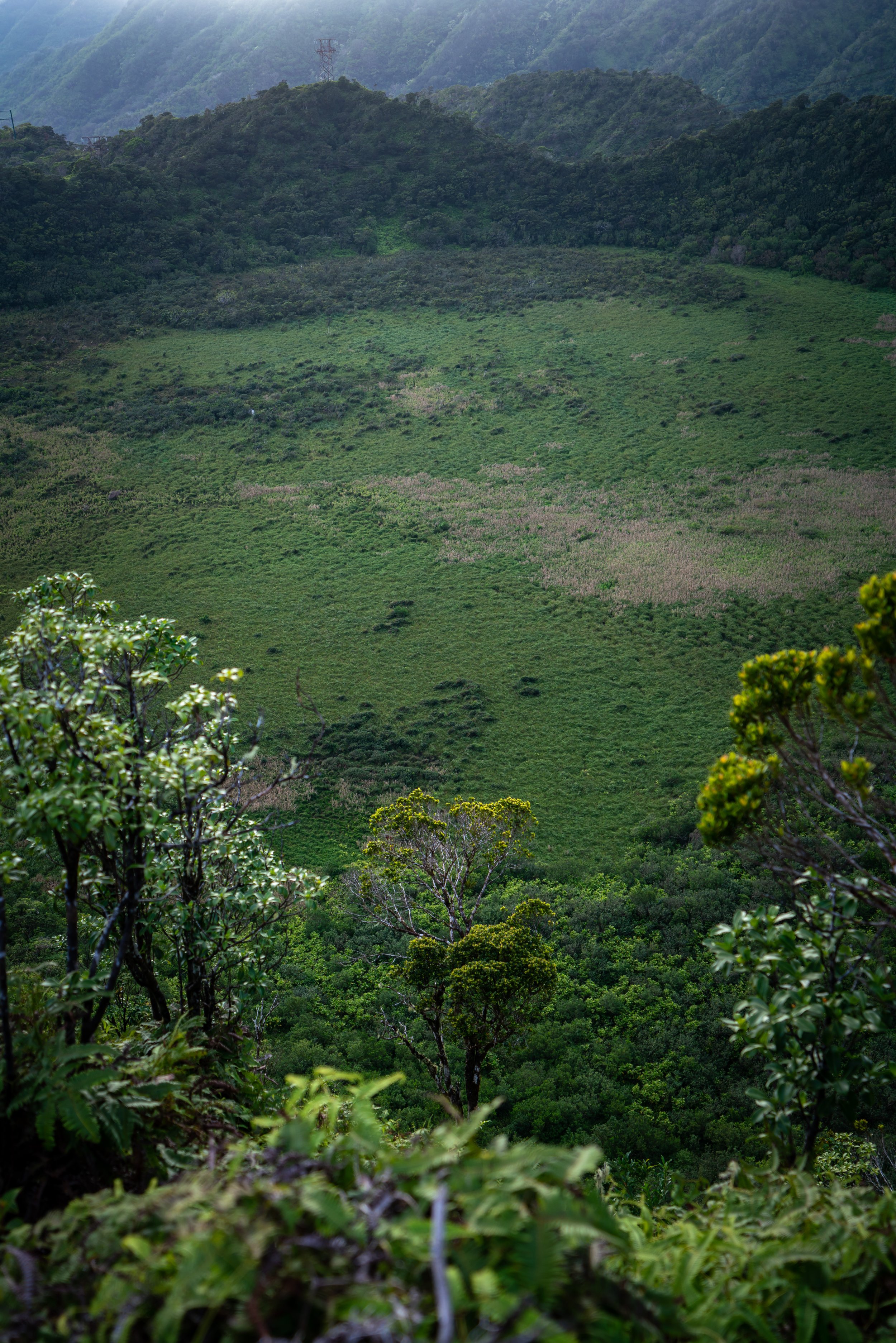
Ulupaina Summit
This is the summit of the community-managed Ulupaina Trail.
If you are curious to explore further, the trail continues just a little past the power lines, but it doesn’t go far before it transitions into a much more involved hike up the ridge.
Second Upper-Lower Loop Junction
This is the same junction as the photo above.
Here, go left to begin the Upper Ulupaina Loop back down to the trailhead.
Upper Ulupaina Loop
If you hiked the Lower Loop first, the Upper Ulupaina Loop will take a fraction of the time to get back to the trailhead.
At the clearing, the trail continues down to the left, where the original junction back down to the trailhead will be located shortly after.
Upper-Lower Loop Junction
This is the same split for the Upper-Lower Loop from the beginning of this post.
That said, go left to hike back down to the trailhead.
Native Plants on the Ulupaina Trail
Since Ulupaina is such a low-elevation trail for Hawaiʻi, most of the hike is dominated by non-native/ invasive species.
However, there are a handful of native plants on the Lower Loop, such as ʻŌhiʻa lehua, Uluhe, Hau, Hala, and Palaʻā, to name a few.
If you would like to learn more about these and many other native Hawaiian plants from across the islands, I encourage you to check out my separate post linked below.
Read My Separate Post: Native Hawaiian Plant Guide