Hiking the Hauʻula Loop Trail on the North Shore of Oʻahu, Hawaiʻi
Distance: 2.7 miles / 4.3 km
The Hauʻula Loop Trail on the North Shore of Oʻahu is a beautiful, scenic, and relatively easy day hike that can most similarly be compared to the ʻAiea Loop Trail in central Oʻahu.
I say this because the Hauʻula Loop Trail isn’t too long, doesn’t have too much uphill, and—compared to nearby trails, like the ʻEhukai Pillbox Trail—it’s not nearly as muddy as others typically are.
All in all, the Hauʻula Loop Trail is easily one of the best kid-friendly adventures on Oʻahu, and it’s one that I often think of as a great trail-running hike near Turtle Bay!
Hauʻula Loop vs. Maʻakua Ridge
If you’re trying to decide between the Hauʻula Loop Trail or the Maʻakua Ridge Trail, I personally recommend the Hauʻula Loop.
I say this because the Hauʻula Loop Trail has better views—on both the trail and of Kaipapaʻu Gulch—than Maʻakua Ridge does on the other side of the Maʻakua Gulch.
However, this opinion does not apply to the Papali Ridge Trail, as that is an entirely different and truly incomparable adventure to both the Hauʻula and Maʻakua Loop.
Read My Separate Post: Maʻakua Ridge Trail
Hauʻula Loop Trailhead Parking
Since parking is limited in the neighborhood leading up to the Hauʻula Loop Trail, it is best to park at the Hauʻula Beach Park, located directly across the street from where the trail begins on Hauʻula Homestead Road.
Note that the distance above is not the distance from the Hauʻula Beach Park, but rather, from the start of the first trail sign on Maʻakua Road.
Google Maps Directions: Hauʻula Beach Park
Hiking the Hauʻula Loop Trail
The Hauʻula Loop Trail begins at the end of Hauʻula Homestead/ Maʻakua Road, which is marked by a Nā Ala Hele trail sign for both the Hauʻula Loop and Maʻakua Ridge Trail.
Shortly after passing the sign in the photo above, the road will lead through two sets of gates before reaching the true trailhead, located about 0.1 miles (0.2 km) away on the right-hand side of the road.
Hauʻula Loop-Maʻakua Ridge Trailhead
After 0.1 miles (0.2 km), go right to being the Hauʻula Loop Trail, as the trail to the left begins Maʻakua Ridge Trail, along with Papali Ridge and the Castle Trail.
Read My Separate Posts: Maʻakua Ridge Trail / Papali Ridge Trail / Castle Trail
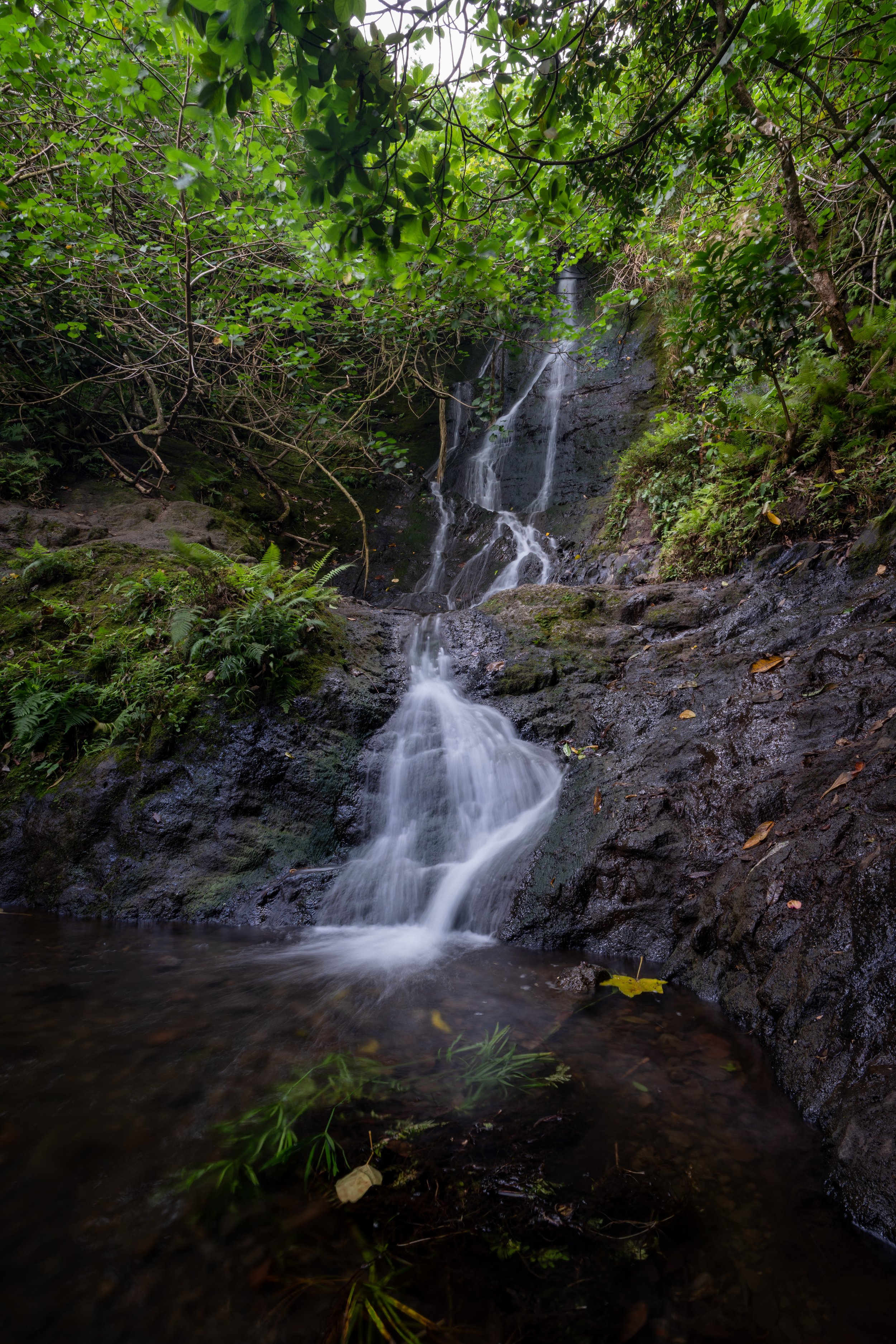
The Hauʻula Loop Trail starts off on a relatively flat trail before coming to a stream crossing within the first 0.1 miles (0.2 km) of the trailhead.
Depending on how recently it has rained, this stream may or may not be flowing.
After the stream crossing, the trail climbs a number of switchbacks until the split for the Hauʻula Loop.
Hauʻula Loop Trail
In my opinion, the north side of the loop (right) is the more beautiful half, and the south side of the loop (left) is the less beautiful half.
That said, I personally prefer to go left through the less-scenic half first because I think it makes the loop more enjoyable, which is exactly the direction this article is written.
From the Hauʻula Loop split, the trail gradually climbs about 430 ft. (131 m) until both sides of the loop meet at the second Waipilopilo junction.
East Waipilopilo Junction
The path leading up the ridge to the left is for the longer Hauʻula-Waipilopilo Loop Trail.
However, go right if you weren’t planning on hiking further than the Hauʻula Loop, as the less-trafficked Waipilopilo Trail is a bit more confusing and adds an additional 1.8 miles (2.9 km) to the hike.
After the first Waipilopilo junction, the trail descends down to a small stream crossing.
West Waipilopilo Junction
Shortly past the stream, the second Waipilopilo junction meets with the Hauʻula Loop Trail at the first Kaipapaʻu Gulch viewpoint.
In my opinion, the Cook Pine forest is the best part of the Hauʻula Loop, which is why I like to save it for the end.
Toward the end of the Hauʻula Loop, the trail descends back down to the original split from the beginning.
Hauʻula Loop Junction
At the end of the loop, go left to head back down to the trailhead.
Native Plants on the Hauʻula Loop Trail
Since the Hauʻula Loop Trail is relatively low-elevation adventure, there isn’t a ton of diversity when it comes to native plants. Furthermore, many of the plants that you will come across are non-native/ invasive species, like Christmas berry.
However, toward the upper elevations of the trail, you can see native species, like ʻĀkia, Uluhe, Koa, Palaʻā, Kōlea, and some ʻŌhiʻa lehua trees.
If you’d like to learn more about these and tons other native Hawaiian plants from across the islands, I encourage you to read more in my separate post linked below.
Read My Separate Post: Native Hawaiian Plant Guide