Hiking the Kamiloʻiki Ridge Trail on Oʻahu, Hawaiʻi
Distance: 4.6 miles / 7.4 km
The Kamiloʻiki Ridge Trail in Hawaiʻi Kai on Oʻahu is a fairly easy ridge hike—truly one of the easiest ridges on the island—to reach the Koʻolau Summit, a sentiment that certainly cannot be said about countless other ridge trails on Oʻahu.
Now, it’s important to mention that access and the very beginning sections of the Kamiloʻiki Ridge Trail are not very straightforward, which is why I’ve chosen to redact the first few sections of this article.
I do this from time to time when information about certain places is sensitive, and, in this case, I do not want to ruin relationships regarding this local hidden gem.
What I will say is that Kamiloʻiki Ridge is not accessible via the Pahua Heiau, and, in fact, the Office of Hawaiian Affairs has done a very good job of building up the overgrowth, including Kīawe, to make that access point very inaccessible—not to mention, the adjacent residents may confront you by attempting to begin there.
All this to say, please understand that these thoughts are written with the best intention of keeping local hikes local!
Hiking the Kamiloʻiki Ridge Trail
Assuming that you know the correct route to the top of Kamiloʻiki Ridge, this is where the trail continues to the Koʻolau Summit.
For the most part, Kamiloʻiki Ridge is very gradual, which is why I always say it’s one of the easiest day hikes on Oʻahu to reach the Koʻolau Summit.
If there’s one thing I hope these photos show, it’s that there’s very little shade on the Kamiloʻiki Ridge Trail, which is why I recommend wearing a hooded sun shirt to stay safe.
This is the view looking southeast toward Koko Head and the challenging side of the Koko Crater Rim Trail.
The Hoary Abutilon is always one of the more resilient native Hawaiian plants across heavily invaded environments, like Kamiloʻiki Ridge.
For those looking for a relatively short sunset hike on Oʻahu, this first 1.0 mile (1.6 km) on Kamiloʻiki Ridge is a great option, as the hike back down can be fairly quick and easy as long as you have a good headlamp!
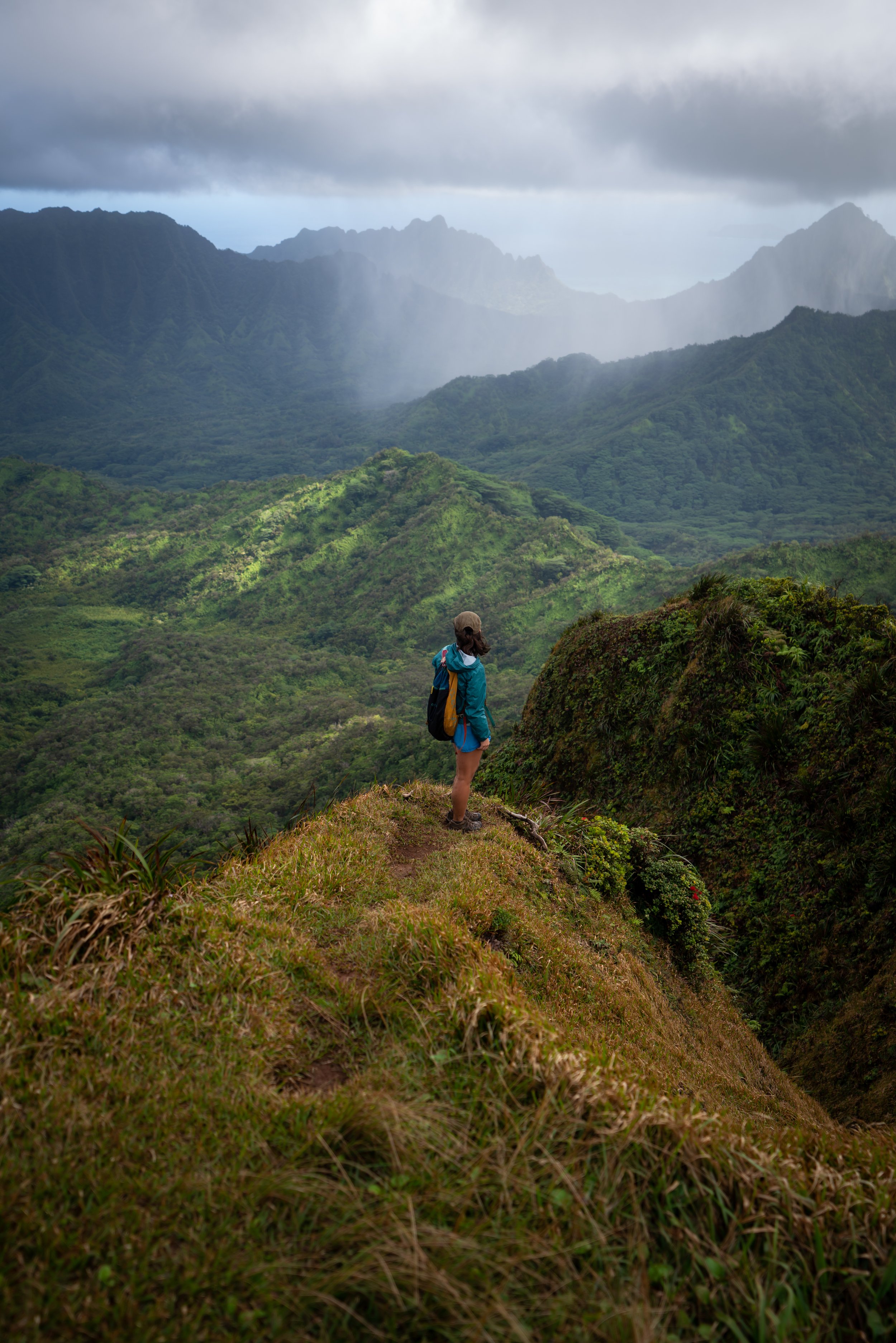
When the Kamiloʻiki Ridge Trail reaches this unnamed viewpoint about 0.5 miles (0.8 km) up from the point where the trail met the ridge, the rest of Kamiloʻiki Ridge can be seen in the distance!
This is one reason I think the Kamiloʻiki Ridge Trail moves fast, as nearly every section can be seen after the first 0.9 miles (1.4 km) to get to this point.
Alaheʻe trees lining the trail are some the more common native plants on the hike up Kamiloʻiki Ridge.
After the first 1.0 mile (1.6 km), including the steep ascent to get up to Kamiloʻiki Ridge, I personally think the trail becomes much easier, as the elevation change is minimal until it enters the overstory forest near the uppermost elevations of the hike.
Once again, I want to stress the importance of wearing good sun protection, as there is very little shade on Kamiloʻiki Ridge, even during the wet winter season, when the ridges across southeast Oʻahu are greener than they are here.
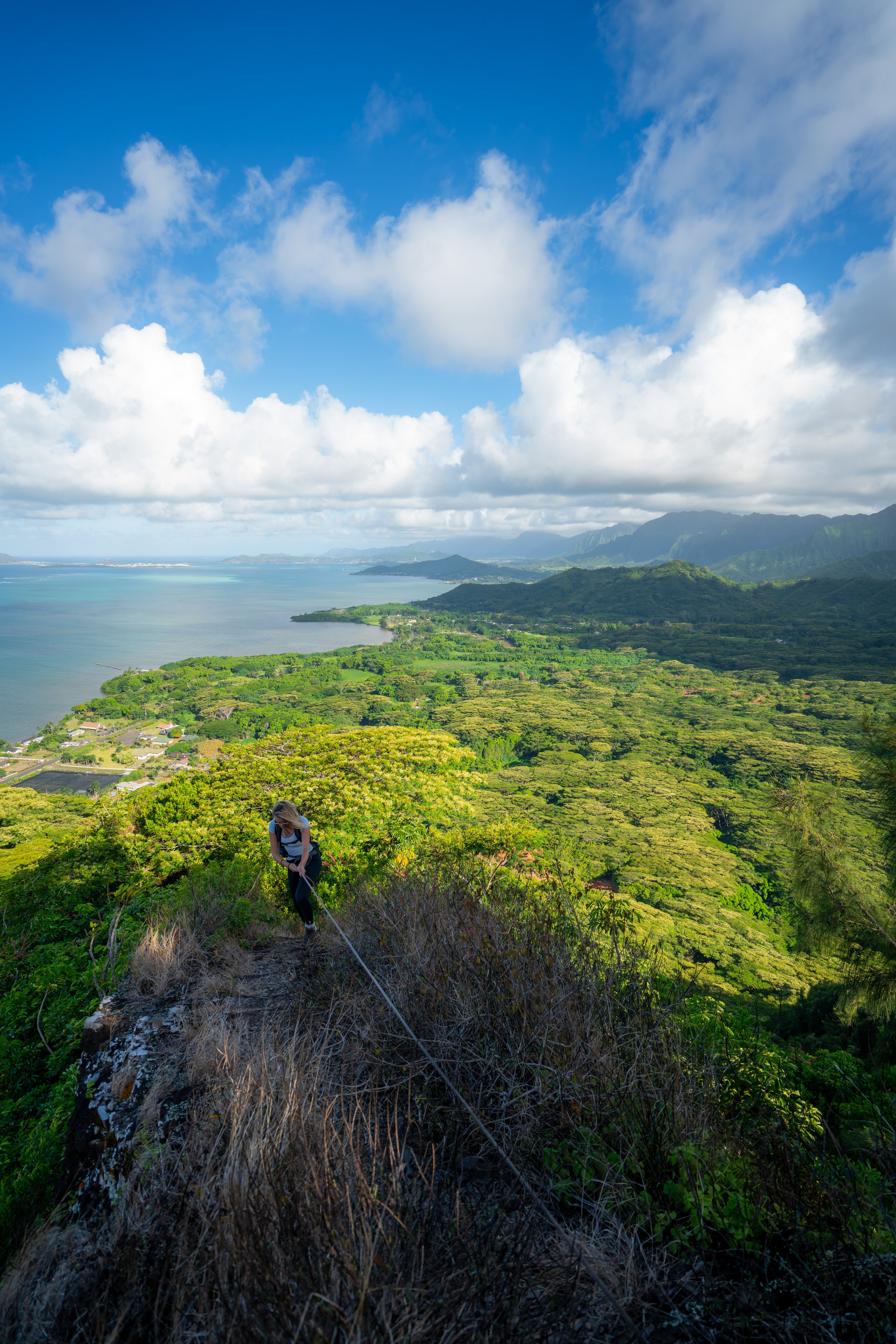
At this cliff face, the Kamiloʻiki Ridge Trail contours around the ridgeline on the right-hand side.
This short section is the most exposed place on the Kamiloʻiki Ridge Trail, and it should be considered a no-fall zone.
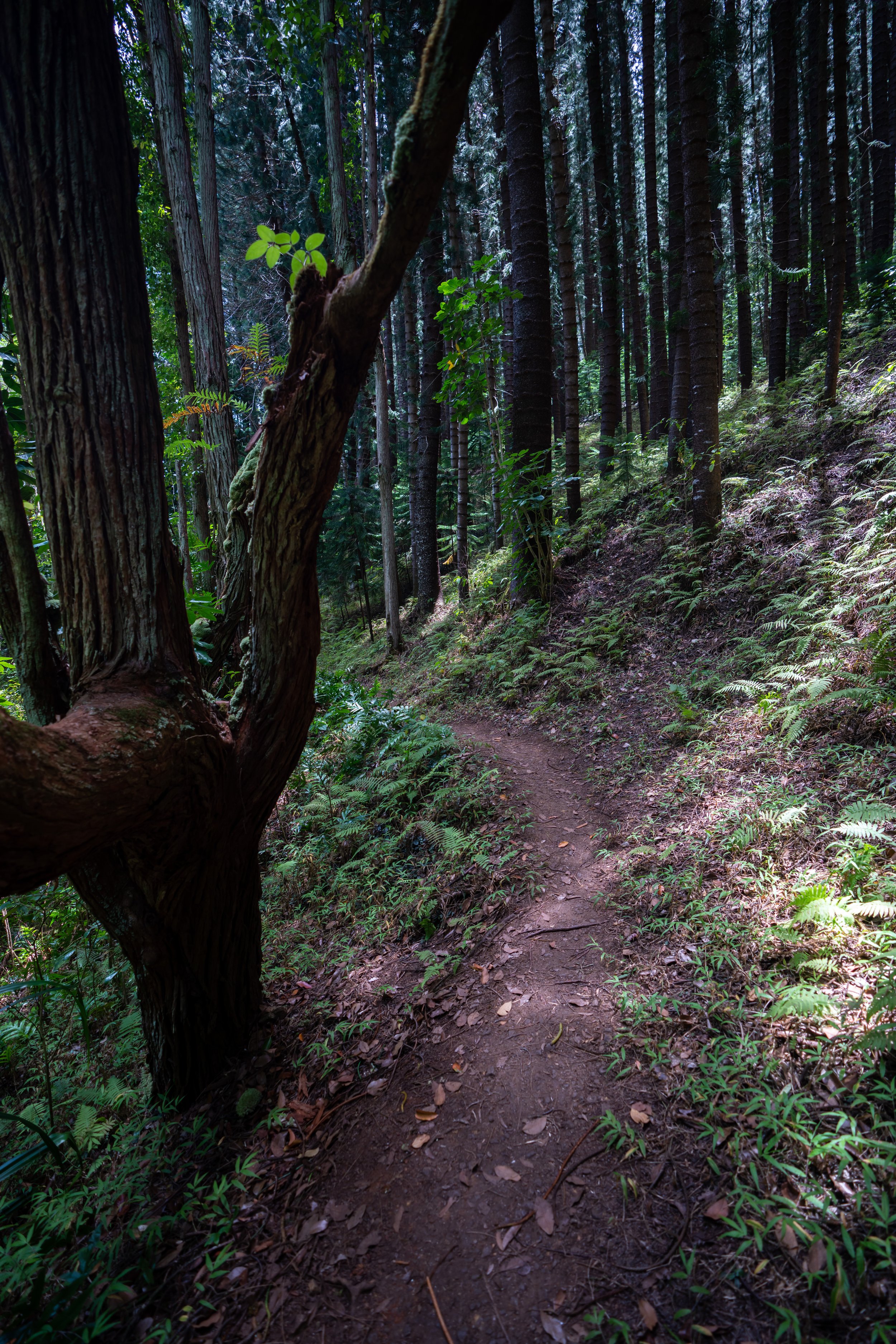
After the short exposed section, the Kamiloʻiki Ridge Trail will continue up a fairly gradual slope, but this will abruptly change a short distance ahead, as the trail enters the overstory forest prior to Camp Walden.
This is where the Kamiloʻiki Ridge Trail leaves the exposed ridgeline behind and enters an overstory forest that transitions from a False Koa to an Ironwood, and eventually to a towering Eucalyptus forest as it nears the Koʻolau Summit.
These upper-elevation sections before Camp Walden are some of the steeper areas on Kamiloʻiki Ridge, but the trail levels out significantly from the camp and on to the summit.
The tower that can be seen on the right side of the photo below is the top of Kamehame Ridge, which can make for a great loop and run back to the start of Kamiloʻiki Ridge for those interested in hiking farther on the KST.
If this is something that you are interested in, I recommend a good road-to-trail shoe like the ones linked below.
This is where the Kamiloʻiki Ridge Trail levels out prior to Camp Walden.
Camp Walden
Camp Walden is this seemingly ever-growing campsite on Kamiloʻiki Ridge that always seems to change every time I hike by.
However, I’ve never once ran into a group spending the night here.
Past the campsite, the Kamiloʻiki Ridge Trail continues along the ridgeline, which begins to enter some of the most confusing parts of the hike just below the summit.
Watch out for the anchor points hidden in the grass below this power line.
Kamiloʻiki Ridge-Kamilonui Valley Junction
Shortly before the final ascent to the Koʻolau Summit, the Kamiloʻiki Ridge Trail passes a somewhat hidden side trail on the left-hand side.
This is the route that leads into Kamilonui Valley, and it’s actually a fairly well-trafficked trail, as many hikers opt to make a loop out of Kamiloʻiki Ridge by using this route.
In any case, make a mental note of this junction to stay on the correct route for the hike back down, but to continue up to the summit, go straight at this split.
When the grass is much taller and greener, this flat section on the approach to the final two switchbacks can be confusing to navigate.
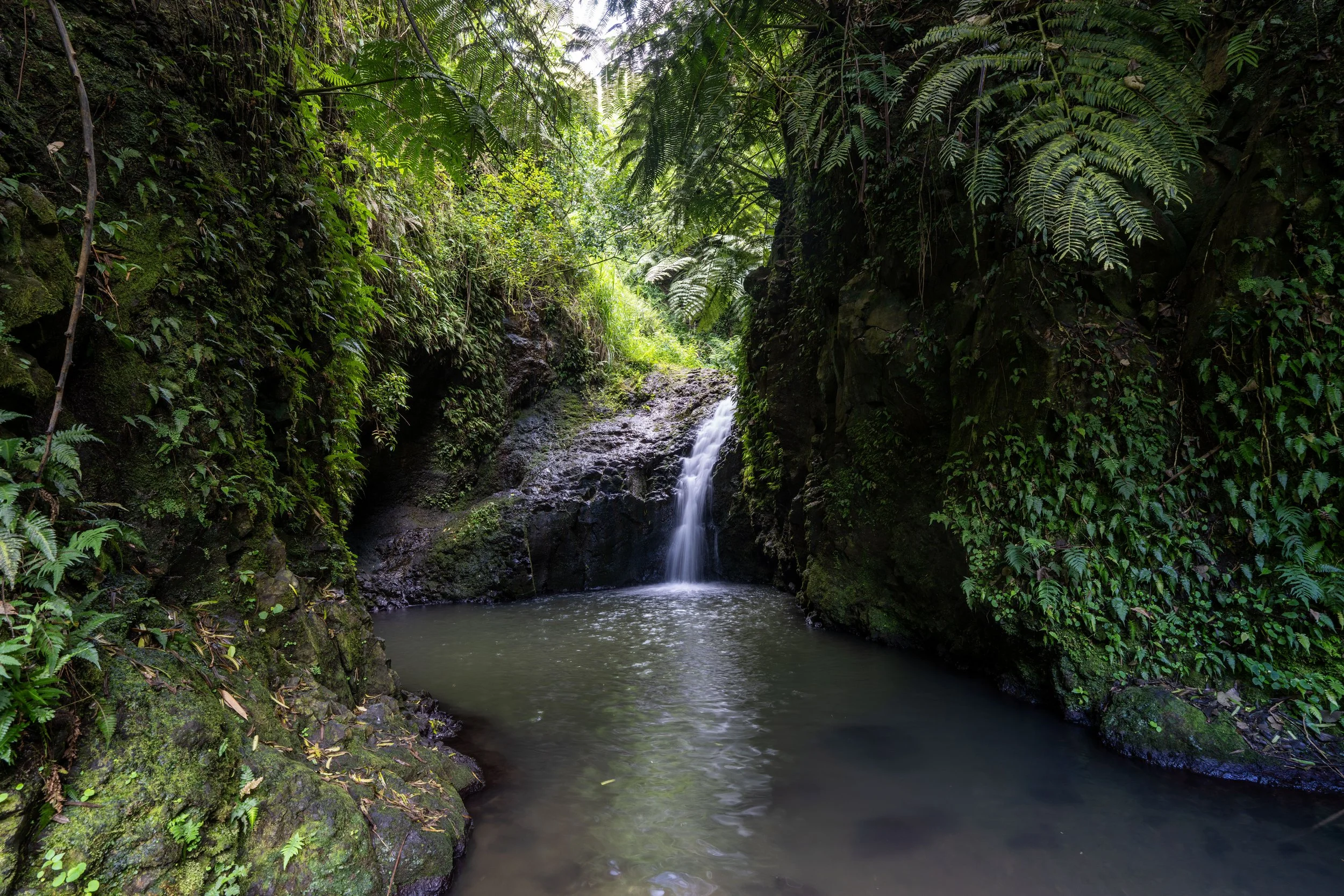
This beautiful, towering Eucalyptus forest atop Kamiloʻiki Ridge always feels like a hidden gem!
Just before the summit, Kamiloʻiki Ridge will climb two switchbacks.
That said, there’s either the option to go right here and cut up the steep hillside, or to go left and climb a much more gradual slope ahead.
This is the more gradual route up the first switchback.
This is the second switchback and the final one before Kamiloʻiki Ridge reaches the KST.
Kamiloʻiki Summit
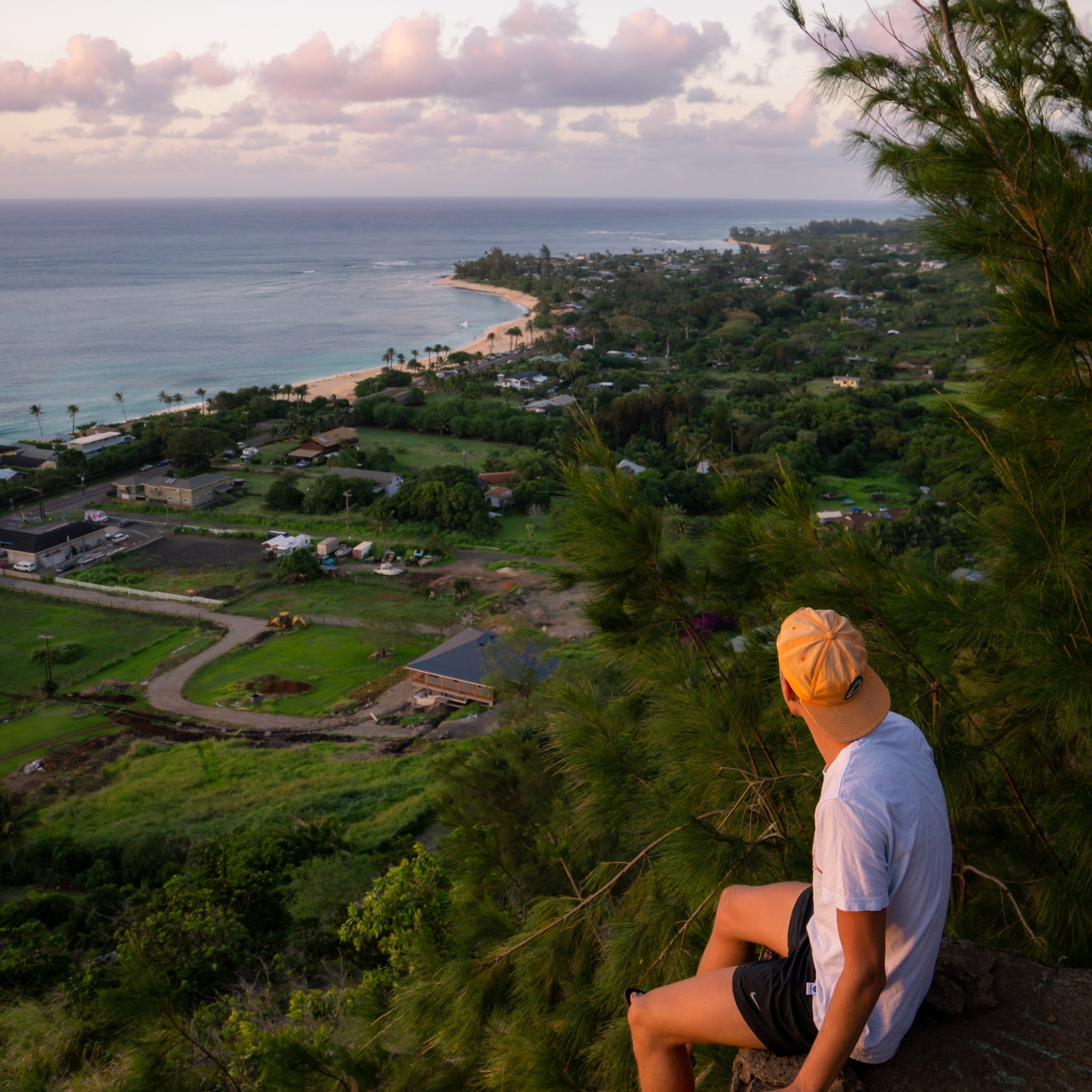
After 2.3 miles (3.7 km), the Kamiloʻiki Ridge Trail ends at a beautiful overlook above Waimānalo Beach, where it meets the Koʻolau Summit Trail (KST).
From here, you can see notable places, like Mt. Olomana, the Lanikai Pillboxes (Kaʻiwa Ridge), and, on the clearest days, Kualoa Ranch and Mokoliʻi to the north!
Koʻolau Summit Trail (KST)
If you weren’t planning on hiking past Kamiloʻiki Summit, I don’t recommend hiking farther on the KST, as summit trail is more difficult than the hike to get to this point.
That said, the next notable summits to the north include Mariners Ridge, followed by Pyramid Rock and Kuliʻouʻou Ridge, and to the south, the next significant trails are Kamehame Ridge (Deadman’s Catwalk), followed by the Makapuʻu Tom Tom Trail.
Read My Separate Post: Koʻolau Summit Trail (KST)
Native Plants on the Kamiloʻiki Ridge Trail
By Hawaiʻi standards, the entirety of Kamiloʻiki Ridge is a very low-elevation trail, meaning it is dominated by non-native, invasive species, like Fountain Grass and Koa Haole.
However, there are a number of native plants scattered throughout, such as ʻUhaloa, the Hoary Abutilon, ʻIlima, Wiliwili, Alaheʻe, ʻAʻaliʻi, ʻIlieʻe, and Pāpala Kēpau, to name a few.
If you would like to learn more about these and many other native Hawaiian plants from across the islands, I encourage you to check out my separate post linked below.
Read My Separate Post: Native Hawaiian Plant Guide