Hiking the Kuaokalā Trail on Oʻahu, Hawaiʻi
Distance (One Way): 2.6 miles / 4.2 km
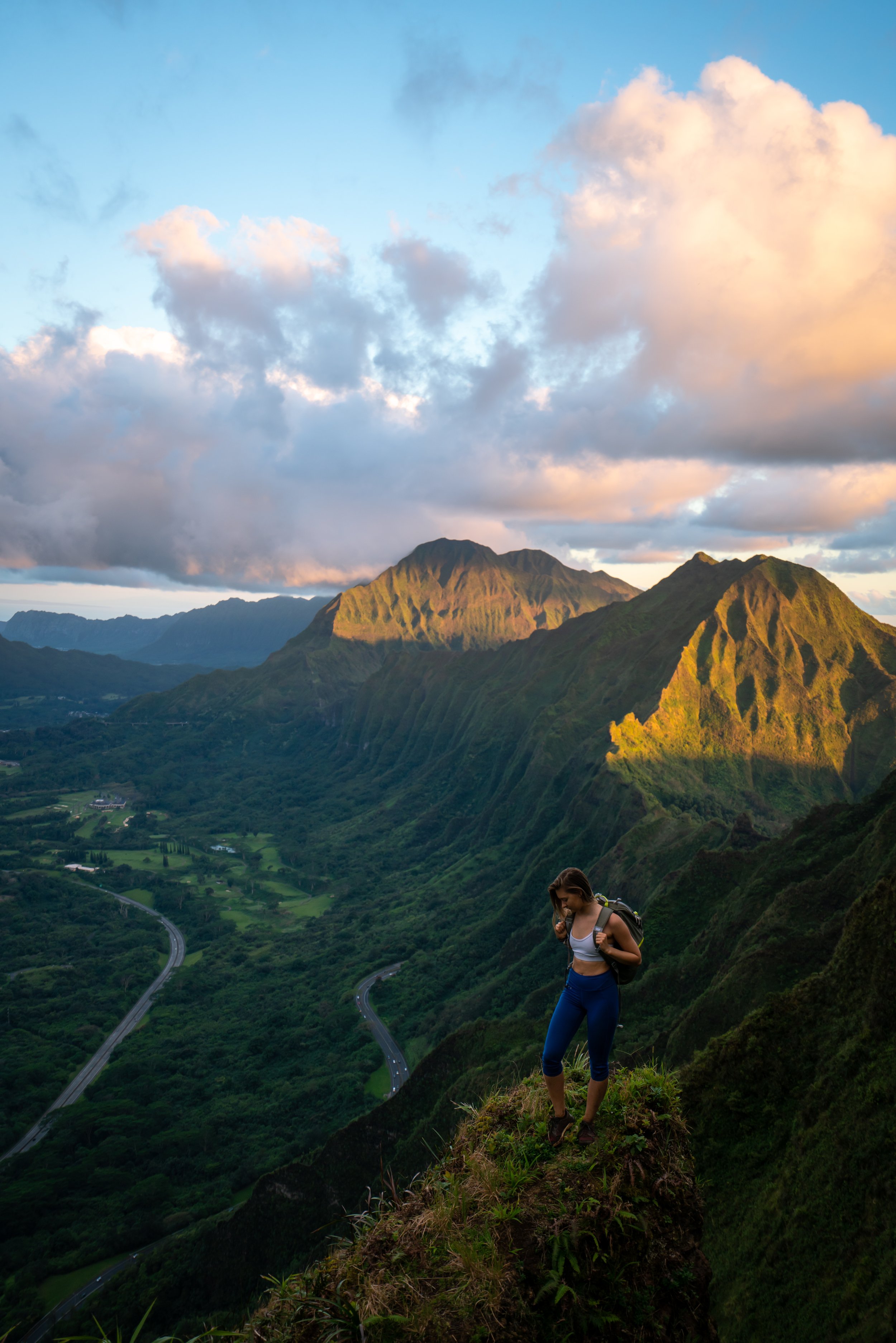
The Kuaokalā Trail in the Waiʻanae Mountains on Oʻahu is easily one of the most beautiful, secluded trails on the island, due in large part to the trail’s accessibility.
By this, I mean that there are two separate trailheads that hikers can utilize to access the Kuaokalā Trail, both located high in the Waiʻanae Range.
This means that you can either choose to begin via the Space Force Tracking Station, located above Yokohama Bay, or on the Keālia Trail in Mokulēʻia on the North Shore of Oʻahu.
That said, my personal preference always favors the Kuaokalā Trail via Keālia because of how annoying and tedious the process can be to access the trailhead from the West Side of Oʻahu, which includes getting a permit, the long drive on Farrington Highway, and dealing with the guided access process through the military base. On top of all this, I have even been rejected at the military gate with a valid permit because the Space Force 'forgot to put gas in their car' to escort my group to the public trailhead.
This is all to say that the Kuaokalā Trail via Keālia does not require a permit, but this doesn’t go without saying that hiking from Mokulēʻia adds an additional 3.3 miles (5.3 km) each way onto the hike.
However, I feel that the additional distance is worth the effort because the hiking from Keālia to Kuaokalā isn’t particularly difficult, and it is much more hassle-free!
Read My Separate Post:Keālia Trail
Do I Need a Permit to Hike the Kuaokalā Trail?
No. Permits are not required to hike the Kuaokalā Trail via Keālia or the Mokulēʻia Access Road.
They are only required if you desire to drive to the Kuaokalā Trail from the Kaʻena Point Tracking Station on the West Side of Oʻahu, which can cut out a lot of the distance and elevation gain required to get to the most beautiful parts of the trail.
Book Here:Kuaokalā Permit
Kuaokalā Trailhead Parking
Parking for the Kuaokalā Trail is located at either the Kawaihāpai Airfield in Mokulēʻia, formerly known as Dillingham, or at the parking area past the Kaʻena Point Space Force Tracking Station above Yokohama Bay.
This obviously depends on which route you prefer to hike, but if you read the introduction above, you’ll understand why I prefer to begin at Kawaihāpai.
Google Maps Directions: Keālia Trailhead / Kuaokalā Trailhead
Hiking the Kuaokalā Trail
Since I always prefer to begin on Keālia, this is where the Kuaokalā Trail begins after completing the hike from the Keālia Shelter.
To learn more about how to access the Kuaokalā Trail from the Keālia Shelter, including all the different turns through the forest reserve, be sure to check out my separate post.
Read My Separate Post: Keālia Trail
With that in mind, don’t forget to pack a headlamp for the long hike if you’re beginning from Keālia at Kawaihāpai.
After leaving the Kuaokalā gate, the trail immediately begins to drop steeply, as it follows the fence line.
Then, at this section in the photo below, go right to stay on the easiest path.
As the trail nears the areas with some of the best viewpoints, it will continue to follow the Mākua Valley fence line through the Black Wattle-Slash Pine forest until the gate shown below.
At only 0.9 miles (1.4 km) from the first Kuaokalā Trailhead, this gate in the fence around Mākua Valley is a very common turnaround point because the majority of the best views are located here or before the gate.
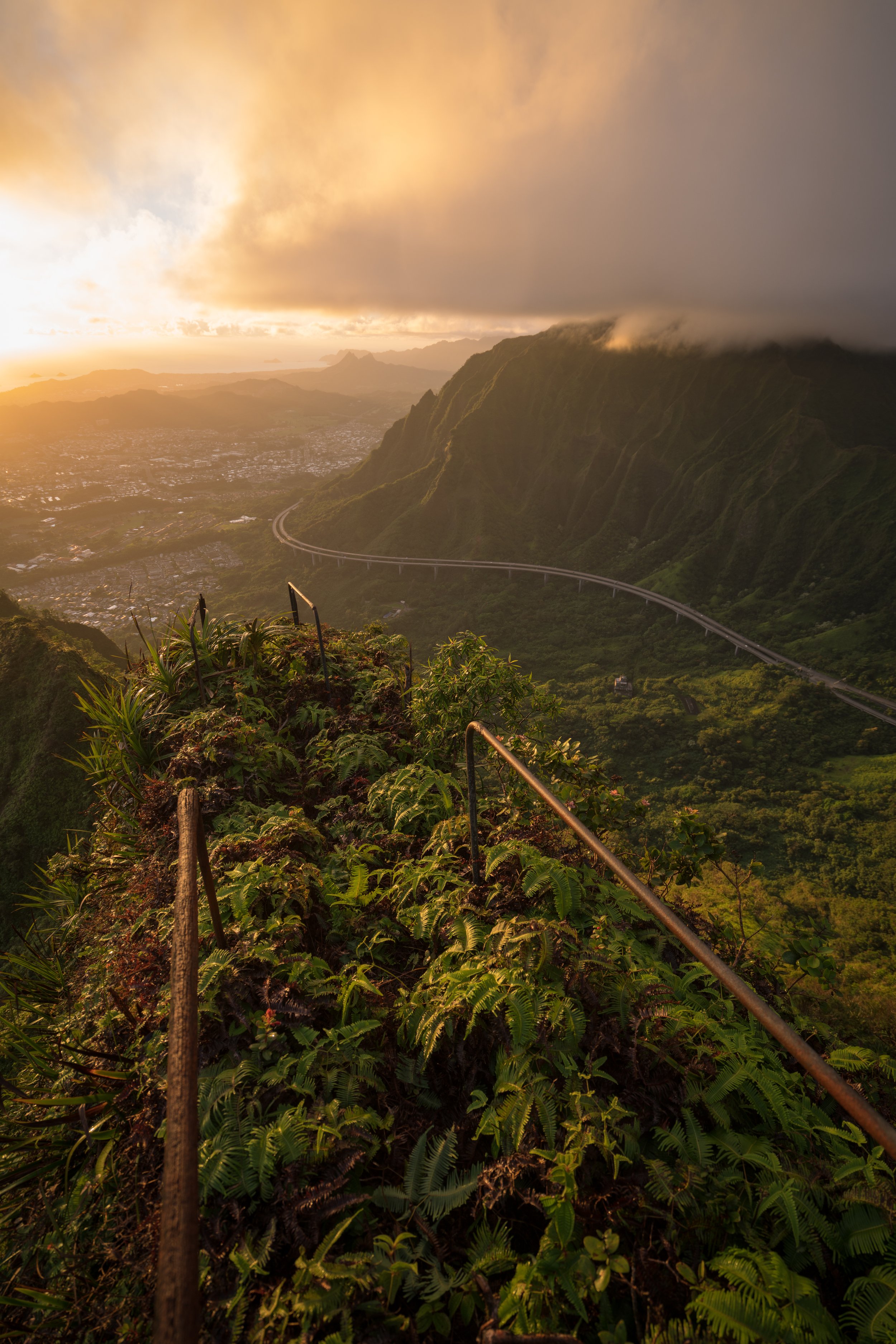
That said, the Kuaokalā Trail continues for another 1.5 miles (2.4 km) until the Space Force Tracking Station if you’re interested in completing the rest of the trail.
Past the gate in the photo above, the Kuaokalā Trail heads back into the forest for most of the remaining hike to the Kaʻena Tracking Station.
At this area, stay to the right, as the next stretch of the Kuaokalā Trail is follows a dirt road.
Kuaokalā Campsite 1
Along with the day-use permits, there are a number of different campsites along the Kuaokalā Trail that can be reserved for overnight use.
In my experience, Kuaokalā camping permits are considerably easier to come by compared to Peacock Flats, located further in the forest reserve.
That said, if you are interested in camping here at one of the other Kuaokalā sites, it’s definitely most practical to drive up from Yokohama Bay over doing the hike from Keālia. You’ll save an immense amount of time and effort, and a 4WD vehicle is not needed to drive up, park at the trailhead, and do the short hike to your campsite.
Book Here: Kuaokalā Camping Permits
After the road section, the Kuaokalā Trail turns right to begin hiking a real trail again for the remainder of the hike to the tracking station.
Kaʻena Point Space Force Tracking Station
This is the only publicly accessible part of the Space Force Tracking Station, with the public parking area located just past the access road shown in the photo below.
If you are interested in seeing the Kuaokalā Trail in the opposite direction from my preferred trailhead via Keālia, I encourage you to check out my separate post on the Waiʻanae Summit Trail (WST), written from west to east.
Read My Separate Post: Waiʻanae Summit Trail (WST)
Native Plants on the Kuaokalā Trail
While the majority of the Kuaokalā Trail is dominated by non-native/ invasive species, like Slash Pine, Kuaokalā is, by far, the best trail on Oʻahu to see ʻIliahi aloʻe growing throughout.
In addition, other natives like ʻŌhiʻa lehua, ʻIlima, ʻUhaloa, Palaʻā, Alaheʻe, and ʻĀkia can be found on the Kuaokalā Trail, to truly name only a few.
If you would like to learn more about these and many other native Hawaiian plants from across the islands, I encourage you to check out my separate post linked below.
Read My Separate Post: Native Hawaiian Plant Guide