


20 Best Things to Do in Badlands National Park
From its rugged, ever-eroding ridges to drive-up panoramic overlooks with views as far as the eye can see, Badlands National Park in western South Dakota is truly a paradise for any type of traveler!
By this, I mean that Badlands National Park has so much to offer, including scenic viewpoints, an array of wildlife, mostly flat, easy trails, and sunsets and sunrises that bring the best out of this dramatic landscape!
For all these reasons, I believe there is something for everyone to enjoy in Badlands National Park—especially considering the park’s open-hiking policy!
Yes, it is widely advertised that hiking and exploring off-trail is not only legal but encouraged in Badlands National Park, so long as you can do so safely and within your abilities. That said, scrambling up random ridges or simply pulling off the road to check out some nearby formations is sure to bring out the kid in everyone, which is why sometimes the best plan is no plan in Badlands National Park, as you truly can create your own adventure off any of the park’s main roads and trails!
What is the Best Time of Year to Visit Badlands National Park?
I’ve been fortunate to experience Badlands National Park multiple times during both the beautiful but popular summer season, as well as the cooler fall months, and my number one recommendation—by far—is to visit during the fall.
This is a larger sentiment that has to do with the greater Black Hills area, including Wind Cave National Park, but I mainly recommend the fall for two reasons.
The first is that fall in Badlands National Park is a much cooler and more comfortable time of year to hike. By this, I mean that the vast majority of trails in the Badlands have very limited shade, which can make hiking across the open prairie very hot and exposed, and the risk of summer afternoon thunderstorms is that much more increased.
However, visiting in the fall considerably mitigates all of these concerns, and that’s not to say there are any notable fall colors to enjoy in Bandlands National Park—apart from a few sporadic Cottonwood trees.
The second—and perhaps more important—reason is that fall in Badlands National Park is significantly less busy than the summer.
It’s no secret that Badlands National Park and the greater Black Hills area are often treated as drive-thru destinations on a roadtrip further west, meaning visitors are lucky to dedicate more than a few days in western South Dakota as they drive across the state to get to the much more popular and iconic Grand Teton National Park and Yellowstone National Park in northwest Wyoming.
That said, summer is easily one of the most popular and beautiful times to visit the parks in Wyoming, and Badlands National Park is simply a byproduct of that peak traffic.
How to Plan a Roadtrip to Western South Dakota and Northwest Wyoming?
If you were to ask me, I would say that it’s certainly more than practical to see the best of the Badlands, Wind Cave, the Black Hills, Devils Tower, Grand Teton, and Yellowstone in one summer road trip—but it just takes time.
A one-week vacation is not the right way to try and visit the best of everything there is to see and do, but for a trip to all the places mentioned above, I recommend traveling for closer to a month.
Now, I definitely hear the way that comes across, as most people can’t take that much time off work, which is why I would honestly recommend two trips over one.
Western South Dakota and Devils Tower can easily be their own trip, considering all there is to see and do, but as for the parks in northwest Wyoming, including the Beartooth and Wind River Mountain Ranges, this is a place that you don’t want to rush.
The Yellowstone–Teton area is, without a doubt, one of the best and most beautiful places to visit in the entire country—and the world—which is why I strongly recommend against trying to cram in all there is to see in South Dakota and Wyoming into one trip.
This is certainly just one person’s opinion, but if you were to dedicate less time on one trip to South Dakota and more time to northwest Wyoming on a different trip, it may not be impractical to fit in Glacier National Park for a trip closer to, or longer than, two weeks.
Hiking Checklist - Badlands
Obviously, for camping, you will need general backpacking gear. For this reason, I wrote a separate post about what backpacking gear is worth the money, from my experience, and what the best alternatives are to save you money.
Read My Separate Post: Best Ultralight Backpacking Gear
In addition, here is a complete list of must-have things that you will want for any hike in Badlands National Park.
20 Best Things to Do in Badlands National Park
The following list is written in no particular order of best or worst.
On a different note, you can save time when you arrive by purchasing your National Park pass, along with your other outdoor gear, at REI before traveling to the park!
1. Notch Trail
Distance: 1.5 miles / 2.4 km
The Notch Trail is the most iconic and popular day hike in Badlands National Park, largely due to the fun challenge that climbing the Notch Ladder poses in reaching the viewpoint at the end!
However, what most visitors don’t realize before visiting is that there is a little more to the Notch Trail beyond the ladder itself, including a few short, moderately exposed sections along the upper part of the trail that must be navigated to reach the overlook atop the Badlands Wall.
For all these reasons, I strongly recommend checking out my separate article, where I show detailed photos of the entire hike, including the most common off-trail viewpoints past the end of the Notch Trail that many hikers opt to check out before turning back!
Read My Separate Post: Notch Trail
2. Panorama Point
Panorama Point is the best all-around sunrise and sunset overlook in Badlands National Park, as its east-facing views make for a beautiful, direct view of the sunrise, while sunset to the west lights up the best of the layered ridges that can be seen in the photo below.
That said, Panorama Point is not nearly as busy as other sunrise viewpoints in the park, which is why I recommend it more for sunrise if you’re looking for a beautiful, quiet place to escape the crowds elsewhere!
Google Maps Directions: Panorama Point
3. Cliff Shelf Nature Trail
Distance: 0.5 miles / 0.8 km
The Cliff Shelf Nature Trail is a one-of-a-kind loop trail in Badlands National Park, as it traverses a unique microclimate filled with trees, birds, wildflowers, and much more!
I highlight all this because the Cliff Shelf Nature Trail, situated against the dramatic Badlands Wall, is quite the anomaly in Badlands National Park, given the fact that the vast majority of the landscape, including all the other established trails, has little, if any, trees.
This is why I recommend the Cliff Shelf Nature Trail for those who want to learn more about the Badlands and why this small, biodiverse hotspot is so special!
Read My Separate Post: Cliff Shelf Nature Trail
4. Big Badlands Overlook (Sunrise)
The Big Badlands Overlook is one of the best things to do in Badlands National Park because it’s arguably the best viewpoint in the park to catch sunrise!
On top of this, the overlook is only 3.8 miles (6.1 km), or about a 6-minute drive, south of Interstate 90, making the overlook one of the quickest, easiest ways to see the park in a hurry!
Google Maps Directions: Big Badlands Overlook
5. Saddle Pass Trail
Distance (One Way): 0.4 miles / 0.6 km
Elevation Gain: 210 ft. / 64 m
The Saddle Pass Trail is one of the best day hikes in Badlands National Park because it’s the only established day hike that climbs the dramatic Badlands Wall!
For this reason, the short hike up to Saddle Pass is one of the few trails in the Badlands that has any notable elevation change, which all combines to make the Saddle Pass Trail one of the best day hikes to scramble off-trail and create your own adventure!
Read My Separate Post: Saddle Pass Trail
6. Sage Creek Campground
The Sage Creek Campground is a free, drive-up campground within the park that operates on a first-come, first-served basis, rather than through reservations like Cedar Pass Campground near the Ben Reifel Visitor Center.
This is great because Sage Creek really isn’t all that far from some of the most popular areas within the park, like the Pinnacles Overlook—not to mention it’s an easy, mostly paved drive from Wall, SD to get there!
Google Maps Directions: Sage Creek Campground
7. Burns Basin Overlook (Sunset)
The Burns Basin Overlook is arguably the most underrated, overlooked side-of-the-road viewpoint when it comes to catching sunset in Badlands National Park!
I say this because it’s very likely that you’ll be the only one there, compared to the much more popular Pinnacles Overlook just a few minutes up the road—making the Burns Basin Overlook one of my personal favorites to sit back and relax, especially with a cold beer or a bottle of wine!
Google Maps Directions: Burns Basin Overlook
8. White River Valley Overlook
Located just a few minutes away from Panorama Point, the south-facing White River Valley Overlook is my second favorite choice for the best all-around sunrise and sunset viewpoint in Badlands National Park!
I say this because it truly doesn’t matter which time of day you decide to visit the White River Valley Overlook, as the soft, golden light on the layered Badland formations is uniquely beautiful at either time of day!
Google Maps Directions: White River Valley Overlook
9. Yellow Mounds Overlook
The Yellow Mounds Overlook is a unique area within the Badlands where many of the surrounding formations are distinctly yellow, unlike the rest of the landscape across the park.
This is because of a mineral called goethite, which is responsible for the mustard-colored formations at the Yellow Mounds Overlook and the surrounding area.
As for the overlook itself, it’s not the same as most of the viewpoints scattered along Badlands Loop Road, as it is more of a place to get out of your car and explore than a typical roadside overlook.
That said, the Yellow Mounds Overlook is a great place to climb around on all the surrounding formations, and it’s a great place to hike around with young kids, given that you’re never too far from where you parked!
Google Maps Directions: Yellow Mounds Overlook
10. Fossil Exhibit Trail
Distance: 0.25 miles / 0.4 km
The Fossil Exhibit Trail is a very short loop trail along one long boardwalk, where visitors can learn about the paleontological life of the Badlands and the greater area.
That said, the Fossil Exhibit Trail is officially known as the Fossil Exhibit National Recreation Trail, as it is a federally recognized hike in the National Trails System because of the educational experience that it provides park visitors.
All this to say, the Fossil Exhibit Trail is very short and easy, but expect to spend a little more time than a 0.25-mile (0.4 km) trail would lead you to believe, given how much there is to read along the short loop.
Read My Separate Post: Fossil Exhibit Trail
11. Quinn Road Prairie Dog Town
The Quinn Road Prairie Dog Town is a roadside Prairie Dog town off the intersection of Badlands Loop and Quinn Road, where visitors can see and hear countless Prairie Dogs and their burrows dotted along all sides of both roads.
For those trying to get a good photo of a Prairie Dog, I can speak from experience that it can take a bit of patience, which is why my best advice is to simply stand quietly, don’t make sudden movements, and use a telephoto lens if you have one.
Prairie Dogs are very quick to run to their burrows, but if you wait long enough, there’s almost always a good opportunity to capture a good photo with the right lens!
Google Maps Directions: Quinn Road Prairie Dog Town
12. Door Trail
Distance: 1.0 miles / 1.6 km
The Door Trail is a fun, easy, beautiful day hike that feels much more remote than it actually is!
I say this because once the trail passes through the natural 'Door,' the surrounding landscape becomes much more quiet as the trail follows a series of strategically placed trail markers out to a stunning viewpoint that overlooks a sea of Badland formations!
To add to this, the Door Trail is the best sunrise hike in Badlands National Park, which is almost certain to have no other visitors at this time, given the number of easy drive-up viewpoints scattered along Badlands Loop Road!
Read My Separate Post: Door Trail
13. Castle Trail
Distance (One Way): 5.2 miles / 8.4 km
The Castle Trail is the longest established trail in Badlands National Park!
That said, the Castle Trail is not a difficult adventure by any means, as the entirety of the hike from end to end has very little elevation change as it traverses the prairie along the upper Badlands Wall.
However, what can make the hike difficult more than anything else is the exposure, as there is very little shade along the vast majority of the trail.
This is why I recommend checking out my separate post to figure out how much or how little of the Castle Trail you’re interested in seeing, which should be dictated by the time of year you’re visiting.
This is also why only the one-way distance is posted above, because it’s not uncommon to start at one trailhead and hike one way to another if someone in your party isn’t interested in going along.
All this to say, my separate post can easily be navigated by using the pop-up bubble in the right-hand corner of the page, and note that I also believe there are better sections than others, which I discuss in more detail in the article linked below.
Read My Separate Post: Castle Trail
14. Medicine Root Loop Trail
Distance: 4.1 miles / 6.6 km
The Medicine Root Loop Trail is specifically listed after the Castle Trail because the two are truly synonymous, given that the southern half of the Medicine Root Loop is also the same as the Castle Trail.
This is why the two adventures are often combined into one longer day hike—typically from the Millard Ridge Trailhead on the eastern end.
However, for a much shorter hike, there is a lesser-known trailhead specifically for the Medicine Root Loop Trail, which you can learn all about in my separate post below.
Read My Separate Post: Medicine Root Loop Trail
15. Pinnacles Overlook (Sunset)
The Pinnacles Overlook is a panoramic viewpoint near the Pinnacles Entrance Station that overlooks a very similar Juniper-dominated microclimate that the Cliff Shelf Nature Trail traverses.
That said, the overlook itself is stunning, and it’s one of the best easy places to catch sunset in Badlands National Park, similar to how the Big Badlands Overlook is an easy-to-get-to overlook for sunrise.
However, because of its location, the Pinnacles Overlook is a little more on the busy end, and while it’s absolutely beautiful and deserves to be on this list in its own right, I recommend checking it out but planning sunset elsewhere if you want a more secluded, quiet experience.
Google Maps Directions: Pinnacles Overlook
16. Cedar Pass Campground & Lodge (Cabins)
The Cedar Pass Campground and Lodge is the most beautiful and centrally located place to stay within Badlands National Park!
This is because both the campground and the cabins are located near the Ben Reifel Visitor Center and all the best day hikes in the park, just up the hill beyond Cedar Pass.
Before visiting, know that advanced reservations are highly recommended for both the campground and the cabins, which are bookable through two different operators.
The campground is managed through the National Park Service, and reservations are made through Recreation.gov, unlike the Sage Creek Campground, which is first come, first served.
As for the cabins, they are operated through a different private vendor and are much more popular throughout the busy summer travel season. This is why it’s highly recommended that you secure your reservations as soon as you know your travel dates!
Book Here: Cedar Pass Campground / Cedar Pass Cabins
No information is collected by this website when using the Recreation.gov booking widget, and all reservations made here are secure through the official website.
17. Roberts Prairie Dog Town
The Roberts Prairie Dog Town is a lesser-known Prairie Dog town than the one off Quinn Road, but if you find yourself checking out the many overlooks off Sage Creek-Rim Road, I recommend stopping at Roberts Prairie Dog Town for a much quieter place to try to spot them!
I say this because, while Quinn Road is certainly more convenient to everything else there is to do in the park, Badlands Loop Road can be a bit busy, which is why stopping at the Roberts Prairie Dog Town is often a much quieter, more enjoyable experience overall.
Google Maps Directions: Roberts Prairie Dog Town
18. Window Trail
Distance: 0.2 miles / 0.3 km
The Window Trail is the best kid-friendly day hike in Badlands National Park, which has little to do with the trail itself and everything to do with the fun, off-trail scrambling just off the main trail.
What I mean is that the Window Trail itself is nothing more than a very short walk on a boardwalk to a beautiful overlook across the Badlands, but what I think is even more significant is all the fun climbing that visitors can do just to the right of the overlook.
This is why, if you don’t think of yourself as the type of person to venture out on the Castle Trail, the Door Trail, or the Notch Trail, I still recommend stopping at the Millard Ridge Trailhead for the very easy, fun exploring that visitors can do near the Window Trail!
Read My Separate Post: Window Trail
19. Deer Haven Trailhead
The Deer Haven Trailhead is a paradise for those who truly want to embrace the park’s open-hiking policy!
That said, there are no established trails that begin at the Deer Have Trailhead, meaning this trailhead is just that—a starting point!
For most visitors, the Deer Haven Trailhead is a great place to adventure if you’re interested in scrambling up some the nearby ridges, but for those looking to venture farther, it’s important to know that the main loop, often called the Sage Creek Loop Trail, is not a real trail. This is why I’ve chosen not to write about it.
Nevertheless, I highly recommend visiting the Deer Haven Trailhead, even if only for a few hours, as it’s a great place to escape the vast majority of crowds found in the busier areas of Badlands National Park—not mention it’s a really fun place for those that like to create their own adventure!
Google Maps Directions: Deer Haven Trailhead
20. Prairie Wind Overlook
Across the world, the prairie is widely regarded as the most heavily-altered ecosystem on Earth, and in the United States, estimates say that roughly 80% of all original grasslands and prairie have been destroyed, including and 99% of all tallgrass prairie, largely due to agriculture.
This is why, even though the Prairie Wind Overlook may not look like much, you really are standing in a place that’s quite few and far between across North America and the world today.
For all these reasons, I recommend taking the time to stop and read the signs, and hopefully see and appreciate how special this seemingly unimpressive landscape really is!
Google Maps Directions: Prairie Wind Overlook
20 Best Things to Do Near Badlands National Park
1. Wind Cave National Park
In western South Dakota, both Badlands National Park and Wind Cave National Park are seemingly synonymous and are often paired together into one roadtrip.
In fact, it’s only a 2-hour, 20-minute drive from the Pinnacles Entrance Station just to south of Wall and I-90 to the Wind Cave Visitor Center.
This is why, if you enjoyed reading everything I’ve written about the Badlands, I recommend checking out my separate article about Wind Cave National Park, where I share the same inside information about everything there is to see and do on all sides of the park.
Read My Separate Post: Wind Cave National Park
2. Wall Drug Store
I mean, did you even visit the Badlands if you didn’t sit on the giant Jackelope at Wall Drug..?
Jokes aside, Wall Drug is an iconic staple in the Badlands, as it has served as a roadside stop for travelers since they first opened their doors in 1931!
Needless to say, Wall Drug has grown over the years since its humble beginnings and lure of free ice water, where travelers today can stop in to shop, eat, and of course—sit on the giant Jackelope!
All this to say, there really is too much to try and fit into a couple sentences when it comes to visiting Wall Drug, as they have everything from different shops and ice cream to a U.S. post office, an art gallery, and so much more! However, among all there is to do at Wall Drug, don’t leave without trying a slice of their famous pie!
Google Maps Directions: Wall Drug Store
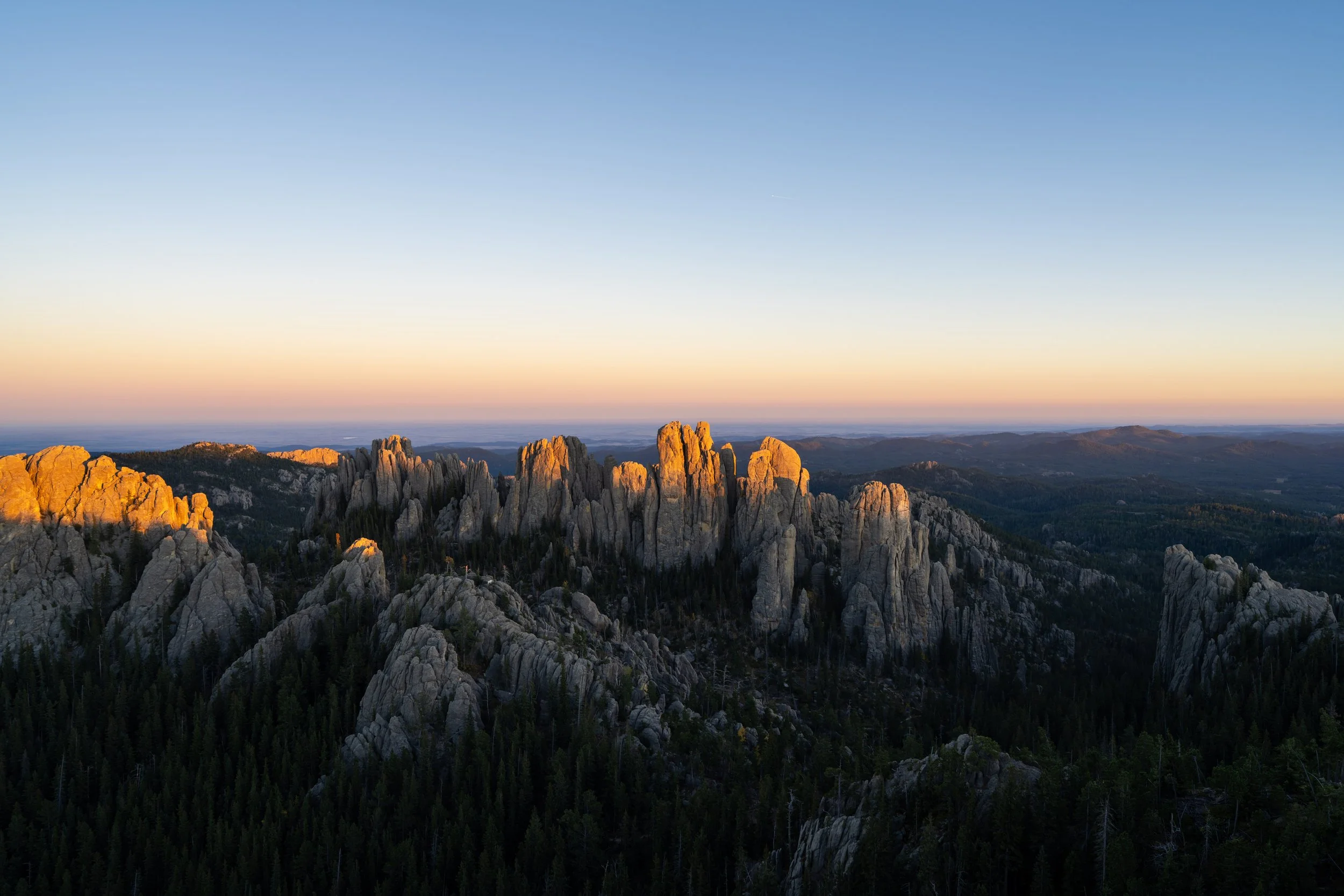
3. Little Devils Tower Trail
Distance: 2.8 miles / 4.5 km
Suggesting just Custer State Park and leaving it at that would be a bit of a lazy recommendation, which is why I wanted to dive deeper and highlight all the best things to do on this list, as Custer is truly one of the best and most beautiful places to visit in the Black Hills of western South Dakota!
That said, the Little Devils Tower Trail is my number one recommendation in Custer State Park because it’s such a fun, easy, and beautiful day hike, but most importantly, it’s the best sunset hike across the Black Hills!
Before visiting, I highly recommend reading my separate post, as there are a few short scrambling sections leading to the summit that some hikers may have difficulty navigating.
Read My Separate Post: Little Devils Tower Trail
My Print - Little Devils Tower Trail (Sunset)
4. Drive the Needles Highway
The Needles Highway in Custer State Park is a narrow, windy, scenic byway through one of the most fun and beautiful stretches of road in the Black Hills, passing iconic spots along the way such as Sylvan Lake, the Needles Eye Tunnel, the Cathedral Spires Trail, the Little Devils Tower Trail, and a number of other unnamed scenic viewpoints!
That said, if you plan to hike some of the best trails in Custer State Park, you’ll inevitably drive the best and most beautiful parts to get to the different trailheads off the highway, making the drive one of the best places to spend a full day!
Before visiting, it is imperative that only vehicles capable of fitting through the one-lane Needles Eye Tunnel drive the highway, which measures 8 ft. (2.4 m) wide by 9 ft. 9 in. (~3 m) high.
Google Maps Directions: Needles Highway (Needles Eye Tunnel)
5. Mount Rushmore National Memorial
Distance: 0.6 miles / 1.0 km
Mount Rushmore National Memorial is an iconic, must-see national landmark that I personally think is best enjoyed by hiking the short 0.6-mile (1.0 km) Presidential Loop, as the trail allows visitors the opportunity to learn about each of the four presidents featured and how the monument was carved when it passes the Sculptor’s Studio on the return side of the loop.
Before visiting, know that most federal recreation passes do not cover the parking fee at Mt. Rushmore, with some limited exceptions, including active U.S. military personnel with a valid ID.
Read My Separate Post: Presidential Trail
6. Black Elk Peak Trail (Highest Peak in SD)
Distance: 6.8 miles / 10.9 km
Elevation Gain: 1,050 ft. / 320 m
The Black Elk Peak Trail via Custer State Park is a stunning day hike through some of the most beautiful granite formations the Black Hills has to offer, ultimately ending at the Harney Peak Lookout—the highest peak in South Dakota!
That said, hiking up Black Elk Peak is not a difficult adventure by any means, as the trail to the summit is very gradual for what climbing to the highest peak in the state truly could be.
To add to this, the Black Elk Peak Trail via Sylvan Lake in Custer State Park is one of the best places to enjoy the fall colors in the Black Hills, as beautiful golden Aspens follow the trail all the way to the summit, making the hike that much more spectacular if you catch it at the right time of year!
Read My Separate Post: Black Elk Peak Trail
7. Drive the Spearfish Canyon Scenic Byway
The Spearfish Canyon Scenic Byway is an 18.5-mile (29.8 km) scenic drive between Spearfish, off I-90 on the northern end, and the Cheyenne Crossing at the southern.
The drive is renowned by both locals and visitors alike for a number of very short but beautiful day hikes, as well as some of the best fall colors the Black Hills has to offer! I recommend following the Spearfish Canyon Color Report for the most up-to-date local color conditions if this is something you’re interested in planning.
However, there is truly a benefit to driving Spearfish Canyon throughout the year, as swimming in Spearfish Creek and the Devil’s Bathtub is best enjoyed during the warmer summer months.
If you’re not into hiking, the relatively short 13.2-mile (21.2 km)out-and-back drive between Spearfish and Savoy is worth the trip alone, as Spearfish Falls can be enjoyed with very little effort—not to mention the Latchstring Restaurant is a great place to stop and grab a meal.
Google Maps Directions: Spearfish Canyon Scenic Byway
Read My Separate Posts: Spearfish Falls Trail / Roughlock Falls Trail / Devil’s Bathtub Trail / Community Caves Trail / 76 Trail / Eleventh Hour Gulch Trail
8. REDwater Kitchen (Spearfish)
I’ve speak highly about every restaurant on this list because I have truly spent so much time exploring western South Dakota, which has allowed me to try the good, the bad, and everything in between. I mean it when I say there are a few places I wouldn’t even consider putting on this list.
However, the recommendations on this list truly deserve to be here!
I write all this because when I write about the REDwater Kitchen specifically, I want to stress that I mean it when I say: I had the best pasta I’ve ever eaten at the REDwater Kitchen in Spearfish!
There’s only one other time on this huge blog that I’ve given such a glowing recommendation, which is when I ate the best steak of my life in Tusayan, Arizona, just outside of the South Rim of the Grand Canyon.
All of this to say, I highly recommend trying the Rabbit-Rattlesnake Sausage Pasta, which may sound weird, but wow, it was incredible!
Yelp: REDwater Kitchen
9. Sunday Gulch Trail
Distance: 4.1 miles / 6.6 km
Elevation Change: 550 ft. / 168 m
The Sunday Gulch Trail is arguably the most unique day hike in Custer State Park, as the trail descends a series of railings and staircases through a winding, narrow, beautiful gulch on the west side of Sylvan Lake!
After navigating these fun sections through Sunday Gulch, the trail then loops back around to the other side of the Sylvan Lake Shore Trail, making the adventure feel like two hikes in one!
Before visiting, I recommend reading my separate article, as there is a beautiful, narrow slot canyon on the return side of the loop that can be easy to miss if you take one of a few wrong turns when the trail nears Sylvan Lake.
Read My Separate Post: Sunday Gulch Trail
10. Drive the Peter Norbeck Scenic Byway
The Peter Norbeck Scenic Byway, also called Iron Mountain Road, is a stunningly beautiful drive that is often less talked about compared to the iconic Needles Highway in Custer State Park!
That said, the 16.5-mile (26.6 km) drive connects Keystone on the northern end with Highway 36, just a few miles west of Hermosa.
Similar to the Needles Highway, Iron Mountain Road also has height and width requirements for vehicles, as the winding scenic drive passes through three mountain tunnels, with the smallest being the Scovel Johnson Tunnel at 10 ft. 9 in. (~3.3 m) wide by 11 ft. (~3.4 m) high.
All that aside, the Peter Norbeck Scenic Byway is not only a great time for a number of beautiful viewpoints looking across the Black Hills, but for unique views of Mount Rushmore that can’t be seen from anywhere else, including the National Memorial itself.
Google Maps Directions: Peter Norbeck Scenic Byway (Norbeck Overlook)
11. Crazy Horse Memorial
The Crazy Horse Memorial is an iconic granite sculpture in the Black Hills, just to the north of Custer, dedicated to honoring the Lakota leader Crazy Horse and the culture of numerous Native American tribes.
Unlike most other destinations in the Black Hills, Crazy Horse is privately owned, operated, and funded, which is why the memorial is still under construction today.
If you’re visiting for the first time, know that visiting Crazy Horse is much more about the education center than the mountain, as the viewing platform is quite far away from the actual sculpture. The reason this photo looks so close is because it was shot on a telephoto lens, but in reality, photos don’t usually turn out this well without some kind of long lens.
On a different note, there is one hidden secret about Crazy Horse that occurs just twice a year, which is when the mountain is opened to the public to hike!
If you happen to be visiting the Black Hills on one of these days, be sure not to miss this event, as so few visitors actually get to see Crazy Horse up close, as you do on the hike up the mountain.
Google Maps Directions: Crazy Horse Memorial
12. Devils Tower National Monument
Devils Tower National Monument is the most out of the way, in terms of everything in Badlands National Park and the greater Black Hills area, but between Yellowstone and Grand Teton National Park in northwest Wyoming, Devils Tower is easily the best and most popular place to stop and visit!
Among everything there is to see and do at Devils Tower, the Tower Trail is easily the most popular adventure, but if you have more time to spend, I’ve hiked all the best day hikes within the National Monument, which you can read more about in each of my separate posts linked below!
Read My Separate Posts: Tower Trail / Joyner Ridge Trail / Red Beds Trail
13. Yellowstone National Park
In this part of the country, Badlands National Park, Wind Cave National Park, and the Black Hills are most often combined with a roadtrip across Wyoming to visit both Yellowstone National Park and Grand Teton National Park. The drive from the Pinnacles Entrance Station to the East Entrance near Sylvan Pass, west of Cody, WY, is roughly 7 hours and 50 minutes, which really isn’t all that bad considering most people make the long drive across Wyoming starting from Devils Tower, not the Badlands.
That said, Yellowstone National Park is a very big National Park that can feel overwhelming when visiting for the first time.
I say this because there truly is so much to see and do beyond the most iconic stops, like Old Faithful. This is why, I highly recommend reading my separate article linked below, as I have been fortunate to visit many times over many years, which is why I’m confident my local insights—including places to see wildlife, trails, food, camping, and so much more—are truly the best recommendations you will find!
Read My Separate Post: Yellowstone National Park
14. Grand Teton National Park
One certainly can’t talk about Yellowstone National Park without highlighting Grand Teton National Park just a few miles to the south, as the two really go hand in hand, just like the Badlands and Wind Cave!
As for Grand Teton, the National Park and Jackson, Wyoming, are often more enjoyed by the more adventurous types of visitors, as the rugged Teton Range truly is a playground—from the easiest of trails, like the Jenny Lake Loop Trail, to popular off-trail adventures, like the hike up to Delta Lake.
In either case, I have also visited Grand Teton National Park many times over many years, as I have Yellowstone, which is why I highly recommend checking out my separate post for the best insider secrets and information before visiting!
Read My Separate Post: Grand Teton National Park
15. Beau’s Diner (Rapid City)
Beau’s Diner in Rapid City is the best hometown breakfast diner in western South Dakota!
Think big portions, veterans telling war stories, coffee that keeps on coming, and reasonable prices at this local hidden gem!
However, if you’re looking for a great place to grab breakfast a little closer to Badlands National Park, stop in at the Red Rock Restaurant in Wall. They really are the best place to eat early in the morning!
Yelp: Beau’s Diner
16. Jewel Cave National Monument
Distance (Roof): 0.4 miles / 0.6 km
Distance (Canyons): 3.6 miles / 5.8 km
Jewel Cave National Monument is a small National Monument by land area, but, like Wind Cave National Park, hosts an expansive underground network of caves that is far from being mapped in its entirety!
That said, I personally think Jewel Cave is absolutely worth the visit, but don’t think it’s worth more than spending a few hours.
By this, I mean that booking either the Scenic Tour or the Discovery Tour are easily the two most popular options, but apart from the guided tours offered through the National Park Service, I recommend planning to spend more time elsewhere—especially when it comes to hiking.
I don’t write this to suggest that the two day hikes in Jewel Cave National Monument are bad by any means, but I simply mean that if time is a factor on your trip, I recommend planning to hike in Wind Cave National Park or the Black Hills over the trails in Jewel Cave.
However, if you have more time to spare, either before or after a scheduled cave tour, I recommend checking out the Roof Trail for the shortest and easiest option, or the Canyons Trail, which encompasses much of the Roof Trail.
Read My Separate Posts: Roof Trail / Canyons Trail
17. Graffiti Alley (Art Alley)
In the heart of downtown Rapid City is a little-known side street behind some of the best restaurants in town, known locally as Graffiti Alley, or Art Alley.
This is one of those things that I wouldn’t necessarily say is worth driving out of the way for if you aren’t in the area, but since it’s located just around the corner from some of the best coffee shops and restaurants downtown, like Tally’s Silver Spoon, I recommend walking over if you’re already in the area!
Google Maps Directions: Graffiti Alley (Art Alley)
18. Ma Cualli (Rapid City)
Ma Cualli is a local Mexican restaurant in Rapid City that I would argue is one of the best local restaurants to eat at when you’re in the area!
I say this because it’s one of those places where everything on the menu looks and smells amazing, making it hard to pick just one entrée!
Yelp: Ma Cualli
19. Cathedral Spires Trail
Distance: 1.8 miles / 2.9 km
The Cathedral Spires Trail is a fairly easy, beautiful day hike in Custer State Park, and because of this, it’s also one of the most popular trails off the Needles Highway!
Before setting off, there are a few things to know regarding the very limited parking situation, as well as the best times of day to hike the trail.
This is why I recommend reading all the details in my separate post, as the best photos are often taken when you’d least likely want to visit, based on where the sun rises and sets, as well as visitor traffic.
Read My Separate Post: Cathedral Spires Trail
20. Buzzards Roost Trail
Distance (Full Loop): 2.9 miles / 4.7 km
The Buzzards Roost Trail is a little-known hidden gem just outside of Rapid City that makes for a quick and easy adventure when you’re looking to hike something beautiful, uncrowded, but not too difficult!
On top of this, the Buzzards Roost Trail is the best sunset hike near Rapid City, though my number-one recommendation across the Black Hills still goes to the Little Devils Tower Trail in Custer State Park!
Read My Separate Post: Buzzards Roost Trail
5 Things to Know Before Visiting Badlands National Park
1. Badlands National Park has very few established trails.
Badlands National Park has just eight established trails, which, in large part, is intentional, given the park’s open-hiking policy.
This is why visiting the Badlands with no plan is actually a great plan, because those who are willing to explore can find beautiful, unique, and best of all, uncrowded viewpoints by venturing away of the main areas, especially from the Deer Haven Trailhead!
National Park Service: Badlands Open-Hiking Policy
2. Hiking is very exposed in Badlands National Park.
The wide-open prairie that extends across much of Badlands National Park is great for panoramic views, but not so great when it comes to shade and shelter—and I say shelter for good reason!
By this, I mean that Badlands National Park is essentially one big exposed landscape, which is why the vast majority of the hikes in the park have little-to-no shade.
This is also why I mentioned in the beginning that fall is one of the best seasons to visit, as hiking during the hottest summer months can not only be exhausting but dangerous.
Aside from the heat, summer afternoon thunderstorms are a serious risk across the Black Hills and the Mountain West in general, which is why it’s imperative to know the forecast before setting off on any adventure.
However, I can speak from experience that even the best planning still warrants knowing what to do in the worst-case scenario with lightning overhead, which is why I highly recommend learning how to react if you’re caught in a thunderstorm and find yourself as the tallest object around.
National Park Service: Lightning Safety Tips
3. The majority of the best views are found at named overlooks off Badlands Loop Road.
Since trails in Badlands National Park are quite limited and are largely located away from the dramatic cliffs along the upper Badlands Wall, many of the best views in the park are found at both named and unnamed roadside viewpoints.
That said, I do not recommend visiting most of the viewpoints at random, unless you don’t have a lot of time to spend in the park. I say this because the majority of the best overlooks are best planned at either sunrise or sunset, which brings out the best of the colors on the layered formations below the Badlands Wall.
4. Two to three days dedicated to Badlands National Park is a good amount of time.
I personally favor longer stays over shorter ones, but I do believe that just one day is too short of a time to see the best of Badlands National Park.
Instead, I recommend at least two full days in the park—if not three—which allows for a much more comfortable and relaxed visit, given how rushed and exhausting it can be to drive and stop over and over throughout a one-day visit at each overlook.
However, with at least two days, you can allow yourself more time to stretch your legs on some of the park’s best trails and strategically plan different viewpoints for different times of the day, as opposed to just cramming them all in at once.
5. Both Wall and Rapid City are fairly practical places to stay when visiting the Badlands.
In many National Parks across the United States, such as Yosemite, Crater Lake, Lassen Volcanic, and countless more, the biggest nearby city—or any town, for that matter—is often a long, remote drive to get to and from.
However, the Pinnacles Entrance Station is only a 12-minute drive from Wall, and a 55-minute drive from downtown Rapid City.
That said, Wall is by far the more practical option, for obvious reasons, as it should have everything you need, including great places to eat, for a few days in Badlands National Park!