Hiking the Delta Lake Trail via Lupine Meadows in Grand Teton National Park
Distance: 7.6 miles / 12.2 km
Elevation Gain: 2,275 ft. / 693 m
The Delta Lake Trail in Grand Teton National Park is a beautiful and popular day hike that climbs its way to a stunning, turquoise-blue alpine lake located directly beneath the Grand Teton and the Teton Glacier!
I would even go as far as to say that Delta Lake is one of the best things to do in Grand Teton National Park, as the hike is to the Tetons what the Beehive Trail is to Acadia National Park, or what Angels Landing is to Zion National Park.
That is to say, I highly recommend adding the Delta Lake Trail to your Grand Teton bucket list if it’s your first time visiting, but all this goes without saying that this beauty has inevitably made Delta Lake one of the most popular adventures among those visiting the park and Jackson for the first time.
Furthermore, I do not believe the hike up the Delta Lake Trail and the steep off-trail scramble at the very end is an adventure for all people of all abilities. I say this because the hike up to Delta Lake is not maintained by the National Park Service, and as a result, it is what they commonly call a 'social trail,' unlike the established trails that leads to the hidden junction and the start of the true Delta Lake Trail.
With all that in mind, the Delta Lake Trail is easily one of the best and most beautiful day hikes in Grand Teton National Park, but before visiting, I highly recommend preparing both in terms of knowing where to leave the maintained trail, as well as having the proper hiking gear for the off-trail sections up the final steep ascent at the very end.
Delta Lake Trailhead Parking
Parking for the Delta Lake Trail is located at the Lupine Meadows Trailhead, a joint trailhead that serves countless different day hikes and climbs, like the hike up the Surprise and Amphitheater Lakes Trail, as well as the climb up the Grand.
This is exactly why the Lupine Meadows Trailhead is one of the top three busiest trailheads in Grand Teton National Park, next to the Jenny Lake Trailhead and the Phelps Lake Trailhead.
That said, this traffic is largely driven by the increased popularity of Delta Lake over the years, which is to say: you need to park early in order to find parking at all, as most stalls are typically taken well before sunrise, with it being nearly impossible to find a spot about 30 minutes after during the busy summer travel season!
Seriously, get there early, or you’re at the mercy of someone returning from their hike hours later.
Google Maps Directions: Delta Lake Trailhead (Lupine Meadows)
Hiking Checklist - Yellowstone–Tetons
Here is a complete list of must-have things that you will want for any hike in the Yellowstone–Teton area.
Hiking the Delta Lake Trail
The Lupine Meadows Trailhead can be found at the far southern end of Lupine Meadows Road, just a few steps past the last parking area.
This final lot is the hardest place to find parking, as spots are typically taken in the afternoon hours by those beginning an overnight climb up the Grand or other nearby peaks.
Take these signs seriously, as I have hiked the Delta Lake Trail many times, and I have never not seen a bear.
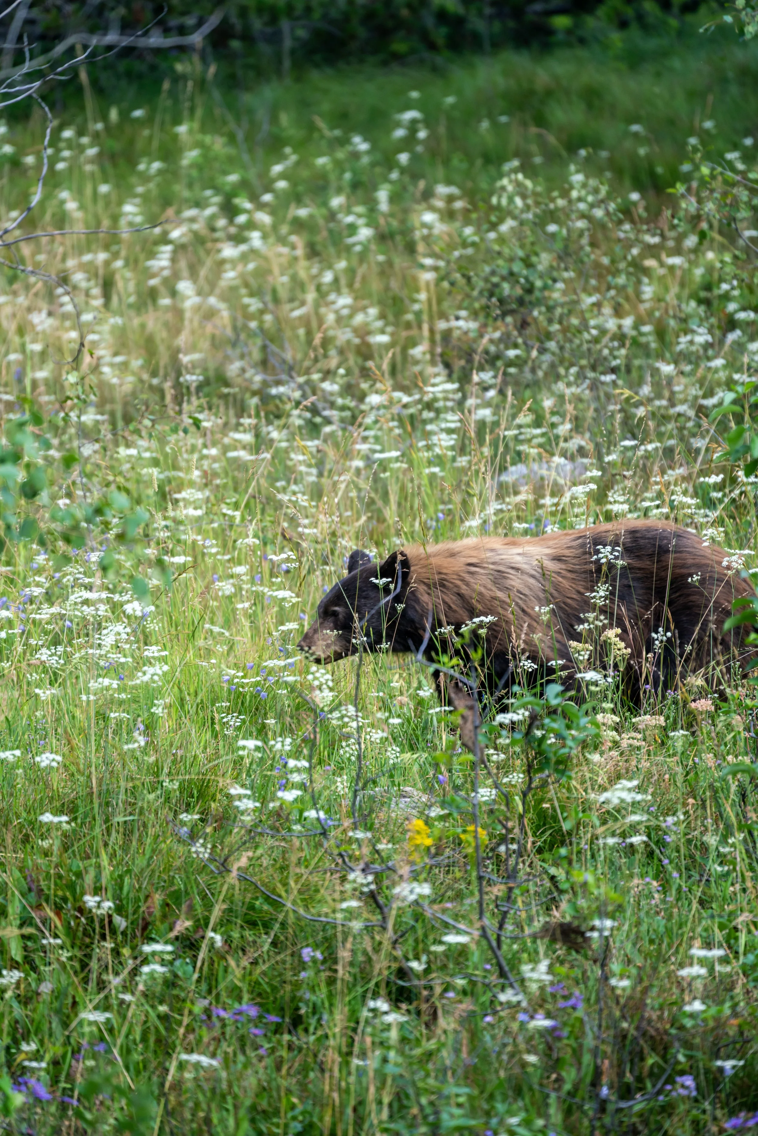
In fact, on the hike when I took these photos, I saw four different bears, which is why I feel confident saying it’s at least as likely as not that you will have an encounter.
In the beginning, there isn’t much to know about the hike to Delta Lake, as the first 0.4 miles (0.6 km) of the trail are very flat.
However, this doesn’t last long, meaning that after these initial sections, the Delta Lake Trail is almost always climbing—especially after it branches away from the maintained trail that leads up to Surprise and Amphitheater Lakes.
This is exactly where I had my first Black Bear encounter on the day I took these photos—not 10 minutes into the hike!
This big boulder marks the start of what is a long, near-constant ascent to Delta Lake.
That said, the climb remains fairly steady for most of the hike up the maintained trail, but it isn’t until the Delta Lake Trail branches away and begins the social trail that the hike significantly gets much steeper.
This is where the Delta Lake Trail crosses Glacier Gulch Creek, the same creek that the trail will parallel up the final steep slope at the very end, just before the lake.
This is where the Delta Lake Trail starts to turn west and up the ridge that leads toward the Valley Trail junction and the start of the switchbacks.
The big boulder in the photo below marks 1.0 mile (1.6 km) from the Lupine Meadows Trailhead, meaning that, from this point, there is only about 0.8 miles (1.3 km) left to the Valley Trail junction and the start of the switchbacks.
This is where the Grand Teton can start to be seen through the trees for the first time!
This is where the trail noticeably starts getting steeper, and it’s why some hikers may want to use trekking poles on the hike up to Delta Lake—something that can certainly be useful on countless different day hikes across Grand Teton National Park, as many trails in the Teton Range involve a lot of elevation change!
When the Delta Lake Trail starts following the crest of the ridgeline, it’s a nice sign that there is only 0.4 miles (0.6 km) to go before the Valley Trail junction.
The peak on the left-hand side of the photo below is Nez Perce.
Delta Lake-Valley Trail Junction
After 1.8 miles (2.9 km), the Valley Trail finally splits from the rest of the trails that climb higher up the Tetons, including the trail to Delta Lake.
Once here, go straight at this junction to continue up the Delta Lake Trail and begin the switchbacks toward the hidden junction that branches off the maintained National Park Service trail ahead.
This is the beginning of the switchbacks and what I would argue is the most important part of the Delta Lake Trail to start paying attention to, as many hikers miss the hidden turn to Delta Lake—especially when there are no other hikers near the unmarked junction.
That said, the Delta Lake Trail follows the maintained National Park Service trail up six switchbacks, not including the sharp turn at the Valley Trail junction shown above.
The easiest way to know when you’re getting close is to look out for the Garnet Canyon junction, located between the fifth and sixth switchbacks.
This is where the Delta Lake Trail turns the first of six switchbacks on the hike to the unmarked junction.
This is the second of six switchbacks.
One of the most notable things about the switchbacks, other than remembering to count them on the hike up, is that there is a lot less shade following the Valley Trail junction.
This is why I highly recommend hiking in a hooded sun shirt, especially considering how much easier it is to burn at these higher elevations, which climb to just above 9,000 ft. (2,743 m) at Delta Lake.
This is where the Delta Lake Trail turns the third of six switchbacks on the hike up to the hidden junction.
Many times when I’ve seen bears on the hike to Delta Lake, they are either cutting straight up or down the hillside, or hanging out right next to the trail looking for food.
This is why it’s important to be paying attention, no matter what part of the trail you are on.
This is the fourth switchback before the hidden junction at switchback six.
This is where the Delta Lake Trail turns the fifth switchback, which is a nice sign that the Garnet Canyon junction is not far ahead!
Delta Lake-Garnet Canyon Junction
After 3.2 miles (5.1 km), the Delta Lake Trail passes the junction where the Garnet Canyon Trail continues up to the Lower Saddle and the Grand Teton beyond.
This is the second and final junction before the Delta Lake Trail branches away from the maintained National Park Service trail.
That said, go straight at this split and continue hiking for a little less than 0.2 miles (0.3 km) to the next switchback to find the most important split, where the Delta Lake Trail branches away.
Delta Lake-Surprise & Amphitheater Lakes Junction
This is the sixth switchback, located about 3.4 miles (5.5 km) from the Lupine Meadows Trailhead, where the Delta Lake Trail finally splits off from the maintained National Park Service Trail that continues up to Surprise and Amphitheater Lakes.
What this really means is that this is where the National Park Service stops maintaining the trail, and, as a result, the rest of the hike to Delta Lake follows what is commonly called a 'social trail.'
This explains why there are a number of different routes that all climb their way up to Delta Lake after leaving the maintained trail, but this post shows the best, fastest, and most straightforward route up Glacier Gulch Creek to Delta Lake.
All that to say, go straight at the sixth switchback following the Valley Trail junction to begin the unmaintained portion of the Delta Lake Trail.
Read My Separate Post: Surprise & Amphitheater Lakes Trail
Initially, the Delta Lake Trail will drop below the maintained trail and parallel the steep slope as it navigates its way over to Glacier Gulch Creek and the steepest part of the entire hike.
There really is no consistency, as the Delta Lake Trail constantly climbs and descends on the traverse over to Glacier Gulch Creek.
Over the years, the National Park Service has made minimal improvements to the Delta Lake Trail, such as this bridge, recognizing that while it is not a maintained trail, some steps are necessary to protect the popular hike as it only continues to attract more and more visitors every year.
I mention this because I have personally seen changes to the Delta Lake Trail over the years, and I only expect this trend to continue, as it is simply too difficult to ignore the popularity of the hike and the impacts that all this traffic has on the landscape.
This is the beginning of the steepest part of the Delta Lake Trail, meaning that, from this point to the end, the hike is a near-constant climb up a talus slope that can be loose at times.
That said, micro-spikes, at the very least, may be necessary to hike to Delta Lake safely—especially when visiting Grand Teton National Park early in the season, such as in May and often through much of June.
Yes, this final ascent really is this steep, and it’s why I previously mentioned that trekking poles can be very useful on the Delta Lake Trail.
From this point, the rest of the hike up the steep slope can be seen, as Delta Lake is located just beyond the trees at the top of the hill in the photos below!
This is the bottom of the final steep section before the trail levels out just steps before Delta Lake.
Just before Delta Lake, the trail splits, with the path to the left leading toward the south side of Delta Lake and the path to the right leading toward the creek and beyond to the north side of the lake.
In my opinion, I’ve always liked the south side of the lake more for taking photos of Delta Lake with the Grand Teton in the background, but this article shows the path toward the creek and the center view of Delta Lake.
Delta Lake
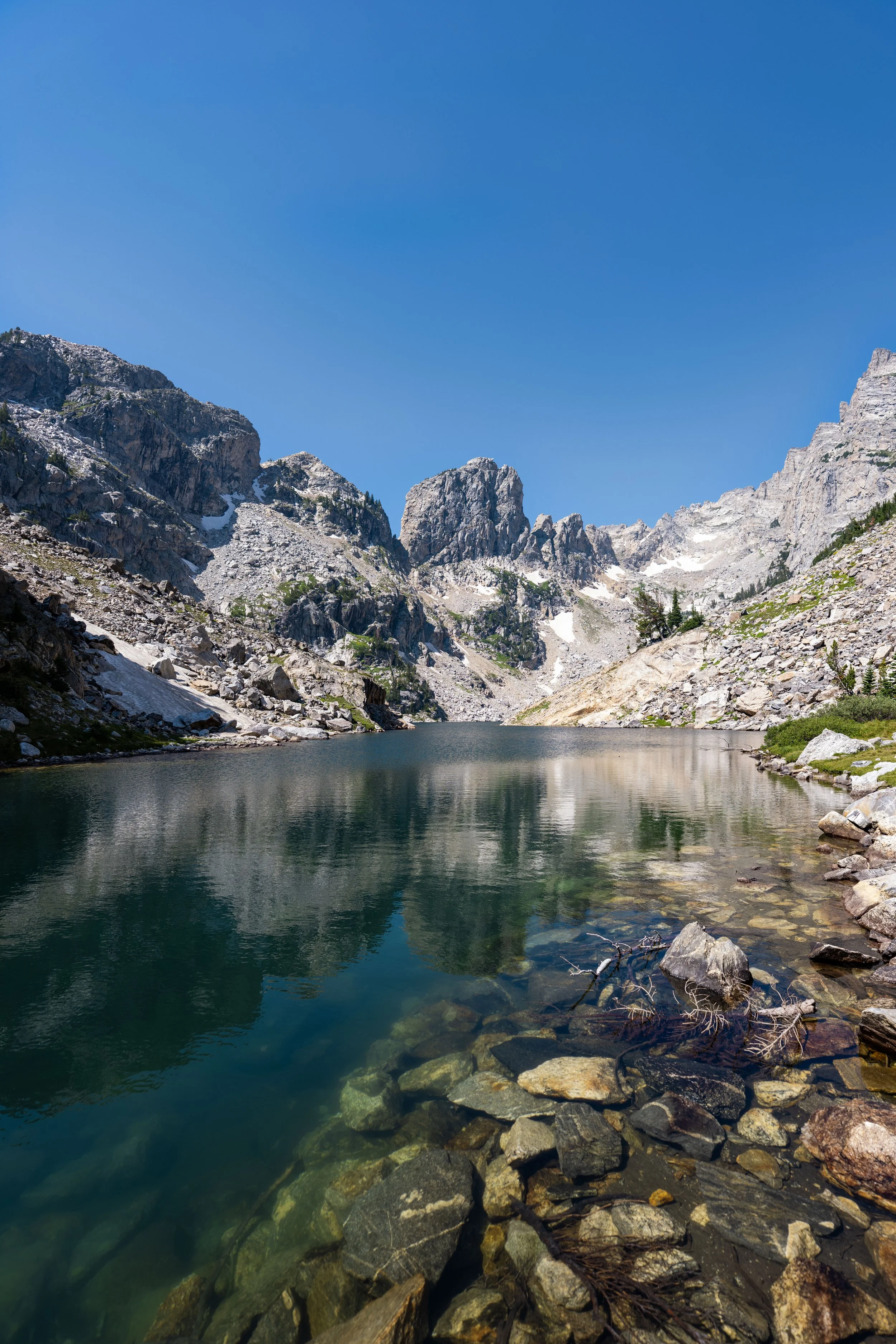
After a nearly constant 3.8-mile (6.1 km) climb, the steep trail finally reaches the beautiful turquoise-blue waters of Delta Lake beneath the Grand Teton and the Teton Glacier!
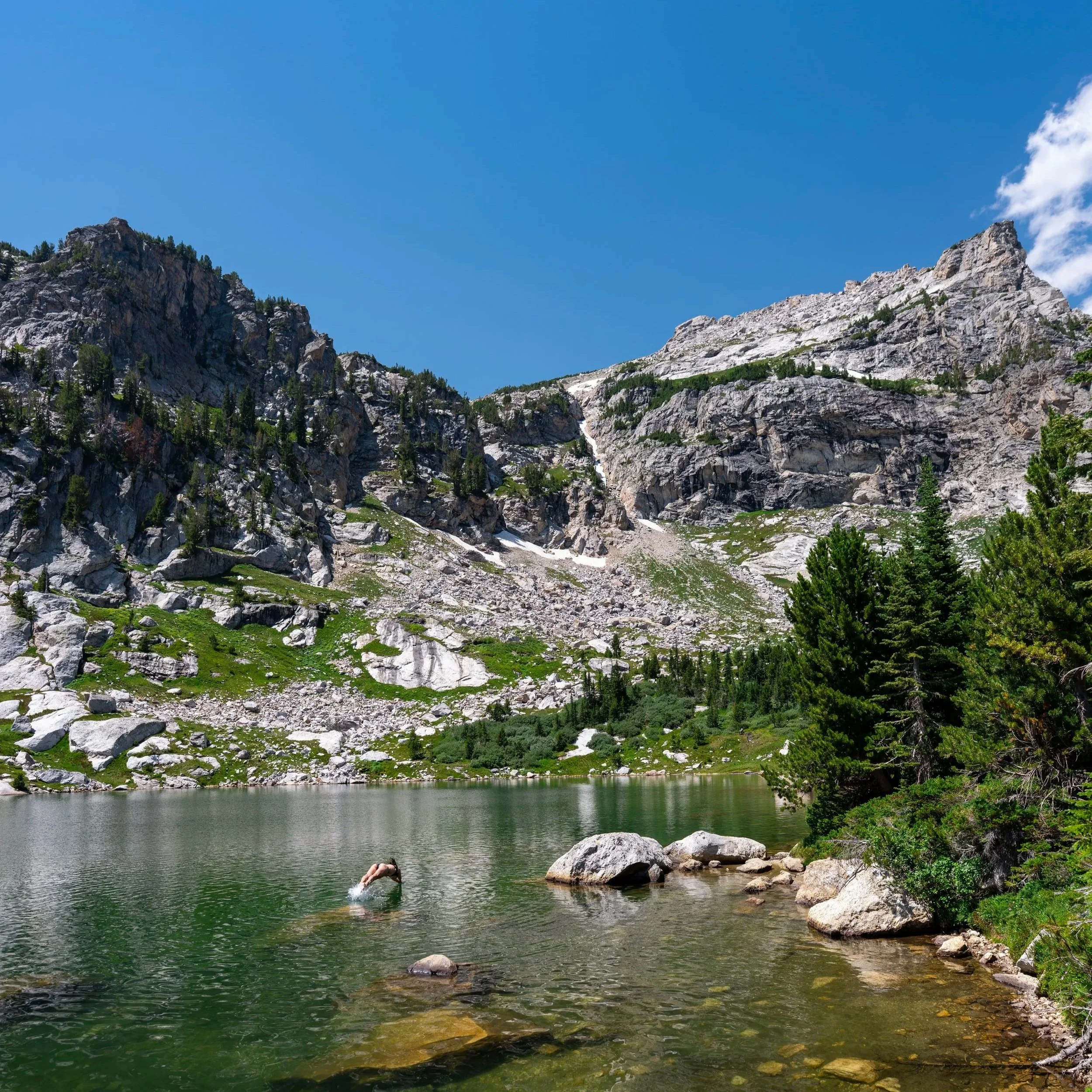
That said, Delta Lake can make for a fun, freezing-cold place to swim and enjoy the sun on a hot summer day, but be careful if you decide to jump in—especially when diving—as the opaque glacial waters are not very clear, meaning the depth can be misleading in spots.