Hiking the Castle Trail in Badlands National Park
Distance (One Way): 5.2 miles / 8.4 km
The Castle Trail in Badlands National Park is a long, relatively flat day hike along the upper Badlands Wall that connects the Millard Ridge Trailhead on the eastern end with the Fossil Exhibit Trail at the western terminus.
That said, the Castle Trail is the longest established trail in Badlands National Park, and I use the word 'longest' with the understanding that visitors can absolutely hike much farther via the Deer Haven Trailhead. However, there are no established trails that begin at Deer Haven.
This is why the Castle Trail is the longest maintained trail in Badlands National Park, which, in my opinion, can really be broken up into three different sections—the three main junctions that can be seen on the park map.
By this, I meant that the first 1.5 miles (2.4 km) of the trail, between the Millard Ridge Trailhead and the start of the Medicine Root Loop, is the most beautiful section of the entire hike, which I discuss in more detail below. Following this, the southern half of the Medicine Root Loop Trail—the Castle Trail—begins a long, largely featureless section along the Badlands Wall, which starts to pass more beautiful formations again in the final section between the Saddle Pass Trail and the Fossil Exhibit Trail.
All of this to say, you can easily skip around this longer post by using the pop-up bubble in the right-hand corner of the page, which will hopefully help you plan how much or how little of the full Castle Trail you’re interested in hiking.
How Long is the Castle Trail?
Since most hikers only hike parts of the full Castle Trail, I’ve broken down each section of the hike to help you plan your adventure.
Castle Distances (One Way):
East Castle Trailhead to the Medicine Root Loop: 1.5 miles (2.4 km)
Medicine Root Loop (Castle) to the Saddle Pass Trail: 1.8 miles (2.9 km)
Optional Medicine Root Loop (North) to Saddle Pass Trail: 2.2 miles (3.5 km)
Saddle Pass Trail to the West Castle Trailhead: 1.9 miles (3.1 km)
Total Distance (One Way): 5.2 miles (8.4 km)
Total Distance (One Way via Medicine Root): 5.6 miles (9.0 km)
Castle Trailhead Parking
Parking for the Castle Trail is located in one of three places, depending on how much or how little of the trail you’re interested in seeing.
The first is the large, paved parking lot at Millard Ridge on the eastern end, which not only serves the Castle Trailhead but also the Notch Trail, the Window Trail, and the Door Trail.
The second is the Medicine Root Trailhead, directly off Old Northeast Road. This trailhead cuts out the first 1.5 miles (2.4 km) between Millard Ridge and the Medicine Root Loop, which, as previously mentioned, is the most beautiful part of the hike, in my opinion.
Finally, parking can also be found at the Fossil Exhibit Trailhead on the western end, which is typically the least popular place to begin the hike, as it’s farthest from the most beautiful sections closest to Millard Ridge, as well as the fairly popular Medicine Root Loop Trail.
Google Maps Directions: Castle Trailhead (Millard Ridge) / Castle Trailhead (Medicine Root) / Castle Trailhead (Fossil Exhibit)
Hiking Checklist - Badlands
Here is a complete list of must-have things that you will want for any hike in Badlands National Park.
Hiking the Castle Trail
While the Castle Trail can begin from one of three different trailheads, this article is about the full Castle Trail from east to west, or Millard Ridge to the Fossil Exhibit Trail.
That said, take the crosswalk to the other side of Badlands Loop Road to find where the Castle Trail begins.
The National Park Service asks that hikers sign in at either Castle Trailhead, which is entirely for safety and accountability purposes—especially during the hot summer months.
Upon leaving the trailhead, the Castle Trail begins traversing a number of rolling hills as it approaches the ridgeline in the distance.
This is the Prairie Sunflower, which is closely related to the Common Sunflower grown for commercial purposes across the Dakotas.
This split only exists because this is one of the lower-lying areas on the Castle Trail, which often holds water after heavy rain and spring snowmelt.
Cottonwood trees are very sporadic in Badlands National Park, which I mention because there are truly very few places to find shade on a typically sunny day on the Castle Trail.
For this reason, I could not recommend hiking in a hooded sun shirt more, which will certainly be useful on other adventures within the Badlands, as well as those within the Black Hills and Wind Cave National Park.
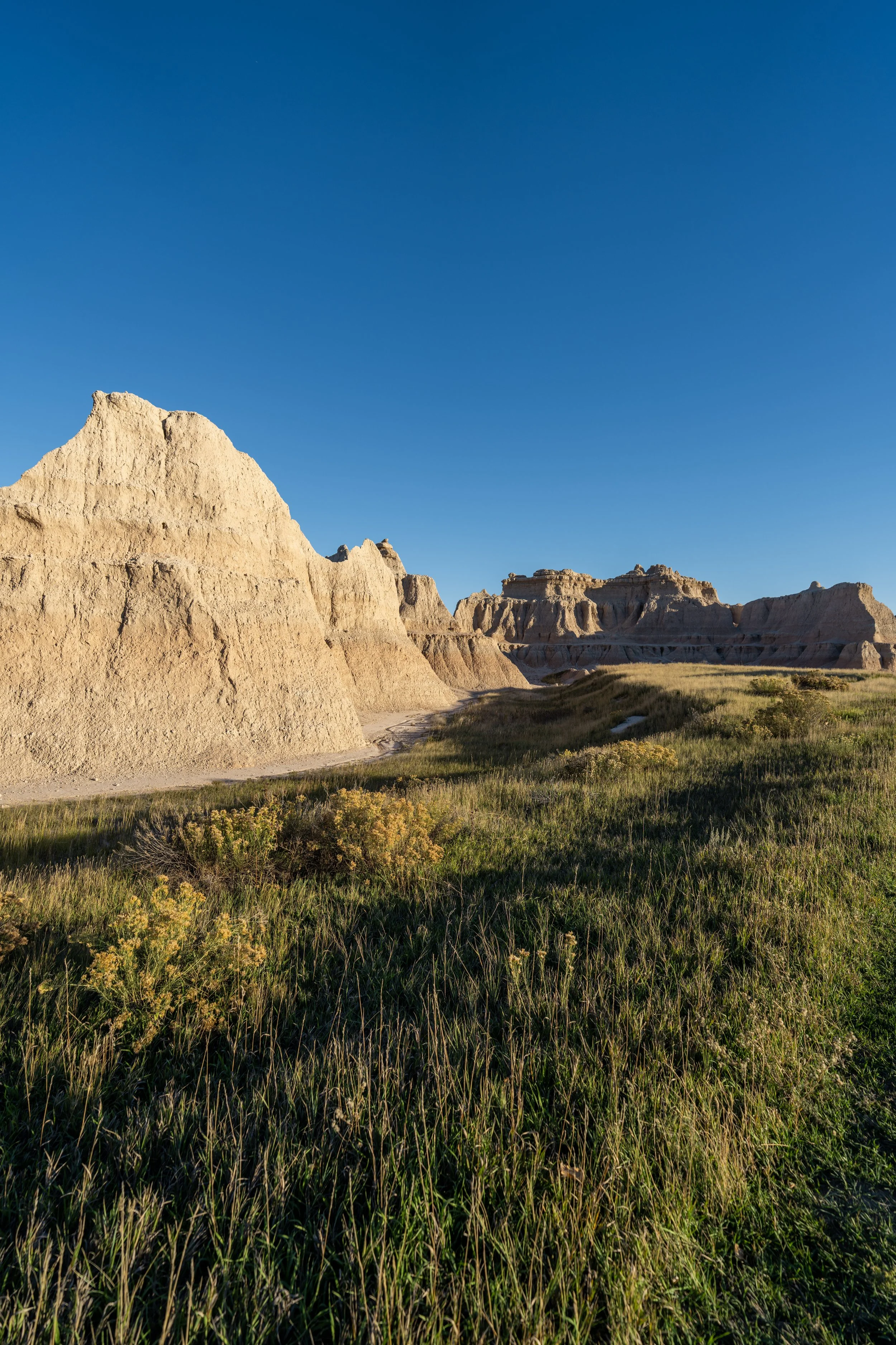
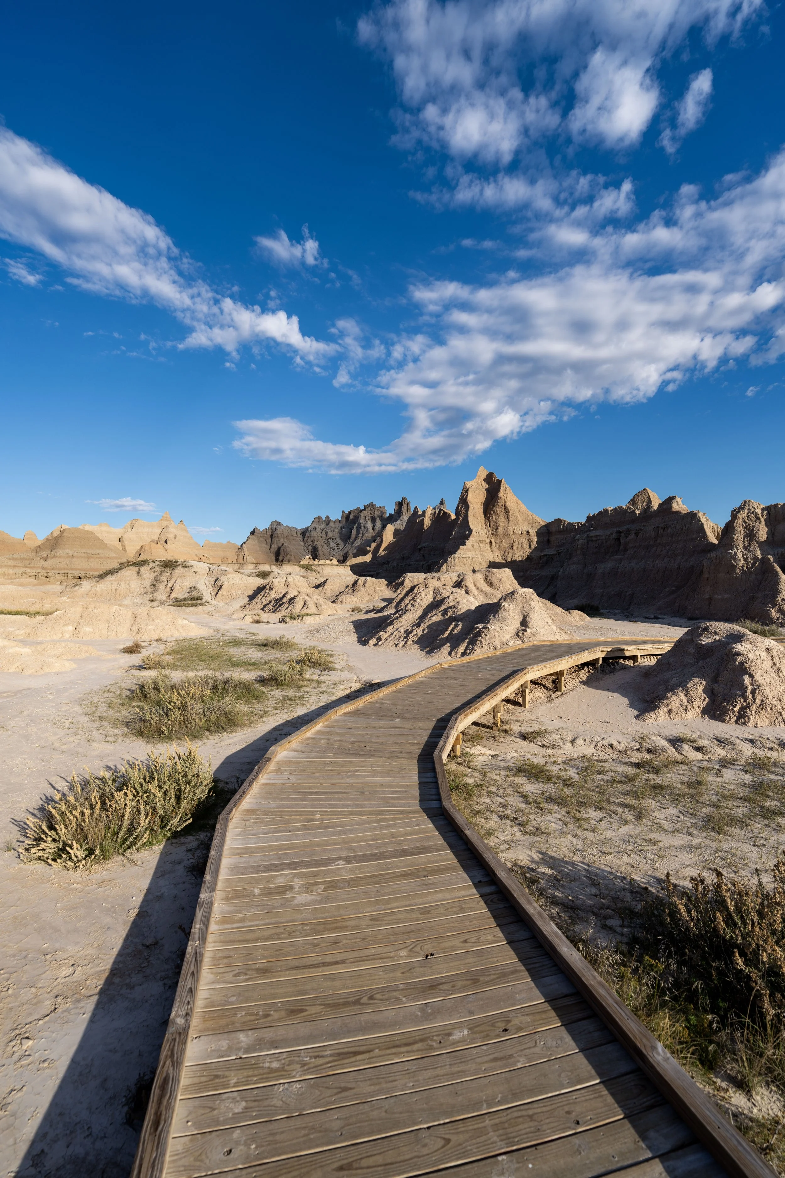
This is where the Castle Trail reaches the unnamed ridge that could be seen in the distance from the beginning of the trail.
That said, this is the only section on the entire Castle Trail that traverses an area surrounded by Badland formations, which is exactly why I believe the first 1.5 miles (2.4 km) of the hike between Millard Ridge and the Medicine Root Trail is the most beautiful section of the entire hike.
After the Castle Trail leaves the area behind shown above, I still recommend continuing farther, even if you don’t plan to hike all 5.2 miles (8.4 km) to the Fossil Exhibit Trail.
I say this because the Castle Trail is still very beautiful until at least the 1.2-mile (1.9 km) mark, where it makes an abrupt turn to the south toward Old Northeast Road and the Medicine Root Trailhead.
Beginning at about the 0.7-mile (1.1 km) mark, the Castle Trail begins what I think is the most confusing part of the entire hike, as there are a number of side trails that braid out from one another.
That said, there is one central path to follow, and know that all the varying trails lead in the same general direction, meaning they will all meet again shortly ahead.
At this formation, the official trail stays to the left, but both sides will come together again on the other side.
This split is, again, another social trail created over time, with the official path continuing straight (left), as before.
This is where all the interconnecting paths come together again, making the rest of the hike to the Medicine Root Loop much less confusing.
Given the size of this hole, my best guess is that it was made by a Badger!
This is where the Castle Trail starts to approach the northernmost portion of the unnamed ridge it has been paralleling, which is where the trail makes a hard turn to the south (left) once on the other side.
This is where the Castle Trail starts heading south toward the Medicine Root Loop Trail, which at the same time is almost exactly the 1.2-mile (1.9 km) mark mentioned previously.
I point this out because this is where I believe the Castle Trail abruptly leaves behind the most beautiful parts of the hike, but I don’t write this to suggest the rest of the hike isn’t worth it.
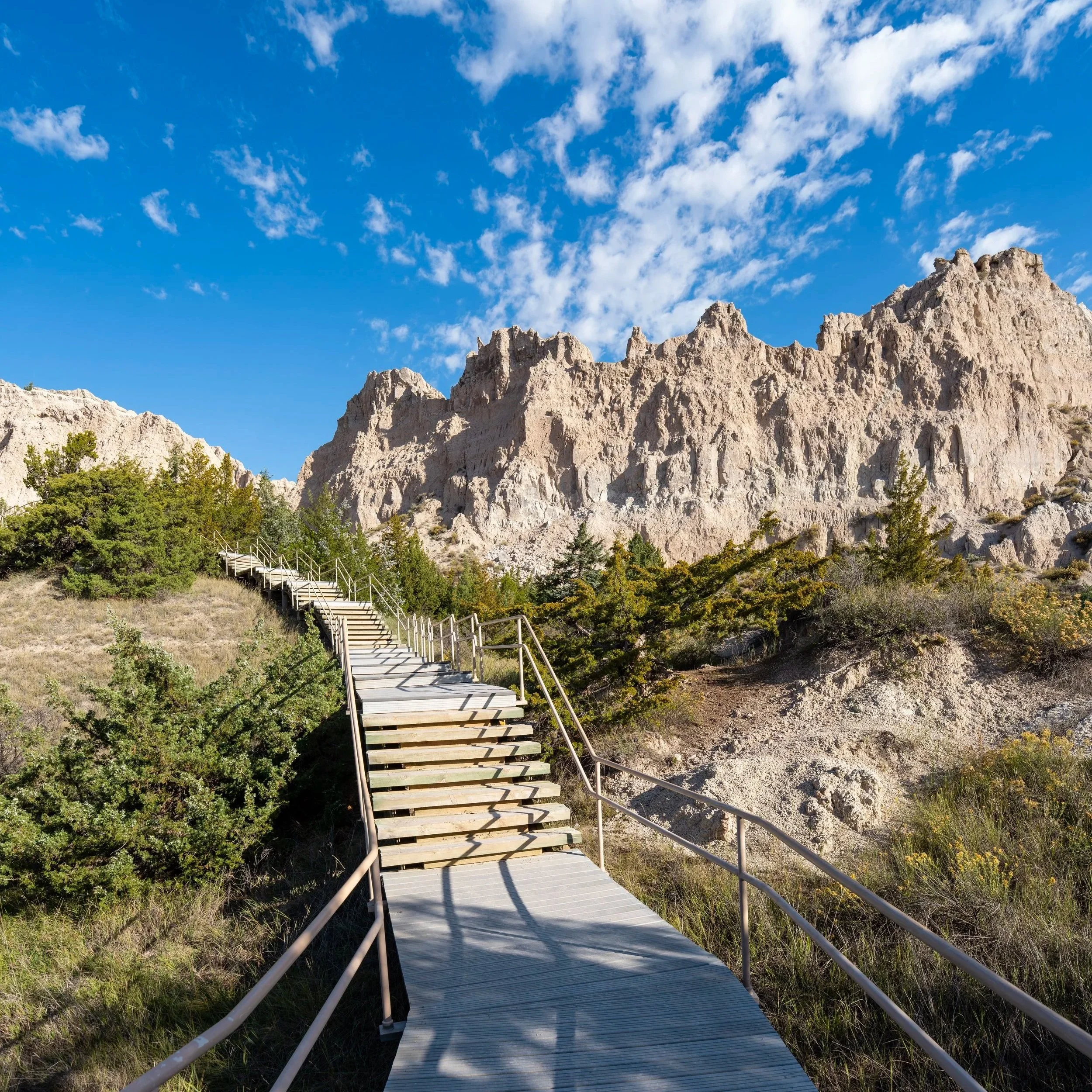
In my opinion, the Castle Trail starts to become much prettier once again near Saddle Pass and beyond to the western terminus, which is to say, if time is a factor or you don’t think of yourself as the biggest hiker, then the 1.2-mile (1.9 km) mark is a great turnaround point.
However, if you enjoy long days outside, the Castle Trail is not a difficult adventure by any means—outside of the hot mid-summer weather—which is why I recommend hiking it from end to end if you have the time.
The power lines in the distance are a nice sign the Medicine Root Loop Trail is getting close!
Castle-Medicine Root Trailhead (Old Northeast Road)
This is where the Castle Trail crosses Old Northeast Road, the same area mentioned above that can serve as an alternative place to park.
Once here, go straight across the road to find where the Castle Trail continues west toward the start of the Medicine Root Loop, just a few steps ahead.
Read My Separate Post: Medicine Root Loop Trail
Castle-Medicine Root Loop Junction
Shortly after crossing Old Northeast Road, the Medicine Root Loop Trail begins, with both sides meeting again at the Saddle Pass junction ahead.
That said, the Castle Trail—the southern half of the Medicine Root Loop—is only 1.8 miles (2.9 km) from this point to the Saddle Pass junction, while the Medicine Root Trail, the northern half of the Medicine Root Loop, is roughly 2.2 miles (3.5 km) to the same junction.
All that to say, go left to continue hiking the Castle Trail, or right if you’d prefer to take the slightly longer Medicine Root Trail to the western side of the loop.
Read My Separate Post: Medicine Root Loop Trail
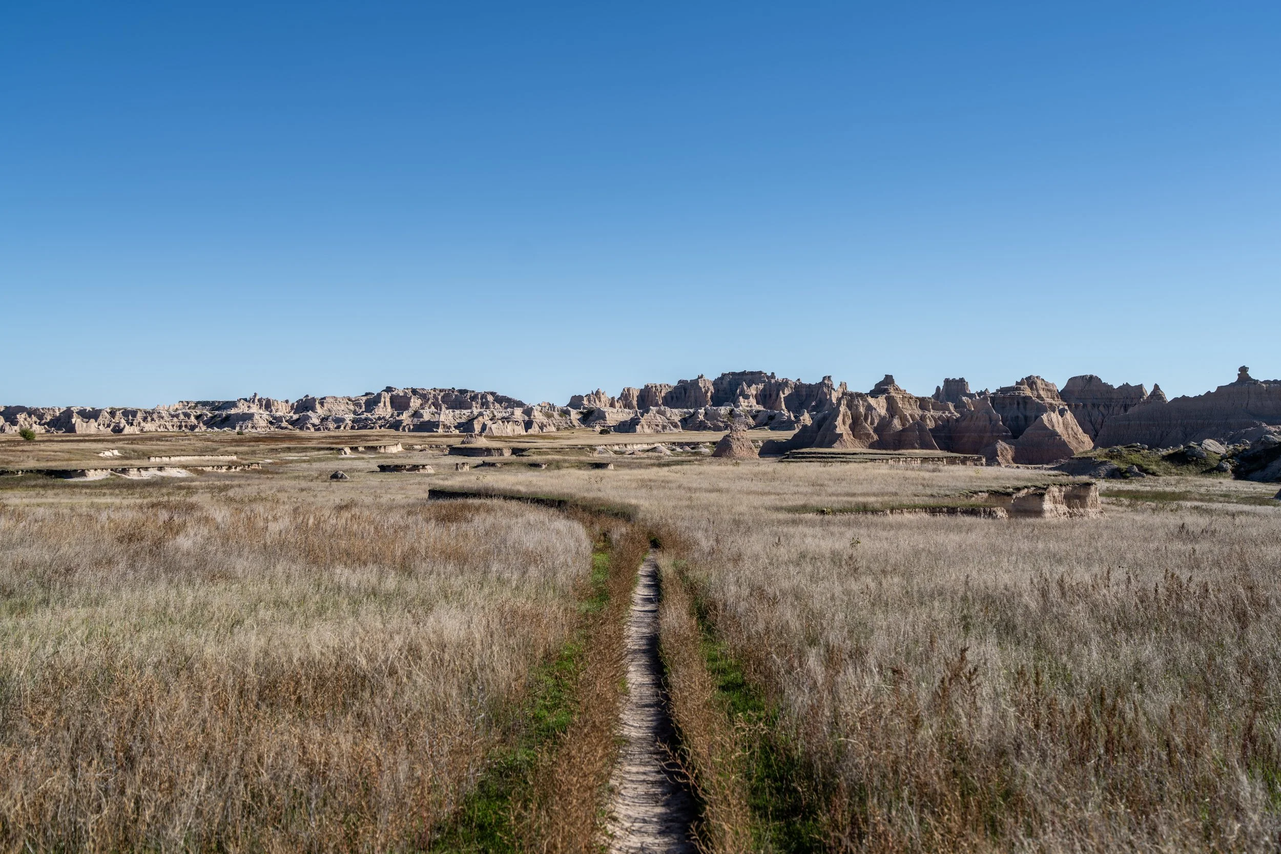
Once on the Medicine Root Loop portion of the hike, the Castle Trail heads south toward the Badlands Wall, beginning some of the most wide-open parts of the hike across the prairie.
This is the last time the Castle Trail will see these power lines until the return hike, which are a really nice mental indicator that the trail is getting close to Old Northeast Road again.
Badlands Wall
When the Castle Trail turns back to the west, the southern half of the Medicine Root Loop will have reached the edge of the Badlands Wall, the natural escarpment that forms dramatic cliffs and Badland terrain where the higher prairie meets the lower prairie.
However, on these sections of the Castle Trail, the Wall is hardly noticeable or as dramatic as the many side-of-the-road viewpoints scattered along Badlands Loop Road, but it becomes more noticeable toward the western terminus.
Once again, I cannot stress the importance of wearing a hooded sun shirt on the Castle Trail—especially if you plan a roundtrip hike after reaching the Fossil Exhibit Trail.
The Saddle Pass Trail is not directly beyond the next formations in the distance.
Instead, the Castle Trail must navigate around the next two ridges that extend to the north before Saddle Pass can be seen on the other side.
This is roughly the halfway point between the start of the Medicine Root Loop and the Saddle Pass Trail ahead.
The Badland formations in the distance is where the Castle Trail curves around the first of the two ridgelines before Saddle Pass.
This is where hikers can see the second unnamed ridge the Castle Trail must curve around before reaching Saddle Pass, which is the most prominent Badland formation on the left-hand side of the photo below.
This sharp turn to the south is a nice sign that the Saddle Pass Trail is only about 0.4 miles (0.6 km) ahead.
This is where the Castle Trail curves around the second ridge, which is exactly where Saddle Pass can be seen in the distance for the first time!
Castle-Medicine Root Loop-Saddle Pass Junction
After 3.3 miles (5.3 km), the Castle Trail finally meets the Saddle Pass Trail and the far western end of the Medicine Root Loop Trail.
Once here, go straight to continue hiking the Castle Trail to the Fossil Exhibit Trail at the western terminus, or, if you had planned a ride via the Saddle Pass Trailhead, go left to hike down to Badlands Loop Road, about 0.4 miles (0.6 km) away.
Read My Separate Posts: Medicine Root Loop Trail / Saddle Pass Trail
Following the Saddle Pass junction, the Castle Trail continues to parallel the Badlands Wall for the rest of the hike to the Fossil Exhibit Trail, about 1.9 miles (3.1 km) away.
While I would not recommend hiking the full Castle Trail during the hottest months of the year (June–August), it’s important to come prepared with plenty of water, even during the off-season months like May and September, which can still see highs in the mid-80s ºF (26.6 °C).
This is why I recommend hiking with a 3L water bladder in Badlands National Park and western South Dakota in general, as a reservoir this big allows you to carry more water for longer adventures like this, or less on shorter day hikes like the Notch Trail.
The ridgeline straight ahead in the distance is not the end of the Castle Trail.
Rather, the ridge marking the Castle Trailhead and the Fossil Exhibit Trail beyond is 'mostly' out of view, beyond the Badland formations to the right of the trail.
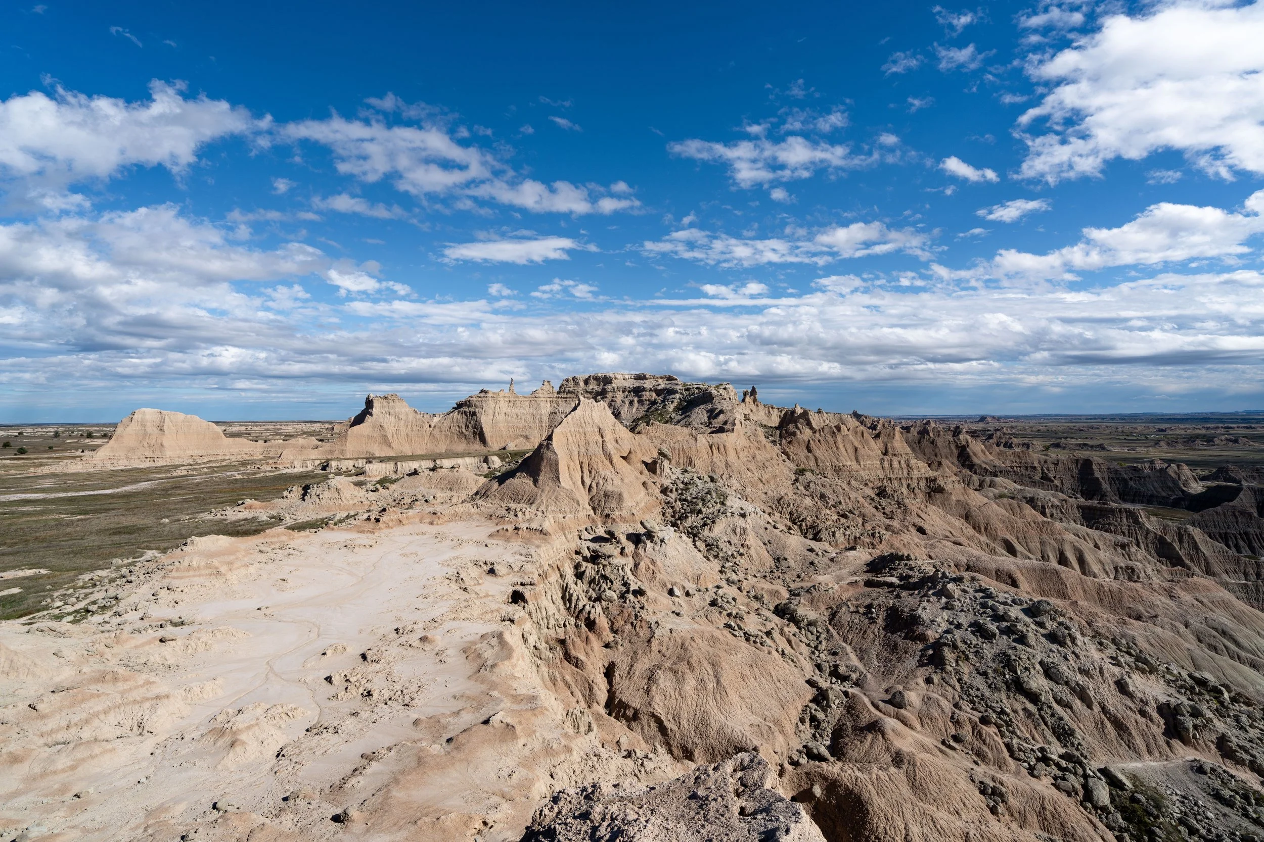
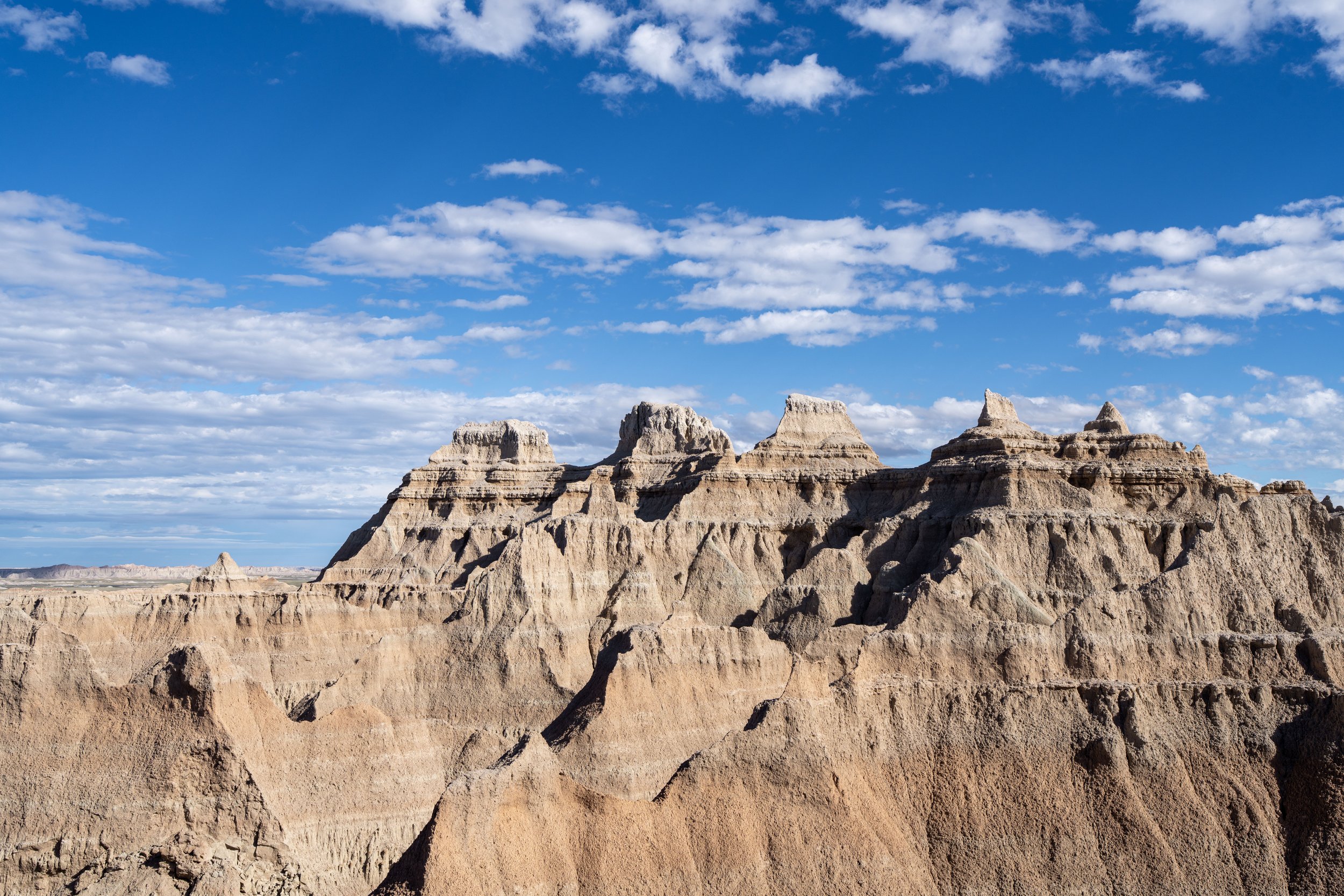
That said, once the Castle Trail curves around the first prominent formations in the distance, the Castle Peak ridgeline, where the Castle Trailhead is located, starts to truly come into view for the first time!
The farthest peaks in the distance, just to the left of the trail marker, is where the West Castle Peak Trailhead is located.
However, the correct peaks are still mostly out of view from this angle.
This cliff edge is the Badlands Wall, which is much more apparent than where the Castle Trail first met the wall on the Medicine Root Loop Trail.
With about 0.8 miles (1.3 km) to go, the Castle Peak ridgeline—where the West Castle Trailhead and Fossil Exhibit Trail are located—fully comes into view for the first time!
In these grassy sections across the Castle Trail, be sure to lookout for rattlesnakes as you hike—especially around dawn and dusk when they are the most active.
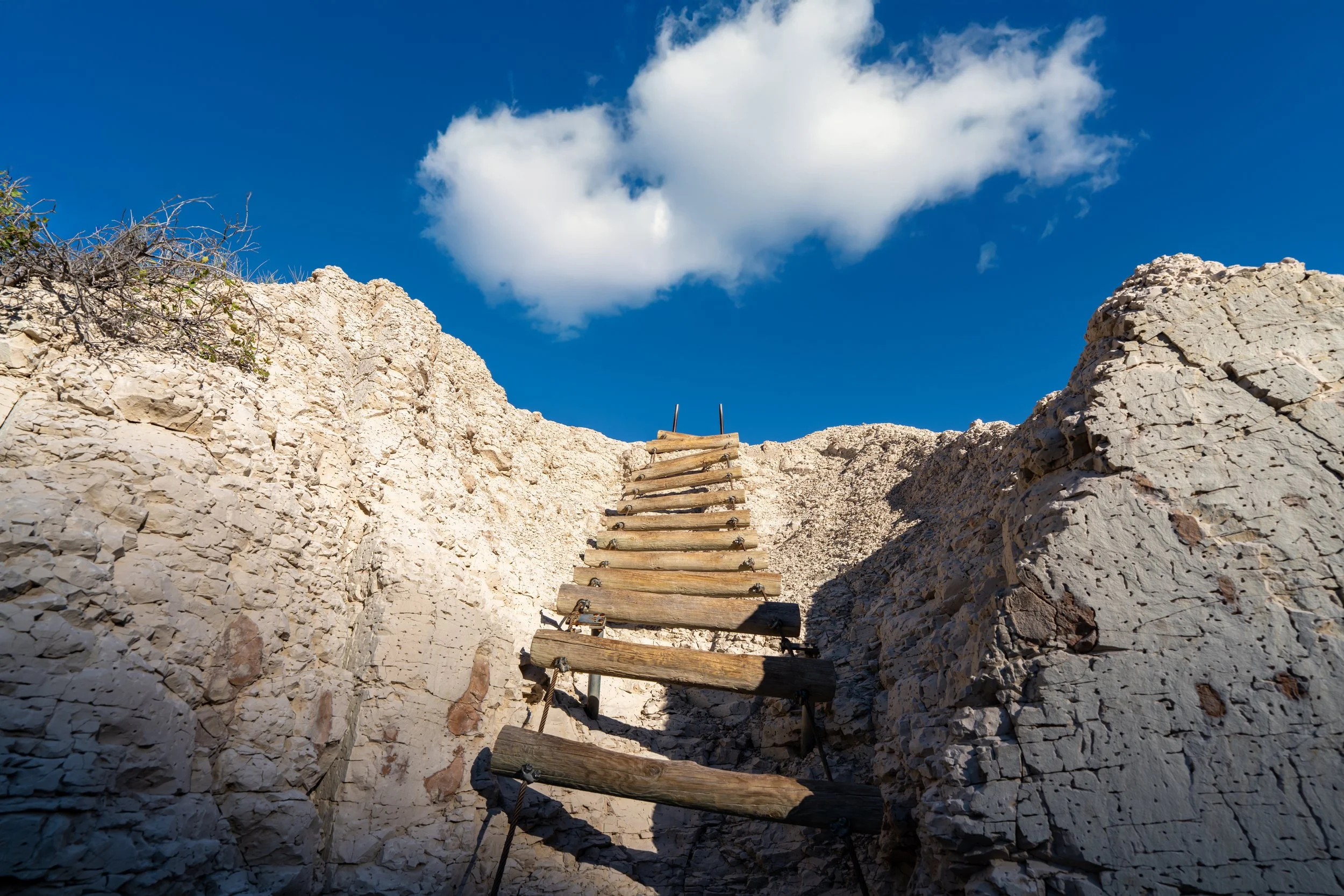
As the Castle Trail nears Norbeck Pass and Badlands Loop Road, the trail drops below the Badlands Wall, which is a nice sign that the end of the hike is not far ahead!
This is where the West Castle Trailhead can finally be seen for the first time!
West Castle Trailhead (Fossil Exhibit)
After what I personally think is a relatively fast 5.2 miles (8.4 km), the Castle Trail finally meets Badlands Loop Road once again, with the Fossil Exhibit Trail located on the other side.
If you had someone in your party planning to pick you up, be sure to sign out of the backcountry log, making it clear that you only hiked one way.
If you are returning to the Millard Ridge Trailhead from the western terminus, I recommend taking the north side of the Medicine Root Loop Trail on the way back, even though it adds about 0.4 miles (0.6 km) to get to Old Northeast Road, because I personally think the change of scenery makes the return trip feel a bit quicker.
Read My Separate Post: Fossil Exhibit Trail