Hiking the Red Beds Trail in Devils Tower National Monument, Wyoming
Distance: 2.9 miles / 4.7 km
The Red Beds Trail, also called the Red Beds Loop Trail, in Devils Tower National Monument, is a longer—and, for this reason, quieter—loop around Devils Tower compared to the much more popular Tower Trail that begins at the same trailhead.
That said, distance is the biggest reason for the Red Beds Trail seeing a fraction of the visitors compared to the Tower Trail, but there is also a little more elevation change over the course of the 2.9-mile (4.7 km) loop.
For these reasons, I personally think the Red Beds Trail is a great option for those looking to escape the crowds at Devils Tower, as it’s one of the least-trafficked trails in the park!
In addition, the Red Beds Trail is also the best trail-running hike at Devils Tower because it is neither too long nor too short, and what elevation change it has remains relatively mild compared to what running across the Mountain West often is!
Red Beds Trailhead Parking
Parking for the Red Beds Trail is located in either the upper lot closest to the Devils Tower Visitor Center or in the overflow lot just down the hill. This is the same parking lot that also serves the Tower Trail.
With either option, be aware that the Tower Trailhead is the most popular area within Devils Tower National Monument, which also means that the visitor center is the most challenging place to find parking.
This is why I recommend arriving early in the day, as both lots tend to fill up by mid-morning—especially during the busy summer travel season.
Google Maps Directions: Red Beds Trailhead
Hiking Checklist - Devils Tower
According to the National Park Service, encounters with Black Bears are incredibly rare at Devils Tower.
That said, here is a complete list of must-have things that you will want for any hike in Devils Tower National Monument.
Hiking the Red Beds Trail
The Red Beds Trail begins at either the Red Beds Trailhead adjacent to the Tower Trailhead, or there is the option to hike up the Tower Trail to begin the opposite side of the loop first, located a short distance after the pavilion.
That said, I chose to begin at the true Red Beds Trailhead in the counterclockwise direction around the loop.
Read My Separate Post: Tower Trail
In the beginning, the Red Beds Trail stays relatively flat as it traverses a few minor hills around the south side of Devils Tower.
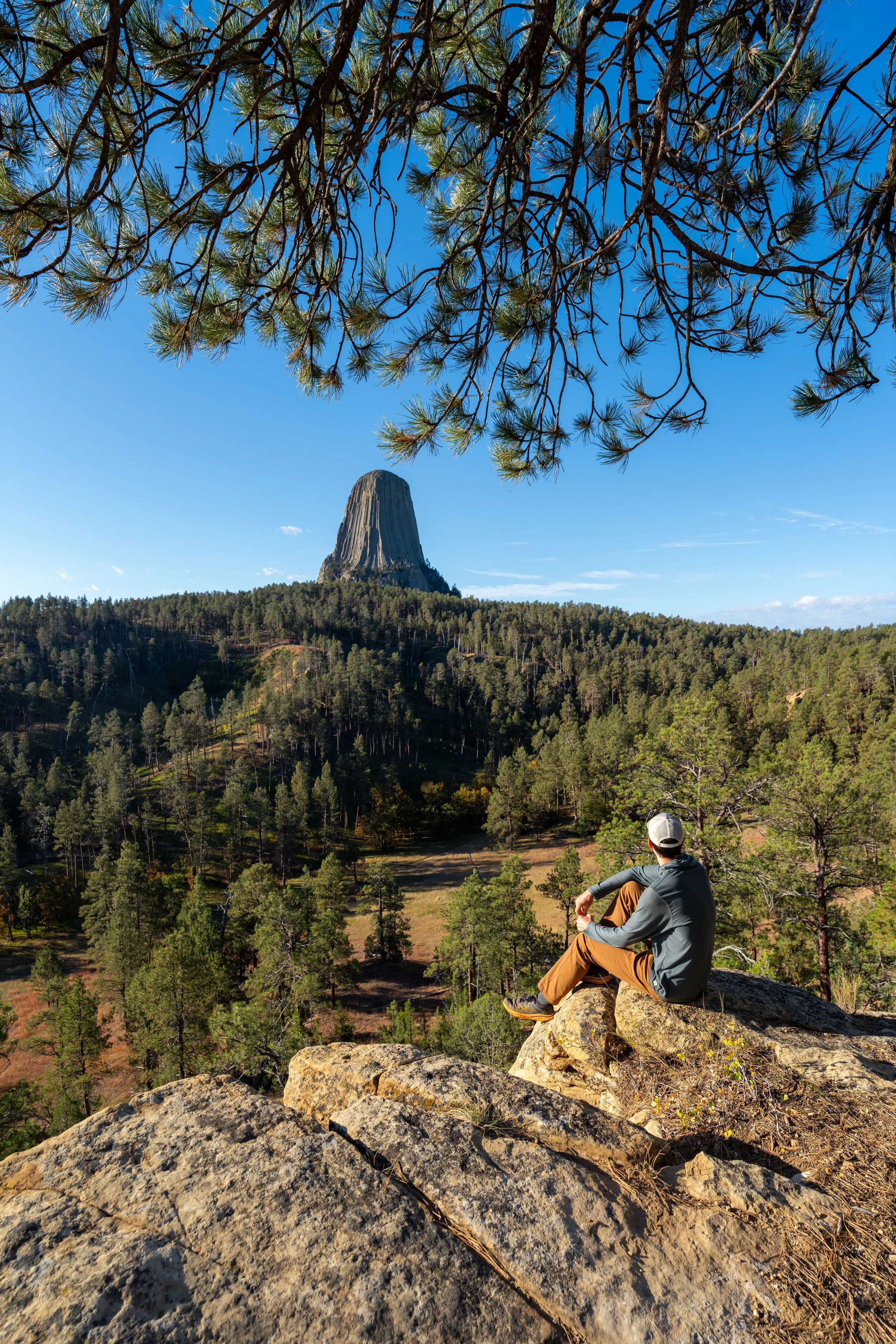
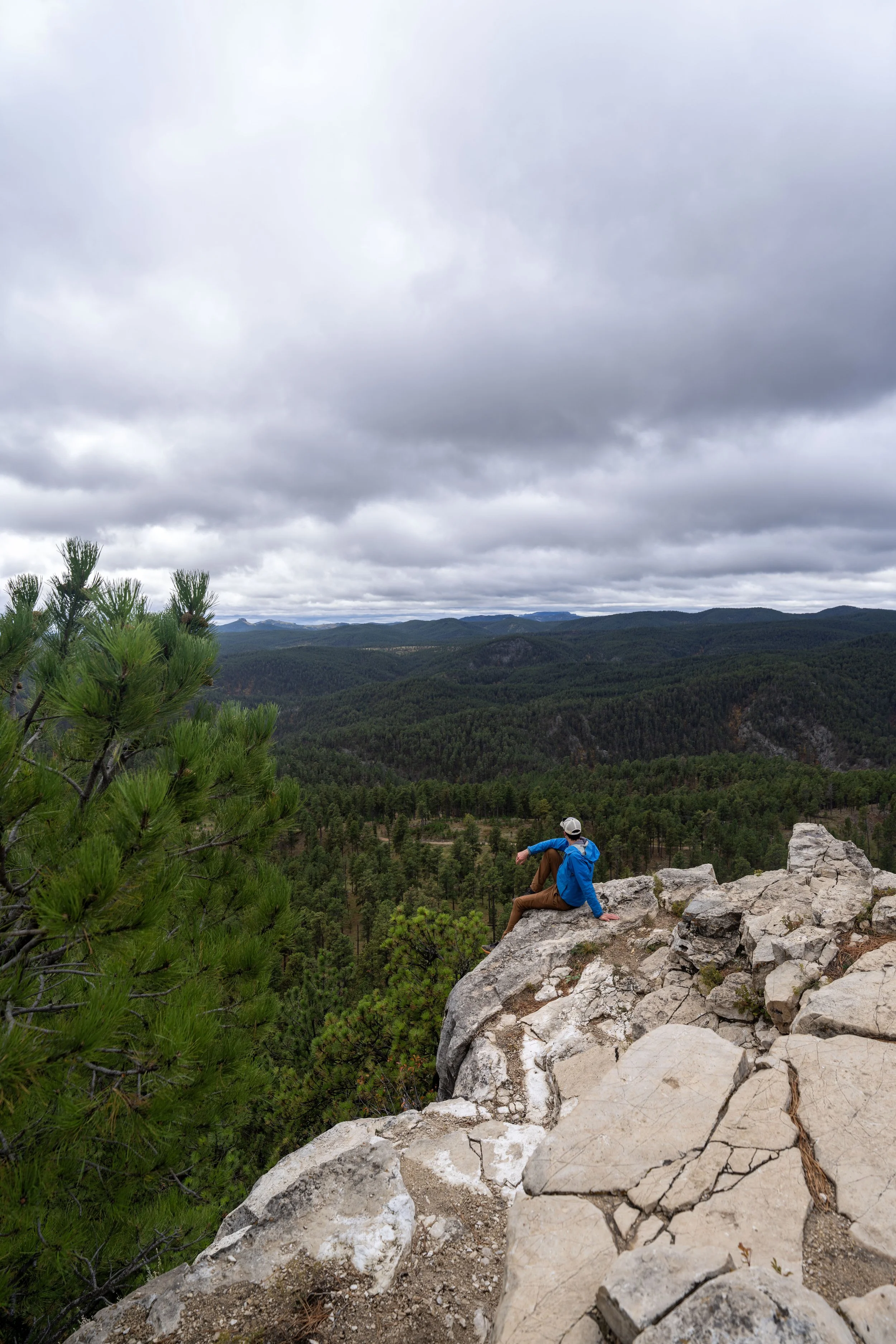
As the Red Bed Trail works its way out to the southernmost portions of the loop, don’t forget to turn back toward Devils Tower, as this is where some of the best views of the mountain and the trail can be framed in a beautiful photo!
This is where I recommend turning around to take some photos!
When the Red Beds Loop begins to turn toward the eastern side of Devils Tower, the trail descends much more noticeably toward the Belle Fourche River.
From this point, this section loses about 200 ft. (61 m) before reaching the lowest part of the loop near the river, about 0.5 miles (0.8 km) away.
From the eastern side of Devils Tower, the Black Hills in western South Dakota can be seen in the distance!
West Red Beds-Valley View (South Side) Junction
The first time the Red Beds Trail splits is where it meets the first of two junctions with the Valley View Loop Trail, also called the South Side Trail.
That said, this side of the Valley View Loop is more or less a short connector between the Red Beds Trail and the Belle Fourche River Campground below, but to stay on the Red Beds Loop, go straight to continue around Devils Tower.
The area in the distance is the small town of Devils Tower, along with the KOA campground just outside the monument.
East Red Beds-Valley View Junction
The second time the Red Beds Trail meets the Valley View Trail, go straight once again to stay on the loop around Devils Tower.
On a different note, this junction is the lowest point on the Red Beds Trail, meaning the loop will gradually start climbing from this point to the beginning.
However, it doesn’t notably get steep until it reaches the north side of Devils Tower.
This is where the Red Beds can start to be seen through the Ponderosa Pines in the distance!
If there’s one thing I hope these photos show, it’s that there is very little shade on the Red Beds Trail, which is why I highly recommend wearing a hooded sun shirt when visiting Devils Tower.
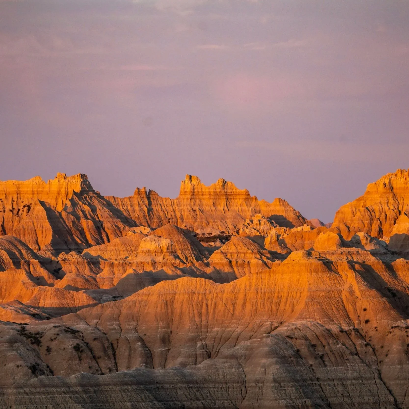
Red Beds
This bright red-orange portion of the loop is the Red Beds, for which the trail is aptly named.
That said, the Red Beds make up only about 0.25 miles (0.4 km) of the entire loop, but it is one of the most beautiful and unique stretches to slow down and take photos!
The Red Beds are said to get their bright color from iron-rich minerals that oxidize over time to create these vivid red-orange hues!
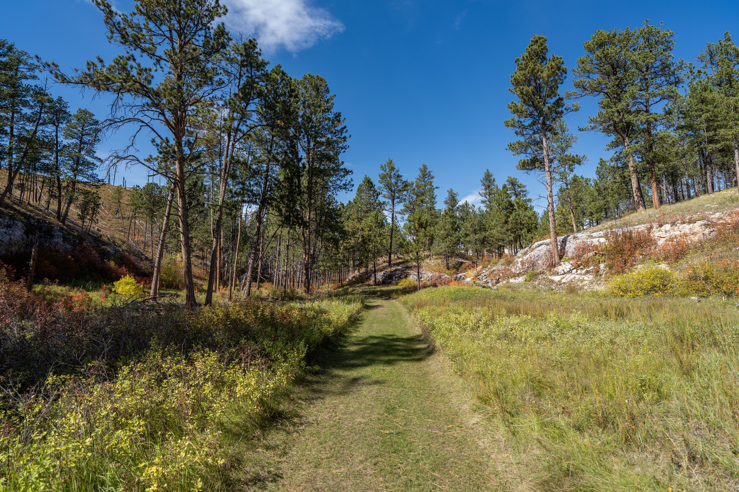
This is where the loop leaves the Red Beds behind, and it’s a nice sign that the trail will stay relatively flat until it begins the final climb back to the trailhead, beginning about 0.25 miles (0.4 km) ahead.
Red Beds-Joyner Ridge Connector Junction
Shortly before the Red Beds Trail begins the climb back up to the trailhead, the loop passes the connector junction with Joyner Ridge.
Personally, I recommend treating both routes as separate day hikes, but if you are trail running, the two can easily be combined for a 5.6-mile (9.0 km) total adventure.
In any case, go left at this split to continue hiking around the Red Beds Loop Trail.
Read My Separate Post: Joyner Ridge Trail
The ridge in the distance is where the Red Beds Trail begins its steep ascent back to the beginning.
This is where the Red Beds Trail begins climbing back to the beginning, gaining roughly 300 ft. (91 m) over the course of the next 0.5 miles (0.8 km).
This hard turn, or switchback, is where the Red Beds Trail first reaches the crest of the ridge, the same ridge that could be seen after the connector with the Joyner Ridge Trail.
The ascent back to the beginning isn’t all that bad, in my opinion, as it’s spread out between a few steep sections followed by gradual, and even downhill, stretches, as shown here.
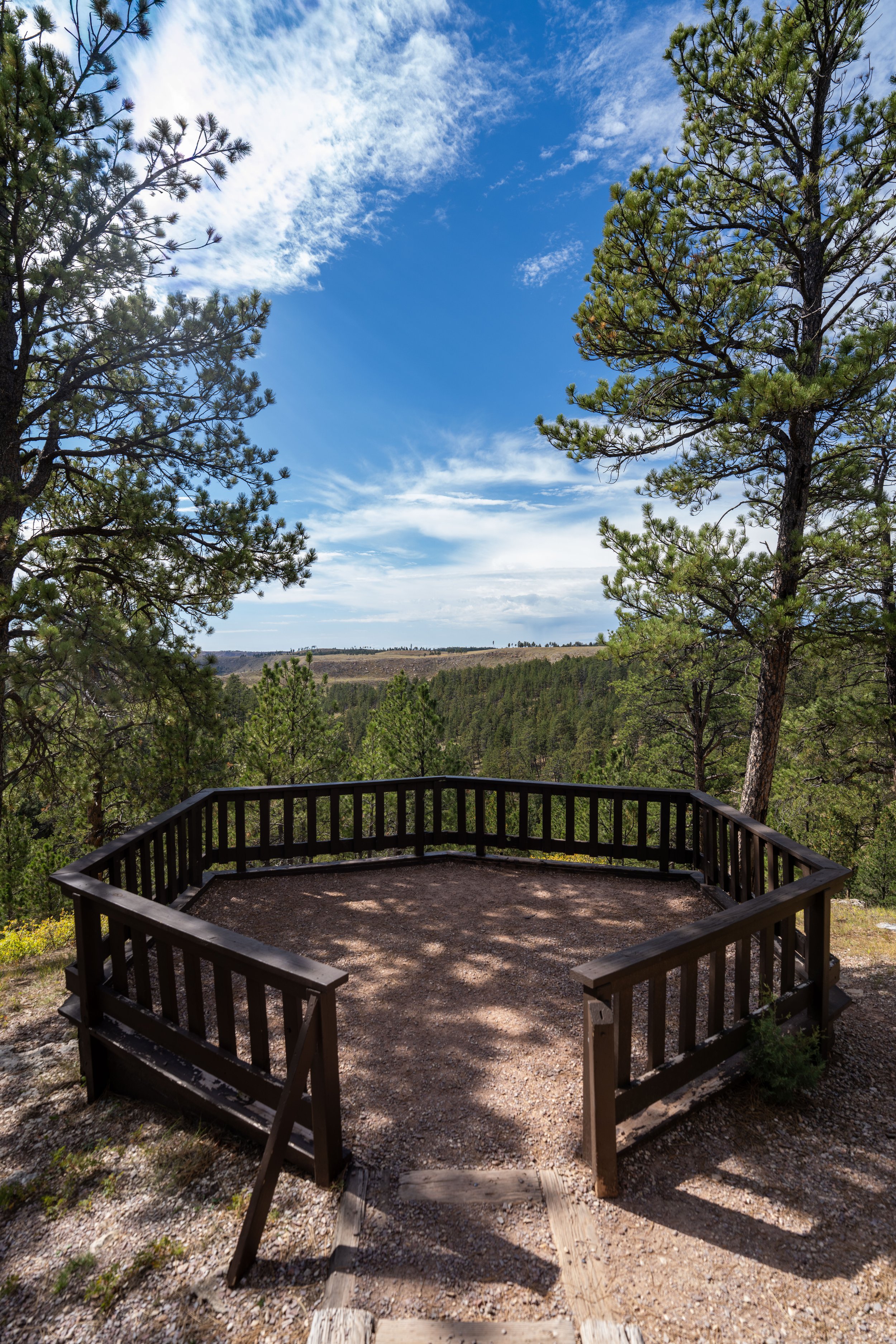
This split simply leads out to a viewpoint just off the loop, but to continue on the Red Beds Trail, go straight at this split.
This is roughly where the Red Beds Trail reaches the top of the steepest part of the ascent back to the beginning, meaning the loop is much more gradual from this point on!
Just before the Red Beds Trail returns to the beginning, the loop will parallel the main park road back to the Devils Tower Visitor Center.
Red Beds-Tower Junction
After 2.8 miles (4.5 km), the Red Beds Trail meets the Tower Trail, where it follows the paved path back down to the trailhead and the visitor center.
Once here, go right to finish the remaining 0.1 miles (0.2 km) back to the beginning.
Read My Separate Post: Tower Trail
Tower Trailhead
This is the Tower Trailhead, with the Red Beds Trail, where this post began, on the right side of the photo below.

South Dakota


Wyoming