Hiking the Yosemite Valley Loop Trail in Yosemite National Park
Distance: 21.6 miles / 34.8 km
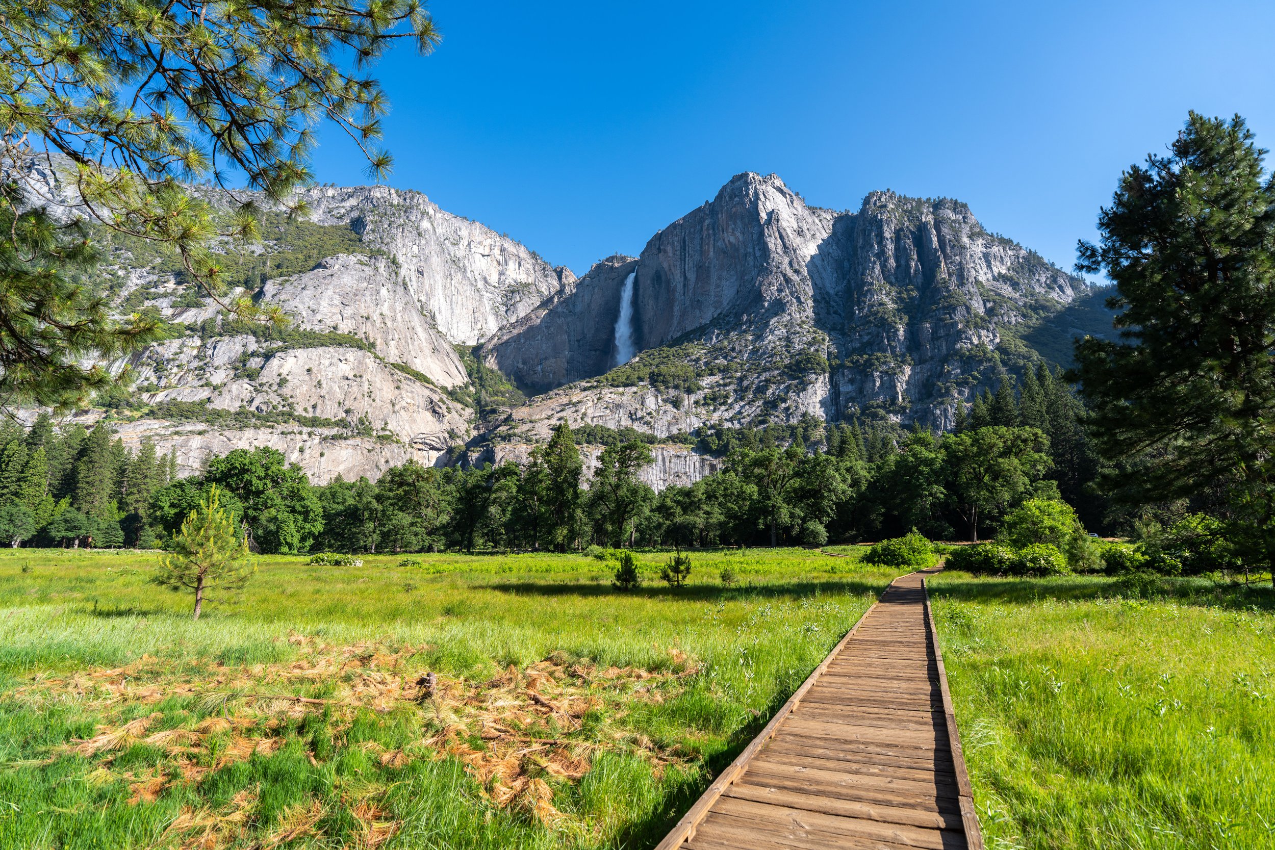
The Yosemite Valley Loop Trail, also called the Valley Loop Trail for short, in Yosemite National Park, is a long but stunning +20.0-mile (32.2 km) loop around the best and most beautiful parts of Yosemite Valley, including iconic spots such as Lower Yosemite Falls, El Capitan, Bridalveil Falls, Curry Village, Mirror Lake, Half Dome, and so much more!
That said, the vast majority of those who visit Yosemite National Park do not walk more than the Lower Yosemite Falls portion of the trail—let alone the full loop!
This is exactly what makes the Yosemite Valley Loop Trail so special, as it allows hikers to see the best parts of the Valley, away from all the busyness that gets concentrated around a few key areas, like Yosemite Village and the Happy Isles Trailhead.
All this to say, the Yosemite Valley Loop Trail is one of my favorite long adventures within the park—not to mention, some of the more remote stretches of the loop are great places to see wildlife in the Valley!
Yosemite Valley Loop Trailhead Parking
Parking for the Yosemite Valley Loop Trail could quite literally be anywhere along the long loop, such as Curry Village, Bridalveil Falls, the Four Mile Trail, among countless others.
However, the Lower Yosemite Fall Trailhead near Yosemite Village is often considered to be the official starting point for the Valley Loop Trail—which is exactly where this article begins!
That said, Yosemite Village is one of the most challenging places in Yosemite National Park to find parking—unless you arrive first thing in the morning, which is what recommend for most adventures in and around Yosemite Valley.
Google Maps Directions: Yosemite Valley Loop Trailhead (Lower Yosemite Falls)
Hiking Checklist - Yosemite
Here is a complete list of must-have things that you will want for any hike in Yosemite National Park.
That said, bear spray is purposefully excluded from this list because, while the Sierra Nevadas are home to a large Black Bear population, bear spray is not allowed in Yosemite National Park.
Hiking the Yosemite Valley Loop Trail
As previously mentioned, the Yosemite Valley Loop Trail could begin from any number of areas throughout the Valley, but this article is written from what most consider to be the official starting point, the Lower Yosemite Falls Trail that begins just to the west of the shuttle stop.
Once here, go straight toward Lower Yosemite Falls to find where the Valley Loop Trail branches away.
Google Maps Directions: Lower Yosemite Falls Trailhead
This is where the Lower Yosemite Falls Trail meets the path that begins at the closest parking area near Yosemite Valley Lodge.
Here, go right to continue hiking toward Lower Yosemite Falls and the beginning of the Yosemite Valley Loop Trail.
West Yosemite Valley Loop-Lower Yosemite Falls Junction
Shortly after the two trails come together, the Lower Yosemite Falls Trail will split with the path for the Yosemite Valley Loop Trail.
That said, go left to begin hiking the Valley Loop Trail, which is the split shown in the second photo below.
Read My Separate Post: Lower Yosemite Falls Trail
Yosemite Valley Loop Trail
This is where the Yosemite Valley Loop leaves the Lower Yosemite Fall Trail and heads west toward Upper Yosemite Falls, about 0.5 miles (0.8 km) away.
Swan Slab
Just to the east of Camp 4 is a climbing spot known as Swan Slab, which can be a great place to watch climbers from the Valley, along with the sections near El Capitan.
Camp 4
The Yosemite Valley Loop Trail passes directly behind Camp 4, the most famous front-country campsite in all of Yosemite National Park.
This is because Camp 4 has a long climbing history, as it is where climbing around the world got its start!
That said, go right to stay on the Yosemite Valley Loop Trail, as shown below, or there is the option to walk through Camp 4 and rejoin the Valley Loop on the Upper Yosemite Falls Trail just ahead.
Yosemite Valley Loop-Upper Yosemite Falls Junction
The Upper Yosemite Falls Trail is the first day hike off the Valley Loop Trail, other than the Lower Yosemite Falls Trail at the very beginning.
In my opinion, Upper Yosemite Falls is easily one of the best things to do in Yosemite National Park, and it’s one that I could not recommend more when visiting Yosemite Valley.
My thoughts aside, go straight at both of the following splits to stay on the Yosemite Valley Loop Trail.
Read My Separate Post: Upper Yosemite Falls Trail
Wahhoga Village
After Upper Yosemite Falls, Wahhoga Village is the next stop on the Valley Loop Trail, which is an ancestral Indigenous settlement that was inhabited until the National Park Service forcibly removed its residents in 1969.
Today, the village is actively being restored by the Southern Sierra Miwuk Nation and the Wahhoga Committee, to be stewarded once again by the people who once lived here before they were evicted from the park.
Be sure to watch out for Poison Oak along the trail, as it is certainly common to come across in Yosemite and throughout the Sierras.
Northside Drive
This is the first of three times the Yosemite Valley Loop Trail crosses Northside Drive, with many more road crossings to come on the south side of the loop.
After the Yosemite Valley Loop crosses Northside Drive for the first time, the trail begins to parallel the Merced River, where some of the best uncrowded beaches in the Valley can be found—if you know where to look!
Since hiking the Yosemite Valley Loop inevitably means spending a lot of time in the sun, I highly recommend wearing a hooded sun shirt to stay safe—even if you only plan to hike smaller sections of the full loop.
These long, more 'remote' miles are among the best places on the Yosemite Valley Loop Trail to look for bears—which was exactly my experience just a short distance ahead!
According to another couple, I walked right by a bear in this area and didn’t even know it, which really just shows how easy they can be to miss!
That said, I always say that it’s easier to hear them first than see them, as long as your group isn’t making too much noise.
I think that this section of the Valley Loop Trail is one of the most beautiful, photogenic spots on the entire trail, and it’s a place I intend to return to early in the morning, when first light hits the Dawn Wall on El Capitan!
East Yosemite Valley Loop-El Capitan Meadow Junction
When the Yosemite Valley Loop meets Northside Drive once again, go right to cross the road for the second of three times.
The trail going straight is the path that leads to El Capitan Meadow, one of the best places in Yosemite Valley to look for climbers on the walls of El Capitan.
This is where the Yosemite Valley Loop Trail passes by a hidden, lesser-known parking area for the El Capitan Meadow.
If you look closely, there’s almost always climbers that can be seen on El Capitan throughout the warmer summer months.
West Yosemite Valley Loop-El Capitan Meadow Junction
About 0.25 miles (0.4 km) past the hidden parking area for El Capitan, the Yosemite Valley Loop passes the connector between the loop and the meadow/ main parking area, as well as the trail that leads to the base of El Capitan just ahead.
Yosemite Valley Loop-El Capitan Southeast Face Junction
The trail branching off to the right is the first of two paths that lead to the base of El Capitan.
That said, go straight to continue on the Yosemite Valley Loop Trail.
Yosemite Valley Loop-El Capitan Southwest Face Junction
Just 0.1 miles (0.2 km) past the first El Capitan junction, the Yosemite Valley Loop meets the second trail to the base of El Capitan, located on the west side of the Nose.
Once again, go straight to continue on the Yosemite Valley Loop Trail.
Yosemite Valley Loop-Rockslides Junction
After El Capitan, the next time the Yosemite Valley Loop splits is at the Rockslides Trail, which is just 0.1 miles (0.2 km) from the halfway point between Lower Yosemite Falls and Bridalveil Falls on the south side of the loop.
That aside, go left at this split to stay on the Valley Loop Trail toward the Pohono Bridge.
After the Rockslides Trail, the Valley Loop will come to one of the more 'confusing' parts of the entire hike, near a service road off Northside Drive.
At this less obvious split, stay to the left to follow the trail toward Northside Drive, where the Yosemite Valley Loop becomes more obvious near a gate just off the main road.
When the trail meets the service road past Ribbon Creek, go straight across to continue on the Yosemite Valley Loop.
After the service road, the Yosemite Valley Loop begins its longest untrafficked section, stretching from this point to Bridalveil Falls on the south side of the loop.
This is Bridalveil Falls on the other side of the Valley.
In addition to Bridalveil Falls, Ribbon Falls can also be seen in the distance.
However, in terms of Yosemite Valley waterfalls, it is typically one of the first to run dry in the hotter summer months of July, August, and into the fall.
Don’t be surprised if you don’t see any other hikers on this long stretch from El Capitan to the Pohono Bridge and beyond.
Northside Drive
This is where the Yosemite Valley Loop Trail crosses Northside Drive for the third and final time of the entire hike.
That said, be careful when crossing the road, as cars leaving Yosemite Valley in the right-hand lane typically don’t slow down as much as cars in the left-hand lane, crossing over the Pohono Bridge.
Pohono Bridge
The Pohono Bridge is the westernmost end of the Yosemite Valley Loop Trail, and it’s where the trail begins the south side of the loop, which continues until it crosses the Merced River for the second time above Mirror Lake.
On the south side of the Pohono Bridge, the Yosemite Valley Loop branches away from Southside Drive, beginning its eastward route up the Merced River toward Bridalveil Falls.
This is the USGS Pohono Bridge stream gauge on the Merced River, which provides real-time data about the river’s water level.
Bridalveil Meadow
When the Yosemite Valley Loop Trail reaches the beginning of Bridalveil Meadow, there are only 0.8 miles (1.3 km) remaining until the trail crosses Southside Drive at the start of the East Bridalveil Falls Trail.
Bridalveil Creek
Bridalveil Creek is the messiest and most confusing part of the entire Yosemite Valley Loop Trail because it is not just one stream to cross.
Rather, Bridalveil Creek ribbons out into a number of smaller creeks just before the Merced River, meaning that during peak snowmelt, much of the most obvious path is washed away or very obscure as hikers look for the easiest way to get across.
However, when Bridalveil Falls stops flowing in the mid- to late-summer months, finding where the Yosemite Valley Loop continues on the far side should be much easier to see!
The best advice I have is to look for the easiest places to cross, closest to the Merced River—not Southside Drive.
This is the final stream crossing over the main part of Bridalveil Creek.
East Bridalveil Falls Trailhead
After the Yosemite Valley Loop crosses Southside Drive for the first time, the trail meets the East Bridalveil Falls Trail, where the two follow the same path for about 0.1 miles (0.2 km).
That said, this short section is often a very busy stretch, but it doesn’t last long!
Read My Separate Post: Bridalveil Falls Trail
East Yosemite Valley Loop-Bridalveil Falls Junction
This is where the trail that leads to Bridalveil Falls and the Yosemite Valley Loop Trail split from one another.
Here, go left to stay on the Yosemite Valley Loop, toward Cathedral Beach and the Four Mile Trail.
Read My Separate Post: Bridalveil Falls Trail
At this split, go right to stay on the Yosemite Valley Loop, as the trail heading straight simply leads to the alternative parking area for Bridalveil Falls.
This open stretch has some of the best views of El Capitan found anywhere along the 21.6-mile (34.8 km) loop.
In all my experiences hiking the Yosemite Valley Loop, the sections past Bridalveil Falls do not get busier than the miles following El Capitan Meadow, which stay that way until the trail gets closer to Yosemite Village up ahead.
This side trail is one of many that lead to various climbing routes off the Yosemite Valley Loop—much like the marked climbing routes on either side of the Nose on El Capitan.
Yosemite Valley Loop-Cathedral Beach Junction
About halfway between Bridalveil Falls and the Four Mile Trail, the Yosemite Valley Loop passes the junction for Cathedral Beach—one of the best places to enjoy the beauty of Yosemite Valley and the Merced River on a hot summer day!
At this split, go straight (right) to stay on the Valley Loop toward the Four Mile Trail and Curry Village beyond.
Again, the Valley Loop Trail after the Cathedral Beach junction continues through some of the most untrafficked sections of the entire hike, which extend beyond the Four Mile junction to Curry Village, as the Four Mile Trail is certainly not the most popular day hike in Yosemite National Park.
Again, be sure to wear a good sun shirt for the long hike around the Valley, as one will most definitely be useful here and on countless other adventures in Yosemite National Park.
This split leads to another marked climbing route off the Yosemite Valley Loop Trail.
This side trail is simply a shortcut to the Four Mile Trailhead just ahead.
Yosemite Valley Loop-Four Mile Junction
After the long, quiet 3.3-mile (5.3 km) stretch following Bridalveil Falls, the Yosemite Valley Loop Trail reaches the Four Mile Trail, which is often seen as the unofficial halfway point, as the Lower Yosemite Falls Trail is located almost directly across the Valley from this junction.
That said, go straight here to stay on the Yosemite Valley Loop Trail, which will begin to enter busier and busier sections as it nears Curry Village up ahead.
Read My Separate Post: Four Mile Trail
The National Park Service really tries to make it clear that the Four Mile Trail cannot be treated as a one-way adventure, unlike the Yosemite Valley Loop Trail, in which hikers can begin and end at a number of different locations, while relying on the free Yosemite shuttle to return to where they began.
Yosemite Valley Loop-Swinging Bridge (Yosemite Village) Junction
The Swinging Bridge junction is a short side trail that leads to the Swinging Bridge Picnic Area, as well as the Swinging Bridge, which crosses the Merced River to Yosemite Village.
Know that visitors often park here not for the picnic area or Yosemite Valley Loop, but because parking in Yosemite Village fills up quickly during the busy summer travel season.
On a different note, know that it is possible to shorten the loop by going left at the Swinging Bridge junction, effectively cutting the trail in 'half.' However, to continue on the Yosemite Valley Loop Trail toward Curry Village, go straight.
These are some of the flattest sections of the entire 21.6-mile (34.8 km) loop, which remains this way until the trail passes the Happy Isle Trailhead, just before the Mirror Lake Loop.
Yosemite Valley Loop-Yosemite Valley Chapel Junction
The next time the Valley Loop Trail splits is when it meets the side trail over to the Yosemite Valley Chapel and the Cook’s Meadow Loop Trail shortly thereafter.
Here, go straight (right) to continue hiking the Valley Loop toward Curry Village.
As the Yosemite Valley Loop Trail approaches Curry Village, the trail will parallel Southside Drive a handful of times, where it shares a path with the bike path to Curry Village and beyond.
At this split, hikers can go in either direction to continue toward Curry Village, but the true Yosemite Valley Loop continues to the right—which is what’s shown below.
Yosemite Conservation Heritage Center
About 0.4 miles (0.6 km) before Curry Village, the Yosemite Valley Loop passes the Yosemite Conservation Heritage Center, a historic building built by the Sierra Club in 1903 where visitors can explore exhibits and learn about Yosemite National Park’s natural and cultural heritage.
When the bike path splits just before the Yosemite Conservation Heritage Center shuttle stop, go right to stay on the Yosemite Valley Loop Trail.
Just before Curry Village, the Yosemite Valley Loop and bike path become one again.
For the next 0.25 miles (0.4 km), the Yosemite Valley Loop Trail will parallel staff housing until Southside Drive meets Northside Drive at Stoneman Meadow.
Southside-Northside-Curry Village Drive Intersection
When the Yosemite Valley Loop Trail meets this three-way intersection just outside Curry Village, go left/ straight across the road to take the paved path through Stoneman Meadow.
Stoneman Meadow
Once across the road, go straight to take the bike path across the meadow.
Next to the section of the Yosemite Valley Loop Trail, beneath the Dawn Wall on El Capitan, Stoneman Meadow is easily one of the most beautiful sections of the entire 21.6-mile (34.8 km) loop.
Yosemite Valley Loop-Curry Village Junction
On the east side of Stoneman Meadow, the Yosemite Valley Loop Trail crosses Curry Village Drive to begin walking along Happy Isles Loop Road.
That said, Curry Village is located just to the right of this junction while the Valley Loop continues straight toward the Happy Isles Trailhead, about 1.0 miles (1.6 km) from this intersection.
This split simply leads over to the Curry Village parking lot.
Go straight at this split, as the path to the left leads to the Lower Pines and North Pines Campground.
For a short 0.1-mile (0.2 km) stretch, the Yosemite Valley Loop briefly leaves the road.
When the trail meets this path, go left to continue toward Happy Isles.
The trail that goes right simply leads back to Curry Village.
This is where the Valley Loop Trail passes by the closest parking area for the Happy Isles Trailhead.
However, if you plan to park here at any time throughout your visit to Yosemite, it’s important to arrive early in the morning, as the National Park Service often closes the road leading into it to prevent overcrowding and traffic from impeding the shuttle.
This 0.6-mile (1.0 km) walk to the Happy Isles Trailhead is the only way to reach the Mist Trail when parking at the closest parking lot mentioned above.
Happy Isles Shuttle Stop
This is the Happy Isles Shuttle Stop, and yes, the lines to get a shuttle bus back to Yosemite Village or elsewhere in the Valley can be very bad in the mid- to late-afternoon hours when most hikers return from the Mist Trail.
This is why arriving early to find parking in the closest lot shown previously, or just after Stoneman Meadow, is one of the best ways to hike one of Yosemite’s most popular day hikes!
After the shuttle stop, go straight to continue over the Happy Isles Bridge to find the Happy Isles Trailhead on the far side.
Happy Isles Trailhead
On the far side of the Merced River, the Yosemite Valley Loop Trail passes the Happy Isles Trailhead, better known as the Mist Trailhead.
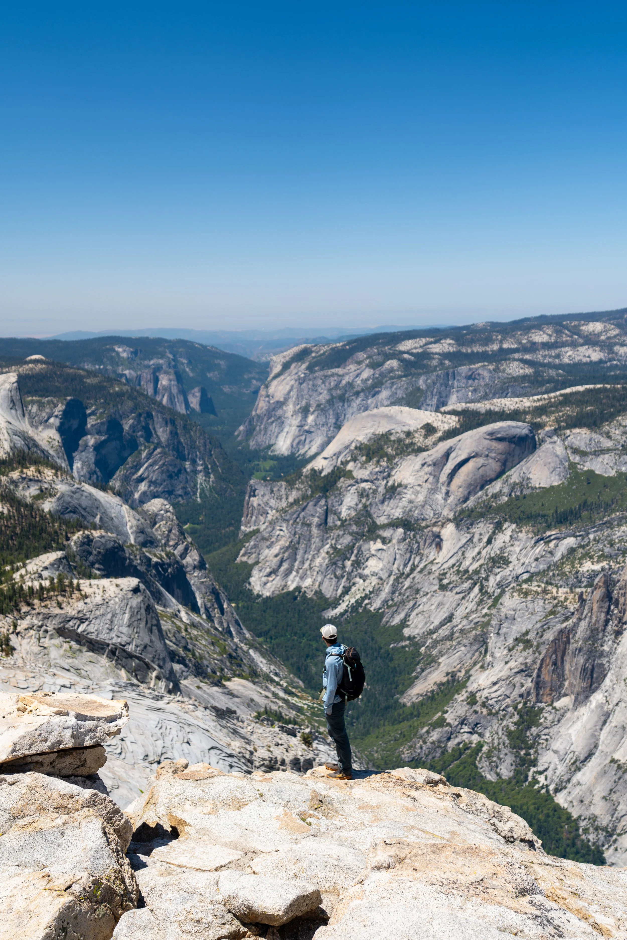
This is because the Mist Trail is one of the most popular day hikes in Yosemite National Park—not to mention that the Mist–John Muir Loop is also the most popular starting point for a number of other day hikes out of Happy Isles, including the Diving Board Trail and The Cables on Half Dome, to name a few.
To learn more about each of these separate adventures, you can find all the details in my separate articles linked below.
Read My Separate Posts: Mist Trail (Vernal & Nevada Falls) / Diving Board Trail / Half Dome Trail
Past the Mist Trail, the Yosemite Valley Loop gets much quieter as it leaves all the busyness of Curry Village and Happy Isles behind, and heads toward Mirror Lake about 2.0 miles (3.2 km) away.
Yosemite Valley Loop-John Muir Junction
This junction is simply a connector trail that leads over to the Mist Trail, just to the right.
That said, go left here to stay on the Yosemite Valley Loop Trail.
This cave reminds me of a somewhat similar cave on the River Trail in Kings Canyon National Park.
At this unmarked split, go right to stay on the Yosemite Valley Loop toward Mirror Lake, as the trail to the left simply leads out to Happy Isles Loop Road.
South Yosemite Valley Loop-Tenaya Creek Bridge Junction
About 1.0 mile (1.6 km) past the Happy Isles Trailhead, the Yosemite Valley Loop comes to this somewhat random split in the trail.
However, it’s one of the most important to mention because the trail to the left is the last option hikers have to cross over Tenaya Creek before the bridge at the far eastern end of the loop.
This means that if you choose to go straight to continue on the Yosemite Valley Loop Trail, there is no quicker option back to Yosemite Village or elsewhere without getting wet in Tanaya Creek or turning back.
All that to say, go straight here to stay on the Yosemite Valley Loop Trail.
These sections on the hike to Mirror Lake tend to be some of the more popular areas of the Valley Loop Trail, as the trail around Mirror Lake—commonly called the Mirror Lake Loop Trail—is a very popular day hike at around 4.0 - 5.0 miles (6.4 - 8.0 km), depending on where you start and end.
This is the beginning of Mirror Lake, which becomes one of the most popular places to swim in Yosemite Valley during the hotter summer months.
That said, Mirror Lake is fed by seasonal snowmelt, meaning that during the mid- to late-summer months, Tenaya Creek shrinks dramatically, along with Mirror Lake.
Therefore, don’t be surprised if you arrive to a dry lakebed, as these photos were taken in mid-June following an average snow year in the Sierras.
Mirror Lake
Technically speaking, the first few ponds along Tenaya Creek are not Mirror Lake.
Rather, this area further back is Mirror Lake, which often surprises visitors when they arrive to find a dry lakebed, as previously mentioned.
This is what Mirror Lake looks like when it dries up, which is common during the summer in Yosemite.
After Mirror Lake, the Yosemite Valley Loop Trail typically becomes much less trafficked, as the vast majority of visitors don’t complete the full loop around Mirror Lake.
As the Yosemite Valley Loop reaches the far eastern end of the trail, don’t forget to look up!
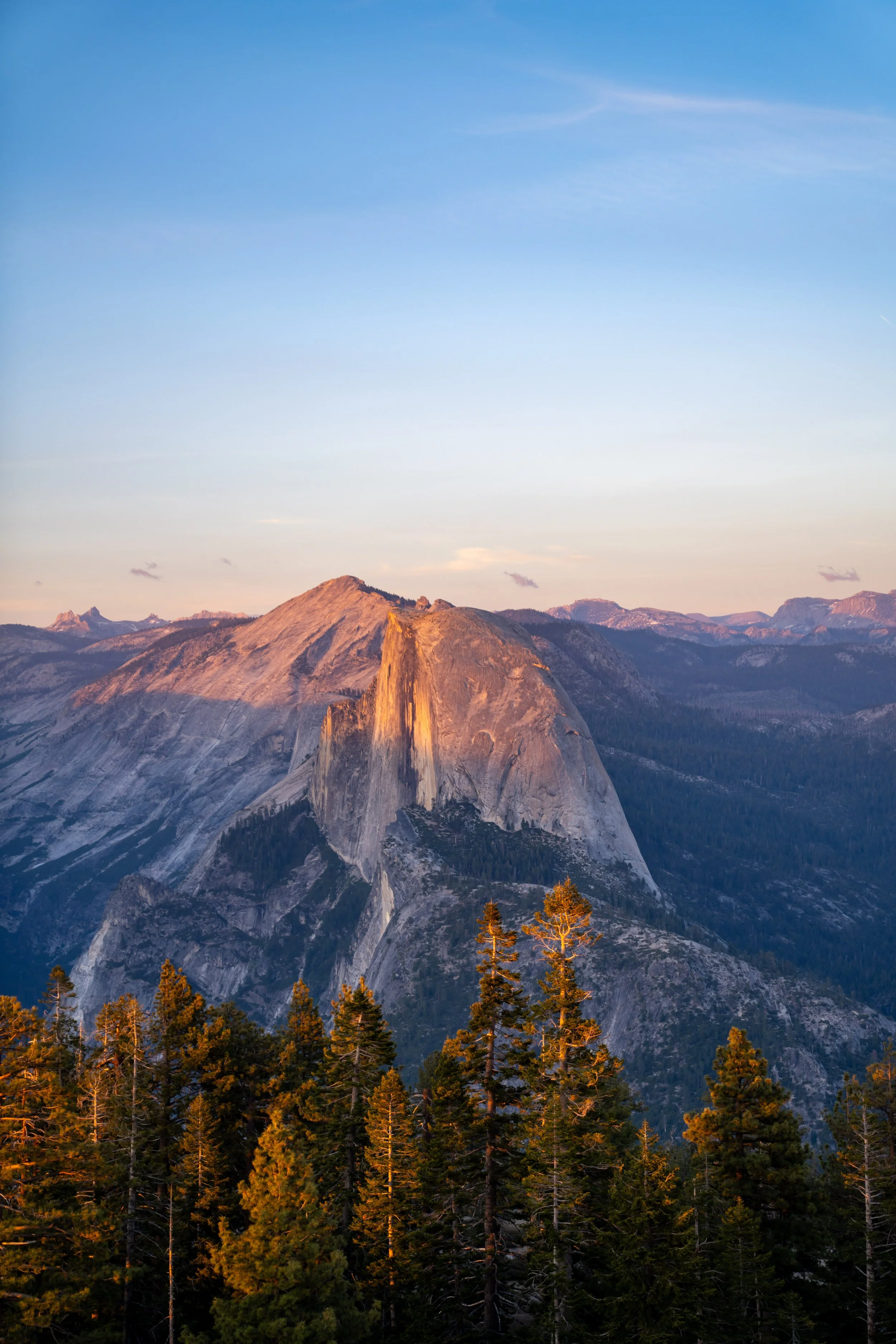
These section passes directly beneath the north face of Half Dome, with the Diving Board located just to the right.
After the boulder field, the Yosemite Valley Loop Trail re-enters the forest.
I mention this because the trail continues through the trees for much of the remaining hike to Lower Yosemite Falls, at the beginning of the loop, meaning there are far fewer views for the rest of the hike to the beginning.
In the spring and early summer months, the Yosemite Valley Loop around Mirror Lake passes a number of typically wet and muddy sections.
However, these sections usually become easier to walk once the snowmelt subsides by mid-summer.
This is another wet section that hikers must navigate, which is why some visitors may prefer to carry trekking poles for the loop around Mirror Lake.
East Tenaya Creek Bridge
The East Tenaya Creek Bridge is the far eastern end of the Yosemite Valley Loop Trail, just like the Pohono Bridge is on the western end.
That said, there are about 5.0 miles (8.0 km) from this point to return to the beginning of the loop, but after everything thus far, these final miles seem to move much faster than other remote areas of the loop.
Yosemite Valley Loop-Snow Creek Junction
The only time the trail splits on the loop around Mirror Lake is at the Snow Creek Trail on the north side of Tenaya Creek.
This route is one of a few commonly hiked to reach North Dome, along with the Upper Yosemite Falls Trail and the Porcupine Creek Trailhead, off Tioga Road.
In any case, go straight (left) at this split to continue back to the beginning of the Mirror Lake Loop.
This is the view toward Half Dome and the Diving Board from the other side of the Mirror Lake Loop.
Yosemite Valley Loop-Mirror Lake Junction
When the Mirror Lake Loop splits again, go right to stay on the Yosemite Valley Loop Trail toward The Ahwahnee, as the split to the left leads to the north side of Mirror Lake and Mirror Lake Road shortly thereafter.
The cool thing about the species shown here is that it is endemic to California, meaning it will not found growing anywhere else in the world except in a few select mountain ranges within the state.
This is where the Yosemite Valley Loop passes by Mirror Lake Road, which hikers can walk over to in order to meet the shuttle, located about 0.4 miles (0.6 km) down the road.
This is why the easternmost portion of the Valley Loop Trail is often called the Mirror Lake Loop Trail.
North Yosemite Valley Loop-Tenaya Creek Bridge Junction
The next junction is more or less the same as the split on the other side of the loop for the Tenaya Creek Bridge on Mirror Lake Road.
That said, go right to stay on the Yosemite Valley Loop Trail, but if hiking in the other direction, know that the trail leaving the loop is the last option hikers have to cross over Tenaya Creek before the bridge at the far eastern end of the Valley.
This means that if you choose to go straight to continue on the Yosemite Valley Loop Trail when hiking the loop in the clockwise direction, there is no quicker option back to Yosemite Village or elsewhere without getting wet in Tanaya Creek or by turning back.
When the Yosemite Valley Loop Trail leaves the Mirror Lake area behind, it becomes much quieter until it reaches Lower Yosemite Falls, which is undoubtedly the busiest part of the entire trail, next to the Happy Isles Trailhead.
This is the bike path that runs between Mirror Lake and Yosemite Village.
Yosemite Valley Loop-North Pines Campground Junction
About 0.4 miles (0.6 km) before The Ahwahnee, the Yosemite Valley Loop Trail splits, with a short connector that leads over to the North Pines Campground.
However, stay to the right and do not cross the bike path to stay on the Yosemite Valley Loop toward Yosemite Village.
Royal Arch Creek
Royal Arch Creek is a nice sign that The Ahwahnee is just a short distance ahead!
The Ahwahnee
This is where the Yosemite Valley Loop Trail passes directly by The Ahwahnee, which is the oldest and most historic hotel in Yosemite—not to mention, staying a few nights in The Ahwahnee is, without a doubt, one of the best things to do in Yosemite National Park!
In any case, the Yosemite Valley Loop Trail does not go toward the hotel in any way; rather, it simply parallels Ahwahnee Drive toward Yosemite Village.
Book Here: The Ahwahnee
Church Bowl Picnic Area
The Church Bowl Picnic Area is one of the best-kept secrets in Yosemite Valley because, when all the parking fills in Yosemite Village, this hidden parking area along the Yosemite Valley Loop Trail can be a great place to find a spot.
Now, finding a place to park is certainly never a guarantee, but fewer visitors know to look for parking here compared to the areas closer to Lower Yosemite Falls.
Yosemite Valley Loop-Yosemite Village Junction
On the far side of the Church Bowl Picnic Area, go right to stay on the Yosemite Valley Loop toward Lower Yosemite Falls.
That said, the trail to the left leads directly through the heart of Yosemite Village, while the Yosemite Valley Loop simply navigates its way around it, avoiding the busiest sections before Lower Yosemite Falls.
These open sections before Lower Yosemite Falls are among the few places after Mirror Lake that have views across Yosemite Valley, which is exactly what I was mentioning after the boulder field on the east end of Mirror Lake.
Yosemite Valley Loop-Yosemite Cemetery Junction
Shortly before the Yosemite Valley Loop Trail reaches the Lower Yosemite Falls Trail, the loop splits—back to back—into two paths that lead into Yosemite Village toward the Yosemite Cemetery.
Here, go right at both splits to stay on the Valley Loop Trail toward Lower Yosemite Falls.
East Yosemite Valley Loop-Lower Yosemite Falls Junction
Finally, after roughly 21.2 miles (34.1 km) of hiking, the Yosemite Valley Loop Trail returns to the Lower Yosemite Falls Trail, where the two trails follow the same path past Lower Yosemite Falls to the start of the loop, as shown at the beginning of this article.
From here, go right to finish hiking the remaining 0.4 miles (0.6 km) back to the beginning.
Read My Separate Post: Lower Yosemite Falls Trail
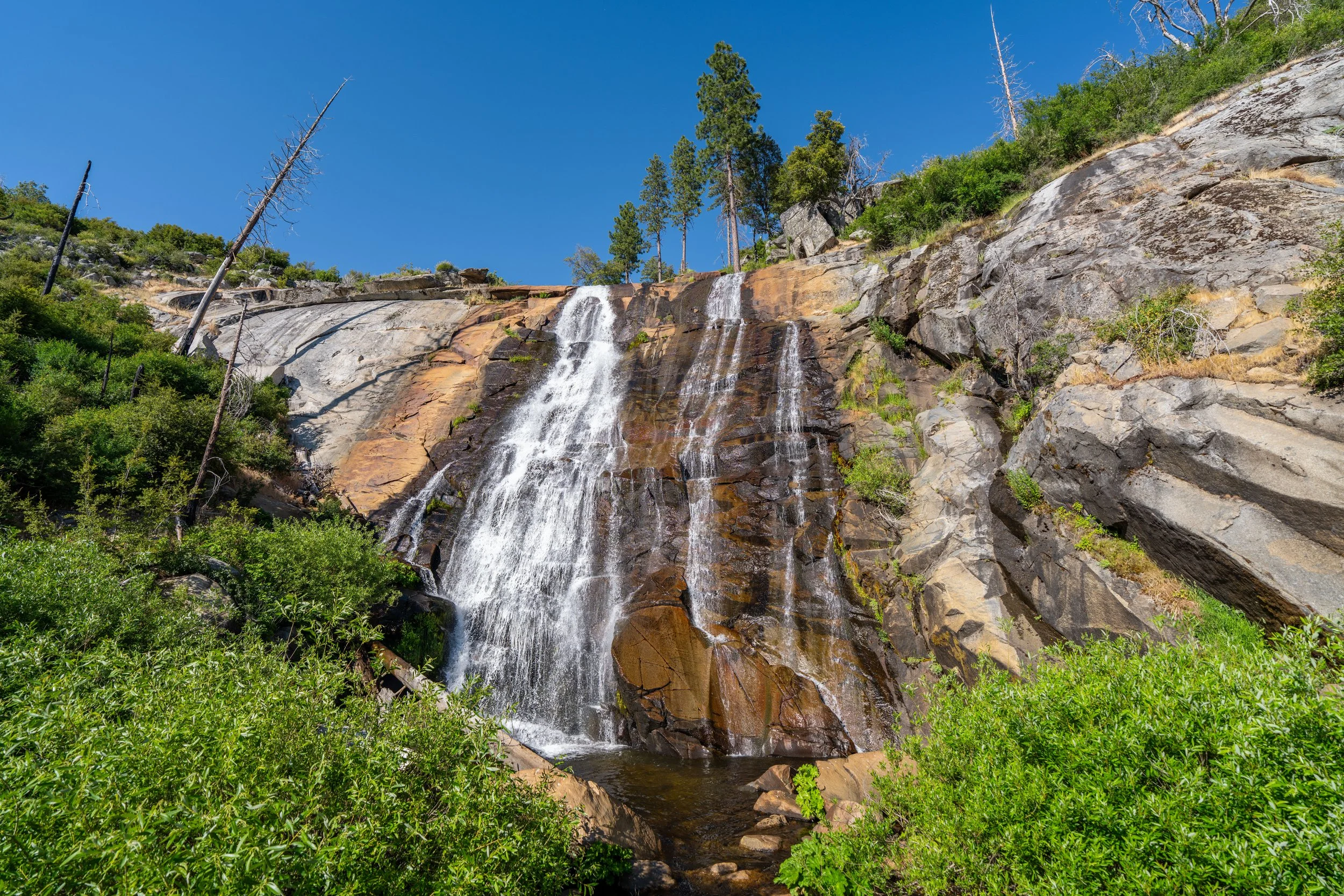
Lower Yosemite Falls
At the very back of the Lower Yosemite Falls Loop, the trail reaches the base of Lower Yosemite Falls, a 320-ft. (98 m) waterfall that is just one of three different drops that make up all of Yosemite Falls.
I think it’s important to mention that this viewpoint is one of the busiest areas in all of Yosemite National Park, which is why I highly recommend hiking to Lower Yosemite Falls first thing in the morning if possible!
At this split, it doesn’t matter which direction you decide to go, as both sides meet again shortly ahead.
West Yosemite Valley Loop-Lower Yosemite Falls Junction
After 21.6 miles (34.8 km), this is where the Yosemite Valley Loop Trail returns to the initial split shown at the beginning of this article.
From here, go left to return to the trailhead and Yosemite Village on the other side of Northside Drive, or go right to continue on the Yosemite Valley Loop toward Upper Yosemite Falls.
Read My Separate Post: Lower Yosemite Falls Trail
To skip back to this same junction from the beginning of this article, click here.