Hiking the Four Mile Trail in Yosemite National Park
Distance (One Way): 5.1 miles / 8.2 km
Elevation Change: 3,220 ft. / 981 m
The Four Mile Trail in Yosemite National Park is one of the most underrated day hikes in Yosemite Valley, which largely has to do with its perception of being a challenging and unnecessary adventure.
By this, I mean that when visitors look at a map and see that the Four Mile Trail simply connects the Yosemite Valley floor with Glacier Point, most think: Why would I hike such a steep trail to get between two points that can be driven to? And, while I think it fair to think this, most don’t account for how incredibly scenic the Four Mile Trail is!
Yes, the Four Mile Trail is one of the most beautiful, panoramic day hikes in Yosemite Valley—even more so than other big-name trails like the Mist Trail, in my opinion.
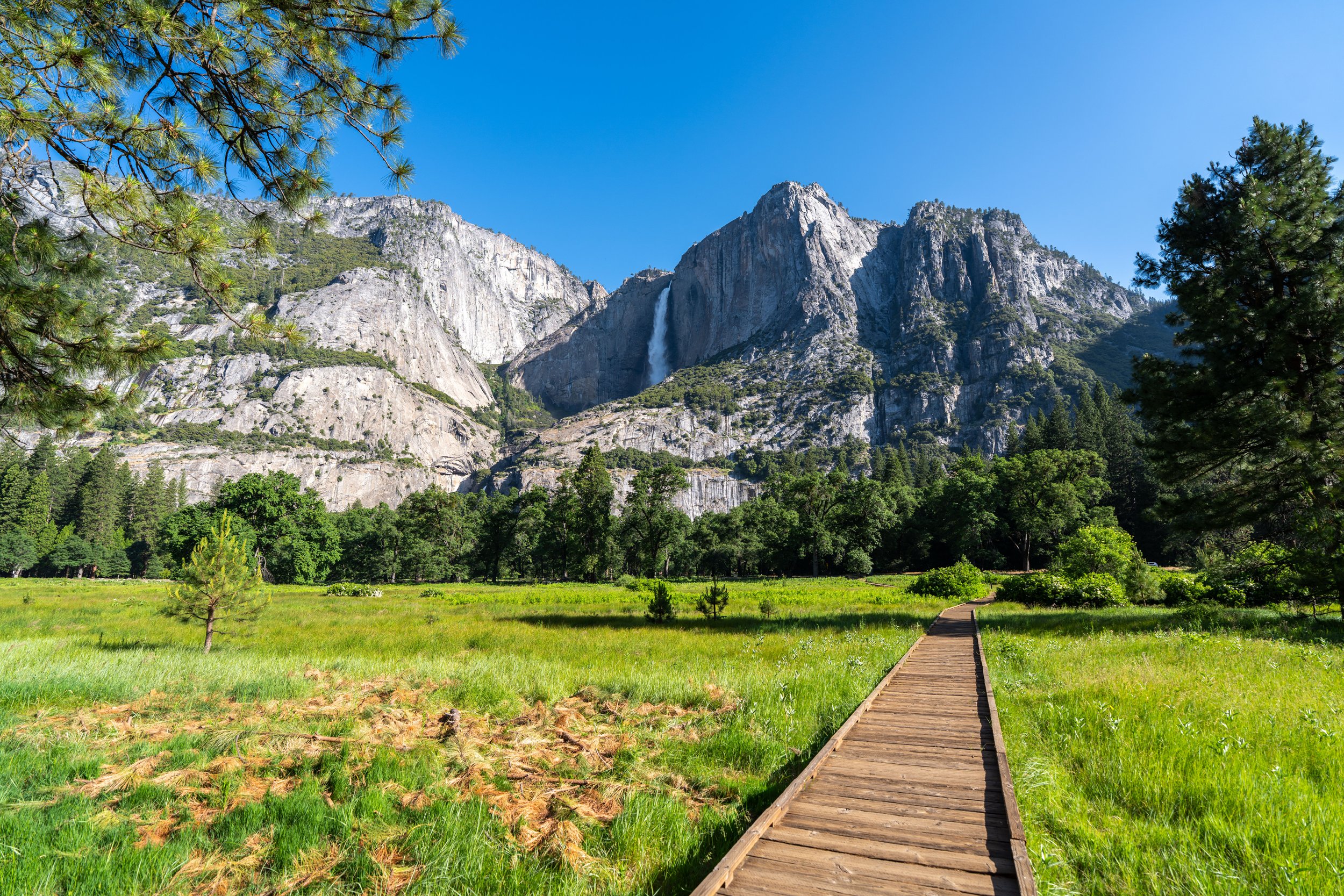
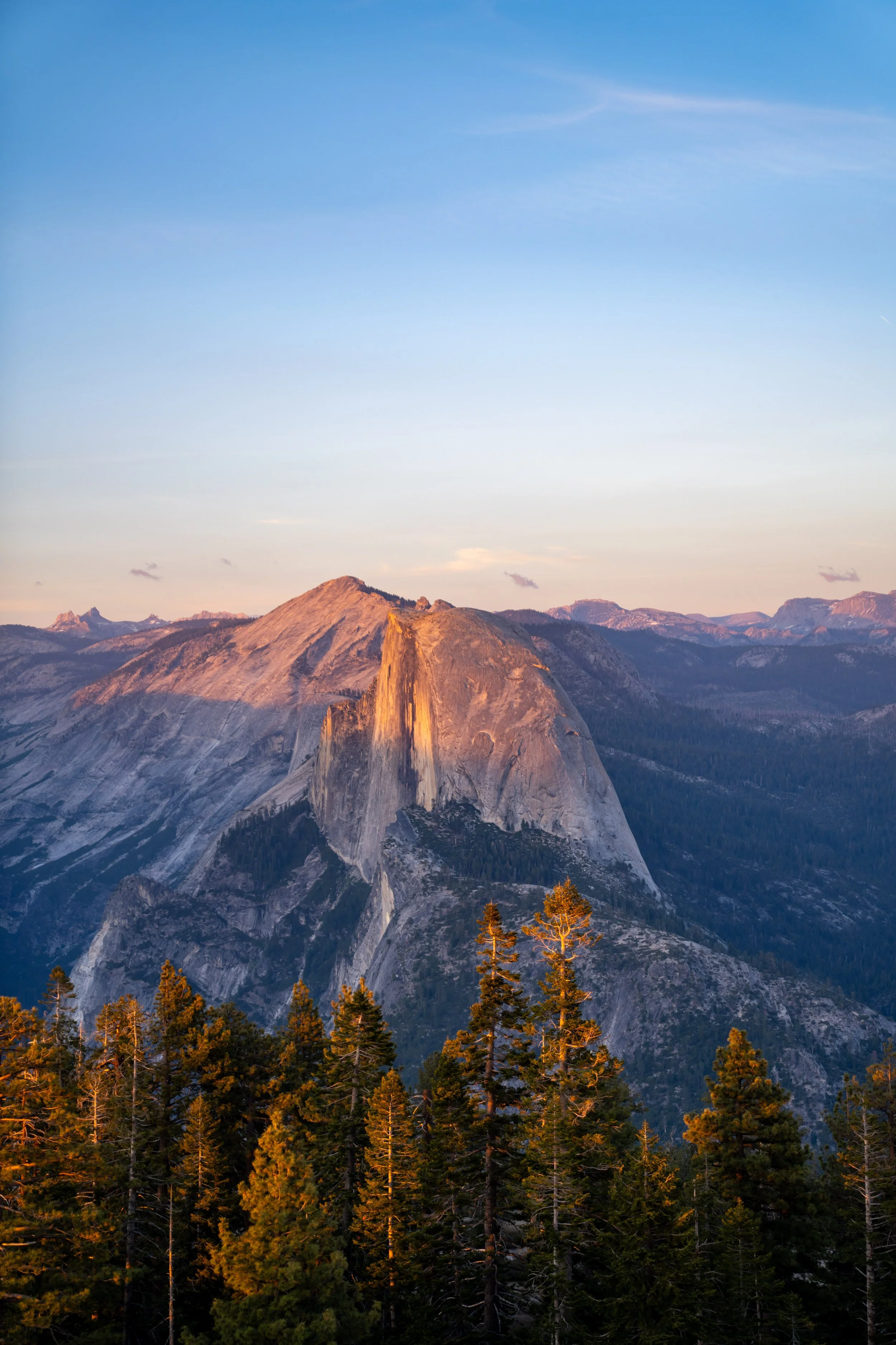
I say this because there are incredible views of El Capitan, Half Dome, Upper Yosemite and Lower Yosemite Falls—not to mention the entire valley floor!
All this goes without saying that the Four Mile Trail can be an incredibly easy, all-downhill adventure for those who have the ability to get dropped off at Glacier Point and picked up in Yosemite Valley. This certainly is the luxury way of doing it, as there are no shuttle buses between the valley floor and Glacier Point, which the National Park Service explicitly posts a number of times throughout the trail. Needless to say, hikers have made this mistake before!
Is the Four Mile Trail in Yosemite Open Year-round?
The short answer is no.
Just like the Mist Trail past Vernal Falls, the National Park Service closes the Four Mile Trail during the winter off-season months—which typically means November/ December - early to mid-May, depending on seasonal snowfall.
Four Mile Trailhead Parking
Parking for the Four Mile Trail is located either on Southside Drive in Yosemite Valley, just past Cathedral Beach, or at Glacier Point, which is easily the busier of the two trailheads to begin.
If you plan to start at the top, know that Glacier Point is the busiest location in Yosemite National Park outside of Yosemite Valley, meaning that parking can be difficult to come by from mid-morning until sunset during the busy summer travel season.
Google Maps Directions: Four Mile Trailhead (Yosemite Valley) / Four Mile Trailhead (Glacier Point)
Hiking Checklist - Yosemite
Here is a complete list of must-have things that you will want for any hike in Yosemite National Park.
That said, bear spray is purposefully excluded from this list because, while the Sierra Nevadas are home to a large Black Bear population, bear spray is not allowed in Yosemite National Park.
Hiking the Four Mile Trail
While the Four Mile Trail can begin from either Yosemite Valley or Glacier Point, this is article is about the trail from bottom to top, which is the most common direction to do the hike.
Four Mile-Yosemite Valley Loop Junction
The only time the Four Mile Trail splits before Glacier Point is right away—when the trail crosses the Yosemite Valley Loop Trail—and at Union Point, about halfway up.
That said, the Yosemite Valley Loop Trail is truly a hike for another day, but it’s an adventure that I highly recommend if you have the time when visiting Yosemite.
In any case, go straight to continue on the Four Mile Trail, which will begin climbing in about 0.1 miles (0.2 km).
Read My Separate Post: Yosemite Valley Loop Trail
It certainly would be nice if there was a shuttle between Yosemite Valley and Glacier Point, as it would also be useful for the Pohono Trail.
However, this is also what makes the Four Mile Trail such a hidden gem, as few visitors hike the switchbacks because of its dramatic elevation change.
Despite its name, the Four Mile Trail is quite a bit longer than 4.0 miles (6.4 km), as the name comes from the original route constructed in 1872 before sections were re-routed into what we have today.
That said, the historical name stuck, even though the one-way distance today measures 5.1 miles (8.2 km) each way—which I measured on two different GPS devices.
On a different note, the National Park Service reports that the Four Mile Trail is a very dangerous, exposed day hike, but, in my opinion, it’s really no different than the Upper Yosemite Falls Trail when the switchbacks are snow-free.
Yosemite Wilderness Boundary
This is where the Four Mile Trail crosses into the Yosemite Wilderness.
This gate is where the National Park Service closes the Four Mile Trail in Yosemite Valley during the winter off-season months.
In total, there are 58 switchbacks from the valley floor to Glacier Point, which—considering that the Upper Yosemite Falls Trail has 60 switchbacks in just the second half of the hike, not including the hike to Columbia Rock—58 doesn’t seem all that bad!
When the Four Mile Trail reaches the sixth switchback, the trail begins the longest straightaway of the entire climb, measuring 0.7 miles (1.1 km) to the next.
This is Bigleaf Maple, which is reported to be the tallest maple species in all of North America, as well as a major contributor to the beautiful fall colors in Yosemite Valley!
The views of Upper Yosemite Falls only continue to get better the higher the Four Mile Trail climbs, especially on the upper half of the hike!
The point that can be seen in the distance is not Glacier Point; rather, Glacier Point is located much farther up, where the faint power lines can be seen disappearing into the trees at the top!
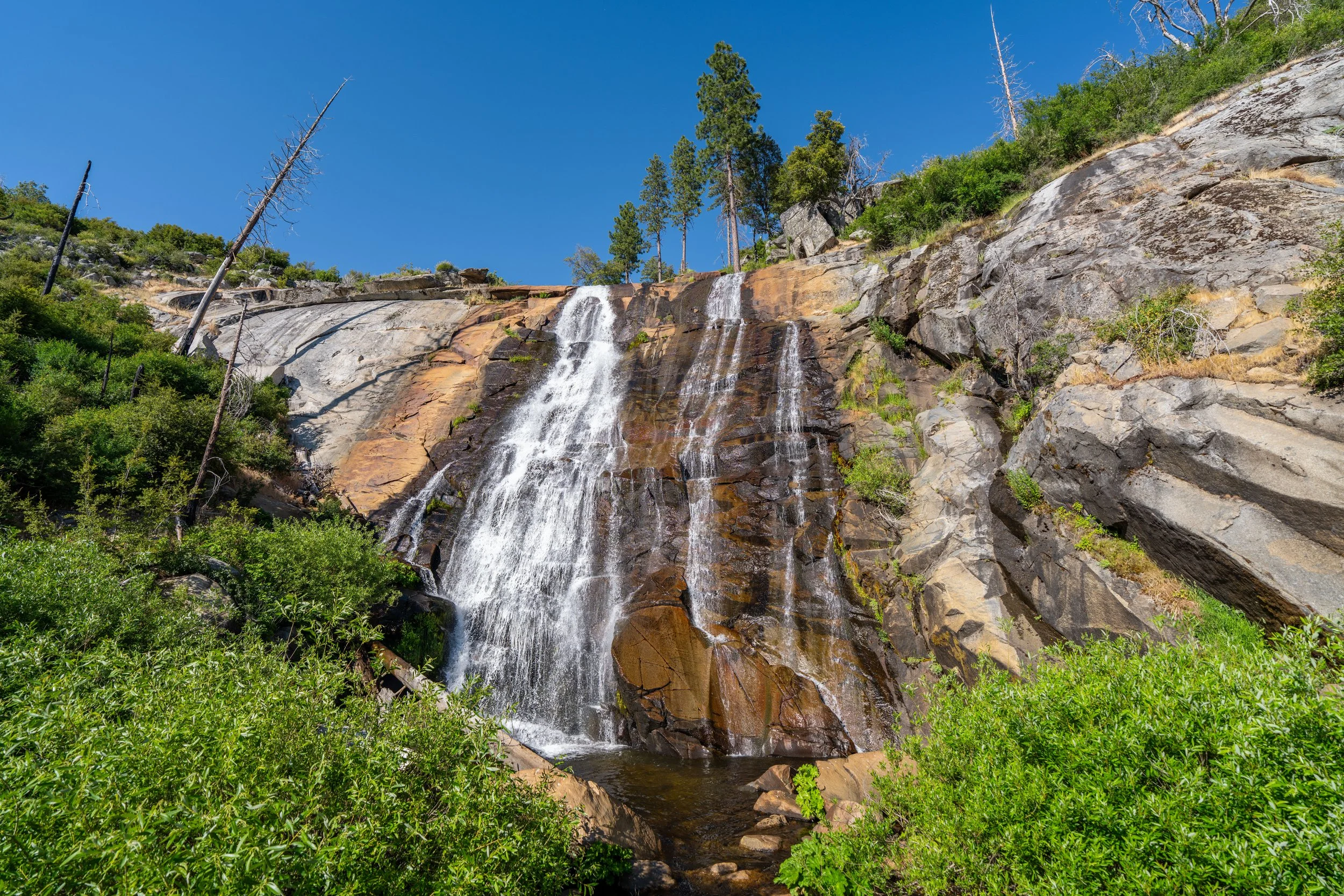
This unnamed creek is often the only 'reliable' water source on the Four Mile Trail, but in the mid- to late-summer months, the creek typically runs dry.
This is the seventh switchback, where the long 0.7-mile (1.1 km) straightaway ends.
Since the Four Mile Trail is such a long and exposed adventure, I highly recommend wearing a hooded sun shirt to stay safe from the sun!
The views really open up quickly on the Four Mile Trail, which I think is important to point out because hiking just the first 1.0 miles (1.6 km) from either trailhead can be a great way to enjoy a quick, uncrowded adventure in Yosemite Valley—especially at golden hour!
These short, condensed switchbacks show just how quick some of the 58 switchbacks can be!
Some hikers may want to carry trekking poles for the near-constant elevation on the Four Mile Trail, as there are truly very few places—other than the very beginning—where the hike is flat!
In my opinion, these middle switchbacks below Union Point are where the Four Mile Trail can start to feel long, like the climb up the Upper Yosemite Falls Trail past the initial viewpoint of the waterfall.
However, at least the views of Yosemite Valley are incredible throughout!
Once again, I want to stress the importance of wearing a hooded sun shirt on the Four Mile Trail—and in Yosemite National Park in general!
Summer days are typically very sunny and hot in the Sierras, and if you plan to hike a number of popular trails throughout the park, one—or even a few sun shirts—will be more than useful for a multi-day visit.
These views out toward Upper Yosemite Falls certainly wouldn’t be the same in the mid to late summer months, when the streams in the Valley run dry!
The cliffs straight ahead are located directly beneath Union Point, which is a nice sign that there’s only about 2.0 miles (3.2 km) remaining from this point to the top of the Four Mile Trail.
Just like the gate at the very first switchback, this is where the National Park Service closes the Four Mile Trail during the winter off-season.
Four Mile-Union Point Junction
At about 1.8 miles (2.9 km) from Glacier Point, the Four Mile Trail reaches a short out-and-back side trail to Union Point.
That said, go left to stay on the Four Mile Trail, or go right to walk out to Union Point.
This is the short trail out to Union Point.
Union Point
Union Point is the only named vantage point on the Four Mile Trail, but, in my opinion, the best views can be found along the uppermost switchback before the trail turns into the forest toward Glacier Point.
As for the name itself, Union Point is documented as having an unknown origin, but historical records indicate that it was almost certainly named after the Union from the Civil War days, as this was a very patriotic name at the time of the trail’s construction in 1872.
Following Union Point, the Four Mile Trail climbs 13 more switchbacks to the top, with the best and most beautiful carved into the mountain, before the views disappear altogether in the forest below Glacier Point.
This is the final switchback, where the best views on the Four Mile Trail can be found just a short distance ahead!
This final switchback, before the Four Mile Trail turns into the forest toward Glacier Point, is the most scenic stretch of the entire hike, and it’s a great, easy destination to reach from the upper trailhead, as it’s only a 0.9-mile (1.4 km) hike to get to this point from the top!
When the Four Mile Trail turns into the forest, following the final switchbacks, the views of Yosemite Valley are all but gone.
However, Glacier Point is often seen as the end of the Four Mile Trail, and that alone is worth the hike to the top—especially at sunset!
Four Mile-Glacier Point Junction
This is the beginning of the Four Mile Trail from Glacier Point, with Glacier Point located to the left of this junction and the Glacier Point Trailhead located to the right of this junction.
On a different note, I highly recommend stopping in the Glacier Point Gift Shop for some ice cream once you make it to the top, as there’s truly nothing quite like taking a break on a hot summer day at Glacier Point with a cold ice cream sandwich in hand!
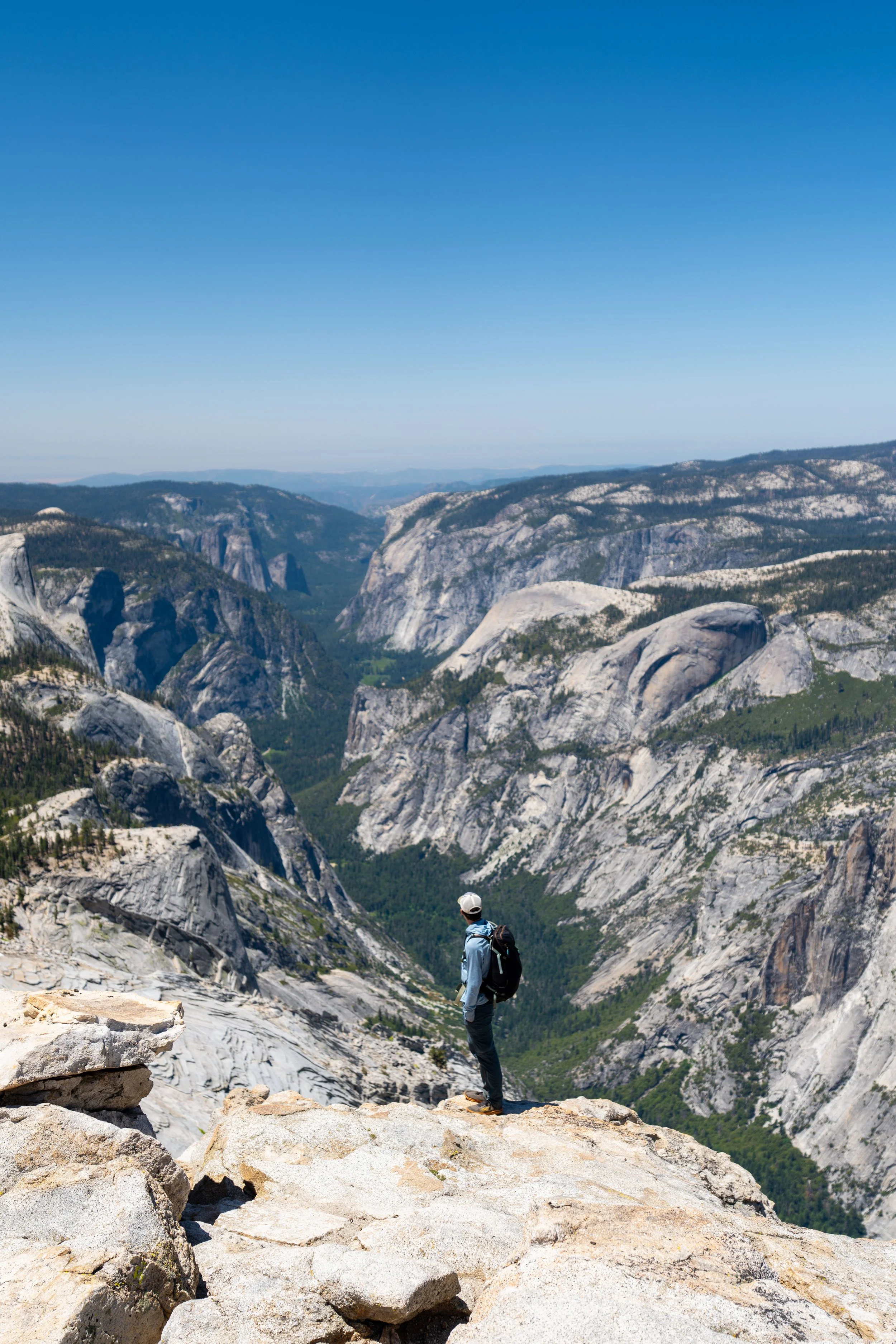
Glacier Point
Glacier Point is easily one of the most beautiful panoramic viewpoints in all of Yosemite National Park, and it’s a place that I highly recommend visiting for sunset—even if that means making the long drive back up after hiking the Four Mile Trail.
I say this because Glacier Point, along with Washburn Point and the Sentinel Dome just up the road, are three of the best sunset spots in all of Yosemite National Park, and all three just so happen to be located within a very short distance of one another!