Hiking the Upper Yosemite Falls Trail in Yosemite National Park
Distance (Top of Yosemite Falls): 7.0 miles / 11.3 km
Distance (Yosemite Point & Top of Yosemite Falls): 8.8 miles / 14.2 km
Elevation Gain (Top of Yosemite Falls): 2,710 ft. / 826 m
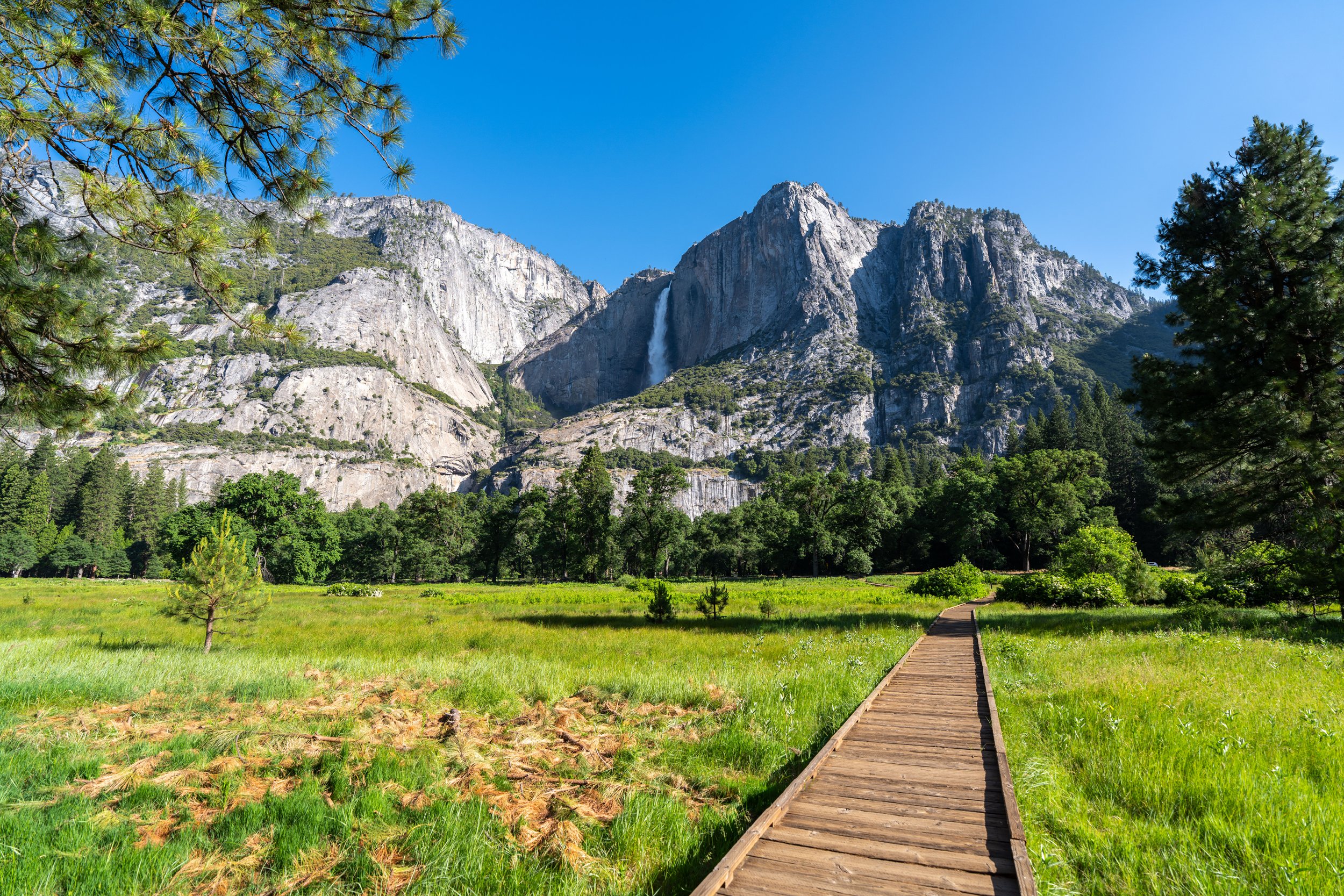
The Upper Yosemite Falls Trail in Yosemite National Park is the best of the best!
It’s without a doubt one of the best things to do in Yosemite Valley—not to mention, the trail is significantly less crowded than the Mist Trail because there is so much elevation gain.
That said, I personally don’t believe that hikers have to climb all the way to the top of Yosemite Falls to enjoy the best of the trail, as the best views, in my opinion, are located less than 2.0 miles (3.2 km) into the hike.
All this to say, I could not recommend hiking the Upper Yosemite Falls Trail more, as it’s one of my favorite hikes in Yosemite Valley when the waterfalls are flowing, and the views of both Yosemite Falls and the Valley are truly second to none throughout the trail!

My Print - Upper Yosemite Falls
Upper Yosemite Falls Trailhead Parking
Parking for the Upper Yosemite Falls Trail is located directly across from the overnight parking area for Camp 4. This is the day-use lot, whereas day hikers are not permitted to park in the Camp 4 parking lot closest to the trailhead.
That said, parking in the Upper Yosemite Falls day-use lot can be very difficult to find by midday, as all the spots typically fill early once the lots in Yosemite Village begin to get full.
This is why I always recommend arriving first thing in the morning, which is something I say for most adventures in and around Yosemite Valley.
Google Maps Directions: Upper Yosemite Falls Trailhead
Hiking Checklist - Yosemite
Here is a complete list of must-have things that you will want for any hike in Yosemite National Park.
That said, bear spray is purposefully excluded from this list because, while the Sierra Nevadas are home to a large Black Bear population, bear spray is not allowed in Yosemite National Park.
Hiking the Upper Yosemite Falls Trail
From the day-use Upper Yosemite Falls parking lot, the true trailhead can be found across Northside Drive and on the far side the Camp 4 parking lot.
Upper Yosemite Falls Trailhead
This is where the true Upper Yosemite Falls Trail begins!
Upper Yosemite Falls-Yosemite Valley Loop Junction
After just 0.1 miles (0.2 km) from Camp 4, the Upper Yosemite Falls Trail splits for the first and only time before the trail climbs to the top of the waterfall; this is the Yosemite Valley Loop Trail.
Here, go left, then right immediately following to begin the switchbacks up to Columbia Rock and Upper Yosemite Falls beyond.
Read My Separate Post: Yosemite Valley Loop Trail
Other than the top of Yosemite Falls, Yosemite Point is the second-most popular day-hiking destination on the Upper Yosemite Falls Trail, which I’ve included in this post below.
Yosemite Wilderness Boundary
This is where the Upper Yosemite Falls Trail crosses into the Yosemite Wilderness.
After crossing the wilderness boundary, the Upper Yosemite Falls Trail begins climbing 46 or 47 switchbacks—depending on how you count—to reach the straightaway atop the initial ascent.
That said, the number of switchbacks may seem intimidating, but the vast majority are very short, as the trail constantly switches directions up the steep valley walls.
Some hikers will definitely want to carry trekking poles on the Upper Yosemite Falls Trail because the elevation change really is that rapid, at 2,710 ft (826 m), to the uppermost part of the hike just before the overlook at the top.
I’ve included a lot of photos throughout this section, but it’s not because these initial switchbacks cover a lot of distance.
In fact, the uppermost switchback on this initial ascent is only located 0.8 miles (1.3 km) into the hike.
However, I wanted to show just how much elevation change there really is on the Upper Yosemite Falls Trail, since it’s hard to visualize all the uphill—especially because these switchbacks are hidden by the trees from the valley floor.
This is where the Upper Yosemite Falls Trail reaches the 47th switchback, and the straightaway toward One Mile Corner.
This 'flatter' section really is a nice break after the tedious hike up to get to this point!
One Mile Corner
One Mile Corner is the unofficial name for this switchback and viewpoint, located right around the 1.0-mile (1.6 km) mark below Columbia Rock.
Those who are familiar may recognize this name from Two Mile Corner on the Bright Angel Trail in Grand Canyon National Park.
After One Mile Corner, the Upper Yosemite Falls Trail climbs 7 more switchbacks to reach Columbia Rock.
Columbia Rock
After 1.2 miles (1.9 km), the Upper Yosemite Falls Trail reaches Columbia Rock, a panoramic viewpoint overlooking Yosemite Valley in all directions.
From here, the trail continues for another 0.5 miles (0.8 km) to the point where Upper Yosemite Falls finally becomes visible from the trail.
Other than this one steep section, the hike past Columbia Rock to the viewpoint of Upper Yosemite Falls is much flatter than the beginning switchbacks.
This is where the trail descends two switchbacks just before the viewpoint of Upper Yosemite Falls.
These switchbacks certainly are a little annoying on the hike back!
After the two switchbacks, the Upper Yosemite Falls Trail continues on a gradual downhill path toward the viewpoint just ahead.
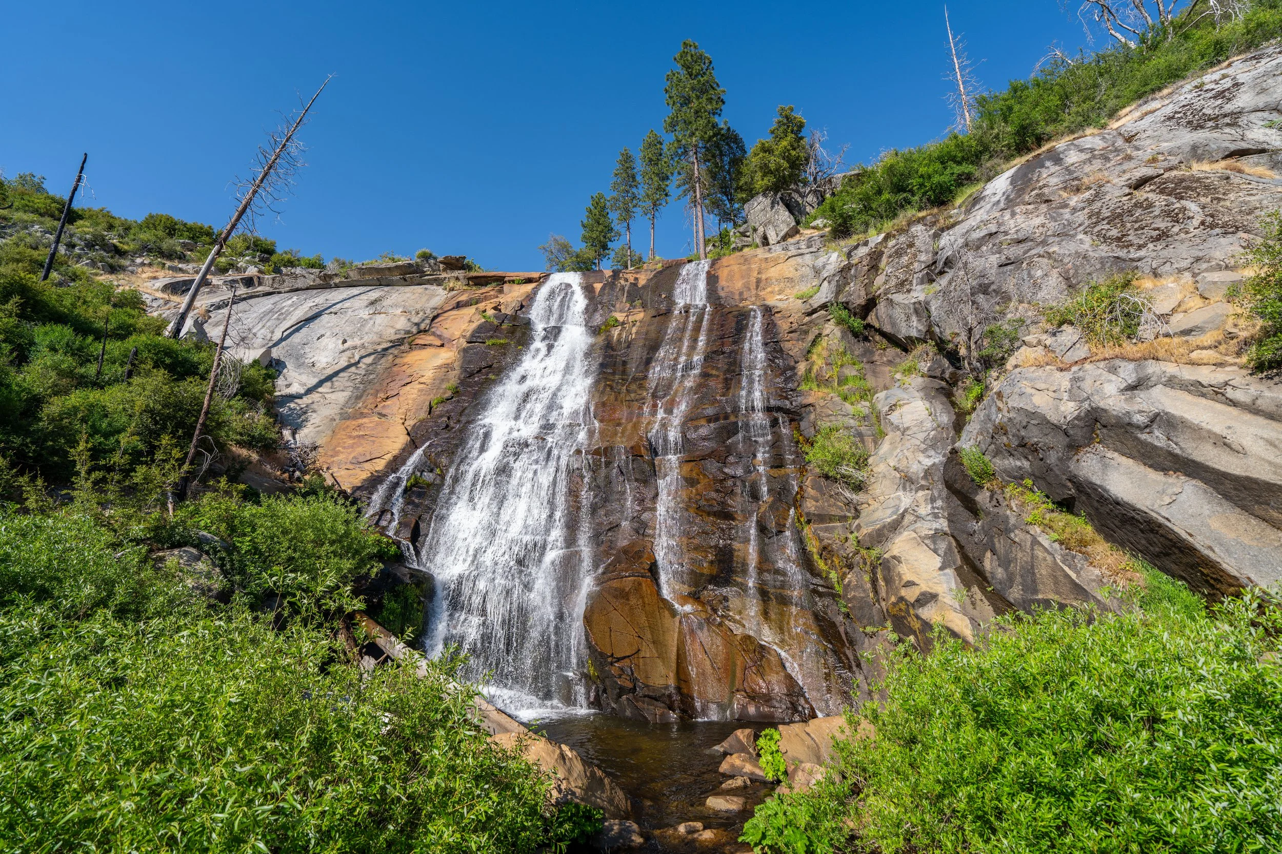
After a long and tedious 1.7-mile (2.7 km) ascent, Upper Yosemite Falls finally becomes visible after rounding this corner.
That said, I personally think these next few switchbacks are some of the best places on the entire hike to enjoy Upper Yosemite Falls. Which is to say, if you don’t feel like hiking the entire trail up to the top, somewhere over the next 0.25 miles (0.4 km) makes for a great turnaround point, because you can enjoy the best of the waterfall without committing to the most challenging sections of the hike on the switchbacks ahead.
From the switchbacks above to the trees ahead, the best places to take photos of Upper Yosemite Falls can be found!
It’s certainly important to recognize the dangers of hiking along such a cliff—especially when things are still melting in the late spring and early summer months.
That is to say, life-threatening rockfall has occurred here in the past.
When the Upper Yosemite Falls Trail re-enters the forest, the switchbacks to the top of the waterfall start almost immediately.
Here, the trail climbs a series of 59 or 60 switchbacks—depending on how you count—to reach the junction at the top of the waterfall.
Yes, nearly 60 switchbacks to climb up this long ascent, with some ranging from just a couple of steps to as much as 0.1 miles (0.2 km) long.
To put it in perspective, these two photos show three very short switchbacks that cover almost no distance at all.
The next two back-to-back switchbacks, numbers 15 and 17, are the two best places on the entire hike up to see all of Upper Yosemite Falls from the trail.
The top of this switchback is another great place to enjoy the waterfall.
This is why, if the first one is crowded, I recommend walking just a little farther to reach this second spot to take a break and enjoy the view!
This is the view from the upper switchback.
After the two viewpoints mentioned above, the Upper Yosemite Falls Trail gradually begins to transition out of the trees.
The views definitely get better and better on the hike up, but with that, the shade quickly disappears!
This remains the case for much of the hike to the top, which usually means that either on the hike up or down, you’ll be spending a lot of time in the sun.
This is why I highly recommend hiking in a good hooded sun shirt, as one will certainly be useful here and for day hikes across Yosemite National Park.
This certainly was a beautiful day in the Valley!
This is where the top of Yosemite Falls and Yosemite Point start to become visible, if you know where to look!
These upper switchbacks are noticeably longer than the very short, quick ones at the beginning of this steep ascent.
As previously mentioned, some hikers may want to carry trekking poles, especially for the hike back down!
These final switchbacks in the sun are really where the hike up started to feel long.
However, having the option to swim once at the top makes this steep climb all worth it!
Upper Yosemite Falls-Eagle Peak Junction
At the very top of the switchbacks, the Upper Yosemite Falls Trail reaches this junction that splits to the left toward Eagle Peak and El Capitan, and to the right toward Upper Yosemite Falls and the North Dome.
That said, go right to reach the top of Yosemite Falls, about 0.3 miles (0.5 km) away.
Upper Yosemite Falls-North Dome Junction
The next split is where the Upper Yosemite Falls Trail branches off toward the top of the waterfall, as well as where the North Dome Trail begins toward Yosemite Point.
Here, go right to reach the top of Yosemite Falls, about 0.2 miles (0.3 km) away.
The very end of the Upper Yosemite Falls Trail is a steep, narrow descent to an overlook directly adjacent to the top of the waterfall.
This is similar to the viewpoint at the top of Vernal Falls, but know that this final 0.1-mile (0.2 km) stretch is easily the most dangerous part of the entire hike because the trail is so narrow and exposed.
This descent should never be attempted when the trail is icy or slippery in any way; the consequences are just too high!
When the trail turns to the right toward Yosemite Valley, it will begin the final narrow ledge to the viewpoint above the waterfall.
This is the most exposed section of the hike down to the top of Yosemite Falls.
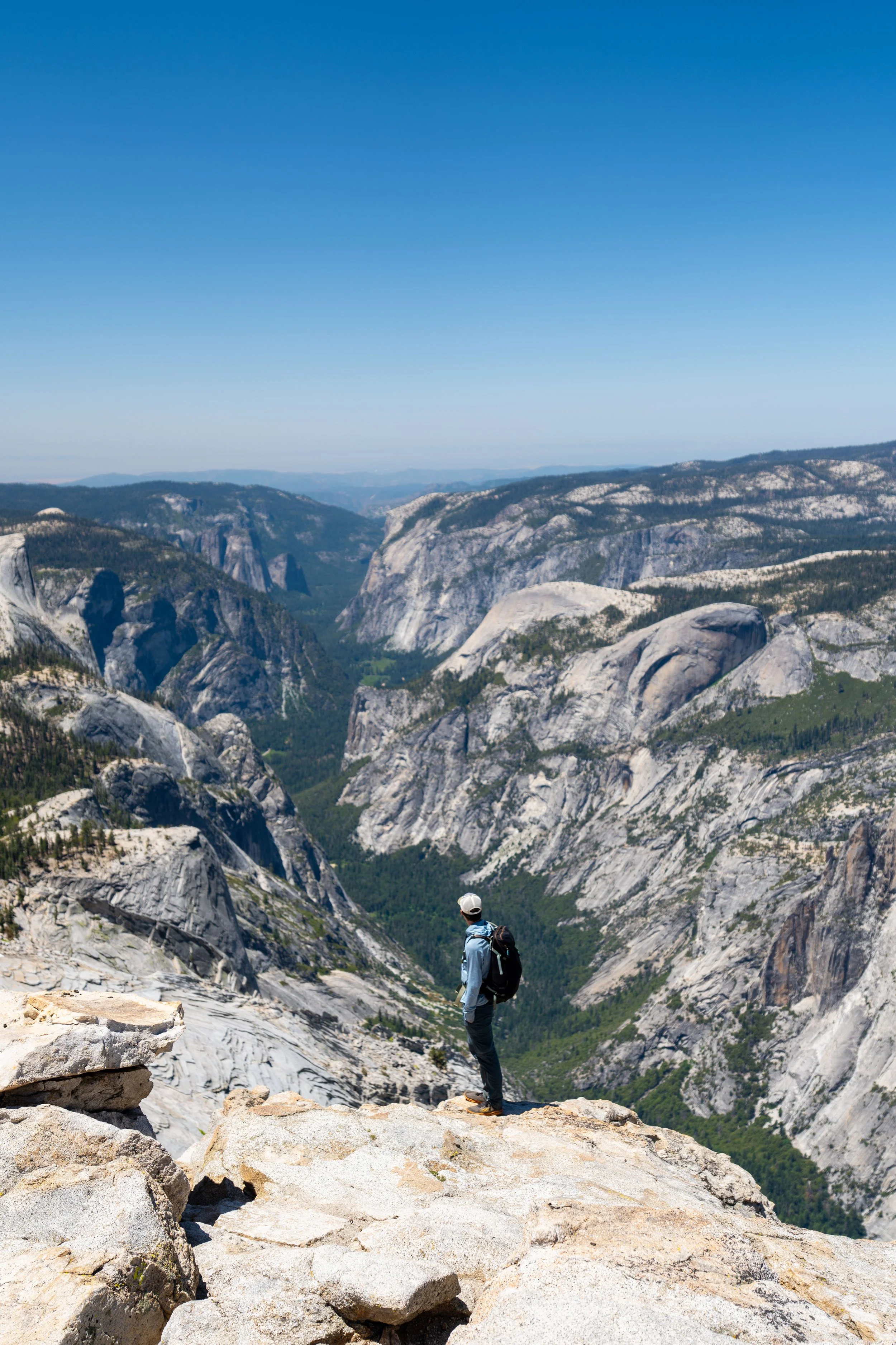
Top of Yosemite Falls
The top of Yosemite Falls is this viewpoint above the 2,425 ft. (739 m) waterfall that includes both Upper and Lower Yosemite Falls, as well as the middle cascades.
Capturing a photo like this certainly is cool, but at the same time, it’s worth pointing out that hikers have died from falling over the cliff at the top of Yosemite Falls.
Please know your limits before getting this close!
Upper Yosemite Falls-North Dome Junction
Once back at the North Dome junction, hikers have the option to continue down to Yosemite Creek—a popular swimming spot when snowmelt has subsided from its peak—as well as Yosemite Point, about 0.9 miles (1.4 km) away.
That said, go straight (right) to begin the North Dome Trail toward Yosemite Point, or go left to return to the beginning.
At first, the North Dome Trail drops down to Yosemite Creek, where visitors often enjoy getting in the water on a hot summer day.
Signs like this are definitely put up with good intentions, as swimming here—or in any creek in the Sierras—can be dangerous throughout the year, especially in the late spring and early summer months.
After crossing Yosemite Creek, the North Dome Trail climbs 11 short and gradual switchbacks to reach Yosemite Point.
These switchbacks are nowhere near as challenging as the ones that climb to Columbia Rock or the top of Yosemite Falls.
This is the final 0.3-mile (0.5 km) stretch that leads straight out to Yosemite Point at the top of the switchbacks.
Yosemite Point-North Dome Junction
Just before Yosemite Point, the North Trail splits away to the left toward North Dome, located roughly 3.5 miles (5.6 km) to the east.
Yosemite Point
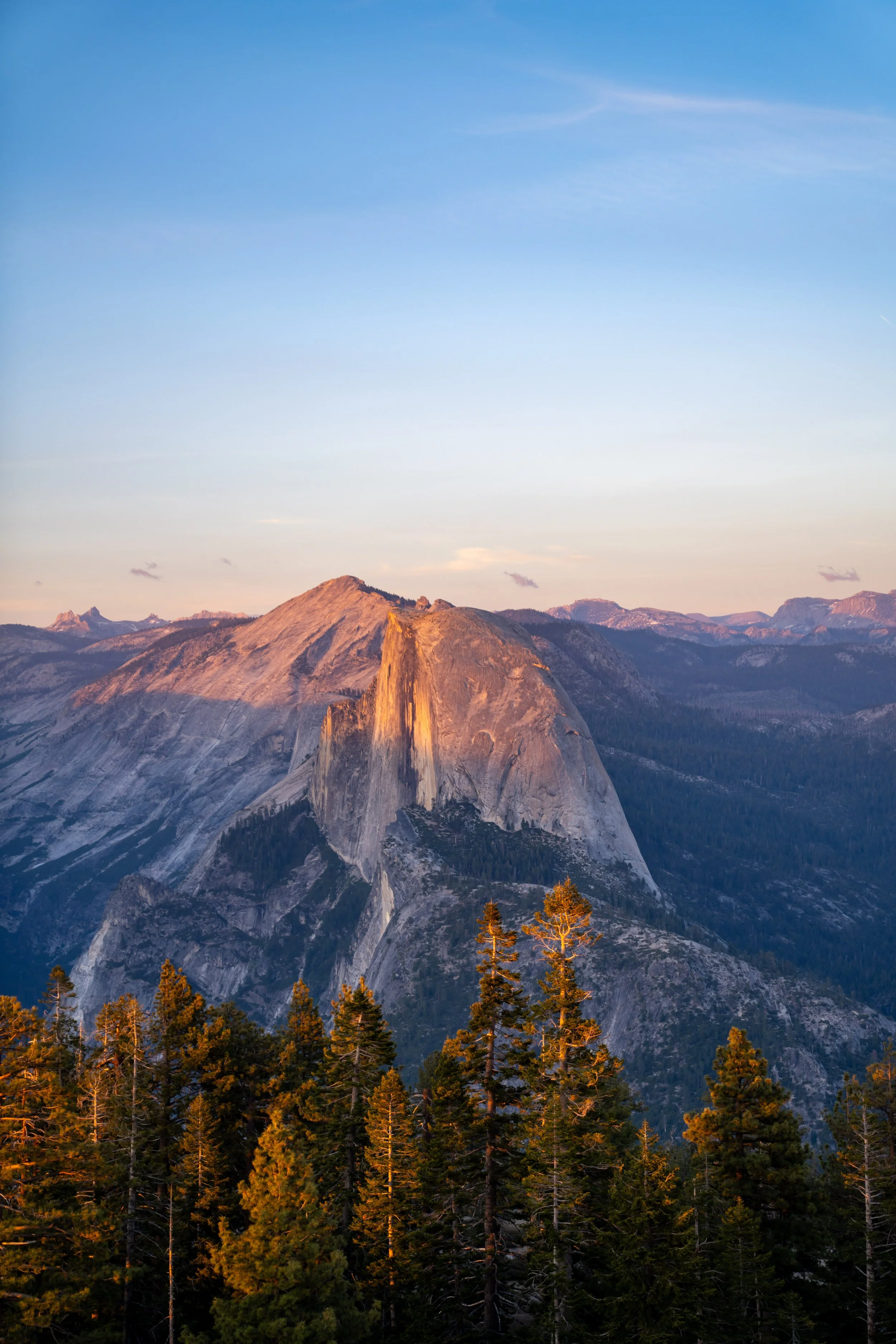
This is Yosemite Point, sitting about 2,950 ft. (899 m) above the Valley floor, which, on a clear day like this, allows for great views of Half Dome, Nevada Falls, and Glacier Point, to name just a few notable landmarks!
However, if the weather isn’t looking good, being somewhere as exposed as Yosemite Point can be quite dangerous, which is why I recommend reading the warning below.