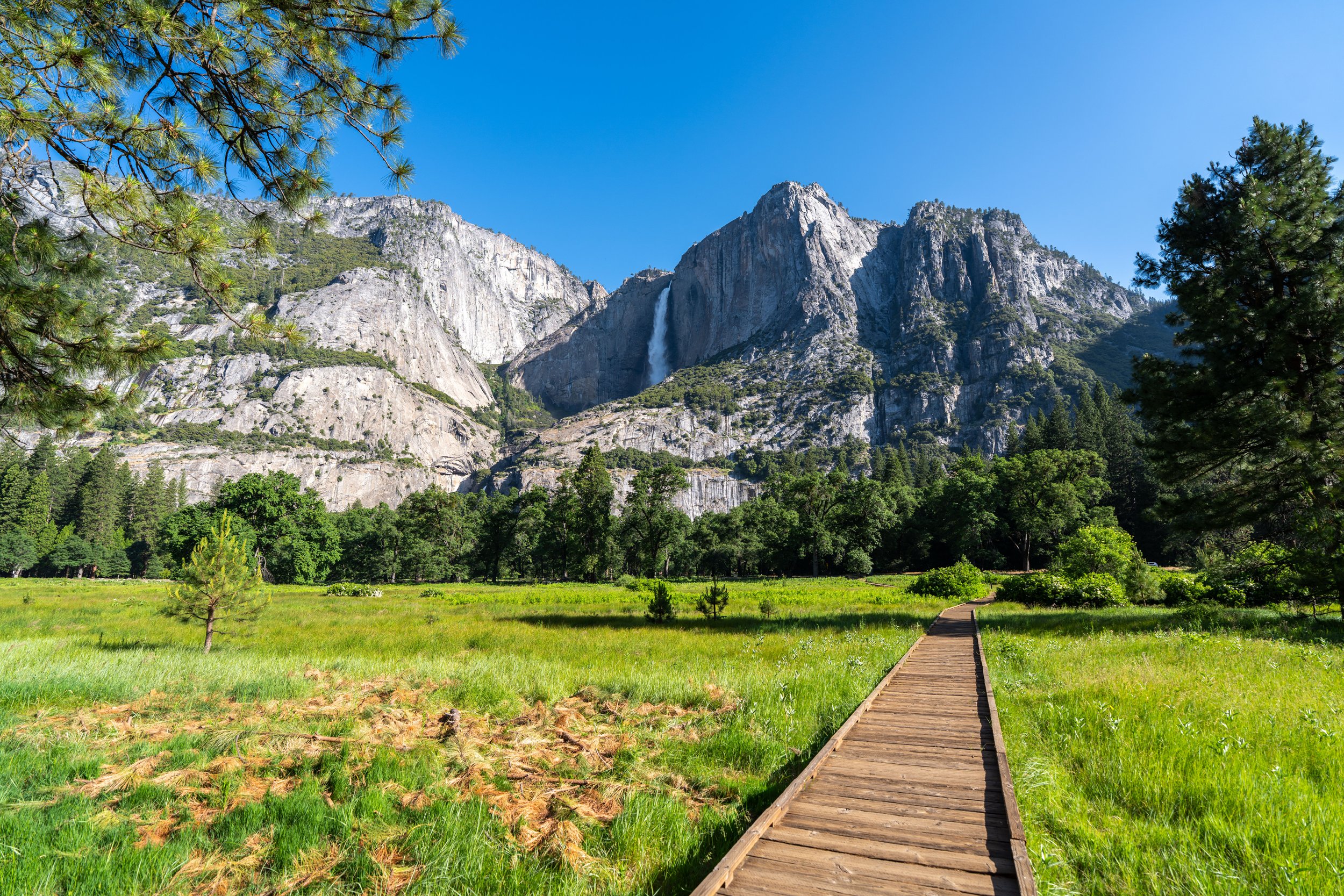
Hiking the Panorama Trail (Illilouette Falls & Panorama Point) in Yosemite National Park
Distance (RT: Glacier Point to Panorama Point): 6.6 miles / 10.6 km
The Panorama Trail in Yosemite National Park is a beautiful day hike that connects both Glacier Point and the Mist–John Muir Loop Trail to Vernal and Nevada Falls, where hikers can begin at either end to get to Illilouette Falls and Panorama Point.
That said, I highly recommend starting the Panorama Trail from Glacier Point, and I say this for a number of reasons.
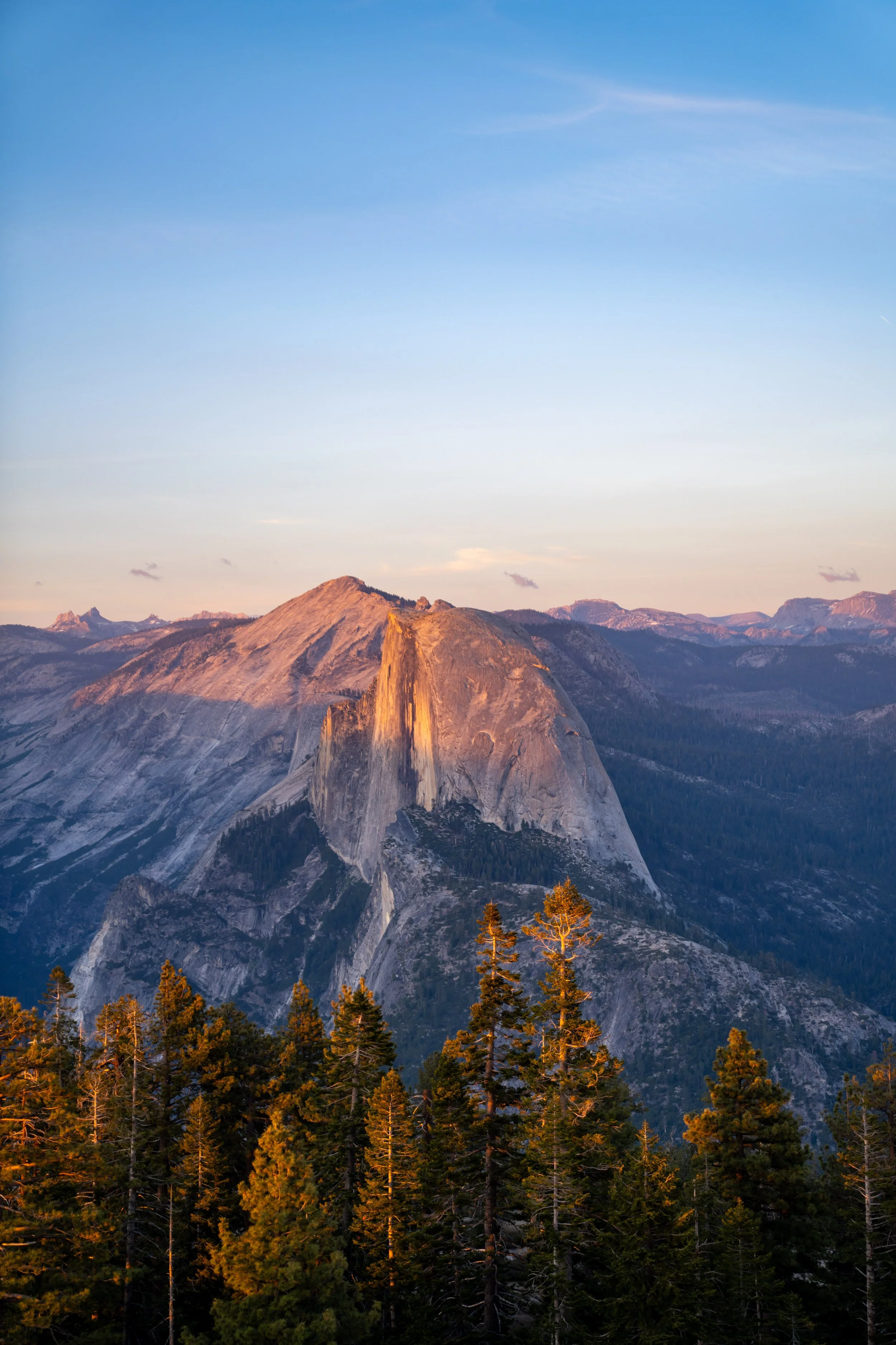
The first is that the first mile of the Panorama Trail, as it leaves Glacier Point, is absolutely stunning, as the trail parallels incredible views of Half Dome, Vernal and Nevada Falls, and Little Yosemite Valley. This section of the trail would likely be missed by beginning from the bottom and climbing up the other way.
The second reason entirely has to do with distance and elevation change. Both Illilouette Falls and Panorama Point are easily the two best destinations on the entire trail, and they can be reached much more easily from Glacier Point than from the Happy Isles Trailhead. This is why I personally don’t think that climbing up from Happy Isles is worth the effort—which is even more true since this route misses the best of the entire hike in the first mile.
All that to say, the Panorama Trail is easily one of my favorite day hikes in Yosemite National Park, especially when Half Dome starts to glow in the late evening light!
Panorama Trailhead Parking
Parking for the Panorama Trail is located at Glacier Point, the very far eastern end of Glacier Point Road.
Before arriving, know that Glacier Point is the busiest location in Yosemite National Park outside of Yosemite Valley, meaning that parking can be difficult to come by from mid-morning until sunset during the busy summer travel season.
Google Maps Directions: Panorama Trailhead
Hiking Checklist - Yosemite
Here is a complete list of must-have things that you will want for any hike in Yosemite National Park.
That said, bear spray is purposefully excluded from this list because, while the Sierra Nevadas are home to a large Black Bear population, bear spray is not allowed in Yosemite National Park.
Hiking the Panorama Trail
The Panorama Trail via Glacier Point begins at the joint Glacier Point Trailhead, which serves as the starting point for a number of day hikes, including the Pohono Trail, the Four Mile Trail, and the Panorama Trail.
From here, go straight, then turn right at either the first or second junction on the way to the Glacier Point Amphitheater to find the beginning of the Panorama Trail.
Glacier Point-Panorama Junction
At this first split, go right, then take one of the next two right turns, as previously mentioned.
If you take the first right turn, go left to find the true Panorama Trailhead, as shown below.
This sign, adjacent to the Glacier Point Amphitheater, is where the Panorama Trail and Pohono Trail leave the Glacier Point area.
Panorama-Pohono Junction
At the top of the initial hill, the Pohono Trail will branch away to the right.
That said, go left to continue on the Panorama Trail and begin the switchbacks down to Illilouette Falls.
It’s not hard to see where the Panorama Trail gets its name, as the views open up immediately after leaving the Pohono Trail behind!
The one thing that should be obvious is that the Panorama Trail is entirely downhill to Illilouette Creek, dropping roughly 1,350 ft. (412 m) from the Pohono Trail junction to the bridge.
However, when comparing that to the Panorama Trail via Happy Isles, there’s roughly 1,960 ft. (597 m) of elevation gain just to get to the start of the Panorama Trail via the John Muir Trail—and that doesn’t even include everything gained after that to get to Panorama Point and Illilouette Falls.
All that said, I hope it’s clear why starting from Glacier Point is the better choice—especially when considering my thoughts at the beginning of this article.
When the Panorama Trail rounds this second switchback on the way down, it begins the longest switchback on the entire hike—measuring roughly 1.3 miles (2.1 km) each way.
As the Panorama Trail descends, the views toward Half Dome and Little Yosemite Valley inevitably get blocked by the trees, which is why I think it’s worth mentioning that just the uppermost switchback off Glacier Point is one of the best short sunset hikes in all of Yosemite National Park!
As I’m sure is obvious, there is very little shade on the Panorama Trail during the day, which is why I highly recommend hiking in a hooded sun shirt—something that will certainly be useful on countless day hikes across Yosemite National Park!
Other than a sun shirt, some hikers may prefer to carry trekking poles on the Panorama Trail, as there are almost no flat sections throughout the entire hike!
Panorama-Buena Vista Junction
The only time the Panorama Trail splits when beginning from Glacier Point is at the third switchback—following the long 1.3-mile (2.1 km) stretch from the last.
This is where it connects with the Buena Vista Trail, which heads south into the Yosemite backcountry.
Once here, go straight here to continue down to Illilouette Falls—just 6 more, much shorter switchbacks below!
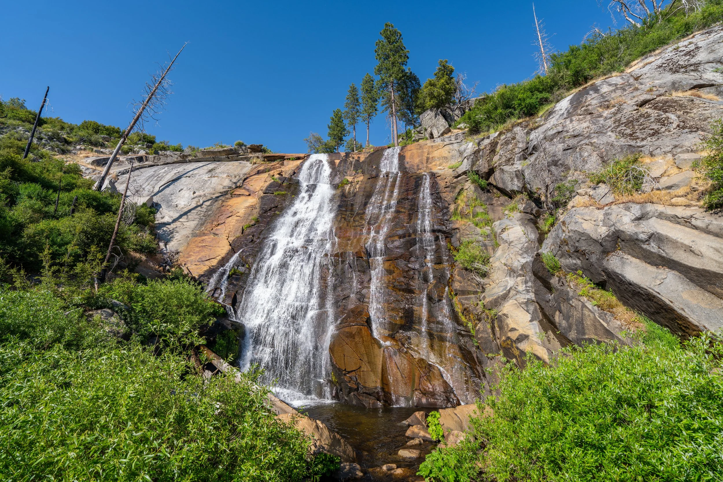
Following the Buena Vista Trail, it’s important to count out the 6 final switchbacks down to the creek, because, in order to see Illilouette Falls, it’s important to know which switchback to look out for, as the waterfall is not easily visible from any point on the trail.
Therefore, my best recommendation is to continue hiking down the Panorama Trail as normal, but at the fifth and second-to-last switchback, look for an area just off the trail on the left-hand side that appears to be a short side trail.
This is where hikers can see all of Illilouette Falls—which cannot be seen from any other part of the trail.
This is the second-to-last switchback before the Panorama Trail reaches Illilouette Creek, and it’s exactly where the short side trail that leads to the viewpoint of Illilouette Falls can be found.
This path, off the trail on the left-hand side, is where hikers can see all of Illilouette Falls from top to bottom—something that isn’t true about any other part of the trail!
Illilouette Falls certainly is a tricky one to see, but it’s definitely worth the effort if you look in the right spot!
After the viewpoint of Illilouette Falls, the Panorama Trail simply winds its way down to Illilouette Creek and the bridge, which continues on to Panorama Point.
Just before the Panorama Trail crosses the Illilouette Creek Bridge, the trail splits, with a short side trail that leads out to the top of the waterfall.
That said, I strongly recommend against following this side trail for the reasons I’ve outlined below—not to mention that the views at Panorama Point are much better, and much safer, than the views atop Illilouette Falls.
Illilouette Falls
Just for the sake of saving anyone the curiosity: the trail along the west side of Illilouette Creek leads out to this rocky ledge, with the waterfall straight ahead and the cliff edge just to the left.
If you were to follow the hillside up from this point to try and get a better view of Illilouette Falls, I can say from experience that there isn’t one!
This is exactly why I said previously that the best view of Illilouette Falls is just off the trail on the second-to-last switchback before the bridge.
After crossing Illilouette Creek, the Panorama Trail begins to climb 8 or 9 gradual switchbacks—depending on how you count—up to Panorama Point, about 0.7 miles (1.1 km) away.
This first switchback is the longest of the eight to ascend.
These switchbacks certainly are a little annoying, especially considering that returning to Glacier Point inevitably means hiking back down and up again, but in perspective, the Panorama Trail via Glacier Point is still significantly easier than beginning from Happy Isles.
Again, some hikers may want to carry trekking poles for all the constant elevation changes.
This is the final switchback before Panorama Point.
Panorama-Panorama Point Junction
This inconspicuous junction is where the Panorama Point Trail splits away from the main Panorama Trail that continues down to the John Muir Trail.
Once here, go left to follow the short 0.1-mile (0.2 km) side trail out to the viewpoint straight ahead.
Read My Separate Post: Mist Trail (Vernal & Nevada Falls)
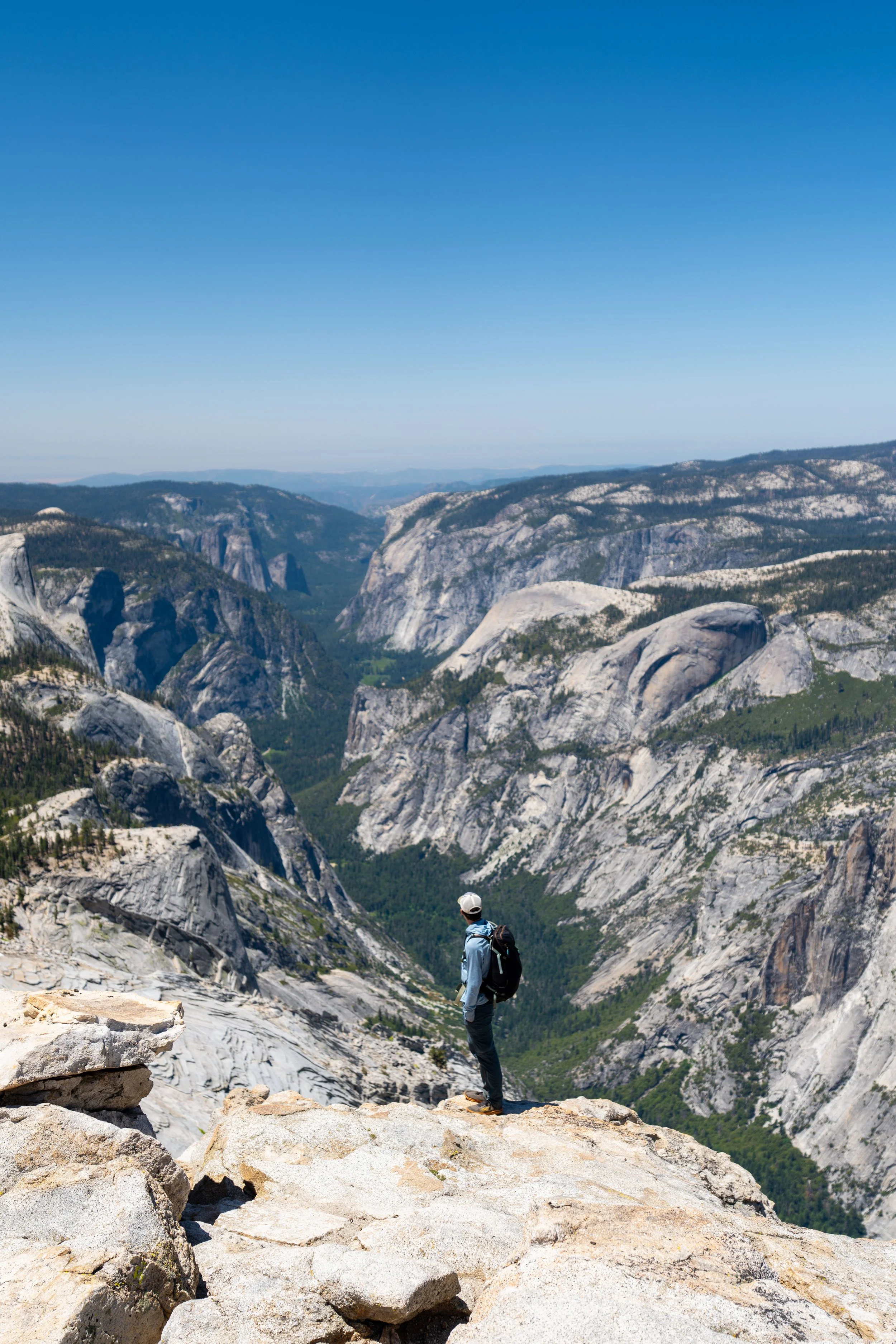
Panorama Point
Panorama Point is this stunning viewpoint above the Illilouette Gorge and Happy Isles, with Yosemite Valley and North Dome in the background.
Before arriving, be aware that the cliff edge at Panorama Point is extremely dangerous, as a fall from anywhere along the point would almost certainly be fatal.
I say that to say, please be careful, and know that Panorama Point is definitely somewhere to keep your kids close!