Hiking the Snake Divide Trail to Magic Grove & Mt. Washington in Great Basin National Park
Distance (One Way to Mt. Washington): 6.3 miles / 10.1 km
Elevation Gain: 3,110 ft. / 948 m
The Snake Divide Trail in Great Basin National Park is a beautiful but long day hike that climbs its way up a steep ridge to one of the park’s most secluded Bristlecone groves, known as Magic Grove, and ends where the trail meets the Highland Ridge Route, at which point hikers have the option to continue just a little farther to the summit of Mt. Washington!
For all these reasons, there’s a lot to love about the Snake Divide Trail, but that doesn’t go without saying that hiking as far as Magic Grove—or farther to Mt. Washington—always makes for a long day outside.
On top of this, the Snake Divide Trail is one of the more remote adventures in Great Basin National Park, which is why it’s important to set out with the expectation that you will likely be the only person or group on the entire trail that day—or even that week. Your safety is your responsibility, and know that I often say the word "remote" is an understatement when talking about adventures in Nevada.
I do not write all this to scare anyone from hiking the Snake Divide Trail, as there’s truly nothing technical about the hike to Mt. Washington. In fact, the hardest part of the hike is the long, steep ascent to Magic Grove.
However, I write all of this because I believe those interested in such a long and remote adventure should arrive with more than enough food and water, and hopefully, you’ll be pleasantly surprised if you’re prepared for the near-constant climb to Magic Grove and Mt. Washington beyond!
Snake Divide Trailhead Parking
Parking for the Snake Divide Trail is located at the Snake Creek Trailhead—the trailhead at the very end of Snake Creek Road—about 12.2 miles (19.6 km) from Highway 487 near the Nevada–Utah state line.
The Snake Creek Trailhead is the joint trailhead that serves several different day hikes and overnight adventures, including the Johnson Lake Trail, the Snake Creek Overlook Trail, the Dead Lake Trail, and more.
Google Maps Directions: Snake Divide Trailhead
Hiking Checklist - Great Basin
Here is a complete list of must-have things that you will want for any hike in Great Basin National Park.
Hiking the Snake Divide Trail
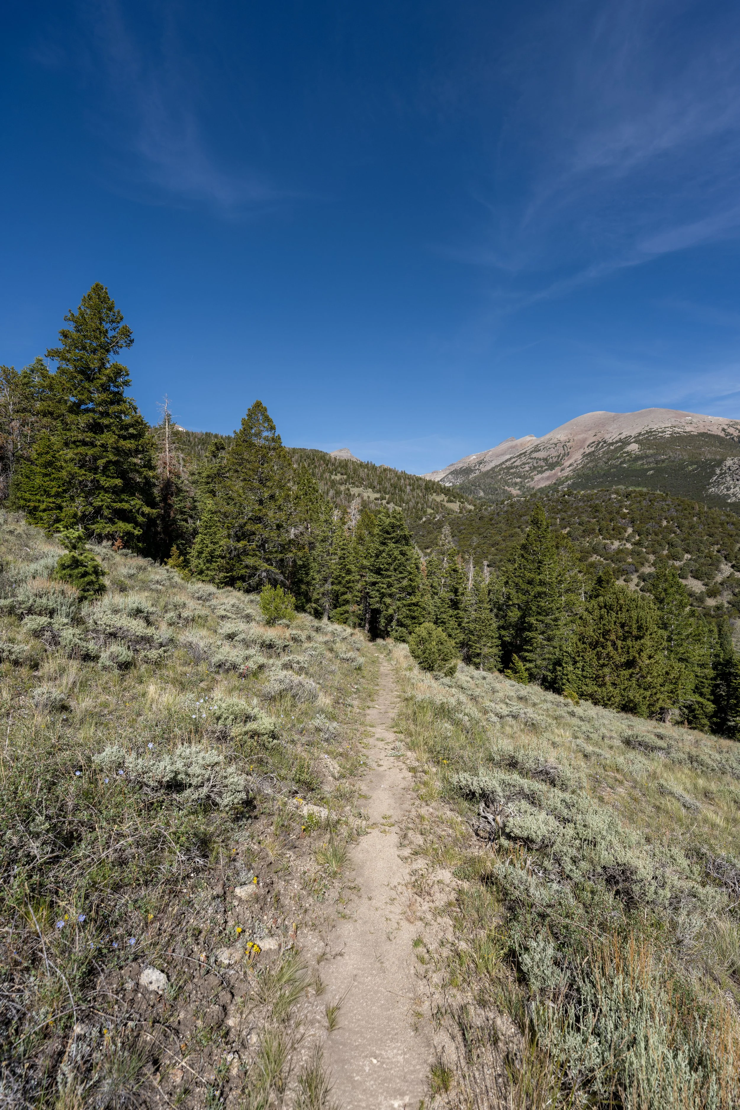
The Snake Divide Trail begins on the south side of the Snake Creek Trailhead, where it follows the Shoshone Trail for the entire hike up and out of the Snake Creek Basin to the ridgeline.
Shoshone (Snake Divide)-Dead Lake Junction
After a short walk, the Shoshone Trail passes the Dead Lake Trail, which also leads to the Johnson Lake Trail a short distance past Dead Lake.
That said, go straight to continue on the Shoshone Trail up toward the Snake Divide Trail at the top of the ridge.
Read My Separate Post: Dead Lake Trail
This bridge is where the Shoshone Trail crosses Snake Creek, which is truly the best sight on the way back after the long out-and-back hike to Mt. Washington!
Beginning at the Snake Creek Trailhead, the Shoshone Trail climbs roughly 710 ft. (216 m) in 1.4 miles (2.3 km) to the top of the ridgeline and the beginning of the Snake Divide Trail.
Since there is so much elevation change on the hike up to Magic Grove and Mt. Washington, some hikers may want to bring trekking poles, which will not only help on the climb but also on a long and annoying sidehill section farther up the ridge.
This sharp turn is where the Shoshone Trail begins the steepest section of the entire hike prior to Mt. Washington.
This long, steep ascent is certainly nothing to look forward to, but it is a nice sign that the top of the ridgeline—and the beginning of the Snake Divide Trail—is not far ahead!
This is where the Shoshone Trail turns the final switchback before reaching the top of the ridgeline and the beginning of the Snake Divide Trail.
Snake Divide-Shoshone (Big Wash) Junction
This is where the Shoshone Trail reaches the top of the ridge and the beginning of the official Snake Divide Trail.
Once here, go right to begin hiking the Snake Divide Trail up the ridge to Magic Grove and Mt. Washington shortly thereafter.
On a different note, the rest of the Shoshone Trail to the Big Wash Trail at the bottom of the canyon is one of very few adventures in Great Basin National Park that I haven’t hiked, and I’m not sure I ever will.
I say this because I’ve often looked at Big Wash and simply asked myself, "Why? Why would anyone go down that long, miserable, overgrown desert trail?" However, if you know differently, I’d love to hear why in the comments! Maybe I have it all wrong, but it just doesn’t seem like an adventure that’s worth the effort, which is something I don’t often say.
Once on the ridgeline, the Snake Divide Trail begins a long, somewhat tedious section that winds back and forth up the slope.
Some of these turns are true switchbacks, but others are much more ambiguous, which is why I think it’s difficult to say there are "x" number of switchbacks to keep in mind.
Regardless, this windy section stretches for roughly 1.2 miles (1.9 km), and I personally feel it is one the more annoying parts of the entire hike, as there are no real views and no great mental checkpoints along this stretch, with the exception of a few random Bristlecone Pines that begin partway up the ridge.
The peak on the left-hand side of the photo below is not Mt. Washington.
Rather, it’s an unnamed peak just to the east of Lincoln Peak.
This sign, at about 9,340 ft. (2,847 m), may seem like an arbitrary place to ban campfires, but fires are prohibited in two places in the Great Basin backcountry.
First, fires are prohibited at all elevations above 10,000 ft. (3,048 m), and second, they are prohibited in areas where Bristlecone Pines grow.
That said, this is obviously not the 10,000-ft. (3,048 m) mark, which is why the sign is a nice indicator that Bristlecone Pines will start appearing along the trail shortly ahead!
This rocky outcropping, at about 9,450 ft. (2,880 m), is where I first started noticing Bristlecone Pines on my most recent hike up the Snake Divide Trail!
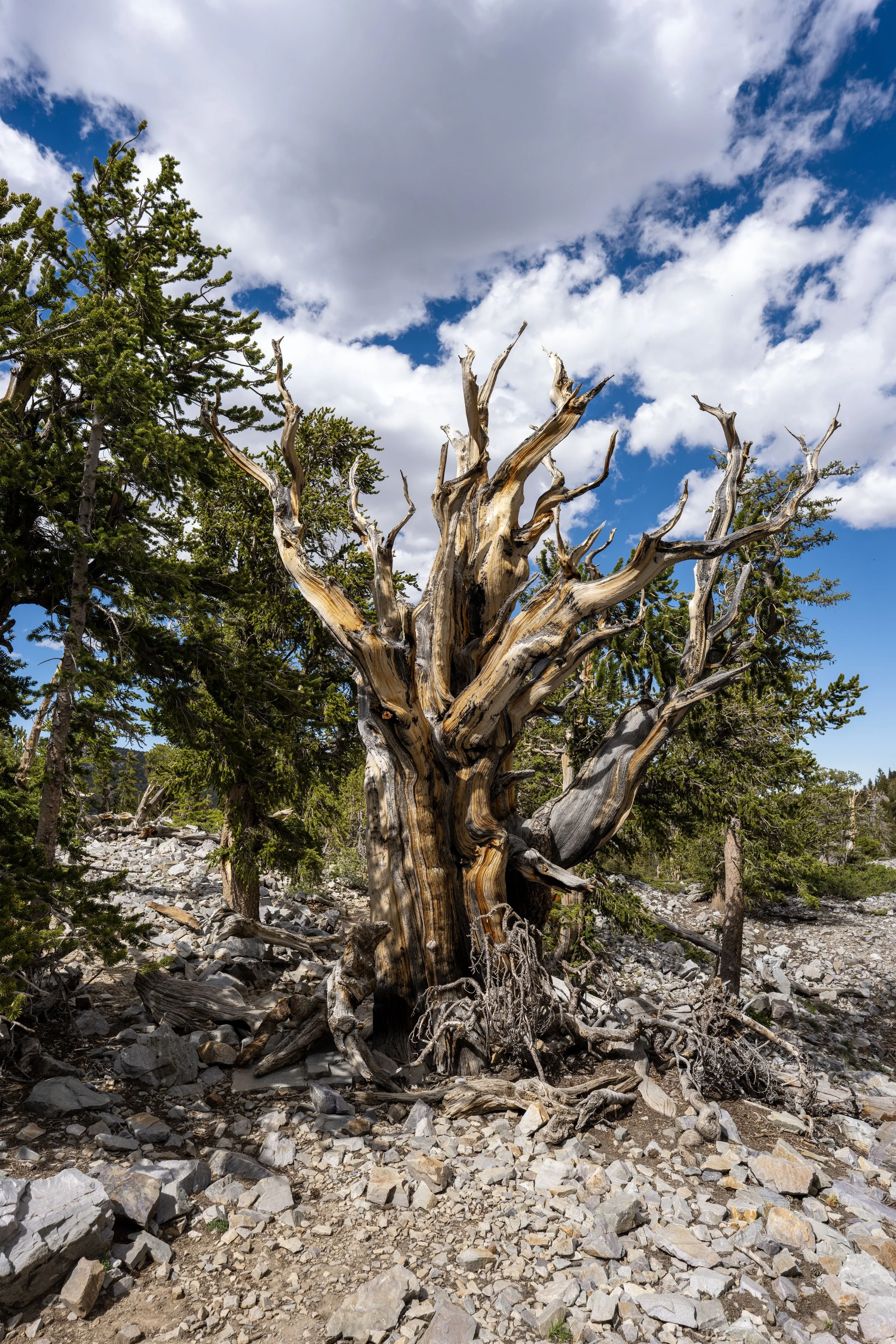
The interesting thing about the Bristlecone Pines found this far from Magic Grove is that they grow taller and straighter than those at higher elevations, which are susceptible to much harsher conditions.
As a result, the Bristlecone Pines down here do not live as long, as height is not an asset for the species. Instead, taller height makes them more likely to fall during extreme storms, while those closer to Mt. Washington are better adapted to survive such conditions.
This is the end of the long, windy 1.2-mile (1.9 km) ascent that began at the start of the official Snake Divide Trail.
Finally, after roughly 2.6 miles (4.2 km) since leaving the Snake Creek Trailhead, the Snake Divide Trail passes the first views of Mt. Washington!
That said, I think these photos do a good job of making Mt. Washington feel closer than it actually is because, in person, this vantage point still feels very far from the summit.
However, I think it’s worth noting that there is only one slow and tedious section left, and it begins just a few steps ahead.
This is the first of two separate times the Snake Divide Trail leaves the ridgeline before Magic Grove, which marks the start of the final annoying section I previously mentioned.
I say this not because it’s necessarily challenging, like the steep climb up to this point, but because the trail feels like one long sidehill, where one foot is always higher than the other.
This continues for exactly 1.0 mile (1.6 km) before the Snake Divide Trail finally regains the ridgeline and follows it for the rest of the hike to the summit.
Initially, the Snake Divide Trail descends four short switchbacks along the first short sidehill.
The first section along the side of the ridgeline does not last very long, but the second, much longer sidehill begins just a short distance ahead.
This is where the Snake Divide Trail leaves the top of the ridgeline again, beginning what I think is probably the most annoying part of the entire hike, both on the way up and down.
Bringing trekking poles can certainly be a blessing for this long section on the side of the ridge, and I’m not the only one who feels this way!
By this, I mean that comments about the Snake Divide Trail on other hiking sites mention that this is most people’s least favorite part of the long hike up to Magic Grove.
At this point, the Snake Divide Trail climbs a few very short and inconspicuous switchbacks before the path becomes more obvious once again.
This is not the end of the long section on the side of the ridge.
This is where the Snake Divide Trail crosses above 10,000 ft. (3,048 m).
This is the view looking northeast toward Eagle Peak, as well as the Snake Creek Trailhead down in the basin.
On that note, Eagle Peak is home to the least-visited and most remote Bristlecone Pine grove in Great Basin National Park, as there is no trail to the summit from any side of the mountain!
This is where the Snake Divide Trail climbs back to the ridgeline after the very long and tedious 1.0-mile (1.6 km) sidehill, following the first views of Mt. Washington!
This is the spot where the Snake Divide Trail regains the ridgeline, and it’s one of the most important to remember for the hike back down, as the ridgeline, while perhaps more straightforward, is not easier than following the actual trail.
From this point to Magic Grove, the Snake Divide Trail simply follows the ridgeline up the mountain, which is truly a great feeling after all the tedious climbing to get this far!
At this point, I’ve always believed the Snake Divide Trail gets a lot more fun, even though there is quite a bit of elevation left to gain before reaching Magic Grove.
I say this because the Snake Divide Trail moves a lot faster after it regains the ridgeline, and the trail is much more open than all the sections leading up to this point, which mentally makes it feel like it’s moving quicker!
Since the trail is so open as it nears Magic Grove, I highly recommend wearing a hooded sun shirt to stay safe, especially considering how long the Snake Divide Trail is and how easy it can be to burn at these high elevations!
In addition to a good sun shirt, don’t forget to bring sunglasses for the bright, rocky granite slopes below Mt. Washington—and trust me, you’ll be thankful you did!
By this point on the Snake Divide Trail, Bristlecone Pines dominate the remaining trees closest to the treeline.
This is where the Snake Divide Trail crosses above 11,000 ft. (3,353 m).
The cluster of trees on the ridge in the distance is Magic Grove!
Magic Grove
After a very long and steep 5.6-mile (9.0 km) hike from the Snake Creek Trailhead, the Snake Divide Trail finally reaches Magic Grove, one of three bristlecone groves in Great Basin National Park!
Of these three, Magic Grove lands right in the middle in terms of difficulty to reach, with the Wheeler Peak Bristlecone Grove—off the Bristlecone Trail and the Glacier Trail—being the easiest to hike to, while the Eagle Peak Grove is by far the hardest!
Magic Grove, including the trees on the slopes of Mount Washington, is the largest Bristlecone Pine grove in Great Basin National Park!
End of Magic Grove
This sign marks the end of Magic Grove, but not the end of all the Bristlecone Pines on the slopes of Mt. Washington.
Is it Worth Continuing to the Summit of Mt. Washington?
I believe it is!
After all the effort put in to get to this point, climbing the rest of the way to the summit of Mt. Washington is truly one of the easier parts of the entire hike.
I say this because all the most difficult sections are over by this point, and it’s only another 0.5 miles (0.8 km) from the end of the Snake Divide Trail to the summit, starting at the junction shortly ahead.
Past Magic Grove, the Snake Divide Trail simply continues up to the summit ridge, where it officially ends at the Highland Ridge Route junction, just a few steps ahead.
Snake Divide-Highland Ridge Route Junction
This is the end of the Snake Divide Trail and the point where the ridge meets the Highland Ridge Route, a long backcountry traverse across the tallest peaks in the Snake Range.
That said, Pyramid Peak is located to the right (north) of this junction, while Mt. Washington is located just 0.5 miles (0.8 km) to the left (south) of this sign.
Once on the Highland Ridge Route, simply walk straight toward Mt. Washington to continue up the easiest trail.
The summit is the second, or farthest, peak in the photo below, while the first peak feels more like a false summit.
The base of Mt. Washington is the most difficult and steepest part of the hike to the summit.
Once at this point, there are two routes up the first false summit.
The first is a somewhat obvious, loose trail on the left-hand side of the ridge, but I recommend going straight up the steep ridgeline because the footing is more secure than on the scree-like slopes to the left.
Growing on the high alpine slopes of Mt. Washington is a little-known and very rare plant known as the Nevada Primrose.
If you look closely on the hike to the summit, it’s not hard to spot, but please do your part to watch where you step, as it is considered to be one of the rarest plants in Great Basin National Park!
At this point, both the routes at the base of Mt. Washington become one again and follow the same path the rest of the way to the summit.
This is the top of the first false summit.
If you’re visiting Great Basin National Park in May, and sometimes in June, micro-spikes may be necessary to climb Mt. Washington safely—especially when early-summer temperatures melt snow during the day, but it refreezes overnight.
The final slopes up Mt. Washington are a bit loose, but the hike is easy enough to follow the main route, as shown here, or cut straight up to the summit.
Just before the summit, the Highland Route turns somewhat of a switchback that leads to the top.
Mt. Washington
This is the summit of Mt. Washington, which, according to the National Park Service, stands at approximately 11,660 ft. (3,554 m), or 1,403 ft. (428 m) below Wheeler Peak, the tallest summit in Great Basin National Park.
One day, I hope to catch a sunrise or sunset from the peak, but that would certainly be a long trek in the dark to reach or return from this very remote summit!