Hiking the South Mt. Washburn Trail (Dunraven Pass) in Yellowstone National Park
Distance: 7.0 miles / 11.3 km
Elevation Gain: ~1,350 ft. / 411 m
The North Mt. Washburn Trail in Yellowstone National Park is a fun and incredibly scenic day hike off Dunraven Pass that winds its way up five beautiful switchbacks to the summit of one of the most panoramic peaks in the park!
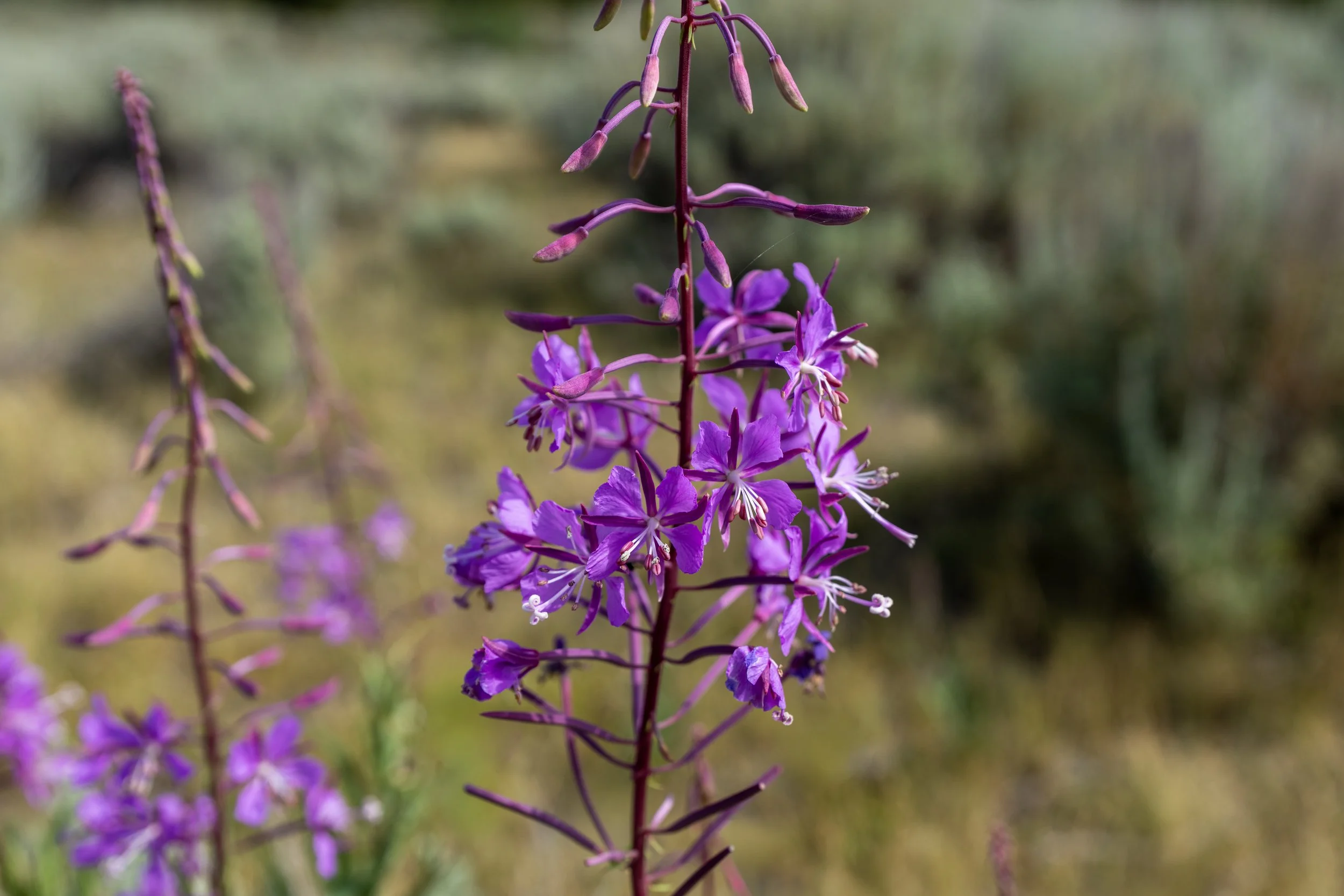
However, what I think sets the Mt. Washburn Trail via Dunraven Pass apart from the North Mt. Washburn Trail via Chittenden Road is the endless wildflowers that can be enjoyed throughout the best and most beautiful mid-summer months!
I would even go so far as to say that the South Mt. Washburn Trail is the best day hike visitors can do to enjoy wildflowers in Yellowstone National Park!
That said, if you’re unsure and trying to decide which route you’d prefer to hike, I highly recommend reading my side-by-side comparison below, where I break down the most important differences between the two!
Mt. Washburn Trail - Chittenden Road vs. Dunraven Pass
The obvious difference is that the Mt. Washburn Trail via Chittenden Road is roughly 0.6 miles (1.0 km) shorter each way but has about 125 ft. (38 m) more of elevation gain.
However, I do not recommend using the distance or elevation gain as the deciding factor between the two, as there are more important differences described below.
First and foremost, the Mt. Washburn Trail via Dunraven Pass is the more beautiful side of the mountain, in my opinion. I say this because the south slopes of Mt. Washburn are arguably the best place in Yellowstone National Park to enjoy wildflowers throughout the summer season, and the views from the hike up from Dunraven Pass are simply better and more beautiful than those from Chittenden Road!
However, that’s not to say the Mt. Washburn Trail via Chittenden Road is not beautiful. I just don’t believe they are as beautiful. Nevertheless, I prefer the hike up Chittenden Road when I’m hiking the Mt. Washburn Trail for sunset, as the shorter distance makes for a much nicer and easier hike back in the dark—and there is typically more light on Chittenden Road after sunset than on the south side of the mountain.
Read My Separate Post: Mt. Washburn Trail via Chittenden Road

My Print - North Mt. Washburn Trail (Sunset)
South Mt. Washburn Trailhead Parking
Parking for the South Mt. Washburn Trail is located in a small, paved parking lot at Dunraven Pass, just off Grand Loop Road.
That said, the parking lot for the Mt. Washburn Trail via Dunraven Pass is significantly smaller than the parking area off Chittenden Road, which is why the trail from the north can be a great alternative if parking at the South Mt. Washburn Trailhead is full.
Google Maps Directions: Mt. Washburn Trailhead (Dunraven Pass)
Hiking Checklist - Yellowstone–Tetons
Here is a complete list of must-have things that you will want for any hike in the Yellowstone–Teton area.
Hiking the South Mt. Washburn Trail
South Mt. Washburn Trailhead
The Mt. Washburn Trail via Dunraven Pass begins in a dense Lodgepole Pine forest, but it doesn’t take long for the views to open up to the south—just 0.1 miles (0.2 km) into the hike!
This is where the views on the South Mt. Washburn Trail open up for the first time, which only continue to get better the higher the trail climbs!
I think it’s important to mention that I have seen a Grizzly and her cub hanging out in the trees near Dunraven Pass.
What I hope this shows is that Grizzlies can be anywhere, at any time, in any season in Yellowstone National Park, and it’s why hiking prepared is essential, including knowing how to identify the differences between a Black Bear and a Grizzly.
This is where the South Mt. Washburn Trail crosses above 9,000 ft. (2,743 m).
In my experience, the first 0.4 miles (0.6 km) of the Mt. Washburn Trail via Dunraven Pass is the best place on the hike to enjoy the wildflowers and take great photos!
When the South Mt. Washburn Trail enters the trees before the first switchback, the trail crosses the 0.4-mile (0.6 km) mark, mentioned above, and begins climbing above the areas with the best wildflowers.
However, that’s not to say there aren’t more views to come, as I believe they only get better on the switchbacks just ahead!
This is the first of five switchbacks on the Mt. Washburn Trail via Dunraven Pass.
After turning the first switchback, the summit of Mt. Washburn and the fire lookout at the top can be seen from the trail for the first time!
This is what I meant in my side-by-side comparison above about the views being better from the South Mt. Washburn Trail compared to Mt. Washburn via Chittenden Road—and they only continue to get better and better!
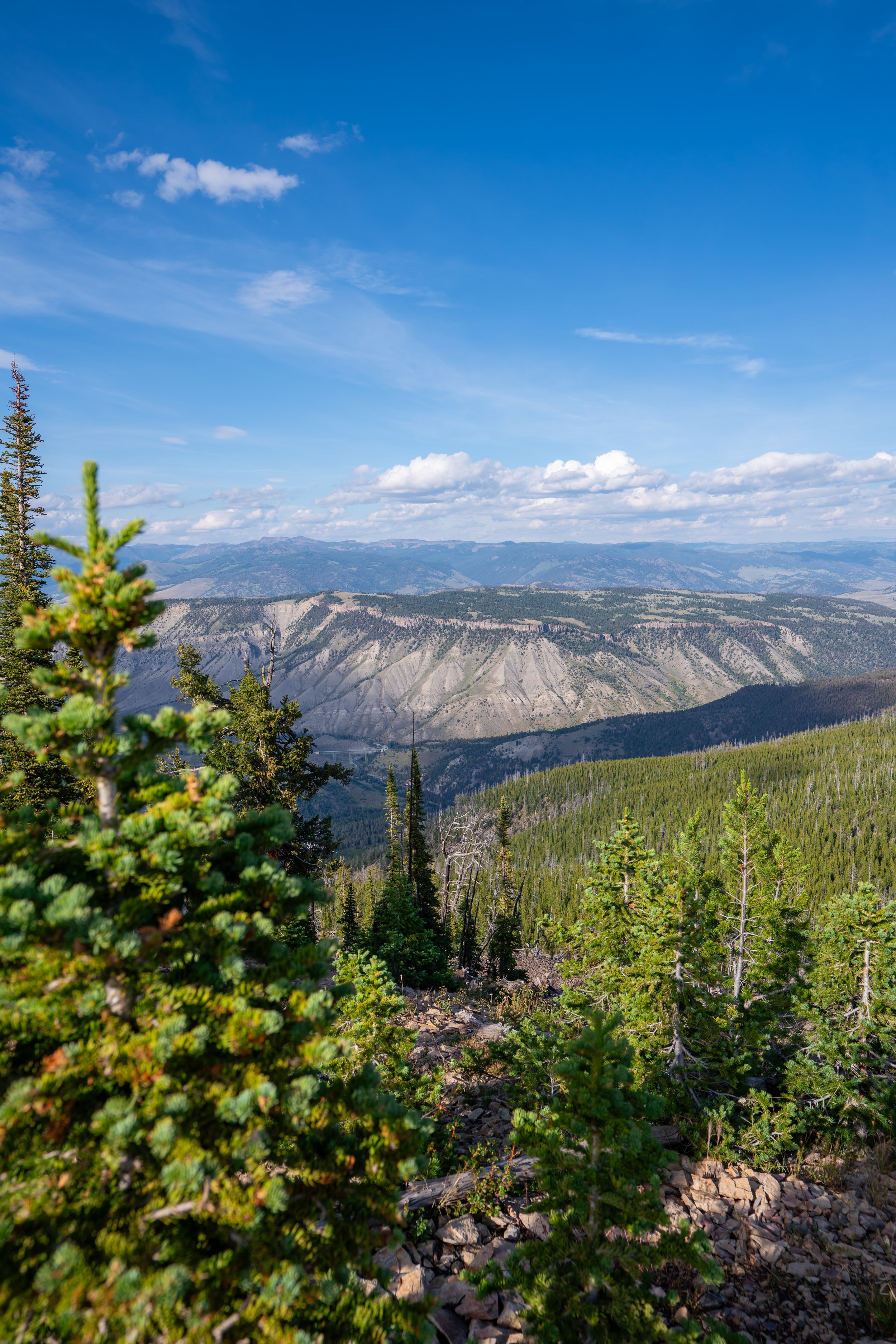
The views to the south look toward the Grand Canyon of Yellowstone, with summits like Avalanche Peak far in the distance!
Since there is less elevation gain on the Mt. Washburn Trail via Dunraven Pass compared to the north, some hikers opt for a one-way hike to the North Mt. Washburn Trailhead.
Now, that is obviously best planned when a pickup from someone in your party can be arranged, but hitching a ride has worked for me before. It’s just not something I can endorse for obvious safety reasons.
When the South Mt. Washburn Trail exits the long stretch of trees after the first switchback, it’s a nice sign that the second switchback is not far ahead!
This is where the South Mt. Washburn Trail turns the second of five switchbacks on the hike up to Chittenden Road.
On the upper elevations of Mt. Washburn, there is quite a lot of exposure throughout much of the day.
This is why I recommend wearing a hooded sun shirt to stay safe, especially if you have plans to hike down Chittenden Road, as there is a lot less shade on the north side of Mt. Washburn.
This is the third of four switchbacks on the South Mt. Washburn Trail.
This is where the South Mt. Washburn Trail crosses above 9,500 ft. (2,896 m).
At the fourth switchback, hikers can see evidence from when Chittenden Road was first paved before ultimately becoming the trail we have today.
This is the fifth and final switchback on the Mt. Washburn Trail via Dunraven Pass.
After the fifth switchback, there is roughly 0.8 miles (1.3 km) left until the South Mt. Washburn Trail reaches the saddle and Chittenden Road, which continues up to the summit.
This is where the South Mt. Washburn Trail cross above 10,000 ft. (3,048 m) and coincidentally starts closely following the summit ridge at the same time.
As a result, the views in all directions open up for much of the hike to Chittenden Road!
This is what I meant previously when I said the views only get better and better the higher the trail climbs!
South Mt. Washburn-Chittenden Road-Spur Junction
With about 0.3 miles (0.5 km) to go before the South Mt. Washburn Trail reaches the summit of Mt. Washburn, the trail from the south meets the North Mt. Washburn Trail.
This is where the two routes become one for the rest of the hike to the summit.
Once here, go left at this junction to begin hiking up Chittenden Road to the summit of Mt. Washburn.
Read My Separate Post: Mt. Washburn Trail via Chittenden Road
The uppermost elevations of Chittenden Road wrap around the far side of the fire lookout before reaching the summit of Mt. Washburn.
Mt. Washburn
This is the summit of Mt. Washburn and the Mt. Washburn Fire Lookout at the top of Chittenden Road, which, according to the National Park Service, stands at approximately 10,219 ft. (3,115 m).
Mount Washburn Fire Lookout
A little-known secret at the summit of Mt. Washburn is that the lower level of the fire lookout is open to the public!
Once inside, hikers can learn about the history of Mt. Washburn as an early fire lookout in Yellowstone National Park, as well as use the interpretive maps to pick out landmarks across much of the surrounding landscape.
Furthermore, the Mt. Washburn Fire Lookout can be a great place to get out of the cold and typically windy weather, which can get quite chilly around sunset, even during the mid-summer months!
Old Faithful (Upper–Lower Geyser Basins)

Canyon Village
Maddison–Norris
Yellowstone Lake & East Entrance

Mammoth, Lamar Valley & Tower