Hiking the Storm Point Trail in Yellowstone National Park
Distance (Full Loop): 2.5 miles / 4.0 km
The Storm Point Trail in Yellowstone National Park is a beautiful, flat, and easy day hike along the shores of Yellowstone Lake that leads to a panoramic, windswept stretch of coastline before looping back to the beginning!
That said, the Storm Point Trail is one of the best kid-friendly hikes in Yellowstone National Park—especially because the loop can easily be shortened into an out-and-back hike by simply returning on the east side of the loop rather than continuing around the west side.
In any case, I’ve always loved the Storm Point Trail because it is typically a very quiet, uncrowded adventure, making it one of the best ways to enjoy Yellowstone Lake away from busier areas like Lake Village and the West Thumb Geyser Basin!
How Long is the Storm Point Trail?
Since many hikers only hike part of the full Storm Point Trail, I’ve broken down each section to help you plan your adventure.
Storm Point Trailhead to the Storm Point Loop Trail: 0.5 miles (0.8 km)
Storm Point Loop Trail to Storm Point: 0.5 miles (0.8 km)
Storm Point to the Storm Point Loop Junction (via Western Half): 1.0 miles (1.6 km)
Total Distance: 2.5 miles (4.0 km)
Storm Point Trailhead Parking
Parking for the Storm Point Trail is located in one of two adjacent parking lots directly off East Entrance Road near Indian Pond.
Personally, I don’t believe it makes much of a difference which trailhead you choose to begin from, as both routes come together just a few steps from the trailhead.
Google Maps Directions: East Storm Point Trailhead / West Storm Point Trailhead
Hiking Checklist - Yellowstone–Tetons
Here is a complete list of must-have things that you will want for any hike in the Yellowstone–Teton area.
Hiking the Storm Point Trail
This is where the Storm Point Trail begins from the East Storm Point Trailhead.
After just 0.1 miles (0.2 km), both paths from the East and West Trailheads come together.
Once the two routes come together, the Storm Point Trail heads directly south toward the trees in the distance until it eventually meets Yellowstone Lake just on the other side.
This split is an optional side trail that passes closer to Indian Pond on the left-hand side.
I chose to go left on the trail past Indian Pond.
Since there is quite a bit of exposure on the Storm Point Trail, I highly recommend wearing a hooded sun shirt to stay safe!
This first set of trees, just 0.3 miles (0.5 km) south of either trailhead, is a nice sign that the Storm Point Trail is about to reach Yellowstone Lake!
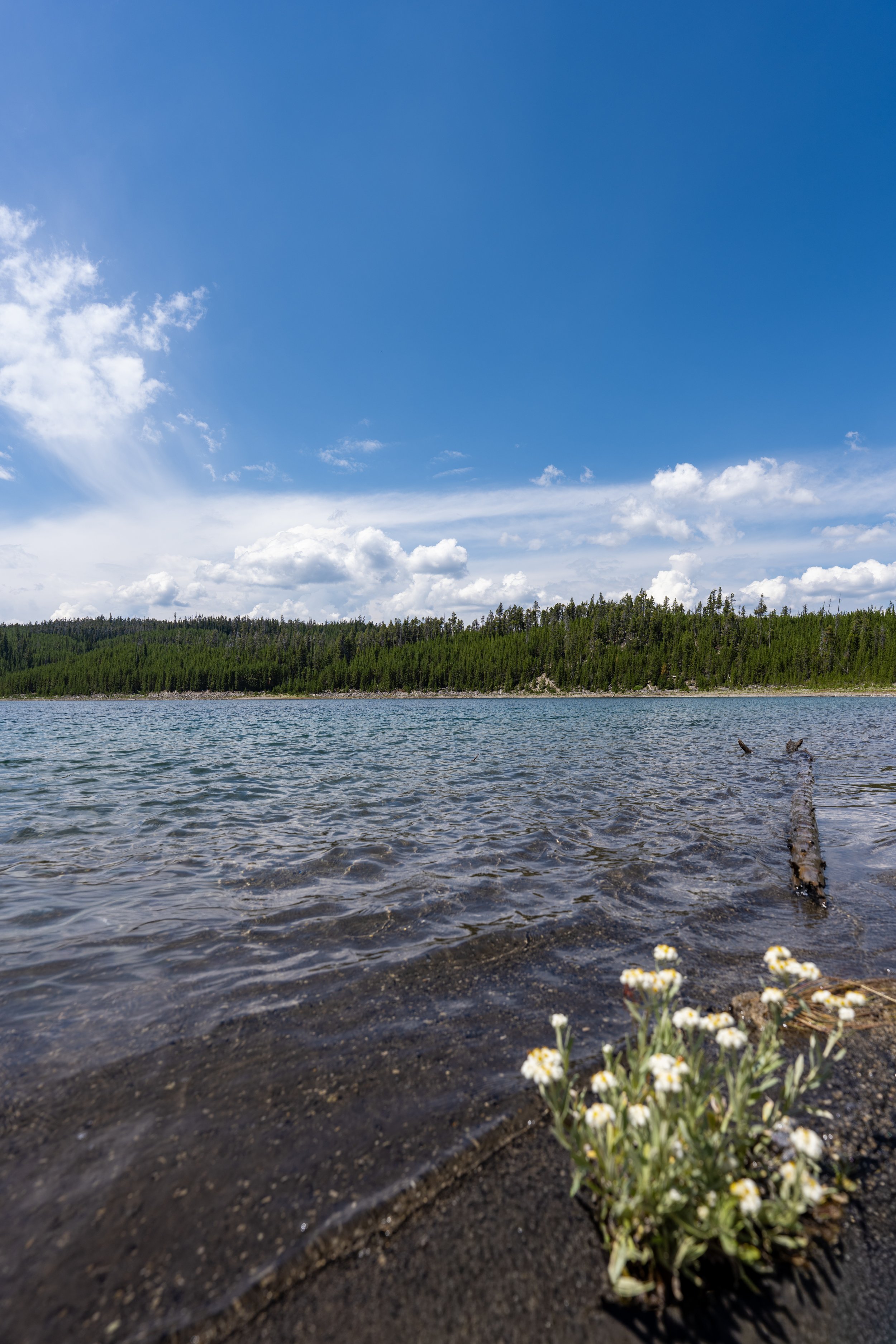
This is the first time the Storm Point Trail reaches Yellowstone Lake, which it will parallel for roughly the next 0.8 miles (1.3 km) until the loop turns away from the lake at the rare plant area closure past Storm Point.
Just before the Storm Point Trail crosses a small unnamed creek and reaches the start of the loop, hikers have the option to walk down to a beautiful beach along Mary Bay.
After the beach on Mary Bay, the Storm Point Trail continues just a few more steps until it reaches the start of the loop.
Storm Point Loop Trail
This is the start of the Storm Point Loop Trail, a 1.5-mile (2.4 km) loop along the shoreline of Yellowstone Lake and through the forest on the western half.
From here, both routes lead to Storm Point, with the east side of the loop only being 0.5 miles (0.8 km) away and the west side about 1.0 mile (1.6 km) away, as it takes a longer route through the trees before returning to the lake.
That said, it is most common to continue straight on the east side first because it is the most direct route, but either way, I recommend hiking the full loop at some point because there is so much more to enjoy between Storm Point and the rare plant area closure!
Regarding my thoughts above, I chose to go straight to hike clockwise around the loop.
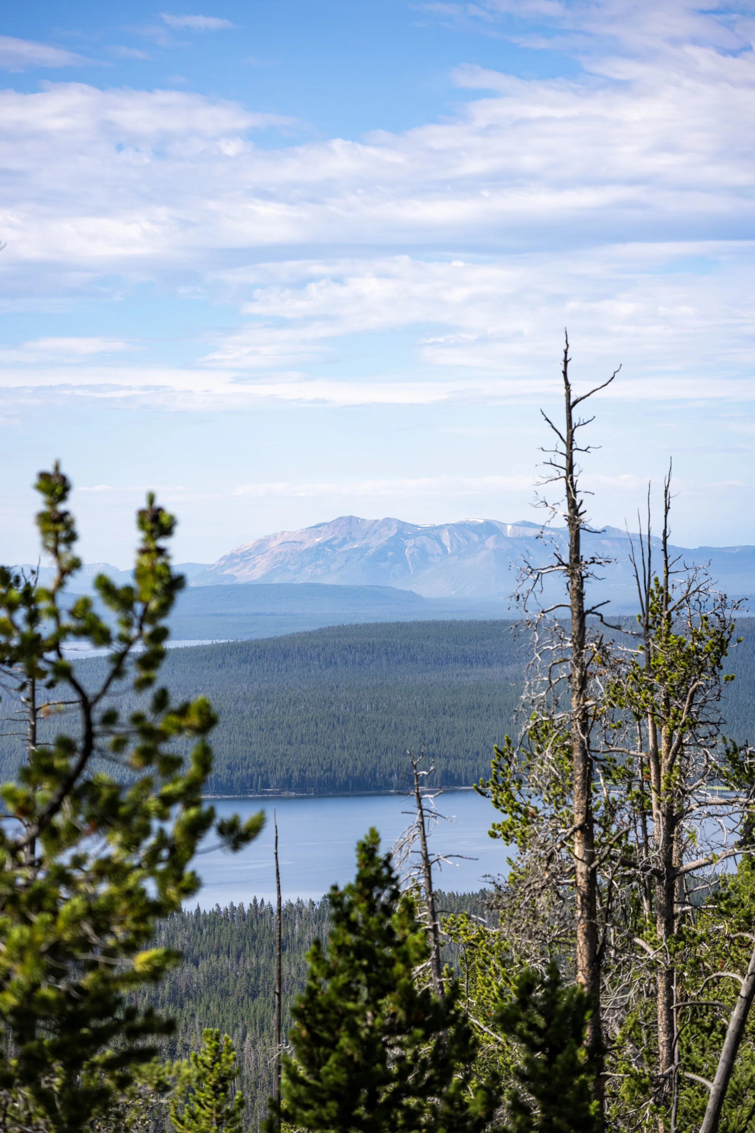
The views from the east side of the loop look out toward the beautiful and remote Absaroka Mountains, which border the east and southeast sides of Yellowstone National Park before eventually becoming the Wind River Range!
Is the Storm Point Trail Open Year-Round?
No. The National Park Service closes the Storm Point Trail on a regular annual basis because of high Grizzly activity in the late spring and early summer.
During this time, Grizzlies are typically moving around more intensively after denning, feeding on emerging vegetation and other food sources. On top of this, females often have young cubs with them.
This combination makes surprise encounters more likely, which is why the National Park Service temporarily closes trails when bear activity reaches a level officials consider unsafe.
This is all to say, always hike with bear spray on any trail in Yellowstone National Park, and know that Yellowstone Lake and Sylvan Pass through the East Entrance are notorious for higher Grizzly activity than other areas of the park.
Near the southern end of the loop, the forest begins to thin, which is a nice sign that Storm Point is just 0.2 miles (0.3 km) ahead!
This is the first time Storm Point can be seen in the distance!
Storm Point
After almost exactly 1.0 mile (1.6 km) since leaving either trailhead off East Entrance Road, the Storm Point Trail reaches Storm Point and the west side of the loop on the right-hand side.
That said, go straight to continue out to Storm Point just ahead!
This is Storm Point, a name that dates back to the early surveys of Yellowstone Lake and was inspired by the point’s windswept exposure.
As for the water itself, Yellowstone Lake only averages about 41°F (5°C) year-round—not to mention that swimming can be dangerous because it’s such a large and often very choppy body of water.
After returning to the previous junction just before Storm Point, there’s either the option to go left to complete the full 1.5-mile (2.4 km) loop, or straight to return via the same way taken on the east side of the loop.
That said, the difference is roughly 0.5 miles (0.8 km), with the west side of the loop being roughly 1.0 mile (1.6 km) to the initial split and the east side being 0.5 miles (0.8 km).
Personally, I prefer to go left because the next stretch along Yellowstone Lake to the rare plant closure is arguably the most beautiful section of the full Storm Point Loop Trail!
Regarding my thoughts above, I chose to go left around the full Storm Point Loop Trail.
This beautiful stretch between Storm Point and the rare plant area closure is roughly 0.2 miles (0.3 km), at which point the trail abruptly turns back toward the forest to return to the beginning.
Area Closure
On the far southwestern side of the loop, the Storm Point Trail passes this set of signs indicating the closed area along Yellowstone Lake that I’ve continually mentioned. This is set aside to protect one of the park’s rarest endemic species: the Yellowstone Sand Verbena.
If you don’t know, endemic refers to a native species found only in a specific location, such as the Kodiak Bear, an endemic subspecies of the same Brown Bear, or Grizzly, found here in Yellowstone.
That said, please do not ignore these signs, as the Yellowstone Sand Verbena is the pinpoint definition of a narrow endemic, and trampling by visitors is known to be one of its biggest threats.
This is where the Storm Point Loop turns away from Yellowstone Lake and starts working its way back toward East Entrance Road.
Once the Storm Point Trail re-enters the forest, the hike will remain in the trees until it returns to the beginning of the loop.
What this really means is that views of Yellowstone Lake don’t open up again until the very beginning, the same place trail first met the shoreline along Mary Bay near the start of the loop.
Once again, always remember to hike with bear spray, especially considering that far fewer visitors hike the full loop compared to the shortest route to Storm Point along the shoreline.
This is where the Storm Point Trail turns sharply to the south to return to the beginning of the Storm Point Loop.
Storm Point Loop Junction
This is where the Storm Point Trail completes the roughly 1.5-mile (2.4 km) loop.
That said, go left at this junction to finish the remaining 0.5 miles (0.8 km) and return to the Storm Point Trailhead.
Old Faithful (Upper–Lower Geyser Basins)



Canyon Village

Maddison–Norris

Yellowstone Lake & East Entrance

Mammoth, Lamar Valley & Tower