Hiking the South Rim Trail in Yellowstone National Park
Distance (One Way): 2.1 miles / 3.4 km
The South Rim Trail in Yellowstone National Park is a beautiful out-and-back or one-way day hike along the south side of the Grand Canyon of the Yellowstone that connects the Chittenden Bridge on one end to the world-renowned Artist Point on the other!
The South Rim Trail is a great adventure for people of all ages, as there is nothing overly difficult about the hike, apart from a few minor hills scattered throughout!
More importantly, what I think sets the South Rim Trail apart from simply visiting the drive-up viewpoints off South Rim Drive is all the hidden, unnamed viewpoints along the way—particularly those that immediately follow Uncle Tom’s Trail when hiking toward Artist Point, as I personally believe they are some of the best views of Lower Yellowstone Falls on either side of the canyon!
With all that in mind, the South Rim Trail really is a fun and beautiful adventure—especially considering that it is so much shorter and, as a result, quicker than the North Rim Trail on the other side of the canyon!
How Long is the South Rim Trail?
Since many hikers break up the South Rim Trail in a variety of different ways, I’ve broken down each section to help you plan your adventure.
South Rim Distances:
Wapiti Lake Trailhead to the South Rim Trailhead (Chittenden): 0.05 miles (0.08 km)
South Rim Trailhead to Discovery Overlook: 0.5 miles (0.8 km)
Discovery Overlook to Upper Falls View: 0.2 miles (0.3 km)
Upper Falls View to the Uncle Tom’s Junction: 0.3 miles (0.5 km)
Uncle Tom’s Junction to the South Rim Trailhead (Artist Point): 0.8 miles (1.3 km)
South Rim Trailhead (Artist Point) to Artist Point: 0.25 miles (0.4 km)
Total Distance (One Way): 2.1 miles (3.4 km)
North Rim Trail vs. South Rim Trail
First and foremost, both sides of the Grand Canyon of the Yellowstone are stunning and absolutely worth the effort if you have time for both!
However, I personally like the North Rim Trail better than the South Rim Trail because I believe the views are better, there are more of them, and there are longer sections between the most popular viewpoints, which make for great places to escape the crowds at the various drive-up viewpoints and trails.
On top of this, neither side of the Grand Canyon of the Yellowstone is a difficult hike, which is why I believe the longer hike on the North Rim, at 3.3 miles (5.3 km) each way, is far more rewarding than the 2.1-mile (3.4 km) one-way hike on the South Rim.
Now, once again, both the North Rim Trail and the South Rim Trail are worth the effort if you have the time to hike both, but if time is a factor, I recommend using my thoughts here and in my detailed, separate articles to help you decide which side sounds more interesting to you and your group!
Read My Separate Post: North Rim Trail
South Rim Trailhead Parking
Parking for the South Rim Trail is located at either the Wapiti Lake Trailhead, Upper Falls View, or Artist Point.
In my experience, it doesn’t matter which trailhead you decide to begin hiking from, as the South Rim is not nearly as busy as all the beautiful viewpoints and trails off North Rim Drive and Inspiration Point Road.
Google Maps Directions: South Rim Trailhead (Wapiti Lake) / South Rim Trailhead (Artist Point)
Hiking Checklist - Yellowstone–Tetons
Here is a complete list of must-have things that you will want for any hike in the Yellowstone–Teton area.
Hiking the South Rim Trail
Walking to the Trailhead (Wapiti Lake Trailhead)
This is where the South Rim Trail begins from the Wapiti Lake Trailhead at the southern terminus.
That said, follow the path on the east side of the parking lot that leads down to South Rim Drive and the Chittenden Bridge to find the true South Rim Trailhead on the far side of the crosswalk just ahead.
South Rim Drive
Once the paved trail reaches South Rim Drive, go left, then right, and follow the crosswalk to the north side of the road.
The South Rim Trail begins on the north side of the crosswalk.
South Rim Trailhead (Chittenden Bridge)
This is where the South Rim Trail officially begins on the far side of South Rim Drive.
After leaving the trailhead, the South Rim Trail closely follows the riverbank for the first 0.25 miles (0.4 km), at which point the trail climbs steeply to the Discovery Overlook and Upper Falls View a short distance beyond.
The beginning of the South Rim Trail along the Yellowstone River is somewhat hilly, which is true for much of the hike to Artist Point, unlike the adjacent North Rim Trail.
By this, I mean that there are countless small hills throughout the South Rim Trail, but few are steep or long by any means, though some visitors may still want to carry trekking poles just in case.
This is where the South Rim Trail passes the historic Canyon Bridge on the North Rim Trail across the river.
After 0.25 miles (0.4 km), the South Rim Trail sharply turns up and away from the riverbank, beginning the climb to Discovery Overlook and Upper Falls View shortly thereafter.
This hill up to the Discovery Overlook junction is about as steep as the South Rim Trail gets, but thankfully, it’s only 0.1 mile (0.2 km) long!
This is where the steep hill mostly levels out.
South Rim-Discovery Overlook Junction
After 0.5 miles (0.8 km) since leaving the South Rim Trailhead at the Chittenden Bridge, the South Rim Trail reaches this paved junction, which is the split that leads down to Discovery Overlook.
Once here, go right to continue hiking on the South Rim Trail toward Upper Falls View, but I first recommend walking down to Discovery Overlook, since it adds very little distance.
This is the short path that leads down to Discovery Overlook.
Discovery Overlook
This is Discovery Overlook, which is a relatively 'new' viewpoint in Yellowstone National Park, as it was added during the 2019 phase of the multi-year Canyon Rim Overlooks and Trails Rehabilitation Project.
On a different note, I personally believe Discovery Overlook has a better view of Upper Yellowstone Falls and the canyon than Upper Falls View, just up the trail!
South Rim-Discovery Overlook Junction
This is where the short Discovery Overlook side trail returns to the South Rim Trail.
That said, go straight to continue hiking the South Rim Trail to Upper Falls View, about 0.2 miles (0.3 km) from this point.
This small bridge is a nice sign that Upper Falls View is not far ahead!
Upper Falls View
After 0.75 miles (1.2 km), the South Rim Trail reaches the popular Upper Falls View.
This is the first and only drive-up viewpoint on South Rim Drive before Artist Point at the very end.
For that reason, Upper Falls View is often one of the busiest areas on the South Rim Trail, though the crowds typically do not extend far past the main view of Upper Yellowstone Falls.
Once again, I believe Discovery Overlook is a better viewpoint overall, though it does not have as direct a view of Upper Yellowstone Falls as this!
This is where the South Rim Trail continues north past the overlook, leaving the busyness of Upper Falls View behind.
The path on the right simply leads back to the Upper Falls View parking area, and the path on the left is nothing more than a small overlook.
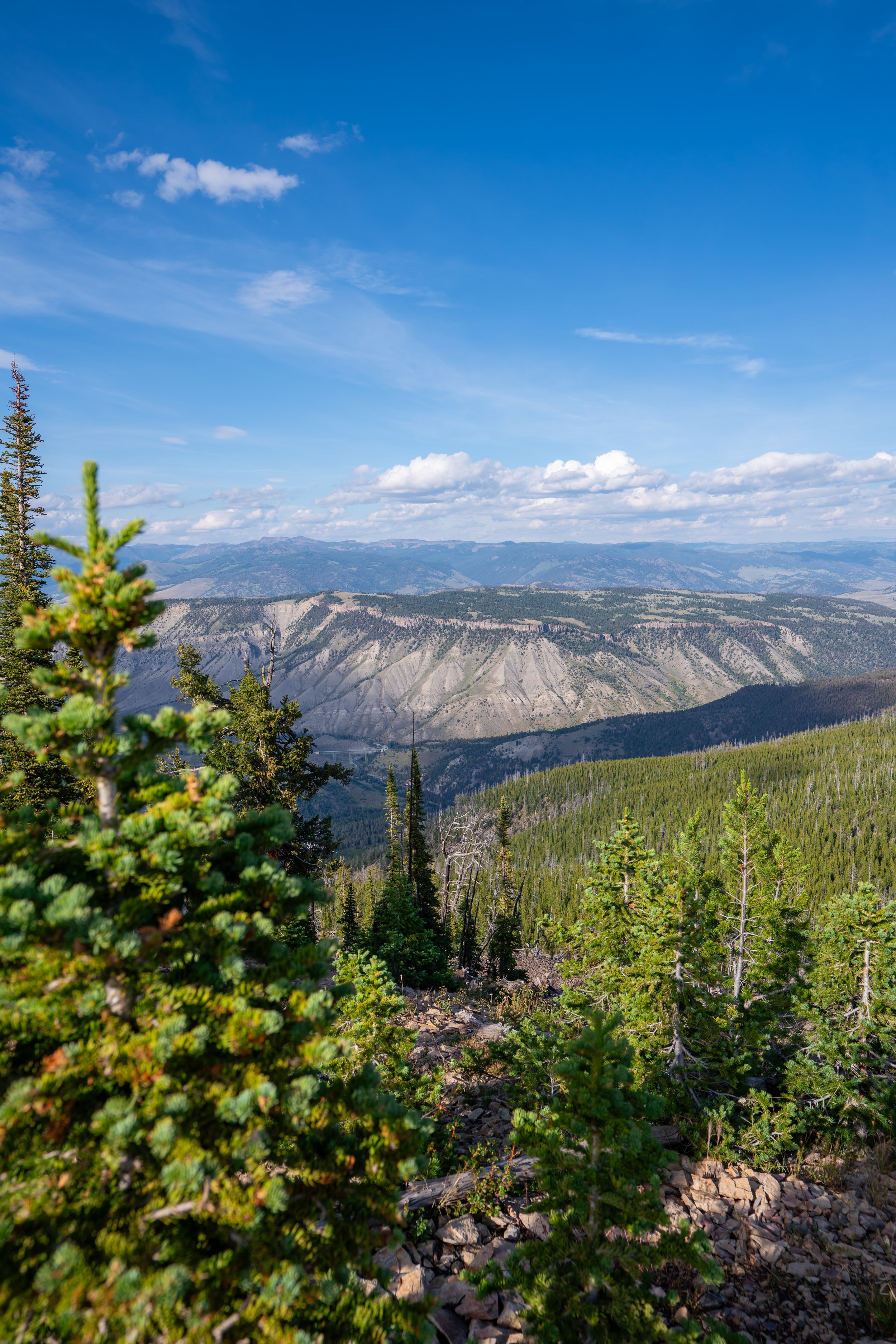
The best part about the South Rim Trail between Upper Falls View and Artist Point is that there are countless amazing unnamed viewpoints along the way, similar to the North Rim Trail between Grand View and Inspiration Point.
That said, it is certainly worth considering a one-way hike between Upper Falls View and Artist Point if there are some in your group uninterested in hiking in between, as the total one-way distance is only 1.1 miles (1.8 km) to the South Rim Trailhead at Artist Point.
This short descent is a nice sign that Uncle Tom’s Trail is just around the corner!
South Rim-Old Uncle Tom’s Trailhead Junction
This is where the South Rim Trail reaches the route that formerly connected the Upper Falls View parking lot to Uncle Tom’s Trail, shortly ahead.
However, the trail leading up the hill today serves as nothing more than a connector trail, which you can learn all about in the next section below.
In any case, go left at this split to continue hiking east on the South Rim Trail to Artist Point.
South Rim-Uncle Tom’s Junction
This is where the South Rim Trail passes the old Uncle Tom’s Trail junction.
What is the Uncle Tom’s Trail?
Uncle Tom’s Trail is named after H. F. "Uncle Tom" Richardson, an early Yellowstone guide at the Grand Canyon of the Yellowstone from 1898 to 1905 who once guided tourists from the canyon rim to the Yellowstone River for a grand total of $1.00!
During this time, early visitors descended using ropes and ladders, but in 1903, the U.S. Army Corps of Engineers completed the Chittenden Bridge, which essentially undercut an important part of Richardson’s business, in which he would ferry visitors across the river as part of his paid excursion.
Then, from 1905–1906, the U.S. Army built a wooden stairway along the route, effectively creating a more developed Uncle Tom’s Trail but killing the last major part of Uncle Tom’s business at the same time.
Fast forward to 1965, and the National Park Service built a more modern steel staircase that most visitors are familiar with and can sometimes be seen from the North Rim. This 'newer' route remained open until 2017, when it was closed as part of the Canyon Rim Overlooks and Trails Rehabilitation Project, the same project that first created Discovery Point.
The old steel staircase was originally supposed to be replaced as part of the project, but the initiative to replace the stairs was later dropped from due to increasing costs. The National Park Service subsequently reopened Uncle Tom’s Trail briefly in October 2018 and again in the summer of 2019, but it was closed later that same year due to structural-safety concerns, including damage from rockfall.
This is what ultimately led to Uncle Tom’s Trail being permanently closed, and it has been closed ever since.
The official stance of the National Park Service is that Uncle Tom’s Trail is permanently closed, with no plans to ever fix the old staircase, but perhaps public pressure—and a lot of money—could one day change that if enough funding ever became available to replace the old nostalgic stairs.
In my opinion, this is the best viewpoint between Upper Falls View and Artist Point!
For this reason, if you don’t plan to hike the full South Rim Trail, I recommend hiking just a short distance past Uncle Tom’s Trail, as it’s only a 0.3-mile (0.5 km) hike from Upper Falls View!
If you look closely, visitors can often be seen hiking the Brink of the Lower Falls Trail and the North Rim Trail on the other side!
This second viewpoint east of Upper Falls View is only another 0.1 miles (0.2 km) past the first, or 0.4 miles (0.6 km) from the Old Uncle Tom’s Trailhead and Upper Falls View.
With about 0.5 miles (0.8 km) to go before the end of the South Rim Trail at Artist Point, the trail climbs four very short switchbacks.
This is why I previously mentioned that the elevation changes on the South Rim Trail are always very mild, even if they are somewhat steep.
This is the top of the fourth switchback.
The first time I ever hiked the South Rim Trail, there was a Black Bear in the trees just off the path between the switchbacks and Artist Point.
While it was a great wildlife encounter, in my opinion, I think it should serve as an important reminder that even in busier areas, bears are certainly present, which is why carrying bear spray is essential when hiking anywhere in Grizzly country.
This is the view looking toward Lower Yellowstone Falls, but this is also where Artist Point can be seen for the first time through the trees in the opposite direction!
If you look east before the trail re-enters the forest, Artist Point can be seen from the South Rim Trail for the first time!
South Rim Trailhead (Artist Point)
This is where the South Rim Trail officially ends at Artist Point.
However, it would be very unusual to turn back before reaching Artist Point, and honestly, no one who hikes from trailhead to trailhead skips Artist Point because it is arguably the best part of the entire hike!
Walking to the Artist Point Overlook Trailhead
From the end of the South Rim Trail, simply follow the paved path that parallels the parking lot to continue toward the start of the Artist Point Overlook Trail at the far end.
Artist Point Overlook Trailhead
This is where the paved path around the Artist Point parking lot reaches the Artist Point Overlook Trailhead, which is also the trailhead for the Ribbon Lake Trail.
That said, go left to continue hiking to Artist Point, about 0.1 miles (0.2 km) from the joint trailhead.
Artist Point Overlook-Ribbon Lake Junction
Shortly before the trail ends at Artist Point, it splits, with a more direct route down the stairs to the left and a wheelchair-accessible path to the right (straight) that leads to the same lower overlook, as well as the start of the Ribbon Lake Trail.
Once here, follow either path to continue to the best views of Lower Yellowstone Falls just ahead!
This is the more direct path to Artist Point on the left.
These stairs climb to the best and most panoramic viewpoint at Artist Point!
Artist Point
This is Artist Point, which was first named in 1883 by photographer F. Jay Haynes.
In my opinion, Artist Point is one of the most beautiful overlooks on both sides of the Grand Canyon of the Yellowstone—especially at sunset, as it sets just to the north of Lower Yellowstone Falls during the best and most beautiful summer months to visit Yellowstone!
Old Faithful (Upper–Lower Geyser Basins)

Canyon Village
Maddison–Norris
Yellowstone Lake & East Entrance

Mammoth, Lamar Valley & Tower