Hiking the North Rim Trail in Yellowstone National Park
Distance (One Way): 3.3 miles / 5.3 km
The North Rim Trail in Yellowstone National Park is a stunning out-and-back day hike along the North Rim of the Grand Canyon of the Yellowstone that connects all the best and most beautiful viewpoints on one continuous hike, beginning at the Chittenden Bridge on the southern end and ending at Inspiration Point, the northern terminus!
That said, the North Rim Trail could easily be hiked in shorter sections or one way by planning a drop-off and pick-up with others in your group.
If not, the full 6.6-mile (10.6 km) roundtrip hike is not a difficult adventure, as the hills that do exist are very quick, and the hike mentally moves faster than it may seem, given all the beautiful views along the way!
With all this in mind, I could not recommend hiking the full North Rim Trail more, as it is my favorite of the two sides of the canyon for all the reasons mentioned in my side-by-side comparison below.
How Long is the North Rim Trail?
Since many hikers break up the North Rim Trail in a variety of different ways, I’ve broken down each section to help you plan your adventure.
North Rim Distances:
Wapiti Lake Trailhead to the North Rim Trailhead: 0.1 miles (0.2 km)
North Rim Trailhead to the Brink of the Upper Falls: 0.5 miles (0.8 km)
Brink of the Upper Falls to the Crystal Falls Overlook: 0.25 miles (0.4 km)
Crystal Falls Overlook to the Brink of the Lower Falls JCT: 0.4 miles (0.6 km)
Brink of the Lower Falls JCT to the Brink of the Lower Falls TH: 0.1 miles (0.2 km)
Brink of the Lower Falls TH to Lookout Point: 0.5 miles (0.8 km)
Lookout Point to the Grand View: 0.25 miles (0.4 km)
Grand View to Inspiration Point: 1.2 miles (1.9 km)
Total Distance (One Way): 3.3 miles (5.3 km)
North Rim Trail vs. South Rim Trail
First and foremost, both sides of the Grand Canyon of the Yellowstone are stunning and absolutely worth the effort if you have time for both!
However, I personally like the North Rim Trail better than the South Rim Trail because I believe the views are better, there are more of them, and there are longer sections between the most popular viewpoints, which make for great places to escape the crowds at the various drive-up viewpoints and trails.
On top of this, neither side of the Grand Canyon of the Yellowstone is a difficult hike, which is why I believe the longer hike on the North Rim, at 3.3 miles (5.3 km) each way, is far more rewarding than the 2.1-mile (3.4 km) one-way hike on the South Rim.
Now, once again, both the North Rim Trail and the South Rim Trail are worth the effort if you have the time to hike both, but if time is a factor, I recommend using my thoughts here and in my detailed, separate articles to help you decide which side sounds more interesting to you and your group!
Read My Separate Post: South Rim Trail
North Rim Trailhead Parking
Parking for the North Rim Trail is located at any of the drive-up viewpoints and trailheads along North Rim Drive and Inspiration Point Road, including Brink of the Upper Falls, the Brink of the Lower Falls Trail, Lookout Point, Grand View, and Inspiration Point.
However, for the purposes of hiking the full North Rim Trail, as outlined in this article, parking at either terminus is located at the Wapiti Lake Trailhead on the southern end or Inspiration Point on the northern end.
Even if you don’t plan to hike the entirety of the North Rim Trail, I recommend parking at one end or the other, as parking at either terminus is generally easier and less competitive than parking at the viewpoints and trailheads along the way.
Google Maps Directions: North Rim Trailhead (Wapiti Lake) / North Rim Trailhead (Inspiration Point)
Hiking Checklist - Yellowstone–Tetons
Here is a complete list of must-have things that you will want for any hike in the Yellowstone–Teton area.
Hiking the North Rim Trail
Walking to the Trailhead (Wapiti Lake Trailhead)
This is where the North Rim Trail begins from the Wapiti Lake Trailhead at the southern terminus.
That said, follow the path on the east side of the parking lot that leads down to South Rim Drive and the Chittenden Bridge to find the true North Rim Trailhead on the west side of the Yellowstone River.
On a different note, I’ve always preferred to hike south to north on the North Rim Trail because I believe it is the best way to take photos in the Grand Canyon of the Yellowstone when starting from the trailhead in the mid-afternoon hours.
I say this because the best photos at both the Brink of the Upper Falls and the Brink of the Lower Falls are taken when the sun is far to the west, which creates a rainbow in the mist of each waterfall that cannot be seen earlier in the day!
South Rim Drive
Once the paved trail reaches South Rim Drive, go left, then right, and follow the crosswalk to the north side of the road.
South Rim Trailhead (Chittenden Bridge)
The South Rim Trail begins on the north side of the crosswalk.
However, once on the far side, go left to cross the Chittenden Bridge, and the North Rim Trailhead will be found immediately on the other side.
Read My Separate Post: South Rim Trail
Chittenden Bridge
The Chittenden Bridge is a very popular first stop among those beginning South Rim Drive to see all the viewpoints along the way to Artist Point.
This is the view of the Yellowstone River just prior to Upper Yellowstone Falls.
North Rim Trailhead (Chittenden Bridge)
On the far west side of Chittenden Bridge, the North Rim Trail officially begins along Old Route 16, which was the original road through this area before the route was abandoned in 1961 and replaced by a newer Grand Loop Road alignment, the route that we still use today.
At the same time, the National Park Service decided to incorporate this historic section of Route 16 into the North Rim Trail, which follows it for only the first 0.5 miles (0.8 km) before reaching the short path that leads down to the Brink of the Upper Falls.
The Canyon Bridge
The Canyon Bridge is a remnant of historic Route 16, which used to carry vehicle traffic along the Yellowstone River until the road was abandoned in 1961.
The bridge originally opened in June 1915, and today it remains one of the most beautiful sections of this first 0.5-mile (0.8 km) stretch between South Rim Drive and the Brink of the Upper Falls!
If you look closely, the South Rim Trail can be seen just above the banks of the river on the other side.
Brink of the Upper Falls (Upper Overlook)
After 0.5 miles (0.8 km) from South Rim Drive, or 0.6 miles (1.0 km) from the Wapiti Lake Trailhead, the North Rim Trail passes the Brink of the Upper Falls viewpoint.
That said, there are three different viewpoints at the Brink of the Upper Falls, with the lowest—the one closest to the Yellowstone River—being the best!
This is where the path leads down to both the Middle and Lower Overlooks.
Middle Overlook
This is the Middle Overlook, which, in my opinion, is second best behind the Lower Overlook, located right along the Yellowstone River.
Lower Overlook (Brink of the Upper Falls)
The Lower Overlook is the third and final viewpoint, and it is the best, in my opinion, because it is truly the Brink of the Upper Falls!
This is the rainbow that can be seen in the afternoon on sunny days, both here and at the Brink of the Lower Falls!
Once back on the North Rim Trail, the paved path simply continues up to the Brink of the Upper Falls parking area, which is how most visitors access the viewpoints previously shown.
Once at the parking lot, simply follow the paved path toward the access road, also called Falls Brink Road.
Once at the road, go right, then right again, to continue on the North Rim Trail to the Crystal Falls Overlook and the Brink of the Lower Falls beyond.
This is where the North Rim Trail branches away from Falls Brink Road.
Crystal Falls Overlook
Shortly after leaving the road, the North Rim Trail reaches the Crystal Falls Overlook.
Since it is so close to the Brink of the Upper Falls, it is common for visitors to make their way over, but far fewer continue along the section between the Crystal Falls Overlook and the Brink of the Lower Falls Trail.
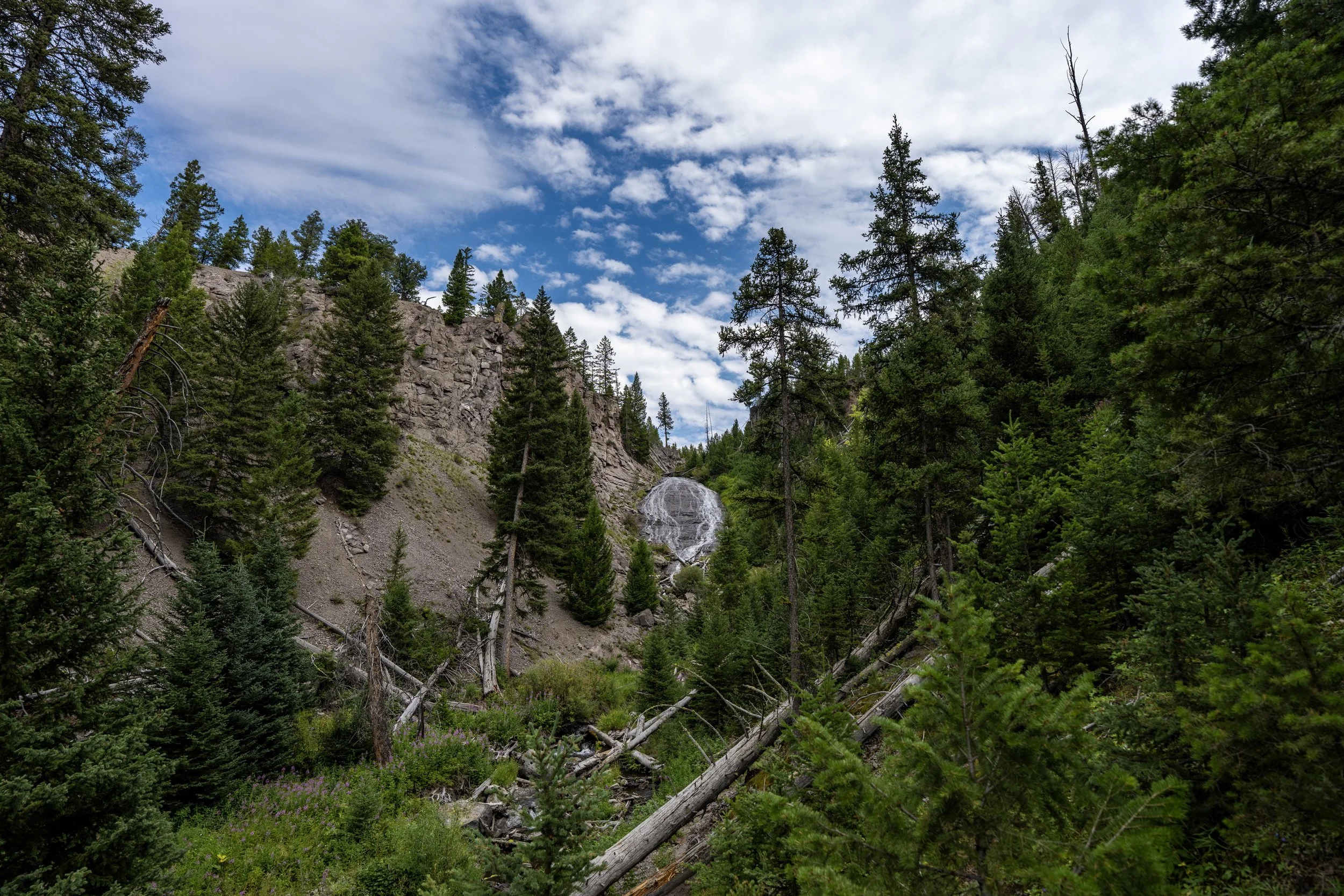
Crystal Falls, or rather Cascade Creek, is fed primarily by snowmelt, meaning that the falls can look very different in early summer than it does in August and September, as shown here.
After the Crystal Falls Overlook, the North Rim Trail begins a roughly 50-ft (15.2 m) descent toward Cascade Creek.
Cascade Creek
This is where the North Rim Trail crosses Cascade Creek, beginning a roughly 110-ft. (33.5 m) gradual ascent to the start of the Brink of the Lower Falls Trail.
This open meadow is a nice sign that the Brink of the Lower Falls Trail is just around the corner!
North Rim-Brink of the Lower Falls Junction
After 1.25 miles (2.0 km) since leaving the Wapiti Lake Trailhead, the North Rim Trail finally reaches the Brink of the Lower Falls Trail and one of the busiest sections on the entire hike.
That said, this is the first of nine switchbacks on the steep descent to the waterfall, meaning it is a bit of a longer side trail compared to the much shorter 0.1-mile (0.2 km) hike off the North Rim Trail to reach the Brink of the Upper Falls.
This is why I recommend reading my separate article about the full trail if you’re interested in learning more about the steep hike down to the Lower Falls.
In any case, to continue on the North Rim Trail, go left toward the Brink of the Lower Falls Trailhead and parking lot just beyond.
Read My Separate Post: Brink of the Lower Falls Trail
This short section between the first switchback and the Brink of the Lower Falls Trailhead is roughly 0.1 miles (0.2 km).
Brink of the Lower Falls Trailhead
This is the Brink of the Lower Falls Trailhead, and it, along with the Lookout Point Trailhead, is arguably the busiest section of the entire hike on most beautiful days throughout the summer travel season.
Once here, simply walk along the paved path on the canyon side of the parking lot to continue hiking the North Rim Trail toward Inspiration Point.
Grand Canyon of the Yellowstone
This is where the North Rim Trail passes Lower Yellowstone Falls, meaning the Grand Canyon of the Yellowstone officially begins!
On the far western side of the Brink of the Lower Falls parking lot, the North Rim Trail splits, with a path that parallels the canyon rim and passes a number of additional viewpoints before leaving the busy area for Lookout Point.
For obvious reasons, I recommend going right to hike past the three additional viewpoints!
Lower Yellowstone Falls can best be seen from the second and third viewpoints before leaving the Brink of the Lower Falls Trailhead area.
This is the third and final viewpoint before the North Rim Trail leaves the Brink of the Lower Falls Trailhead.
After the Brink of the Lower Falls, the North Rim Trail begins a fairly easy 0.4-mile (0.6 km) stretch to Lookout Point—or, rather, 0.5 miles (0.8 km) from the actual Brink of the Lower Falls Trailhead, as stated at the beginning of this article.
That said, this stretch between the two trails is one of the busier sections of the entire North Rim Trail, simply because both the Brink of the Lower Falls and Lookout Point are the two busiest drive-up spots in general.
I think it’s important to mention the need to carry bear spray on the North Rim Trail, regardless of the fact that there are so many people visiting both sides of the canyon.
In fact, I once encountered a Black Bear on the South Rim Trail during one visit, so I can confidently say they are around, and it’s important to never get complacent simply because it’s a busier area.
What is the Grand Canyon of the Yellowstone?
After Lower Yellowstone Falls, the Grand Canyon of the Yellowstone officially begins, stretching for some 20 miles (32.2 km) from the Lower Falls to Calcite Springs, just a short distance downstream of the end of the Tower Falls Trail.
That said, old signs often report 24 miles (38.6 km) as the official distance, but after taking the time to measure the canyon myself, the most accurate distance I’ve found is 19.2 miles (30.9 km) from Lower Yellowstone Falls to Calcite Springs.
In any case, the most beautiful sections of the canyon are all located past Lower Yellowstone Falls and are found along the North Rim, in my opinion!
After the small gully in the photo above, the North Rim Trail begins a gradual ascent up to the Lookout Point Trailhead, a little less than 0.2 miles (0.3 km) away.
Lookout Point Trailhead
This is where the North Rim Trail passes the short path that leads down to Lookout Point and Red Rock Point, and just like the Brink of the Lower Falls Trail, both viewpoints are a little bit of a hike off the main trail along the canyon rim, adding roughly 0.7 miles (1.1 km) to the overall distance.
While not terrible, I believe it’s best to treat both as separate adventures if you have plans to hike all the way to Inspiration Point and back, but this is certainly just one person’s opinion.
In any case, go straight to continue on the paved path past the parking area to stay on the North Rim Trail toward Inspiration Point.
This is where the North Rim Trail leaves the Lookout Point Trailhead area behind.
If you look closely, hikers can often be seen hiking the South Rim Trail on the far side of the canyon!
This 0.25-mile (0.4 km) section between Lookout Point and Grand View is paved the entire way.
Grand View
This is where the North Rim Trail passes the short path that leads out to Grand View, which is considerably shorter than the path that first branched away at the Brink of the Upper Falls.
The Grand View is located directly across the Grand Canyon of the Yellowstone from Artist Point and the end of the South Rim Trail.
This hopefully helps illustrate why the North Rim Trail is a bit longer, as it continues for another 1.2 miles (1.9 km) from this point to Inspiration Point, the northern terminus.
This is where the North Rim Trail passes the Grand View parking area, which is noticeably less crowded than the trailhead for Lookout Point, just 0.3 miles (0.5 km) away.
Once again, follow the paved path past the parking area to continue on the North Rim Trail toward Inspiration Point.
After Grand View, the North Rim Trail begins the longest stretch between any of the drive-up viewpoints and trailheads on the entire 3.3-mile (5.3 km) hike.
For obvious reasons, this is also the least-trafficked section of the North Rim Trail and one of my favorites, as there are countless stunning viewpoints along the way that almost always have few, if any, other visitors!
Grand Viewpoint
This is where the North Rim Trail passes what’s often labeled as the Grand Viewpoint on some maps, though the National Park Service does not distinguish this as a different named overlook from the Grand View shown above.
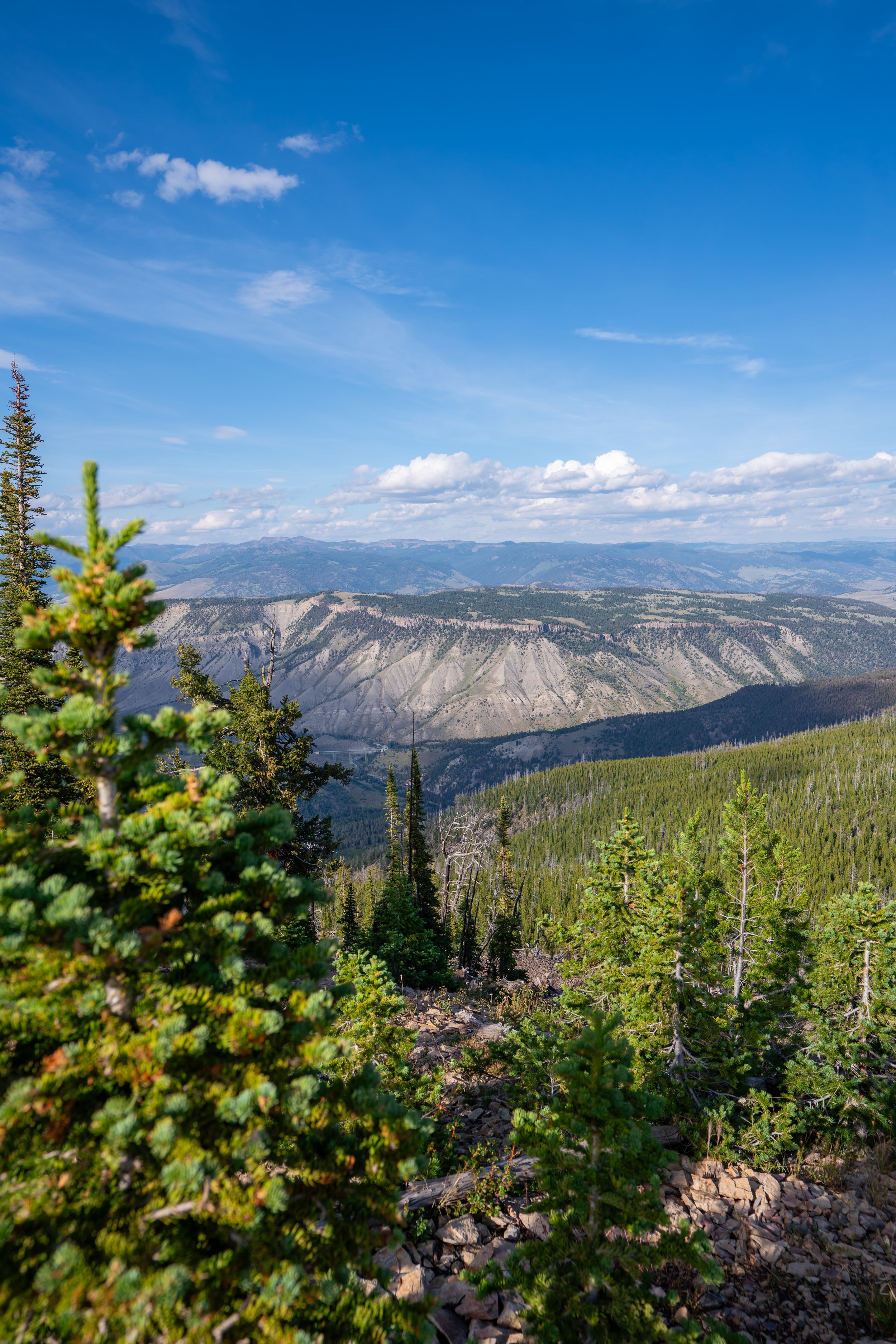
All of these sections along the rim of the Grand Canyon of the Yellowstone have truly spectacular views looking east down the narrow river corridor!
That said, late afternoon/ early evening is the best time for photos on a beautiful, sunny day like this, as photos taken earlier in the day just don’t come out as well with the low-hanging sun, apart from actually catching sunrise!
If you’ve made it this far in the article, I’ll share a little-known secret! That is, this short stretch after Grand Viewpoint, but before the trail starts curving east, is one of the best places to watch the sunrise in Yellowstone National Park—and the best part is that it’s only a 0.1-mile (0.2 km) walk from the closest parking area after Grand View!
This is where the North Rim Trail starts curving east, leaving the best and most direct views down the Yellowstone River and of the sunrise behind.
This is what I mean about the view changing from the long, east-facing Yellowstone River corridor, similar to Dragon Point in Black Canyon of the Gunnison National Park, to simply facing the far side of the canyon again.
This is where the North Rim Trail sharply curves away from the canyon rim as it works its way around a large depression before arriving at Inspiration Point on the far side.
Once again, always remember to carry bear spray when hiking in Yellowstone National Park—especially considering how there are far fewer people on these longer sections between the main drive-up viewpoints and trailheads.
This is where the North Rim Trail turns sharply to the west, beginning the final 0.5-mile (0.8 km) section until the trail reaches the West Overlook at Inspiration Point!
Even though there is quite a bit of shade among the Lodgepole Pines that dominate much of the landscape in Yellowstone National Park, I still recommend wearing a hooded sun shirt on the North Rim Trail, as 6.6 miles (10.6 km)—and potentially farther with the side trails—is inevitably a long day outside if you plan to hike from end to end, as outlined here.
This is the final viewpoint before the North Rim Trail reaches the West Overlook at Inspiration Point, just 0.1 miles (0.2 km) away!
Inspiration Point
This is where the North Rim Trail begins the final 0.1-mile (0.2 km) section at Inspiration Point, with three main viewpoints along the way!
At this split, there’s either the option to go straight to hike directly to the trailhead or right to the three main viewpoints at Inspiration Point.
For obvious reasons, I recommend going right to continue along the canyon rim.
West Overlook
This is the West Overlook and the first of the three viewpoints at the northern terminus.
Middle Overlook
This is the Middle Overlook, located just a few steps below the trailhead but above the Lower Overlook and Inspiration Point.
This is the short side trail that leads down to the Lower Overlook.
Lower Overlook (Inspiration Point)
This is Inspiration Point, the lowest and final of the three main overlooks at the end of the North Rim Trail.
That said, Inspiration Point is one of the best places to catch the sunset in Yellowstone National Park, just as Artist Point is on the South Rim!
Between the two, my personal preference leans toward Artist Point, simply because of the view looking directly toward Lower Yellowstone Falls.
These are the final few steps from the Middle Overlook to the North Rim Trailhead at Inspiration Point.
North Rim Trailhead (Inspiration Point)
This is the northern terminus and the end of the 3.3-mile (5.3 km) one-way hike from the Wapiti Lake Trailhead near the Chittenden Bridge.
If you have folks in your group who were uninterested in hiking the full North Rim Trail, or even part of the trail from one of the viewpoints along the way, this can be a great place to plan a ride!
However, if you had to turn back, I would not consider the return hike to be any more or less difficult than the hike to Inspiration Point, as the whole trail is nothing more than mild rolling hills.
Old Faithful (Upper–Lower Geyser Basins)

Canyon Village
Maddison–Norris
Yellowstone Lake & East Entrance

Mammoth, Lamar Valley & Tower