Hiking the Wraith Falls Trail in Yellowstone National Park
Distance: 0.9 miles / 1.4 km
The Wraith Falls Trail in Yellowstone National Park is a short and easy day hike between Mammoth and Tower on the Blacktail Plateau that follows a mostly flat path before climbing a short hill to an upper vantage point overlooking the beautiful 79-ft. (24 m) cascade in Lupine Creek known as Wraith Falls!
That said, the Wraith Falls Trail, at only 0.45 miles (0.7 km) each way, truly does not take much time to enjoy, which is why I recommend adding it as a quick stop whenever you have plans to drive between Mammoth Hot Springs and Tower Junction. The same could also be said about the Forces of the Northern Range Trail, just a few miles to the east.
In any case, the Wraith Falls Trail is a great family-friendly adventure on the northern edge of Yellowstone National Park, and it’s one that I personally enjoy because it is quite removed from some of the busiest areas in the park, like Old Faithful and the Norris Geyser Basin, to name a few.
Wraith Falls Trailhead Parking
Parking for the Wraith Falls Trail is located in a small pullout directly off Grand Loop Road.
That said, finding a spot is typically never an issue, as Wraith Falls and the greater Blacktail Plateau area, including Lamar Valley, are all some of the quietest places visitors can find in Yellowstone National Park!
Google Maps Directions: Wraith Falls Trailhead
Hiking Checklist - Yellowstone–Tetons
Here is a complete list of must-have things that you will want for any hike in the Yellowstone–Teton area.
Hiking the Wraith Falls Trail
As previously mentioned, the Wraith Falls Trail is a very easy, mostly flat adventure, as the trail only gains about 50 ft. (15 m) over the first 0.4 miles (0.6 km) to the base of the hill that leads up to the final viewpoint.
Where Does the Name Wraith Come From?
The word Wraith quite literally means "ghost," and it was given to the waterfall in Lupine Creek by members of the U.S. Geological Survey in 1885 because of the fall’s thin, ghostlike appearance as water spreads across the rock face.
While the exact reasoning was never formally recorded, early Yellowstone records classified the name as "characteristic," strongly suggesting it was chosen to describe the waterfall’s appearance.
As with every day hike in Yellowstone National Park, always hike with bear spray—especially considering that there are far fewer visitors on all the trails between Mammoth and Cooke City.
Lupine Creek
Just before the path turns sharply to the east and begins its climb toward the final viewpoint, the Wraith Falls Trail crosses Lupine Creek.
This is where the Wraith Falls Trail begins climbing the one and only significant hill, about 0.4 miles (0.6 km) from the trailhead.
Wraith Falls
This is the end of the maintained trail and the best viewpoint of the beautiful 79-ft. (24 m) Wraith Falls!
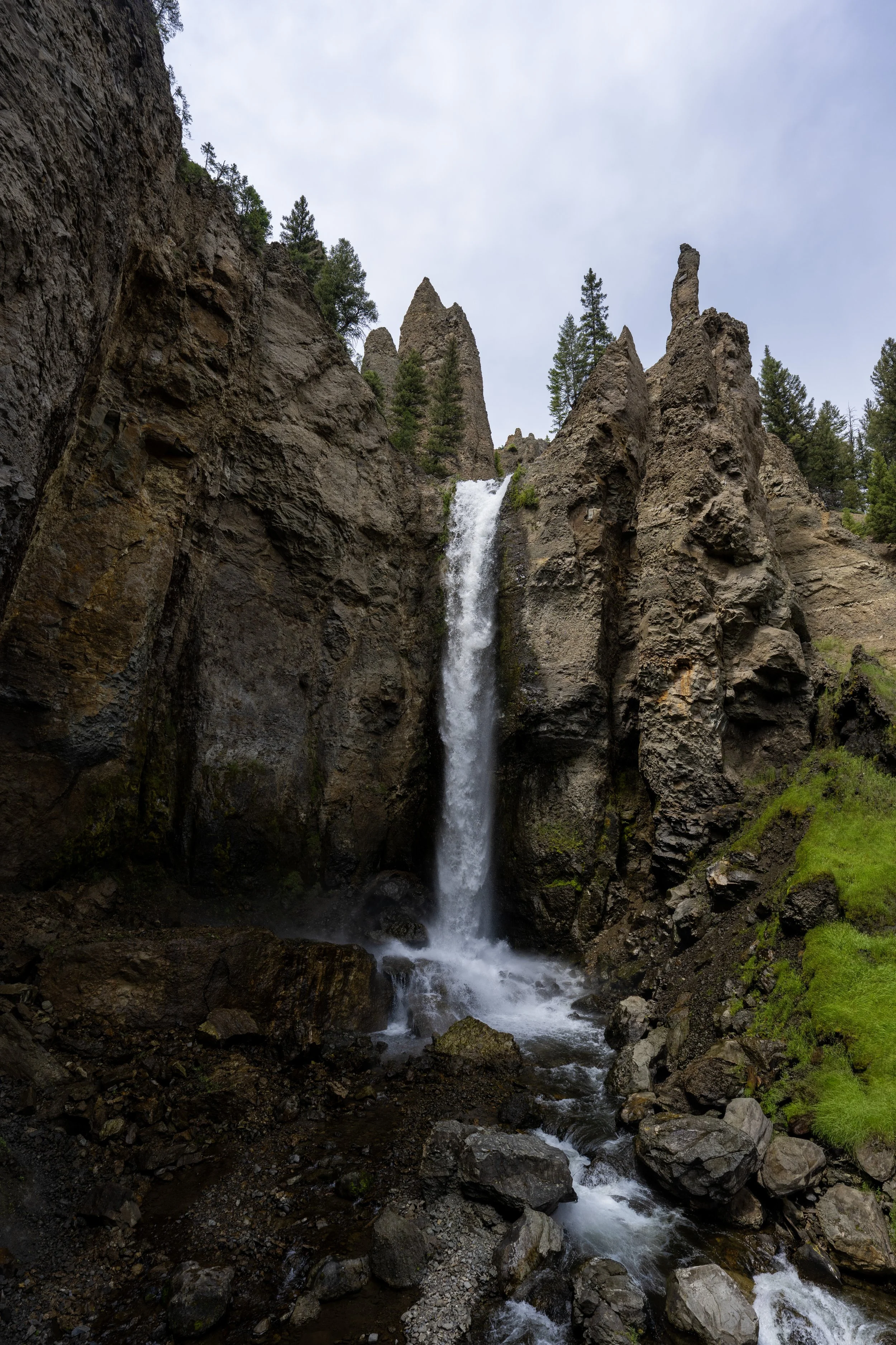
I say this because it is possible to scramble down to the base of Wraith Falls when snowmelt has significantly subsided from its late-spring/ early-summer peak, but the view from the bottom of the waterfall, as shown below, is not better than this upper viewpoint from afar—at least in my opinion.
This is the view from the bottom of Wraith Falls.
Old Faithful (Upper–Lower Geyser Basins)


Canyon Village
Maddison–Norris
Yellowstone Lake & East Entrance

Mammoth, Lamar Valley & Tower