Hiking the Upper Geyser Basin Trail in Yellowstone National Park
Distance (Full Loop + Morning Glory Pool): 3.15 miles / 5.1 km
The Upper Geyser Basin Trail in Yellowstone National Park is a beautiful, easy day hike that begins at the iconic Old Faithful Geyser and follows a series of paths and boardwalks past countless unique thermal features of all kind—totaling 150 geysers in all—making the Upper Basin the most densely concentrated geyser field on Earth!
This is the area visitors are commonly referring to when they talk about the boardwalks in Yellowstone National Park!
That said, there is A LOT to consider before hiking the Upper Geyser Basin Trail because the trail isn’t designed as one clean, easy-to-follow path. Instead, the Upper Geyser Basin Trail branches out in a number of different directions from the viewing platform that surrounds the south side of Old Faithful, linking together everything from Biscuit Basin on the far northern end, Black Sand Basin on the far side of Grand Loop Road, and, obviously, the entire area surrounding Old Faithful.
It is all these paths that the National Park Service collectively calls the Upper Geyser Basin Trail, which is why it can seem confusing when trying to plan which way to go and what to prioritize.
This is why I strongly recommend setting off on the Upper Geyser Basin Trail with a plan because I know how easy it can be to walk slowly trying to see it all, only to find yourself miles away from wherever you parked after having spent a lot of time in the sun.
What I mean when I say this is that I think it’s best to set hard turnaround points. This way, you can return to your car, drive a little, and park elsewhere if you’re really trying to see all the Upper Geyser Basin has to offer. For example, I do not recommend parking at Old Faithful with the plan of hiking as far north as the Artemisia Trailhead near Biscuit Basin or across Grand Loop Road to Black Sand Basin, as both are better treated as separate destinations in order to maximize time and effort and to reduce time spent in the sun!
All that to say, there is quite a bit to consider before setting off on the Upper Geyser Basin Trail, but I recommend using this post to learn about the most popular geysers—including the Major Five—and thermal features in the Upper Basin, in order to make a plan regarding how much or how little you’re interested in seeing—bearing in mind that only hiking the Upper Geyser Hill Trail closest to Old Faithful is a great way to experience the basin without walking the full loop!
How Long is the Upper Geyser Basin Trail?
Since many hikers break up the Upper Geyser Basin Trail in a variety of different ways, I’ve broken down each section to help you plan your adventure.
Upper Geyser Basin Distances:
Upper Geyser Basin Trailhead to the Observation Point Junction: 0.25 miles (0.4 km)
Observation Point Junction to the Upper Geyser Hill Loop Trail: 0.05 miles (0.08 km)
Upper Geyser Hill Loop Trail to the Upper Geyser Basin Junction: 0.25 miles (0.4 km)
Upper Geyser Basin Junction to the Sawmill Complex: 0.3 miles (0.5 km)
Castle Shortcut to the Castle Junction: 0.2 miles (0.3 km)
Sawmill Complex to the Grotto Junction: 0.6 miles (1.0 km)
Grotto Junction to the Morning Glory Pool (One Way): 0.25 miles (0.4 km)
Grotto Junction to the Black Sand Basin Junction: 0.1 miles (0.2 km)
Black Sand Basin Junction to the Daisy Geyser (One Way): 0.1 miles (0.2 km)
Black Sand Basin Junction to the Castle Junction: 0.6 miles (1.0 km)
Castle Junction to Upper Geyser Basin Trailhead: 0.5 miles (0.8 km)
Total Distance (Full Loop + Morning Glory Pool): 3.15 miles (5.1 km)
Upper Geyser Basin Trailhead Parking
Parking for the Upper Geyser Basin Trail is located at Old Faithful.
This is the busiest area and trailhead of any in Yellowstone National Park.
However, Old Faithful and everything that surrounds it is one of the most well-constructed areas in Yellowstone National Park to handle all the traffic the area attracts, meaning that even though it’s incredibly busy, finding a place to park is typically not too much of an issue because there are so many different parking lots to look for a spot.
That said, visitors can find parking anywhere near the Hamilton Store, the Old Faithful Inn, the Old Faithful Visitor Center, and the Old Faithful Lodge.
Either way, getting to the trailhead on the east side of Old Faithful is typically fairly easy and straightforward.
Google Maps Directions: Upper Geyser Basin Trailhead (Old Faithful)
Hiking Checklist - Yellowstone–Tetons
Here is a complete list of must-have things that you will want for any hike in the Yellowstone–Teton area.
Hiking the Upper Geyser Basin Trail
Upper Geyser Basin Trailhead
Depending on exactly where you park in the Old Faithful area, the Upper Geyser Basin Trail could begin in any number of directions.
That said, this article begins from the official Upper Geyser Basin Trailhead near the Old Faithful Lodge, which is the jumping-off point for a number of different day hikes that all branch out from the popular observation deck that surrounds Old Faithful.
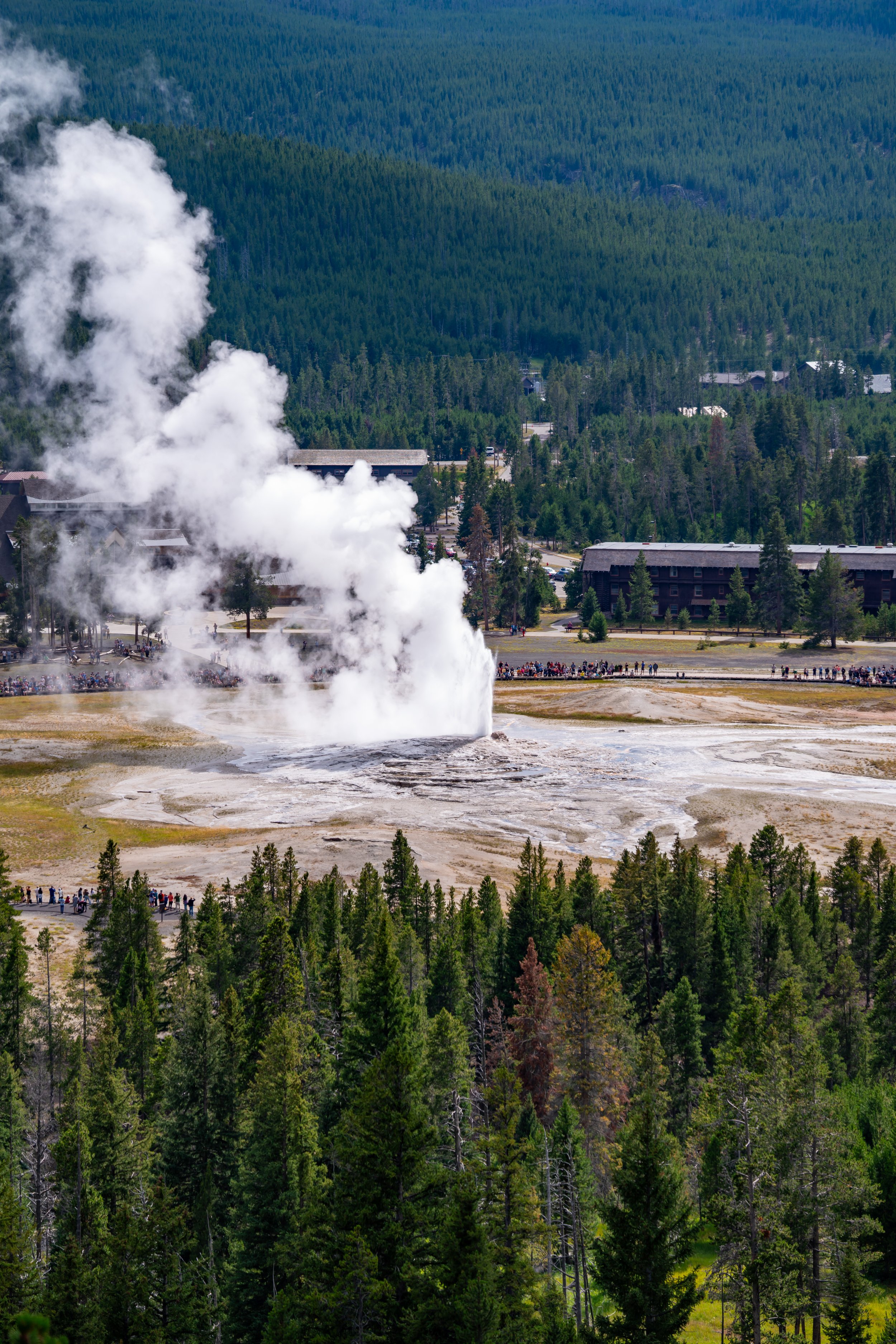
Old Faithful
Regardless of which path you take to reach the observation deck that wraps around the south side of Old Faithful, go right and walk to the far eastern end, where the boardwalk ends and the trail begins.
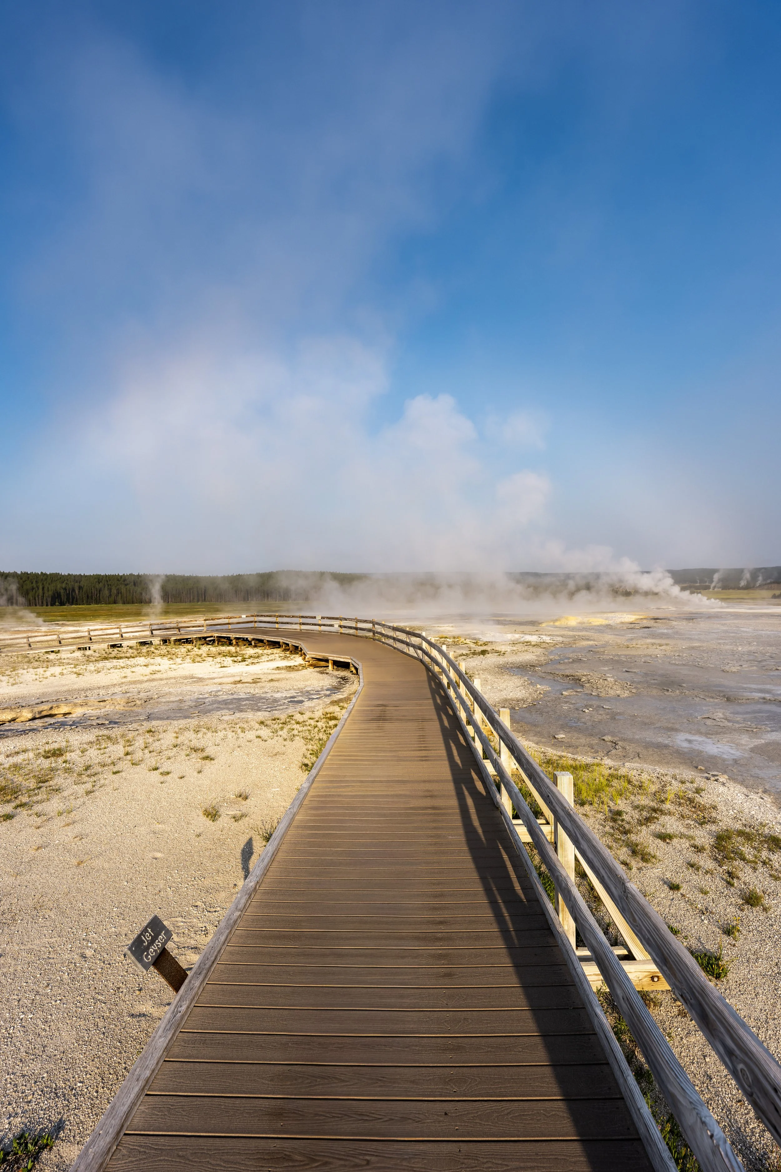
When the Upper Geyser Basin Trail leaves the boardwalk on the east side of Old Faithful, it will not return to a boardwalk until the start of the Upper Geyser Hill Loop, just beyond the Observation Point junction.
Upper Geyser Hill-Old Faithful Loop Junction
Shortly before the Upper Geyser Basin Trail crosses the Firehole River, the path reaches this split for the very short loop around Old Faithful on the left (straight), and the trail on the right that leads into the heart of the Upper Geyser Basin.
Once here, go right to begin hiking the Upper Geyser Hill Trail toward the start of the boardwalk loop, roughly 0.2 miles (0.3 km) away from this point.
Firehole River
This is the first of at least two times the Upper Geyser Basin Trail crosses the Firehole River, but there are more beautiful bridges on both the Castle Shortcut and on the final stretch to the Morning Glory Pool.
South Upper Geyser Hill-Observation Point Junction
Shortly after crossing the Firehole River, the Upper Geyser Hill Trail passes the beginning of the Observation Point Trail.
At this split, go straight to continue hiking up to the start of the Upper Geyser Hill Loop, located just a few steps ahead.
Read My Separate Post: Observation Point Trail
Upper Geyser Hill Loop Trail
This is the beginning of the 0.5-mile (0.8 km) Upper Geyser Hill Loop, with both sides coming together again where the Upper Geyser Basin Trail branches away and continues farther north.
That said, each half of the loop is almost exactly 0.25 miles (0.4 km) to the Upper Geyser Basin junction near the Lion Geyser, and I don’t believe it makes much of a difference which direction you decide to go in terms of enjoying the trail.
Read My Separate Post: Upper Geyser Hill Trail
For no particular reason, I decided to go left in the clockwise direction around the Upper Geyser Hill Loop Trail.
Anemone Geysers
The Anemone Geyser is actually plural, meaning geysers, as there are two geysers within 10 ft. (3 m) of one another, known as Big Anemone and Little Anemone.
Beehive Geyser
The Beehive Geyser, along with the Lion Geyser just ahead, is one of the most well-known geysers on the Upper Geyser Hill Loop because of its unique siliceous-sinter cone, which resembles a 'beehive' and acts like a nozzle that produces eruptions that reach heights of up to 200 ft. (61 m).
According to the National Park Service, eruptions are somewhat irregular, but Beehive has what’s known as an indicator—essentially acting like an early-warning sign for when the next eruption is likely to occur.
Beehive’s Indicator, quite literally named just that, is a small geyser located just a few feet from the main cone, and it typically begins erupting about 10–20 minutes before the main Beehive eruption.
Lion Geyser
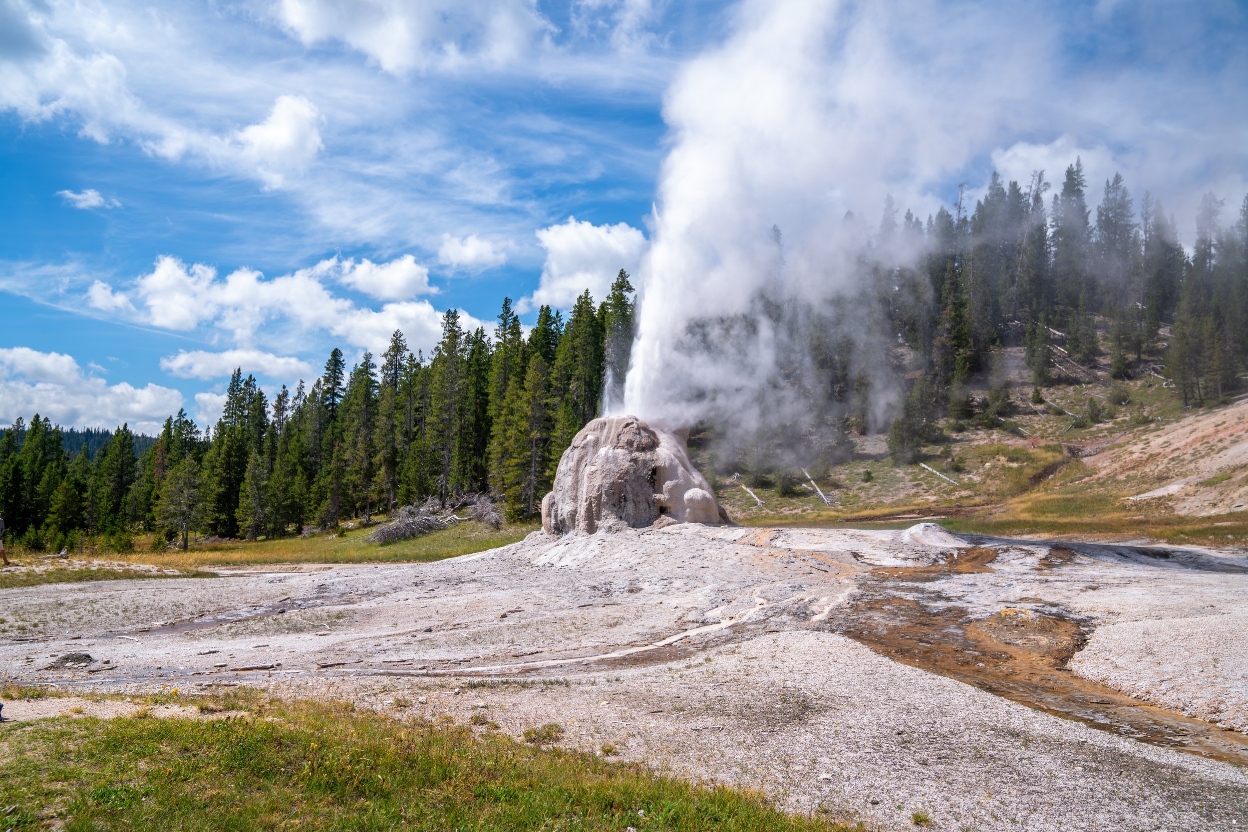
The Lion Geyser, better known as the Lion Geyser Complex, is actually just one of four geysers, along with three hot springs, with Lion being the most prominent.
Unlike Beehive, the Lion Geyser is fairly predictable and has the tallest eruptions in the group, reaching heights of up to 60 ft. (18.3 m), with eruptions ranging anywhere from 60–90 minutes apart!
Therefore, I like to say, don’t try too hard to time it, and if you happen to see it erupting from any point along the 0.5-mile (0.8 km) loop, there’s a good chance you’ll have enough time to hurry over and get a better view!

My Print - Lion Geyser
Upper Geyser Basin-Upper Geyser Hill Junction
This is where the Upper Geyser Hill Trail reaches the junction where the Upper Geyser Basin Trail leaves the loop and continues north toward the Morning Glory Pool, exactly halfway, or 0.25 miles (0.4 km), from the start of the loop shown above.
Once here, go left to leave the Upper Geyser Hill Trail and continue north toward both the Sawmill Complex and the Castle Shortcut, about 0.3 miles (0.5 km) away.
Read My Separate Post: Upper Geyser Hill Trail
Between the Upper Geyser Hill Loop and the Sawmill Complex, there are a few geysers and thermal features along the way, but they are a lot more spread out than everything passed along the trail thus far.
What are the Major Five?
The Major Five refers to the five most predictable geysers in the Upper Geyser Basin.
They include Old Faithful, the Grand Geyser, the Riverside Geyser, the Daisy Geyser, and the Castle Geyser, in terms of what is reached next when hiking counterclockwise around the loop, as is common and shown in this post.
The 'Major Five' does not refer to the five biggest geysers or five geyers with the tallest eruptions. They really are just that, the most predictable, and typically speaking, the National Park Service is fairly good about keeping the most up-to-date information posted both in the Old Faithful Visitor Center and on the signs at the geysers themselves.
Upper Geyser Basin-Sawmill Loop-Castle Shortcut Junction
After 0.3 miles (0.5 km) since leaving the Upper Geyser Hill Loop, the Upper Geyser Basin Trail reaches this three-way junction.
The first split on the right is the route around the Sawmill Loop, also called the Sawmill Complex, the second route on the left is the Upper Geyser Basin Shortcut, also called the Castle Shortcut because it leads directly to Castle Geyser on the far side of the Firehole River, and the trail going straight is the continuation of the Upper Geyser Basin Trail.
That said, hikers can either go right or straight to continue around the longer Upper Geyser Basin Loop, as both routes meet again just a few steps ahead. However, if you are more interested in shortening the loop and returning to Old Faithful, go left toward the bridge across the Firehole River.
To skip ahead to the Castle Shortcut, click here.
Sawmill Geyser
The Sawmill Geyser has undergone periods of frequent activity, followed by years of dormancy.
This photo is actually from an active eruption, where heights reached about 10–15 ft. (3–4.6 m), though the National Park Service says they can get up to 30 ft. (9.1 m)!
What all this really says is that you never know what to expect in Yellowstone National Park. Geyser activity seems to change from one year to the next, especially when there is some kind of seismic event, as with the 1983 earthquake near Mt. Borah in Idaho that altered activity in Aurum Geyser on the Upper Geyser Hill Loop.
This is where both the Sawmill Complex Loop and the main Upper Geyser Basin Trail come back together.
If you chose to go straight at both splits shown above, go straight once again to continue north on the Upper Geyser Basin Trail toward the Morning Glory Pool.
West Triplet Geyser (Grand Group)
The West Triplet Geyser is actually one of seven geysers surrounding Grand Geyser, including West Triplet, North Triplet, East Triplet, Rift Geyser, Percolator Geyser, Vent Geyser, and Turban Geyser, of which both Vent and Turban often appear as one geyser.
Together, these interconnected features form part of what is known as the Grand Group, an underground hydrothermal system in which the activity of one geyser can influence the behavior and timing of another.
Grand Geyser
The Grand Geyser is known by the National Park Service as the "largest predictable geyser in the world," with eruptions that can reach heights of up to 200 ft. (61 m)!
This explains the larger-than-normal viewing platform around the Grand Geyser, similar to the much larger platform surrounding Old Faithful.
The National Park Service says that if a crowd is gathered around the Grand Geyser when you walk by, it may be worth waiting a while, as eruptions only occur every 6 and a half hours, with 1 hour of variability on either side. That works out to about 3–4 eruptions per day, making it fairly practical if you want to try to time it, though I recommend against trying for a midday eruption because of the lack of shade—not to mention, late afternoon/ early evening is the best time to take photos when it erupts!
Economic Geyser
The Economic Geyser carries its unusual name because early park observers noticed that much of its water fell back into the crater during eruptions instead of draining away.
In other words, the geyser appeared to reuse its own water efficiently, first leading to the names "Economy" and "Economical," before eventually becoming the Economic Geyser.
The USGS says the Economic Geyser used to erupt every few minutes, throwing water as high as 25 ft. (7.6 m), and was considered a fan favorite before its regular eruptive activity largely died out by the 1920s.
Today, eruptions are extremely rare, though the geyser has shown brief periods of renewed activity following major earthquakes. However, most visitors now see it as a quiet thermal pool rather than an actively erupting geyser.
Since there is very little shade on much of the Upper Geyser Basin Trail, I highly recommend wearing a hooded sun shirt to stay safe, especially considering how much easier it is to burn at these higher elevations, which sit above 7,000 ft. (2,134 m) throughout the entire basin.
This is where the Upper Geyser Basin Trail descends a short hill to the second bridge across the Firehole River.
Firehole River
This is the second of four bridges across the Firehole River, with the first and closest to Old Faithful being my favorite!
Giant Geyser
Shortly after crossing the Firehole River for the second time, the Upper Geyser Basin Trail passes Giant Geyser on the right-hand side.
The Giant Geyser bears this name because it is one of the most powerful geysers in the Upper Geyser Basin and because an early explorer named Walter Trumbull said that he and others in his expedition thought it discharged more water than any other geyser they saw erupting!
That said, eruptions are elusive and unpredictable today, but if you happen to get lucky, Giant Geyser can be seen from very far away, as it has been known to reach heights between 200 and 300 ft. (61–91 m)!
Grotto Geyser
The Grotto Geyser is located just before the Upper Geyser Basin Trail reaches the west side of the loop, which is where hikers can either continue north toward the Riverside Geyser and the Morning Glory Pool or south to return to Old Faithful.
This is why this junction is called the Grotto Junction.
In any case, the geyser itself is one of the more unusual in the Upper Geyser Basin, as the National Park Service believes its prominent siliceous sinter cone formed over the stumps of dead Lodgepole Pines.
Today, the Grotto Geyser only reaches heights of around 15 ft. (4.6 m) when it does erupt, though it is not predictable—something that is true of most geysers in the Upper Basin and across the park.
Grotto Junction
After roughly 0.6 miles (1.0 km) from the Sawmill Complex, the Upper Geyser Basin Trail reaches the Grotto Junction, adjacent to Grotto Geyser.
This is where visitors have the option to continue north to the Riverside Geyser and the Morning Glory Pool or head south to begin the return hike back to Old Faithful.
If you’ve come this far, I recommend going right to visit Morning Glory Pool, as it is only 0.25 miles (0.4 km) from this junction, with Riverside Geyser located about halfway in between.
To skip past the Riverside Geyser and the Morning Glory Pool, click here.
Regarding my thoughts above, I chose to go right to continue hiking north toward Riverside Geyser and the Morning Glory Pool, about 0.25 miles (0.4 km) away from Grotto Junction.
South Upper Geyser Basin-Riverside Geyser Junction
This is where the Upper Geyser Basin Trail splits with the path that leads to Riverside Geyser, similar to the short loop for the Sawmill Complex.
Personally, I recommend going right to walk along the Firehole River, as it adds little, if any, distance to the overall hike.
In addition, be aware that it is possible to time the Riverside Geyser eruption, so it may be worth walking out to the viewpoint to see if the National Park Service has anything posted about the next potential eruption.
Regarding my thoughts above, I chose to go right toward the Riverside Geyser.
Riverside Geyser
The Riverside Geyser is the farthest north of the Five Major Geysers.
That said, the National Park Service reports that eruptions occur roughly every six and a half hours, with 30 minutes of variability on either side of the estimated prediction.
Since it is so far from the Upper Geyser Basin Trailhead, I recommend checking the next prediction inside the Old Faithful Visitor Center before beginning the Upper Geyser Basin Trail if you want to see it.
This way, if time is a factor in trying to get to this point before the next eruption, there is the option to consider closer trailheads that lead directly to it, most notably the Artemisia Trail near Biscuit Basin from the north.
North Upper Geyser Basin-Riverside Geyser Junction
This is where the short side trail past Riverside Geyser returns to the main Upper Geyser Basin Trail, which continues north toward Morning Glory Pool.
If you chose to follow the Riverside Geyser Trail as outlined above, go right at this split to continue hiking north toward the Artemisia Trail and Morning Glory Pool just ahead!
Firehole River
This is the third bridge across the Firehole River, and it is one of the more unique crossings because there are a number of geysers located just on the other side!
Mortar, Fan, & Spiteful Geysers
This is the collection of geysers on the north side of the third bridge, with Mortar Geyser located on the left, Fan Geyser in the middle, and Spiteful Geyser on the right side of the photo below.
All three are part of what’s known as the Fan and Mortar Geyser Complex, and they are quite unreliable in terms of predicting their next eruption.
If you are lucky, both Fan and Mortar put on quite a show, and the National Park Service says they are hydraulically linked.
However, the Spiteful Geyser has been inactive since 1998, but if one thing holds true in Yellowstone, anything can change!
Upper Geyser Basin-Artemisia Junction
This is the far northern end, where the Upper Geyser Basin Trail meets the junction with the Artemisia Trail, the trail that continues north toward Biscuit Basin.
This junction is located about 0.9 miles (1.4 km) from Grand Loop Road and 1.0 mile (1.6 km) from Biscuit Basin on the other side, which is why the Artemisia Trail is such a great option if you want to hike directly to this must-see hidden gem—not to mention the hike also passes other lesser-known geysers along the way, such as Cauliflower Geyser and Artemisia Geyser, to name a few!
All that to say, go left (straight) at this junction to continue to the beautiful Morning Glory Pool just ahead!
Read My Separate Post: Artemisia Trail
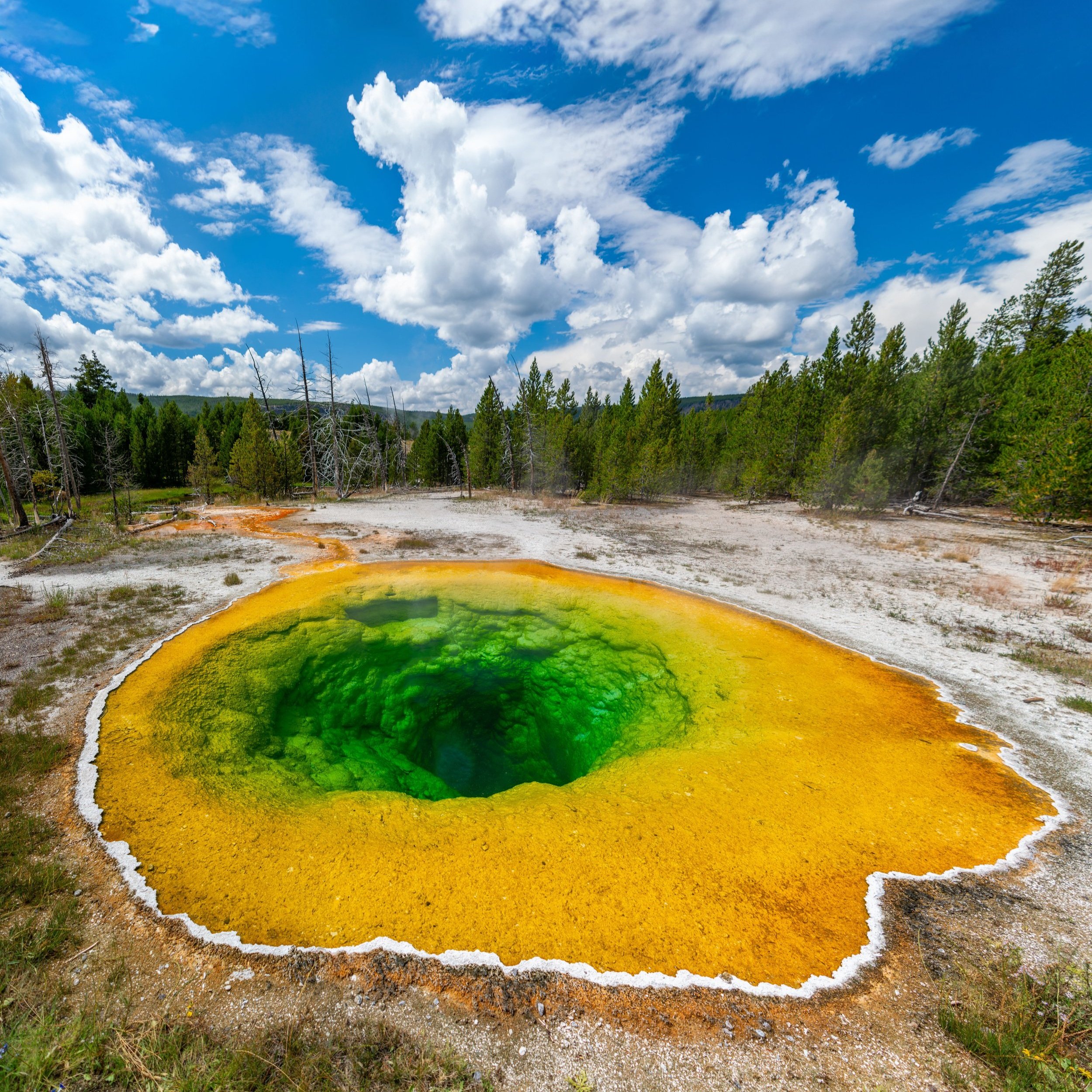
Morning Glory Pool
The end of the boardwalk is the Morning Glory Pool, which, for obvious reasons, is one of the highlights of all the thermal features in the Upper Geyser Basin and easily one of the best things to do in Yellowstone National Park!
According to the National Park Service, the Morning Glory Pool is a hot spring, not a geyser, and has an average water temperature of about 159.3 °F (70.7 °C).
How to Take Good Photos at the Morning Glory Pool?
If you want to try and take good photos at the Morning Glory Pool, there are two things to think about: the first is the time of day, and the second is the type of lens.
What I mean is that good photos at the Morning Glory Pool are incredibly tricky to capture because it’s very hard to get the entire pool in one shot without the boardwalk in your photo.
This is because the boardwalk is simply too close, and the pool is simply too big for most point-and-shoot cameras to capture it all in one shot—not to mention, the best angle has the boardwalk in the background.
If you are using a professional camera, a 16mm lens, or preferably wider, is needed at the very least. If you are using a phone, a wide-angle lens, such as the one on the iPhone, is best.
As for the time of day, the best photos of the Morning Glory Pool are captured in the morning before solar noon—the time when the sun is highest in the sky. The trick is to visit mid-morning, after the shadows are no longer covering any part of the pool but before solar noon, as the sun descends directly behind the pool from the best angle that most photos are commonly taken.
Grotto Junction
After returning to the Grotto Junction from the Morning Glory Pool, go straight to begin the west side of the Upper Geyser Basin Loop Trail toward the Black Sand Basin Junction, about 0.1 miles (0.2 km) away.
Upper Geyser Basin-Daisy Junction
After just a few steps since leaving the Grotto Geyser and beginning the west side of the Upper Geyser Basin Loop, the trail passes the first of two junctions that head west toward Daisy Geyser.
This first side trail is the Daisy Trail, which leads toward the Daisy Geyser and the Daisy Trailhead off Grand Loop Road, the same trailhead I recommend utilizing to begin the Mystic Falls Trail. The second side trail, just ahead, is the Black Sand Basin Trail, which also leads to the Daisy Geyser and continues beyond to the Black Sand Basin on the far side of the main road.
If you are interested in checking out the Daisy Geyser off the main loop, I recommend choosing either side trail based on the time of day.
By this, I mean that photos of the Daisy Geyser are better taken from the Daisy Trail in the afternoon and from the Black Sand Basin Trail in the morning.
Since I was hiking the Upper Geyser Basin Loop early in the morning on this day, I chose to go straight toward the Black Sand Basin Trail before branching away.
Upper Geyser Basin-Black Sand Basin Junction
After about 0.1 miles (0.2 km) since leaving the Grotto Geyser, the Upper Geyser Basin Trail passes the second side trail for the Daisy Geyser, this time on the south side.
If you are interested in leaving the main loop to check out the Daisy Geyser, go right to begin the short side hike on the Black Sand Basin Trail.
However, to continue on the main Upper Geyser Basin Trail and return to Old Faithful, go straight to continue south along the west side of the Firehole River.
To skip ahead to the Black Sand Basin Trail that leads to Daisy Geyser, click here.
Once again, I could not recommend wearing a hooded sun shirt more, as the full Upper Geyser Basin Trail really is a long day outside—especially if you have plans to wait for any of the Major Five predictable eruptions.
The most notable thing about the west side of the Upper Geyser Basin Loop is that there are far fewer geysers and thermal features compared to the boardwalks on the east side, which, in my opinion, isn’t necessarily a bad thing because it is nice to move more quickly after a lot of time spent in the sun to get to this point.
Upper Geyser Basin-Castle Shortcut Junction
This is where the Upper Geyser Basin Trail finally reaches the far side of the Castle Shortcut, the same side trail that first branched away from the loop at the Sawmill Complex.
This is where the 0.2-mile (0.3 km) shortcut would have taken you if you chose not to continue hiking north toward the Grand Geyser at the Sawmill Complex.
In any case, go straight at this split to continue hiking back to Old Faithful, about 0.5 miles (0.8 km) from this point.
Castle Geyser
The Castle Geyser is the final predictable geyser on the Upper Geyser Basin Trail before returning to Old Faithful, with eruptions that occur roughly every 13 and a half hours.
That said, it is arguably the most difficult of the Major Five to see because its intervals are the most spread apart.
However, if you have an idea regarding when the next eruption will occur, it’s actually very practical to hurry over to see it, as the Upper Geyser Basin Trail from this point to Old Faithful is only 0.5 miles (0.8 km) each way!
Upper Geyser Basin-Hamilton Store Junction
Shortly past the Castle Junction, the Upper Geyser Basin Trail returns to the Old Faithful area and all the historic buildings that surround this iconic landmark.
I mention this because it’s worth noting that there is so much for visitors to enjoy in all the buildings surrounding Old Faithful, beginning here with the Lower Hamilton Store.
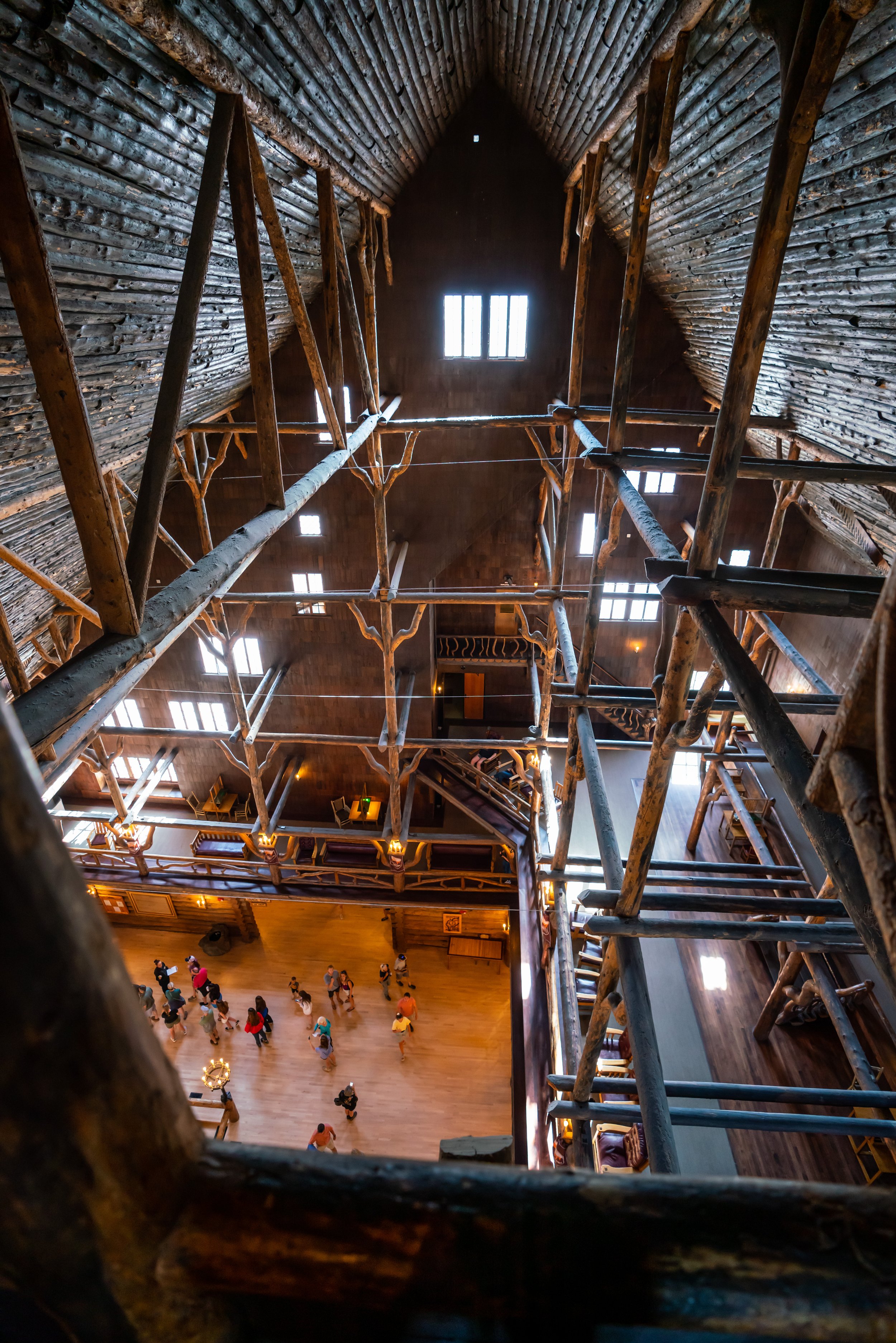
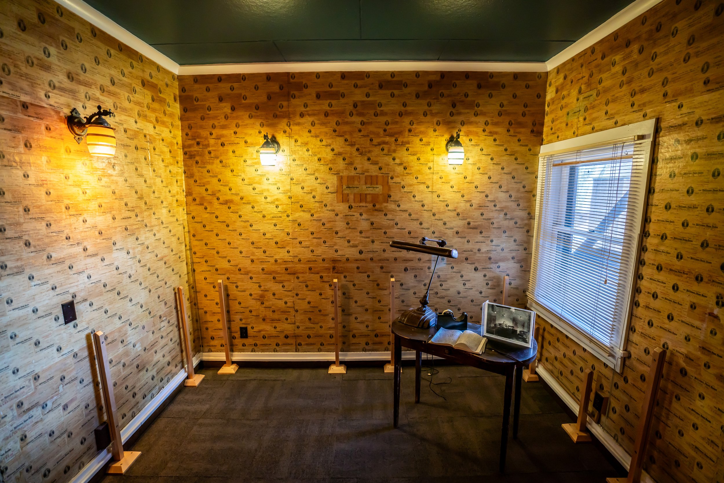
What I mean is that the Hamilton Store adjacent to the Old Faithful Inn is home to a little-known secret, known as the Million Dollar Room!
The Million Dollar Room is open to all park visitors, but there are a few things to know in order to see this hidden gem in Yellowstone National Park, which you can learn all about in my separate post linked below.
All that aside, go straight (left) to continue on the Upper Geyser Basin Trail that returns to Old Faithful.
Read My Separate Post: Million Dollar Room (Hamilton Tour)
East Upper Geyser Basin-Hamilton Store Junction
Just a few steps past the first path, the Upper Geyser Basin Trail passes the second, much closer path that leads over to the Hamilton Store and the Old Faithful Inn.
Now, just like my thoughts above regarding the hidden Million Dollar Room inside the Hamilton Store, I also highly recommend reading my separate article about the Crow’s Nest inside the Old Faithful Inn!
This is the most sought-after—and, I would argue, better of the two—hidden tours in Yellowstone National Park!
In any case, go straight (left) once again to continue hiking back to Old Faithful.
Read My Separate Posts: Million Dollar Room (Hamilton Tour) / Crow’s Nest in the Old Faithful Inn
Upper Geyser Basin-Old Faithful Loop Junction
Just before the Upper Geyser Basin Trail returns to Old Faithful and the popular observation deck surrounding the south side of the geyser, the trail passes the other side of the Old Faithful Loop Trail, which first branched away from where the Upper Geyser Hill Trail began at the very beginning of this article.
This is the last junction before the Upper Geyser Basin Trail returns to the beginning.
That said, go straight one last time, and the trail will reach the far west side of the Old Faithful observation deck, near the Old Faithful Inn, shortly ahead.
West Upper Geyser Basin Trailhead (Old Faithful Inn)
Finally, after roughly 3.0 miles (4.8 km) since leaving the main trailhead in the center of the Old Faithful observation deck, the Upper Geyser Basin Trail returns to the heart of the Old Faithful area, with the Old Faithful Inn on the right, Old Faithful on the left, and the Old Faithful Lodge and Visitor Center straight ahead.
If you’ve hiked the full loop to the Morning Glory Pool, as outlined in this article, I highly recommend heading over to the General Store right next to the Snow Lodge to get some of the park’s famous huckleberry ice cream, as there really is not a better way to finish a hot hike in the sun!
Read My Separate Post: Crow’s Nest in the Old Faithful Inn
Upper Geyser Basin-Black Sand Basin Junction
If you’re hiking south on the west side of the Upper Geyser Basin Loop early in the morning and want to see Daisy Geyser from the best viewpoint, go right to begin hiking west on the Black Sand Basin Trail.
The hike from the Upper Geyser Basin Loop to the Daisy Geyser viewpoint is only 0.1 miles (0.2 km) each way.
Daisy Geyser
The Daisy Geyser is one of the Major Five, meaning five most predictable geysers in the Upper Geyser Basin.
That said, it’s best to check the Old Faithful Visitor Center for the most up-to-date information regarding the next eruption before setting off, but the nice thing is that it’s not too hard to see!
The Daisy Geyser erupts every 2 hours and 45 minutes, on average, and reaches heights of up to 75 ft. (23 m)!
On a different note, I previously mentioned how photos are best taken at the Daisy Geyser from the Black Sand side in the morning and the Daisy Trail in the afternoon, which was largely centered around not wanting to take photos facing the sun.
However, if the next predicted eruption is right at sunrise or sunset, these thoughts go away, as golden hour facing the rising or setting sun is second to none—especially when there is a slight breeze creating all sorts of unique effects with the mist!
To skip back to the Upper Geyser Basin–Black Sand Basin Junction, click here.
Upper Geyser Basin-Sawmill Loop-Castle Shortcut Junction
If you are more interested in returning to the Old Faithful area on the shortest route possible, go left at Sawmill Geyser to begin hiking the Castle Shortcut toward the Firehole River.
For context, simply turning back on the same trail taken to this point is roughly 0.85 miles (1.4 km), while taking the shortcut is roughly 0.7 miles (1.1 km).
Firehole River
When utilizing the shortcut, this is the second and final time the Upper Geyser Basin Trail crosses the Firehole River before returning to Old Faithful.
Upper Geyser Basin-Castle Shortcut Junction
This is where the Castle Shortcut Trail meets the western side of the Upper Geyser Basin Loop, effectively cutting out about 1.1 miles (1.8 km) from the total hike, not including the additional 0.5 miles (0.8 km) saved by not continuing past the Grotto Junction to the Morning Glory Pool.
All that to say, go left at this split to begin hiking south toward Old Faithful and the Upper Geyser Basin Trailhead.
To skip back to this same junction shown previously, click here.
Old Faithful (Upper–Lower Geyser Basins)
Canyon Village
Maddison–Norris
Yellowstone Lake & East Entrance

Mammoth, Lamar Valley & Tower