Hiking the Avalanche Peak Trail in Yellowstone National Park
Distance (RT Avalanche Peak Trail): 4.6 miles / 7.4 km
Distance (Full Avalanche Peak Loop): 4.9 miles / 7.9 km
Elevation Gain: ~2,075 ft. / 632 m
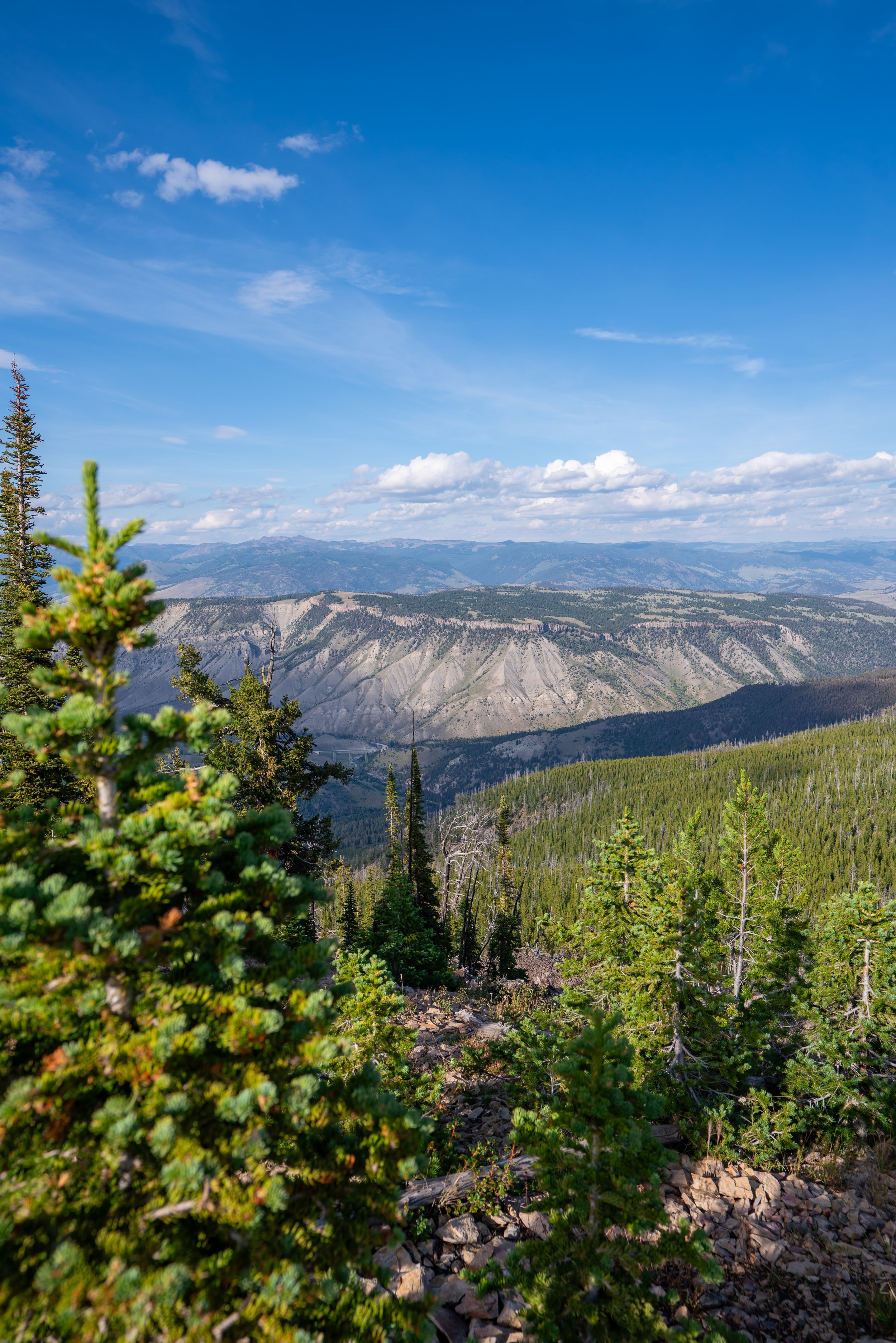
The Avalanche Peak Trail in Yellowstone National Park is a steep but very beautiful day hike near Sylvan Pass and the East Entrance that climbs high above the tree line, where visitors can enjoy panoramic views across much of the park, including Yellowstone Lake and the rugged Absaroka Range!
I would even go so far as to say that Avalanche Peak is the best summit in Yellowstone National Park, at least when compared to some of the other popular summits, like Mt. Washburn via Dunraven Pass and Bunsen Peak near Mammoth.
That said, I hold the Avalanche Peak Trail in such high regard over countless other adventures because the trail is relatively short, the panoramic views from the summit are second to none, and Avalanche Peak—specifically Sylvan Pass—is one of the best trails in Yellowstone National Park to see wildlife from above!
How Long is the Avalanche Peak Trail?
Since some visitors treat the Avalanche Peak Trail as an out-and-back hike, while others choose to complete the full loop, I’ve broken down each section to help you best plan your adventure.
Avalanche Peak Distances:
Avalanche Peak Trailhead to the Avalanche Peak Loop Trail: 1.3 miles (2.1 km)
Avalanche Peak Loop Trail to Avalanche Peak (Standard Route): 1.0 miles (1.6 km)
Avalanche Peak to the Avalanche Peak Loop Junction (via Loop): 1.3 miles (2.1 km)
Total Distance (Out and Back): 4.6 miles (7.4 km)
Total Distance (Loop): 4.9 miles (7.9 km)
Avalanche Peak Trailhead Parking
Parking for the Avalanche Peak Trail is located directly off of U.S. Highway 14 on the left-hand side when entering the park from Cody, or on the right-hand side when driving up from Yellowstone Lake.
If you’re coming from Cody, the trailhead will be 7.7 miles (12.4 km) into the park from the East Entrance.
Google Maps Directions: Avalanche Peak Trailhead
Hiking Checklist - Yellowstone–Tetons
Here is a complete list of must-have things that you will want for any hike in the Yellowstone–Teton area.
Hiking the Avalanche Peak Trail
The Avalanche Peak Trail begins on the north side of Highway 14.
That said, be careful when crossing the road, as visitors entering or exiting the park typically don’t expect to see hikers this far away from some of the more popular areas, like Yellowstone Lake and Old Faithful.
Since the Avalanche Peak Trail is a slightly more involved and remote trail, the National Park Service typically has a logbook for hikers to sign at the trailhead.
Once above Highway 14, the Avalanche Peak Trail enters a dense Lodgepole–Engelmann Spruce–Subalpine Fir forest, which it will remain in for much of the hike up to tree line.
I mention this because the first 1.3 miles (2.1 km) to the Avalanche Peak Loop can feel slow, as the views are limited.
However, the good news is that it’s short—it’s just steep!
Probably the most notable thing about the Avalanche Peak Trail is that there aren’t switchbacks—or at least not many!
I mention this because the vast majority of the 2,075-ft. (623 m) ascent is straight up, which is why some hikers may want to bring trekking poles.
This is a perfect example of just how steep much of the Avalanche Peak Trail truly is!
One of the most important things hikers should know is that Sylvan Pass—the exact area where the Avalanche Peak Trail is located—is an area with one of the highest Grizzly Bear densities in Yellowstone National Park.
This is mainly because the pass, and the Absaroka Range more broadly, provide extraordinarily rich seasonal feeding habitat, particularly due to the abundance of Army Cutworm Moths, which I will discuss in more detail later in this article.
However, on top of this, the surrounding landscape offers several other important food sources and habitat advantages that attract Grizzlies throughout the year. These include Whitebark Pine Seeds, Elk and other ungulates, seasonal carcasses, productive alpine and subalpine meadows, and the relative security provided by the rugged, less-developed terrain of the Absaroka Range. Together, these factors make the Sylvan Pass area particularly attractive to Grizzlies and contribute to the unusually high level of bear activity hikers may see on the trail.
Now, all this is not meant to deter anyone from hiking the Avalanche Peak Trail, but rather to encourage responsibility. This means always hike with bear spray and prepare by knowing how to react properly and calmly in the event of an unlikely but possible encounter.
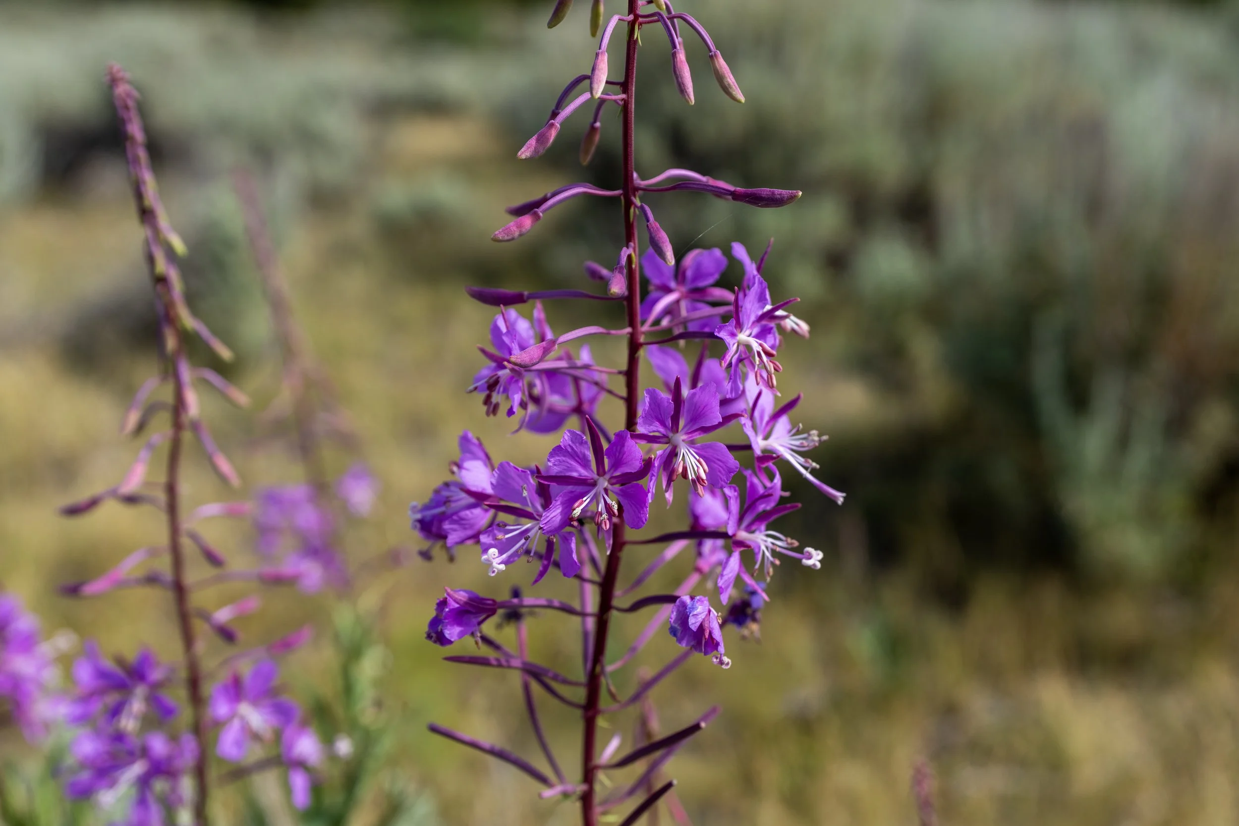
Wildflowers are somewhat minimal along the lowest elevations of the Avalanche Peak Trail, but they only get better and more abundant as the trail climbs higher!
This open meadow is located about 0.75 miles (1.2 km) from the trailhead off Highway 14, and it’s arguably the best mental checkpoint on both the way up and down, as much of the hike through the forest looks the same!
On a different note, this meadow is also one of the best places to enjoy wildflowers throughout the beautiful summer months, as there are countless different species to enjoy over this very short stretch.
After the meadow, the trees surrounding the Avalanche Peak Trail begin to slowly transition into a predominantly Whitebark Pine forest as the trail nears treeline.
This becomes especially apparent when the trail starts passing through stands and stands of dead trees, many of which are Whitebark Pines that have succumbed to White Pine Blister Rust, a disease caused by a non-native, invasive fungus.
This is where the Avalanche Peak Trail abruptly enters the Whitebark Pine forest mentioned above.
That said, Whitebark Pines dominate the glacial cirque beneath Avalanche Peak, which is a nice sign that the trail is getting close to the start of the Avalanche Peak Loop Trail.
This hard right turn on the hike up is where the Avalanche Peak Trail passes an old shortcut between this point and the loop.
However, the effectiveness of the shortcut is nominal at best, which is why I ask that you please follow the true Avalanche Peak Trail and not cause further erosion in such a fragile landscape.
When the Avalanche Peak Trail turns to the west, it’s a nice sign that the start of the loop is not far ahead!
This is where Avalanche Peak can be seen for the first time through the trees!
Avalanche Peak Loop Trail
After 1.3 miles (2.1 km), the Avalanche Peak Trail passes a little-known junction—or at least little-known on the hike up, as it’s often not recognized until the loop returns to this point.
That said, this is the start of the Avalanche Peak Loop Trail, the 2.3-mile (3.7 km) loop around the Avalanche Peak Basin.
Once here, I recommend going straight at this junction because the Avalanche Peak Trail makes for a better loop when the maintained portion of the hike is taken to the summit, as it is easier and more gradual compared to the steep sections to the right, which are harder to follow when hiking uphill than when hiking down.
Regarding my thoughts above, I chose to go straight at the junction previously shown, which is the most common direction and the route I’ve always taken over countless adventures up Avalanche Peak.
This is one of the last remaining stands of trees on the hike up Avalanche Peak, which is to say there is not a lot of shade after the trail begins the Avalanche Peak Loop.
This is why I highly recommend wearing a hooded sun shirt, especially considering the high elevations above 10,000 ft. (3,048 m) and how much easier it is to burn above tree line.
In the early summer season, particularly in May and often throughout much of June, micro-spikes may be necessary, at the very least, to hike these more exposed areas of the Avalanche Peak Trail safely.
There are countless different types of wildflowers to enjoy on the high-alpine slopes in the Absaroka Range, much like the beautiful open meadow on the hike up!
This hard switchback to the east is located at exactly 10,000 ft. (3,048 m).
This is where the Avalanche Peak Trail tops out on the wide-open plateau just below the summit ridge.
With about 0.4 miles (0.6 km) to go, the Avalanche Peak Trail reaches the first of three different routes that branch away from the official trail.
That said, this article follows the official Avalanche Peak Trail to the summit, which is the path up the hill to the left.
However, both routes lead to the summit, with the difference in distance being less than 0.1 miles (0.2 km). This is why the upper mountain is often hiked as a loop, but not the same loop around the entire basin that I previously mentioned.
In any case, go left at this split to stay on the official Avalanche Peak Trail, which is the route shown below.
This is where the Avalanche Peak Trail crosses above the tree line at roughly 10,300 ft. (3,139 m).
Once again, I could not recommend wearing a hooded sun shirt more, especially if you plan to hike the full Avalanche Peak Loop past the summit.
This is where the Avalanche Peak Trail passes the second alternate route to the summit ridge on the left-hand side, which I recommend against following because it is a bit out of the way and climbs higher than necessary, ultimately requiring you to lose elevation to reach the true summit.
This is where the Avalanche Peak Trail passes the third and final alternate route before the summit ridge.
That said, go right to stay on the official Avalanche Peak Trail, but know that this final side trail on the left is the least out of the way in terms of effort and distance required to reach the summit.
This is where the Avalanche Peak Trail finally reaches the panoramic summit ridge, about 0.1 miles (0.2 km) from the true summit!
This is where the first of the three alternate routes meets the summit ridge and rejoins the official Avalanche Peak Trail.
Avalanche Peak
This is the true summit of Avalanche Peak, which stands at about 10,568 ft. (3,221 m).
Now, I continually say "true summit" because, according to every major map, the highest point on the summit ridge that I’m standing on is not Avalanche Peak. Rather, Avalanche Peak is consistently labeled as the point farthest along the ridge to the northeast, right along the park boundary.
In any case, the views from the summit are spectacular, to say the least, and places as far away as the Tetons can even be seen on the clearest of days!
Something that’s often not considered about Avalanche Peak is that it can be a great place to look for bears in the mid- to late-summer months.
This is because, as previously mentioned, Grizzlies are often found high on talus alpine slopes looking for Army Cutworm Moths, as they are a very calorie-rich part of their diet.
That said, hiking up with binoculars to scan the landscape is always a great way to slow down and spend some time enjoying the summit!
Past the true summit, the Avalanche Peak Trail continues to the park boundary and beyond. This is the section that I’ve consistently been referring to as the Avalanche Peak Loop Trail.
Now, there are some important considerations to keep in mind if you want to hike the full loop, most notably which route to take, the time of year you’re visiting, and the fact that the National Park Service does not maintain the trail beyond the park boundary.
By all this, I mean that there are multiple routes that descend back into the basin beneath the peak. Deciding which route to follow should come down to what month you’re climbing and how much snow is on the trail, which I will discuss in more detail below.
However, what’s perhaps most important is that the National Park Service does not maintain the trail. This doesn’t necessarily mean it’s a particularly difficult hike to navigate, but it will be evident, as the lack of traffic is noticeable in some vague sections near and below tree line.
Yellowstone National Park Boundary
This is where the Avalanche Peak Trail reaches the National Park boundary, which is the place labeled as Avalanche Peak on most maps.
Once here, go right to continue around the Avalanche Peak Loop and begin the somewhat steep descent off the summit ridge.
This initial descent loses about 150 ft. (46 m) in just over 0.1 miles (0.2 km) until the point where the trail levels out just before the split that can be seen in the distance.
Since this descent is so steep and loose, trekking poles can be very useful, especially if there are still patches of snow on the trail.
This is the bottom of the very steep 150-ft. (46 m) descent, which is also the steepest part of the Avalanche Peak Loop if you follow the easiest route shown in this post.
When the Avalanche Peak Loop reaches this split on the east ridge, there’s the option to go either way to return to the original loop junction in the basin.
That said, there is a notable difference in difficulty between the two routes, which is that the trail that descends to the left follows a very gradual path back into the basin, while the trail on the ridge to the right ultimately summits the high point in the distance, then descends a very steep and loose scree-covered slope to get to the same point.
This is what I previously meant when I said the time of year—or rather, the amount of snow on the mountain—should dictate which route you take, because if the mountain is still covered in snow, the only safe way down the route to the right might mean having spikes and an ice axe in hand.
However, that kind of preparation is generally not necessary, given the much easier route on the left.
When it is snow-free, however, the descent on the right is, for lack of a better description, one big slide down the steep slope. It is not a particularly difficult descent if you’re used to this type of loose terrain, but it may not be the route for everyone.
Regarding all my thoughts above, I chose to go left to follow the much more gradual route back to the beginning.
I have hiked both routes multiple times in the past, and I generally prefer going left for all the reasons mentioned above and because the route on the ridge and down the steep slope does not meet up with the trail at the bottom of the basin in a very obvious place.
However, if the descent is snow-free but the basin is still covered in snow, that thought can be disregarded because the trail is already vague when there isn’t snow in the basin, meaning that, when there is snow at the bottom, simply navigating by compass instead of following the trail is generally the easiest way back.
This section of the trail outside of Yellowstone National Park is quite impressive and easy to follow, considering that it is not maintained by the National Park Service!
Just like on the exposed slopes of the standard route shortly after the Avalanche Peak Trail begins to climb the southeast ridge, micro-spikes may be necessary in the early season to traverse these more exposed sections safely.
When the trail reaches this split, you can go in either direction to find where the Avalanche Peak Loop Trail wraps around the east ridge.
Just before the Avalanche Peak Loop Trail turned to the south, I passed this recently disturbed spot in the alpine tundra.
Now, while I cannot positively confirm it, this is consistent with Grizzly activity in search of food, the same activity that I’ve consistently mentioned throughout this article.
This, again, is why hiking with bear spray is always important in the Yellowstone-Teton area, regardless if you are in the trees or well above.
This is where the Avalanche Peak Loop Trail starts heading south and begins the final descent back to the bottom of the basin, about 0.3 miles (0.5 km) away from this turn.
This is the view looking east toward the unnamed alpine lakes on the north side of Hoyt Peak.
Yellowstone National Park Boundary
This is where the Avalanche Peak Loop Trail re-enters Yellowstone National Park.
With just over 0.3 miles (0.5 km) to go before the trail returns to the beginning of the loop, the steep descent ends, and the section through the glacial basin begins!
At this point, the Avalanche Peak Loop simply winds its way back to the beginning on a much more gradual trail through a similarly disturbed Whitebark Pine stand as those encountered previously.
For the most part, there should be a vague trail to follow through the basin, but when there is still a lot of snow in the early summer months, navigating by direction is often more useful.
Avalanche Peak Loop Junction
This is where the Avalanche Peak Trail completes the 2.3-mile (3.7 km) loop around the glacial cirque—or, rather, the 1.3-mile (2.1 km) hike past the true summit.
If you decided to hike the full loop, go left at this point to begin the roughly 1.3-mile (2.1 km) hike back to the trailhead off Highway 14.
Old Faithful (Upper–Lower Geyser Basins)

Canyon Village
Maddison–Norris
Yellowstone Lake & East Entrance

Mammoth, Lamar Valley & Tower