Hiking the Kolowalu Trail to Waʻahila Ridge on Oʻahu, Hawaiʻi
Distance (Roundtrip): 2.2 miles / 3.5 km
Elevation Gain: ~1,250 ft. / 381 m
The Kolowalu Trail in the back of Mānoa Valley on Oʻahu is best known for being a short but steep connector trail between the bottom of the valley, and the Waʻahila Ridge Trail above.
This inevitably makes Kolowalu one of Oʻahu’s least-hiked trails, as it is best known as a quick evening workout, given that the elevation gain and intensity are comparable to the Koko Crater Stairs in Hawaiʻi Kai.
However, for others, Kolowalu is treated as a connector trail—like the ʻAihualama Trail is with Puʻu Kōnāhuanui (K1) on the other side of the valley, or the Nuʻuanu Trail is with K1 on the other side of Tantalus. But here, a loop can be created with the Mānoa Middle Ridge Trail, the Koʻolau Summit, and Waʻahila Ridge—allowing hikers to experience four different trails while starting and ending at the same place!
Puʻu Pia / Kolowalu Trailhead Parking
Parking for the Kolowalu Trail is located on Alani Drive in the very back of Mānoa Valley.
That said, be aware that parking is only allowed on the valley side (right side) of the road when facing the ocean, so as to allow for traffic to pass, like the city bus.
Google Maps Directions:Kolowalu Trailhead
Hiking the Kolowalu Trail
From the parking area, the Kolowalu Trailhead is located a bit further up Alani Drive, but parking is not allowed any closer than where it is shown above.
Once on the Kolowalu Trail, be sure to watch out for this chain across the path in the beginning, especially if you’re trail running.
Puʻu Pia-Kolowalu Junction
At about 0.2 miles (0.3 km), the Kolowalu Trail splits with the Puʻu Pia Trail that leads up to a completely separate viewpoint overlooking Mānoa Valley.
In any case, go right to stay on the Kolowalu Trail.
Read My Separate Post: Puʻu Pia Trail
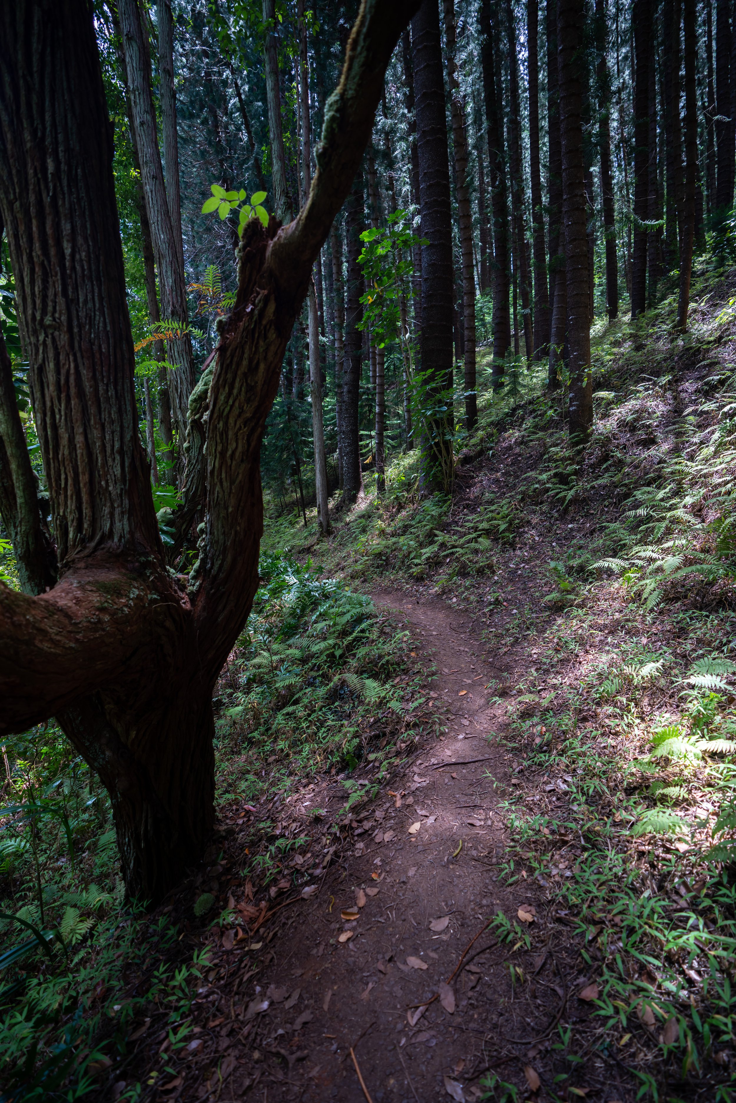
After the Puʻu Pia Trail split, the Kolowalu Trail will climb gradually before getting steeper, following the landslide section shown below.
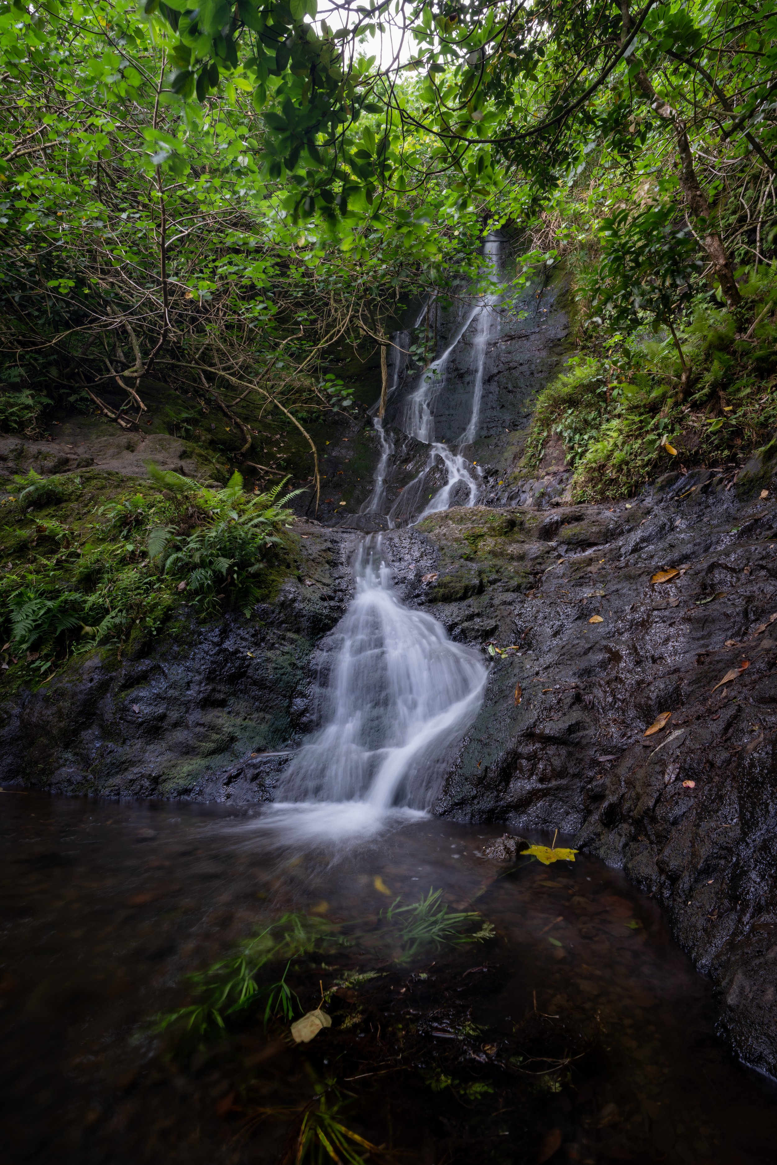
Kolowalu Landslide
For as long as I’ve been hiking Kolowalu, this section of trail, located about 0.5 miles (0.8 km) up the trail from the Puʻu Pia split, has always been a bit washed out, muddy, and a little more unstable.
However, follow the best path you can until it comes to a hard right, followed by a section that may or may not have ropes to help you up. Then, after a short detour around the landslide, the rest of the maintained trail can be found shortly after.
This is the hard right turn around the landslide.
Once back on the Kolowalu Trail, the hike will continue to climb gradually until the switchback in the photo below.
This switchback on the Kolowalu Trail is where the hike makes a seemingly stark change between the more gradual beginning and the steeper upper trail to Waʻahila Ridge.
It’s because of this steep section that previously, I compared the Kolowalu Trail to the Koko Head Stairs.
As the canopy begins to open, this upper section of the Kolowalu Trail is a great place to slow down and look for various native Hawaiian plants, which I’ll talk more about below.
Kolowalu-Waʻahila Ridge Junction
After 1.1 miles (1.8 km), the Kolowalu Trail ends where it meets Waʻahila Ridge at about 1.4 miles (2.3 km) from the state recreation trailhead atop St. Louis Heights.
However, if you were interested in climbing to the top of Mt. Olympus, the summit of Waʻahila Ridge, I actually don’t recommend beginning from the Kolowalu Trailhead because of all the elevation gain just to get to this point.
By this, I mean that to climb out of Mānoa Valley via Kolowalu, the trail gains roughly 1,250 ft. (381 m) in just over 1.0 miles (1.6 km), but by starting from the Waʻahila Ridge Trailhead, there’s only about 150 ft. (46 m) of net elevation gain to get to this point.
Therefore, I tend to think of the Kolowalu Trail as a quick workout or a connector trail with other hikes across the Koʻolau Summit, such as the Mānoa Middle Ridge Trail. This way, Kolowalu can make for a nice loop where you can both start and end in Mānoa Valley, or it makes for a nice sunset hike, especially in the winter when the sun sets further to the south.
Read My Separate Post: Waʻahila Ridge Trail
Native Plants on Kolowalu
For being a relatively low-elevation hike, the Kolowalu Trail is a surprisingly great place to find a variety of native Hawaiian plants.
On the upper switchbacks, you can expect to see Uluhe, ʻŌhiʻa lehua, Kōpiko, ʻIeʻie, Pilo, and I think my favorite is the Neleau trees, as they are not the most common species to see across Oʻahu.
If you would like to learn more about these and tons of other native Hawaiian plants from across the islands, I encourage you to learn more in my separate post.
Read My Separate Post: Native Hawaiian Plant Guide