Hiking the Mānoa Falls Trail on Oʻahu, Hawaiʻi
Distance: 1.7 miles / 2.7 km
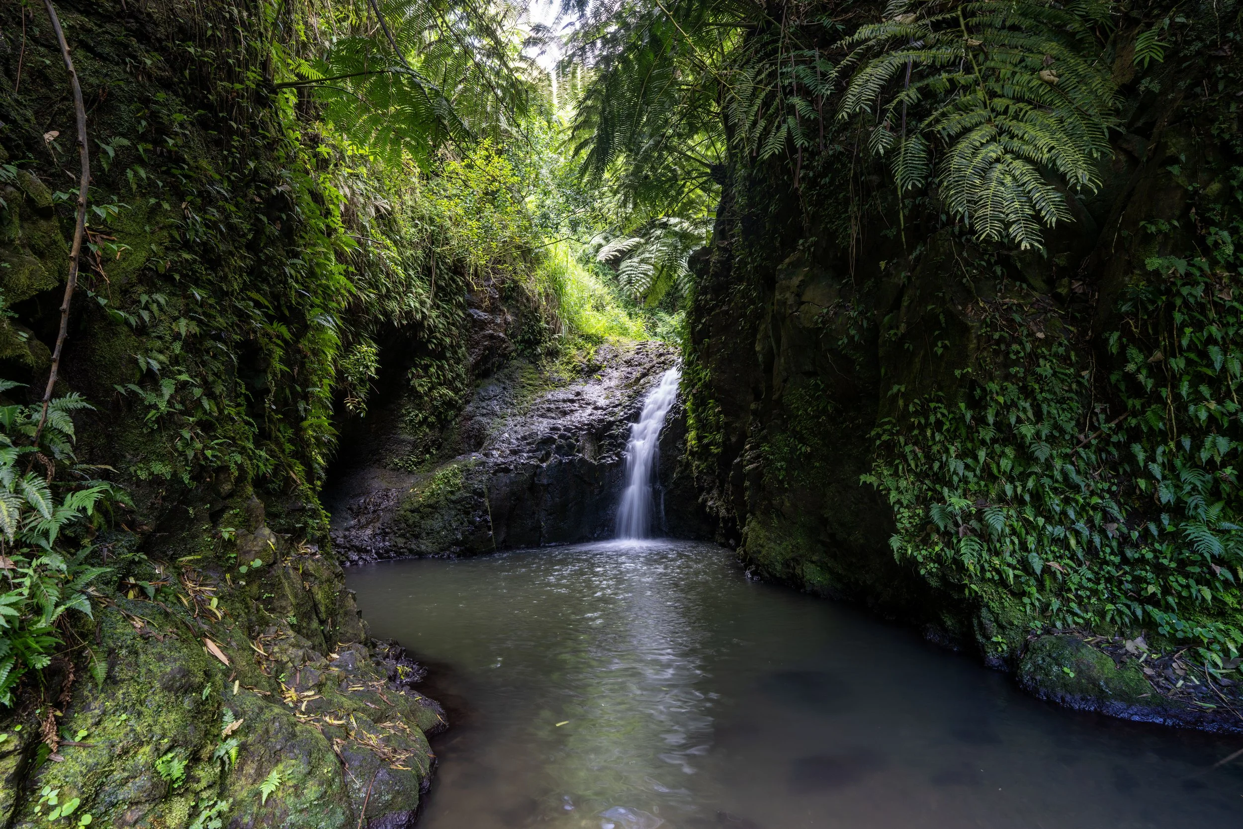
The Mānoa Falls Trail in Mānoa Valley on Oʻahu is a renowned, family-friendly waterfall hike among those visiting the island, as the relatively short 0.85-mile (1.4 km) trail navigates through a stunning tropical rainforest to the towering 150-ft. (46 m) Mānoa Falls at the base of Oʻahu’s rugged Koʻolau Mountains.
For all these reasons, the Mānoa Falls Trail is inevitably one of the most popular day hikes on Oʻahu, comparable only to the Makapuʻu Lighthouse Trail and Diamond Head Trail in Waikīkī.
Nonetheless, the Mānoa Falls Trail really is a fun and beautiful, kid-friendly hike on Oʻahu, but if you are interested in learning about some great and much less crowded adventures within a short drive of Waikīkī, I recommend reading my separate article linked below.
Read My Separate Post: Best Hikes Near Waikīkī
Is the Mānoa Falls Trail Free to Hike?
Yes, the Mānoa Falls Trail is a State of Hawaiʻi–managed hike, and as such, the trail is 100% free to hike.
However, the parking lot at the base of the trail is not owned or managed by the state, and as a result, there is a small fee to park. This means that if you arrive by bus or rideshare, you are free to walk past the parking attendant without paying.
Is Mānoa Falls Flowing Year-Round?
No. Mānoa Falls is a rain-fed waterfall, meaning that after prolonged periods of dry weather—which is more typical during the summer months—the waterfall may be reduced to a trickle or a completely dry wall.
However, this is not the case for the majority of the year, but it’s why keeping other Oʻahu waterfalls in mind, such as Likeke Falls and Lulumahu Falls, can be great options, as they are spring-fed, not rain-fed.
What is the Weather Like on the Mānoa Falls Trail?
I like to say, anticipate pouring rain and hope for beautiful sunny skies!
A rain-fed waterfall should say all you need to know about the back of Mānoa Valley, which is to say, it does rain a lot on the Mānoa Falls Trail—but hopefully you can get lucky under sunny skies like this!
Mānoa Falls Guided Hiking Tour
If you don’t have transportation or would like to learn about the hike from a guide, I highly recommend booking one of the tours below. They are not only some of the cheapest options to hike Mānoa Falls, but both options provide roundtrip transportation from your hotel in Waikīkī.
Furthermore, one of my favorite things about booking through Viator is the reserve-now-and-pay-later option. As long as you’re booking more than three days in advance, you have the option to book ahead and cancel in the future if you change your mind.
Mānoa Falls Trailhead Parking
Parking for the Mānoa Falls Trail is located at the very end of Mānoa Road in a small parking lot just prior to the trailhead.
Before arriving, be aware that there is a small fee to park, and know that parking is illegal along the side of the short road prior to the paid parking area.
Google Maps Directions: Mānoa Falls Trailhead
Hiking the Mānoa Falls Trail
Walking to the Trailhead
To get to the start of the Mānoa Falls Trail, hikers must walk about 0.1 miles (0.2 km) up the road toward the Lyon Arboretum and the ʻAihualama Falls Trail.
To skip ahead to the Mānoa Falls Trailhead, click here.
At this first split in the road, go right to continue up to the Mānoa Falls Trailhead.
What is the Lyon Arboretum & ʻAihualama Falls?
Just steps before the Mānoa Falls Trailhead, Mānoa Road passes the entrance to Lyon Arboretum on the left-hand side.
That said, the Harold L. Lyon Arboretum is a jointly managed arboretum by both the State of Hawaiʻi and the University of Hawaiʻi at Mānoa, located just minutes down the road from the Mānoa Falls Trail.
The arboretum itself is a beautiful collection of tropical plants from around the world, but what makes it so special in Hawaiʻi is that it is one of the most important places when it comes to growing and propagating some of Hawaiʻi’s rarest and endemic plant species—many of which would otherwise be extinct if it wasn’t for Lyon Arboretum and a few others scattered throughout the islands.
All of this is to say, visitors are welcome at Lyon Arboretum, and advanced reservations are no longer required.
To learn more about visiting Lyon Arboretum and the trail to ʻAihualama Falls, I recommend reading all the details in my separate article linked below.
Read My Separate Post: ʻAihualama Falls Trail (Lyon Arboretum)
Mānoa Falls Trailhead
This is where the Mānoa Falls Trail begins at the very end of Mānoa Road.
That said, the 1.7-mile (2.7 km) roundtrip distance posted above begins here, not at the parking area down the road.
Once past the trailhead, the Mānoa Falls Trail begins on a fairly flat path for about 0.3 miles (0.5 km), which is where the trail will noticeably start to gain elevation.
However, the elevation gain doesn’t really become significant until the 0.6-mile (1.0 km) mark, the same place as the Kahuwaiʻiki Falls junction.
Hau is one of the very few native Hawaiian plants on the Mānoa Falls Trail, and it’s one of seven Hibiscus species that are native to Hawaiʻi!
This unique container bridge is a 'more recent' replacement of an old, deteriorating bridge, following a multi-year project that began in 2019 to essentially reconstruct the hike to Mānoa Falls, giving us the trail we have today.
I write all this because, prior to the 2021 reopening of the Mānoa Falls Trail, the hike was significantly more challenging to traverse, as it was muddier, more slippery, and more eroded.
However, following the reconstruction, the Mānoa Falls Trail became much easier to hike, as the State of Hawaiʻi took a once very muddy and heavily-trafficked trail and transformed nearly every muddy and eroded section into a hardened, more stable surface to walk on.
Apart from Mānoa Falls itself, this wide-open stretch is one of the most photographed sections of the entire trail!
Mānoa Falls-Luaʻalaea Falls Junction
When the Mānoa Falls Trail crosses this bridge, the trail passes the first of two side trails that branch off the much more popular and maintained trail.
This first is for a lesser-known waterfall called Luaʻalaea Falls, one of six different waterfalls located across the back of Mānoa Valley.
That said, I strongly recommend against hiking either side trail, as both are very rough, rugged, overgrown adventures that require a lot more planning and preparation to do safely—not to mention, there’s a very high likelihood of getting lost and injured on either if you don’t know what you’re getting into.
All of this to say, true Hawaiʻi hiking is far more dangerous than hiking elsewhere across the mainland U.S., which I write to try and encourage all visitors to be safe—not challenge you—as at least three of the six waterfalls across the back of the valley should only be attempted by more experienced Oʻahu hikers.
Read My Separate Post: Luaʻalaea Falls Trail
After the Luaʻalaea Falls junction, the Mānoa Falls Trail passes through a handful of Eucalyptus trees, again one of the more photogenic spots on the entire hike.
Following the Eucalyptus trees, the Mānoa Falls Trail simply winds its way through the dense tropical rainforest, gaining elevation gradually, until it reaches the 0.6-mile (1.0 km) mark, as previously mentioned.
The big ferns that can be seen growing up in the trees are known as ʻĒkaha ferns, which are native to Hawaiʻi and thrive in the shade of a large overstory canopy.
That said, the overstory canopy does not have to be native for ʻĒkaha ferns to grow, as is the case on the Mānoa Falls Trail, but where the ferns do grow in Hawaiʻi’s native forests, they serve as a good indicator species of an unhealthy native forest because if they start to die off, it generally means something is wrong with the larger trees on which they depend.
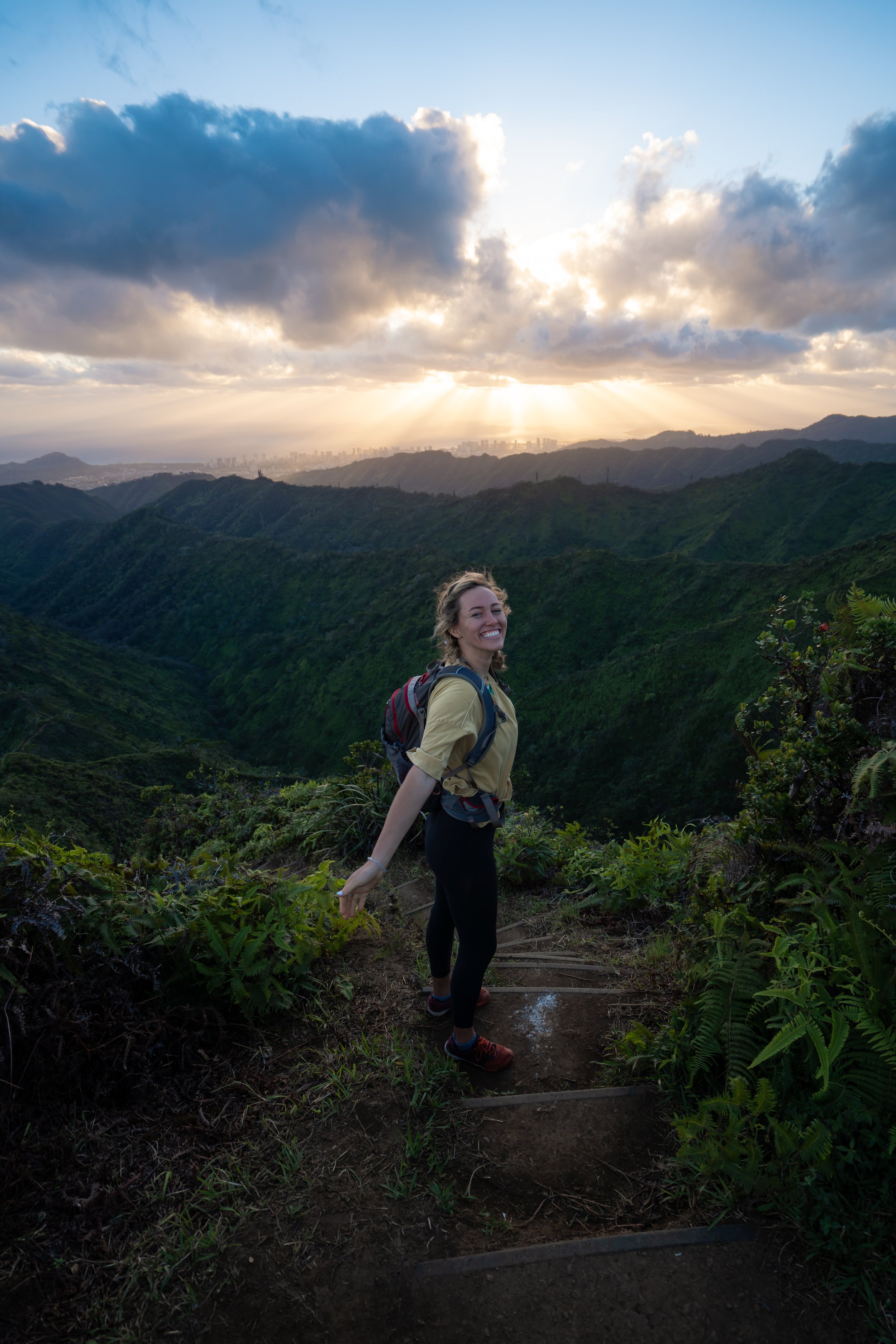
I think it’s worth mentioning that a bright, sunny day in the back of Mānoa Valley, such as this, is not the most common.
It’s not that it’s at all uncommon either, but it’s important to keep in mind that Mānoa Falls is a rain-fed waterfall, meaning that it’s not uncommon to hike the entire trail when it’s raining.
To add to this, it’s actually quite impressive how much more rain the back of Mānoa Valley gets compared to both the University of Hawaiʻi and Waikīkī just down the road, which is why I highly recommend coming prepared with a good rain jacket—especially during the wetter winter months.
In addition to a rain jacket, some hikers may want to bring trekking poles for the Mānoa Falls Trail because, while the trail certainly is less muddy following the 2019 reconstruction project, it is much rockier and can be very slippery in spots.
Mānoa Falls-Kahuwaiʻiki Falls Junction
After roughly 0.6 miles (1.0 km) into the hike, the Mānoa Falls Trail passes a second little-known side 'trail' that leads to Kahuwaiʻiki Falls.
Now, I use the word 'trail' loosely here, as there is actually no trail, unlike the hike to Luaʻalaea Falls.
Rather, Kahuwaiʻiki Falls is reached via an entirely off-trail route through a rugged, overgrown gulch, ending at one of Mānoa Valley’s least-visited waterfalls.
All that said, go left to stay on the much more obvious Mānoa Falls Trail, and know that I, again, don’t write this to challenge you, as only Oʻahu’s most experienced hikers should attempt such an adventure, given the high likelihood of getting lost or injured.
Read My Separate Post: Kahuwaiʻiki Falls Trail
Immediately after the Kahuwaiʻiki Falls junction, the Mānoa Falls Trail starts climbing a number of hills, the most significant of which are located after the rest area just a short distance ahead.
Again, some hikers may want to use trekking poles for these steeper, slippery sections.
At this split, go left to continue hiking up the Mānoa Falls Trail, as the path to the right is the rest area mentioned previously.
With about 0.2 miles (0.3 km) to go, the Mānoa Falls Trail begins the steepest section of the entire hike, marked by a number of fairly large steps leading up the trail.
From this point, the very top of Mānoa Falls can be seen in the distance for the first time!
This is the last rest area before the trail reaches Mānoa Falls.
Mānoa Falls-ʻAihualama Junction
Just steps before the waterfall, the Mānoa Falls Trail passes a junction for the ʻAihualama Trail, which is essentially a connector trail between this point and the much larger network of trails located up on Tantalus. This is what the map of trails shows in the photo below.
That said, most hikers on the Mānoa Falls Trail have never even heard of the ʻAihualama Trail before reaching this junction, and I think, for the most part, this is for good reason.
I say this because the ʻAihualama Trail really is just that: a connector trail. There is but one small view on the entire trail, and it’s why if any of the trails on the map below seem interesting to you, I recommend driving up Tantalus to begin hiking, instead of starting here.
By this, I mean that the entirety of the Tantalus Trail Network, also called the Tantalus Loop Trail, is intersected by Tantalus-Round Top Drive, meaning there are a ton of trailheads scattered throughout that make for much easier places to begin hiking, largely because all the elevation gain on the ʻAihualama Trail can be avoided by simply driving up.
So, to answer the question, what are the best trails on Tantalus? By and large, the renowned favorites are the Pauoa Flats Trail because of the views at the end, the Nuʻuanu Trail because of the views on the uppermost elevations of the trail, and the Mānoa Cliff Trail because it passes through a beautifully restored native Hawaiian forest.
As for the ʻAihualama Trail, the Pauoa Flats Bench is the number one destination when hiking up from Mānoa Falls, which is to say, it’s not unreasonable to hike to the bench from Mānoa Falls. It’s just a little more effort than driving up to the Puʻu ʻŌhiʻa Trail or the Kalāwahine Trail to get there.
Read My Separate Post: ʻAihualama Trail
Mānoa Falls
After roughly 0.85 miles (1.4 km), the trail ends at this viewing area just before the base of Mānoa Falls!
Warning
In years past, it was legal to swim in the pool at the base of Mānoa Falls, but following the 2021 trail renovation, swimming is now illegal—and yes, hikers have been cited in the past for ignoring the signs. From what I’ve been told, individuals typically receive a warning first but are later fined for disregarding a law enforcement officer’s instructions.
By this, I mean that, despite being told not to proceed, hikers sometimes walk down to the waterfall when they think an officer has left, only to be caught when the officer turns around and walks back up the trail.
Take that as you will, but know that there are other waterfalls, such as Lulumahu Falls and Likeke Falls, that are much better for swimming!
Native Plants on the Mānoa Falls Trail
It is unfortunate, but the vast majority of plants along the Mānoa Falls Trail are non-native, invasive introductions, which is why Lyon Arboretum and the ʻAihualama Falls Trail are the best places to hike in Mānoa Valley to see a number of tropical native species.
However, there are a handful of natives to look out for along the Mānoa Falls Trail, such as Hau, Māmaki, ʻĒkaha, Palaʻā, and Uluhe.
If you are curious about trying the native Hawaiian Māmaki tea, I kindly ask that you don’t harvest Māmaki from our native forests but, instead, buy from one of the local reputable vendors, such as those listed below.
If you would like to learn more about these and many other native Hawaiian plants from across the islands, I encourage you to check out my separate post linked below.
Read My Separate Post: Native Hawaiian Plant Guide