Hiking the Maunawili Falls Trail on Oʻahu, Hawaiʻi
Distance (One Way via Kīnāʻole & Old Pali Road): 4.3 miles / 6.9 km
The Maunawili Falls Trail is a beautiful day hike on the east side of Oʻahu that leads hikers through one of the wettest rainforests along the base of the Koʻolau Mountains to a hidden 20-ft. (6.1 m) waterfall and swimming hole deep within Maunawili Valley!
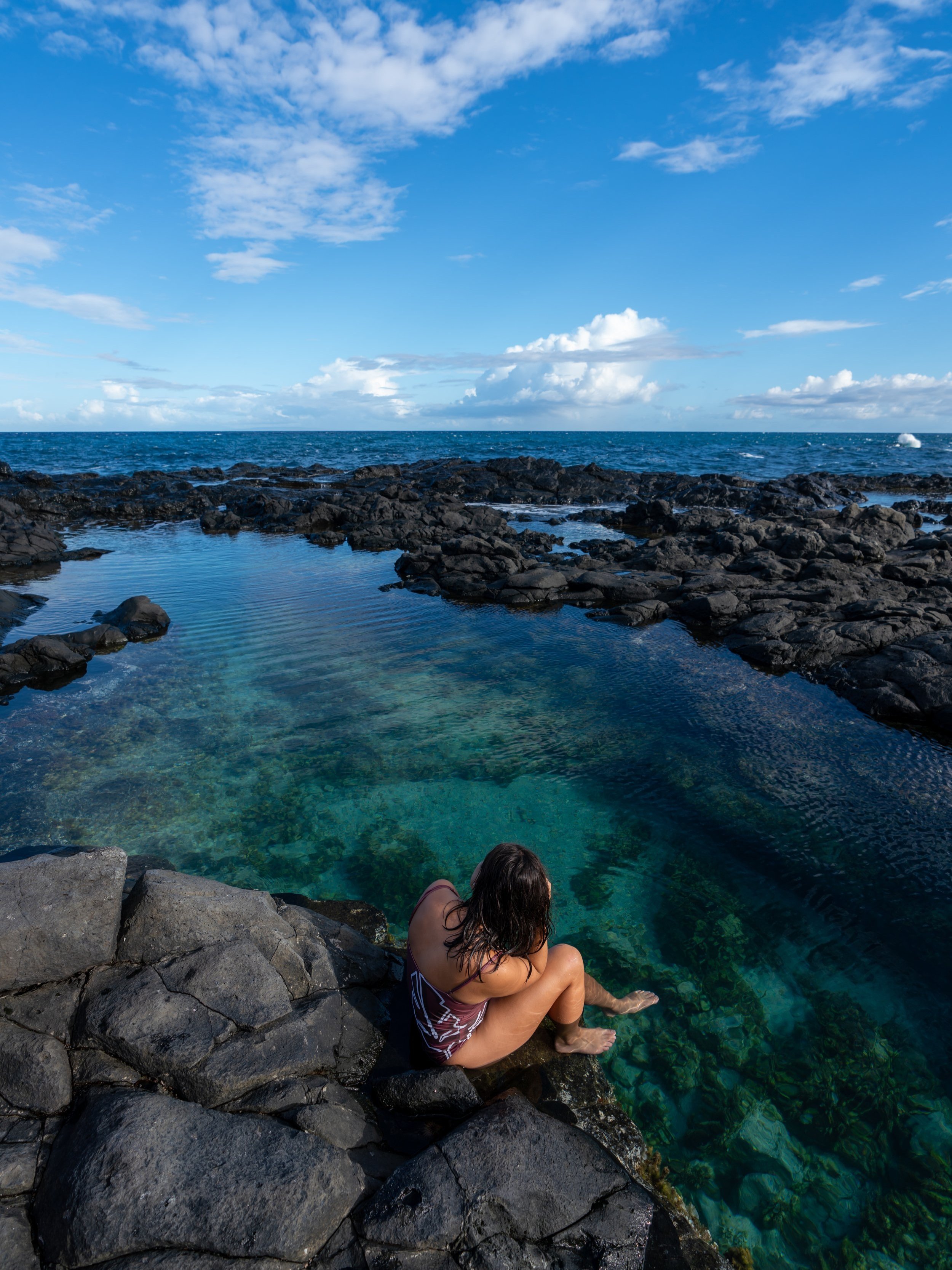
That said, Maunawili Falls is just as much about the waterfall as it is the deep pool at the base of the falls. By this, I mean that Maunawili is renowned for a number of different cliff-jumping spots from varying heights on all sides of the waterfall, which is why it is such a fun place to hang out and swim after a long hike!
All this aside, it’s important to know that access to Maunawili Falls has dramatically changed over the years, due to trailhead closures, private property issues, and residents’ complaints about the number of hikers accessing the old trailhead in a small local neighborhood that was never meant to receive the amount of traffic that it did.
This is why I highly recommend reading through the next few sections in order to fully understand what happened, why access changed, and which of the three most popular routes to Maunawili Falls is the best!
Why Did the Original Maunawili Falls Trail Close?
According to a personal conversation I had with the landowner, the renowned Maunawili Falls Trail, via Maunawili Road, closed in 2021 because of very legitimate concerns about the degradation of the unmaintained trail, due to its insane popularity among both locals and visitors alike.
In fact, the original 1.5-mile (2.4 km) trail via Maunawili Road was never a State of Hawaiʻi–managed trail, like the Maunawili Falls Trail from the route shown in this article.
This inevitably led the private landowner responsible to close the trailhead in 2021 for what was only supposed to last two years. However, following the closure, residents who live near the Maunawili Road Trailhead fought hard—and rightfully so—to move the trail’s access point away from its original location, which is why there is still no long-term resolution today—and maybe never will be.
What are the Different Maunawili Falls Access Points Today?
Today, the Maunawili Falls Trail can only be accessed via the Maunawili Demonstration Trail, with the easiest and shortest access point located in one of three places near the hairpin turn off the Pali Highway.
The first and closest access point to Maunawili Falls is the Maunawili Demonstration Trailhead at the hairpin turn directly off the Pali Highway. However, I strongly recommend against starting here unless you feel like paying for an Uber or a Lyft.
I say this because parking at the hairpin turn is limited to a maximum of two hours—and yes, HPD strictly enforces this time limit.
Now, if you decide that you’d like to start from the hairpin turn because its the closest trailhead, know that it can only be accessed in the windward-bound direction. This means that a rideshare must be booked on the Nuʻuanu Valley side of the Pali Lookout in order to reach the pullout on the right-hand side of the highway.
Google Maps Directions: Maunawili Demonstration Trailhead (Hairpin Turn)
The second option is to begin from the Nuʻuanu Pali Lookout, utilizing the Old Pali Road to hike to the Maunawili Demonstration Trail, about 0.6 miles (1.0 km) away.
This is a fairly practical option, but technically speaking, hiking the Old Pali Road from the Pali Lookout is illegal—not to mention that all out-of-state residents must pay to park at the Pali Lookout.
Google Maps Directions: Nuʻuanu Pali Lookout
The third option is to access the Old Pali Road via Kīnāʻole Road, which is my preferred route for a number of reasons, the most important of which is that accessing the Maunawili Demonstration Trail from the Likeke Falls Trailhead is legal.
That said, PLEASE BE RESPECTFUL! Access to the Old Pali Road via Likeke Falls is only possible through a public–private relationship. This means that if hikers are loud, park illegally, litter, vandalize, or are disrespectful for any number of reasons, legal access to the trailhead may be close at the discretion of the landowner. So again, I ask that you PLEASE DO YOUR PART!
Aside from this, parking on Kīnāʻole Road is free, and there is no parking time limit, like the hairpin turn. However, to park as close as possible there is also the option to drive directly to the Koʻolau Golf Course/ First Presbyterian Church at the end of the road and pay a small fee.
Google Maps Directions: Koʻolau Golf Club / Kīnāʻole Road
Maunawili Falls Trailhead Parking
Parking for the Maunawili Falls Trail via Kīnāʻole Road is located in one of two places.
First, there is the option to park off Kīnāʻole Road for free and walk about 0.3 - 0.4 miles (0.5 - 0.6 km) to the actual trailhead, or there is the option to pay to park adjacent to the Likeke Falls Trailhead at the First Presbyterian Church/ Koʻolau Golf Club for a small fee.
That said, I always choose to park for free on the side of Kīnāʻole Road just before entering the golf course, but be careful if doing so in a low-clearance vehicle. The shoulder is typically very muddy, and in the past, I’ve had to use 4WD to get out when the east side of Oʻahu has seen a lot of recent rain.
Google Maps Directions: Maunawili Falls Trailhead (Likeke Falls)
Hiking the Maunawili Falls Trail
Walking to the Trailhead
If you decide to park for free off Kīnāʻole Road, go right where the road splits to begin walking the private road toward the First Presbyterian Church/ Koʻolau Golf Club.
Maunawili Falls Trailhead
Just before the back of the parking lot, the road on the left will pass this discreet trailhead on the left-hand side, which is the start of the hike to Maunawili Falls.
Read My Separate Post: Likeke Falls Trail
Initially, the Maunawili Falls Trail will descend a short but steep hill to the hidden road below.
Kīnāʻole Road
When the short trail reaches the hidden road—the historic section of Kīnāʻole Road—go right to begin walking up toward the Old Pali Highway.
The historic section of Kīnāʻole Road, originally part of the Old Pali Road, climbs about 220 ft. (67 m) over the first 0.5 miles (0.8 km) to Halfway House junction, where the Old Pali Road officially branches away.
On account of the trailhead closure making the hike to Maunawili Falls significantly longer than it was originally, I highly recommend hiking the trail in a hooded sun shirt.
One will certainly be useful here, as well as countless other adventures across Oʻahu.
This bridge, just before the Halfway junction, is where the trail that heads straight past Likeke Falls meets Kīnāʻole Road.
However, the path really isn’t all that obvious unless you’re looking for it on the right-hand side of the road.
Halfway House Junction (Second Morgan’s Corner)
At about 0.5 miles (0.8 km) into the hike, Kīnāʻole Road reaches this three-way intersection, historically known as the Halfway House junction.
This is where Kīnāʻole Road ends and the Old Pali Highway begins, which, in my opinion, marks the start of some of the most fun and unique parts of the entire hike.
That said, go right to begin hiking the Old Pali Road, as the route heading downhill to the left is simply the historic portion of Kalanianaʻole that leads out to the Pali Highway.
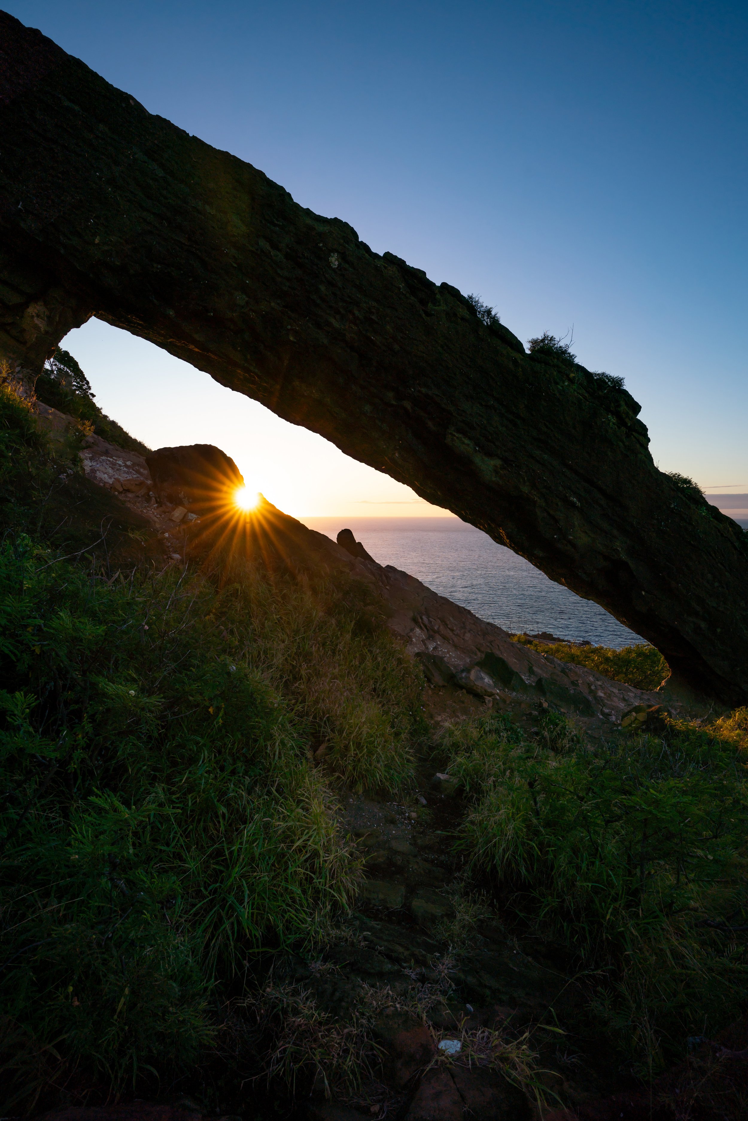
Old Pali Road
This is the original Pali Road, now called the Old Pali Road, which was completed in 1898 and used until 1961, when the current Pali Highway replaced it.
Today, the Old Pali Road is primarily used by hikers and trail runners, but it is also a fun and unique way to hike to Maunawili Falls and other places off the Demonstration Trail.
These really are some of the most beautiful sections of the hike to Maunawili Falls—especially on a sunny day like this!
As the Old Pali Road approaches the current Pali Highway, it passes beneath the highway for a short stretch, before reaching one of the most unique parts of the hike shortly thereafter.
This is where the Old Pali Road passes under the current Pali Highway for the second time, which, in my opinion, is one of the most unique parts of the entire Maunawili Falls Trail!
When the Maunawili Falls Trail reaches the second bridge, hikers must duck considerably lower than at the first bridge to reach the ladder on the other side.
Once at the top of the ladder, the Maunawili Falls Trail continues just a few steps ahead to the cliffside and the junction, where the trail leaves the Old Pali Road behind.
Maunawili Demonstration Connector-Old Pali Road Junction
This is where the Maunawili Falls Trail leaves the Old Pali Highway behind and begins following the originally established Maunawili Demonstration Trail from the early 1990s.
However, this section—now seen as a connector trail—is all but forgotten, as the original Demonstration Trailhead, which once began at the Nuʻuanu Pali Lookout, was moved to the hairpin turn off the Pali Highway, leaving this section in the condition we see today.
In any case, go left at this junction just before the cliff face, as the trail to the right is simply where the Old Pali Road/ original Maunawili Demonstration Trail continues up to the Nuʻuanu Pali Lookout.
For a very short stretch, the Maunawili Falls Trail will squeeze its way between the cliffside and this chain-link fence, a remnant from the Demonstration Trail’s original construction.
Once on the other side of the fence, the Maunawili Falls Trail will continue to parallel the Pali Highway toward the hairpin turn and the Maunawili Demonstration Trail, which is the trailhead I mentioned in the beginning that can be an option for those interested in shortening the overall distance.
When the trail reaches this clearing, Mt. Olomana can be seen for the first time.
I mention this because Olomana serves as one of the best visual references for how much is left to hike, as the angle will change considerably from this point to the Maunawili Falls Ridge that descends into Maunawili Valley.
When the connector trail with the Old Pali Road and the Maunawili Demonstration Trail re-enters the forest, the views won’t open up again until the stairs that lead down to the connection with the hairpin turn.
This is where the connector between the Old Pali Road and the Maunawili Demonstration Trail emerges from the trees, just before the hairpin-turn junction mentioned previously.
Maunawili Demonstration-MD Connector Junction
At about 0.6 miles (1.0 km) past the Old Pali Road, the Maunawili Falls Trail finally reaches the Maunawili Demonstration Trail.
This is the portion that makes up the majority of the hike to Maunawili Falls.
That said, go right here to begin the Maunawili Demonstration Trail toward Maunawili Falls.
On a different note, everything described thus far—about 1.5 miles (2.4 km) in all—is what can be avoided if you choose to begin from the hairpin turn located just 0.1 miles (0.2 km) down the hill to the left. However, remember that parking is limited to two hours, which is not enough time to hike to Maunawili Falls and back.
Where Did the Name 'Demonstration' Come From?
The name Maunawili Demonstration Trail is a historical reference to the trail’s construction, where the name "Demonstration" actually refers to the time when the trail was built in the early 1990s, when its intent was to serve as a demonstration project, showing how public hiking trails could be developed, maintained, and managed for recreation in Hawaiʻi.
Furthermore, the Maunawili Trail project was used to demonstrate proper trail-building techniques, environmental considerations, and how public agencies could partner with community groups to maintain recreational access.
Today the Maunawili Demonstration Trail is often, and more simply, referred to as the Maunawili Trail, though many locals still call it by its historical name because of its origins as the model project.
St. Stevens Water Tank
The seemingly random water tank on the Maunawili Demonstration Trail is an old rainwater collection tank for Saint Stephen Diocesan Center, just down the hill.
Today, however, it’s mostly a landmark on the Demonstration Trail, but it can serve as one of the more reliable water sources for those thru-hiking the Koʻolau Summit Trail (KST), as long as the water is treated before use.
Notice how much the views of Mt. Olomana have changed since the first time it could be seen before the hairpin turn.
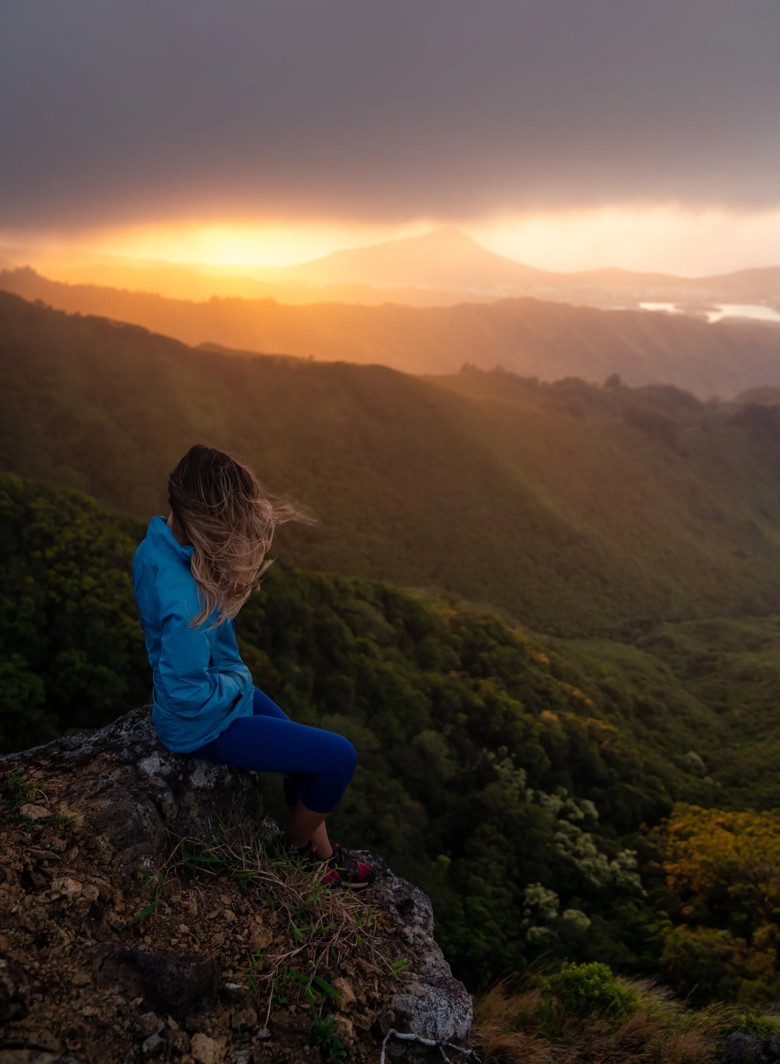
Something that I think is very important to note is that hiking the Maunawili Falls Trail or Maunawili Demonstration Trail on a bright, sunny day like this is quite a rare occurrence.
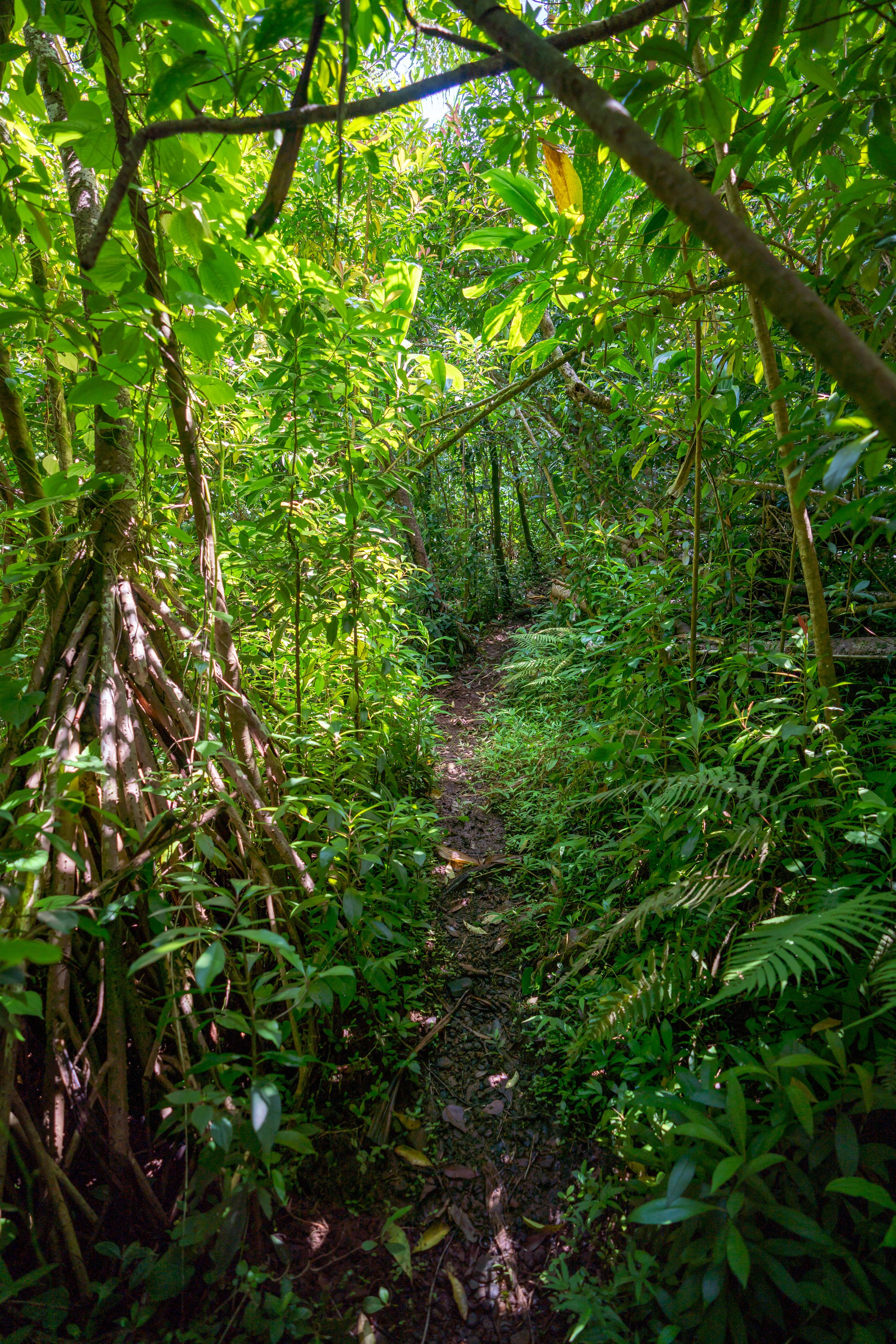
I mention this because this area on Oʻahu is, more often than not, very cloudy and receives quite a bit of rain, which is why the hike to Maunawili Falls can be a very muddy adventure.
For this reason, don’t wear clothes that you care about keeping clean, and I even think that hiking in pants with swimsuits beneath is the best way to go, both for the Uluhe ferns down the ridge to Maunawili Falls ahead and because mosquitoes can be more of a nuisance if you take breaks anywhere on the Maunawili Demonstration Trail.
If you know what to look for, ʻŌhiʻa ʻAi—more commonly called Mountain Apple—can be seen growing directly alongside the Maunawili Demonstration Trail!
Maunawili Demonstration-Piliwale Ridge Junction
This small clearing/ junction in the Maunawili Demonstration Trail is where the trail passes over a prominent ridge that extends east off Kōnāhuanui, known as Piliwale Ridge.
That said, Piliwale Ridge is a notoriously steep, challenging, near-vertical ascent up to the summit of Puʻu Kōnāhuanui and should not be compared with other steep hikes on Oʻahu, like Mt. Olomana (Three Peaks) or the Southeast Ridge of Puʻu ʻŌhulehule. Piliwale is more difficult.
All that aside, most people hiking to Maunawili Falls won’t even notice the trail branching off the Demonstration Trail, but I wanted to mention all this to deter anyone from carelessly exploring the trail.
Between Piliwale Ridge and the true Maunawili Falls Trail, the Demonstration Trail measures roughly 1.4 miles (2.3 km) as it continues to wind its way in and out of countless gulches along the base of the Koʻolau Range.
After Piliwale Ridge, hikers, for the first time, can start to look ahead and see the ridge heading down to Maunawili Falls!
However, the Maunawili Falls Ridge that branches off the Demonstration Trail is not nearly as prominent or as noticeable as Piliwale Ridge, meaning you really need to know where to look in order to see it.
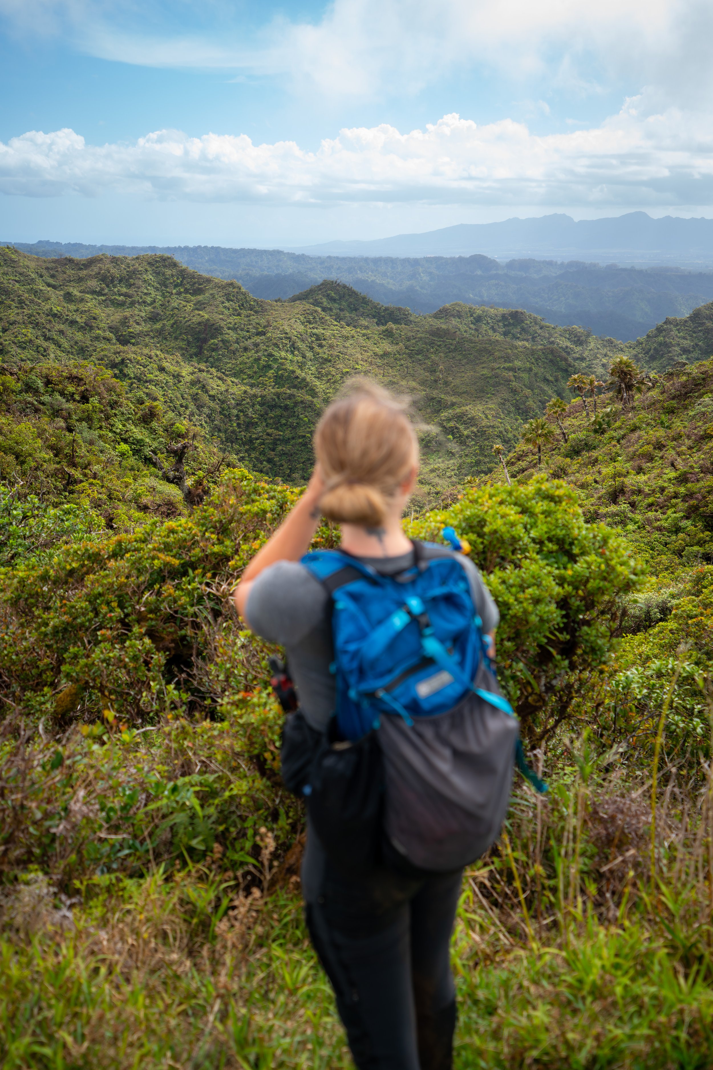
That said, this is the view looking across Maunawili Valley, with Mānoa Valley on the right, Mt. Olympus and Kaʻau Crater in the middle, and all the other notable hiking summits toward Kuliʻouʻou to the south (left).
Going along with my previous thoughts about the Maunawili Falls Trail being such a cloudy and often wet Hawaiʻi adventure, it’s important to mention what this means in terms of hiking back.
By this, I mean that what may seem like a beautiful, fairly straightforward day hike on the way to Maunawili Falls can be a completely different experience on the hike back, both because of afternoon cloud buildup that often gets concentrated over the mountains and because the sun moves to the other side of the ridge in the early evening.
I mention this because forested Hawaiʻi hikes, like the Maunawili Demonstration Trail, get very, very dark at this time of day—which is why I highly recommend hiking with a good headlamp to be safe!
Even though the Maunawili Demonstration Trail can be a very tedious, muddy adventure, it is a fairly popular trail-running hike for those who live on the east side of Oʻahu.
That said, don’t be surprised if you suddenly bump into a trail runner around a blind corner, as it really is difficult to see far ahead on the Demonstration Trail.
This second open section after Piliwale Ridge is another great mental checkpoint, as it’s located almost exactly 1.0 mile (1.6 km) away from the Maunawili Falls Ridge that leaves the Demonstration Trail.
This is the view looking back toward Piliwale Ridge.
Hawaiʻi’s native Hāpuʻu ferns are some of the more common endemic species that can be seen on the hike to Maunawili Falls.
When the Maunawili Demonstration Trail turns on this seemingly abrupt switchback, there are only 0.5 miles (0.8 km) left to reach the Maunawili Falls Ridge junction!
From this viewpoint, the Maunawili Falls Trail leading down into Maunawili Valley can be seen more clearly than ever before!
This short stretch along the base of Kōnānuanui is a perfect example of how the sun, moving over the ridge in the afternoon, makes the Maunawili Demonstration Trail much darker than it would be otherwise.
On that note, imagine hiking back even an hour later, and I think it should be clear why I highly recommend bringing a good headlamp before setting off on the hike to Maunawili Falls.
Maunawili Falls-Maunawili Demonstration Junction
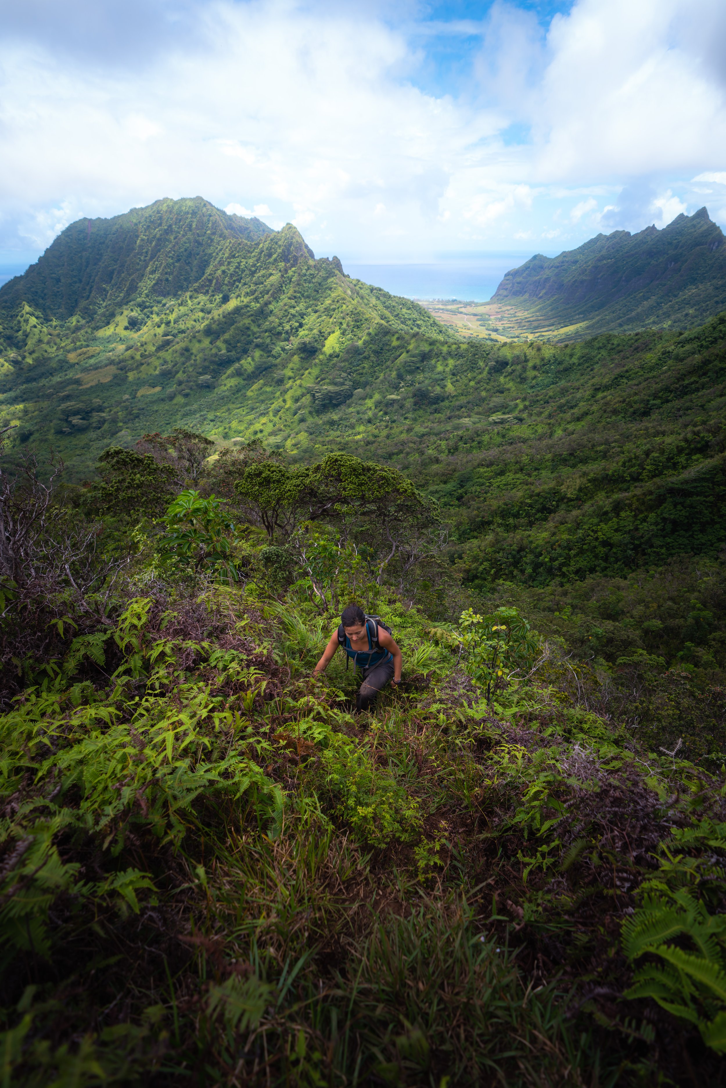
After hiking roughly 3.5 miles (5.6 km) from the Koʻolau Golf Club, the true Maunawili Falls Trail finally branches away into Maunawili Valley.
That said, go left to leave the Maunawili Demonstration Trail and begin descending the ridge toward Maunawili Stream.
From the Demonstration Trail to the point where the stairs near the end reach the stream, the Maunawili Falls Trail loses about 520 ft. (158 m) of elevation, which will have to be re-hiked on the way back to the trailhead.
If not for any other part of the trail, good hiking pants will certainly be nice to have on the hike down the ridge to Maunawili Falls.
This really was one of the clearest, most beautiful days I could have chosen to hike to Maunawili Falls!
This route leading off the ridge is nothing more than a path used by hunters.
That said, do not leave the ridge until you reach the bench and the stairs leading off the ridge on the right-hand side.
The Uluhe really does create tunnels in some sections!
In reality, these Uluhe tunnels are not as bad as they may seem in these photos.
After descending about 0.5 miles (0.8 km), the Maunawili Falls Trail will level out significantly—a nice sign that the ridge is nearing the bench where the stairs lead down to the Maunawili Stream.
Maunawili Falls-Old Maunawili Falls Junction
After roughly 4.0 miles (6.4 km) of hiking to get to this point, the Maunawili Falls Trail finally reaches the infamous bench at the top of the stairs that lead down to the Maunawili Stream.
That said, this bench is also where the original—but now closed—route, which once began on private property, met the public Maunawili Falls Trail. On that note, I personally think that the original access point may never open again, given that the original 2021 closure was only supposed to last for two years.
All this aside, go right at this junction to begin the stairs down the steep and typically muddy hill to the stream at the base of the ridge.
Since this particular section can be very slippery when it has been raining—which is the case more often than not—some hikers may prefer to carry trekking poles for the steep hike down to Maunawili Falls.
When the Maunawili Falls Trail reaches the bottom of the stairs along the banks of the stream, go left to get down to the stream.
Maunawili Stream
At this point, there’s either the option to hike directly up the stream toward Maunawili Falls, a short distance ahead, or go straight across to avoid the stream as much as possible and continue hiking along the trail.
This is the trail located straight across the first part of Maunawili Stream.
Almost immediately, the Maunawili Falls Trail drops back down to the stream, where it continues to the waterfall on the other side.
At this point, most hikers simply opt to start walking upstream to Maunawili Falls, or there is the option to follow one more short section of the trail on the right-hand side.
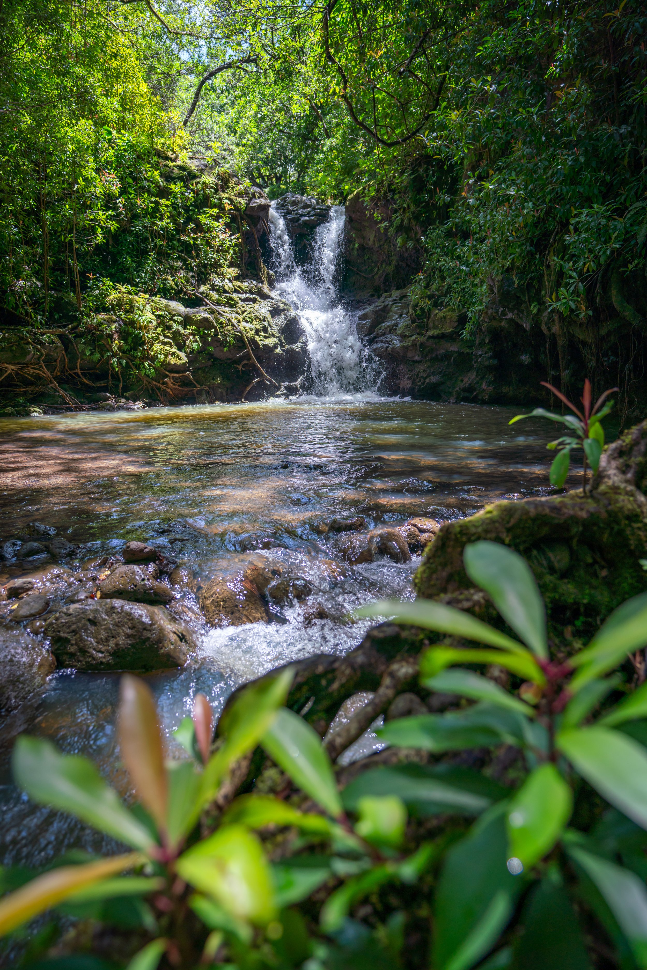
Maunawili Falls
This is Maunawili Falls, a beautiful multi-tiered waterfall and swimming hole located deep within Maunawili Valley.
That said, I think it’s important to mention that this photo was taken on a weekday, when Maunawili Falls is typically less busy. However, on weekends, the waterfall is often busier with hikers who live on Oʻahu.
Warning
I would be remiss if I didn’t discuss the cliff jumps from all sides of Maunawili Falls.
First, I want to say that I have personally jumped from all three sides of Maunawili Falls many times, but I certainly do not recommend the uppermost jump on the left-hand side of the pool.
That said, the three most common places to jump are the short ledge directly adjacent to Maunawili Falls, the middle cliff ledges on the upper right side of the waterfall (which are the sketchiest and most challenging to reach), and the tallest and most dangerous jump on the upper left side of the waterfall.
Before visiting, understand that many hikers have been very seriously injured by jumping from the uppermost ledge on the left-hand side of the pool.
Furthermore, I can speak from experience that there is no room for error. A jump from the upper 45-ft. (14 m) ledge needs to be perfect—meaning landing right in the middle of the pool, committing to the jump without hesitation, and successfully pushing off the very muddy ledge without slipping.
For all these reasons, I highly recommend against attempting the upper two jumps—especially the one on the left!
Native Plants on the Maunawili Falls Trail
By Hawaiʻi standards, the Maunawili Falls Trail is a relatively low-elevation trail, which is why the vast majority of plants along the hike are non-native, invasive species.
However, there are still a ton of natives to look out for, such as ʻŌhiʻa lehua, Koa, Uluhe, Hāpuʻu, Palaʻā, Hau, Hala, and ʻĒkaha—to truly name just a few.
If you would like to learn more about these and many other native Hawaiian plants from across the islands, I encourage you to check out my separate post linked below.
Read My Separate Post: Native Hawaiian Plant Guide