Hiking the Puʻu Piei Trail on Oʻahu, Hawaiʻi
Distance: 1.0 - 3.5 miles / 1.6 - 5.6 km
The Puʻu Piei Trail on the east side of Oʻahu is a lot of different adventures in one, depending on who you ask!
For some, Puʻu Piei is simply an out-and-back sunrise hike, while for others hoping to reach the summit via the Piei Makai Ridge, Puʻu Piei is a much more extreme scrambling/ climbing adventure up and down the teeth just prior to the summit.
This doesn’t even mention that there are numerous routes that ascend the east side of Puʻu Piei, which hopefully helps explain why the distance above is so variable.
All this to say, I personally recommend both the North Ridge and Middle Ridge mentioned below, because hiking to the true summit via the Piei Makai ridgeline is not worth the risk. I say this because there are no views from the summit, meaning that the only point in hiking to the summit of Puʻu Piei is to traverse the Piei Makai Ridge 'teeth.'
Puʻu Piei Routes
There are four routes up to the Piei Makai ridgeline, with some being significantly more difficult than others.
In order from north to south, they are the North Ridge, the Middle Ridge, Kila Ridge, and Puʻu Piei Ridge, with Puʻu Piei Ridge being the most direct route to the summit, while avoiding all the teeth along Piei Makai.
That said, both Kila and Puʻu Piei Ridge branch off the Kapaʻeleʻele Trail, while the other two begin off of Kamehameha Highway.
Overall, be aware that any route other than the North Ridge gets much more technical because of the climbing involved.
Puʻu Piei Trailhead Parking
Parking for the Puʻu Piei Trail depends on which route you are taking up to the ridgeline.
For the North and Middle Ridges, parking for Puʻu Piei is located on the north side of Kahana Bay along Kamehameha Highway.
However, for Kila and Puʻu Piei Ridge, parking is best at the Kapaʻeleʻele Trailhead.
Google Maps Directions: North & Middle Ridge Trailhead / Kapaʻeleʻele Trailhead
Hiking the Puʻu Piei Trail
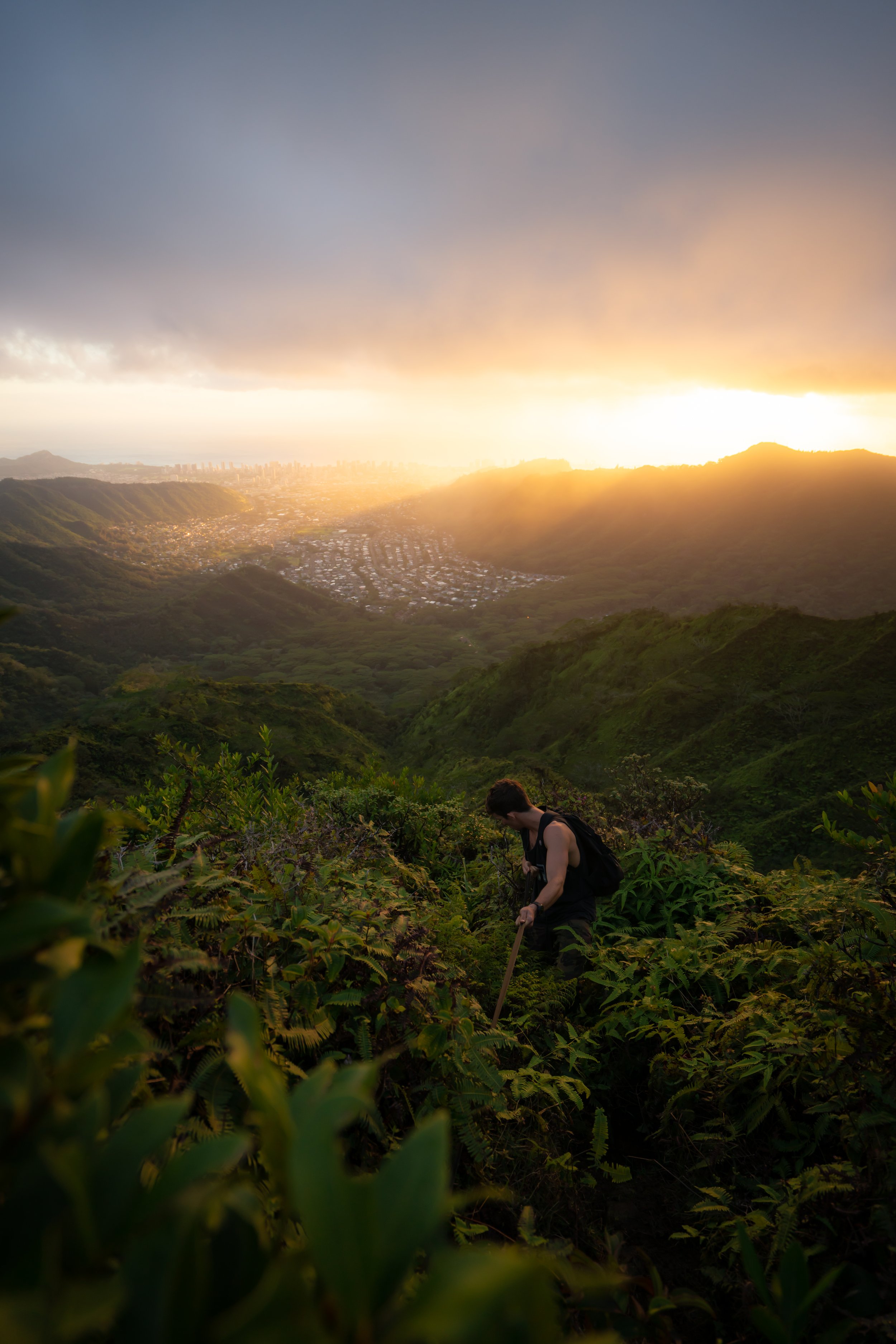
Don’t forget to pack a headlamp for a sunrise hike.
North Ridge
The reason this post is written the way it is stems from both the difficulty and popularity of the routes up Puʻu Piei.
There’s no doubt that the North Ridge up Puʻu Piei is the easiest of all routes, meaning that if you’re simply looking to enjoy the views, choose the North Ridge. The difficulty on Puʻu Piei goes up drastically as you start hiking the subsequent ridges to the south.
The North Ridge begins up an unmarked trail, heading straight uphill off Kamehameha Highway.
If you’re looking at a satellite view, this is the last ridge to the north before the highway turns toward Punaluʻu.
Eventually, the North Ridge crosses over a stream bed that will more than likely be dry.
Look for the trail above the erosion scar on the left.
It can be a little tricky to find.
The second half of the North Ridge is where the hike really starts to get steep.
The last stretch up to the summit of the North Ridge is the steepest and most exposed part of the hike.
However, I think these photos may make this part look more difficult than it is.
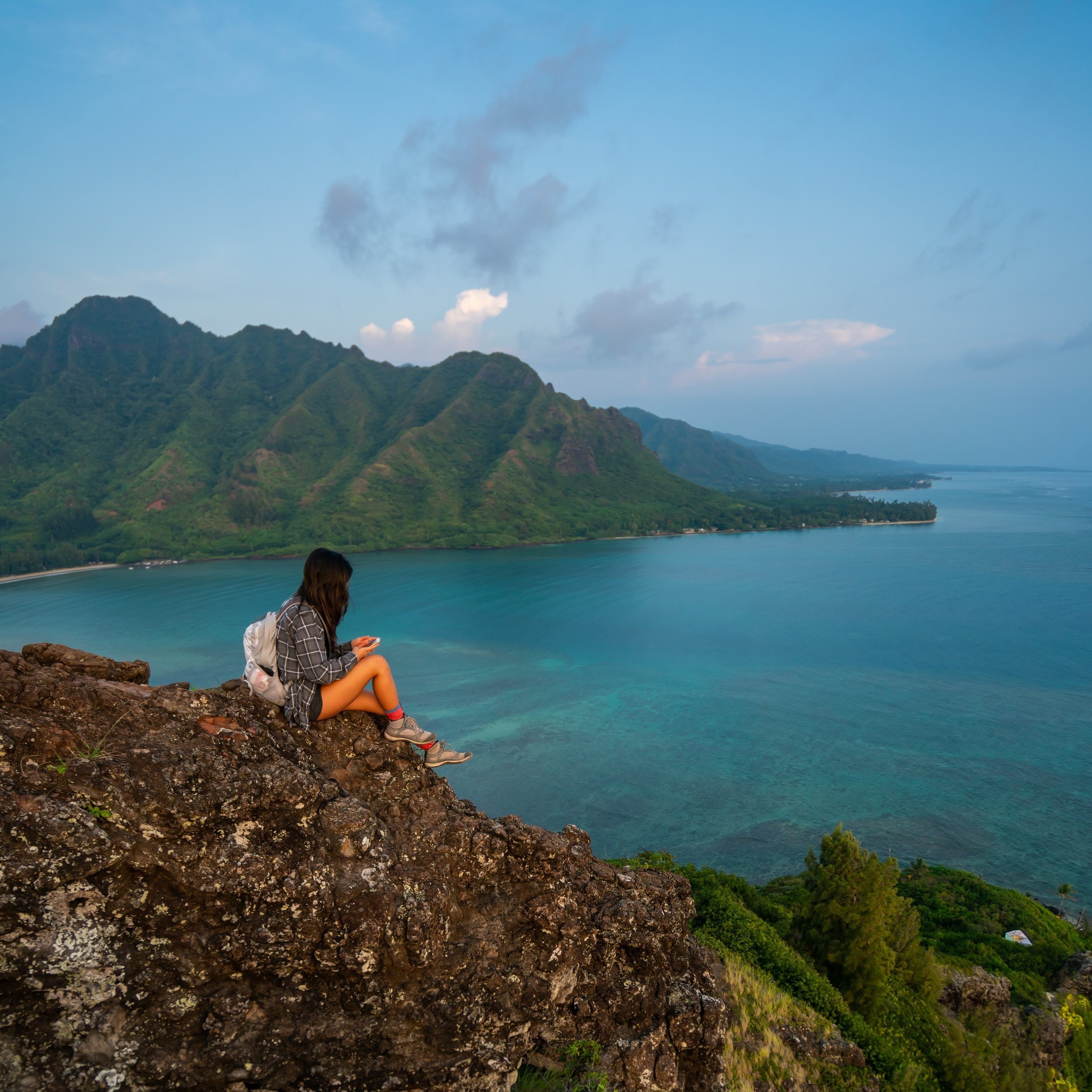
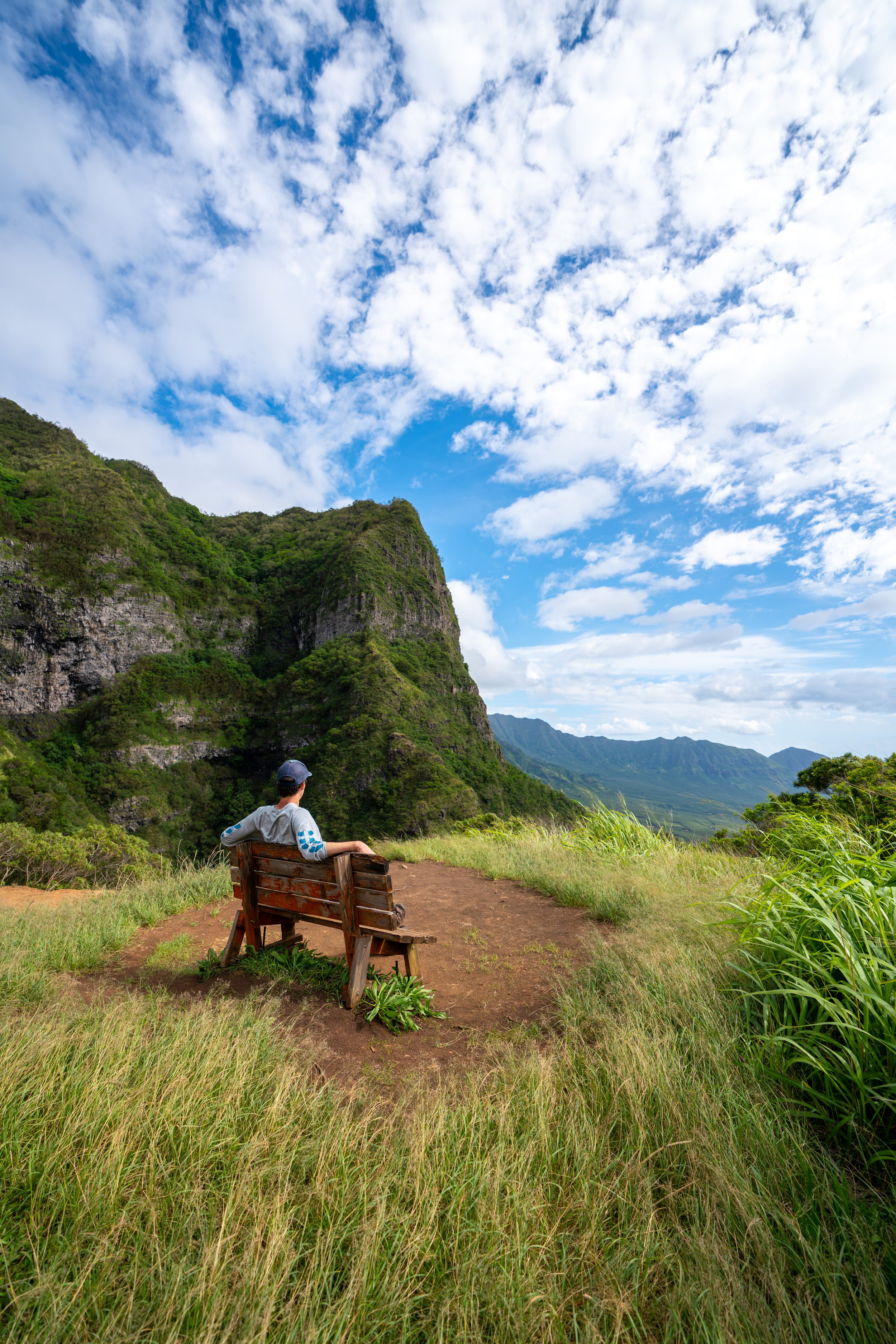
North Ridge Summit
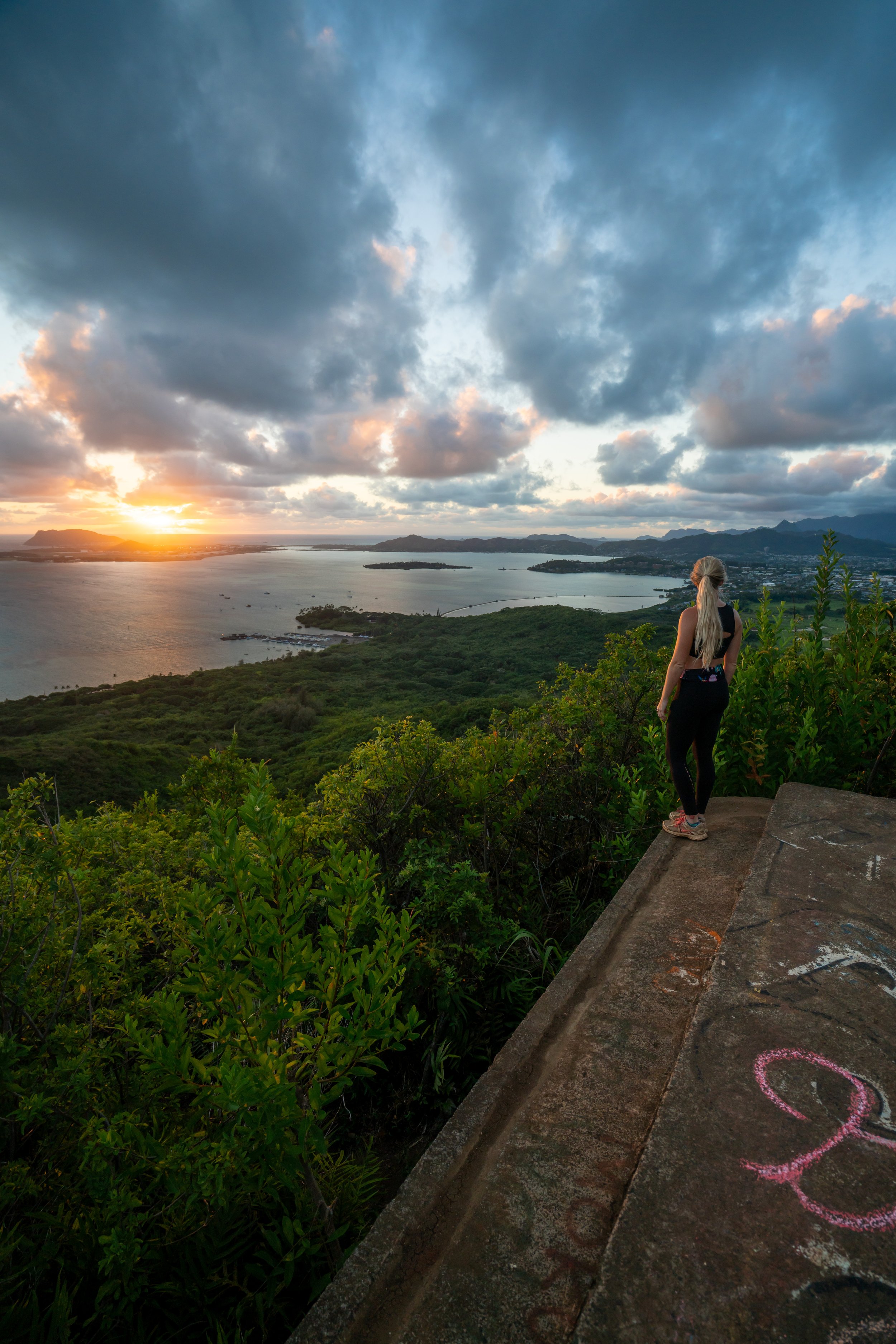
This is the summit of the North Ridge on Puʻu Piei, which is typically as far as most hikers go.
That said, this viewpoint is one of my favorite sunrise spots on Oʻahu! I say this because far fewer hikers climb Puʻu Piei compared to the neighboring Crouching Lion Trail.
However, the difficulty on Puʻu Piei should not be compared to Crouching Lion or any part of the Puʻu Manamana to Kahekili Ridge Trail, as Puʻu Piei is more challenging in my opinion.
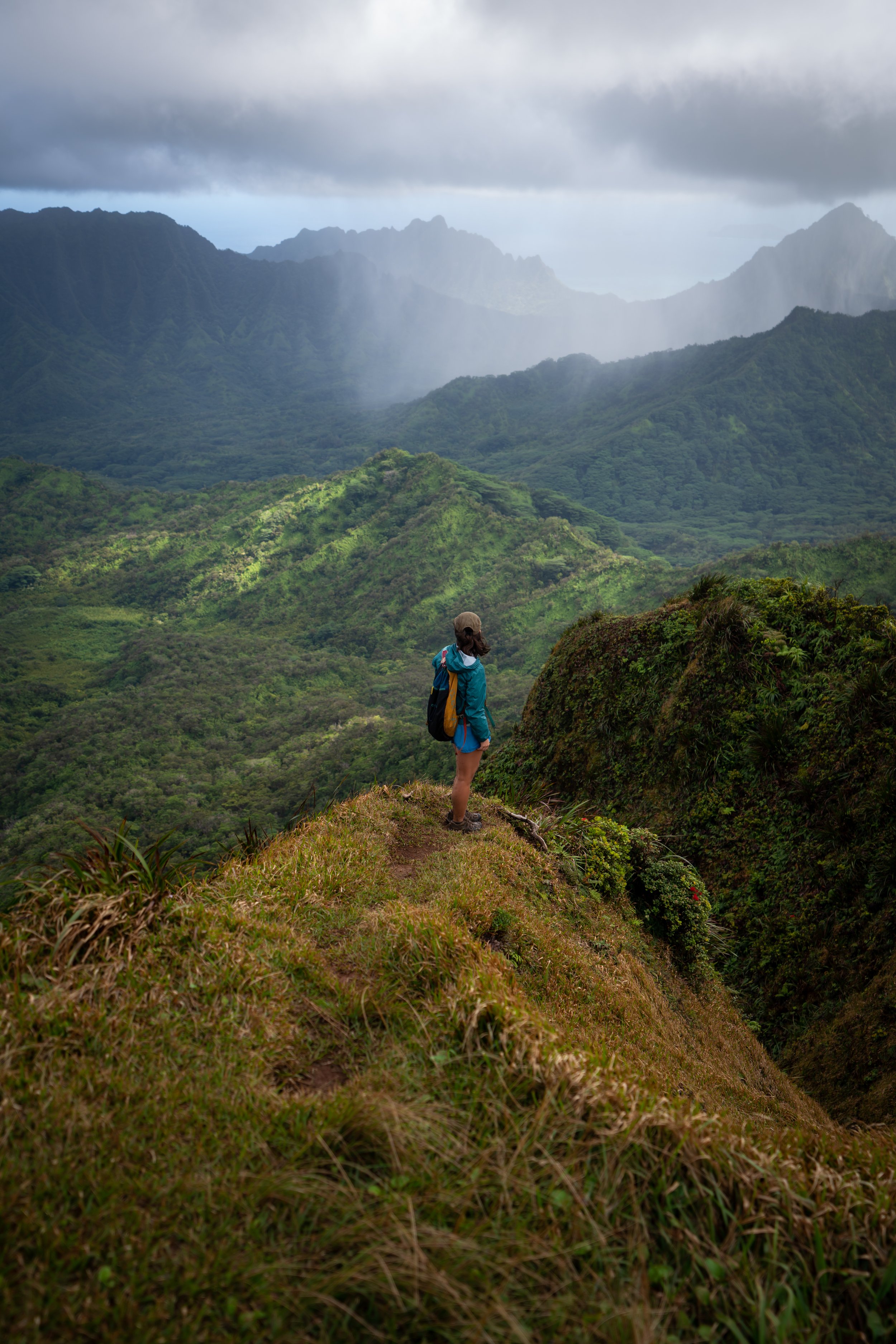
Piei Makai Ridge
Past the North Ridge Summit, the trail follows the much more overgrown Piei Makai Ridge.
Warning
If you had any difficulty reaching the North Summit, turn around here. As I’ve previously said, the Middle Ridge and every subsequent ridge to the south only get more challenging, exposed, and overall, dangerous.
Additionally, the views don’t get better but worse, as the overgrowth gets worse.
In this post, I show the route along Piei Makai from the North Summit to the Middle Ridge and down, while also showing the start of the infamous Puʻu Piei teeth at the end.
Don’t expect much of a trail between the ridges, but as long as you stay on the ridgeline, it should be as straight forward as it can be.
Middle Ridge
The Middle Ridge on Puʻu Piei is not distinguishable by any landmarks.
The summit of the Middle Ridge is more or less an overgrown hill that you may only know you missed when you get a view looking back at it.
To see the infamous Puʻu Piei teeth, read to the end.
The trail off of Piei Makai isn’t very defined, as most hikers on the Middle Ridge don’t hike this high because of the sections to come.
If you’re hiking the loop in this direction, start looking for the ridge down on the right shortly after the down-climb in the photo above.
It won’t be obvious until you get out of the trees in the next photo.
From this point on, the Middle Ridge should be as obvious as it can be, with most of the overgrowth behind you.
Shortly after getting on the ridgeline, the real down-climbing begins.
At first, it’s nothing more than sitting and scooting, but the last two sections are areas that you cannot fall.
These photos are a little disorienting, and I think they make this part look a little harder than it is.
However, I hope they show that you cannot fall. It wouldn’t be the worst idea to bring your own rope.
The next down-climb is the longest and steepest of all.
There are a number of places to put your weight, but if you were to fall, the run-out is very short before the next drop, which could be fatal.
I would also hike in something a little more substantial than my trail-running shoes and shorts.
Sometimes I get a little relaxed about this stuff because I’m so used to it, but in reality, the consequences of falling are at their highest on Puʻu Piei.
The photo below is looking back at the bottom of the down-climb.
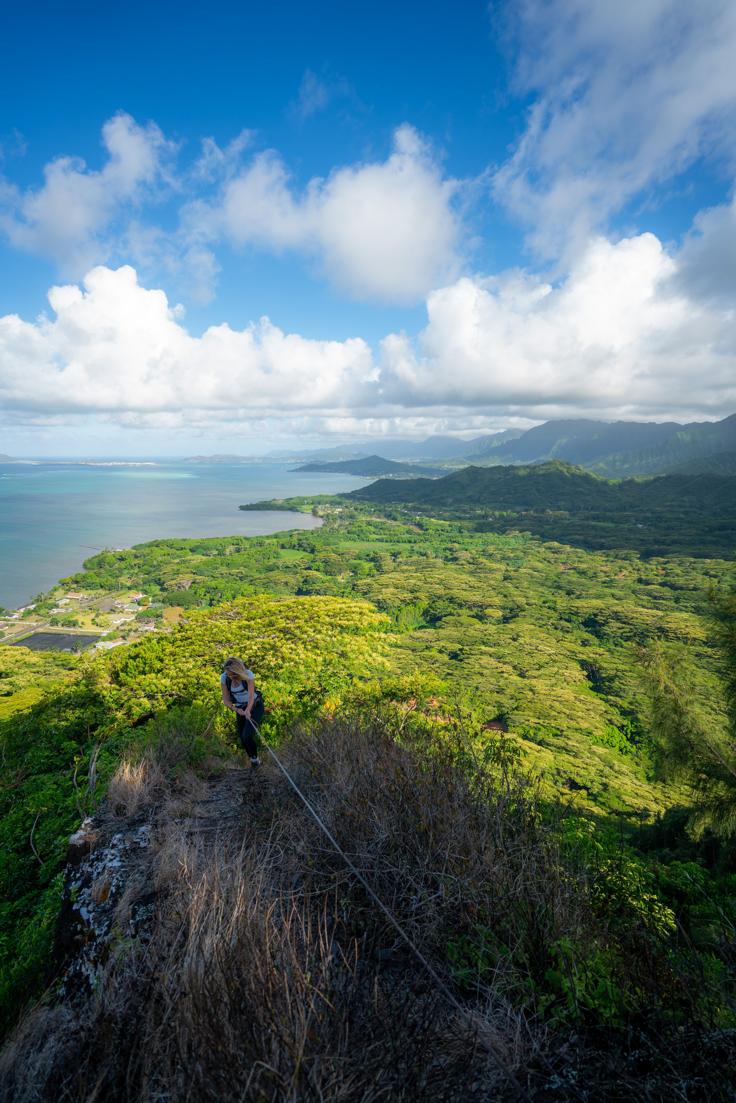
Past all the climbing in the photos above, the Middle Ridge gets a lot easier for the rest of the hike.
Toward the lower sections of the Middle Ridge, the trail should become more defined for the remainder of the hike down to the highway.
Piei Makai
These are the sections past the Middle Ridge looking at Kila Ridge and the teeth.
Warning
The sections leading up to the Kila and the teeth that follow are the most dangerous sections on the Puʻu Piei Trail.
To know if you’re ready for something like this, you should feel 100% comfortable with other Oʻahu hikes first, such as the third peak on Mt. Olomana, the Chimney up the Pali Notches, or even the notch between Puʻu Kawiwi and Kaimaileʻunu.
I have been to the extreme by completing the Kalahaku Teeth, and I can confidently say that these are all good warmup ridges to know if you’re ready for something like Piei Makai.
When I get the chance to get back up there with friends, perhaps on a different ridge than shown in this post, I will fill in this section with photos. However, it was not something that I felt like doing while I was out for a casual day hike on my own.
For now, I recommend checking out the photos on Kenji’s blog. They hiked up the Middle Ridge, over on Piei Makai, and down Puʻu Piei Ridge.
Overall, there are no views to see from Puʻu Piei Summit, which is why I would encourage the North and Middle Ridges over Kila and Puʻu Piei Ridge.
Whichever route you take, expect to be covered in Desmodium seeds from all the sitting and scooting on Puʻu Piei. At the least, your shoes will be covered.
I spent more than an hour getting them all off when I finally got home.
Native Plants on the Puʻu Piei Trail
Even though Puʻu Piei is a relatively low-elevation peak, meaning that it’s covered in invasive Octopus trees and Brazillian Pepper, there are still a variety of native plants to look out for, such as ʻŌhiʻa, ʻŪlei, ʻIlima, Palaʻā, ʻAlaʻala wai nui, and Hala trees.
If you would like to know more about these and other native Hawaiian plants, check out my separate post below.
Read My Separate Post: Native Hawaiian Plant Guide