Hiking the Puʻu Manamana Trail (Crouching Lion to Kahekili Ridge) on Oʻahu, Hawaiʻi
Distance (Full Loop): 5.3 miles / 8.5 km
The Puʻu Manamana Trail, also called the Puʻu Manamana Turnover Trail, on the east side of Oʻahu is a beautiful and dramatic loop that connects the famous Crouching Lion Trail in Kahana Valley to Kahekili Ridge in Kaʻaʻawa.
That said, the Puʻu Manamana Trail is one of my favorite adventures when I’m looking for a fun, moderately challenging day hike that’s not too long or involved—not to mention that Hidden Valley where the two ridges meet is one of the most beautiful and unique places on Oʻahu!
However, this all goes without saying that the Puʻu Manamana Trail is not a beginner hike, and those interested in hiking the full loop need to be comfortable with high-exposure, some climbing, and comfortability with both if the weather turns. For these reasons, I want to emphasize that the distance alone should not influence your perception about how hard the Puʻu Manamana Loop Trail is.
By this, I mean that the famous Crouching Lion Trail is truly the easiest part—and the start—of the much longer Puʻu Manamana Loop, and it’s only past Crouching Lion that the real hiking begins!
To skip past the beginning portions of the Crouching Lion Trail, click here.
Puʻu Manamana Trailhead Parking
Parking for the Puʻu Manamana Trailhead is located in at either one of two different trailheads.
First, there’s a small dirt lot on the right-hand side of Kamehameha Highway, just before Kahana Bay Beach Park when coming from Kāneʻohe, or on the left after the beach park when coming from the North Shore. This is more famously known as the Crouching Lion Trailhead, which is why it’s the busier of the two.
Alternatively, the Puʻu Manamana Loop could begin via Kahekili Ridge in Kaʻaʻawa. Parking here is located on Huamalani Street, which is much more residential than the Crouching Lion side. Therefore, I ask that you please be quiet and respectful in this residential neighborhood, as too many trails in Hawaiʻi draw too much negative attention because people just don’t understand this.
All being said, consider the Crouching Lion Trailhead to be a high-crime area for petty theft, meaning you should never leave visible bags or anything valuable in your car.
Google Maps Directions: Puʻu Manamana Trailhead / Kahekili Ridge Trailhead
Hiking the Puʻu Manamana Trail
Personally, I always like to start the Puʻu Manamana-Kahekili Loop on the Crouching Lion side, which is the direction that this post is written here. I do this because all of the hardest elevation gain is on the Crouching Lion side, which I like to get out of the way in the beginning.
This makes for a much nicer descent, beginning on the Puʻu Manamana side of the loop, from the junction that drops down into Hidden Valley. However, if you wanted to start from Kahekili Ridge, Puʻu Manamana could just as easily be done in reverse.
In any case, walk in the Kāneʻohe direction toward the first or second sign on the right-hand side of the road to begin hiking up Puʻu Manamana.
Puʻu Manamana Trailhead
This is the first trailhead, and it’s best known for being the fastest route up the Puʻu Manamana-Kahekili Ridge Loop.
That said, both routes connect at the top, creating a 0.6-mile (1.0 km) loop between the trailheads/ ridges that ascend up the mountain.
In any case, this post begins via the Crouching Lion Trail, connecting at the top to Puʻu Manamana.
Crouching Lion Trailhead
This is the Crouching Lion Trailhead, and it’s the route that most hikers take, given the fact that most don’t hike up the Puʻu Manamana Trail.
Read My Separate Post: Crouching Lion Trail
Crouching Lion Trail
Know that if the east side of Oʻahu has been receiving a lot of rain, these lower elevations on the Crouching Lion Trail can be very muddy and slippery.
Not long after beginning the hike, the Crouching Lion Trail begins climbing, which will continue for nearly the entire length of the trail to the main viewpoint above Kahana Bay.
These middle sections of the ridge are always fairly eroded, which can make it particularly challenging when it’s muddy.
After the short but steep 250-ft. (76 m) ascent, the Crouching Lion Trail levels out at this flat clearing above Kaʻaʻawa to the east and Kahana Bay to the north.
Crouching Lion-Puʻu Manamana Connector Junction
It is here at the junction just past the clearing that hikers either have the option to go left toward the main Crouching Lion viewpoint or right to hike toward the Lion’s Head/ Puʻu Manamana Trail.
With that in mind, you can see what the remaining section up the Crouching Lion viewpoint look like in my separate article.
Read My Separate Post: Crouching Lion Trail
Warning
It’s important to stress the dangers of the trail from this point on, as numerous hikers have taken fatal falls because of the steep and dramatic cliffs that parallel the Crouching Lion-Puʻu Manamana Trail.
That said, I only say this to encourage safe decision-making, but also to recommend stopping here if someone in your party is not comfortable proceeding.
Crouching Lion-Puʻu Manamana Connector Trail
This is the Connector Trail, which is only about 0.1 miles (0.2 km) to reach the Puʻu Manamana side of the hike.
Read My Separate Post: Crouching Lion Trail
Crouching Lion’s Head-Bypass Junction
At this split, you can either go left to hike up to the top of Lion’s Head or right to bypass it altogether.
That said, Lion’s Head is a very exposed portion of the Crouching Lion Loop, meaning the Bypass is much easier and safer in comparison.
Crouching Lion Head
This is the top of the Lion’s Head, and while it may seem deceiving as to why it’s called Crouching Lion, the shape of a 'Crouching Lion' can’t be seen from anywhere on the hike.
In fact, the Crouching Lion can only be seen from Kaʻaʻawa down below, which is why I encourage you to look up at the mountain if you’re driving to the trailhead from Kāneʻohe.
Second Crouching Lion’s Head-Bypass Junction
Past the Crouching Lion, the Bypass and Lion’s Head trails meet and continue on toward the Puʻu Manamana-Crouching Lion junction shortly ahead.
Hopefully, this memorial shows how real the consequences of a fall can be.
Seriously, be careful!
Puʻu Manamana-Crouching Lion Conncector Junction
After 0.1 miles (0.2 km), the Puʻu Manamana–Crouching Lion Connector Trail meets the ridge that continues higher up Puʻu Manamana and the trail back down to the highway.
This is the route that completes the short 0.5-mile (0.8 km) Crouching Lion Loop, but know that the alternative Puʻu Manamana Ridge back down is slightly more difficult than the Crouching Lion Trail because of one steep section that must be climbed down.
To learn more about the ridge down to Kahekili Highway, you can see all the major sections at the end of my separate Crouching Lion article.
Read My Separate Post: Crouching Lion Trail
Puʻu Manamana Trail
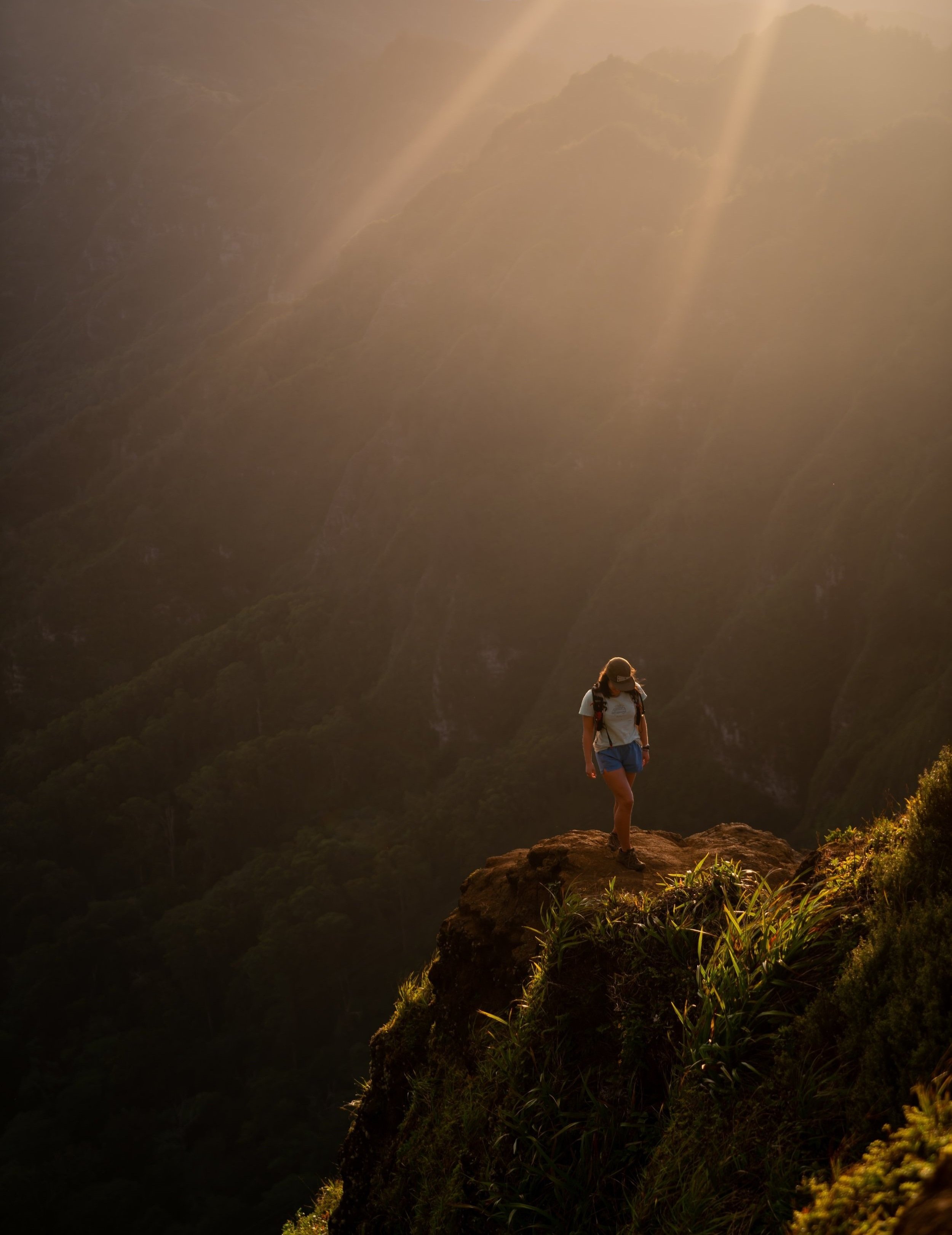
After Crouching Lion, the Puʻu Manamana Trail continues up the ridge for the next 1.4 miles (2.3 km) before making any turns.
That said, the distance on this stretch is deceivingly short because 1.4 miles (2.3 km) to get to the most important turn will take much longer than it may seem.
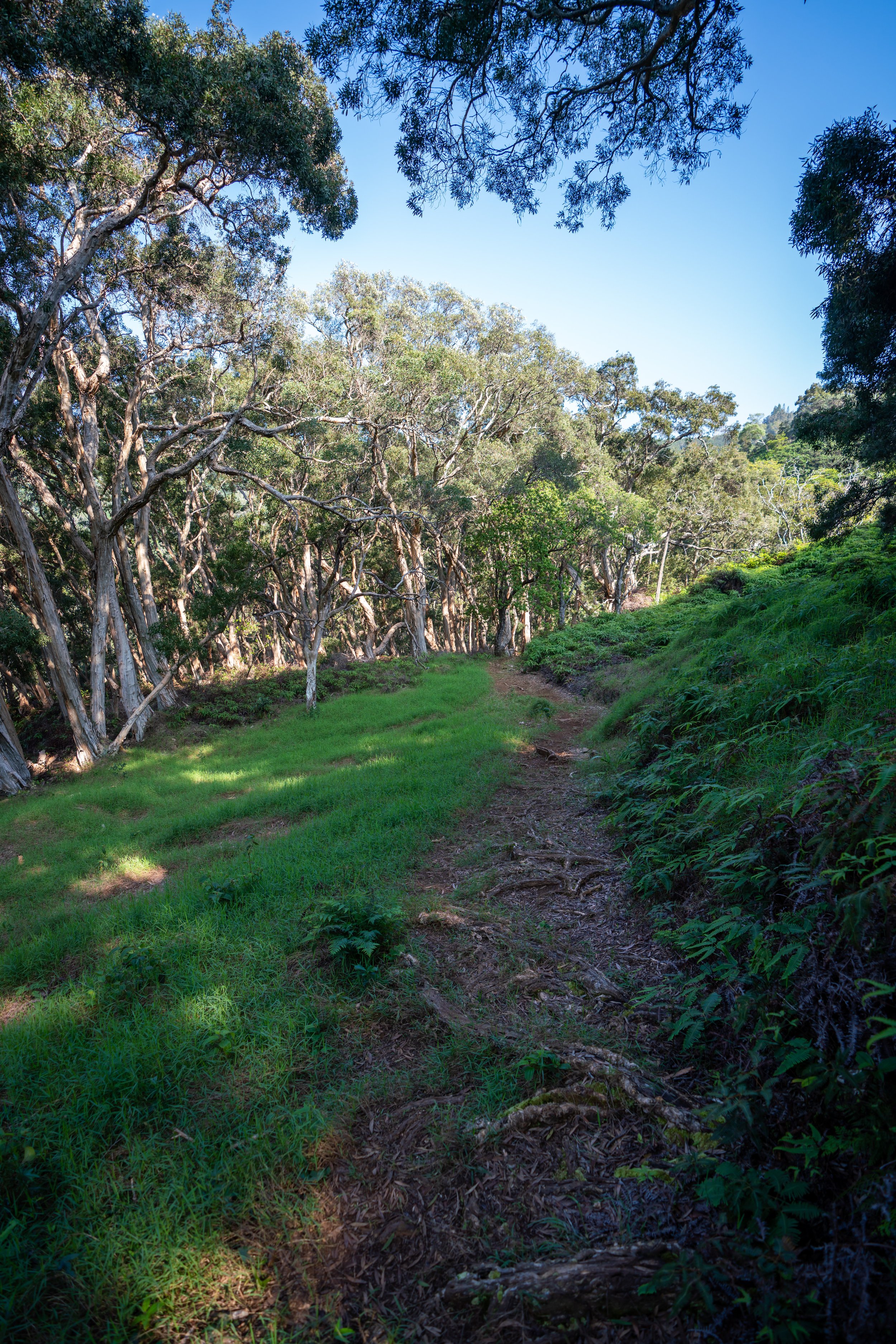
The photo below is the area where the Puʻu Manamana Trail tops out above the steepest part of the ascent.
Know that much of this section is absolutely a no-fall zone! You can’t make a mistake here, or it would likely be fatal.
To this point, the cliffs on Puʻu Manamana are extremely dramatic, and you’ll get a better appreciation for how dramatic they are on the Kahekili side of the loop when you look back in this direction.
Just because I may have done this hike in a really old pair of running shoes doesn’t mean that’s what I recommend.
In fact, I’ve changed to a pair that I enjoy much more, which is what’s shown below.
The photos below are of the third down-climb.
However, the second photo does a bad job of showing the route down. It’s not straight over the face from the angle that this was taken, but rather off to the side.
On the upper portions of the hike, the Puʻu Manamana Trail becomes a bit more overgrown, which is why I recommend hiking in pants.
The pants below are my recommendations that hold up the best with the overgrowth here in Hawaiʻi, but with any hiking pants that need to be durable, make sure that they are at or near 100% nylon. This is really the most important factor!
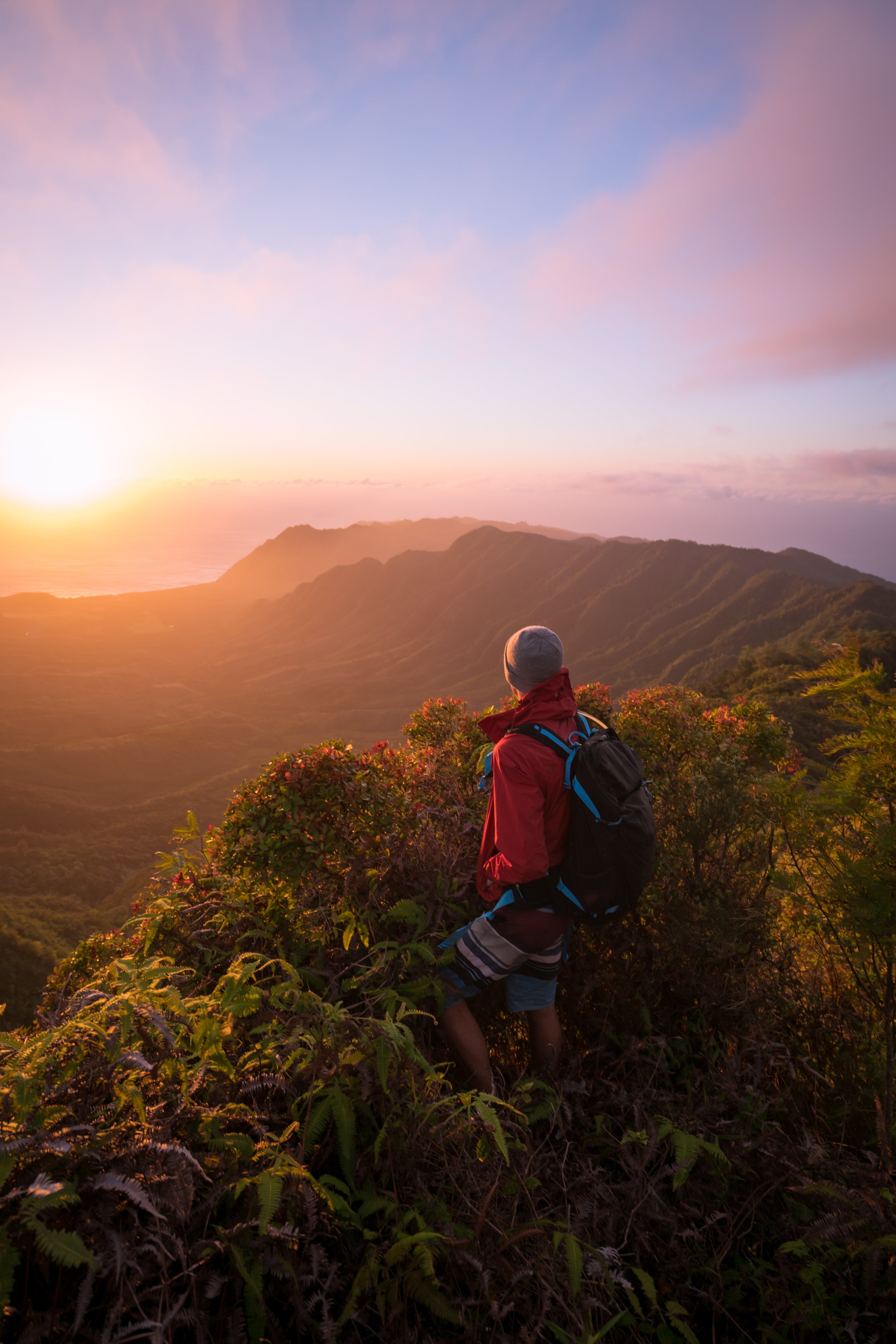
Puʻu Manamana Turnover
The photos below show the highest point on the Puʻu Manamana Crossover Trail at just under 2,000 ft. (610 m), and this also represents the end of the Crouching Lion side of the loop.
To get to Kahekili Ridge, take a hard left down the ridge, and know that if you don’t start immediately descending, you made a wrong turn.
Going straight on the ridge from this point is generally of no interest to most people. It’s called True Manamana, and it’s one of the more advanced hikes on this island, which is also saying that this Crouching Lion Loop is nowhere near the same difficulty as True Manamana.
That said, I’ve been over to True Manamana once, and I can confidently say that I won’t be going back.
The next section of the Puʻu Manamana Trail is called the Puʻu Manamana Crossover or Turnover Trail.
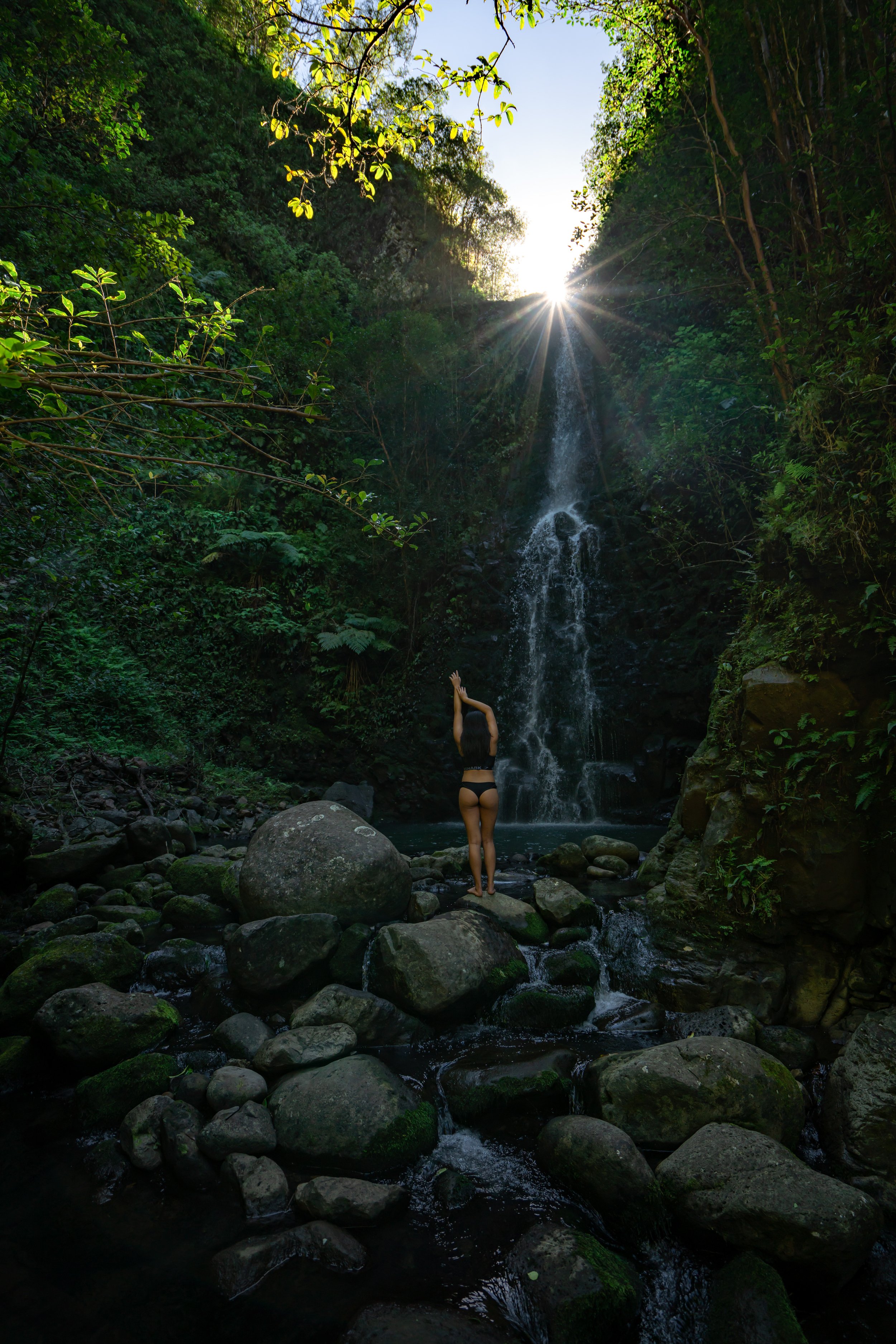
Essentially, the trail descends down a different ridge, until it reaches the top of Makaua Falls, one of the tallest waterfalls on Oʻahu.
Hidden Valley
Once you reach the Makaua Stream, you have officially crossed over to the Kahekili side of the loop. It’s also the side that should move much quicker compared to the Crouching Lion ‘half'.
I say 'half' because the Kahekili Ridge side is significantly shorter and quicker than the Crouching Lion side.
From Upper Makaua Falls, the trail over to Kahekili Ridge ascends back out of the gulch until it meets the Kahekili ridgeline.
Kahekili Ridge
As previously mentioned, the Kahekili Ridge side of the Puʻu Manamana Loop should move much quicker in comparison, and at this point, you’ll already be much lower from all of the elevation lost from the other side to get down to the stream.
For the rest of Kahekili Ridge down to the most popular stopping point near the Kahekili Pillbox, the Puʻu Manamana Loop simply follows the steep ridgeline back down.
Kahekili Pillbox
In my opinion, the Kahekili Pillbox is more or less the same difficulty as the Crouching Lion Trail on the other side.
For this reason, the Kahekili Pillbox, as a stand-alone hike, is a popular stopping point, making it one of the best uncrowded sunrise hikes on Oʻahu.
After the pillbox, the Kahekili Ridge Trail descends steeply, dropping about 400 ft. (122 m) into the Makaua Gulch, where the Kahekili Trailhead will be found shortly after.
Kahekili Ridge-Makaua Falls Junction
At the junction with Makaua Falls, go right to find the trailhead, located shortly ahead.
The trail to the left heads upstream to Makaua Falls, and that’s really a hike for a different day, especially because the rain-fed waterfall is not guaranteed to be flowing at all times of the year.
Unfortunately, one of the least enjoyable aspects of the Puʻu Manamana Loop is the 0.9-mile (1.4 km) walk or run back to your car at the Crouching Lion Trailhead.
Alternatively, taking the bus can be a good option, but if wait times are long, it's likely not worth it.
Native Plants on the Puʻu Manamana Trail
The Puʻu Manamana Turnover Trail is one of the best trails for seeing a variety of native Hawaiian plants across the entire hike.
From the lower elevations to the Crouching Lion area, you can find Lau Hala, ʻUhaloa, ʻŌhiʻa lehua, Hau, and ʻIlima, to name a few.
Once on the upper ridge, the trail transitions into a mixed Lama forest with other plants like Maua, multiple species of Kōlea, ʻĀkia, ʻŪlei, and ʻAlaʻala wai nui. Lama trees are also one of the most easily identifiable, extending from this point all the way down Kahekili Ridge.
In my opinion, the turnover trail or crossover to Kahekili Ridge was my favorite part for finding native plants, which includes Kōpiko, ʻAhakea, ʻAkolea, and Māmaki, to name only a few more.
That said, if you are curious about trying the native Hawaiian Māmaki tea, I kindly ask that you don’t harvest Māmaki from our native forests but, instead, buy from one of the local reputable vendors, such as those listed below.
If you would like to know more about these and tons of other native Hawaiian plants from across the islands, I encourage you to check out my separate post linked below.
Read My Separate Post: Native Hawaiian Plant Guide