Hiking the East Bison Flats Trail in Wind Cave National Park
Distance (One Way): 3.3 miles / 5.3 km
The East Bison Flats Trail in Wind Cave National Park is a hilly and somewhat remote day hike across the open prairie, connecting the park’s southernmost boundary with the Wind Cave Canyon Trail, one of the most popular day hikes in the park.
However, the East Bison Flats Trail is quite the opposite of Wind Cave Canyon, as few park visitors venture out on this 6.6-mile (10.6 km) roundtrip hike, or 3.8 miles (6.1 km) when it’s treated as a one-way hike by exiting via the Wind Cave Canyon Trailhead. In either scenario, don’t be surprised if you’re the only group on the East Bison Flats Trail.
All that aside, I think the East Bison Flats Trail makes for a great option if you’re looking for a little more diversity than some of the flatter trails that cut through the central parts of the park, such as the Highland Creek Trail or the Sanctuary Trail, as it truly is one of the hillier day hikes in Wind Cave National Park—something that cannot be said about most adventures in Wind Cave.
U.S. National Park Pass
There is no entrance fee to visit Wind Cave National Park.
However, entrance fees are collected at Badlands National Park and Devils Tower National Monument, which is why I recommend purchasing your National Park pass in advance before traveling to the Black Hills.
East Bison Flats Trailhead Parking
The East Bison Flats Trailhead is located just outside the Wind Cave National Park entrance sign near the south entrance, about 3.1 miles (5.0 km) south of the turn into the Wind Cave Visitor Center.
Before arriving, I want to stress the importance of being careful here, as vehicles tend to drive fast along this stretch when coming from either direction.
Google Maps Directions: East Bison Flats Trailhead
Hiking Checklist - Wind Cave
Here is a complete list of must-have things that you will want for any hike in Wind Cave National Park.
Hiking the East Bison Flats Trail
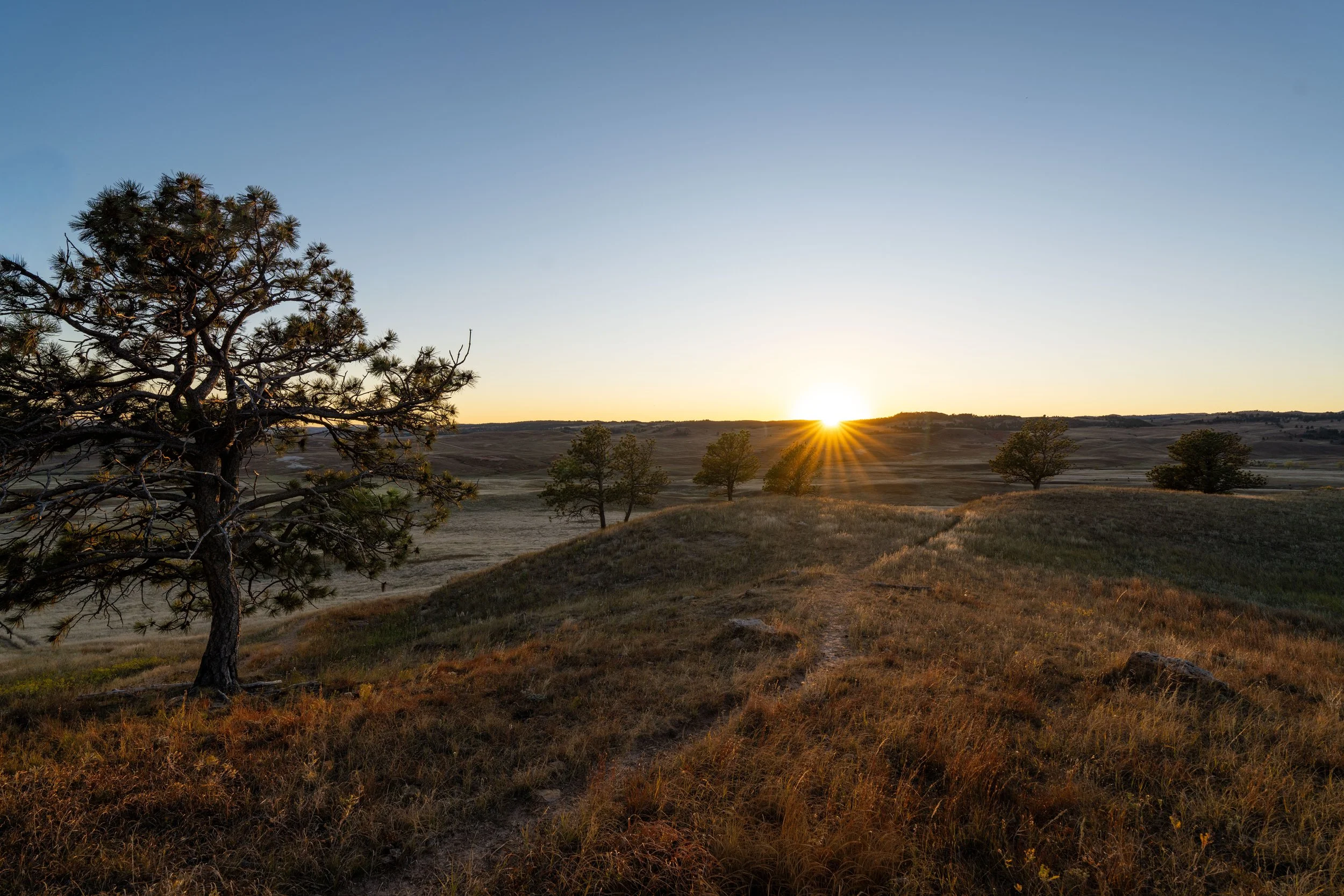
The East Bison Flats Trail begins on somewhat of a high point in terms of the overall hike.
However, over the course of the first 0.8 miles (1.3 km), the trail will lose elevation almost constantly, but subsequently regain it all again—and more—over the following 0.8 miles (1.3 km) to the highest point on the entire hike.
This is one reason I mentioned at the beginning that the East Bison Flats Trail is one of the hillier hikes in Wind Cave National Park, as the initial 1.6 miles (2.6 km) and the final descent into Wind Cave Canyon have elevation changes that are not often seen on other adventures throughout the park.
For about the first 0.1 miles (0.2 km), the East Bison Flats Trail parallels the wildlife fence along the old southern park boundary.
That said, this fence throughout the park will often follow the park boundary, but sometimes it does not, as in the case at the end of the Wind Cave Canyon Trail.
This is because, in September 2011, Wind Cave National Park added about 5,556 acres (22.5 km²) in an expansion known as the Casey Addition, which is why old maps and current fence lines do not always reflect the correct boundary.
I mention this because there’s actually a really cool story behind why this fence is the way it is, and what the park is doing in terms of wildlife management, which I discuss in more detail below.
This is where the East Bison Flats Trail leaves the wildlife fence behind.
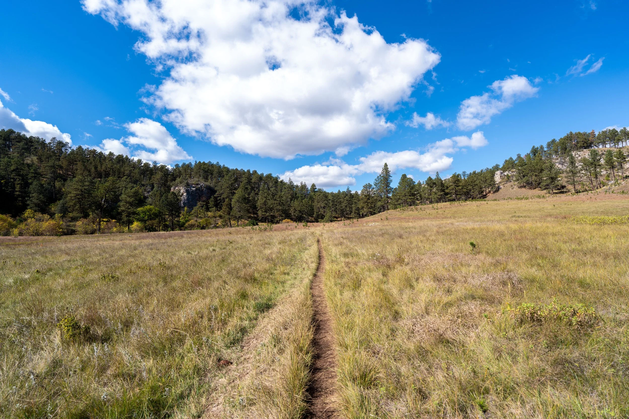
After just 0.2 miles (0.3 km), the East Bison Flats Trail will begin to descend into Gobbler Canyon, which will progressively get steeper as it gets closer.
The one thing I hope these photos show more than anything else is that there is very little shade on the East Bison Flats Trail, which is true for most of the day hikes across the open prairies in Wind Cave National Park.
This is why I highly recommend hiking the trail in a hooded sun shirt, as one will certainly be useful here and for countless other adventures across the Black Hills in western South Dakota.
This is where the East Bison Flats Trail begins to descend off Gobbler Ridge and into the canyon, beginning the steepest part of the entire hike.
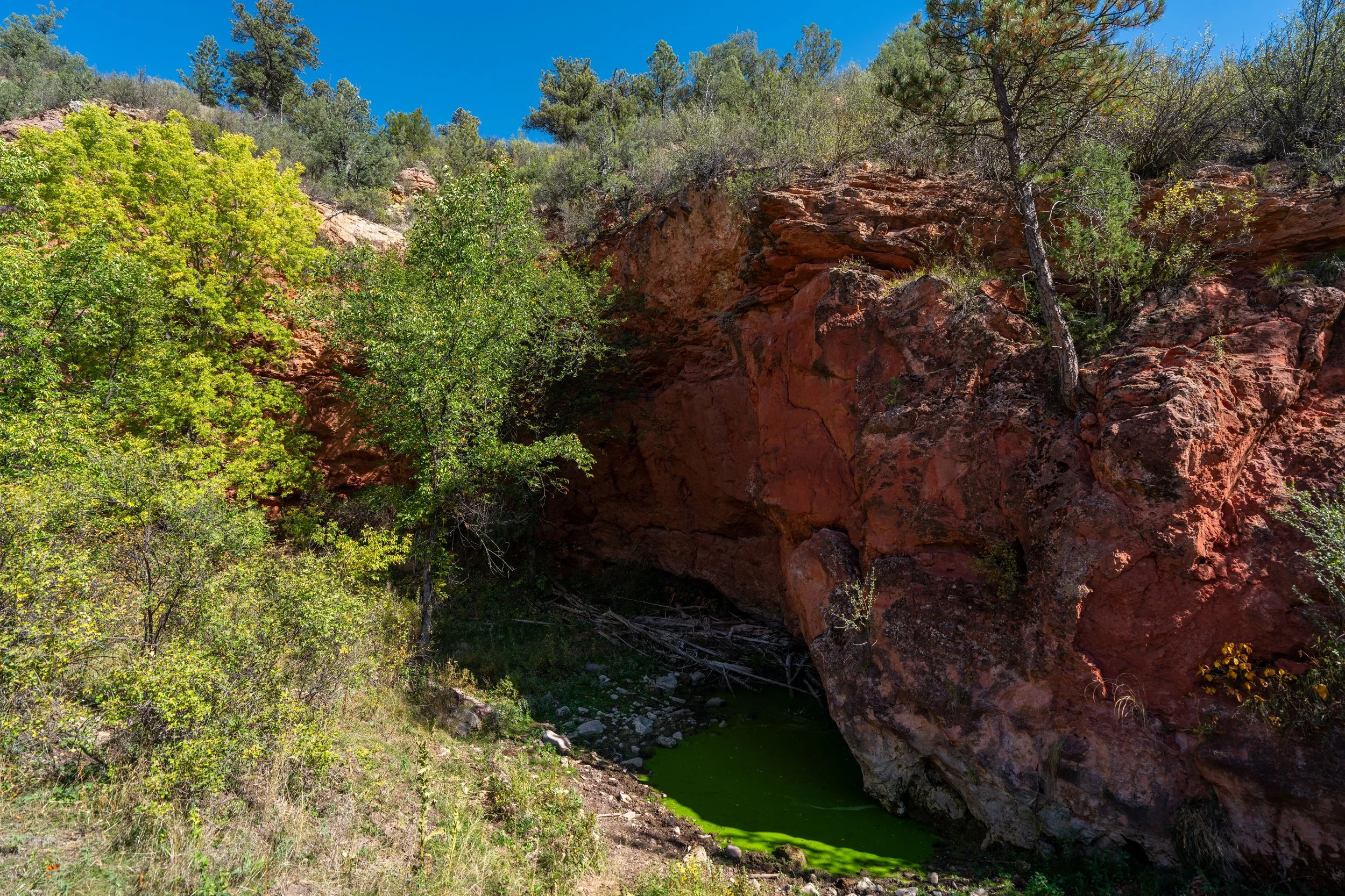
Gobbler Canyon
This is Gobbler Canyon, and it’s the lowest point on the entire hike.
That said, the East Bison Flats Trail does not spend any time down here, as it immediately starts climbing the ridge on the far side of the canyon, which honestly makes all this elevation change a bit defeating mentally.
This is where the East Bison Flats Trail starts its steep ascent out of Gobbler Canyon.
I think it’s fair to say that this ascent out of Gobbler Canyon is one of the steepest sections of trail in Wind Canyon National Park—which is to say, elevation change across much of the park is usually fairly minimal.
This is the only true switchback on the East Bison Flats Trail.
After about 0.2 miles (0.3 km) from the bottom of Gobbler Canyon, the East Bison Flats Trail levels out considerably.
However, the trail will continue to climb steadily over the next 0.6 miles (1.0 km) to the highest point on the entire hike.
This is the view looking back across Gobbler Canyon toward the beginning of the East Bison Flats Trail.
This is Western Poison Ivy, which is very common in Wind Cave National Park and the greater Black Hills area.
That said, it’s highly recommended that you learn to identify it if you plan to do any hiking here or elsewhere across western South Dakota.
The next hill on the East Bison Flats Trail is not the highest point on the entire hike.
Rather, the high point doesn’t become visible until after the top of the hill straight ahead.
The top of the next hill in the distance is the highest point on the East Bison Flats Trail, meaning that from that point on, the trail slowly begins descending toward Wind Cave Canyon, where it becomes steeper again near the end of the trail.
This is the highest point on the East Bison Flats Trail, which is only about 20 ft. (6 m) higher than the trailhead off Highway 385.
Hopefully, this helps to show just how defeating Gobbler Canyon really is, especially if you’re doing a roundtrip hike instead of hiking out of Wind Cave Canyon.
After the high point, the East Bison Flats Trail arguably begins the most challenging section of the entire hike, which has everything to do with finding the correct trail as opposed to the terrain itself.
By this, I mean that the next 0.2 miles (0.3 km) on the East Bison Flats Trail are very vague, after which the trail becomes somewhat clearer with each marker—though it remains confusing for the following 0.5 miles (0.8 km).
This can make staying on the correct path difficult, but there is one best path to follow by simply hiking north and looking for the trail markers, which are often knocked down by the Bison that use them as scratching posts!
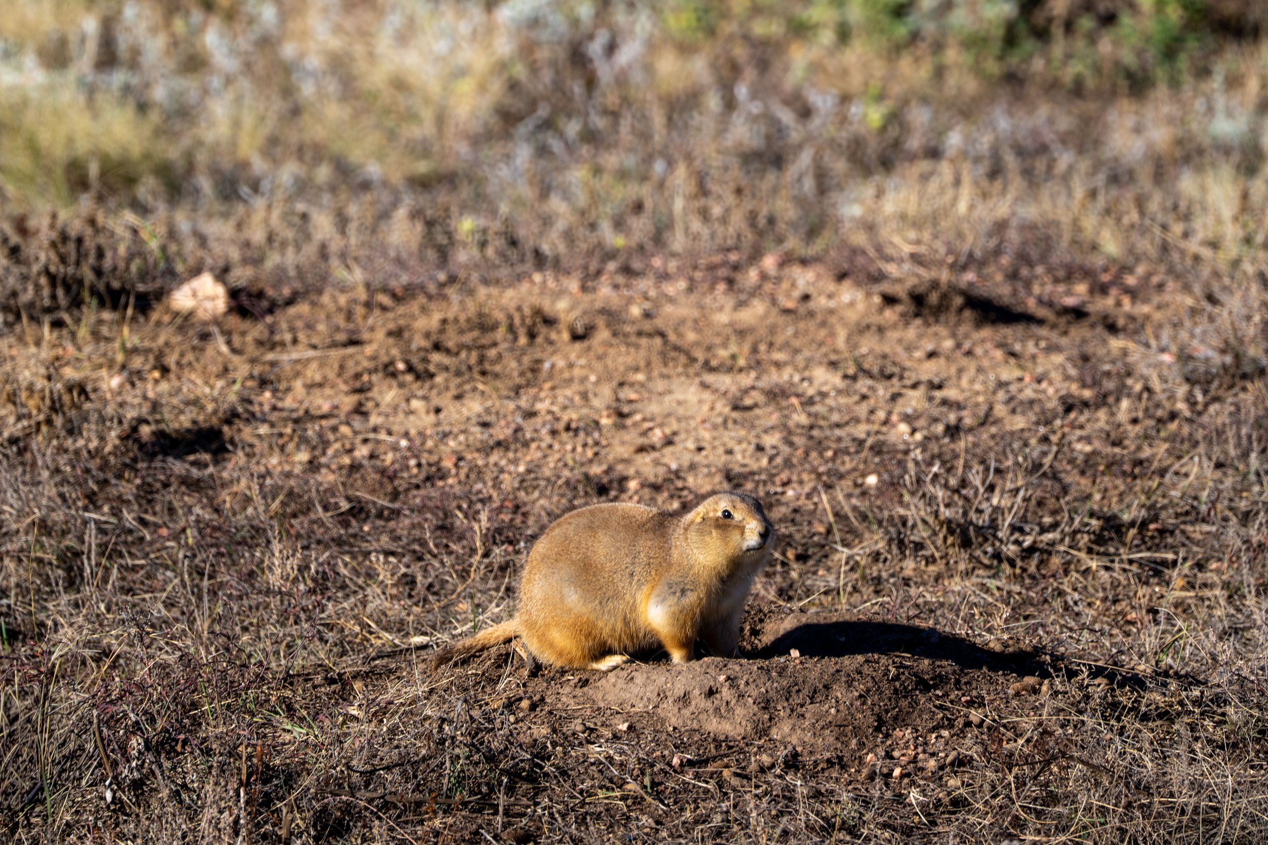
This is a perfect example of what the Bison do when they try to put their weight on the trail markers in Wind Cave National Park.
In any case, the East Bison Flats Trail curves slightly to the right at this point, but don’t turn right, as the trail overall continues north.
This is one of many wildlife trails across the Bison Flats in Wind Cave, which can make hiking across many sections of the prairie confusing, as the East Bison Flats Trail does not cut right like the trail would indicate.
This is roughly the 0.2-mile (0.3 km) mark following the high point, and it’s where, in my experience, the East Bison Flats Trail started to become easier to navigate.
The Bison hair caught in this trail marker is a perfect example of what they do when they scratch themselves on the posts throughout the park.
These trails, again, are more examples of how the East Bison Flats Trail simply heads north across the Bison Flats, as opposed to following one of these alternative paths.
These sections are a somewhat similar reminder of the Alkali Flat Trail in White Sands National Park, which also follow more of a general direction, as opposed to a trail across the gypsum dunes.
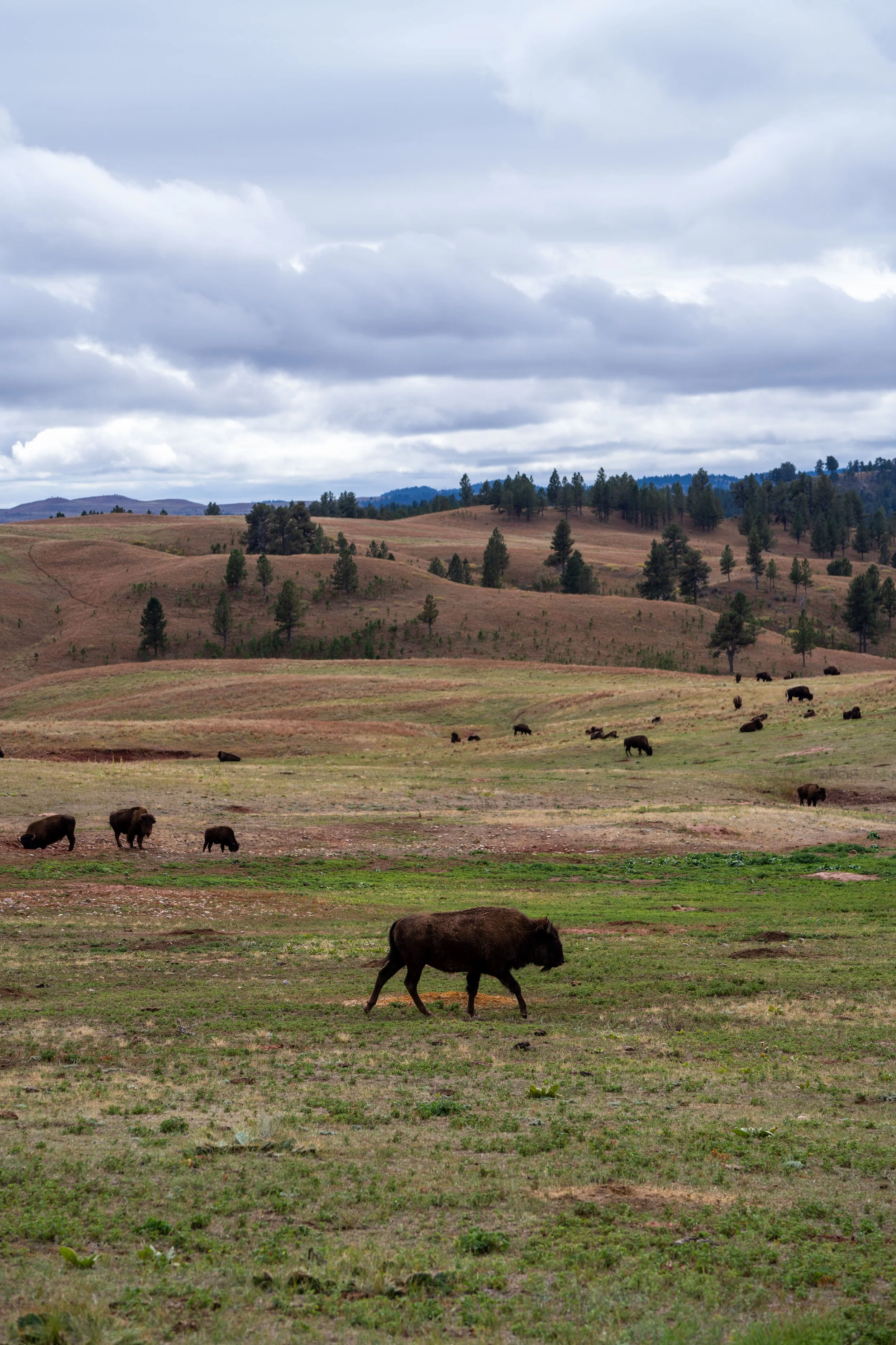
Why is There a Fence Between the Bison in Wind Cave National Park and Custer State Park?
To the blind eye, seeing a fence separate the Bison you see on Wildlife Loop Road and Wind Cave National Park may seem counterintuitive, but it all comes down to one thing: genetics!
According to the National Park Service, there are only two Bison herds in the United States with truly pure American Bison genes. They are the herds in Wind Cave National Park and Yellowstone National Park, a standard that not even the adjacent herds in Grand Teton National Park can live up to.
This is a result of Bison in North America being hunted from the tens of millions prior to the 1800s down to numbers in the hundreds by the 1880s. To try to fix the problem, private herd owners bred Bison and cattle together, which is where cattle genes that appear in the Bison genome come from today.
Following these disorganized conservation efforts, some of these herds were subsequently relocated to public lands, which is why cattle genes have spread and are found in populations across parks today.
However, there are a few herds that reflect the genome of what the American Bison once was, which is why the herd in Wind Cave National Park is so special and rare!
Once again, I cannot stress the importance of wearing a hooded sun shirt on the East Bison Flats Trail—especially if you plan a roundtrip hike after reaching Wind Cave Canyon.
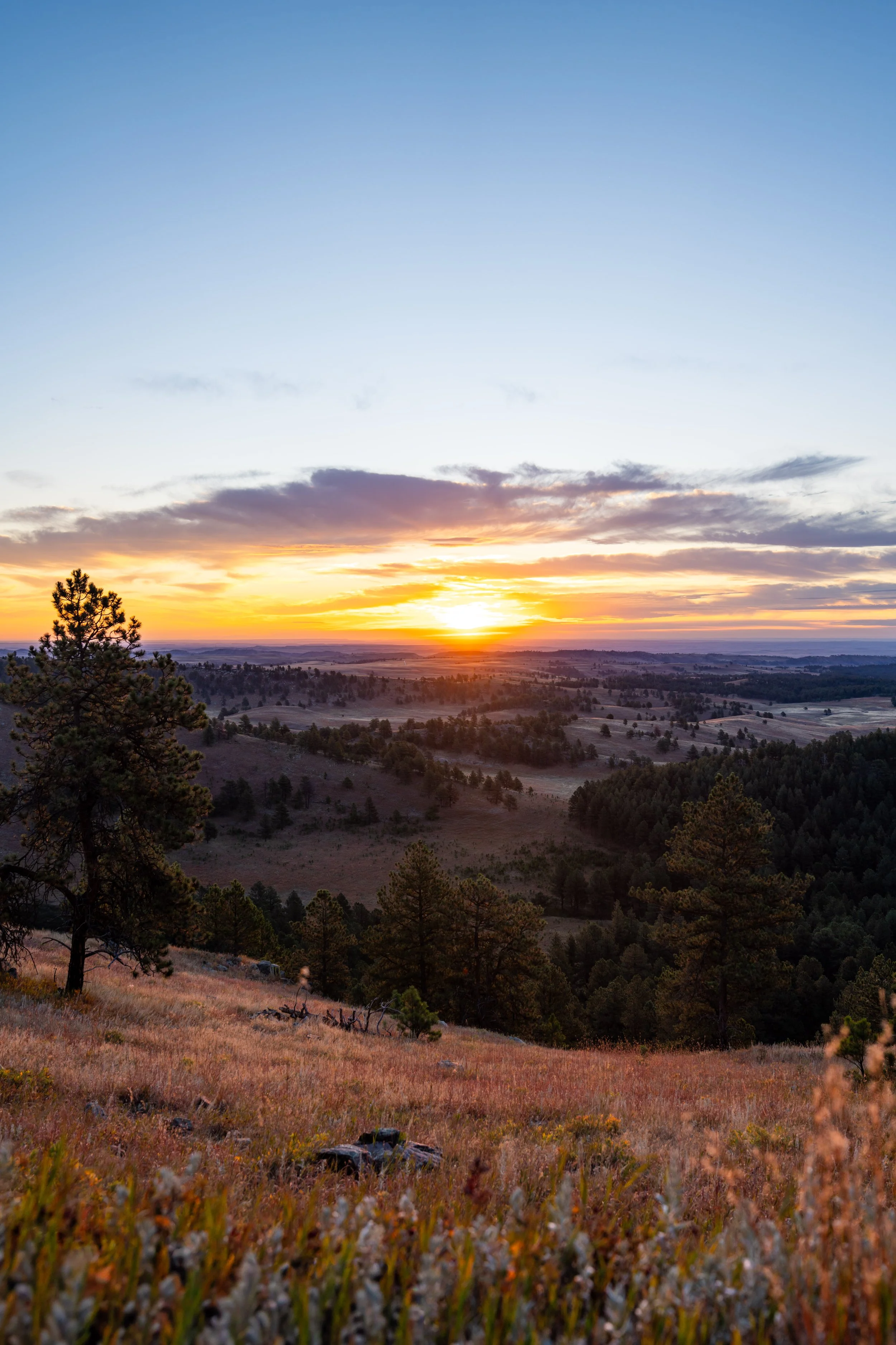
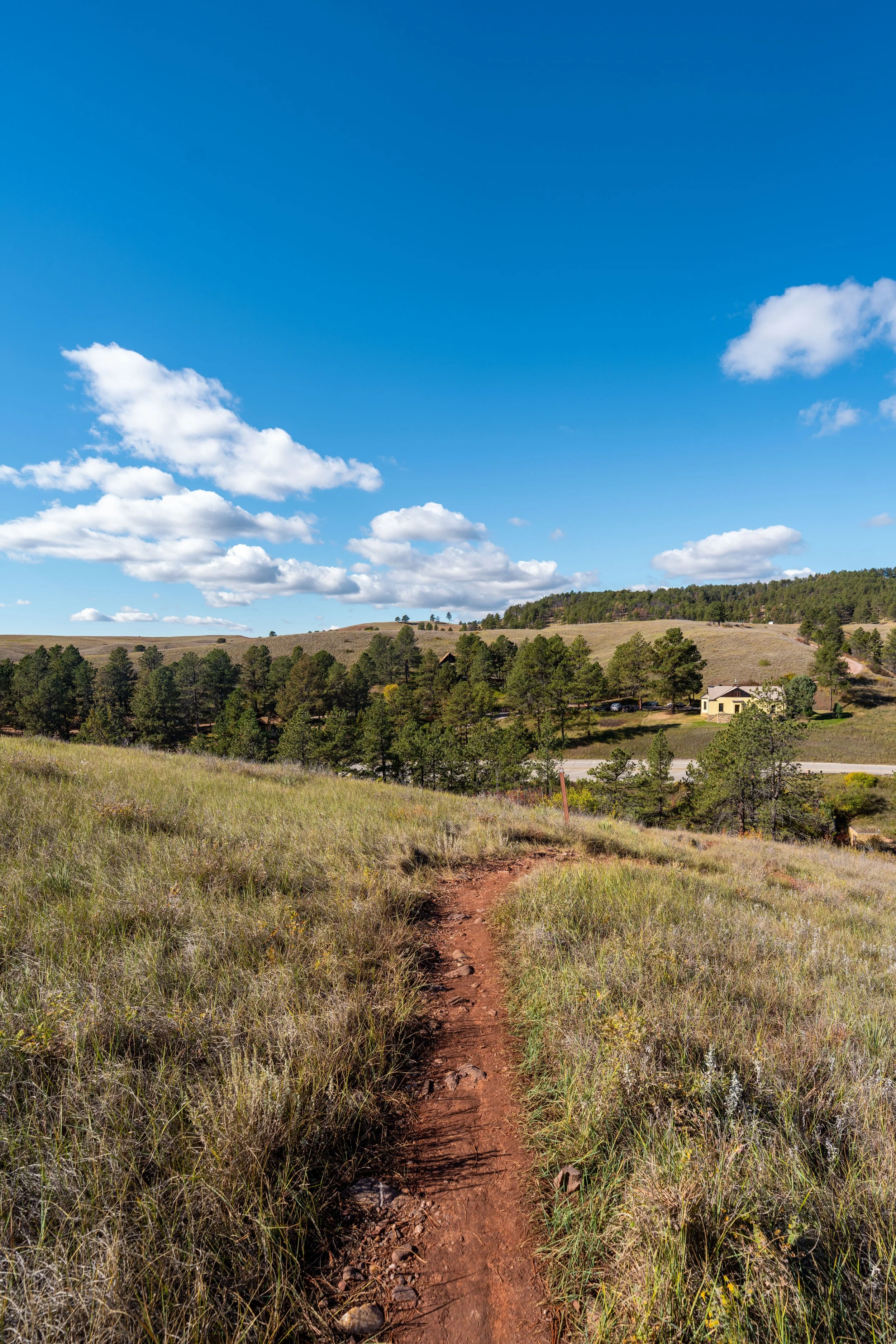
This is the beginning of the final descent into Wind Cave Canyon—meaning there is roughly 0.7 miles (1.1 km) left from this point to the junction at the bottom.
The nice thing about hiking down into Wind Cave Canyon is that the descent is much more gradual compared to the descent into Gobbler Canyon at the beginning of the hike.
East Bison Flats-Wind Cave Canyon Junction
The end of the East Bison Flats Trail is this junction with the Wind Cave Canyon Trail.
This is why I previously mentioned that the East Bison Flats Trail can be treated as a one-way hike by planning a ride from someone in your party and hiking out to the Wind Cave Canyon Trailhead.
That said, go left at this junction to begin hiking toward the Wind Cave Canyon Trailhead, about 0.5 miles (0.8 km) from this point, or the Wind Cave Canyon Trail to the east (right) can be taken to reach the Highland Creek Trail, as well as the same wildlife fence from the beginning at this article at end of Wind Cave Canyon.
If you decide to turn back to re-hike the East Bison Flats Trail at this point, I do feel that the hike across the Bison Flats gets easier to navigate on the return hike, as the trees near the high point serve as a better visual indicator of the correct direction, as opposed to hiking north as outlined in this article.
Read My Separate Post: Wind Cave Canyon Trail