Hiking the Alkali Flat Trail in White Sands National Park
Distance: 4.6 miles / 7.4 km
The Alkali Flat Trail is easily one of the most beautiful day hikes in White Sands National Park, and it’s the best trail to truly immerse yourself in the vastness that is White Sands!
However, the Alkali Flat Trail is the longest-established trail in all of White Sands, and being the case, it is the most challenging day hike in the park.
That being said, I don’t normally classify hikes as being difficult based on distance alone, but hiking in White Sands National Park is unlike anywhere else that you’re likely accustomed to.
I say this because all of the established trails in the dune fields don’t follow a 'trail' in the sense of a path, but rather, the Alkali Flat Trail, and others, follow a series of spaced-out trail markers placed in the dunes to navigate from point to point.
Therefore, when one of these markers gets knocked down by the wind, buried, or visibility is limited because of the wind, navigating from point to point can be challenging and sometimes dangerous—especially during the hotter summer months!
This is all to say that I still highly recommend hiking the Alkali Flat Trail. However, it should only be undertaken by those with good hiking skills and navigational awareness in order to stay safe in this beautiful but unforgiving landscape.
Alkali Flat Trailhead Parking
The Alkali Flat Trailhead is the furtherest trailhead off Dunes Drive, located about 7.4 miles (11.9 km) from the visitor center.
The trailhead area is one of the largest parking areas in all of White Sands National Park because visitors not only come here for the hike, but nearby the dunes are a great drive-up location to go sledding!
Google Maps Directions: Alkali Flat Trailhead
Hiking Checklist - White Sands
Here is a complete list of must-have things that you will want for any hike in White Sands National Park.
Hiking the Alkali Flat Trail
The Alkali Flat Trail, also called the Alkali Flat Loop Trail, begins to the west of the parking area where the trail splits into the loop, about 0.1 miles (0.2 km) into the hike.
The importance of hiking with at least 3-4L of water cannot be understated on the Alkali Flat Trail, especially if you are visiting White Sands during the warmer summer months!
With that in mind, it’s best to try and hike the Alkali Flat Trail during the cooler hours of the day if you are visiting during the summer months, because the dangers associated with the sun and heat-related exposure are far more elevated.
This is exactly why navigating the Alkali Flat Trail and others, like the Backcountry Camping Loop, can be so challenging!
On windy days like this, footprints can disappear quickly in the heart of the dune field.
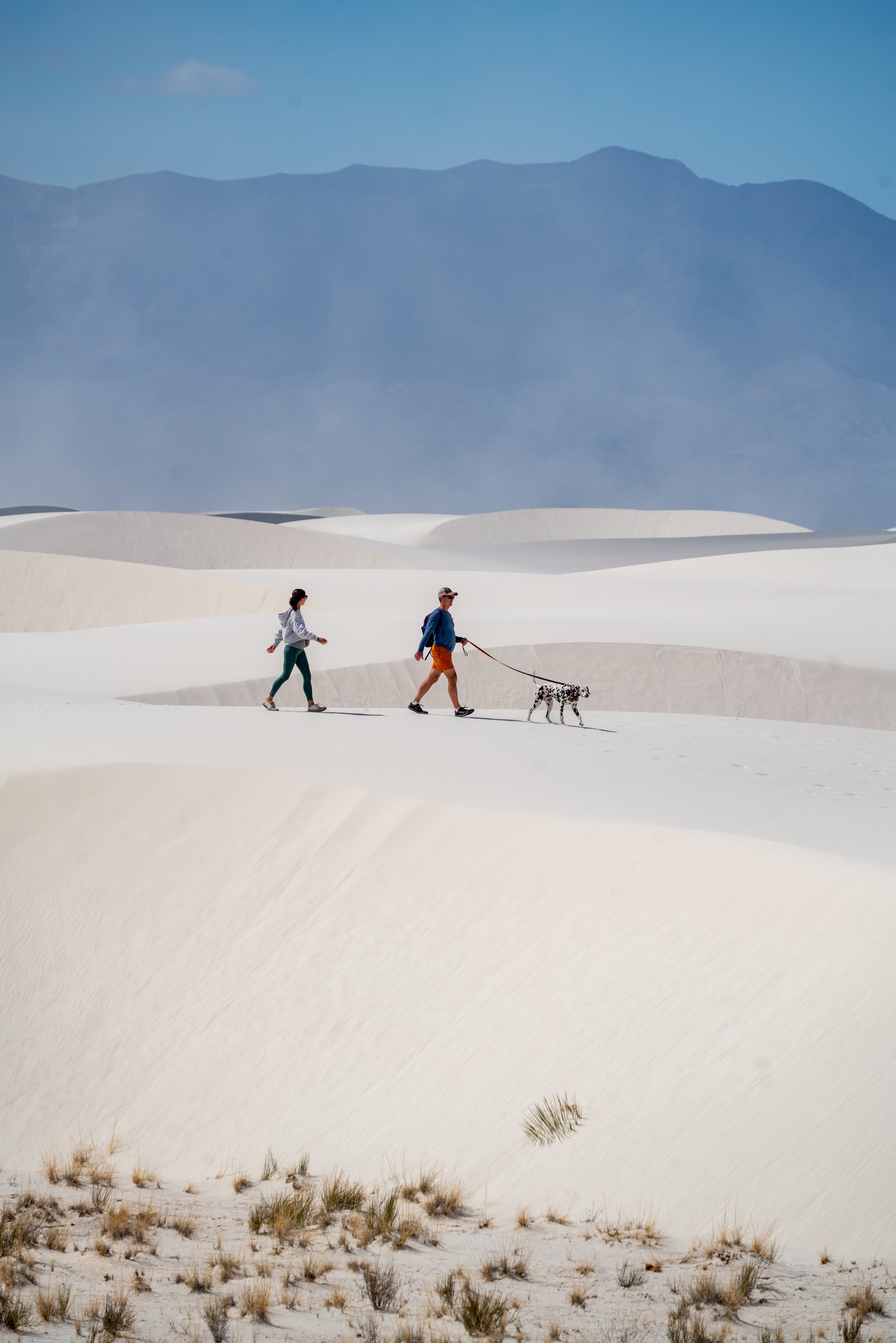
Once in the heart of the Barchanoid Dune Field, the opportunities for beautiful photos are seemingly endless.
One of my favorite photos to take in a landscape like this is a compression shot, where someone stands a few ridges away from the photographer, and the scene is compressed using a longer lens of 70mm or likely much greater.
Believe me, I do see the limitation that these similar-looking photos have to one another, but at the least, I hope they give an idea of what some less-than-ideal conditions look like when the sand gets stirred up by the wind.
In my opinion, some of the most beautiful photography angles can be taken along the edges of these untouched dunes, but for most conditions during the day, a polarizer is necessary because the white sand acts like snow, essentially blowing out the shot if you aren’t using one.
That being said, the polarizer below is one that I’ve trusted and used for many years, which is very universal for a variety of camera lenses.
If you look closely, you can see at least three different trail markers in the photo below, which I hope helps to understand how easy it can be to get off track—especially when visibility in the dunes is limited!
Alkali Flat
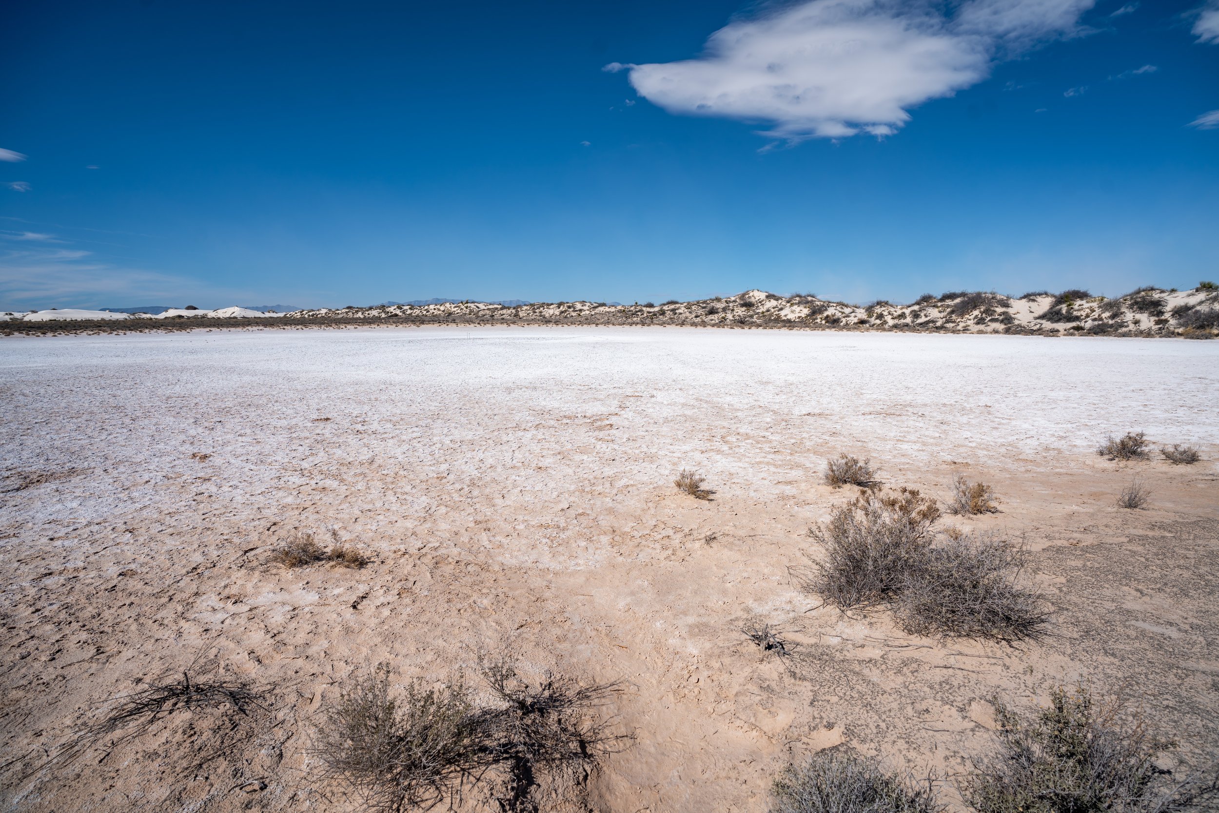
Contrary to what the dunes in White Sands National Park may seem like, the sand dunes are not endless; hence the name, Alkali Flat.
In short, the Alkali Flat Trail traverses through the heart of the dunes until it almost abruptly ends on the Alkali Flats, a dry lakebed of Lake Otero, which is an ancient 1,600-square-mile lake that covered much of the Tularosa Basin.
From the start of the Alkali Flats, the trail only extends for another 0.25 miles (0.4 km) until the sign in the next photo below.
Zone of Co-operative Use - (Restricted Area)
The very far end of the Alkali Flat Trail is the beginning of the Zone of Co-operative Use, a restricted area that is accessible by permit only.
To give further context, White Sands National Park was established in December of 2019 as part of the 2020 National Defense Authorization Act because the original boundaries of the former White Sands National Monument were established prior to the expansion of the White Sands Missile Range.
Over time, there were logistical issues and safety concerns about military testing activities that occurred in close proximity to public areas. Therefore, a land exchange was sought as a solution that benefited both parties. The military received approximately 2,800 acres of land, formerly within the National Monument’s boundaries, and the National Park Service acquired roughly 5,700 acres of land that used to be part of the missile range, expanding the overall park area and moving some military boundaries further away from public areas, creating a more cohesive area for preservation and visitor experience.
This is all to say that venturing beyond this sign was not only illegal but also very dangerous on account of the remoteness of the vast, harsh, and unforgiving desert.
On the return hike, the Alkali Flat Trail begins by splitting to the left, away from trail markers shown above.
That being said, both sides of the loop are generally quite difficult to see from the other, with the exception of the very beginning and far ends of the trail.
In my experience, the north side of the loop was a little trickier to navigate, but I’m sure this can change over time, as the National Park Service adjusts these trail markers.
The one thing I have yet to mention is to be careful when running down the dunes, like in this first photo to the next.
It’s not very apparent, but the bottom of the dunes can feel as hard as concrete, meaning that with each step you may be used to some give in the sand until you’re abruptly met with a surface that has no give.
This hard transition can really increase the risk of serious injury, which is why I recommend slowing down when you’re near the bottom of a sand dune.
This is where the Alkali Flat Trailhead starts to become visible once again.
Overall, I highly recommend hiking the Alkali Flat Trail, as no other day hike in White Sands feels as immersed in the beautiful white sand dunes as this 4.6-mile (7.4 km) trail.
However, that does not go without saying that the out-and-back loop to the Alkali Flats is the most challenging and remote established trail in the park.
Therefore, I highly recommend coming to White Sands with a good headlamp, especially if you plan to watch the sunset in the dune field.
All said, the headlamp options below are the ones that I use and trust for my own adventures, and I would never recommend anything that I don’t personally use!


