Hiking the Cold Brook Canyon Trail in Wind Cave National Park
Distance: 2.8 miles / 4.5 km
The Cold Brook Canyon Trail in Wind Cave National Park is a short and easy out-and-back day hike just to the south of the visitor center that leads hikers through a beautiful, winding drainage to the park’s westernmost boundary.
That said, the Cold Brook Canyon Trail can most similarly be compared to the Wind Cave Canyon Trail just to the north, as the two navigate their way through different but similar canyons, abruptly ending where they meet the wildlife fence that keeps the Bison inside Wind Cave National Park.
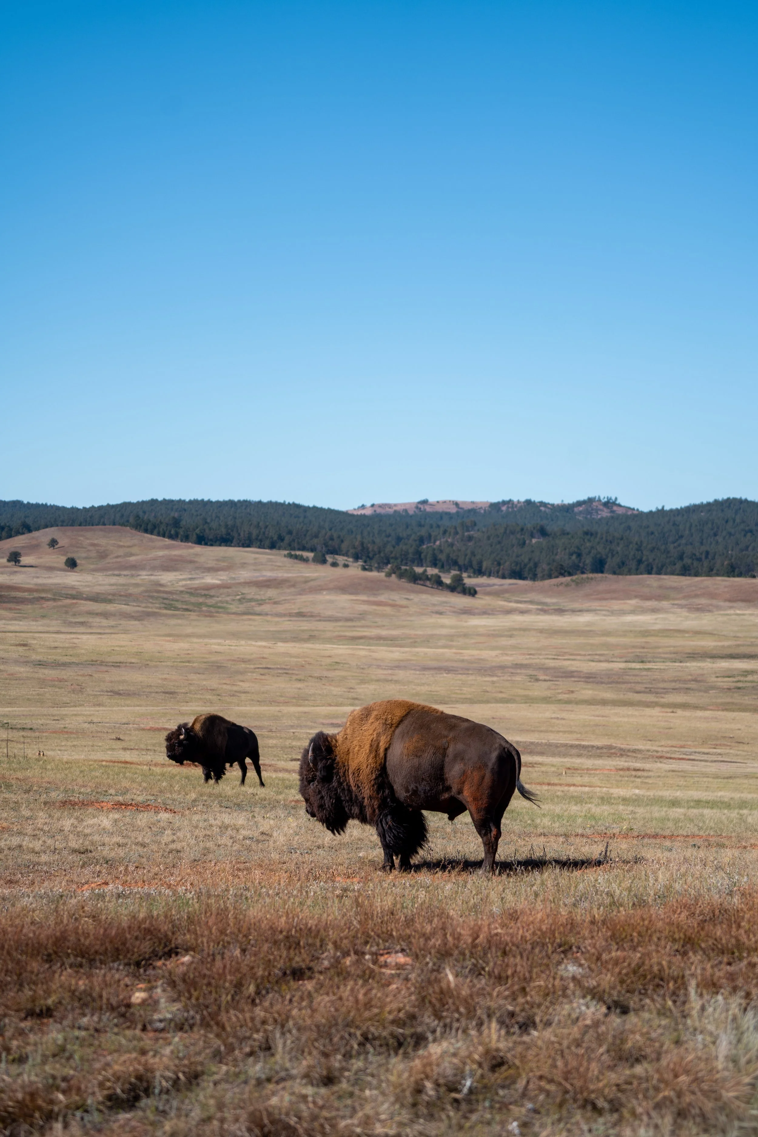
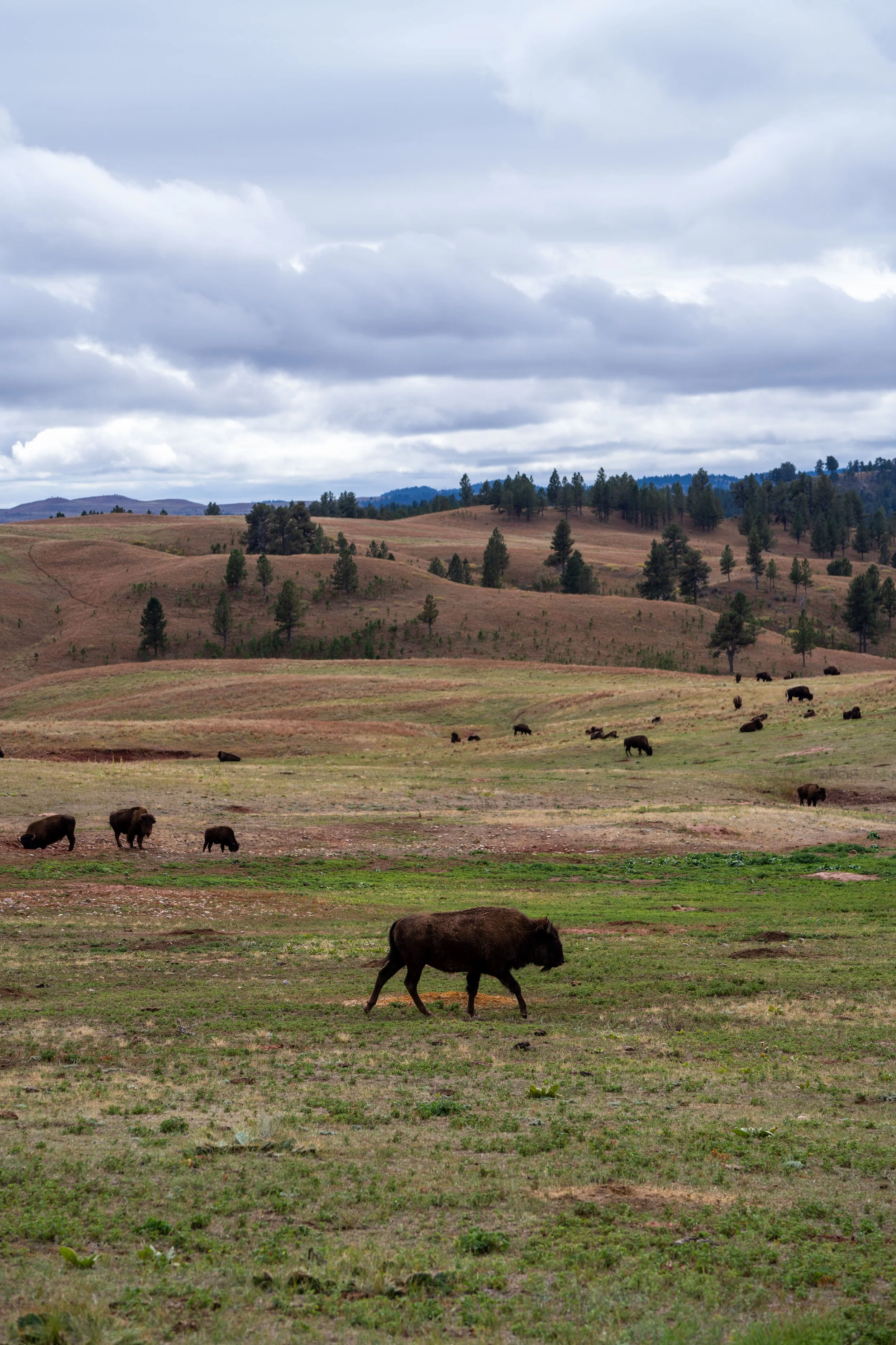
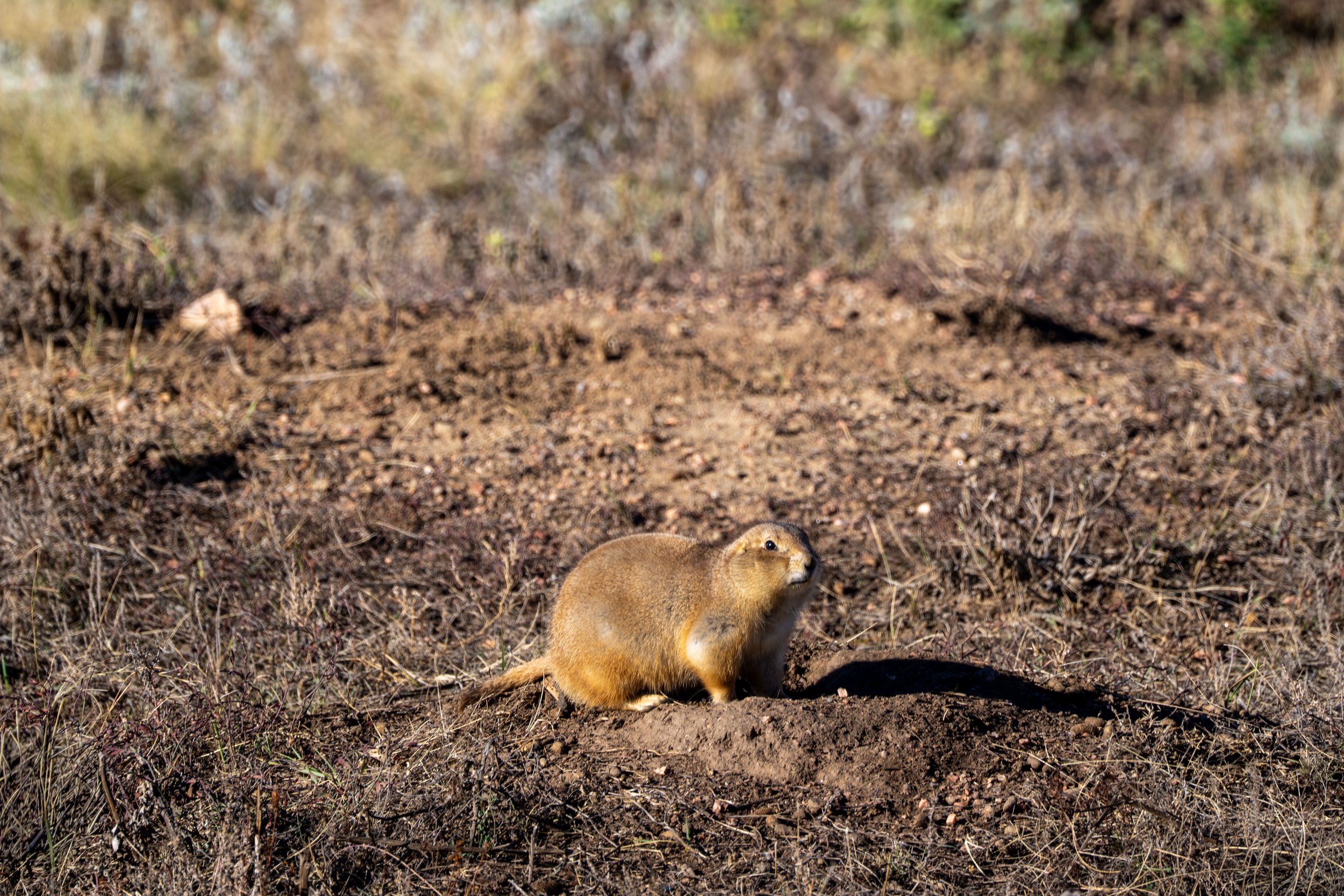
If you’re trying to decide between the two, I personally think the Cold Brook Canyon Trail was easier overall and better for seeing wildlife, like Coyotes, Elk, Bison and Prairie Dogs, but the Wind Cave Canyon Trail is unique in that it feels like a much deeper, closed-in canyon, as opposed to Cold Brook Canyon, which is more wide open.
U.S. National Park Pass
There is no entrance fee to visit Wind Cave National Park.
However, entrance fees are collected at Badlands National Park and Devils Tower National Monument, which is why I recommend purchasing your National Park pass in advance before traveling to the Black Hills.
Cold Brook Canyon Trailhead Parking
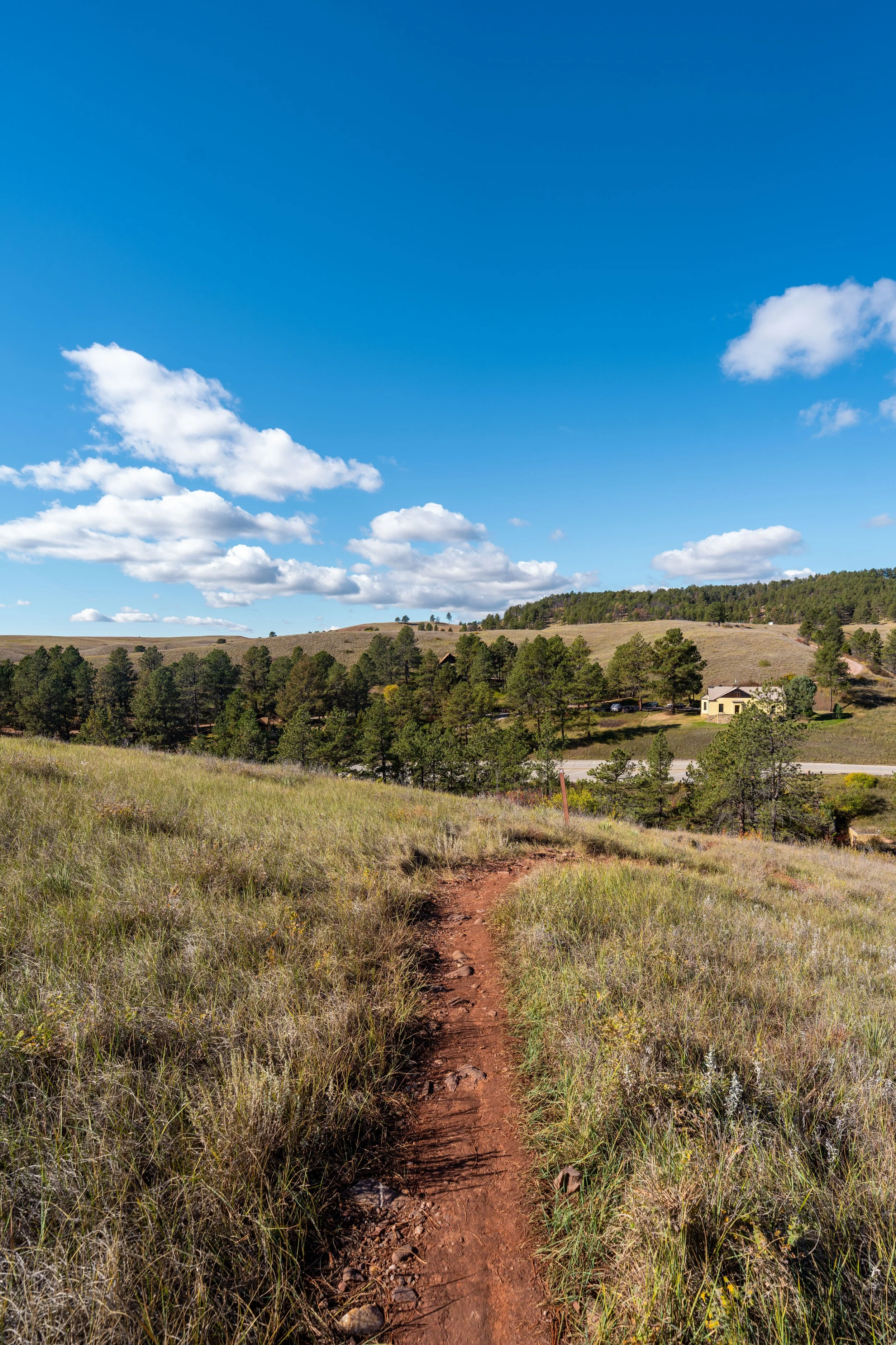
Parking for the Cold Brook Canyon Trail is located in a small parking lot directly off Highway 385, about 1.3 miles (2.1 km) south of the southern junction to the Wind Cave Visitor Center.
Google Maps Directions: Cold Brook Canyon Trailhead
Hiking Checklist - Wind Cave
Here is a complete list of must-have things that you will want for any hike in Wind Cave National Park.
Hiking the Cold Brook Canyon Trail
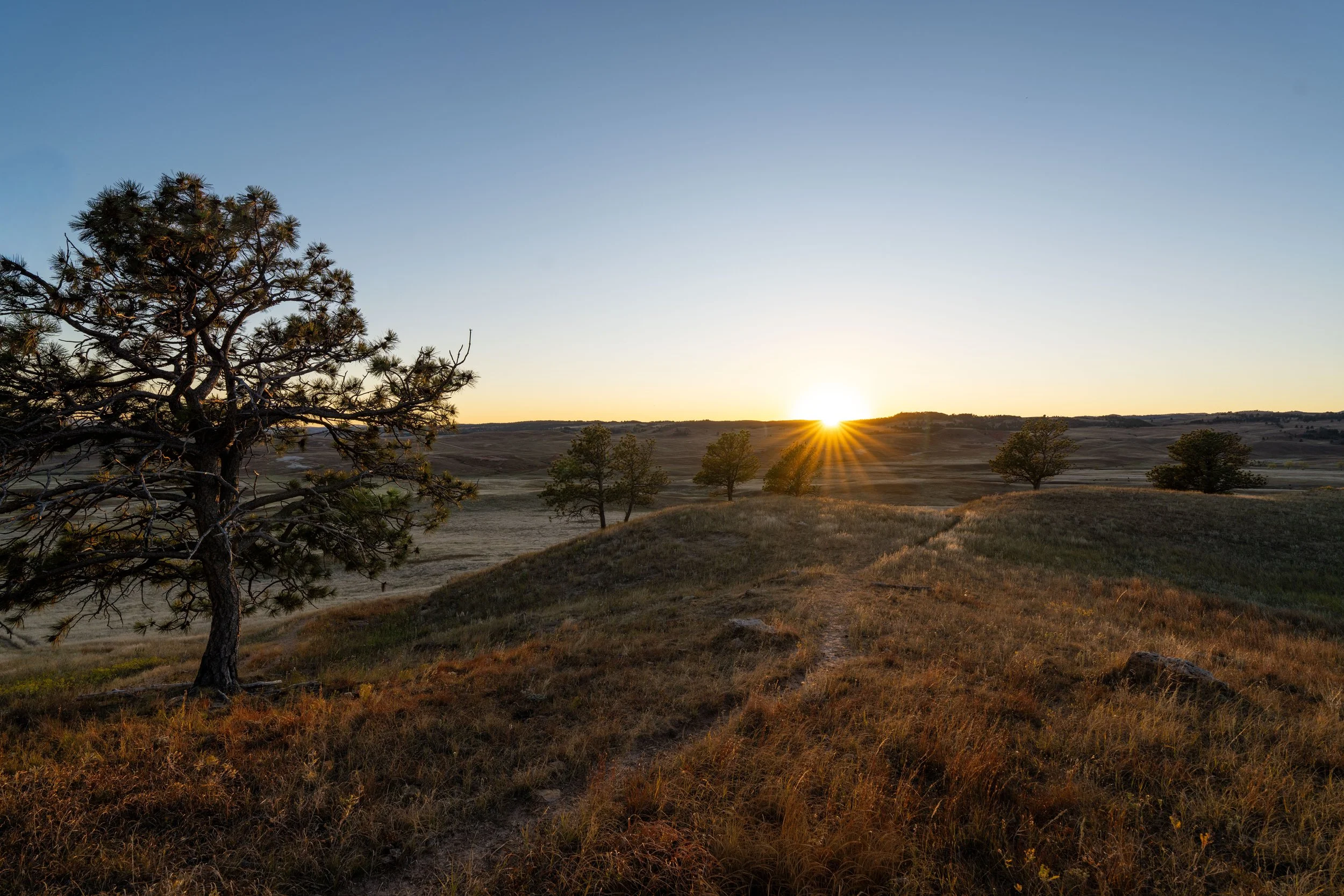
The Cold Brook Canyon Trailhead is the highest point on the entire hike.
This means that, from this point, the Cold Brook Canyon Trail begins a fairly gradual but easy descent into the canyon, which levels out after just 0.25 mile (0.4 km) once at the bottom.
This is where the Cold Brook Canyon Trail more noticeably begins descending, losing about 100 ft. (30.5 m) overall until the trail levels out at the bottom.
Just before the bottom of the descent, the Cold Brook Canyon Trail makes a hard right turn down the only switchback on the entire trail.
This is the bottom of the 100-ft. (30.5 m) descent from the trailhead off Highway 385.
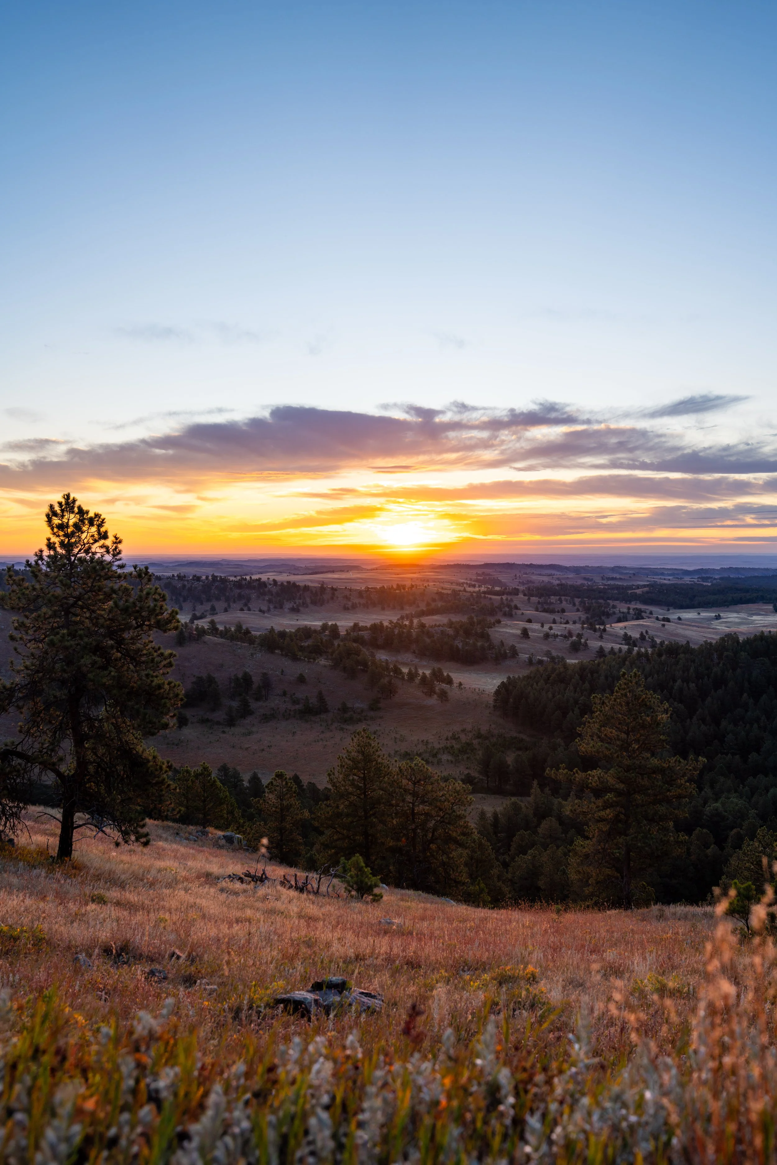
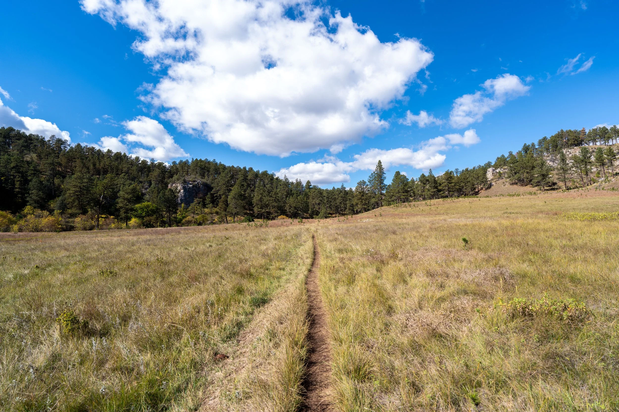
When the Cold Brook Canyon Trail reaches the bottom, the trail becomes much flatter as it winds its way across a wide-open, expansive prairie until the walls of Cold Brook Canyon begin to close in near the end of the hike.
This is what makes the Cold Brook Canyon Trail so different from the Wind Cave Canyon Trail, which is surrounded by much steeper hillsides for the majority of the hike.
The one thing I hope these photos show more than anything else is that there is very little shade on the Cold Brook Canyon Trail, which is true for most of the day hikes across the open prairies in Wind Cave National Park.
This is why I highly recommend hiking the trail in a hooded sun shirt, as one will certainly be useful here and for countless other adventures across the Black Hills in western South Dakota.
This is where the Cold Brook Canyon Trail passes through a little Prairie Dog town.
The tree line in the distance is where the walls of Cold Brook Canyon start to close in, which is a nice sign that the end of the hike is not far ahead!
This is where the walls on either side start to close in, resembling what the Wind Cave Canyon Trail is like throughout much of the hike.
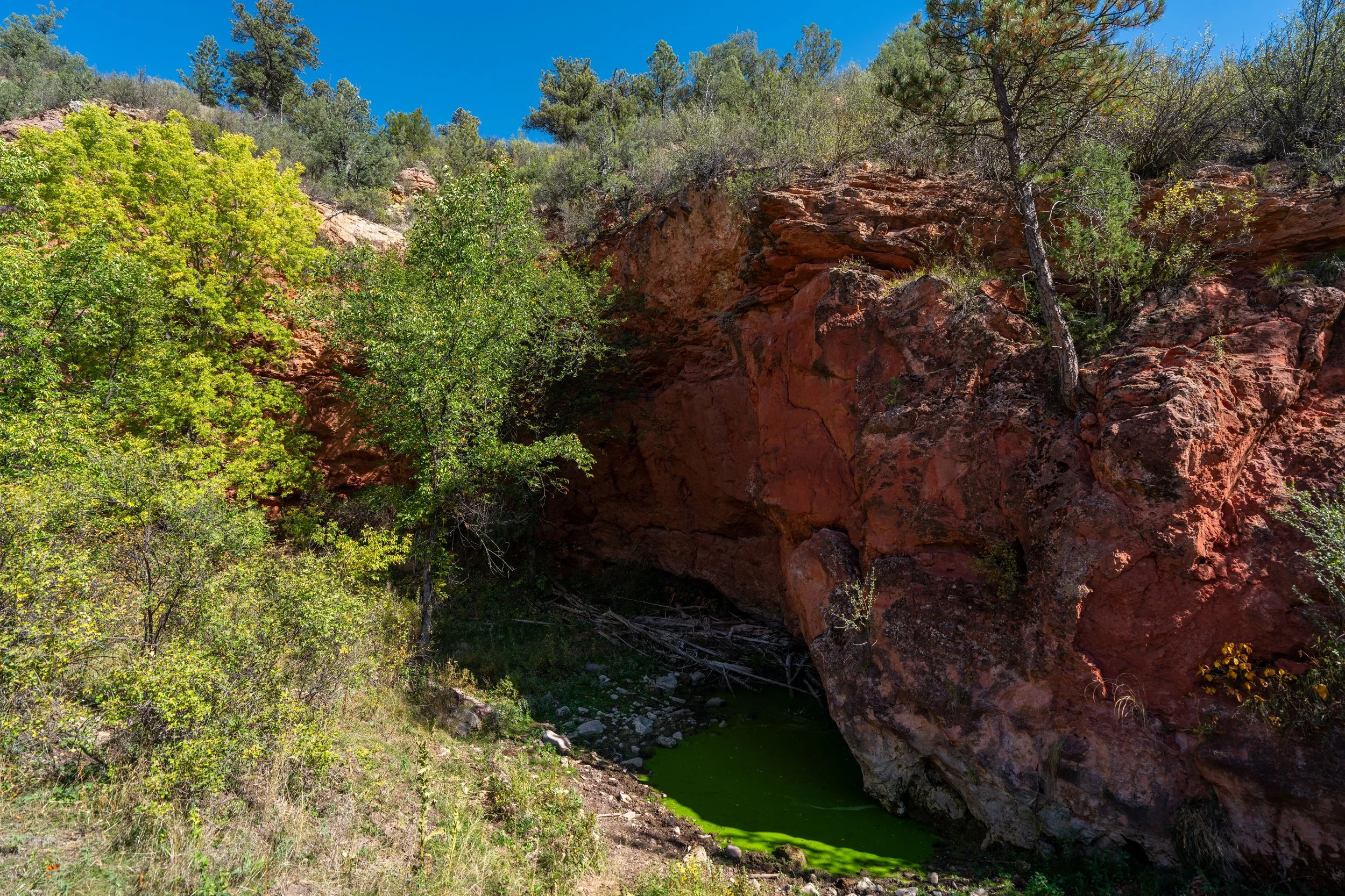
In my opinion, these final sections before the park boundary are the most beautiful parts of the entire Cold Brook Canyon Trail.
End of the Trail
The end of the Cold Brook Canyon Trail is marked by the Wind Cave National Park boundary fence, which also serves as a wildlife fence to keep the park’s genetically pure Bison herd from roaming off and diluting the protected genome.
That said, the far side of the fence is still public land within the Black Hills National Forest, but there is no easy way to cross the fence for those who are interested in exploring further.