Hiking the Highland Creek Trail in Wind Cave National Park
Distance (One Way): 8.7 mile / 14.0 km
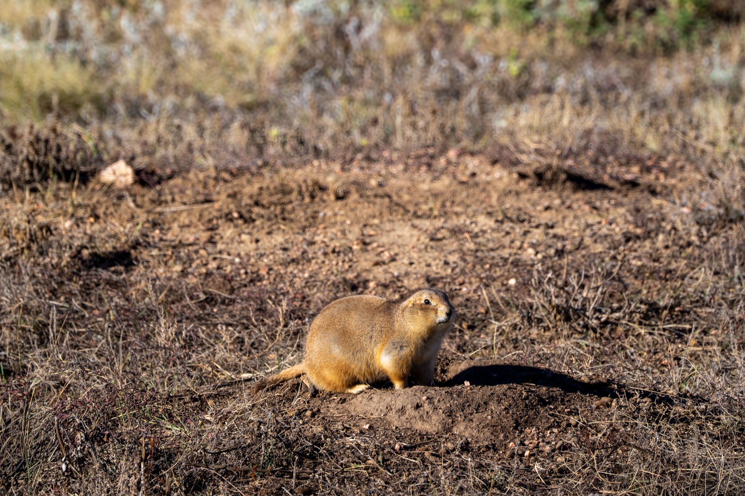
The Highland Creek Trail in Wind Cave National Park is a long day hike through the heart of the Wind Cave backcountry, as it traverses vast stretches of open prairie, in and out of numerous canyons, and has some of the best opportunities to see wildlife, including Bison, Coyotes, Elk, Prairie Dogs, Pronghorns, and more!
The Highland Creek Trail is also the longest and most remote trail in Wind Cave National Park, which is why I’ve only listed the one-way distance from the trailhead off Highland Ridge Road (NPS 5) to Wind Cave Canyon on the southern end.
I did this because it’s very uncommon to hike the entirety of the Highland Creek Trail as outlined in this post. However, if you have someone in your party uninterested in the full hike, or even part of the hike, the Highland Creek Trail can easily be shortened by hiking out to one of many different trailheads to the west and scheduling a pickup.
Furthermore, all the different sections of the Highland Creek Trail can easily be found in this long post by simply using the pop-up bubble in the bottom right-hand corner of the page to skip around to different areas, which should help you plan how much or how little of the full Highland Creek Trail you’re interested in seeing!
How Long is the Highland Creek Trail?
Since most hikers only hike as far as Wind Cave Canyon, I’ve broken down each section of the Highland Creek Trail to help you plan your adventure.
Highland Creek Distances (One Way):
Highland Creek Trailhead to the Sanctuary Trail: 3.3 miles (5.3 km)
Sanctuary Trail to the Centennial Connector Junction: 2.4 miles (3.9 km)
Centennial Connector Junction to the Lookout Point Trail: 0.6 miles (1.0 km)
Lookout Point Trail to Wind Cave Canyon: 2.4 miles (3.9 km)
Total Distance (One Way): 8.7 miles (14.0 km)
U.S. National Park Pass
There is no entrance fee to visit Wind Cave National Park.
However, entrance fees are collected at Badlands National Park and Devils Tower National Monument, which is why I recommend purchasing your National Park pass in advance before traveling to the Black Hills.
Highland Creek Trailhead Parking
The Highland Creek Trailhead is located in a very small parking area at the sharp 90º bend in Highland Ridge Road (NPS 5), about 2.7 miles (4.3 km) west of Highway 87.
That said, do not be surprised if you are the only vehicle here, as it’s not uncommon to be the only hikers on any day of the week, given that the Highland Creek Trail is the least-trafficked trail in Wind Cave National Park, which says more about the length of the trail than the trail itself.
Google Maps Directions: Highland Creek Trailhead
Hiking Checklist - Wind Cave
Here is a complete list of must-have things that you will want for any hike in Wind Cave National Park.
Hiking the Highland Creek Trail
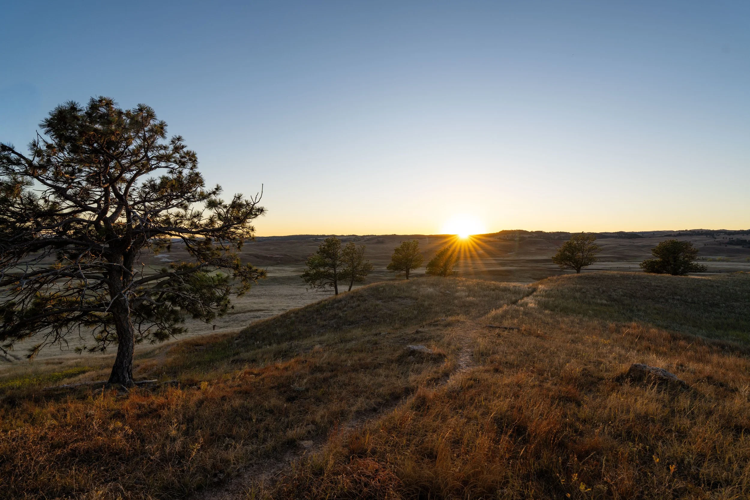
The Highland Creek Trail begins on a wide open, featureless prairie, meaning the only apparent landmarks around are this trailhead sign and the Ponderosa Pines far in the distance.
However, this trend doesn’t last long, as only the very beginning of the Highland Creek Trail feels this expansive, while the rest of the hike navigates its way in and around numerous drainages and vast stretches of forest.
This is why the Highland Creek Trail, while seemingly long, actually moves very quickly, as it isn’t overly strenuous in any way—apart from hiking it on a hot, cloudless summer day.
In the beginning, and the immediate sections that follow the Lookout Point Loop, the trail markers are incredibly useful for staying on track.
After just 0.3 miles (0.5 km), the Highland Creek Trail starts to get hillier, which is mentally nicer than the very flat sections at the very beginning.
At this point, the Highland Creek Trail turns right off the ridge.
This split is where the Highland Creek Trail starts to turn toward the southeast, which can be very clearly seen on a map of the trail.
That said, go right here to continue following the trail markers toward the Sanctuary Trail.
After the split, the Highland Creek Trail heads directly toward Highland Creek, the only time on the entire hike that it crosses this drainage.
Highland Creek
At about 1.6 miles (2.6 km), the Highland Creek Trail crosses Highland Creek for the first and only time during the entire hike.
However, this low point will most likely be dry outside of peak-season snowmelt in the late spring.
This is roughly the halfway point between the Highland Creek Trailhead and the Sanctuary Trail junction.
This is where the Highland Creek Trail makes a sharp right turn to the north before it begins to turn back west and eventually south again toward the Sanctuary Trail.
About a short 0.3-mile (0.5 km) section to the north, the Highland Creek Trail makes a distinct turn to the west, which can clearly be seen on a map of the trail.
This left-hand turn is where the Highland Creek Trail turns back to the south, meaning the Sanctuary Trail is a little less than 0.5 miles (0.8 km) away from this point.
Highland Creek-Sanctuary Junction
After 3.3 miles (5.3 km), the Highland Creek Trail reaches the first of three side trails before Wind Cave Canyon.
That said, the Sanctuary Trail to the Centennial Trail is the shortest and most practical choice for hikers to turn around and create a loop with Highland Ridge Road (NPS 5).
However, to continue on the Highland Creek Trail toward Beaver Creek Canyon and the Lookout Point Loop Trail, go straight (left) at this split.
Read My Separate Post: Sanctuary Trail
After the Sanctuary Trail, the Highland Creek Trail continues south across a number of rolling hills toward Limestone Canyon and the Lookout Point Loop Trail shortly thereafter.
This section, between the Sanctuary Trail and the start of the descent into Beaver Creek Canyon (Limestone Canyon), measures roughly 1.5 miles (2.4 km).
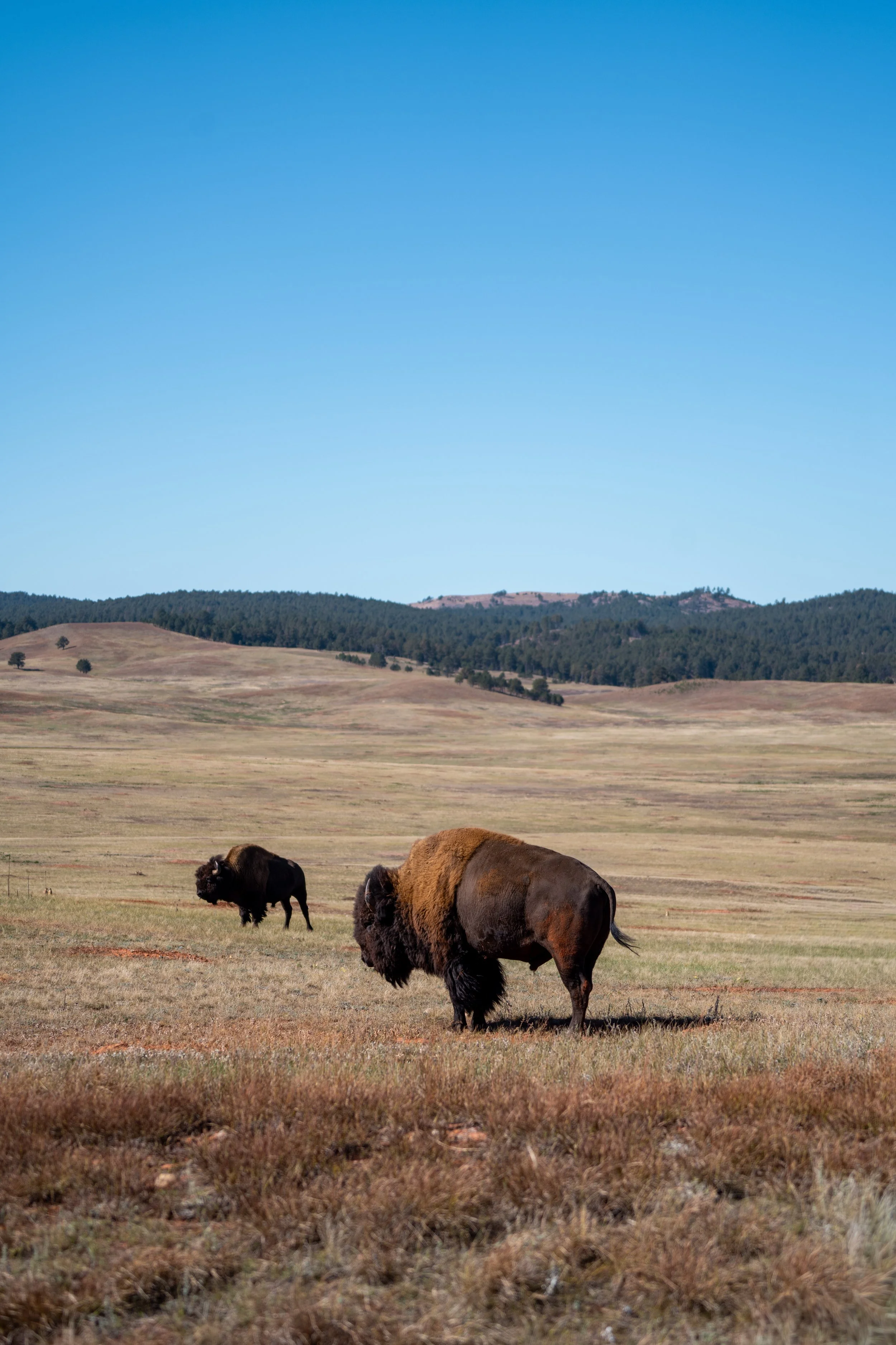
Why is There a Fence Between the Bison in Wind Cave National Park and Custer State Park?
To the blind eye, seeing a fence separate the Bison you see on Wildlife Loop Road and Wind Cave National Park may seem counterintuitive, but it all comes down to one thing: genetics!
According to the National Park Service, there are only two Bison herds in the United States with truly pure American Bison genes. They are the herds in Wind Cave National Park and Yellowstone National Park, a standard that not even the adjacent herds in Grand Teton National Park can live up to.
This is a result of Bison in North America being hunted from the tens of millions prior to the 1800s down to numbers in the hundreds by the 1880s. To try to fix the problem, private herd owners bred Bison and cattle together, which is where cattle genes that appear in the Bison genome come from today.
Following these disorganized conservation efforts, some of these herds were subsequently relocated to public lands, which is why cattle genes have spread and are found in populations across parks today.
However, there are a few herds that reflect the genome of what the American Bison once was, which is why the herd in Wind Cave National Park is so special and rare!
While I may have gotten lucky with an overcast day, the Highland Creek Trail traverses long, shadeless miles of open prairie.
This is why I highly recommend hiking the trail in a hooded sun shirt, as one will certainly be useful here and for countless other adventures across the Black Hills in western South Dakota.
At this split, it makes no difference which path you choose to follow, as they both meet again shortly ahead.
This is where both sides meet again.
This is Western Poison Ivy, which is very common in Wind Cave National Park and the greater Black Hills area.
That said, it’s highly recommended that you learn to identify it if you plan to do any hiking here or elsewhere across western South Dakota.
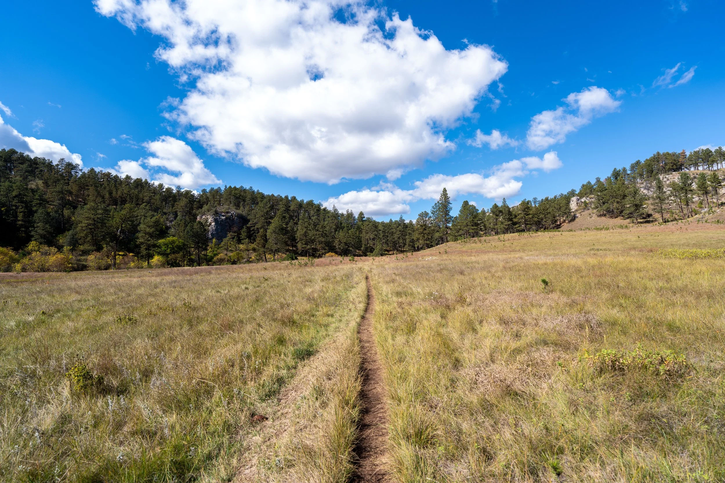
This long stretch of open prairie is the last before the Highland Creek Trail begins descending Limestone Canyon to Beaver Creek Canyon at the bottom.
The corner of this fence is where the Highland Creek Trail passes the old park boundary that can be seen on outdated maps of Wind Cave National Park.
However, this fence line is no longer the park boundary, as Wind Cave National Park added about 5,556 acres (22.5 km²) in September 2011 in an expansion known as the Casey Addition.
This is where the Highland Creek Trail noticeably begins descending into Limestone Canyon, a branch off the larger Beaver Creek Canyon.
From this point, the trail will lose about 275 ft. (84 m) to reach the creek at the bottom.
Beaver Creek Canyon
After 0.5 miles (0.8 km), the Highland Creek Trail exits Limestone Canyon and reaches the bottom of Beaver Creek Canyon, where the trail will remain mostly flat as it winds its way over to the Lookout Point Trail, about 0.4 miles (0.6 km) ahead.
At this split, go right to stay on the Highland Creek Trail.
Beaver Creek
This is where the Highland Creek Trail crosses Beaver Creek, meaning the Lookout Point Loop is just a few steps ahead!
Highland Creek-Centennial Connector Junction
After 5.7 miles (9.2 km), the Highland Creek Trail reaches the Lookout Point Trail, also called the Lookout Point Loop Trail, as the trail heading straight is a great way to loop back through Beaver Creek Canyon to the Centennial Trail and up to the Lookout Point Trailhead.
However, to stay on the Highland Creek Trail, go left at this split to begin the hike up and out of Beaver Creek Canyon.
Read My Separate Post: Lookout Point Loop Trail
For the next 0.6 miles (1.0 km), the Highland Creek Trail and the Lookout Point Trail share the same path up and out of Beaver Creek Canyon.
This is why the trail markers reflect both NPS 4 and 7, but this eventually stops when the Highland Creek Trail reaches the top of the ascent, the same place where the Lookout Point Loop branches away to the west.
This ascent out of Beaver Creek Canyon gains roughly 260 ft. (79 m) from the connector junction at the bottom to the Lookout Point junction at the top.
At this split, it doesn’t matter which direction you decide to go, as the two paths meet again just a few steps ahead.
When the Highland Creek Trail emerges from the trees, the second Lookout Point junction is not far ahead.
Highland Creek-Lookout Point Junction
This split is the second Lookout Point Loop junction and the last time the Highland Creek Trail meets an exit trail prior to Wind Cave Canyon.
That said, go left to continue south on the Highland Creek Trail, beginning the final 2.4 miles (3.9 km) of the hike, not including the hike out of Wind Cave Canyon.
Read My Separate Post: Lookout Point Loop Trail
The southern Lookout Point Loop junction is also surrounded by a large Prairie Dog town!
After leaving the Lookout Point Trail behind, it doesn’t take long for the Highland Creek Trail to begin the second vague, largely featureless section of open prairie, similar to the very beginning of the hike.
To add to this sentiment, I personally think this section—until the Highland Creek Trail reaches a large Bison wallow—is a bit more challenging to navigate than the beginning.
This is why the best advice I have is to simply try and look for the trail markers off in the distance—that is, if the Bison haven’t knocked them down.
The trail markers reading NPS 7 are a good sign you’re on the correct trail after leaving Beaver Creek Canyon!
This is where the Highland Creek Trail turns left to start heading east, the same turn in the trail that is south of the Lookout Point Loop on the park map.
After the turn to the east, the Highland Creek Trail starts to become more defined as it approaches the large Bison wallow mentioned previously.
This is the large Bison wallow I continue to reference, which is also where I had to leave the Highland Creek Trail because a number of Bison were in and around it until I started to walk by.
After the Bison wallow, there is roughly 1.4 miles (2.3 km) left until the end of the Highland Creek Trail at the bottom of Wind Cave Canyon.
Goldenrod is always much prettier when it’s blooming, unlike when I found it on this cooler fall hike here.
Once again, I cannot stress the importance of wearing a hooded sun shirt on the Highland Creek Trail—especially if you plan a roundtrip hike after reaching Wind Cave Canyon!
The treeline in the distance is where the Highland Creek Trail will begin the final descent into Wind Cave Canyon!
This is the beginning of the final descent into Wind Cave Canyon, where the Highland Creek Trail will lose about 300 ft. (91 m) from this point to the bottom.
This descent is roughly 0.6 miles (1.0 km) total, similar to the climb out of Beaver Creek Canyon a few miles back.
This is where the bottom of Wind Cave Canyon can be seen for the first time!
Highland Creek-Wind Cave Canyon Junction
The end of the Highland Creek Trail is this junction at the bottom of Wind Cave Canyon, similar to the end of the East Bison Flats Trail, just 0.6 miles (1.0 km) to the west (right) of here.
That said, if you were crazy enough, like myself, to hike the whole Highland Creek Trail, the most practical option from this point would be to hike out and ideally have a ride waiting for you at the Wind Cave Canyon Trailhead.
However, if this isn’t your scenario, the best and most practical option is to simply turn back to re-hike the Highland Creek Trail, as I can speak from experience: hiking out and walking the road is not worth it!
It’s 1.1 miles (1.8 km) from this point to the Wind Cave Canyon Trailhead, and 11.5 miles (18.5 km) if you decide to walk or run the most direct route back through Wind Cave National Park to the Highland Creek Trailhead.
Take that as you will, but I wish I had chosen to turn back up the Highland Creek Trail, rather than follow the roads.
Read My Separate Post: Wind Cave Canyon Trail