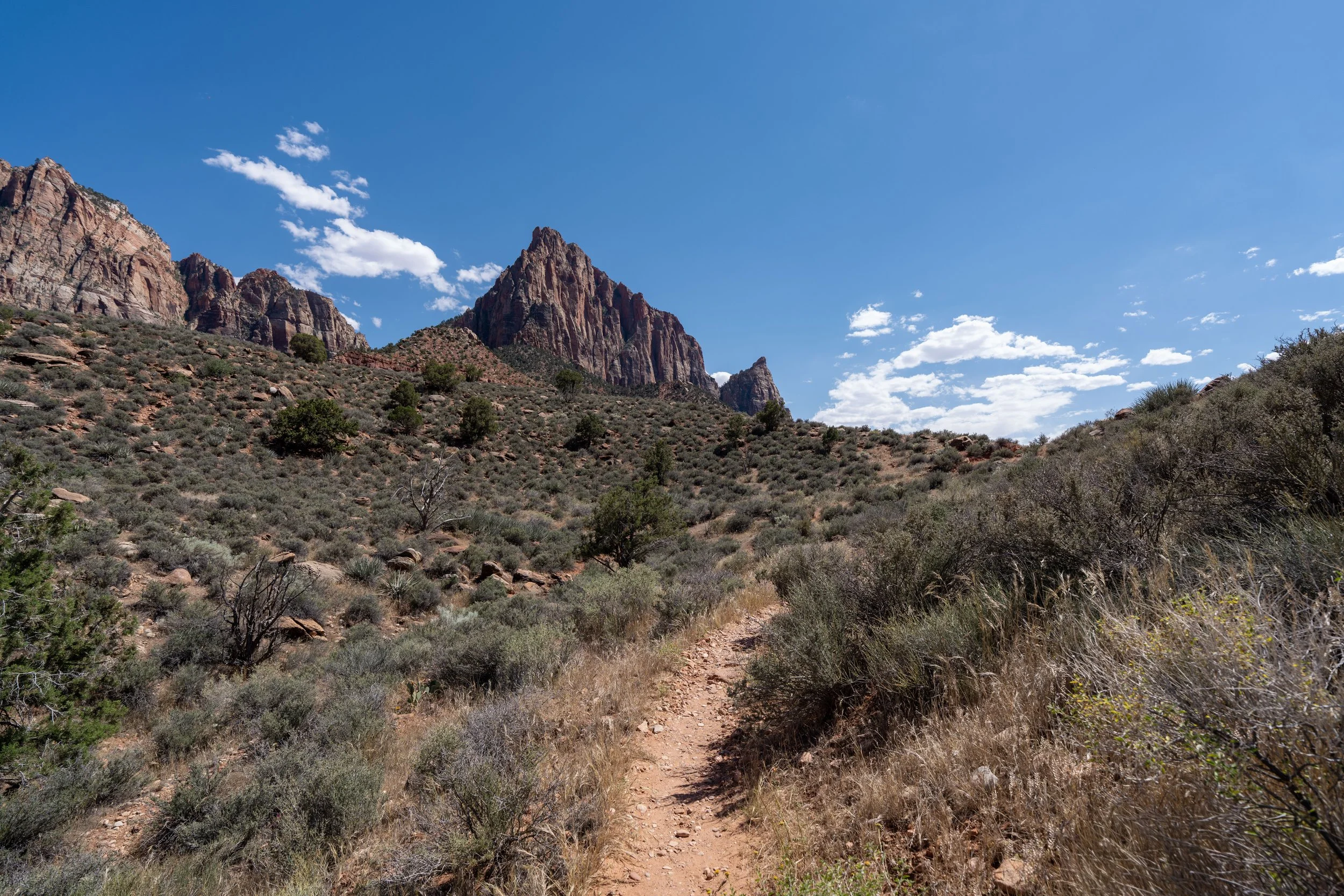
Hiking the Deertrap Mountain Trail in Zion National Park
Distance (RT via Stave Spring): 10.8 miles / 17.4 km
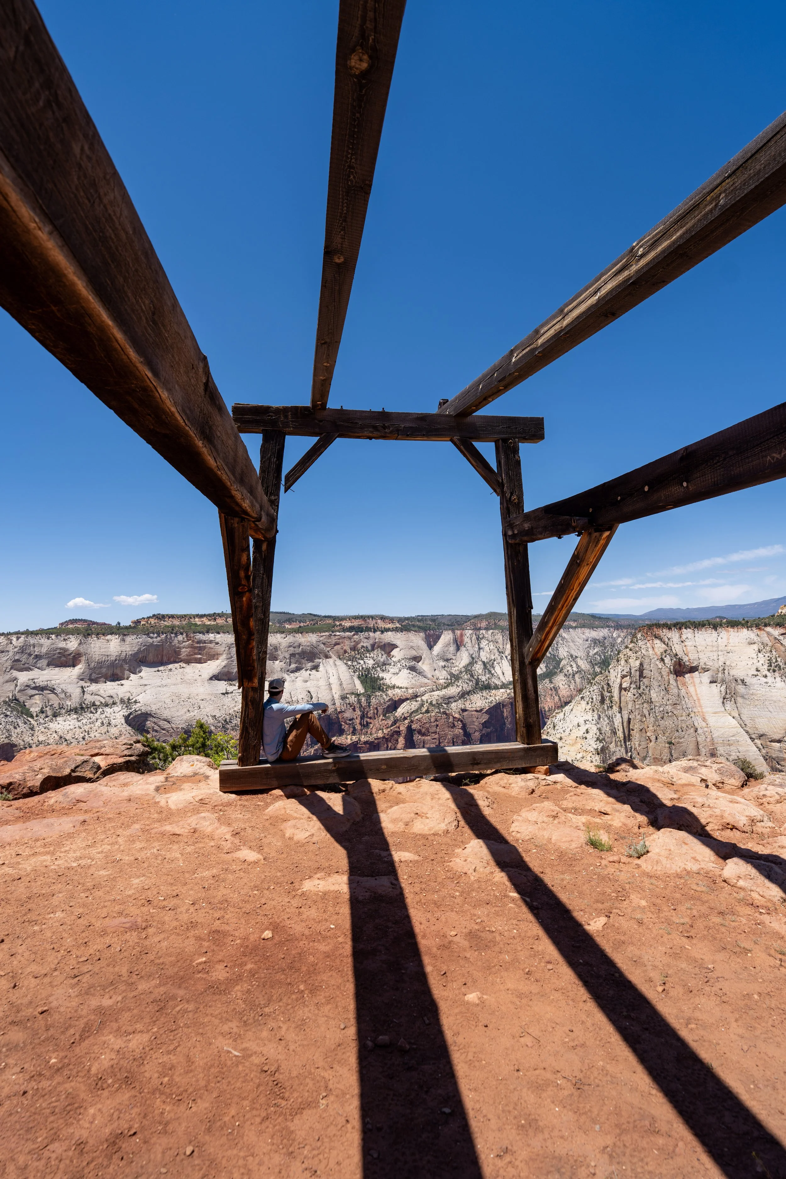
The Deertrap Mountain Trail in Zion National Park is a long and somewhat remote day hike atop Zion’s East Mesa that winds its way out to a number of stunning viewpoints above Zion Canyon and the Zion Canyon Lodge!
Of the three most popular day hikes on the East Mesa, including Deertrap Mountain, the Observation Point Trail, and the Cable Mountain Trail, Deertrap Mountain is by far the least trafficked, due in large part to the fact that it is the longest of the three.
However, I do not believe the long distance is indicative of the trail’s difficulty, as there are certainly much shorter yet far more difficult day hikes across Zion National Park.
That is to say that the elevation changes on the Deertrap Mountain Trail are very minor compared to many other adventures, like the Angels Landing Trail, which is why I believe the long day hike via Stave Spring is a great way to escape the crowds in an otherwise very busy National Park down in the canyon.
Deertrap Mountain Trailhead Parking
Parking for the Deertrap Mountain Trail via the Stave Spring Trailhead is located at the very end of West Pine Street atop Zion’s East Mesa.
The Stave Spring Trailhead and the East Mesa Trailhead are both located near the Zion Ponderosa Ranch, but the routes to the two trailheads split after passing through the ranch on the way to the park boundary.
Google Maps Directions: Deertrap Mountain Trailhead (Stave Spring)
Hiking Checklist - Zion
Here is a complete list of must-have things that you will want for any hike in Zion National Park.
Hiking the Deertrap Mountain Trail
The Deertrap Mountain Trail can either begin at the East Rim Trailhead near the East Entrance or here at the Stave Spring Trailhead up on the East Mesa.
That said, I highly recommend starting the hike from the Stave Spring Trailhead because it is much shorter and more direct—not to mention, there is a lot less elevation to gain when starting on the East Mesa near the Zion Ponderosa Ranch.
Zion Wilderness Boundary
Immediately after starting the hike to Deertrap Mountain, the Stave Spring Trail crosses the Zion Wilderness Boundary.
The beginning of the Stave Spring Trail starts out in beautiful Ponderosa forest, but it doesn’t take long for the trees to start to thin, which is why the entire 5.4-mile (8.7 km) Deertrap Mountain Trail is inevitably a long day in the sun.
This is something I will highlight again and again throughout this article, as a hooded sun shirt is truly essential for the long hike—especially if you plan to combine the Deertrap Mountain Trail with the Cable Mountain Trail.
This is where the Stave Spring Trail leaves the overstory Ponderosa forest behind, which largely remains the case as the trail winds its way through a mixed Juniper–Piñon–Ponderosa Pine forest for the majority of the hike.
Stave Spring-East Rim Junction
After just 0.5 miles (0.8 km), the Stave Spring Trail comes to an end where it meets the East Rim Trail at this T-intersection, which leads both to the start of the Deertrap Mountain Trail to the south and the East Mesa Trail to Observation Point to the north.
At this split, go left to start hiking north on the East Rim Trail toward the start of the Deertrap Mountain Trail, about 0.3 miles (0.5 km) away from this point.
Early in the morning, this bluff on the left-hand side of the East Rim Trail, is one of the very few stretches on the hike to Deertrap Mountain with any significant shade, which is, again, why I strongly recommend hiking in a hooded sun shirt.
Deertrap Mountain-East Rim Junction
After 0.8 miles (1.3 km) since leaving the Stave Spring Trailhead, the hike to Deertrap Mountain finally reaches the start of the true Deertrap Mountain Trail.
Once here, go right to continue hiking toward both Deertrap and Cable Mountain.
However, if you are interested in seeing Stave Spring, the spring can be found just 0.1 miles (0.2 km) to the left, though I must warn that it’s not very impressive and should only be used as a water source in the event of an emergency.
After about 0.2 miles (0.3 km) since leaving the East Rim Trail, the Deertrap Mountain Trail passes the first of two junctions with the old Deertrap Mountain Trail, which was re-routed in 2011 to the current path we have today.
Since the change, I have hiked the old section between this point and the second junction near the Cable Mountain Trail, and while it was manageable when I last visited, I have to imagine it will only get more and more overgrown as the years go on.
This section between the East Rim Trail and the Cable Mountain Trail is roughly 1.4 miles (2.3 km), compared to only 1.2 miles (1.9 km) before the trail was re-routed in 2011.
These hills may look steep, but between the East Rim Trail and Cable Mountain Trail, the Deertrap Mountain Trail only climbs about 410 ft. (125 m), which is fairly easy over this distance and why I said in the beginning that the elevation changes are quite negligible.
This is where the Deertrap Mountain Trail starts to turn south toward both the second historic junction and the Cable Mountain junction, shortly thereafter.
With about 0.1 miles (0.2 km) to go before the Cable Mountain Trail branches away, the Deertrap Mountain Trail passes the second junction, where the historic trail intersects with the current trail.
For most visitors unfamiliar with the 2011 rerouting project, it’s likely that the old route won’t even stand out, as the National Park Service has done a great job of hiding both junctions that connect with the current trail.
Deertrap Mountain-Cable Mountain Junction
Excluding the historic trail, the beginning of the Cable Mountain Trail is the third and final time the Deertrap Mountain Trail splits with another route.
At this final junction, go left to continue on the Deertrap Mountain Trail toward the end of the hike and some of the best views of Zion Canyon from above!
Read My Separate Post: Cable Mountain Trail
This final stretch between the Cable Mountain Trail and the end of the hike above the Zion Canyon Lodge is roughly 3.2 miles (5.1 km) each way, compared to only 1.8 miles (2.9 km) each way to get to Cable Mountain.
This is why the Deertrap Mountain Trail is one of the least-trafficked day hikes in Zion National Park—especially considering that the vast majority of visitors who make the drive up the East Mesa are here to hike the East Mesa Trail to Observation Point.
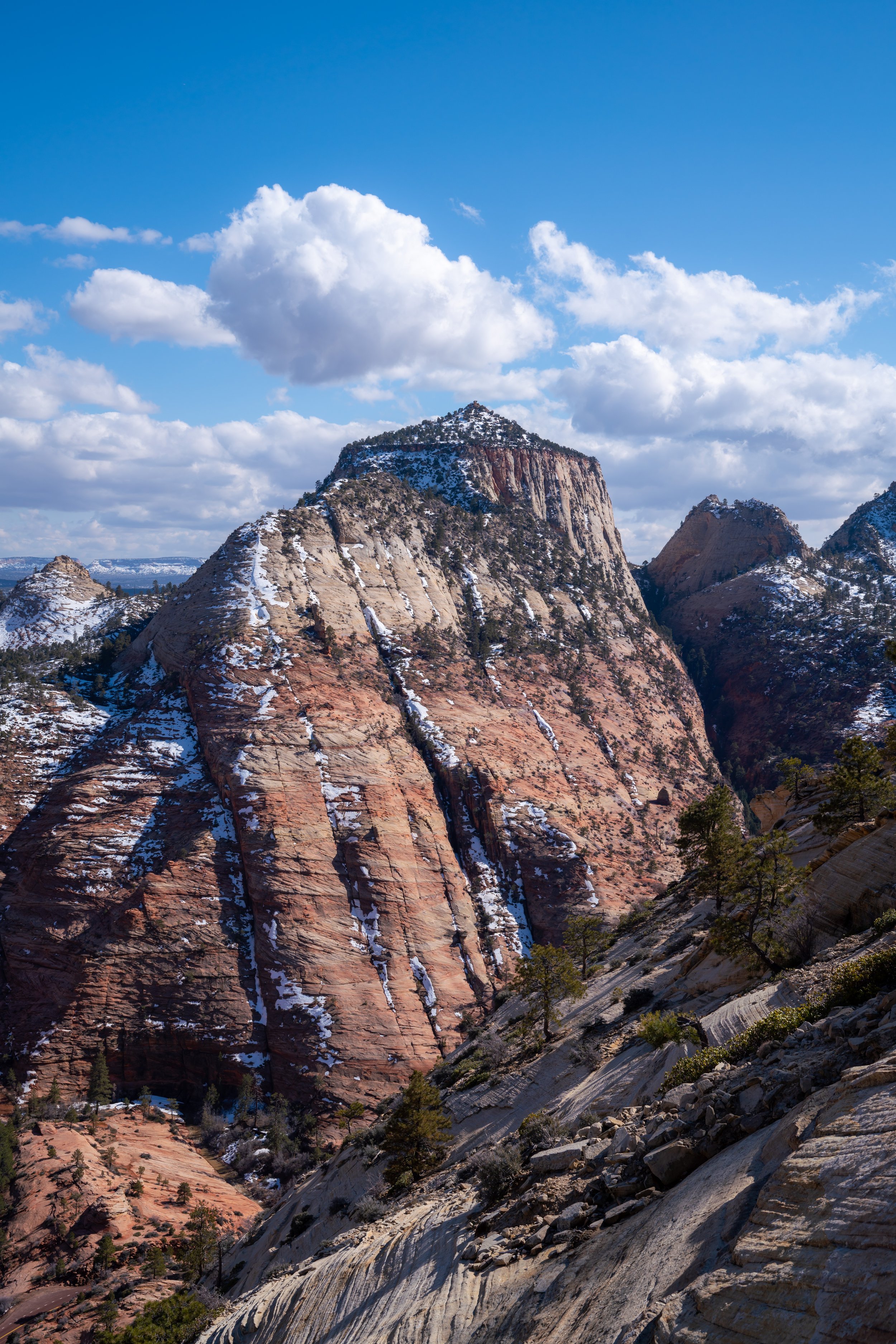
Almost immediately after the Cable Mountain junction, The West Temple and a number of lesser-known peaks on the far side of Zion Canyon can be seen from the Deertrap Mountain Trail for the first time!
As I hope it’s obvious—and it’s why I continually say this—there is very little shade on the Deertrap Mountain Trail, which is not only a message to hike the trail in a hooded sun shirt but, frankly, to avoid the trail during the hottest midday hours during the summer months, especially considering how remote the far western end of the trail is in the event of an emergency.
When the Deertrap Mountain Trail makes a hard turn to the south to begin navigating around Hidden Canyon, the end of the hike can be seen for the first time!
From this point, there is roughly 2.4 miles (3.9 km) until the viewpoint above Zion Lodge.
That said, the end of the Deertrap Mountain Trail is not the elevated mesa that can be seen in the distance. Rather, it’s located at the very end of the flatter green area to the right, as the trail must climb up and over the unnamed mesa to get to the rim of Zion Canyon.
This is where the Deertrap Mountain Trail starts to turn west again toward the mesa that separates this point from the end of the trail along Zion Canyon.
While these long, remote sections may seem uneventful, I personally think they are quite enjoyable after spending a few days down in the busier parts of the canyon.
This is why I like to say: leave Zion Canyon if you have a few days in the park, as there are countless great ways to escape the crowds in Zion National Park, particularly here on the East Mesa, Kolob Terrace Road, and the Kolob Canyons District, just to the south of Cedar City.
This is the view looking southwest toward The East Temple.
This switchback is one of only a few on the entire Deertrap Mountain Trail, with most of the noticeable elevation change located on the east and west side of the mesa shortly ahead.
This is where the Deertrap Mountain Trail starts the climb up and over the east side of the unnamed mesa that divides the end of the hike between the Cable Mountain junction and the rim of Zion Canyon.
This ascent only climbs about 150 ft. (46 m) over 0.2 miles (0.3 km), which is why I mentioned previously that the elevation changes on the Deertrap Mountain Trail are fairly negligible.
This is where the Deertrap Mountain Trail starts the descent on the west side of the mesa—the slightly steeper side.
On the return hike, these very short back-and-forth switchbacks are the most challenging part of the entire trail.
However, just like the east side, the elevation change, at only 175 ft. (53 m) over 0.2 miles (0.3 km), is so minimal that it’s not really fair to call the Deertrap Mountain Trail a steep hike by any means.
Once at the bottom of the descent, the Deertrap Mountain Trail heads straight toward the rim of Zion Canyon, where the best views on the entire hike finally open up!
This is where the Deertrap Mountain Trail finally reaches the rim of Zion Canyon and the hard right turn to the north that leads to the end of the hike.
On a different note, most out-of-state visitors typically don’t know is that this point is actually the connection with a fairly advanced off-trail scramble that climbs up and out of Zion Canyon.
While that route is not the purpose of this article, I think it’s worth mentioning that there are countless lesser-known, off-trail adventures across Zion National Park, but even beginning to scratch the surface of all there is to do truly takes a lifetime!
This is the view looking southwest toward the Mountain of the Sun, with Birch Creek Canyon and the beginning of the Sand Bench Trail beyond!
This final stretch along the rim of Zion Canyon is roughly 0.5 miles (0.8 km) each way, similar to the Stave Spring Trail from the very beginning of the hike.
For those hiking the Deertrap Mountain Trail with younger kids, know that the drops along the canyon rim are very dramatic.
Now, I wouldn’t necessarily considering the Deertrap Mountain Trail to be a dangerous hike overall, but if there is one section to highlight, this final stretch certainly is the most dangerous part of the entire 5.4-mile (8.7 km) adventure.
End of the Deertrap Mountain Trail
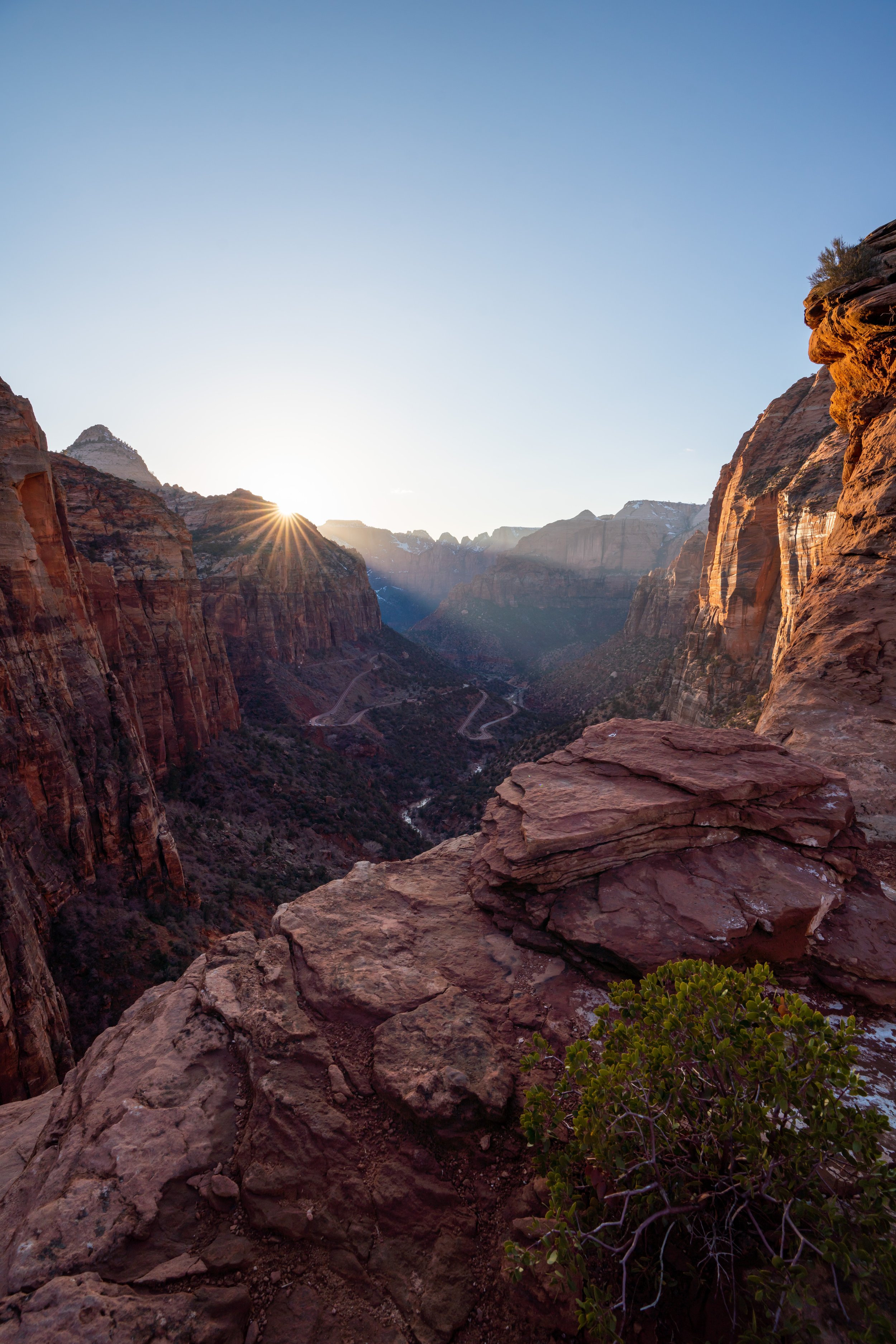
After a long 5.4-mile (8.7 km) hike from the Stave Spring Trailhead, the Deertrap Mountain Trail finally reaches the viewpoint above Zion Lodge!
Some of the many notable landmarks that can be seen from the end include Angels Landing, Observation Point, the Emerald Pools Trail, and the beginning of The Narrows, to name a few.
If you were planning to hike both the Deertrap Mountain Trail and the Cable Mountain Trail upon making it back to the previous junction, the total roundtrip distance is roughly 14.4 miles (23.2 km) when beginning from the Stave Spring Trailhead.
In my opinion, I think the total distance makes both adventures sound more intimidating than they actually are, and I say this because there is nothing particularly difficult about either trail. Combining both really is just one big walk, and as long as you plan properly, carry plenty of food and water, and don’t hike during the hottest summer months, both when combined can make for a great long day outside!