Hiking the Lind Point Trail in Virgin Islands National Park
Distance (Full Loop Only): 2.0 miles / 3.2 km
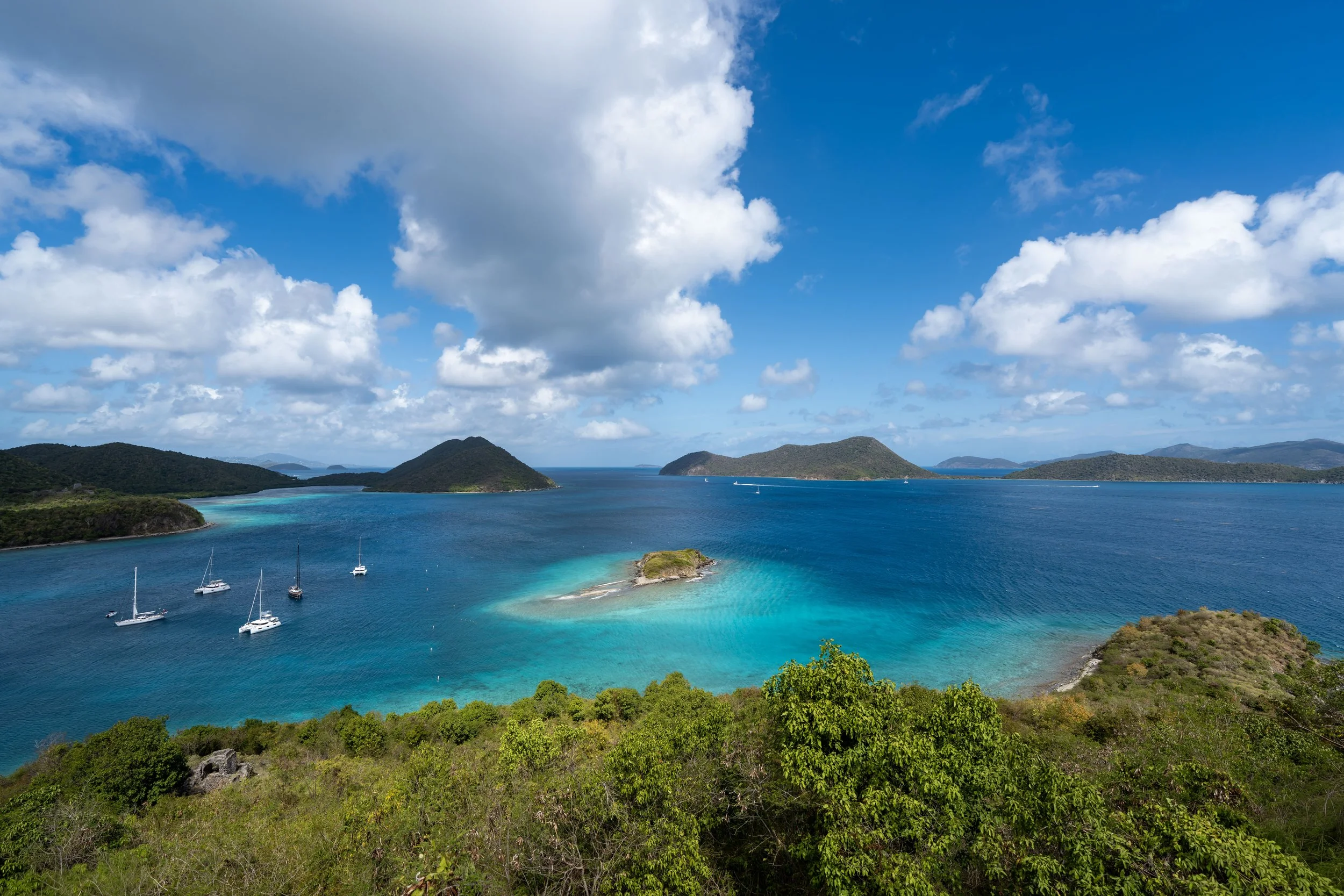
The Lind Point Trail, also called the Lind Point Loop Trail, in Virgin Islands National Park is a beautiful, mostly flat loop trail near the Cruz Bay Visitor Center that leads to not one, but two beautiful white-sand beaches, both of which can only be reached by hiking or by boat!
What this really means is that, unlike most drive-up North Shore beaches, both Salomon and Honeymoon Beach are typically much quieter, more relaxing beaches than others just down the road, like Trunk Bay.
That said, there are a few ways to hike to both beaches, including different trailheads, which direction to hike the Lind Point Loop, as well as an optional short connector between both the Upper and Lower Lind Point Trails.
As for this article, I hiked the full Lind Point Trail beginning from the Cruz Bay Visitor Center, but if you’re more interested in seeing one part of the loop over another, use the pop-up bubble in the right-hand corner of the page to navigate around this longer post more easily.
Lind Point Trailhead Parking
Parking for the Lind Point Trail is located at either the Cruz Bay Visitor Center, or the Biosphere Reserve Center just up the hill, where visitors can begin the Lind Point Trail via the Spur Trail.
In either case, a free parking pass from the visitor center is required to park during most hours of the day. This is meant to discourage the general public from abusing the limited available parking spaces in Cruz Bay, as parking anywhere in town can be quite a challenge.
That said, deciding whether to begin at the Lower Lower Lind Trailhead at the visitor center or the Lind Point Spur Trailhead up the hill will likely come down to where an available parking space can be found. However, if you’re more interested in which route is easier, the Spur Trailhead is significantly closer to both beaches, which is why it is the most popular route.
Google Maps Directions: Lind Point Trailhead (Visitor Center) / Lind Point Spur Trailhead (Biosphere Reserve Center)
Hiking Checklist - Virgin Islands
Here is a complete list of must-have things that you will want for any hike in Virgin Islands National Park.
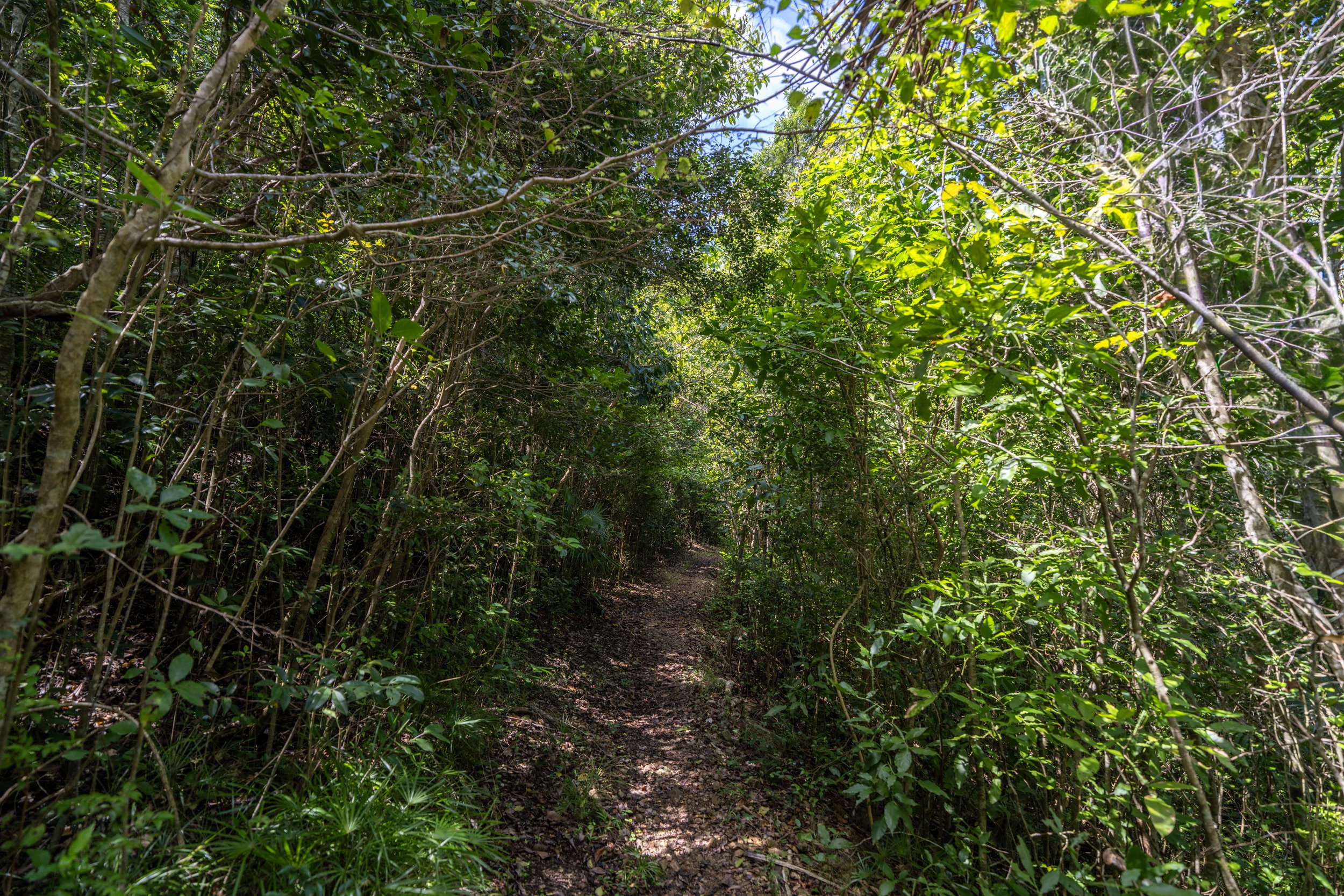
Hiking the Lind Point Trail
Unlike the Caneel Hill Trail, which shares the same parking area at the Cruz Bay Visitor Center, the Lind Point Trail begins in the parking lot, where it first climbs a set of stairs up to Dock Trail—the road that leads to the boat ramp up the hill.
To begin reading from the Lind Point Spur Trail, click here.
Lower Lind Point-Dock Junction
Once at the top of the stairs, go left to continue toward the true Lind Point Trailhead.
At this split, go straight, and the true Lind Point Trailhead can be found just a few steps ahead on the right-hand side.
Upper Lind Point-Dock Junction
This is where the Lind Point Trail branches away from the road, marking the true start of the hike toward Salomon and Honeymoon Beach.
That said, go right, and the Lind Point Trail will continue up to the start of the loop, about 0.2 miles (0.3 km) from this point.
Lind Point Loop Trail (South Upper-Lower Lind Point Junction)
After roughly 0.25 miles (0.4 km) since leaving the Cruz Bay Visitor Center, the Lind Point Trail reaches the start of the loop—or, in other words, the junction between the Upper and Lower Lind Point Trails.
If hiking directly to either beach is what you’re most interested in, I recommend taking the Upper Lind Point Trail first because it’s the shortest route to both beaches when beginning from the visitor center. However, if you are interested in hiking the full loop as well as visiting both beaches, I recommend taking the Lower Lind Point Trail first, as the slightly quicker Upper Lind Point Trail is nice to save for the end after spending time at both beaches.
Lower Lind Point Trail
Given my thoughts above, I chose to go left to begin the Lower Lind Point Trail first.
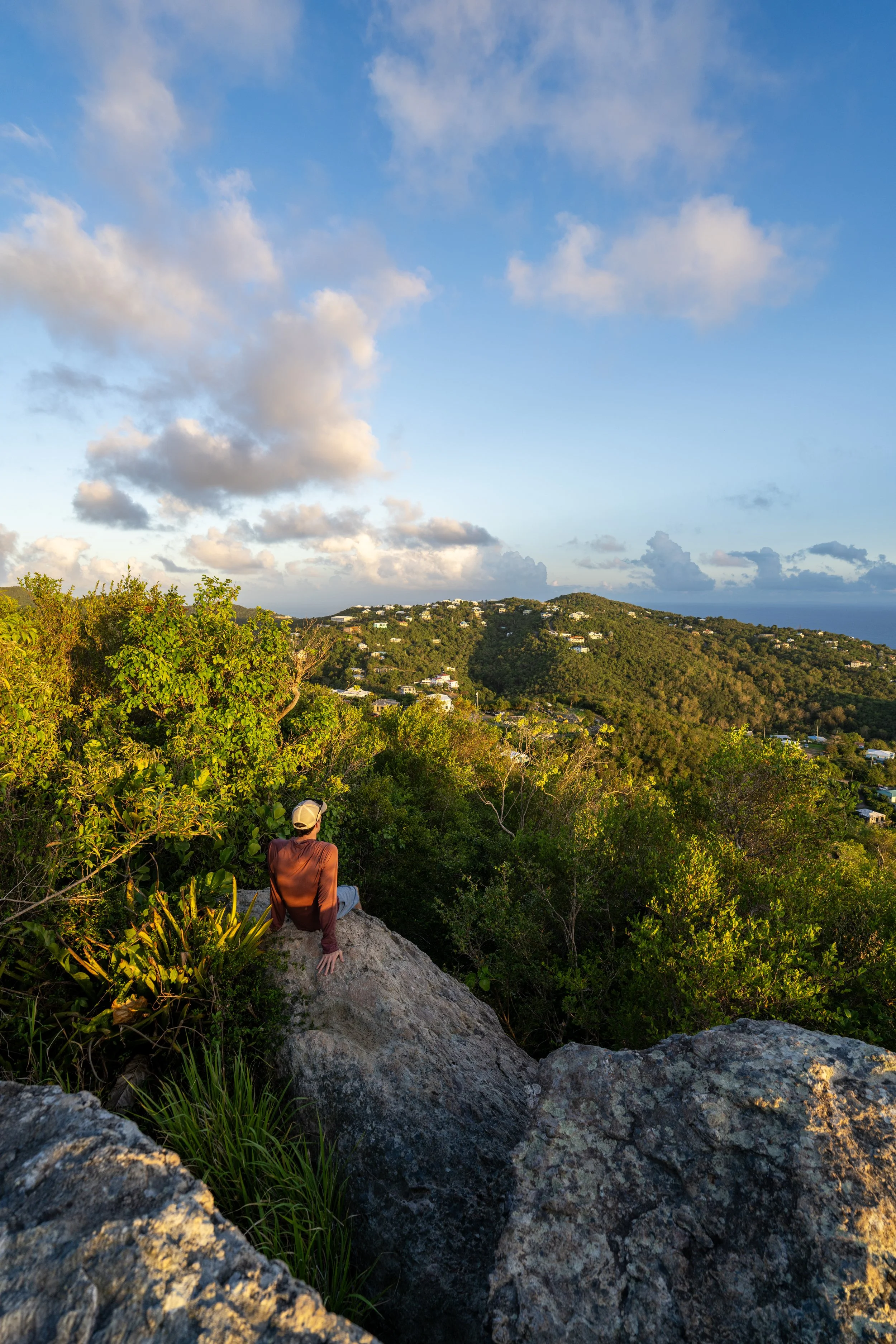
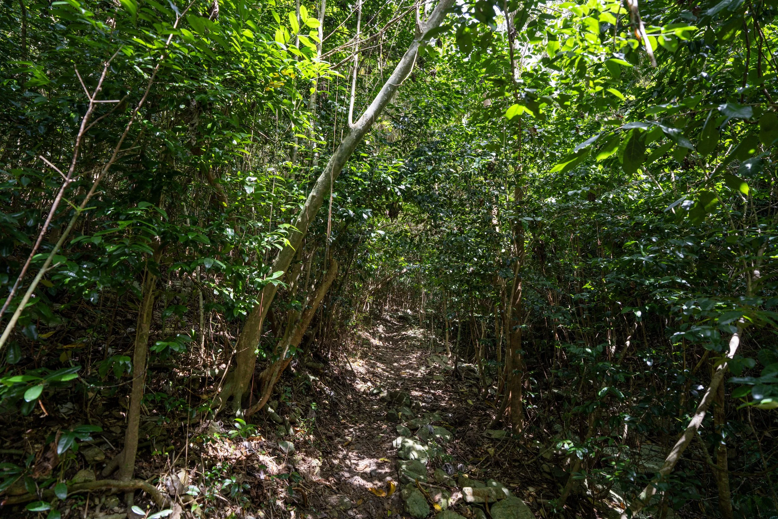
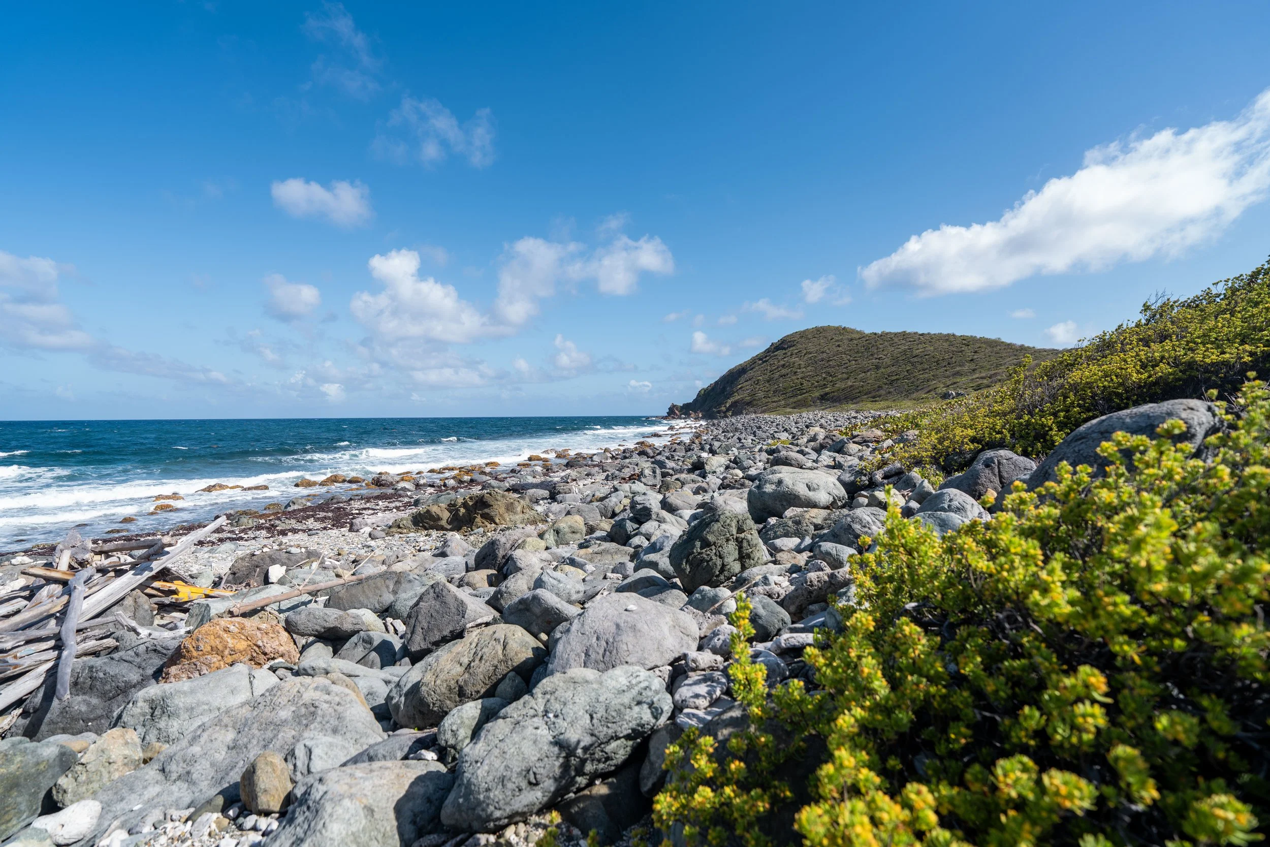
For the most part, the majority of the Lind Point Trail is flat, apart for the short paths that lead down to either beach.
This is why I often think the Lind Point Trail is one of the best trail-running hikes in Virgin Islands National Park—especially first thing in the morning before it gets busier!
If trail running is something you’re considering, I recommend using the shoes I have linked below, as they work well for both hiking and trail running on all the best adventures on St. John.
Apart from hiking the Lind Point Trail early in the morning, as shown in these photos, there is very little shade on the full loop.
This is why I highly recommend hiking the Lind Point Trail in a hooded sun shirt—especially if you plan to spend even more time down at either beach.
West Lower Lind Point-Salomon Beach Junction
After just over 0.5 miles (0.8 km) from the beginning of the loop, the Lower Lind Point Trail reaches the first of two side trails that lead down to Salomon Beach.
This is also the junction with a very short connector between both sides of the loop, and it’s why I mentioned at the beginning that the Upper Lind Point Trail is the quickest route to both beaches, as this connector cuts out the slightly longer hike on the Lower Lind Point Trail—especially when starting from the Lind Point Spur Trail at the Biosphere Reserve Center.
In any case, go left to hike down to Salomon Beach, or go straight at this split to continue on the Lower Lind Point Trail toward Honeymoon Beach.
West Salomon Beach Trail
This is the short 0.1-mile (0.2 km) trail that leads down to Salomon Beach.
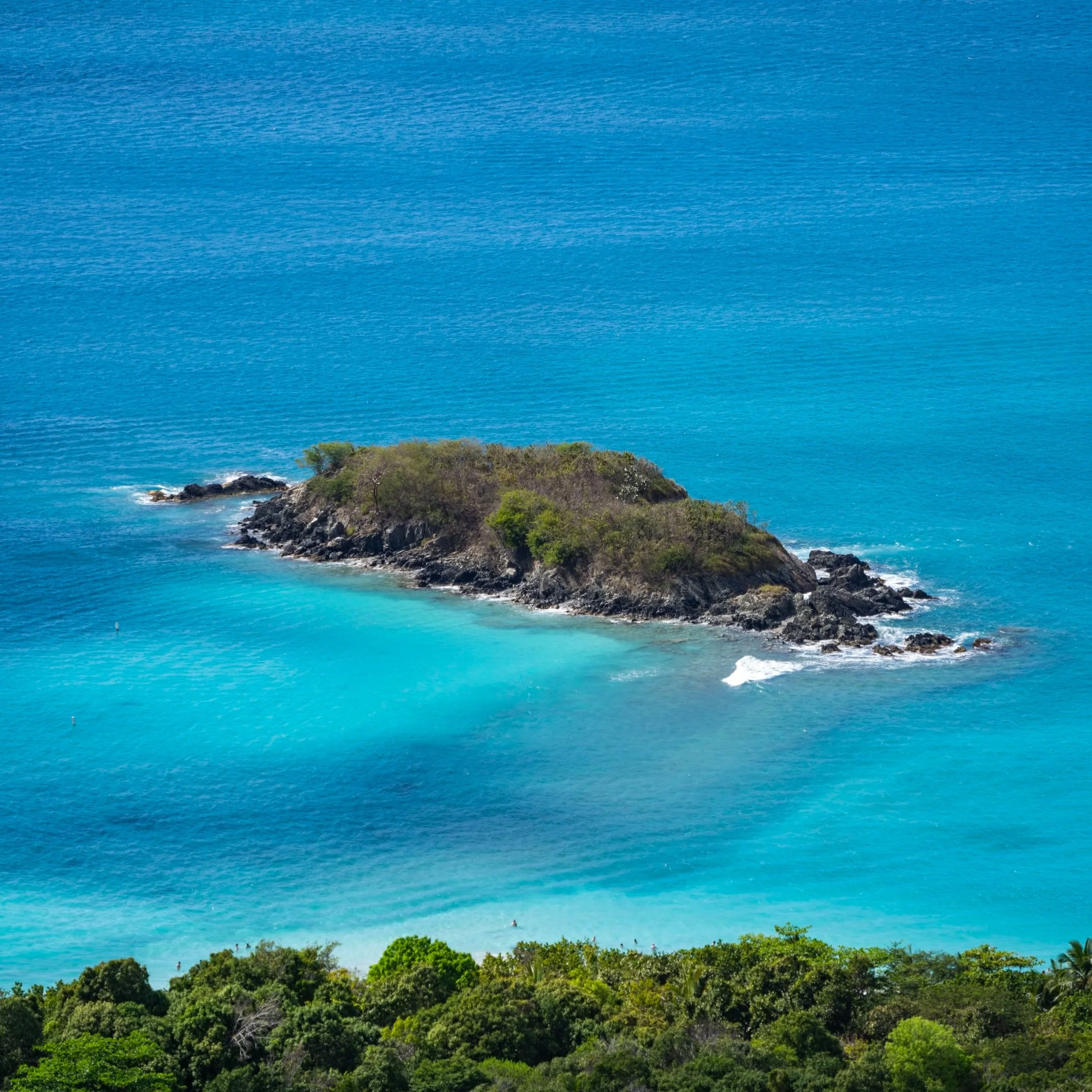
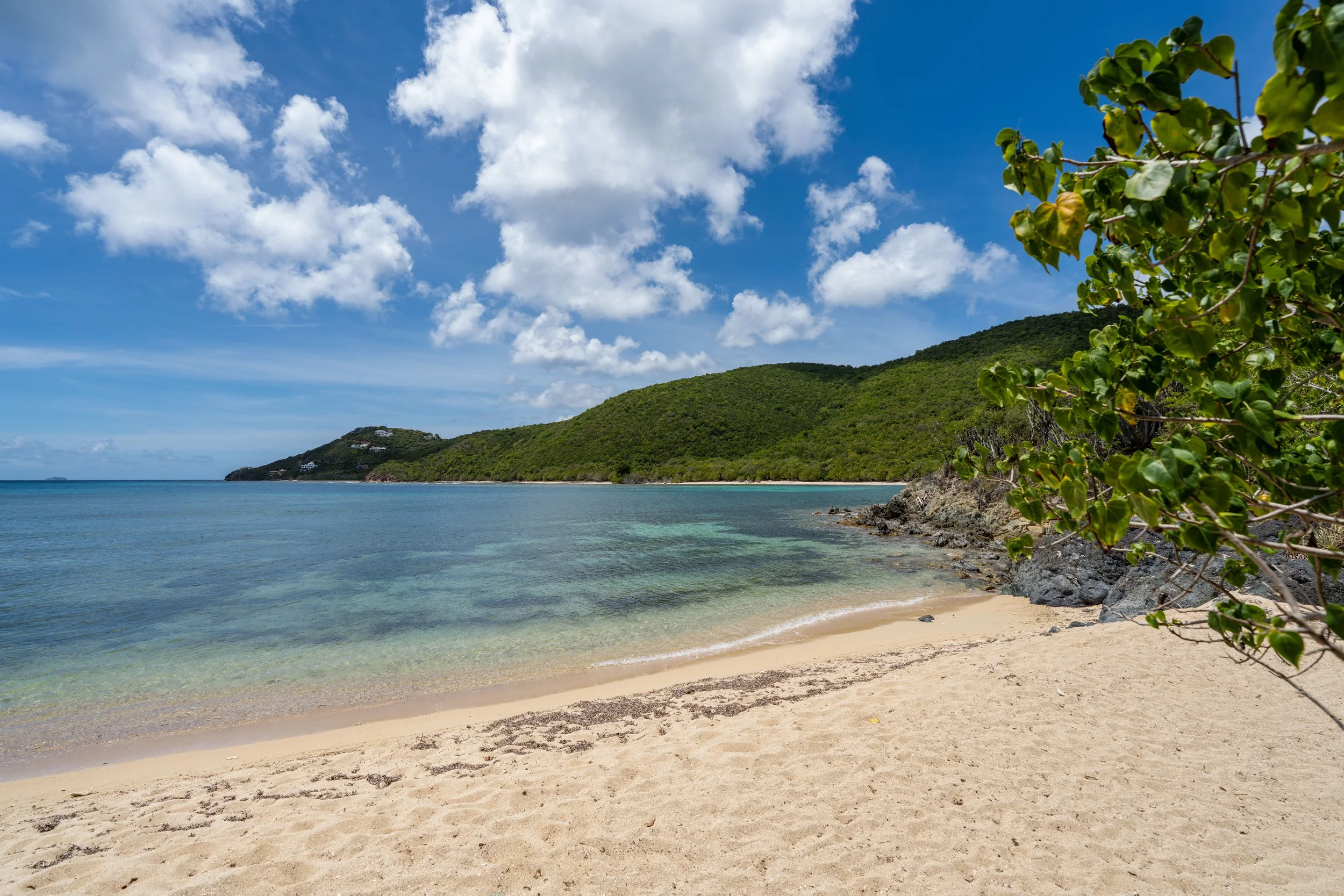
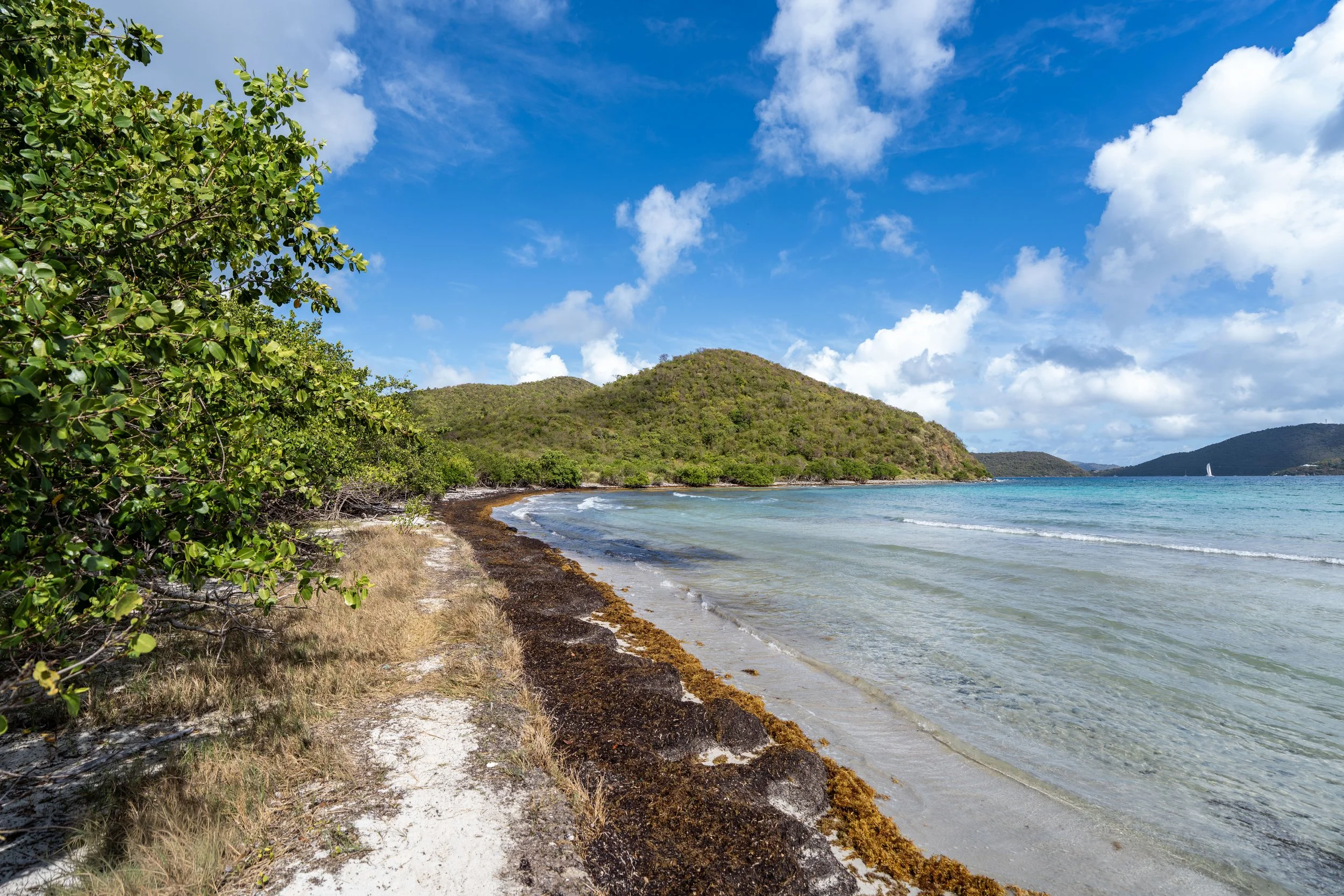
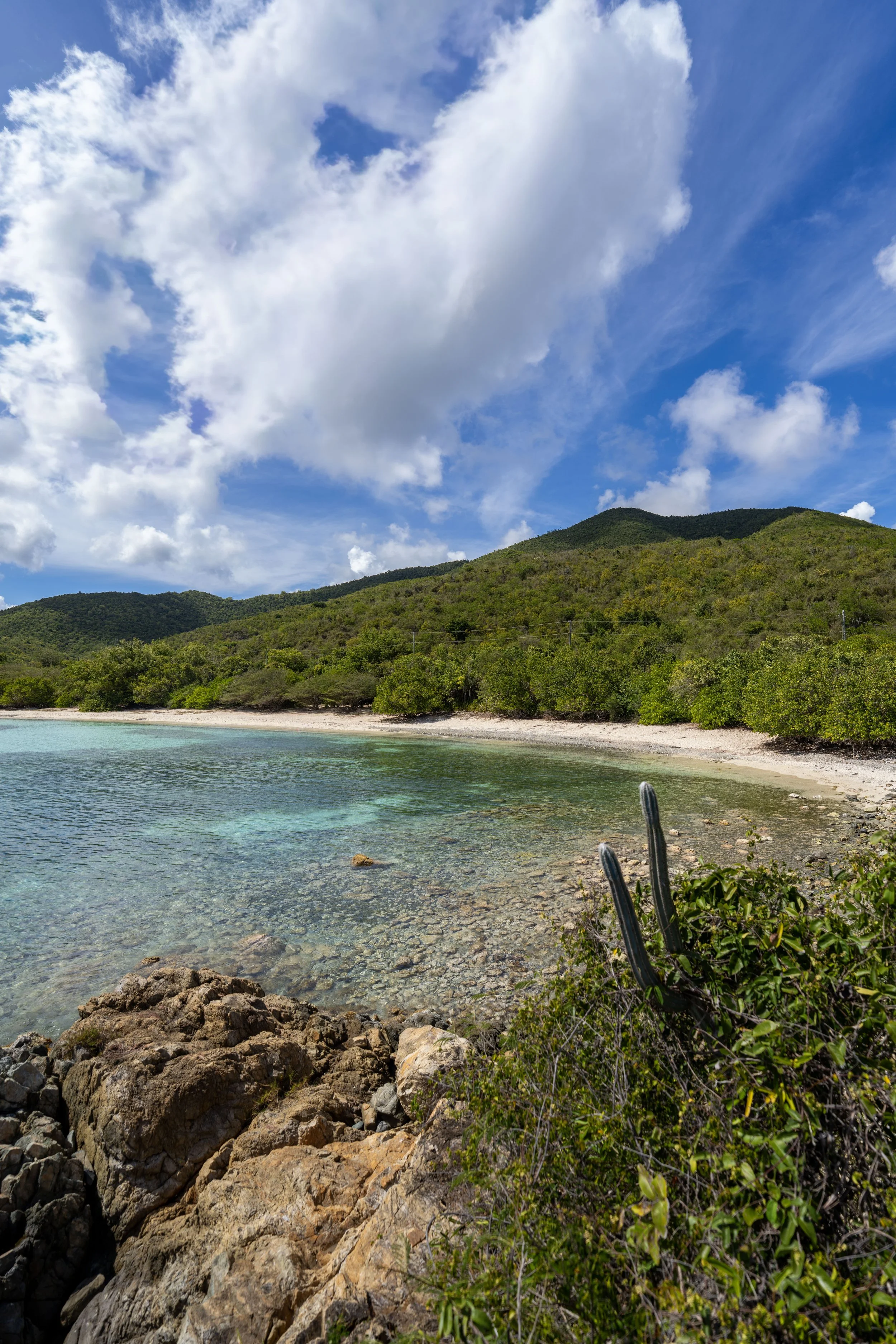
Salomon Beach
This is Salomon Beach, the much quieter of the two beaches off the Lind Point Trail!
That said, I’ve never actually understood why Salomon Beach is so much less crowded, apart from a few thoughts I mention about Honeymoon Beach later in this article.
In any case, Salomon Beach is just as—if not more—beautiful than Honeymoon Beach, and it is only 0.1 miles (0.2 km) farther to hike to when starting from the Lind Point Spur Trailhead at the Biosphere Reserve Center.
For those interested, the East Salomon Beach Trail can be found on the far side of the beach and can be used to hike back up to the Lind Point Loop instead of returning on the same trail taken down.
Once back on the Lower Lind Point Trail, there is roughly 0.1 miles (0.2 km) between the West Salomon Beach Trail and the East Salomon Beach Trail.
East Lower Lind Point-Salomon Beach Junction
This is the second (east) very short, 0.1-mile (0.2 km) trail that leads down to Salomon Beach from the Lower Lind Point Trail, which is very similar to the West Trail, and is why I decided to exclude the second short side trail from this post.
After the East Salomon Beach Trail, there is only 0.1 miles (0.2 km) left before the loop reaches the junction with Honeymoon Beach.
Lind Point Loop-Honeymoon Beach Junction
This is the far northern end of the Lind Point Loop, where the Lower Lind Point Trail ends and the Upper Lind Point Trail begins.
From here, go left to begin the short hike down to Honeymoon Beach, or go right to continue around the Lind Point Loop, beginning the Upper Lind Point Trail and the return hike back to either trailhead.
Honeymoon Beach Trail
This is the short, 0.1-mile (0.2 km) trail that leads down to Honeymoon Beach.
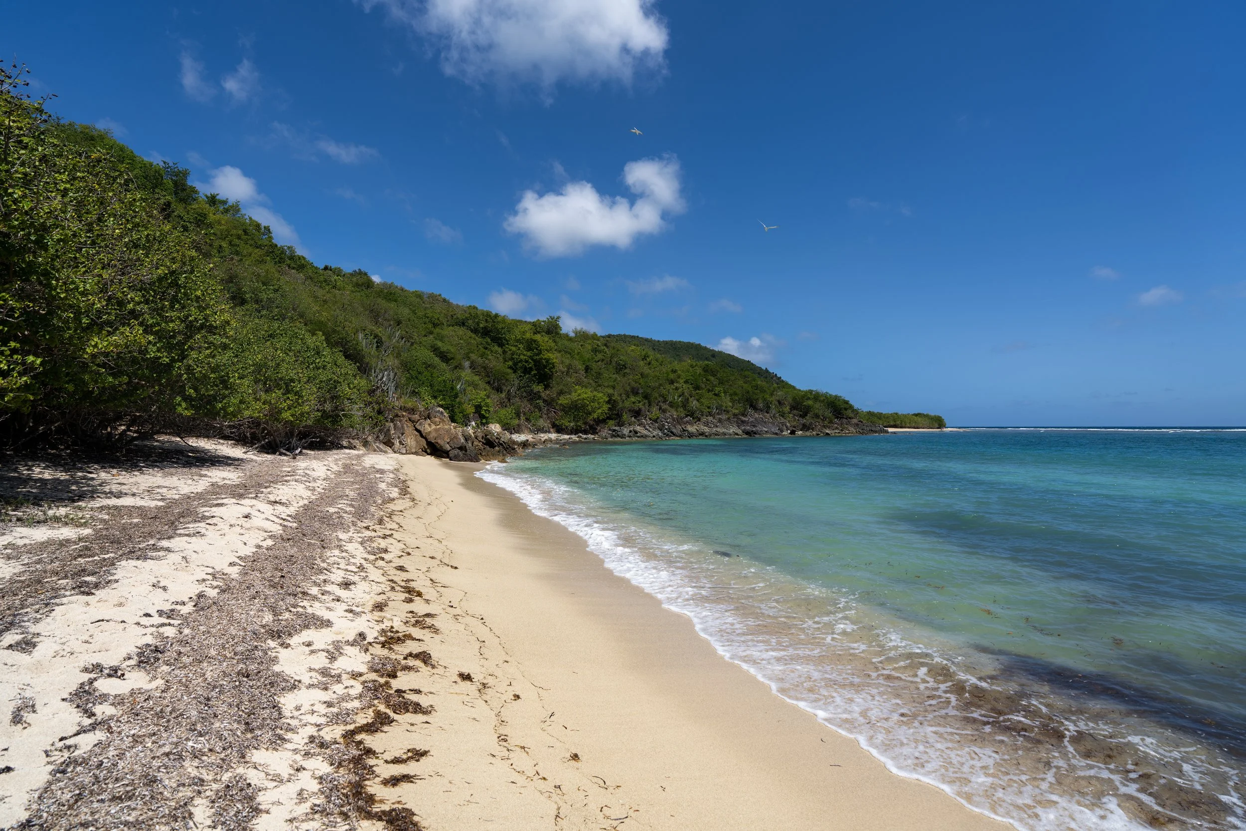
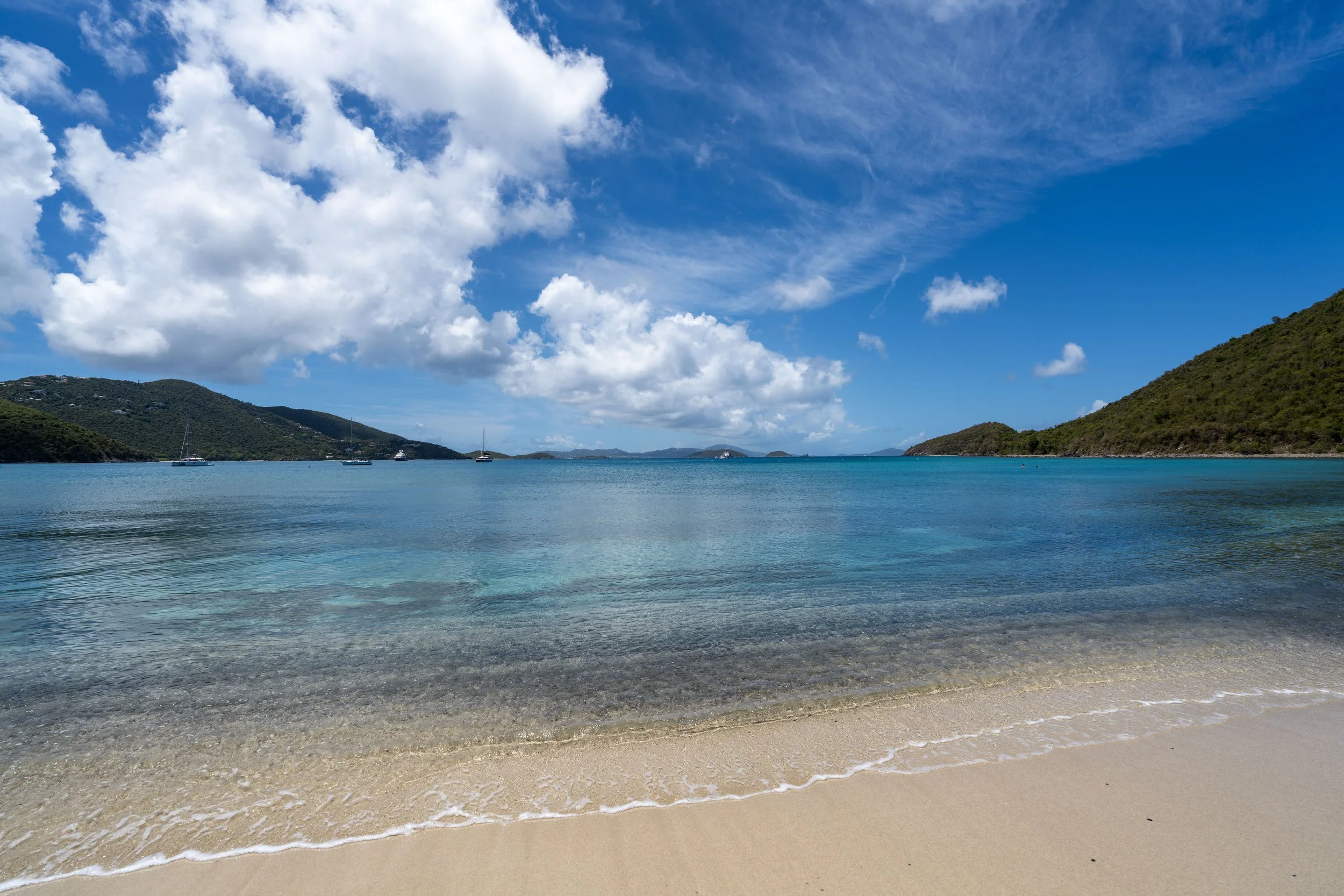
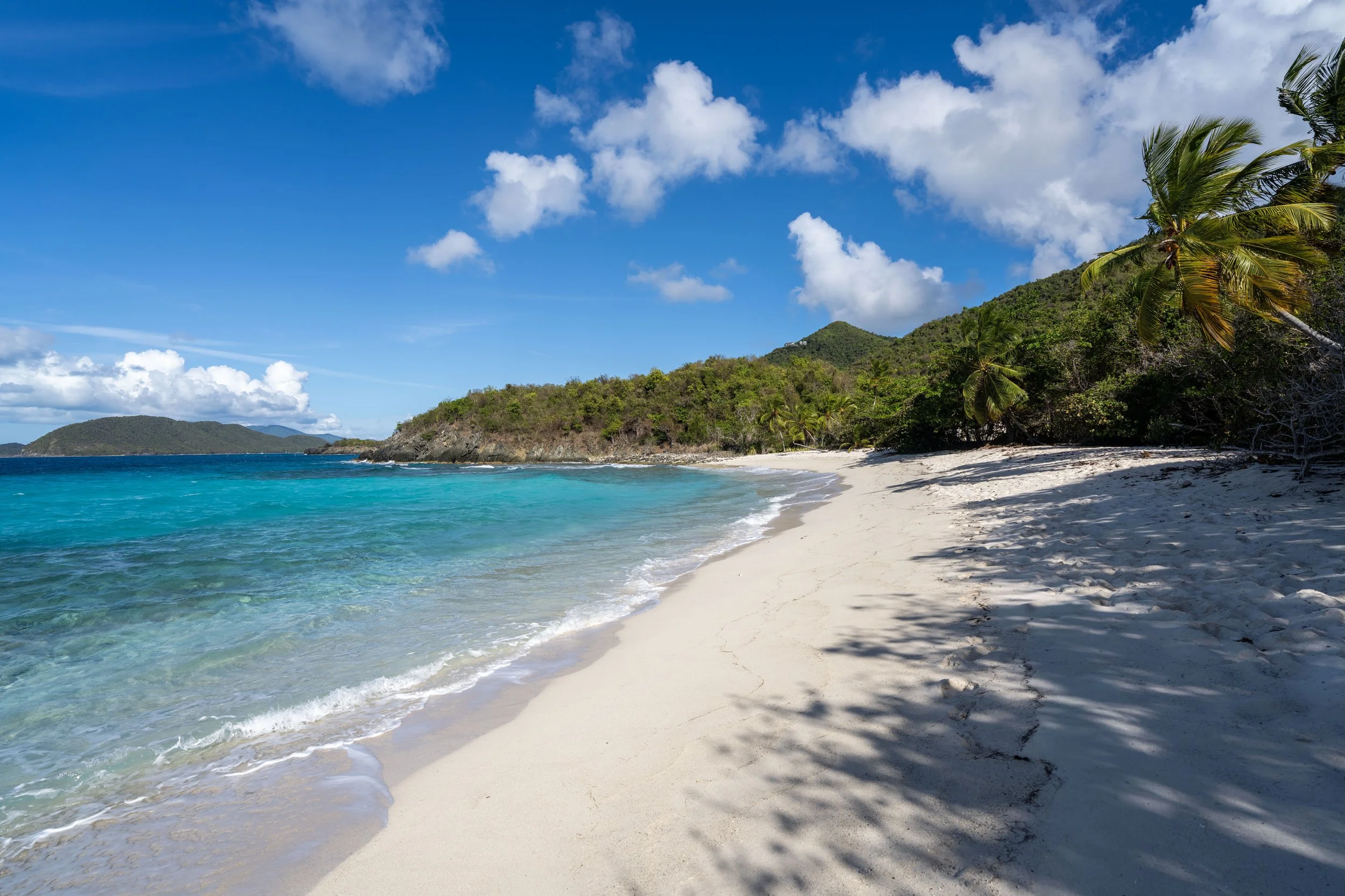
Honeymoon Beach
After a short walk from the junction above, the trail arrives at Honeymoon Beach, the more popular of the two beaches off the Lind Point Trail.
This is largely because of its close proximity to Caneel Bay, the fact that Honeymoon Beach is one of the main launch points for visitors kayaking to Henley Cay, and that many hikers are unaware of the short connector between both sides of the Lind Point Loop, which makes Salomon Beach seem like a longer hike than it actually is.
Similar to most North Shore beaches in Virgin Islands National Park, Honeymoon Beach is a great, family-friendly beach and a great place to hike down to with a mask and snorkel!
For those interested, the mask and snorkel linked below are exactly the ones that I use at home in Hawaiʻi, and they’re exactly what I traveled to Virgin Islands National Park with when I visited for the first time!
Lind Point Loop-Honeymoon Beach Junction
Once back at the Honeymoon Beach junction, I chose to go left to begin the Upper Lind Point Trail and continue hiking clockwise around the loop.
This short uphill section, between the Honeymoon Beach junction and the Lind Point Spur Trail ahead, is very mild—especially compared to all the steep adventures that begin off Centerline Road, like the Reef Bay Trail and the L'Esperance Trail.
Upper Lind Point-Lind Point Spur Junction
After just 0.1 miles (0.2 km) on the Upper Lind Point Trail, the loop passes the very short connector that leads up to the Biosphere Reserve Center and the joint Caneel Hill Spur–Lind Point Spur Trailhead.
That said, some signs and maps label this short trail as the Caneel Hill Spur, while others call it the Lind Point Spur. This is why, to avoid confusion, I’ve chosen to label it as the Lind Point Spur Trail in this article.
In any case, the one-way hike to Honeymoon Beach can be as short as 0.3 miles (0.5 km), and the one-way hike to Salomon Beach can be as short as 0.4 miles (0.6 km) when starting from the Biosphere Reserve Center.
All that aside, go straight to continue on the Upper Lind Point Trail toward the Lind Point Overlook, or click the link below if you’re interested in reading about the short spur to get to this point.
To skip ahead to the beginning of the Lind Point Spur Trail, click here.
Upper Lind Point-Salomon Beach Junction
This is the beginning of the Salomon Beach Trail, the same short connector between both sides of the Lind Point Loop.
When starting from the Lind Point Spur Trailhead, this route is the fastest way down to Salomon Beach, but to continue on the Upper Lind Point Trail toward the overlook, go straight to stay on the main loop.
Upper Lind Point-Lind Point Overlook Junction
With about 0.2 miles (0.3 km) remaining before the Upper Lind Point Trail returns to the beginning of the loop, the trail splits one final time, with a short out-and-back trail that leads to the Lind Point Overlook.
From here, there’s either the option to go right to walk out to the Lind Point Overlook, or go left to complete the loop and return to the Cruz Bay Visitor Center.
Lind Point Overlook Trail
I chose to go right to begin the short 0.1-mile (0.2 km) out-and-back trail to the Lind Point Overlook.
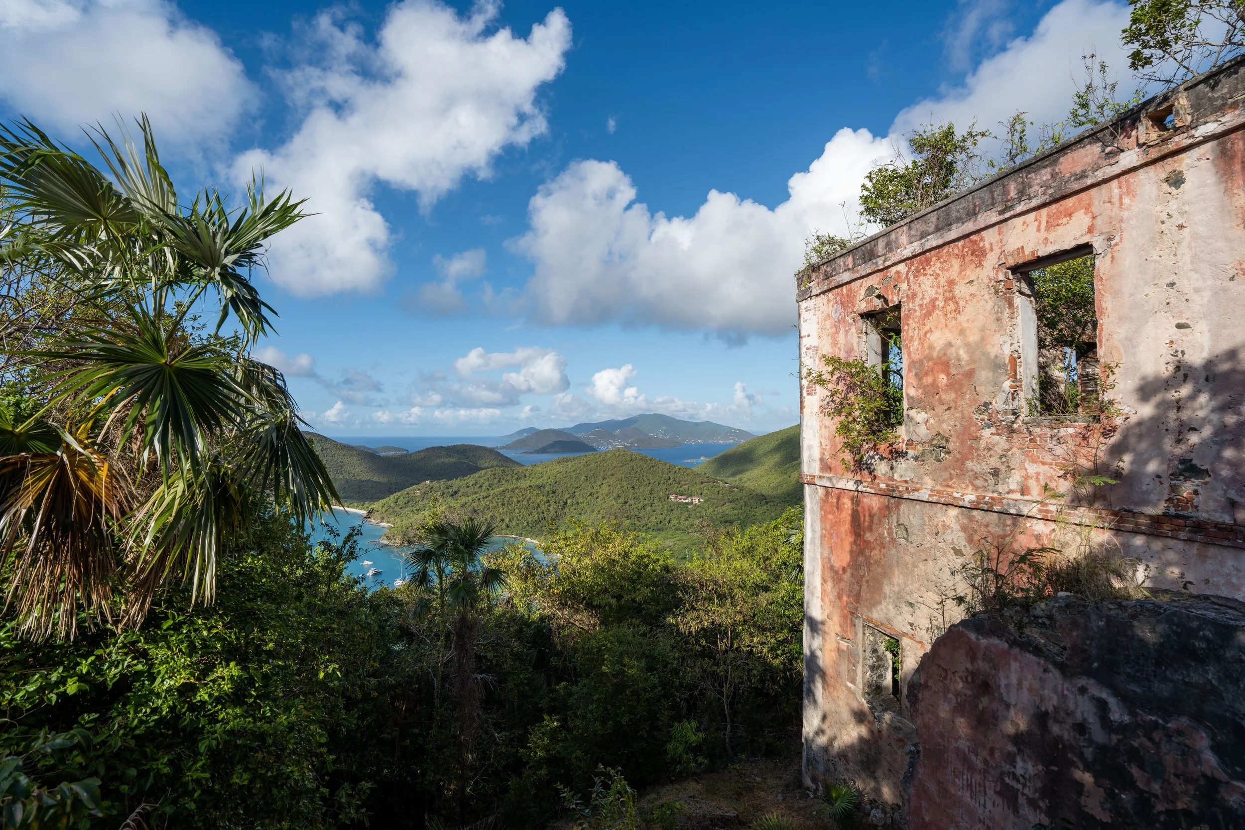
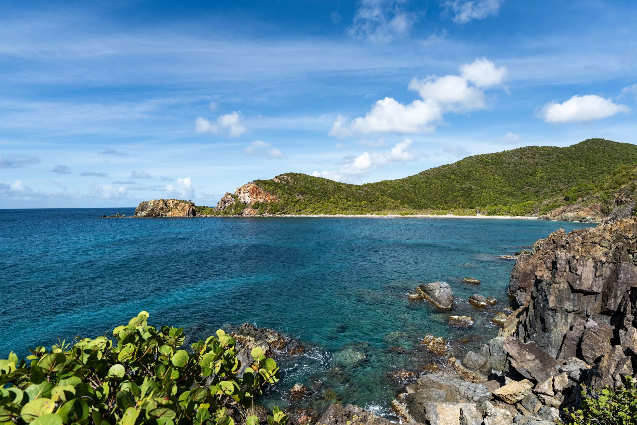
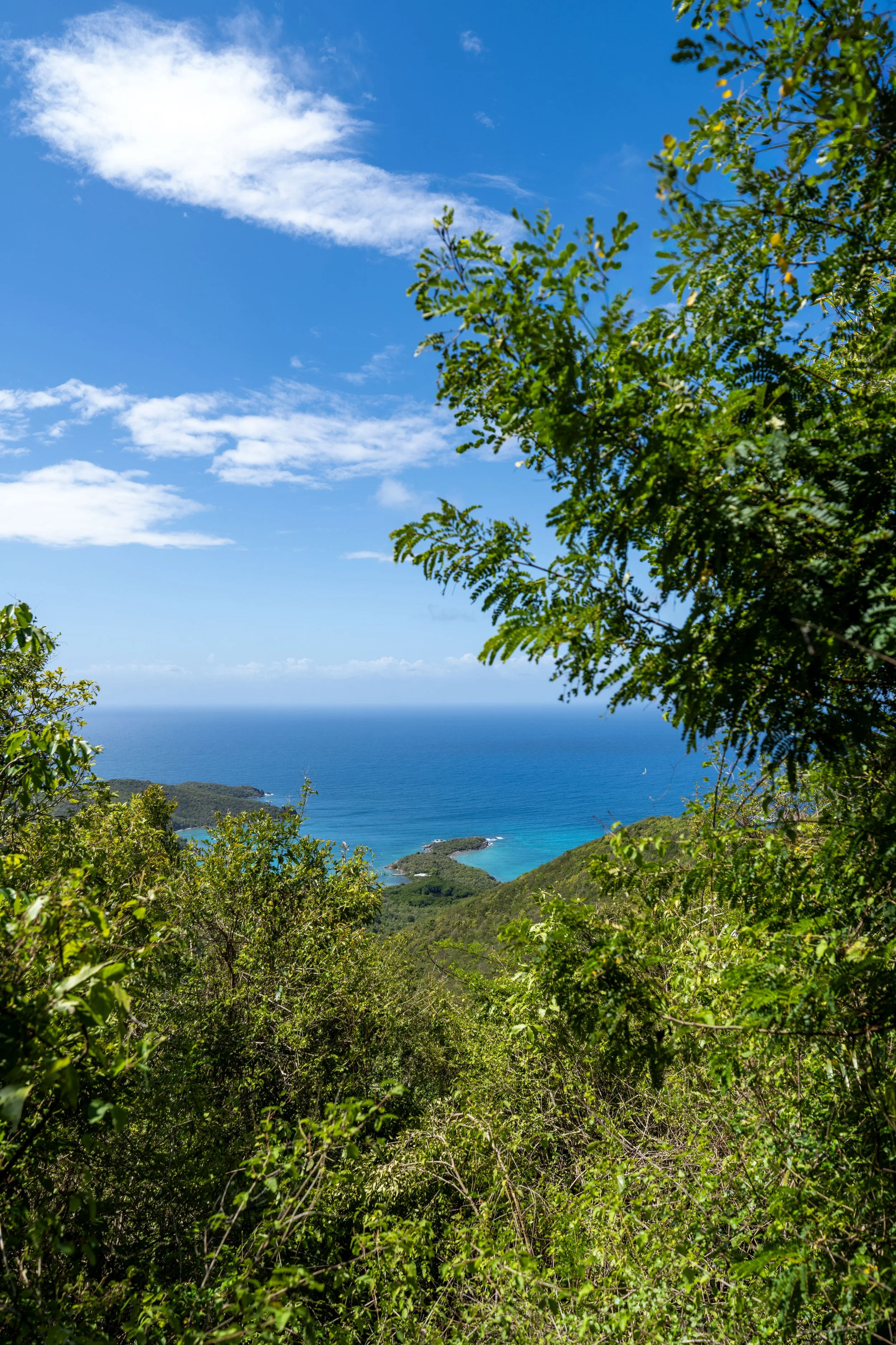
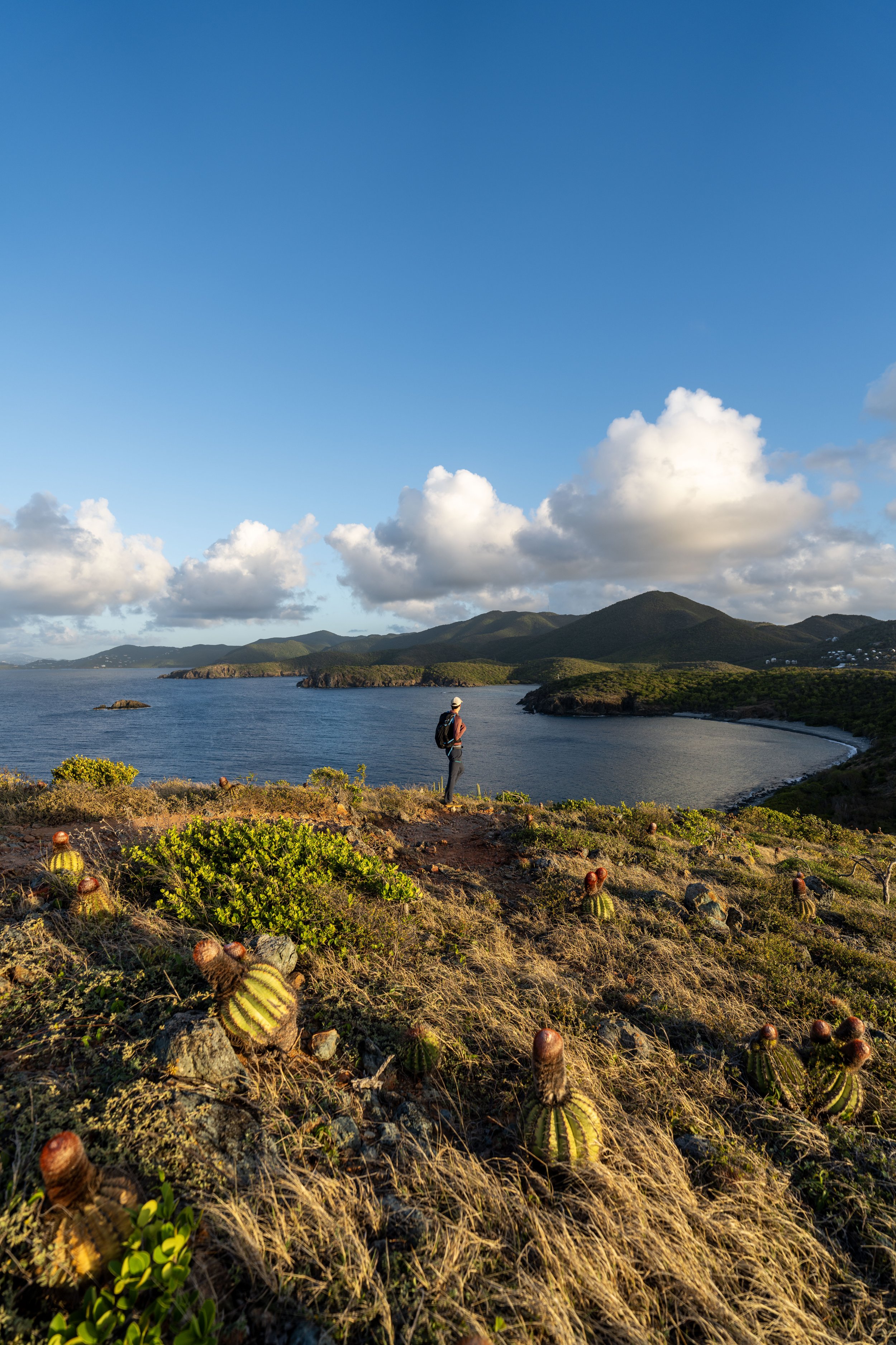
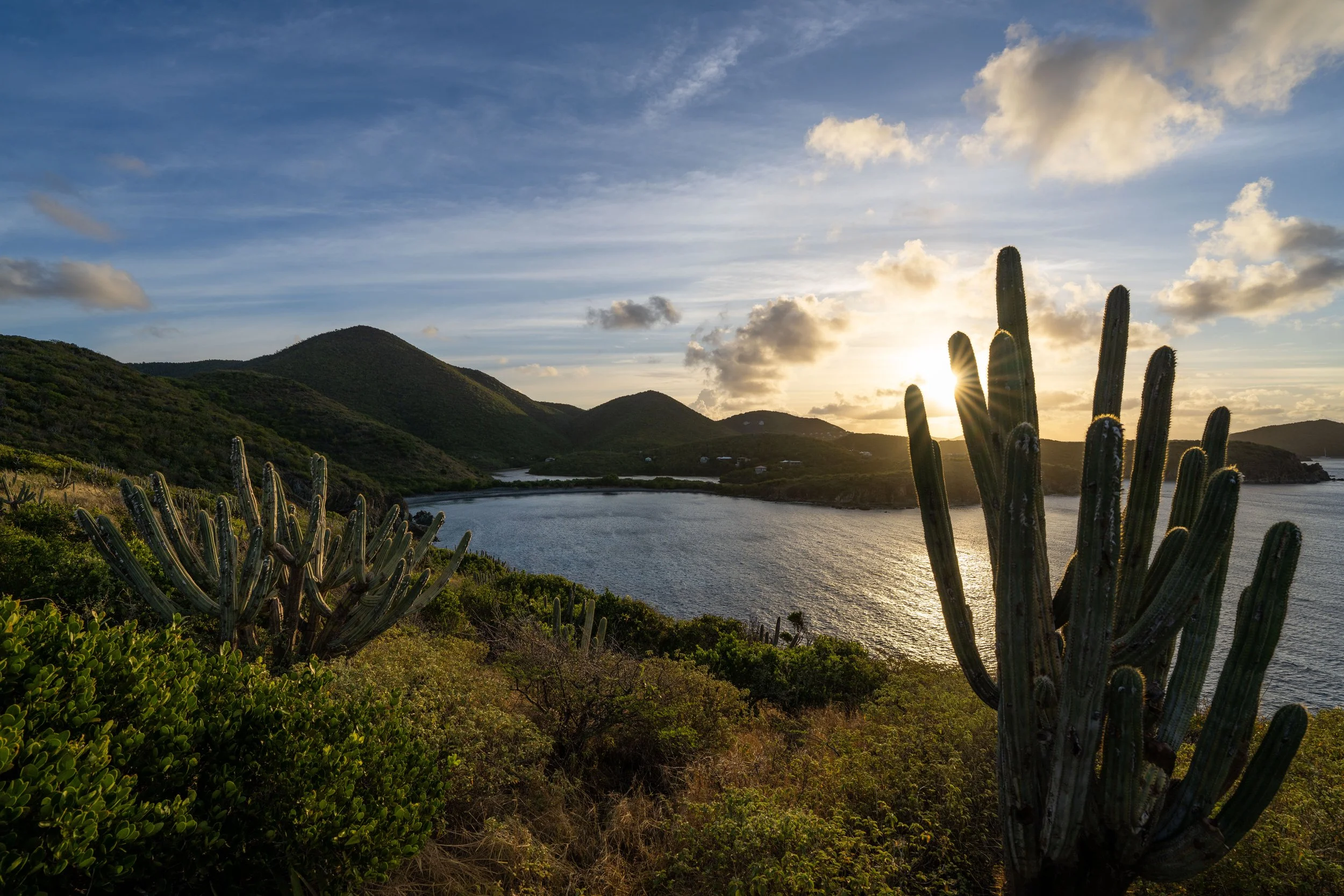
Lind Point Overlook
The Lind Point Overlook is a beautiful west-facing viewpoint above Cruz Bay, with views looking out toward St. Thomas in the distance!
This is what makes the Lind Point Overlook one of the best places to catch a sunset in Virgin Islands National Park, especially considering that it is only a 0.5-mile (0.8 km) hike from the Cruz Bay Visitor Center down the hill.
If this is something you’re interested in, be sure to pack a good headlamp for this and all the best sunrise and sunset hikes in Virgin Islands National Park, including the Ram Head Trail and the Caneel Hill Trail.
Upper Lind Point-Lind Point Overlook Junction
Once back at the previous junction, go right to complete the Lind Point Loop and return to the Cruz Bay Visitor Center.
South Upper-Lower Lind Point Junction
This is where the Lind Point Trail completes the 1.5-mile (2.4 km) Lind Point Loop.
From here, go left to return to the Cruz Bay Visitor Center, located about 0.25 miles (0.4 km) away from this initial junction.
Lind Point Spur Trailhead
This is where the Lind Point Spur Trail begins at the Biosphere Reserve Center off North Shore Road, the shortest route to hike to both Salomon and Honeymoon Beach.
On a different note, this is also the same trailhead that serves the Caneel Hill Spur Trail across the road.
Read My Separate Post: Caneel Hill Trail
This short connector between North Shore Road and the Lind Point Loop is only 0.1 miles (0.2 km) each way.
Upper Lind Point-Lind Point Spur Junction
This is where the Lind Point Spur reaches the Lind Point Loop.
That said, go left at this split to hike over to the connector between both sides of the loop, or go right to hike over to the far northern end of the loop and the junction with Honeymoon Beach.
To skip back to this same junction above, click here.