Hiking the ʻĀhuimanu Falls Trail on Oʻahu, Hawaiʻi
Distance: 1.4 miles / 2.3 km
The ʻĀhuimanu Falls Trail on the windward side of Oʻahu is one of many waterfall chutes along the dramatic Koʻolau Range, similar to Temple Falls and Kahaluʻu Falls nearby, or the V Falls Trail further to the south.
However, of these examples, ʻĀhuimanu Falls is one of the easier waterfalls to hike to, as the entirety of the trail follows a path rather than a stream bed. I mention this because following a stream bed is common when it comes to Hawaiʻi gulch hikes—especially longer adventures like the Kōloa Gulch Trail on the North Shore of Oʻahu—but ʻĀhuimanu Falls is different in that the only time hikers are required to get in the stream is at the very end, just before the waterfall.
This is all goes without saying that, regardless of the trail, windward Koʻolau Oʻahu waterfalls are undoubtedly more difficult and more dangerous to hike than more maintained trails, like the Lulumahu Falls Trail. I say this to hopefully provide realistic expectations, as these trails do not see regular hiking traffic or upkeep—meaning they are inevitably more challenging to reach than other notable waterfalls.
ʻĀhuimanu Falls Trailhead Parking
Parking for the ʻĀhuimanu Falls Trail is located adjacent to the trailhead on Hui Kēlū Street or Lile Place in the back of ʻĀhuimanu Valley.
That said, please be quiet and respectful in this local residential neighborhood, as too many trails in Hawaiʻi draw too much negative attention because people just don’t understand this.
Google Maps Directions: ʻĀhuimanu Falls Trailhead
Hiking the ʻĀhuimanu Falls Trail
ʻĀhuimanu Restoration Area
This area along the ʻĀhuimanu Stream is known locally as the ʻĀhuimanu Restoration Area, as both community volunteers and the local elementary school work to restore this small community space.
It is here, at the back of the Restoration Area, that the ʻĀhuimanu Falls Trailhead can be found.
ʻĀhuimanu Falls Trailhead (ʻĀhuimanu Terrace Complex)
These signs refer to the ʻĀhuimanu Terrace Complex, which extends from this trailhead off Hui Kēlū Place to the uppermost portions of ʻĀhuimanu Valley.
With that in mind, please do everything you can to avoid touching, standing on, or disturbing the terrace walls, as they represent the largest intact wetland Taro system across all of Oʻahu—not to mention, the complex is recognized in the National Register of Historic Places.
Following the trailhead, the ʻĀhuimanu Falls Trail will turn away from the ʻĀhuimanu Stream until it reaches the first of three stream crossings, about 0.4 mile (0.6 km) into the hike.
These short iron-rung ladders are in place to protect the historic dry-stacked terrace walls.
At this second sign about the ʻĀhuimanu Taro Complex, the trail makes a hard left-hand turn to continue up the valley.
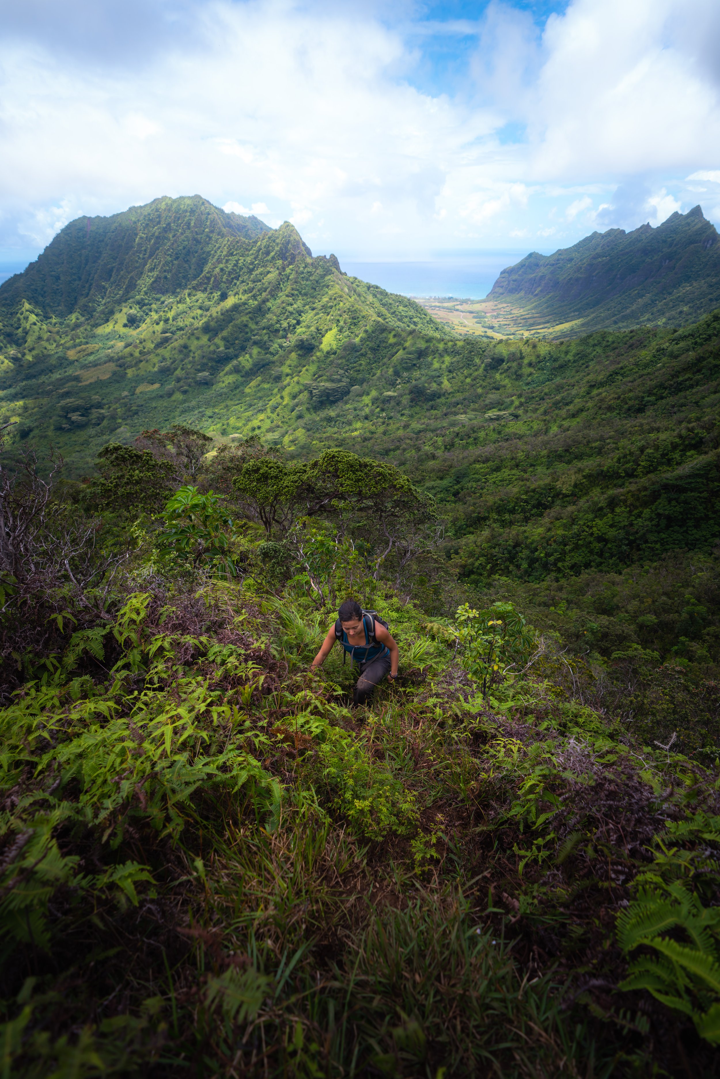
Climbing over fallen trees is certainly not uncommon on the ʻĀhuimanu Falls Trail, as the hike is typically only maintained by community volunteers.
An entanglement of Hau trees, such as this, is seemingly a familiar experience on Hawaiʻi trails, as countless day hikes across the islands—like the Kulanaʻahane Trail in Moanalua Valley or the Waimano Ridge Trail—navigate through very similar sections.
Hawaiʻi’s indigenous ʻĒkaha fern is one of the more common native plants on the ʻĀhuimanu Falls Trail.
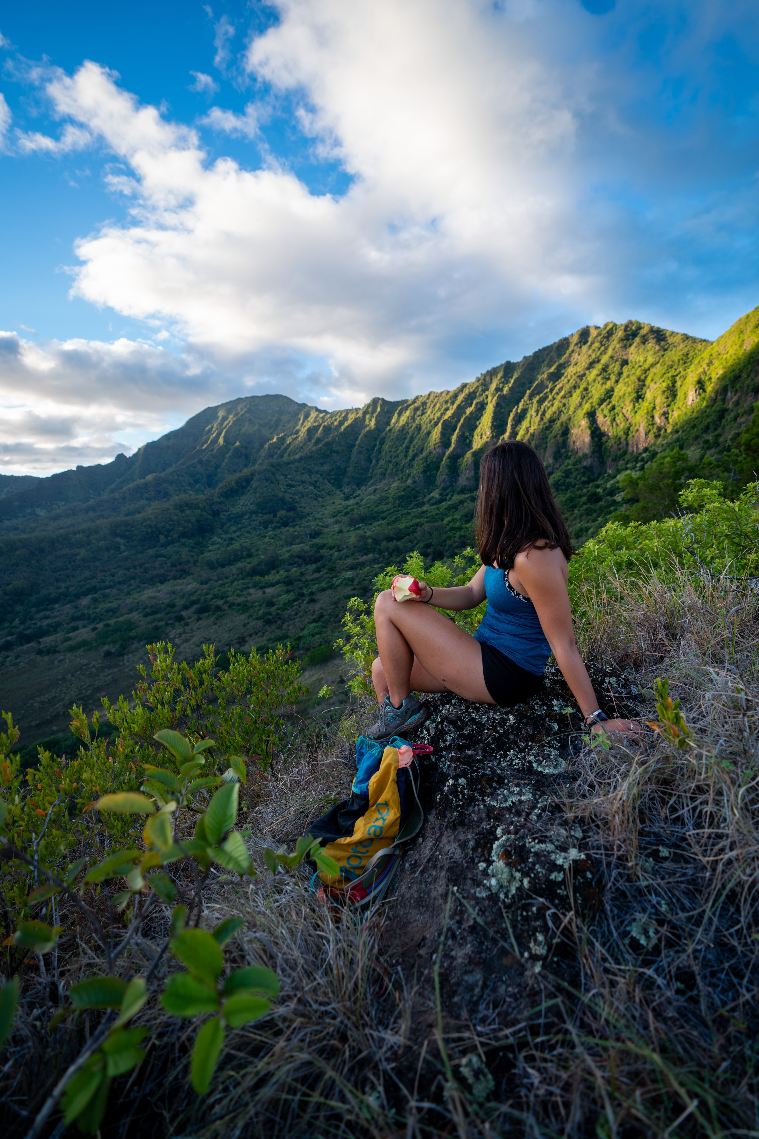
While ʻŌhiʻa ʻAi, or Mountain Apple, is not a native Hawaiian species, it is a canoe plant—meaning it was brought to Hawaiʻi by the first Polynesians.
However, it’s always better to find larger Mountain Apple trees that actually have fruit, but keep an eye out, as they grow across most areas of the trail.
These are more of the dry-stacked walls in the complex that extend all the way to the back of ʻĀhuimanu Valley — the wall just before the third and final stream crossing.
ʻĀhuimanu Stream
When the ʻĀhuimanu Falls Trail comes to this split, go right to cross the stream.
While it may seem as if there’s a trail heading up the valley without crossing the stream, do not follow it. This alternative route is largely created by hikers going a short distance up, then turning back to this crossing, because the trail going straight is unnecessarily more difficult in comparison.
Warning
If this first stream crossing is borderline or too difficult to cross, don’t attempt to continue up to ʻĀhuimanu Falls.
I say this because the final section of the trail navigates up a narrow gulch, where a flash flood can have the greatest consequences—meaning, if it’s too difficult to cross here, the final section of the trail will certainly be more challenging and unnecessarily risky in comparison.
After the first stream crossing, the ʻĀhuimanu Falls Trail will 'seemingly' climb high and away from the stream, but in fact, these uppermost portions of the valley are where the stream descends most rapidly.
This is why sticking to the true trail, shown here, is always easier than trying to follow the stream at the split shown above.
ʻĀhuimanu Falls-Heno Junction
This junction is one of only two times that the ʻĀhuimanu Falls Trail splits, with the trail to the right leading to two alternative trailheads at the back of ʻĀhuimanu Valley.
That said, go left to continue on the ʻĀhuimanu Falls Trail up the valley, as both trails that diverge to the right end on private property. This is why the trailhead shown at the beginning—the ʻĀhuimanu Terrace Complex Trailhead—is the only one I recommend.
On a different note, if you return to the final stream crossing and it appears to be too dangerous to cross on a rainy day, follow this trail down to one of the two alternative trailheads on Heno or Hui Kēlū Place. Both of these options are certainly a better alternative than taking an unnecessary risk.
This is the invasive Kahili Ginger, and it’s known for being one of Hawaiʻi’s most noxious weeds—especially in more pristine environments, like Puʻu Kōnāhuanui (K1) and Hawaiʻi Volcanoes National Park.
But here, I can say that ʻĀhuimanu Valley did not look like this a number of years ago, and it’s truly unfortunate how many areas across the islands it has spread.
This is the second of three times the ʻĀhuimanu Falls Trail crosses the ʻĀhuimanu Stream, with the final crossing just a short distance ahead.
Shortly after the second crossing, the ʻĀhuimanu Falls Trail comes to this headwall at the base of the Koʻolau Range, as well as the alternative—and honestly unnecessary—route that split at the first stream crossing.
That said, go right to follow this wall to reach the third stream crossing a short distance ahead.
This is the third and final ʻĀhuimanu Stream crossing.
Following the final stream crossing, the ʻĀhuimanu Falls Trail begins a short but steep climb along the banks of the upper gulch.
However, this quickly levels out, as the waterfall is only 0.1 miles (0.2 km) from the third crossing.
It’s always great to find Māmaki on Hawaiʻi trails, but if you’re curious to try Māmaki tea, I ask that you please don’t harvest from Hawaiʻi’s native landscapes.
Instead, Māmaki can be purchased, as it is grown commonly for commercial purposes.
This is where the trail ends, and the final part of the hike follows the stream up to ʻĀhuimanu Falls just ahead.
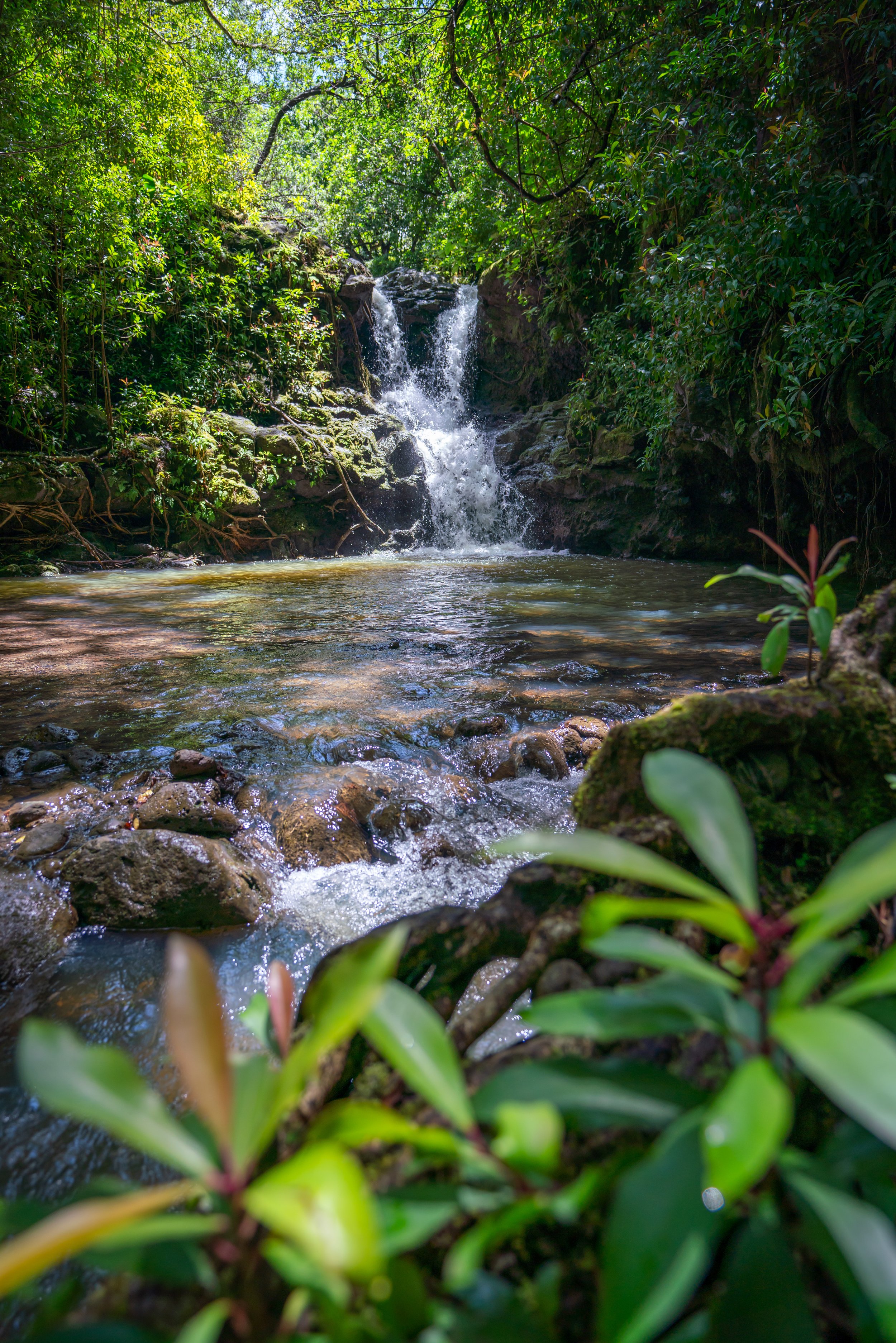
ʻĀhuimanu Falls
ʻĀhuimanu Falls is a multi-tiered waterfall that descends more than 1,000 ft. (305 m) from a small drainage below the Koʻolau Summit, with the final two drops making up the portion of the waterfall that is visible from the hike.
That said, the full extent of ʻĀhuimanu Falls can actually be appreciated better from the neighborhood in ʻĀhuimanu Valley or with a drone from above, as there are additional drops that can’t be seen from the end of the trail.
All this to say, ʻĀhuimanu Falls—like many other Koʻolau waterfalls—are rainy-day adventures, meaning they don’t flow unless enough rain falls in a short period of time.
However, hiking on a rainy day in Hawaiʻi comes with its own inherent risks, as flash floods can be a scary—and even deadly—reality across the islands. Therefore, my best advice is to try hiking the trail just after the rain has cleared.
Also, understand that returning down the same ʻĀhuimanu Falls Trail isn’t a good idea if the stream suddenly swells before you have the opportunity to cross. I can speak from experience that bushwhacking to avoid crossing a stream is, by far, a better alternative than returning on the ʻĀhuimanu Falls Trail just to finish at the Taro Complex Trailhead.
Native Plants on the ʻĀhuimanu Falls Trail
ʻĀhuimanu Valley is relatively low in elevation in terms of Hawaiʻi’s forests, meaning the vast majority of the trail is dominated by non-native, invasive species.
However, there are sporadic native plants to look out for, including in the ʻĀhuimanu Restoration Area at the trailhead.
As for the hike, some native Hawaiian plants that can be seen on the ʻĀhuimanu Falls Trail include Māmaki, ʻĒkaha, Pāpala Kēpau, Hala, and Hau, among a number of canoe plants like Kukui, ʻAwapuhi, and ʻŌhiʻa ʻAi.
If you are curious about trying the native Hawaiian Māmaki tea, I kindly ask that you don’t harvest Māmaki from our native forests but, instead, buy from one of the local reputable vendors, such as those listed below.
If you would like to learn more about these and many other native Hawaiian plants from across the islands, I encourage you to check out my separate post linked below.
Read My Separate Post: Native Hawaiian Plant Guide