
Distance: 28.8 miles / 46.3 km
The Beaten Path Trail in the Absaroka–Beartooth Wilderness of southern Montana is a stunning backcountry adventure through the heart of the Beartooth Mountains that combines the East Rosebud Trail near Red Lodge on the northern end with the Russell Creek Trail off the Beartooth Highway near Cooke City on the southern end, passing a number of beautiful, glacial-fed alpine lakes, towering peaks, and countless waterfalls along the way!
That said, there is a lot to consider when planning The Beaten Path Trail, most notably which trailhead to begin from, how many days to plan on the trail, and whether to stage a car versus reserving a shuttle.
This is why I highly recommend reading my thoughts in the following sections in detail, as I believe there is a lot to think about when it comes to simply planning the hike, especially considering that most people prefer hiking from south to north because it’s 'mostly downhill.'
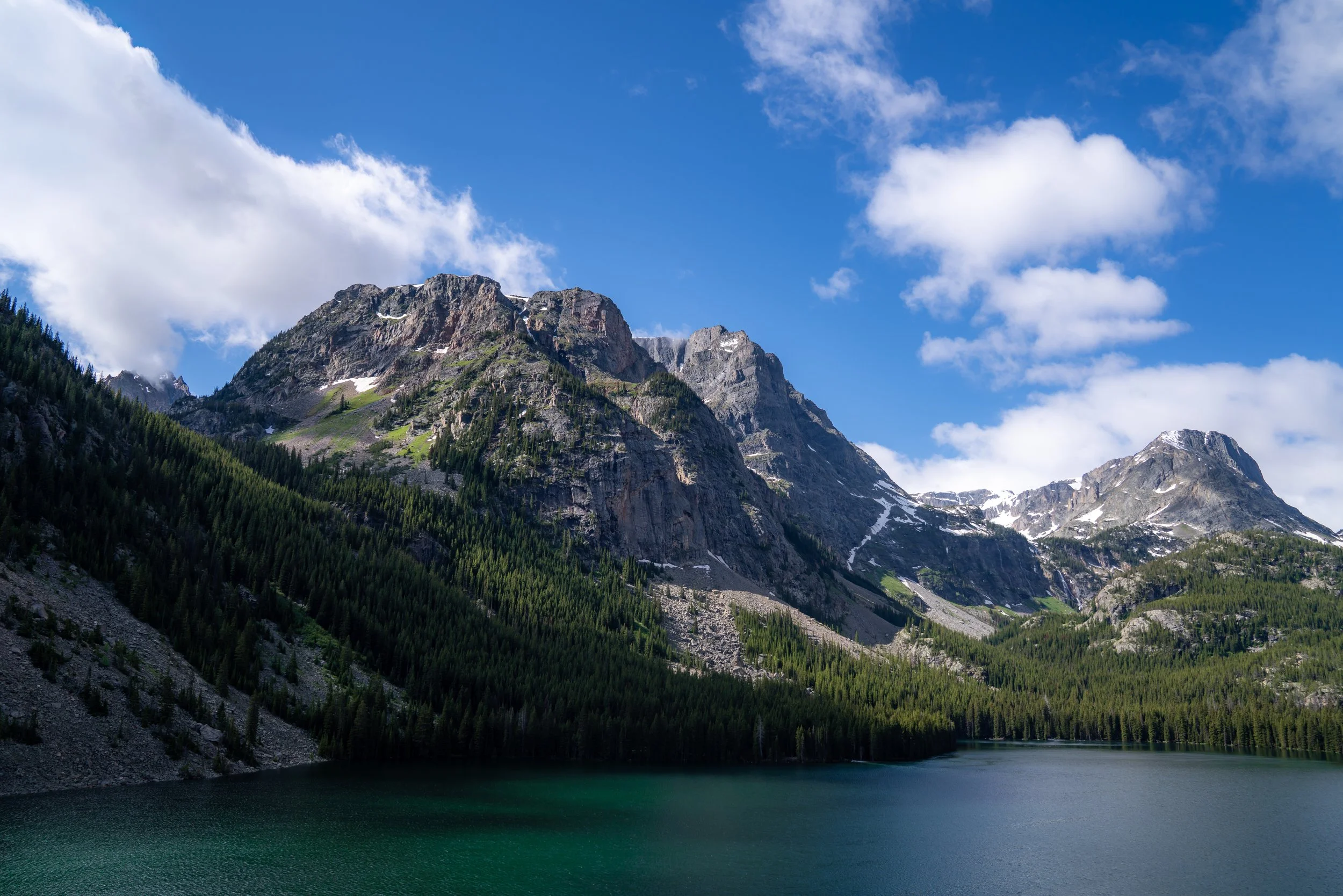
My Print - The Beaten Path Trail (Rainbow Lake)
Is it Better to Begin at East Rosebud or Clarks Fork?
First and foremost, the Clarks Fork Trailhead is roughly 1,710 ft. (521 m) higher than the East Rosebud Trailhead, and it is for this reason alone that the vast majority of hikers opt to start at the southern trailhead and hike north.
That said, I want to provide a different perspective, starting with the fact that both directions are uphill until they eventually meet at the high point on the west side of Fossil Lake.
To get to this point, the Russell Creek Trail gains roughly 1,970 ft. (600 m), while the East Rosebud Trail gains about 3,675 ft. (1,120 m).
This, again, is why most hikers prefer to begin from Clarks Fork, but I still don’t believe these numbers provide the full picture of things to consider.
By this, I mean that crowds are one thing to keep in mind. The Beaten Path certainly is not the Havasupai Trail in Arizona or the Enchantments in Washington, but it is a popular adventure by Montana standards. This means that if you choose to hike from south to north, as most do, you’re going to be following the same general itinerary as most groups—especially if you choose to make a long weekend of it.
However, over multiple trips on the trail, I have always chosen to start from the East Rosebud Trailhead, and on this hike, we even started on a Thursday morning, which meant we were always getting to campsites just as other groups hiking in the opposite direction were packing up and leaving!
This is one main reason I’ve always chosen to hike The Beaten Path from north to south, but what’s perhaps even more important is that the uphill is easy!
Yes, over multiple trips on The Beaten Path with completely different groups, no one has ever complained about the uphill because all the elevation change is spread out over long distances. That is to say, there really aren’t any steep sections, but the same cannot be said about starting from Clarks Fork, as the elevation change is much more compact!
It’s for all these reasons that I have and always will hike The Beaten Path from north to south in the future—especially when the trip is planned over a summer weekend!
How Long is the Beaten Path Trail?
Since many hikers break up The Beaten Path Trail with different stops over different timelines, I’ve broken down each section to help you plan your adventure.
Bear in mind that each segment is only The Beaten Path Trail to the first place the trail encounters a lake or the junction for the lake’s campsites—not any additional hiking that may be required to reach a specific campsite.
East Rosebud Trailhead to Elk Lake: 3.4 miles (5.5 km)
Elk Lake to Rimrock Lake: 2.5 miles (4.0 km)
Rimrock Lake to Rainbow Lake Campsites: 2.0 miles (3.2 km)
Rainbow Lake Campsites to Lake at Falls: 1.5 miles (2.4 km)
Lake at Falls to Duggan Lake: 3.0 miles (4.8 km)
Duggan Lake to Dewey Lake: 2.2 miles (3.5 km)
Dewey Lake to the High Point (Fossil Lake): 3.6 miles (5.8 km)
High Point (Fossil Lake) to Bald Knob Lake: 1.7 miles (2.7 km)
Bald Knob Lake to Ouzel Lake: 0.5 miles (0.8 km)
Ouzel Lake to Russell Lake: 1.7 miles (2.7 km)
Russell Lake to the Fox Lake Junction: 2.5 miles (4.0 km)
Fox Lake Junction to Kersey Lake: 2.7 miles (4.3 km)
Kersey Lake to the Clarks Fork Trailhead: 1.5 miles (2.4 km)
Total Distance (One Way): 28.8 miles (46.3 km)
Beaten Path Trailhead Parking
Parking for The Beaten Path Trail is located at either the East Rosebud Trailhead at the northern terminus or the Clarks Fork Trailhead off the Beartooth Highway, just outside of Cooke City.
Regardless of which direction you decide to begin, both trailheads are generally reachable with a 2WD vehicle, granted that the roads are snow-free.
Google Maps Directions: East Rosebud Trailhead / Clarks Fork Trailhead
Hiking Checklist - Beartooth Mountains
Obviously, for camping, you will need general backpacking gear. For this reason, I wrote a separate post about what backpacking gear is worth the money, from my experience, and what the best alternatives are to save you money.
Read My Separate Post: Best Ultralight Backpacking Gear
In addition, here is a complete list of must-have things that you will want for any hike in the Beartooth Mountains, including bear spray, as the Beartooth Mountains are home to both Black Bears and Grizzlies.
Hiking the Beaten Path Trail
East Rosebud Trailhead
After staging a car at Clarks Fork the day before and spending the night in Red Lodge, we drove to the East Rosebud Trailhead to begin hiking The Beaten Path from north to south.
As previously mentioned, this is not the most common direction hikers opt for, but north to south has always been my preferred direction over multiple trips on The Beaten Path, for all the reasons mentioned above and throughout this post!
As previously mentioned, the elevation gain when starting from East Rosebud is much more spread out than when starting from Clarks Fork.
I would even go as far as to say that much of The Beaten Path to Rainbow Lake is flat, or at least flat in the sense that you’re not going to notice most of the uphill.
The only exceptions to this are a few isolated areas, like the canyon just before Rimrock Lake and a short uphill to Rainbow, as well as a few very short, random spots along the way.
This is why I would not consider the hike to Rainbow Lake a challenging adventure by any means, and note that the distinct uphill sections the trail encounters are very gradual!
When hiking The Beaten Path from south to north, this beginning section through the dense Lodgepole Pine forest tends to feel long and tedious, similar to the sections on the south side between the Fox Lake junction and Clarks Fork.
All these Aspen trees scattered throughout can make The Beaten Path a great late-season adventure before the snow comes shortly after the leaves fall!
The granite hill that can be seen in the distance is one of the most popular day-hiking destinations between the East Rosebud Trailhead and Elk Lake.
This is the view looking back at East Rosebud Lake, located just 0.8 miles (1.3 km) from the East Rosebud Trailhead.
This overlook, at roughly 0.9 miles (1.4 km) into the East Rosebud Trail, is one of the most popular day-hiking destinations on The Beaten Path.
The sign, also found at the overlook, indicates that East Rosebud Creek in Montana's Beartooth Mountains is a federally designated Wild and Scenic River under the National Wild and Scenic Rivers System, a designation signed into law in August 2018 by then-President Trump.
After the beautiful, unnamed viewpoint of East Rosebud Lake, the views looking up East Rosebud Canyon start to open up much more than before, which is nice because the hike mentally moves much quicker compared to the dense forest from the beginning.
Absaroka–Beartooth Wilderness Boundary
This is where the East Rosebud Trail first enters the Absaroka–Beartooth Wilderness.
If all these photos show anything, I hope it’s that there is a lot of sun exposure on The Beaten Path!
This is even more true as the trail climbs higher and higher, eventually topping out on the Beartooth Plateau.
This is why I highly recommend hiking in a hooded sun shirt, as there really is no avoiding all the time spent in the sun over such a long distance as this!
This is where the East Rosebud Trail begins a series of eight very short, back-to-back switchbacks, about 2.0 miles (3.2 km) from the beginning of Elk Lake.
This is also what I meant in the beginning about there being a few random uphill sections scattered throughout.
This is the top of the eighth switchback.
This is where the Beaten Path Trail reaches the two isolated switchbacks following the series of eight shown previously.
If you’re visiting the Beartooth Mountains and hiking The Beaten Path for the first time, these views up East Rosebud Canyon may not look like more than a pristine, picturesque mountain landscape.
However, what’s less and less apparent as the years go on are the scars left behind from the devastating June 2022 floods that tore through East Rosebud Canyon, the town of Red Lodge, and parts of Yellowstone National Park just to the south.
The videos are truly something to see for themselves, as car-sized boulders were moved, bridges were ripped from their foundations, and many people, both hikers and residents, were stranded and required rescue as a result.
But despite all that happened over the course of about 48 hours, the community was resilient, meaning that if you didn’t know what East Rosebud Creek looked like before, you may not even notice the differences today!
Seriously, prepare for a lot of time spent in the sun!
Snow Creek
This is where the East Rosebud Trail crosses Snow Creek, roughly 0.9 miles (1.4 km) from Elk Lake.
I think it’s important to mention that the first 14.6 miles (23.5 km) to Dewey Lake is the most The Beaten Path will be surrounded by towering peaks!
By this, I mean that the second half of the trail, from Dewey Lake to Clarks Fork, undergoes a massive transition as it tops out on the Beartooth Plateau, which is why many of the best places to camp are all leading up to Dewey Lake.
The one exception to this is Bald Knob and Ouzel Lake off the Russell Creek Trail, both of which are located just steps from one another!
Elk Lake
After roughly 3.4 miles (5.5 km), the East Rosebud Trail finally reaches Elk Lake, the second of 15 alpine lakes along The Beaten Path between East Rosebud and Clarks Fork when hiking north to south.
That said, Elk Lake is also the best first place to set up camp along the East Rosebud side of the Beaten Path, but I personally recommend continuing farther because I think it is just too close to the trailhead to make it a good stopping point.
If you decide to continue farther, be aware that Rainbow Lake is the next best place to set up camp, as the only suitable places to set up camp at Rimrock Lake are located on the south side and are extremely limited since the canyon is so steep.
After leaving the north side of Elk Lake, the East Rosebud Trail continues around to the south side and will reach this split almost immediately.
Once here, go right to continue on The Beaten Path, as the path to the left is the trail that leads up to some of the best campsites near Elk Lake.
After Elk Lake, the walls of East Rosebud Canyon start to close in on both sides, eventually leading to some of the most beautiful parts of The Beaten Path between Rimrock Lake and Dewey Lake, with Lake at Falls being one of my personal favorites!
The dramatic cliff face on the left-hand side in the distance is where East Rosebud Canyon narrows significantly as it approaches Rimrock Lake.
That is also where the switchbacks on the hike up to Rimrock and Rainbow Lake begin, which I believe are some of the most beautiful parts of the entire Beaten Path Trail!
These sections of The Beaten Path remind me of hiking through Yosemite Valley!
According to most trip reports, the northern side of the Beartooths, the East Rosebud side of The Beaten Path, is more prevalent with Black Bears, while the southern half, the side after Fossil Lake leading into Yellowstone National Park, is dominated more by Grizzlies.
That said, this sentiment is somewhat anecdotal, but there is also some truth to it.
What I mean is that I have never personally seen a Grizzly on The Beaten Path, but I can speak from many experiences in which I’ve often seen them when and where I least expected to see them.
I talk about this in more detail below, both in regard to food storage and confirmed sightings, but the important thing to remember is to always hike with bear spray when in the Beartooths, as they can be anywhere, regardless of what the trends might show!
With about 0.3 miles (0.5 km) to go before The Beaten Path starts climbing the switchbacks up East Rosebud Canyon to Rimrock Lake, the trail begins navigating through a long section directly impacted by the rising floodwaters from the catastrophic flooding event that occurred in June 2022.
That said, the East Rosebud Trail has since been cleared, but the scars left on the landscape are very much evident and will be for decades to come!
This is where The Beaten Path Trail crosses above 7,000 ft. (2,134 m).
Just imagine what it would have been like to stand here on that mid-June morning, as everything on the canyon floor was covered under a raging river!
This sharp turn is a nice sign that the much more noticeable part of the ascent up to Rimrock Lake is about to begin!
This is where The Beaten Path Trail reaches the first of ten switchbacks on the hike up to Rimrock Lake, and one on the descent, as the trail drops down to the bridge that crosses East Rosebud Creek.
This is the third of ten switchbacks on the hike up to Rimrock Lake.
These are the sections that I previously mentioned that I believe to be among the most beautiful parts of the entire Beaten Path Trail!
I hope these photos show just how easy the ascent is on the hike up to both Rimrock and Rainbow Lake shortly thereafter!
This is why I constantly want to stress that hiking north to south is a great option to consider, regardless of how 3,675 ft. (1,120 m) of climbing may sound, as it’s spread out over 18.2 miles (29.3 km)!
This is East Rosebud Creek and the waterfall that pours out of Rimrock Lake.
This is where the East Rosebud Trail turns the sixth switchback before Rimrock Lake.
This is where The Beaten Path turns the tenth and final switchback on the climb up the narrowest parts of East Rosebud Canyon, meaning the first views of Rimrock Lake are just a short distance ahead!
Rimrock Lake
After 5.9 miles (9.5 km), The Beaten Path Trail reaches this view of Rimrock Lake, at which point the trail descends to a bridge that crosses to the other side of East Rosebud Creek.
This is what I meant about The Beaten Path turning one switchback after the ten prior to get to this point.
During the catastrophic June 2022 floods, this bridge across East Rosebud Creek disappeared, effectively closing The Beaten Path until it reopened again in October 2025.
Following the floods, two hikers, in two completely separate incidents, tragically lost their lives while attempting to cross East Rosebud Creek in the years immediately following the flooding.
One incident occurred in July 2024 and the other in June 2025, which hopefully helps illustrate how fast the water rushes through this narrow gap and why it’s never worth attempting to cross the creek if the bridge isn’t there.
Once on the west side of East Rosebud Creek, The Beaten Path will not cross to the other side for the entire hike up to Fossil Lake, the origins of East Rosebud Creek.
Rimrock Lake Campsites
This is where The Beaten Path passes the only suitable campsites at Rimrock Lake, about one-third of the way down the west side.
This is the view looking back at the best camping area along the west side of Rimrock Lake.
This is where The Beaten Path starts climbing up and away from the shores of Rimrock Lake as it ascends roughly 250 ft. (76 m) until it reaches the first views of Rainbow Lake just ahead!
This is the sharp switchback on the southwest side of Rimrock Lake and the point where the East Rosebud Trail leaves Rimrock Lake on the hike up to Rainbow Lake, about 0.5 miles (0.8 km) away from this point.
Much of the hike between Rimrock and Rainbow Lake winds its way through a dense overstory forest, but without warning, Rainbow Lake will open up all at once, and the views will continue for much of the hike to the campsites on the southern end!
Rainbow Lake
This is where the East Rosebud Trail first reaches Rainbow Lake, meaning there is only another 0.8 miles (1.3 km) to go until the Rainbow Lake campsites, located on the far southwest side of the lake.
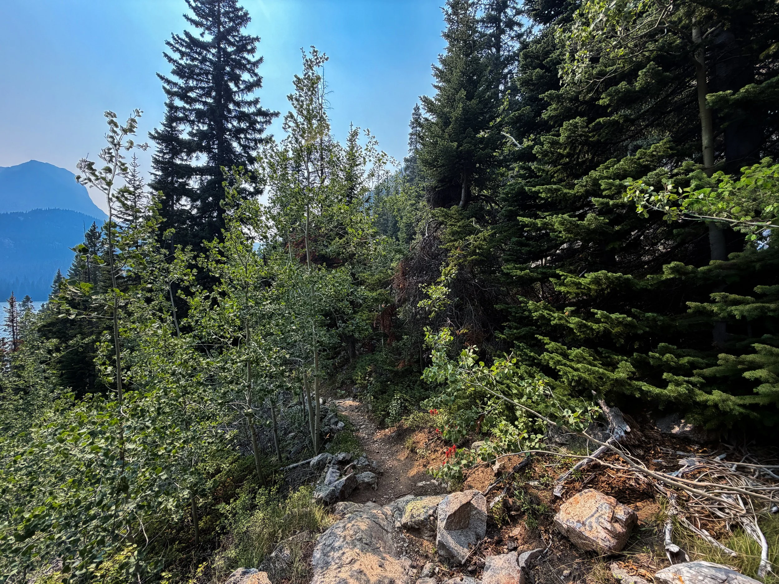
The Beaten Path Trail (East Rosebud)
Rainbow Lake Campsites
After 7.9 miles (12.7 km), the East Rosebud Trail finally reaches the campsites on the far side of Rainbow Lake.
The Rainbow Lake camping area is one of the biggest and most popular places to stay the night on The Beaten Path, mostly because Rainbow Lake is either a first stop on the hike in or the last stop on the hike down to East Rosebud Lake.
In any case, places to camp can be found on both sides of the trail, with none being better or worse, in my opinion. I think it just depends on how far you’re looking to be from the shoreline.
If you’re going to throw a bear bag, hike in knowing how to hang it in free space—don’t just suspend it!
In fact, right before we hiked in on this trip, we were told a group had their food stolen for doing just that.
If you aren’t confident with hanging a proper bear bag or are planning to camp above tree line at Fossil Lake, a bear can is the best way to go!
Rainbow Lake
This is the far southwest side of Rainbow Lake looking northeast down the East Rosebud drainage.
After our first night at Rainbow Lake, we packed and continued up the East Rosebud Trail to Dewey Lake, roughly 6.7 miles (10.8 km) away.
The main thing to know about the hike between Rainbow and Dewey Lake is that more of this section is uphill, unlike the beginning.
However, uphill doesn’t mean steep, as the roughly 1,520 ft. (463 m) of climbing is very gradual, and there is even a very long flat stretch immediately following Lake at Falls.
This is where The Beaten Path Trail turns the first of 12 switchbacks on the hike up to Lake at Falls.
This is where the East Rosebud Trail turns the fifth switchback on the climb up to Lake at Falls.
This is where The Beaten Path Trail crosses above 8,000 ft. (2,438 m).
By no means would I consider these switchbacks steep!
This is the tenth switchback on the hike between Rainbow Lake and Lake at Falls.
This is where the East Rosebud Trail turns the 12th and final switchback on the hike up to Lake at Falls.
Lake at Falls
After 9.4 miles (15.1 km) from the East Rosebud Trailhead, or 1.5 miles (2.4 km) from the campsites at Rainbow Lake, The Beaten Path Trail finally reaches Lake at Falls, one of the most beautiful alpine lakes on the entire hike, in my opinion!
From here, The Beaten Path continues up to Duggan Lake, about 3.0 miles (4.8 km) away, and Dewey Lake, about 5.2 miles (8.4 km) from this point.
The steep canyon walls that closely parallel Lake at Falls are why I believe it is one of the most beautiful lakes on The Beaten Path, though there really aren’t great places to camp because the landscape is so dramatic!
This is where the East Rosebud Trail leaves Lake at Falls behind, beginning the long, flat section that extends from this point to the Granite Creek crossing.
Big Park Lake
Big Park Lake is a quiet little lake between Lake at Falls and Duggan Lake.
That said, I have never seen another group set up anywhere near Big Park Lake, likely because both Rainbow Lake below and Dewey Lake above are two of the best places to camp on The Beaten Path!
Granite Creek
This is where The Beaten Path crosses Granite Creek.
After crossing Granite Creek, the East Rosebud Trail begins climbing again, but all the uphill from this point to Duggan Lake is very gradual.
This is about as steep as it gets between Granite Creek and Duggan Lake.
This is where The Beaten Path Trail makes a sharp turn to the west to begin paralleling East Rosebud Creek once again, about 0.8 miles (1.3 km) from Duggan Lake.
When the East Rosebud Trail starts winding its way up these more exposed granite slopes, it’s a nice sign that Duggan Lake is a little less than 0.5 miles (0.8 km) away.
After Lake at Falls, the dramatic canyon walls first seen along East Rosebud Creek become less and less frequent as The Beaten Path more noticeably starts getting closer to the high-elevation Beartooth Plateau that begins just after Dewey Lake.
This is about as exposed as The Beaten Path Trail ever gets.
This is where the East Rosebud Trail turns the final switchback before reaching Duggan Lake.
Duggan Lake
After 12.4 miles (20.0 km) since leaving the East Rosebud Trailhead, The Beaten Path reaches Duggan Lake, the first of three back-to-back alpine lakes below Fossil Lake.
That said, there is a stunning waterfall that drains into Duggan Lake from Twin Outlets Lake, known as Impasse Falls, and I mention this because it is a fairly easy hike to get to if you are interested in reaching the bottom.
If not, there are also stunning views of Impasse Falls from the trail just ahead.
This is where the East Rosebud Trail turns up and away from Duggan Lake to begin ascending nine switchbacks on the hike up to Twin Outlets Lake.
Since The Beaten Path is almost always climbing or descending, regardless of the direction you choose to begin, some hikers may want to bring trekking poles.
This is where Beaten Path Trail turns the fifth switchback, which is the point where the hike passes the best views of Impasse Falls from the trail just ahead!
This is where The Beaten Path Trail crosses above 9,000 ft. (2,743 m), which is the last elevation benchmark, as the trail never climbs over 10,000 ft. (3,048 m).
Impasse Falls
Impasse Falls is a 190-ft. (58 m) waterfall between Duggan and Twin Outlets Lake, and it is one of the most picturesque waterfalls on The Beaten Path, especially considering how beautiful and accessible the views are from both the base and above!
After Impasse Falls, the Beaten Path Trail ascends four more switchbacks on the hike up to Twin Outlets Lake.
These really are some of the most gradual switchbacks, as the steepest parts between Rainbow Lake and Dewey Lake are all located before the upper view of Impasse Falls.
In my opinion, this unnamed waterfall pouring out of Twin Outlets Lake is just as beautiful as Impasse Falls!
Twin Outlets Lake
This is the beginning of Twin Outlets Lake, meaning there is only about 0.9 miles (1.4 km) left until The Beaten Path finally reaches Dewey Lake, which is up there as one the most beautiful of the 15 alpine lakes, next to Lake at Falls below!
This is the beginning of the ascent between Twin Outlets Lake and Dewey Lake, located about 0.5 miles (0.8 km) up the trail from this point.
Once again, this climb is very gradual, as it closely resembles the sections before Twin Outlets Lake but after Impasse Falls.
Dewey Lake
This is where the East Rosebud Trail first reaches the northeast side of Dewey Lake.
That said, Dewey is one of the most popular places to camp on The Beaten Path because it is arguably the most beautiful of the 15 alpine lakes that the trail passes!
However, my group of three did not have any difficulty finding a good place to set up camp on this hike because, as previously mentioned, we were staggered by one day in our itinerary from most people making a long weekend out of The Beaten Path, meaning we arrived at Dewey on a Friday, which is a bit too far from Clarks Fork for most people starting on a Friday.
The East Rosebud Trail wraps around the north side of Dewey Lake, which is where most of the best campsites are found.
This was our campsite on the west side of Dewey Lake, which I loved because the cliffs on this side of the lake are perfect for jumping in, and this is the best place to camp to catch sunrise in the morning!
After Dewey Lake, the East Rosebud Trail continues climbing gradually up to Fossil Lake, but this section is a little more hilly than everything prior, meaning there is some downhill along with the up.
I personally think the hike becomes much more enjoyable after Dewey Lake, because, as the trail approaches tree line, you’re able to see significantly farther, making it feel like it’s moving quicker than everything up to this point.
As The Beaten Path approaches Fossil Lake, the alpine tundra and wildflowers throughout make the Beartooth Plateau one of the most beautiful sections of the entire trail!
This is one of a few examples where the East Rosebud Trail descends before continuing uphill again.
This is where the East Rosebud Trail crosses the unnamed creek that flows out of Oly Lake.
The peak in the distance is Mt. Dewey, with the Dewey Glacier directly beneath the summit!
This is the start of the somewhat abrupt transition where the East Rosebud Trail climbs above the tree line, or at least Fossil Lake is essentially the boundary between there being trees and not.
I’ll say it again and again: good sun protection is crucial on The Beaten Path, especially this high up, as the trail climbs to just under 10,000 ft. (3,048 m) at its highest point.
Beartooth Plateau
This is more or less where The Beaten Path first reaches the Beartooth Plateau, a high-elevation, remarkably flat landscape covered in glacial lakes, alpine tundra, and what are said to be some of the oldest rocks on Earth!
Who really knows, but this is where The Beaten Path starts to level out as it nears Fossil Lake and the high point on the trail, the same point where the Russell Creek Trail begins!
This is where Fossil Lake can be seen from The Beaten Path for the first time!
Fossil Lake
This is where the East Rosebud Trail first reaches the north side of Fossil Lake, which it will parallel for about 1.0 mile (1.6 km) until it climbs up and away toward the high point and the Russell Creek side of The Beaten Path.
This is where the East Rosebud Trail passes the northernmost reaches of Fossil Lake.
These creeks on the Beartooth Plateau are great places to take a break to filter water—especially if you plan to hike with less water on the uphill sections to get here!
Is Fossil Lake a Good Place to Camp?
Fossil Lake and the greater Beartooth Plateau are certainly beautiful places to camp, but I think answering this question depends on weather, days planned on the trail, and your food storage strategy.
By this, I mean that if the weather is at all chancy, meaning there is a possibility of thunderstorms, the Beartooth Plateau is the last place you want to be, and that even goes for just hiking through it quickly if bad weather is forecasted. Seriously, take it from me, getting caught with lightning overhead in such an exposed environment is a horrible experience! It has happened to me more times than I’d like to admit, and on one rare occasion in Idaho, one other person and I were knocked to the ground by a strike that hit just feet away!
I hope all that intimidates you a little because it should. Lightning is not a risk to take lightly!
The weather and your itinerary aside, bear canisters are required if you plan to camp at Fossil Lake, as there are no places to hang a proper bear bag this high up. In addition, hikers have encountered Grizzlies on the plateau before, but proper food storage is more often for the Marmots!
This is where the East Rosebud Trail turns sharply to the west as it begins heading directly toward the high point and the beginning of the Russell Creek Trail, about 0.4 miles (0.6 km) away.
This is where the East Rosebud Trail leaves Fossil Lake behind, beginning the final 0.25-mile (0.4 km) section up to the high point!
East Rosebud-Russell Creek Junction (High Point)
After 18.2 miles (29.3 km), the East Rosebud Trail finally meets the Russell Creek Trail!
That said, this junction is also the high point on The Beaten Path at around 9,935 ft. (3,028 m), meaning the vast majority of the hike from this spot to Clarks Fork is downhill!
The descent begins immediately after starting the Russell Creek side of The Beaten Path, which is nice because the hike down to Bald Knob Lake feels so light and fast compared to everything up to this point!
This small tarn does not have a name, but if you decided to camp at Fossil Lake, places like this, among a number of nearby lakes on the plateau, would be fairly easy to hike over to and spend the day fishing to see what’s in them!
As the Russell Creek Trail passes the first alpine tarn beneath the high point, a number of peaks can be seen off to the northwest.
I mention this because the most prominent peak on the left side of the photo below is Mt. Villard, but the peak that can barely be seen on the right-hand side is Granite Peak, the highest peak in Montana and one of the hardest state high points in the Lower 48 to climb, next to Gannett Peak in Wyoming!
This is where The Beaten Path starts paralleling Russell Creek for the first time.
Since you can see so far into the distance on the Russell Creek Trail, I’ve always thought the hike down to Bald Knob Lake mentally moves very fast!
Russell Creek
This is where The Beaten Path crosses Russell Creek for the first of three times, just steps before reaching Skull Lake.
Skull Lake
This is where the Russell Creek Trail passes Skull Lake, the 11th of 15 alpine lakes on The Beaten Path, roughly 0.8 miles (1.3 km) below the high point.
That said, Skull Lake is not the most popular place to set up camp because Bald Knob Lake, about 0.9 miles (1.4 km) ahead, is easily one of the most picturesque lakes on The Beaten Path!
After Skull Lake, the one thing that should stand out is how much faster the elevation change is on this section of the Russell Creek Trail.
By this, I mean that between Skull Lake and Russell Lake, The Beaten Path loses about 900 ft. (274 m) over 3.9 miles (6.3 km), making it one of the steeper sections of the entire thru-hike, particularly the descent after Ouzel Lake.
This is yet another reason why hiking north to south can be a better option, but this is just one person’s opinion.
This is where the final descent on the hike to Bald Knob Lake begins.
Bald Knob Lake
When hiking The Beaten Path from north to south, as outlined here, Bald Knob Lake and Ouzel Lake, just beyond, are often seen as the second-to-last best options for places to set up for the night, with Russell Lake being the last.
This is because, after Russell Lake, The Beaten Path is mostly one long tree tunnel, meaning there really aren’t great options to make camp as there are between Rainbow Lake and Russell Lake.
That said, the question should really be: How long do you want your last day to be?
The distance between Bald Knob Lake and Clarks Fork is 8.9 miles (14.3 km), while Russell Lake to Clarks Fork is 6.7 miles (10.9 km).
On this hike, our group opted to camp at Russell Lake, but I think Bald Knob and Ouzel are two to seriously consider because of how incredibly beautiful they really are!
The trail at Bald Knob Lake runs along the south side, where a number of great campsites can be found off the trail and in the trees.
However, the best sites are located a bit off the trail, after the second Russell Creek crossing shown below.
Russell Creek
This is the second of three times The Beaten Path Trail crosses Russell Creek.
On the far side of Russell Creek, go left at the split to continue hiking the Russell Creek Trail toward the best Bald Knob campsites and Ouzel Lake farther down the trail.
Russell Creek-Bald Knob Lake Campsites Junction
Shortly after crossing Russell Creek, The Beaten Path passes the junction for the trail that leads to the best campsites at Bald Knob Lake, about 0.2 miles (0.3 km) off the main trail on the southeast side.
After the Bald Knob Lake campsites, there is less than 0.2 miles (0.3 km) on The Beaten Path until the trail reaches Ouzel Lake.
This is why I believe both Bald Knob and Ouzel should be considered at the same time when looking for a good place to camp.
Ouzel Lake
This is Ouzel Lake, located just a short distance down Russell Creek from Bald Knob Lake.
That said, I think it’s certainly a good debate regarding whether Bald Knob or Ouzel Lake is more beautiful, but again, it’s easy enough to check out both before making your decision because it takes so little time to hike between the two!
After Ouzel Lake, The Beaten Path quickly begins the rapid descent to Russell Lake again, this time being much steeper than the section between Skull Lake and Bald Knob Lake.
This was a very fun and beautiful part of the hike out to Clarks Fork, along with the canyon that immediately follows Russell Lake!
I think it’s important to remind about the importance of carrying bear spray on The Beaten Path, as there are a number of confirmed Grizzly sightings along different parts of the trail.
Once again, Black Bears are typically what most hikers have problems with when it comes to food storage on the East Rosebud side, but hiking with bear spray anywhere in the Greater Yellowstone Ecosystem (GYE) is not only important, but essential for a safe trip—especially noting that this is the side of the trail where Grizzlies are more often encountered!
With about 0.8 miles (1.3 km) to go before The Beaten Path reaches the campsites at Russell Lake, the trail begins a series of 14 steep switchbacks that lose about 325 ft. (99 m) of elevation from this point to the bottom.
This is where The Beaten Path turns the first of 14 switchbacks on the descent to Russell Lake.
This is the fifth switchback on the descent to Russell Lake.
This is where The Beaten Path turns the 12th switchback on the descent to Russell Lake.
Russell Creek-Mariane Lake Junction
At the bottom of the steep descent, The Beaten Path Trail crosses Russell Creek and immediately meets the junction for the Mariane Lake Trail on the far side.
Once here, go right to continue on The Beaten Path, and the Russell Creek Trail will start passing Russell Lake and the best campsites in less than 0.1 miles (0.2 km).
Russell Lake
As The Beaten Path makes its way down the west side of Russell Lake, the trail passes all the best campsites at Russell Lake on the right-hand side of the trail.
Much like the campsites at Rainbow Lake, Russell Lake is one of the bigger camping areas along The Beaten Path, as it is seen as the last best place to stay the night before hiking out to Clarks Fork.
This was our last campsite on this hike from East Rosebud to Clark Fork, meaning that once we packed up after sunrise, we had only 6.7 miles (10.9 km) left to get to our staged car just outside of Cooke City!
This is where The Beaten Path leaves Russell Lake behind.
On our last day, we woke up early, watched the alpenglow hit the far side of Russell Lake, and began the final 6.7-mile (10.8 km) stretch out to Clarks Fork.
That said, much of the hike between Russell Lake and Clarks Fork is one long, tedious tree tunnel, with the exception of the narrow canyon that immediately follows Russell Lake, as it is one of the more beautiful parts of the entire hike, in my opinion!
However, after the initial descent, the Russell Creek Trail becomes much more monotonous, as the views are essentially over and the section with the worst mosquitoes on the hike begins!
I personally recommend bringing a bug net for this stretch alone, especially if you anticipate taking a lot of breaks along the way.
Russell Creek
This is the third and final time The Beaten Path crosses Russell Creek on the hike down to Clarks Fork.
Trekking poles can be very useful for the canyon after Russell Lake.
These are the sections of the canyon after Russell Lake that I believe to be among some of the more beautiful parts of The Beaten Path, similar to the section between Elk Lake and Rimrock Lake on the other side!
This is where the Russell Creek Trail exits the narrowest parts of the canyon following Russell Lake, meaning the beginning of the long tree tunnel that consumes much of this section between the lake and Clarks Fork is not far ahead.
Immediately after leaving the narrowest parts of the canyon behind, the Russell Creek Trail turns two back-to-back uphill switchbacks.
I personally think these switchbacks are nice to look forward to because they are a nice sign that the Russell Creek Trail is about to leave the steepest parts of the hike behind, about 0.3 miles (0.5 km) from this point.
This is where the Russell Creek Trail turns the prominent horseshoe bend that can be seen on trail maps, just before leveling out.
This is the point The Beaten Path abruptly becomes much flatter, as the rest of the Russell Creek Trail, from here to Clarks Fork, only loses about 460 ft. (140 m), which is essentially negligible over the long 5.5-mile (8.9 km) hike to get there.
This is where the Russell Creek Trail turns to the southwest, beginning the long, slow descent toward Kersey Lake.
One of the most positive confirmed Grizzly sightings in recent reports on The Beaten Path was actually right along this stretch between the end of the canyon and Kersey Lake.
It was a mom and her two cubs, and I hope this highlights how important hiking with bear spray is on the trail, especially for sections like this where seeing far into the distance is not easy!
Much of the hike out to Clarks Fork passes through a long, dense overstory of Lodgepole Pine–Subalpine Fir forest, which is quite different from the East Rosebud side of the hike.
I mention this because if you choose to hike from south to north, as most do, you won’t be facing many of the best views looking up East Rosebud Creek.
Those were the sections I previously mentioned that look like something out of Yosemite National Park!
This is yet again another reason why I like hiking north to south, as I have repeatedly mentioned.
Apart from every other reason I’ve mentioned about preferring to begin from East Rosebud thus far, the most important may be that this flat stretch out to Clarks Fork is the worst part of the hike for mosquitoes, the kind of mosquitoes that will carry you away, as they say!
That said, ask yourself: if you had to constantly move without breaks, would you rather do it hiking uphill or down?
I think the answer is obvious, but what I’m really saying is that if you had to put your head down and move, it’s obviously better to be heading out to Clarks Fork than climbing up to Russell Lake—especially considering the steep canyon ascent just before the lake.
This is the last place where Russell Creek parallels the Russell Creek Trail before reaching the Clarks Fork Trailhead, as the creek turns away at this point toward Fox Lake.
I mention this because this spot and the cliffs that parallel the left-hand side of the trail just ahead are a nice sign that the Fox Lake junction is just 0.5 miles (0.8 km) away!
These are the cliffs on the left-hand side mentioned above.
Russell Creek-Fox Lake Junction
After 2.5 miles (4.0 km) since leaving Russell Lake, the Russell Creek Trail passes the Fox Lake junction about 1.2 miles (1.9 km) before the wilderness boundary.
That said, some hikers consider Fox Lake a good place to camp, but I personally don’t recommend it, as both Fox Lake and Kersey Lake below are simply not as beautiful as the lakes higher on the trail.
In any case, go straight at this split to continue on The Beaten Path toward both Kersey Lake and Clarks Fork shortly thereafter.
On the hike between the Fox Lake junction and Kersey Lake, The Beaten Path will pass two separate meadows, located about 1.4 miles (2.3 km) from one another.
This meadow on the left is the first, and the second is located about 0.5 miles (0.8 km) past the Absaroka–Beartooth Wilderness boundary.
These long, flat, straight sections have always been the areas with the worst mosquitoes in my experience!
Seriously, consider bringing a bug net and good hiking pants, even if you’re planning the trip mid-summer.
Russell Creek-Widewater Junction
After 1.2 miles (1.9 km) since passing the Fox Lake junction, the Russell Creek Trail passes two back-to-back side trails, the first being the Widewater Trail.
Once here, go straight at both junctions to continue hiking The Beaten Path toward Kersey Lake and Clarks Fork beyond.
Russell Creek-Rock Island Lake Junction
The second junction, immediately after the Widewater Trail, is the trail that leads to Rock Island Lake, roughly 0.7 miles (1.1 km) off The Beaten Path.
Absaroka–Beartooth Wilderness Boundary
Immediately after the two back-to-back junctions, the Russell Creek Trail leaves the Absaroka–Beartooth Wilderness.
Something that I’ve always thought was interesting about the Beartooth Mountains is that there are said to be more glaciers here than in Glacier National Park!
As previously mentioned, there is only 0.5 miles (0.8 km) between the wilderness boundary and the second meadow just before Kersey Lake.
This is the second meadow just before Kersey Lake!
When hiking The Beaten Path from north to south, as shown here, I believe the most annoying part of the hike is this section around the south side of Kersey Lake!
I say this because, after all the downhill since leaving the high point, the Russell Creek Trail abruptly starts a steep climb as it makes its way around Kersey Lake.
This ascent gains roughly 110 ft. (34 m) in about 0.3 miles (0.5 km), which certainly isn’t the steepest part of The Beaten Path, but it’s just steep enough to be annoying!
These views of Kersey Lake near the top of the hill are much better than where the trail passes the outlet just ahead.
This is the top of the hill on the south side of Kersey Lake.
The descent on the west side of the hill is much shorter than the climb from the second meadow shown above.
Russell Creek-Kersey Lake Cabin Junction
With about 1.5 miles (2.4 km) to go, the Russell Creek Trail passes the junction that leads to the Kersey Lake Outlet and the Kersey Lake Cabin on the far side.
Personally, I would never consider Kersey Lake when looking for places to camp along The Beaten Path because it is both too close to Clarks Fork, and there are far more beautiful places to spend the night farther up the trail.
Russell Creek-Vernon Lake Junction
After just 0.2 mile (0.3 km) since leaving Kersey Lake, the Russell Creek Trail passes the Vernon Lake Trail, a roughly 1.3-mile (2.1 km) side trail off The Beaten Path that leads to two different alpine lakes.
Once here, go straight to continue on The Beaten Path Trail toward Clarks Fork, about 1.3 miles (2.1 km) from this junction.
Russell Creek-Kersey Lake Road (#306) Junction
As the Russell Creek Trail nears the Broadwater River, The Beaten Path passes two back-to-back junctions, the first being Kersey Lake Road (#306).
Once again, go straight to continue on the Russell Creek Trail toward the Broadwater River and Clarks Fork shortly thereafter.
Russell Creek-Clarks Fork Stock Trailhead Junction
This is the second junction, just over 0.1 miles (0.2 km) down the trail from the first, this one leading to the Clarks Fork Stock Trailhead off Kersey Lake Road.
At this split, go left to continue on The Beaten Path toward the footbridge across the Clarks Fork of the Yellowstone River.
This is where the Russell Creek Trail starts paralleling the dramatic canyon that Clarks Fork of the Yellowstone River rapidly descends.
Clarks Fork of the Yellowstone River
This is the hiker-only footbridge across the Clarks Fork of the Yellowstone River.
Russell Creek-Fishing Platform Junction
Just a few steps after crossing the footbridge over the Clarks Fork of the Yellowstone River, the Russell Creek Trail reaches the Clarks Fork Trailhead and Picnic Area.
This is the developed area on the northern end of The Beaten Path Trail, just off the Beartooth Highway.
At this next split, go left to continue on The Beaten Path toward the trailhead, just 0.1 miles (0.2 km) away from this point!
Russell Creek-Power Plant & Waterfall Overlook Junction
Almost immediately after reaching the start of the Clarks Fork Trailhead area, the path splits once again, this time with a short side trail that leads to two overlooks of a waterfall in Clarks Fork of the Yellowstone River and the viewpoint where an old, early-1900s-era power plant once stood.
To continue on The Beaten Path toward the Clarks Fork Trailhead, go straight. However, if you are interested, both viewpoints take very little time to walk over to and enjoy.
This is the short split, just to the left of the photo above, that leads to both viewpoints off the main trail.
After both viewpoints, the Clarks Fork Trailhead is truly just steps away!
Clarks Fork Trailhead
Finally, after a stunning 28.8 miles (46.3 km) since leaving the East Rosebud Trailhead on the north side of the Beartooths, The Beaten Path ends at the Clarks Fork Trailhead, located just off the Beartooth Highway!
If you staged a car, one of the best things about hiking from north to south is that you now get to enjoy the best parts of the Beartooth Highway on the drive down to Red Lodge, and hopefully some great food in town if you’re finishing at a decent hour!
However, if you coordinated your pickup with a shuttle service, be aware that cell coverage can be hard to come by, even down the road in Cooke City.