Hiking the Eagle Rock Trail in Lake Tahoe, California
Distance: 0.8 miles / 1.3 km
The Eagle Rock Trail, on the California side of Lake Tahoe, is a very short, easy, and beautiful day hike just to the south of Tahoe City, and it’s one that I believe is the best sunrise hike of any similar adventure on the western side of the Lake Tahoe Basin!
I say this because the effort-to-reward is like no other, as the Eagle Rock Trail only takes about 10–15 minutes to reach the beautiful east-facing viewpoint above the lake, depending on your pace!
That said, the Eagle Rock Trail is a nearly all-uphill hike, but at only 0.4 miles (0.6 km) each way, there’s truly not an easier adventure that leads to such a rewarding view—especially first thing in the morning!
Eagle Rock Trailhead Parking
Parking for the Eagle Rock Trail is located directly alongside Highway 89, about 4.6 miles (7.4 km) south of the Fanny Bridge junction in Tahoe City.
Before arriving, be aware that the Eagle Rock Trail is a very popular day hike in Lake Tahoe and tends to get busy around mid-morning.
I mention this because parking often fills up during the busiest midday hours, which is truly just another reason to consider hiking Eagle Rock for sunrise!
Google Maps Directions: Eagle Rock Trailhead
Hiking Checklist - Lake Tahoe
The Lake Tahoe Basin is Black Bear country, and, as with any area that is home to Black Bears, hiking with or without bear spray is up to your own discretion and comfort level.
With that in mind, here is a complete list of must-have things that you will want for any hike in the Lake Tahoe Basin.
Hiking the Eagle Rock Trail
The Eagle Rock Trail begins on the south side of the peak, where the short hike starts climbing immediately after the trailhead, gaining roughly 200 ft. (61 m) over 0.4 miles (0.6 km) from this point to the summit.
The nice thing about the Eagle Rock Trail is that this is about as steep as the hike ever gets, apart from a few very short, rocky sections farther up the mountain.
As with every Lake Tahoe adventure, I highly recommend wearing a hooded sun shirt for the typically very sunny weather, which is common across the Sierras—not to mention, the high elevation throughout the entire Lake Tahoe Basin!
This is where the Eagle Rock Trail reaches the far western side of the hike and the point where it begins curving back east toward the summit.
This very short, rocky section is the steepest part of the Eagle Rock Trail.
After the rocky section shown above, the Eagle Rock Trail widens considerably, as hikers tend to branch out in a number of directions toward both the true summit off to the right and the main viewpoint straight ahead.
That said, I recommend staying low and to the left to continue up the easiest, most gradual path to the best viewpoint closest to Lake Tahoe.
Eagle Rock
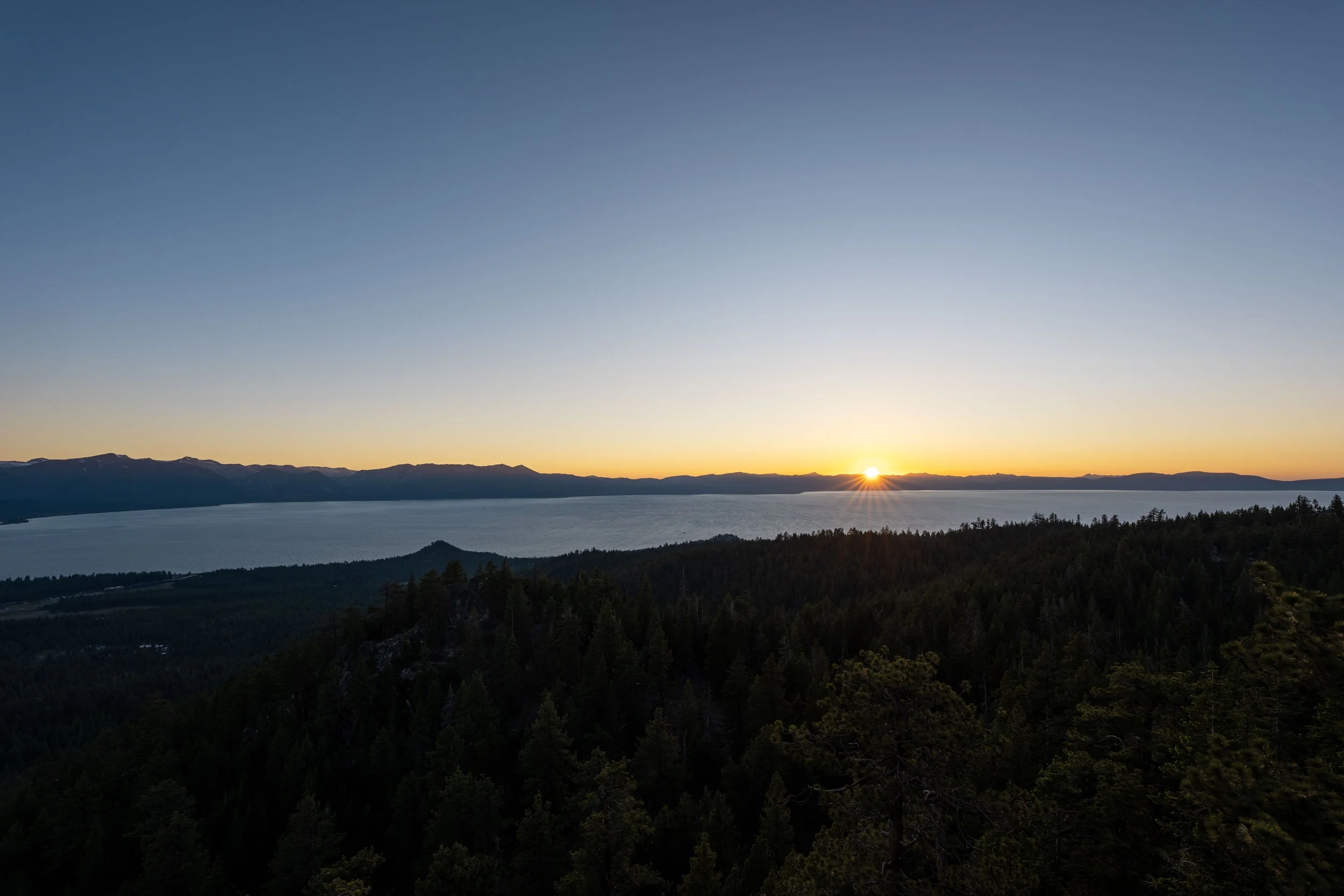
This is the end of the Eagle Rock Trail and the best place to watch the sunrise on the hike, as this lower viewpoint is closer to Lake Tahoe than the true summit located to the right of where the photo below was taken.
If hiking the Eagle Rock Trail for sunrise is something you’re considering, be sure to come prepared with a good headlamp, which can also be useful for countless sunset hikes on the Nevada side of Lake Tahoe, including the Monkey Rock Trail, the Crystal Bay Lookout Trail, and Captain Pomin Rock, to name just a few!
Hiking to the Eagle Rock Summit
If you decide to hike to the true summit on the way up, go right just before the end of the Eagle Rock Trail to continue up the easiest path to the top.
Eagle Rock Summit
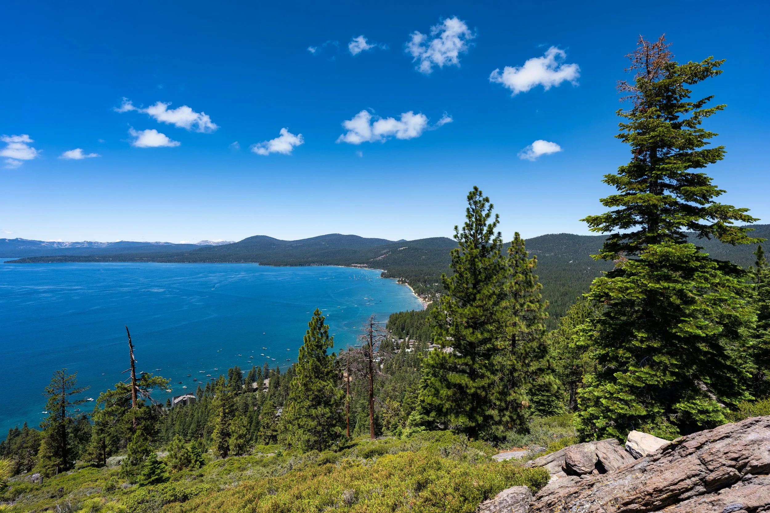
This is the top of Eagle Rock, which has a similar south-facing view as the one at the end of the Eagle Rock Trail shown above.
However, the view toward Lake Tahoe to the east is a little more obstructed, which is why I don’t believe it is the best place on the trail to catch sunrise.
This is the view looking east toward the main viewpoint at the end of the Eagle Rock Trail.
California
Nevada